
Recomendados
Mais conteúdo relacionado
Mais procurados
Mais procurados (20)
Destaque
Semelhante a WS 18 landslides Theo van Asch
Semelhante a WS 18 landslides Theo van Asch (20)
Último
Último (20)
WS 18 landslides Theo van Asch
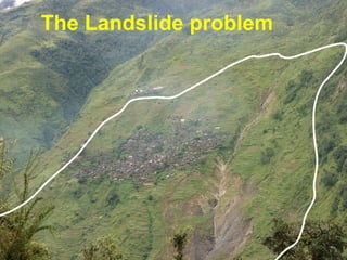
- 1. Contd… Laprak Landslide The Landslide problem
- 2. Theo van Asch: Faculty of Geosciences Utrecht in collaboration with Cees van Westen and Dinand Alkma ITC Enschede
- 4. Landslide hazard analysis Landslide risk analysis . Landslide risk management R isk governance The Landslide problem
- 8. Types of movement Fall Topple Slide Rotational slide Translational slide Type? Where? How often? How fast and intense? How far? Which elements at risk? How vulnerable? Costs?
- 9. Flow Debris/Mud Flow Debris avalanche
- 10. Velocity of mass movement related to water content and type Type? Where? How often? How fast and intense? How far? Which elements at risk? How vulnerable? Costs?
- 11. Translational slide Type? Where? How often? How fast and intense? How far? Which elements at risk? How vulnerable? Costs?
- 12. Rotational slide (Slump) Type? Where? How often? How fast and intense? How far? Which elements at risk? How vulnerable? Costs?
- 13. Rotational slide (Slump) Type? Where? How often? How fast and intense? How far? Which elements at risk? How vulnerable? Costs?
- 14. debris flow Type? Where? How often? How fast and intense? How far? Which elements at risk? How vulnerable? Costs?
- 15. Type? Where? How often? How fast and intense? How far? Which elements at risk? How vulnerable? Costs? debris flow
- 16. Type? Where? How often? How fast and intense? How far? Which elements at risk? How vulnerable? Costs?
- 17. Debris avalanche Type? Where? How often? How fast and intense? How far? Which elements at risk? How vulnerable? Costs?
- 18. Debris avalanche Type? Where? How often? How fast and intense? How far? Which elements at risk? How vulnerable? Costs?
- 21. Landslide maps Type? Where? How often? How fast and intense? How far? Which elements at risk? How vulnerable? Costs?
- 22. Landslide maps Type? Where? How often? How fast and intense? How far? Which elements at risk? How vulnerable? Costs?
- 23. Use of factor maps . Slope classes Landuse Aspect classes Soil depth Lithology Distance from river Weight maps Susceptibility map Total weight Statistical correlation techniques with landslide map Elevation Type? Where? How often? How fast and intense? How far? Which elements at risk? How vulnerable? Costs?
- 24. Susceptibility map Type? Where? How often? How fast and intense? How far? Which elements at risk? How vulnerable? Costs?
- 25. The landslide hazard map Susceptibility map plus temporal frequency Landslide hazard maps Type? Where? How often? How fast and intense? How far? Which elements at risk? How vulnerable? Costs?
- 26. 1D formulation The driving force and frictional resistance The role of deterministic models Deterministic (physical ) models are useful to determine the temporal frequency of slope instability Type? Where? How often? How fast and intense? How far? Which elements at risk? How vulnerable? Costs? x z h i 1m 1/cos h i-1 h i+1 fl,, c , x x d i-1
- 27. Driving forces Resisting forces Groundwater recharge Precipitation /percolation Safety factor<1 Slope triggered by rain Coupled hydrological-slope stability models calculates over time: Temporal frequency of instability Type? Where? How often? How fast and intense? How far? Which elements at risk? How vulnerable? Costs?
- 28. The role of deterministic models Deterministic (physical ) models are also useful to determine the speed extent and impact of landslides Type? Where? How often? How fast and intense? How far? Which elements at risk? How vulnerable? Costs?
- 29. Rapid gravitational debris/mudflows Source area Rema ître 2006 Faucon creek French Alps 2003 event Type? Where? How often? How fast and intense? How far? Which elements at risk? How vulnerable? Costs?
- 30. Rapid gravitational debris/mudflows Transportation and deposition area Type? Where? How often? How fast and intense? How far? Which elements at risk? How vulnerable? Costs?
- 31. Faucon creek French Alps: 2003 event Rapid gravitational debris/mudflows Source area Type? Where? How often? How fast and intense? How far? Which elements at risk? How vulnerable? Costs?
- 32. Faucon creek French Alps: 2003 event Rapid gravitational debris/mudflows Scouring in transportation area Type? Where? How often? How fast and intense? How far? Which elements at risk? How vulnerable? Costs?
- 33. Rapid gravitational debris/mudflows Deposition area Faucon creek French Alps: 2003 event Type? Where? How often? How fast and intense? How far? Which elements at risk? How vulnerable? Costs?
- 34. Coh = 1 kPa , K = 5.0E-2 m kPa.s -1 Average velocity: 6 m s -1 Model simulation in deposition area Faucon Barcelonette Faucon creek French Alps: 2003 event Type? Where? How often? How fast and intense? How far? Which elements at risk? How vulnerable? Costs?
- 35. Wartschenbach 1997 (Austria) Rapid gravitational debris/mudflows Deposition area Type? Where? How often? How fast and intense? How far? Which elements at risk? How vulnerable? Costs?
- 36. Type? Where? How often? How fast and intense? How far? Which elements at risk? How vulnerable? Costs?
- 37. Simulation of an earthflow Type? Where? How often? How fast and intense? How far? Which elements at risk? How vulnerable? Costs?
- 39. Different elements at risk Physical elements Housing Infrastructure (roads, railways.airport etc ) Critical facilities (schools hospitals police..etc ) Utilities (Power supply ,transport services,governmental services..etc) Economic elements Buseness and trade activities, access to work,agricultural land, work force, Societal elements Moving people, vulnerable age categories,Low income groups,homeless people, disabled ,gender Environmental elements Resources: like air, water, fauna, flora ,biodiversity, Type? Where? How often? How fast and intense? How far? Which elements at risk ? How vulnerable? Costs?
- 42. Rockfall on school: 1400 deaths Landslide on neighborhood: 800 deaths Flood caused by a landslide dam Debris flow on 14/9 destroying the remains of Old Beichuan City of Beichuan, deserted after the earthquake on 12 May Type? Where? How often? How fast and intense? How far? Which elements at risk ? How vulnerable? Costs?
- 44. Types of vulnerability Type? Where? How often? How fast and intense? How far? Which elements at risk? How vulnerable? Costs?
- 47. Damages due to various landslides. Type? Where? How often? How fast and intense? How far? Which elements at risk? How vulnerable? Costs?
- 48. Damages due to various landslides. Type? Where? How often? How fast and intense? How far? Which elements at risk? How vulnerable? Costs?
- 49. Quantitative risk assessment Risk = Hazard * Vulnerability * Amount = Temporal frequency (H) * Degree of loss to elements at risk (V) *Cost quantification of elements at risk (A) Quantitative Risk Type? Where? How often? How fast and intense? How far? Which elements at risk? How vulnerable? Costs?
- 50. Specific quantitative risk Specific Risk =0.1 * ((0.1 *50.000)+(0.5*200.000)+(1*100.000)) Landslide Quantitative specific Risk = H*V*A Type? Where? How often? How fast and intense? How far? Which elements at risk? How vulnerable? Costs? A=US $ 50.000 V = 0.1 RP = 10 years H=0.1 A=US $ 200.000 V = 0.5 V = 1 A=US $ 100.000
- 51. Landslide risk map of the Arno river basin over a period of 30 years. The risk is expressed as economic losses due to landslides for each terrain unit (from Catani et al. 2005) Type? Where? How often? How fast and intense? How far? Which elements at risk? How vulnerable? Costs? Risk map Arno river basin Italy