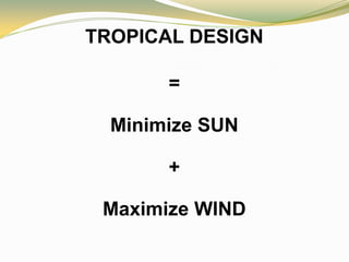
2. TROPICAL DESIGN
TROPICAL DESIGN = passive cooling
PASSIVE COOLING: design with no mechanical equipment
used to induce comfort conditions in building interior
PASSIVE COOLING = inducing air movements
INDUCING AIR MOVEMENTS: relevant for areas with
temperature variations of 10 and with high humidity
INDUCING AIR MOVEMENTS: can improve thermal
comfort up to building interiors 15 meters deep
3. Passive Systems for Various Climates
HOT-HUMID CLIMATE:
maximize wind exposure
maximize internal airflow
minimize radiant heat gain
HOT-DRY CLIMATE:
minimize radiant heat gain
moderate wind resistance
moderate internal airflow
COOL CLIMATE:
maximize thermal retention
maximize radiant heat gain
minimize wind resistance
TEMPERATE CLIMATE: moderate thermal retention
moderate radiant heat gain
slight wind exposure (for humidity control)
moderate internal airflow
4. AIR MOVEMENT ≡ wind
Principles of Air Movement
1. Air flows from a high-pressure to a low-pressure area.
2. INERTIA. Once set in motion, air tends to continue to
flow in its initial direction until some intervening
force is met.
3. Air flows through the path of least resistance.
5. GLOBAL AIR MOVEMENT
General Conditions
1. Equator receives more radiation than do polar regions.
2. Heat from equator move towards polar regions.
3. Hot air moves upwards going to polar regions.
4. Cold air moves to equator close to earth’s surface.
6. GLOBAL AIR MOVEMENT
Specific Conditions
1. Rotation of earth deflects the air = Coriolis Force
2. Wind flows due to heat exchange.
• Air temperature changes faster than ground temperature
• Daily fluctuations of air temperature caused by
physical conduction up to 3 meters above the ground
• Marked differences of air temperature between night and day
7. GEOGRAPHICAL AIR MOVEMENT
Land and Sea Breezes
1. Daytime Heating: land warms more rapidly than water
• SEA BREEZE – wind from the sea directed toward land
• Strongest in the afternoon when heating variance is greatest
2. Night Time Cooling: land cools faster than water
• LAND BREEZE – wind from land directed to sea
9. MONSOONS IN THE PHILIPPINES
Monsoon: large-scale seasonal currents
1. Northeast Monsoon = AMIHAN = the winter monsoon
•
•
•
•
Appears in October
Attains maximum strength in January
Gradually weakens in March
Disappears in April
2. Southwest Monsoon = HABAGAT = the summer monsoon
•
•
•
•
Appears early May
Maximum flows during August
Disappears gradually in October
Persists from November to December
10. AIR MOVEMENT IN BUILDINGS
1. Windward side = positive pressure
Leeward side = negative pressure
2. Air enters through openings located in the positive pressure zone
Air exits through openings located at the negative pressure zone
3. Air enters through lower level openings
Air exits at higher level openings
4. Window width
wall width = 50% to increase indoor air speed
5. Window heights = 1.10 meters for effective indoor air movement
6. Wind deflectors, horizontal and vertical, to redirect air flow
7. Prevent wind shadows by placing openings
11. EFFECT OF LANDSCAPE ELEMENTS
1. Hedges/shrubs should not be more than 3 meters from building
2. Tree foliage above openings promote air motion into openings
3. Combine tree, hedge and building to achieve air flow control
4. Lateral air channels to direct air flow
5. Arrange trees to determine wind shadow
6. Make use of earth mounds to achieve better air movement
12. SOLAR GEOMETRY
1. Rays of the sun vary with time and place (latitude)
2. Celestial Sphere: earth is static; sun moves from east to west
3. The sun moves across the sky at a rate of 15.04 per hour
4. The earth’s polar axis is inclined at 23 47’ from the vertical
5. June 21 is considered the longest day = summer solstice
6. December 21 is the shortest day = winter solstice
7. March 21 and September 21 = equinoxes
13. SUN PATH
1. Solar Altitude Angle = the angle with height above the horizon.
Ranges from 0 when on horizon
to 90 when directly above (noon)
2. Solar Azimuth Angle = the sun’s position as projected on a
horizontal plane.
3. The two solar angles change with Latitude (location on Earth)
4. Metro Manila is located at 14.5 N Latitude
5. Two Methods for Calculating Solar Angles
• Using graphs
• By mathematical calculation
6. Solar Chart = Sun Path Diagrams
7. Different Solar Charts for Different Latitudes