LiDAR Assessment Supports Water Management at Tule-Lake NWR
•
0 likes•531 views

LiDAR technology was used to survey over 90,000 acres of the Lower Klamath and Tule Lake National Wildlife Refuges to support water resource management. The high-accuracy LiDAR data provided detailed digital elevation models, contours, and orthophotos that documented current infrastructure and habitat conditions. This data allows water management alternatives to be thoroughly analyzed by facilitating calculations of areas, volumes, water storage capacities, and potential water reuse capabilities. The comprehensive survey results provide wildlife managers with long-term tools to identify and implement improvements that optimize the efficient use and storage of available water resources.

Recommended
Recommended
More Related Content
What's hot
What's hot (20)
Viewers also liked
Viewers also liked (17)
Similar to LiDAR Assessment Supports Water Management at Tule-Lake NWR
Similar to LiDAR Assessment Supports Water Management at Tule-Lake NWR (20)
More from SAME 2009 California Water Conference
More from SAME 2009 California Water Conference (20)
Recently uploaded
Recently uploaded (20)
LiDAR Assessment Supports Water Management at Tule-Lake NWR
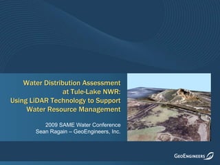
- 1. Water Distribution Assessment at Tule-Lake NWR: Using LiDAR Technology to Support Water Resource Management 2009 SAME Water Conference Sean Ragain – GeoEngineers, Inc.
- 2. Background on the LiDAR System
- 4. Features on the ground are “detected” from a reflection of light energy from an airborne source
- 7. Digital format/data quantification (volume calculations, cross sections, profiles, useable databases – GIS)
- 8. Access to difficult/inaccessible terrain
- 9. Cost – similar $/acre as conventional ground survey ($250 - $600/mi2)
- 10. Speed
- 12. Laser Detector
- 13. Scanning mechanism & controller
- 14. Computer timing circuits for emissions & reflections
- 15. Airborne Differential GPS (position)
- 16. Inertial Measurement Unit (attitude)
- 17. High Capacity Data Recorders
- 20. Using the constant speed of light, the time delay is converted into a slant-range distance
- 22. DEMs produced directly from the LiDAR Triangular Irregular Network (TIN) are not aesthetically pleasing
- 25. The CAD contours are edited to ensure proper cartographic standards
- 27. Combining DEMs and Photos
- 29. Vegetation Volume / Canopy Characteristics Analysis
- 30. Hydrologic and Watershed Modeling
- 31. Slope Stability
- 36. The Refuges are dependent on water supplies from the Bureau of Reclamation’s Klamath Project
- 37. Drought in 2001 brought water resource issues to a head
- 38. Controversy made national news
- 41. Habitat Types
- 42. Permanent and Seasonal Open Water and Marsh
- 43. Lost River and Shortnose Suckers
- 44. Waterfowl
- 45. Permanent and Seasonal Wetlands
- 46. Leased Agricultural Lands (>15,000 acres)
- 49. Potentially diminishing volume from current sources
- 50. Significant water losses to evaporation and seepage
- 52. Recommend facility improvements and analyze management alternatives that:
- 54. Increase efficiency – decrease costs
- 55. Enhance water reuse capabilities
- 56. Increase water storage capacityProject Goals
- 58. Kuchel Act – Requires Refuge land dedicated to wildlife with consideration for optimum agricultural use
- 59. Funding limitations restrict improvement options
- 61. Confirming water flow directions
- 62. Calculating areas and volumes
- 63. Evaluating how water can be moved and reused more efficiently
- 66. Accuracy in x,y,z of 15 to 30 cm required.
- 67. One x,y,z data point for every 2 m2 (approximately 114 million data points - both Refuges)
- 68. Creation of detailed DTMs
- 69. 3-Dimensional modeling necessary for volume/ capacity calculations
- 70. Fully GIS-compatibleRight Tool for the Job
- 74. Survey Area
- 75. Klamath Data Index 44 kilometers Area of enlargement 28 kilometers 2000 meter block
- 76. Area of enlargement Orthophoto
- 77. Orthophoto Zoom
- 83. GIS Inundation Model Plan view of extent of flooding in five (~150A) management units at various water-level stages. Used to determine if installing structures to gravity flow water between the units would allow a large area to be periodically flooded.
- 84. Slopes in 3D
- 85. 3D-Rendering
- 87. Provided highly detailed GIS database supported by orthophotography
- 88. Facilitated analysis of water management alternatives by thoroughly documenting:
- 89. Infrastructure
- 90. Habitat
- 91. Management practices (water rights, etc.)Project Results
- 93. Estimating seepage and evaporation losses needed as part of calculating water-storage balances
- 94. Identifying the optimum use of water at the refuges