Arctic Web Map, PolarMap.js, Arctic Sensor Web, and Arctic Citizen Sensors

This is a presentation presented at FOSS4G North America in Raleigh, NC on May 3rd 2016. We are presenting a suite of web mapping tools designed specifically for the Arctic regions. These tools are Arctic Citizen Sensors, Arctic Web Maps, and PolarMap.js. These Arctic-specific web mapping tools allowing researchers and developers to customize map projections for scientifically accurate visualization and analysis, a function that is critical for arctic research but not easy to do with existing web mapping platforms. Arctic Citizen Sensors is a citizen-sensing platform based on open source hardware and the OGC SensorThings API. It empowers the northern communities to collect environmental sensing data and develop innovative applications with the open sensing data. Arctic Web Maps (AWM) is an Arctic-focused tile server offering mapping tiles. By providing tiles in multiple Arctic projections, data can be more accurately visualized compared to most Mercator projected map tiles. The open source client library, PolarMap.js, is designed to be easy to use and easy to extend. It does this by providing a simple wrapper for building a typical Leaflet map, and also by providing base classes that can be customized to build a web map for your specific situation. This presentation will present and demonstrate the AWM and PolarMap.js and some real-world applications will also be discussed and demonstrated.

Recomendados
Recomendados
Mais conteúdo relacionado
Mais procurados
Mais procurados (20)
Semelhante a Arctic Web Map, PolarMap.js, Arctic Sensor Web, and Arctic Citizen Sensors
Semelhante a Arctic Web Map, PolarMap.js, Arctic Sensor Web, and Arctic Citizen Sensors (20)
Último
Último (17)
Arctic Web Map, PolarMap.js, Arctic Sensor Web, and Arctic Citizen Sensors
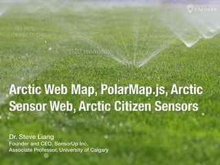
- 1. Arctic Web Map, PolarMap.js, Arctic Sensor Web, Arctic Citizen Sensors 0.23 litre/minute 0.25 litre/minute 0.27 litre/minuteRH: 85 % Temp: 18 Celsius Dr. Steve Liang Founder and CEO, SensorUp Inc. Associate Professor, University of Calgary
- 2. About Dr. Steve Liang ๏ Associate Professor, Geomatics Engineering, Uni. Calgary ๏ AITF-Microsoft Industry Research Chair on Open Sensor Web ๏ Chair OGC SensorThings API Standard Working Group ๏ Rapporteur, ITU-T SG12/11 on Internet of Things Test Specifications ๏ Founder and CEO, SensorUp Inc ๏ Father of Noah Liang
- 3. Where are the wild fire?
- 4. Web Mercator Projection served 80% of world population well however, there are still people living in high latitude regions…such as Canadians…
- 5. Alternative? ๏ Deploy our own web mapping stacks. Open source servers supports multiple projects, right? ๏ OSM is free to use. Data is not a problem anymore! We can always download Planet.osm, load into a web mapping server and set up a cache, right? My friend, it’s a lot of work in order to display the locations of wildfire…
- 6. A typical web mapping site for Arctic
- 7. Why so many applications still using Web Mercator Projections? ๏ Web Mercator-based tools provide great User Experiences (Developer Experience). ๏ Many easy-to-use API/SDKs ๏ Many tiles available with minimum response time ๏ Data available across pan-arctic regions
- 9. Arctic Web Map 1. Arctic Web Map (Tiles) 2. PolarMap.js Based on OSM, synced regularly (great for community engagement), six different projections A Leaflet plugin for AWM tiles and polar-specific functions (e.g., rotation)
- 10. Arctic Web Map
- 11. Example Application - #1
- 12. Example Application - #2 http://russiancouncil.ru/arcticdata/
- 13. Example Application - #3
- 14. Arctic Citizen Sensors ๏ Light ๏ Dust ๏ Humidity ๏ Temperature Working on the second version sensor with an OEM now
- 16. Acknowledgement
- 17. ?