Alternative legacy : lecture @ BAS april 2011
•
0 gostou•1,079 visualizações

This slide is from my lecture I held at Bergen School of Architecture, April 2011

Recomendados
Mais conteúdo relacionado
Semelhante a Alternative legacy : lecture @ BAS april 2011
Semelhante a Alternative legacy : lecture @ BAS april 2011 (17)
Mais de Laura Ve
Mais de Laura Ve (20)
Último
Último (20)
Alternative legacy : lecture @ BAS april 2011
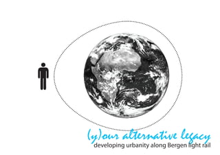
- 1. (y)our alternative legacy developing urbanity along Bergen light rail
- 2. Byparken Nonneseter Bystasjonen Nygård Florida Danmarksplass STRATEGIES : Kronstad Brann stadion decrease the ecological footprint for future inhabitants of Bergen City (in a 40-80 year perspective) Wergeland Sletten - densification surrounding light rail stops - strengthened mobility for soft pedestrians Slettebk - increase knowledge - local recourse circle - cradle to cradle Fantoft - local production - local business - strengthened local attachment - increased local bio-capasity Paradis (y)our alternative legacy Hop developing urbanity along bergen light rail urbandevelopmentbergen.blogspot.com N Nesttun
- 3. #Increase current City stormwater capacity stormwater capacity stormwater capacity #Automobile depen- #Automobile depen- depen- #Automobile dence and transportation dence and transportation EARLY IDEAS :and transportation dence alternatives alternatives alternatives #Pedestrian streets, CONCEPTUAL STRATEGIES streets, #Pedestrian FOR URBANIZATION ALONG THE NEW TRAVEL LINE #Pedestrian streets, public space, and street ain and stormwa- publicand street street public space, space, and design stormwa- ment and treat- design design #The need to demon- ndother “green” d treat- #The need to demon- #The need to demon- strate effective ecological “green” actices strate effective ecological strate effective ecological design, materials, and ase current City design, materials, and design, materials, and methods rent City er capacity methods methods #Education and out- city depen- mobile #Education and out- #Education and out- reach to the community depen- d transportation portation reach toreach to the community the community #Advanced and in- es #Advanced and in- #Advanced and in- novative watershed and strian streets, novative watershed and novative watershed and stormwater management treets, ace, and street stormwater management stormwater management models d street models models #Sustainable public in- eed to demon- #Sustainable public in- #Sustainable public in- frastructure improvements demon- ective ecological frastructure improvements frastructure improvements #Linkages between cologicaland materials, s, and #Linkages betweenbetween #Linkages environmental restoration environmental restoration environmental restoration and sustainable develop- ation and out- and sustainable develop- and sustainable develop- ment nd out- he community ment ment mmunity in- nced and nd in- - stick to your local watershed and - stick to- your local stick to your local footprint, bergen rain/ hed and er management footprint, rain/ footprint, bergen bergen rain/ stormwater, light rail/ less agement stormwater, less stormwater, light rail/light rail/ less cars, walkable/ bikeable inable public in- cars, walkable/ bikeable cars, walkable/ bikeable distance to kindergarten/ public in- re improvements ovements distancedistance to kindergarten/ to kindergarten/ shops/ activities, local gar- ges between shops/ activities, local gar- shops/ activities, local gar- dens/food/seeds/action- weenrestoration ental dens/food/seeds/action- dens/food/seeds/action- ism ideas and dive in!!!! estoration ainable develop- ism ideas and dive in!!!! ism ideas and dive in!!!! develop-
- 4. BACKGROUND OF THE SITUATION LANDSCAPE, NEEDS & INFRASTRUCTURE
- 6. tirsdag 27. juli 2010 BERGEN - LANDSCAPE, PRODUCTIVE LAND & NEEDS The city of Bergen is situated on the west coast of Norway and has been one of the most important national (and inter- escalated. Connecting Bergen to the rest og the national) harbours in its history, with connection to the rest of world with oil. Bergen region = This development of Bergen (prioritating private car infra- 100 % The city is situated in a landscape with strong structure) has continued up until today, and still seems to be caracter surrounded by 7 more or less steep the political mentality in the Region of Bergen. 465,68 km 2 mountains, shaped in arcs called Bergens buene. Bergen Municipality masters an area of 465,68km2. 50% of This hilly topography causes the caracteristic this landscape is above 160m. 4,4% is freshwater surface. humid climate the city is known for; mild humid air from the North Sea and Atlantic comes in and The urban areas are spread out over 108,5 km2, 23,3% of the is pushed up along the mountain sides, causing the total area of the Municipality, temperature to drop and rain. The topography of divided into eight boroughs. With 267 860 inhabitants it is not Bergen also makes city-planning challenging, a big city. regarding settlement pattern and infrastrucutral mobility strategies connected to settlement and 3,5% of Bergens area is farmland supporting only 11 780 people with food, on a vegetarian diet. After centuries of beeing a city connected by sea through the year. and horse (and by foot naturally), from 1900 Bergen developed connection-lines by rail. If all the 267 860 inhabitants was living on a vegetarian diet and it was all to be produced Bergens banen crossing the mountain to the within the Municipality it would require 333,58 km2, 71,6% of eastern part of Norway (Oslo) was built in the beginning of the 20th century. But also within its city-limits and to neighboring municipalities (now The Goverments amitions for the future is that we must be some included into Bergen Municipality) light rail able to support ourselves lines were developed, one of them turning in with 50% of consumed food within national borders to not put todays light rail stop, access-point : Wergeland. ourselves in a voulnerable position. Based on these goals and ambitions to lower our eco-foot- From the middle of the 20th century the private prints car was more and more prioritated, and by massive a change in local political mentality is required. development of the road system a new settlement pattern spread out caused by the accessibility of posted by laura kl. 15:22 the car. Etiketter: :: background, :: oil dependency, :: planning, :: politics, :: process, :: project, :: youralternativelegacy
- 7. Bergen City Centre and its ten satelite centres connected by roads, and now the light rail from the centre to Netun in south end of the valley. URBAN SPRAWL -and the settlement pattern of Bergen Housing construction Over the last 30 years housing construction has accounted for the greatest urban growth in terms of area. Despite the recent intensi cation of housing construction in the centre, population growth has still been greatest in the outermost city districts. The current master plan of the municipality intends to reverse this trend by utilising more development areas for housing Bergen City Centre and its ten satelite and business purposes nearer the city centre. centres connected by roads, The recommendation is to build 1,500 and now the light rail from the centre new housing units per year during the to Netun in south end of the valley. plan period, with a clear focus on densi cation in and around the centres Housing construction of the city districts, the local centres and Over the last 30 years housing construction around the light railway stops. Sixty per has accounted for the greatest urban growth cent of the building is planned as in terms of area. Despite the recent densi cation and forty per cent as eld intensi cation of housing construction in development. The next few years will the centre, population growth has still also see the construction of 2,000 been greatest in the outermost city districts. new student housing units and other The current master plan of the municipality rental housing. intends to reverse this trend by utilising more development areas for housing and business purposes nearer the city centre. The recommendation is to build 1,500
- 9. WHY IS FOOD PRODUCTION AN IMPORTANT PARAMETER IN CITY PLANNING? production of food is space consuming but we depend upon it......
- 11. ECOLOGICAL FOOTPRINT INDIVIDUAL ECOLOGICAL FOOTPRINT AND THE IMPACT ON OUR ENVIRONMENT CHOICE : CAUSE AND EFFECT OF LIFESTYLE...
- 12. THE ECO-FOOTPRINT AND GLOBAL BIOCAPACITY The measurement called “eco-footprint” is an abstract size or number based on the earths global bio capacity divided by the number of people living on the planet at any time. Meaning as time goes and we become more people our ideal eco-footprint shrinks, at the same time as our consumption increases and reduces the planets bio-capacity. In 2008 the individual ideal eco-footprint was 1,3 gha (global hectars), while the average Norwegian eco-footprint was 6,8. the abstract size of “ecological-footprint” visualized in the site
- 13. WORLD BIO - CAPASITY & ECOSYSTEM SERVICES Wild species and natural ecosystems are under pressure across all biomes and regions of the :: habitat loss, fragmentation or change, especially due to agriculture :: pollution :: the spread of invasive species or genes :: climate change (Livingplanet report) ECOSYSTEM SERVICES Humanity depends on healthy ecosystems, they support or improve our quality of life, and with- out them, the Earth would be uninhabitable. The Millennium Ecosystem Assessment (MA) de- scribes four categories of ecosystem services, starting with the most fundamental: :: supporting services such as nutrient cycling :: soil formation and primary production provisioning services such as the production of food, freshwater, materials or fuel pest control :: cultural (including aesthetic, spiritual, educational and recreational) services. The MA reported that biodiversity loss contributes to food and energy insecurity, increased - ability and quality of water, and the erosion of cultural heritage. Most supporting, regulating and cultural ecosystem services are not bought and sold com- mercially, so have no market value. Their decline sends no warning signal to the local or global producers and consumers, but often undermine the biodiversity and ecosystem services on which the production and consumption ultimately depend. The value of biodiversity to human planet that can support its human population and one which cannot. In a globally interdependent economy, people increasingly use ecological capacity from afar. When China imports wood from Tanzania, or Europe imports beef from cattle raised on Brazil- ian soy, these countries are relying on biocapacity outside of their borders to provide the re- sources being consumed by their population. Biocapacity is not evenly distributed around the world. The eight countries with the most bio- capacity ñ the United States, Brazil, Russia, China, Canada, India, Argentina and Australia ñ contain 50 per cent of the total world biocapacity. Three of the eight countries with the largest biocapacity ñ the United States, China and India ñ are ecological debtors, with their national Ecological debtor countries face increasing risk from a growing dependence on the biological capacity of others, while countries with ecological reserves can view their biological wealth as an asset that provides an important competitive advantage in an uncertain world. (Livingplanet report) With the consumption level of the average Norwegian, equivalent to 6,8 gha (global hectares) in 2009 we would need about 4,5 planets to sustain our lifestyle, relative to the number of peo- ple inhabiting the planet now. Increasing local bio-capasity, managing organic waste, re-use of goods and resources, local food production and accessibility for pedestrians will start the change and raise awareness around this.
- 14. THE IDEA OF ARTISAN AGRICULTURE Conventional agriculture does not integrate easily into the from transforming the raw foodstuff into final products. urban fabric. It is space consuming, requires large machinery # integrated infrastructure, water, waste-water, energy and and heavy spraying of fertilizers and pesticides is “normal”. solid-waste management systems offer opportunities to both Risking dust and chemicals to drift into residential areas will integrate with urban infrastructure and turn waste into shared always be a concern and therefore conventional agriculture resources. ( Composting food waste for soil improvement, becomes incompatible with modern city-living. treating urban runoff in ponds using it for irrigation (water In the urban landscape of Bergen, stuck between mountain source), using waste urban heat for green houses. walls, the artisan model can work better as it is more flexible # diverse education, the urban farmers education, or training and adaptable. of skills, covers agroecological farming practices and possible a range of small-business management strategies (to support Artisan: from Italian: artigiano, is a skilled manual worker who the vertically integrated business opportunities). makes items that may be functional or strictly decorative, # economic diversity, mixing agriculture with processing, re- including furniture, clothing, jewelry, household items, and tail, restaurants, agro-tourism and education greater econom- tools. The term can also be used as an adjective to refer to ic diversity is achieved in the community, new opportunities the craft of hand making food products, such as bread, bever- for the inhabitants. ages and cheese. Manufacture by hand and with hand tools imparts unique and Skills and knowledge are of high value,which appeals to us individual qualities to artisanal products, in contrast to mass and inspires us. produced goods where every one is nearly identical. Artisans were the dominant producers of goods before the Industrial Revolution. Artisans employ creative thinking and manual dexterity to produce their goods. (wikipedia.com) When speaking of building communities upon an artisan economy one can assume that the food produced is of good quality and worth celebrating simply because of the knowl- edge, skills and concern put in the effort of making it. Other plus words relating to an artisan agrarian economy are; # low toxicity farming, agroecological farming practices with a minimum of toxic pesticides and fertilizers. # high value products, for urban markets comes from smaller parcels. A community will focus on high value products. (You know your neighbor will suffer if you produce bad sugarpeas or rhubarb.) posted by laura kl. 17:46 # vertically integrated economy, the focus of artisan agricul- Etiketter: :: community, :: economy, :: urban gardening, ture is on finished food products. The local community benefit :: youralternativelegacy
- 16. SHORT TRAVELED FOOD and why this is important Small-scale processed, locally manufactured and short-trav- elled food are important to the environmentally conscious as it relies on and support local economy and businesses. Supporting local food-businesses shifts our food system from a global set of production and economy more dependent on oil as energy source, and a system that consumes a lot more oil. The so called hundred mile diet, or low carbon diet as it is also called, minimizes the emissions released from the production, packaging, processing, transport, preparation and waste of food. Major tenets of a low carbon diet include eating less indus- Bergen trial meat and dairy, eating less industrially produced food in general, eating food grown locally and seasonally, eating less processed and packaged foods and reducing waste from food by proper portion size, recycling or composting.*1 Transport of food across great distances of land or sea in high speed refrigerated ships or airplanes is a contributor to carbon dioxide emissions in the food industry. Some studies have argued that growing food only accounts for 21% of the energy required for many food products. Transportation (14%), processing (16%), packaging (7%), food retailing (4%), restau- rants and caterers (7%) and home refrigeration and preparation (32%) account for the rest. *2 Locavore describes a person attempting to eat a diet consist- ing of foods harvested from within a 100-mile radius. *1 (Randy Hall, “Low Carbon Diet’ Aims to Take Bite Out of Global Warming,” Cybercast News Service, April 18, 2007) *2 (Danielle Murray, “Oil and Food: A Rising Security Challenge,” Earth Policy Institute, May 9, 2005) 12 blue dot : hundred mile diet outline of Bergen (160 km) 13
- 17. introducing the food cycle celebr ption the cycle of life THE URBAN GARDENING CYCLE OF LIFE m atio nsu n Visualization of the processes involved around our need for food can increase our knowledge co wa and awareness around its origin and the destination of the waste products. We have grown a global economy depending on huge amounts of oil, and we are currently in a position to neglect ste the recourses lost by throwing away the waste products, be it organic waste or excess food. -m g ssin Using planning, regulations and education as tools we can little by little facilitate, encourage and ana show each other how to get more out of the local resources just lying there in front of us, spe- proce cially in a mild humid climate like in the city of Bergen, on the west coast of Norway. gem Explaining the steps of the cycle; ent soil im soil improvement, organically, means f.ex charging the soil with nutrients using compost from organic waste, nutrient made from nettle leafs and by using clover, and other cover crops, to let the fields rest in between productive seasons. sting seeding; is the start of the productive season. Schools, kindergartens and private galleries and conservatories can be effective producers in this stage of the cycle. Either for own use or for pro sales. rve planting; in larger fields, agro-parks, vegetable gardens or in the conservatories and galleries; vem giving the seedlings good environment and enough space to grow into crops. ha harvesting; for direct use or when the time is right harvesting of the planted fields, the forest en gardens, the forest, in the mountain or at sea. In surroundings like Bergen the opportunities are t endless from early summer to late autumn. see processing;the harvested raw is made into delicate products. ng din consumption; sales of raw and processed local food-stuff in grocery stores, farmers markets, planti g cafes and restaurants. And of course the food used directly from your private vegetable garden, gallery and conservatory. celebration; of the local products and produce with festivals, farmers markets or simply dinner parties with your family or neighbors. waste management; urban organic waste managed locally in small scale facilities. Compost makes excellent organic nutrient. Kept at a small scale the emission of the green gas methane is much less than in large facilities.
- 18. URBAN STRATEGIES FOR DECREASING OUR ECO-FOOTPRINT THE FIVE ECO-FOOTPRINT PARAMETERS # mobility # services # shelter # goods # food ASPECTS TO IMPLEMENT TO DECREASE FOOTPRINT # increase local bio-capacity # enable use of nature services as much as possible # visualization of the food cycle- “from field to fork” and facili- tate for a “hundred mile diet” # focus on green for production and green for “urban wilds” Establishing areas for urban wilds attracts birds, bugs and animals so that they don´t feed on the crops # education - networking # pedestrian accessibility # densification of central areas to minimize travel time # zero emissions building - ZEB / + housing
- 19. WHY? more needs met locally = less travel = more sustainable and other extra benefits to quality to life.......
- 20. Kronstad Brann stadion Wergeland Sletten Slettebk Fantoft Paradis
- 21. LANDSCAPE SECTION ACCESS POINT WERGELAND N density people : 8 000 ( in section view)
- 22. HISTORIC DEVELOPMENT OF WERGELAND aerial 1951 aerial 2006
- 23. SITUATION TO NEIGHBORING ACCESS-POINTS
- 24. TOPOGRAPHY OF WERGELAND model-view of site facing west, and bottom of valley W nt oi s-p s ce ac
- 25. LANDSCAPE / SITUATION EDGES
- 26. 5 MIN WALKING DISTANCE - 3 MIN DISTANCE BY BICYCLE
- 28. EXITING BICYCLE ROUTES THROUGH SITUATION
- 29. EXISTING GREEN : GRASS FIELDS / WOODS
- 35. INVERSION CAP & TREE BORDER - ZONING LARGE SCALE FOR PRODUCTION
- 36. AERIAL COMPARED TO CITY CENTER VIEW
- 37. DENSITY OF PEOPLE SAME, DENSITY OF BUILDINGS DIFFERENT
- 38. #Pedestrian streets, DENSIFICATION STRATEGIES AND GROWTH CALCULATIONS DENSIFICATION STRATEGIES AND GROWTH CALCULATIONS and street public space, design ESTIMATED POPULATION GROWTH FOR WERGELAND (model view) 2010 -2100 (based on 15% growth every ten years) SSB : 2010 - 2030 238% ESTIMATED GROWTH NEXT90 YEARS #The need to demon- ESTIMATED POPULATION GROWTH FOR BERGEN 2010 -2100 (based on 15% growth every ten years) SSB : 2010 - 2030 238% ESTIMATED GROWTH NEXT90 YEARS strate effective ecological 320 555 423 838 644 611 852 497 10 580 13 992 21 279 28 141 900 000 design, materials, and 30 000 800 000 25000 700 000 methods 20 000 600 000 #Education and out- 15 000 500 000 reach to the community 10 000 400 000 #Advanced and in- 5 000 300 000 novative watershed and 2010 2020 2030 2040 2050 2060 management stormwater 2070 2080 2090 2100 0 252 051 2010 2020 2030 2040 2050 2060 2070 2080 2090 2100 models POPULATION GROWTH #Sustainable public in- frastructure improvements access-point : WERGELAND ; 2010 - 2030 + 2580 #Linkages between access-point : WERGELAND ; 2030 - 2050 + 3412 environmental restoration and sustainable develop- access-point : WERGELAND ; 2050 - 2080 + 7287 ment SIZE OF LIVING SPACE - stick to your local one persons average living space 1980 = 34 m2 (102 m3) footprint, bergen rain/ one persons average living space 2003 = 162 m3 stormwater, light rail/ less cars, walkable/ bikeable one persons living space after 2010= 90 m3 ( 30m3 x 3m hight)* distance to kindergarten/ shops/ activities, local gar- * large space is energy waste, smaller space is energy saving dens/food/seeds/action- ism ideas and dive in!!!!
- 39. MOBILITY AND DENSIFICATION AT THE ACCESS-POINTS Mobility strategies in a situation connected to a system like metro, train or light rail is to develop a street structure leading to the access / departure point. A pedestrian trav- el circle stretches out to 5 min of walking (approx 400 mtrs), while traveling by bike stretches out to around 1000-1500 mtrs. With densification strategies to limit build- ing activity to surrounding access-points one save land and travel time. Develop- ing street-structures for people (instead of cars) with shortcuts and direction towards access-points increases accessibility.
- 40. DENSIFICATION STRATEGIES 300 circle & TRAVEL CORRIDORS Densification of the travel lines with buildings, green and programmes attracts people to walk and bike, as there is more to experience on the way to work etc. Adding building volumes into the in the 300 circle radius; fill in structures intensifies the existing structure to intensify an urban tall and tight to make the street feeling. street feeling, ligaht rail stop accessible to allowing office,-shop,-café is important especially along the travel more people. or other commercial/public/ open window activities to corridors leading to the acces-points. the street level intensifies the This improves the “street feeling”, ap- feeling of an urban environ- ment posed to a “road feeling”, decreasing urban sprawl. Within the 300 mtrs radius of the access point it is strategical to build tall and tight (high density of business and housing), to keep the accessibil- ity to many haigh. Closer is shorter is more accessible. Desification of green zones becomes higher as one travel further out of the 300 circle and into the areas of lower density.
- 41. BUSY STREETS AND PLACES SURROUNDING THE ACCESS-POINT
- 42. IDENTITY, SENSATION AND DIVERSITY IN THE STREETS Investigating concepts, shapes, programs and attributes of the streetscape.... What makes one block or street more interesting than others? With inspiration from f.ex the BORNEO project in Amsterdam (WEST8http://www.west8.nl/projects/all/ borneo_sporenburg/), and other street views and experiences, I am search- ing for some qualities, attributes, intrin- sic values etc that gives character to a neighborhood. This is qualities that one can sense when first experiencing a street or neighbor- hood, the visual impulses and aesthetics. But living in and being a user of a place connects experiences of other dimen- sions to the feeling of a place and the care (or lack of care) you feel for it, in the perspective of investing time and energy to it, making it your own.
- 43. BORNEO PROJECT FROM CANAL SIDE
- 44. The mosaic above is different images from Paris and Malmø. Both the cities have a lot of characteristics and varieties. Especially Paris has a rich variety in programs on street level that the neighbors use; bakery, coffeshop/cafés, grocery stores, laundry etc. Makes it possible for people to do their necessary things within their area... Which again make the area active...
- 45. The two pictures below shows the facades from both sides of Nygårdsgaten here in the City of Bergen, a varied street with different programs on street level and mostly apartments from first floor and above. How can one regulate an area or lead development into a varied expression like this? Is this pos- sible? Maybe the Borneo development shows that it can?
- 46. POSSIBILITIES + = densification ; fill-in structure (creates blokcs and streets) for inside-out- side qualities ; public, semi-public, private some buildings drawn back creates social spaces in streets different type of streets different intensity in programs
- 47. ACTIVE & QUIET : STREETS AND PLACES Striving for inviting ( vs. privatized / repellent) environments in the streets and squares it is important to get people out of the buildings. Without visual connection between people in the streets they appear empty and unattractive. Closed facades, especially on street level is experienced as uninviting. Shops on ground level of the build- ings makes streets, places and spaces experienced more public, and it attracts activity. By applying galleries on the outside of the facades, and conservatories in between, people living there get a climatic zone between inside and outside. This can help extract some activity from the inside, and increase more outside activity. The season is extended.
- 48. SOCIAL SHORTCUTS In the new structure where a differenciation in street and backyard is established and existing ; open up for “shortcuts” (walking paths) through the structure -increase sense of security ,“watching windows”, -increase social meetings -increase accessibility
- 49. INCREASED SOCIAL MEETINGS AND ACCESSIBILITY
- 52. SURFACE WATER TREATMENT Dealing with water on the surface adds qualities to the urban, rurban and rural environment. Green roofs, wetlands and permeable surfaces filters the water before it enters streams and ponds/lakes. Surroundings like this also helps fight urban heat island effect in the grey environment of the city. In an urban gardening environment, surface water installations can also work for irrigation of gardens and fields.
- 53. FOREST GARDENS & FOREST GARDEN: “URBAN WILDS” SEVEN LEVEL BENEFICIAL GUILD. 1.CANOPY (LARGE FRUIT & NUT TREES) 2. LOW TREE LAYER (DWARF FRUIT TREES) Blueberries, strawberries, 3. SHRUB LAYER ( CURRANTS & BERRIES) raspberries, blackberries, 4. HERBACEOUS ( COMFREYS, BEETS, HERBS) hazelnuts, rhubarb, mountain 5. RHIZOSPHERE ( ROOT VEDGETABLES) 6. SOUIL SURFACE ( GROUND COVER, EG, STRAWBERRY, cranberries, wild garlic... ETC.) 7. VERTICAL LAYER (CLIBERS, VINES) Forest gardens and urban wilds gives us the opportunities to harvest berries, fruits and nuts, and it attracts birds and insects away from the crops in the gar- dens, public agro-parks and the production fields. forest garden zones in the urban plan
- 54. SITUATION TODAY - BUILDINGS AND TOPOGRAPHY
- 55. NEW STRUCTURE AND NEW SITUATIONS
- 56. ALL ELEMENTS COMBINED MAKING THE NEW STRUCTURE AND NEW SITUATIONS access-point = the hart secondary squares public agro parks urban wilds / forest gardens (retail, markets, shops, publ. (a shop, a tree, running water, square) the bakery etc) new travel lines / shortcuts larger production zone resource management site (below inversion cap) (composting - cradle to cradle)
- 57. FROM THE “HART” IN THE NEW SITUATION, MIXED PROGRAMS FADES IN CONSENTATION
- 65. laura_ve : MASTER DIPLOMA PROJECT _ (y)our alternative legacy WERGELAND-BERGEN exhibition photos
- 66. feel free to visit : urbandevelopmentbergen.blogspot.com and / or youralternativelegacy.blogspot.com laura_ve : arkitektur&plan ø. korskirkesmauet 2b 5018-NO e: laura@ve.no t : +4791305175 w: lauravearkitekturogplan.blogspot.com laura_ve : MASTER DIPLOMA PROJECT _ (y)our alternative legacy - developing urbanity along bergen light rail Bergen School of Architecture 2010