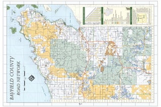
This document is a map showing roads and geographic features in Bayfield County, Wisconsin. It displays townships, roads, islands, and elevation lines. Key details include Raspberry Island, Eagle Island, Bear Island, and roads like Raspberry Shore Rd, Eagle Bay Rd, and Old County Highway K.
1. 91°35'0"W
91°30'0"W
91°25'0"W
91°20'0"W
91°15'0"W
91°10'0"W
91°5'0"W
91°0'0"W
90°55'0"W
90°50'0"W
90°45'0"W
Bear
Island
47°0'0"N 12 7 47°0'0"N
7
9
York Island
13 18
14 16
Raspberry Island
15
15
Sand 18
22
23
BAYFIELD COUNTY Island24 24 19
33000
37000
32000
35000
38000
39000
31000
36000
34000
26 25
21 22
Po 96000
in
tD
et
28 27
ou
r
R
26
d
29
Allen Rd
95000
l Dr
31 ft St
Sha Oak
effe
E Scheffel Dr
32 33 34 35
Sch
Divis
Raspberry Shore Rd
34 35 31 ion Rd
Sa
Island
Raspberry Rd
W
ROAD N ET W ORK Eagle Island 36 Ridge Rd