Capella Space Week 4 H4D Stanford 2016
•
2 likes•32,255 views

stanford, agile, lean, lean launchpad, h4d, hacking for defense, steve blank, BMNT, DIUX, Pete Newell, Joe Felter, customer discovery

Recommended
More Related Content
What's hot
What's hot (20)
Viewers also liked
Viewers also liked (18)
Similar to Capella Space Week 4 H4D Stanford 2016
Similar to Capella Space Week 4 H4D Stanford 2016 (20)
More from Stanford University
More from Stanford University (20)
Recently uploaded
Recently uploaded (20)
Capella Space Week 4 H4D Stanford 2016
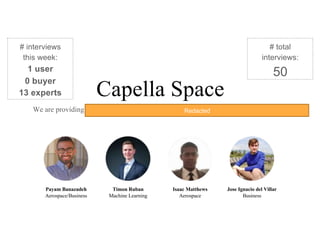
- 1. Capella Space We are providing low-cost SAR imagery satellite constellation with a low revisit rate. Payam Banazadeh Aerospace/Business Timon Ruban Machine Learning Isaac Matthews Aerospace Jose Ignacio del Villar Business # interviews this week: 1 user 0 buyer 13 experts # total interviews: 50 Redacted
- 2. We are at an IMPASSE with DODRedacted
- 3. Experiment #1 - Raw vs. Processed Data for DoD Hypothesis Experiment Result Action DoD organizations seek to gain actionable insights from processed data/ imagery as opposed to raw images. Interviewing with different DoD organizations and specifically with the U.S. Coast Guard, Air National Guard (Air Force), and Navy. Members of the DoD see our technology as another bolt in their ISR machine. A current gap in data analysis capability is filled through ad-hoc use of FSR’s (such as Palantir). The role and oversight of NGA is critical to understanding our value proposition and refining our MVP. Moreover, we should increase focus on commercial applications. To truly help the US Military we need to find commercial applications that validate our technology. We will make them our main focus. Redacted Redacted Redacted Redacted Redacted
- 4. Our two avenues of thinking Through our interviews we realized that there are two different products that we are covering: Raw Imagery Data analysis of the images “consumers wanting actionable intelligence in place of the images is incongruous with all aspects of military intelligence.” -- Intelligence Officer @ Navy But what about oil spills? Or a ship not having their AIS transmitting? Would coast guard not want “actionable intelligence” when it comes to this? Redacted Redacted Redacted Redacted Redacted
- 5. Areas of focus: Commercial focus: Patterns of life Oil/Gas Mining Disaster relief Maritime Domain Awareness? City planning? Agriculture? Construction? DOD focus: NGA Coast Guard - Maritime Domain Awareness? Redacted Redacted
- 6. Potential MVP for coast guard We need to understand this Redacted Redacted
- 7. We need contacts within NGARedacted
- 8. • Deploy 1 to 3 satellites and sell the images by September 2017. • Finish the deployment of 40 satellites by 2020. • Construction of payload for testing • Development of image analysis algorithms • Construction of satellite under required constraints • Data Analytics providers (Orbital Insight, Omni Earth, etc) • Sponsors (military and commercial) • Satellite structure providers • Satellite component providers • Orbital communication providers • Satellite launch providers • Get a customer in a country in the Equatorial orbit (Government) • Get commercial customers interested enough in our tech • The DHS and other government departments adopt our technology: • - USCG: to thwart drug trafficking from Ecuador and Colombia • Summer ground demonstration: $50k • First satellite: $6 million (including operations) • Subsequent satellites: $3 million each • Final constellation: $150 million total over 3 years • Funding to perform payload test during Summer 2016 • Government advocacy for our technology: DHS • Contacts in the Equatorial countries’ government agencies. Beneficiaries Mission AchievementMission Budget/Costs Buy-In/Support Deployment Value PropositionKey Activities Key Resources Commercial Satellite imagery resellers Illegal fishing in Indonesia Oil tankering in Nigeria Stop pirating at sea in Somalia Key Partners USCG Law Enforcement DO Information Watch Officer USCG - Stop more boats carrying drugs from Ecuador/Colombia - Reduce the cost of drug intervention operations NGA Provide better intelligence to other agencies/services Commercial Satellite Imagery Resellers: they can offer better and more diverse products Illegal fishing: tracking of ships that are doing suspicious activities at sea. Better law enforcement. NGA Intelligence Analysts Services in the DoD?? SOCOM Government sector driving demand (Indonesia, Nigeria, Ecuador, Colombia) Coast Guard Deputy Commandant for Operations (CG-DCO) Redacted Redacted Redacted Redacted Redacted Redacted Redacted Redacted Redacted
- 9. Products & Services Run counter-drug Operations Catch “bad guys on boats” Customer Jobs - “The sea is vast” -Low budget (=> cannot deploy to many resources) -Hard to know where to look/patrol Gains Pains Gain Creators Pain Relievers -Information on where boats are in patrol area lets duty officers deploy assets more strategically and more efficiently -High revisit rate enables duty officers to see smugglers even on quick runs (3-5h) - Stop more boats carrying drugs from Ecuador/Colombia - Reduce the cost of drug intervention operations Value Proposition Canvas - USCG Law Enforcement DO -provide locations of boats without AIS in desired area (extracted from SAR images) -web-based UI -modern machine learning/computer vision techniques can scan many images for boats and cover vast areas -locations of boats without AIS can queue where to send patrol vessels/aircrafts Redacted Redacted Redacted Redacted Redacted Redacted Redacted
- 10. Products & Services Deliver geospatial intelligence to, warfighters, intelligence professionals and first responders Customer Jobs - Insufficient knowledge (images) of areas interesting for DoD services - Over-tasking of analysts - Backlog of un-extruded data Gains Pains Gain Creators Pain Relievers - Global Coverage - On-Demand SAR images made possible by a high revisit rate - Data conditioning alleviates analyst tasking - Extrusions may align with current tagging practices -Receive high-resolution imagery from arbitrary places on-demand to make it easy to deliver insight - ??? Value Proposition Canvas - NGA -radar satellites -high-resolution SAR and InSAR images Redacted Redacted Redacted Redacted Redacted Redacted Redacted
- 11. Products & Services -Efficient exploration and production and delivery of fossil fuels Customer Jobs -Temporal and spatial resolution not sufficient -high cost while oil is cheap Gains Pains Gain Creators Pain Relievers -Inform oil production per well -Predict future surface changes based on historical data -Detect oil spills before they become a huge problem -Reduce maintenance cost of tiltmeters -Reduce manpower needed to maintain tiltmeters -Able to provide long term predictions/analysis -Precise surface deformation analysis to estimate well productivity -Efficient resource allocation directly to trouble spots (oil spills) Value Proposition Canvas - Commercial - Hedge Fund Investors, Oil/Mining, Agriculture -radar satellites -image analysis software -web-based UI Redacted Redacted Redacted Redacted Redacted Redacted Redacted Redacted
- 12. 1)What are your problems ? 2)How valuable is the solution to that problem ? ($$) 3)What are you doing about the problem right now? 4)What are the short comings (gaps) to current solutions ? 5)Understand (Authority -> Order -> Delivery -> Use)
Editor's Notes
- We have reached out to our assigned mentors, sponsors, and military liaisons and are leveraging the connections of this network to provide critical insights to open doors to contacts in the Navy 7th Fleet, and the military at large. Through our conversations, we have discovered that the US Navy and Coast Guard is interested in employing state of the art imaging platforms for wide area and continuous monitoring, specifically in the Arctic - SAR is a unique technology that affords the Navy and Coast Guard this capability. We have additionally discovered that the private sector, particularly companies in the Arctic region involved with the commerce, transportation, and exploitation of natural resources, may have an interest in the technology.