History of madras(Chennai) - Tamil Nadu
•Download as PPTX, PDF•
11 likes•7,017 views

plz view presentation in slide show for more content

Recommended
More Related Content
Viewers also liked
Viewers also liked (20)
More from School of Planning and Architecture
More from School of Planning and Architecture (7)
Recently uploaded
Recently uploaded (20)
History of madras(Chennai) - Tamil Nadu
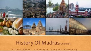
- 1. History Of Madras(Chennai) P r i t h i v i M o h a n 2 1 2 0 2 0 0 1 1 1 3 r d y e a r , B . P l a n n i n g
- 2. ABOUT CHENNAI • Madras, acquired its name from Madraspattinam which is a fishing village situated to the north of Fort St. George. • 400 years old city. • Its older name Madras was officially changed to Chennai in 1996. • 36th metropolitan city all across the world. • The Kapaleeshwarar temple, the Pallava Port and the Parthasarathi Temple of the 7th century are the effervescent facts to prove that the Chennai city has been present since the time. • Chennai is known as the "Detroit /.of India" for its automobile industry. • Population - 4.68 million residents (in 2011) ., making it the sixth most populous city in India. • The area of Chennai was expanded from 176 Sq Km to 426 Sq Km(in 2011). • 8.9 million, making it the fourth most populous metropolitan area in the country and 31st largest urban area in the world. • Madras was the first major British settlement in India, and until 1774 was the capital of the entire British Empire in the east, which stretched from India to Indonesia. Tamil Nadu Elevation – 6m (20ft)Coordinates:13.08389°N 80.27000°E Connectivity Map
- 3. o In 1522, the Portugese built a port called Sao Tome. o On 22nd August 1639, a small piece of land was purchased by the British East India Company which is located on the Coromandel Coast. o The city's Corporation, founded in 1687, was the first such governing body to be set up outside Europe. o Madras soon grew into a settlement of importance but in 1774 the British shifted their capital to Calcutta, influenced by its proximity to the north, its commercial importance represented by industries such as jute and indigo, and its climate. o Until Independence, Madras remained the capital of the Madras Presidency, an area that encompassed the whole of south India as well as parts of Maharashtra and Orissa o Chennai has a very heterogeneous mix of architectural styles ranging from ancient temples to the British colonial era buildings and to the latest modern buildings. Most of the buildings constructed during the colonial era are of the Indo-Sarcenic style. HISTORY 17th century o Scattered settlements separated by long distances. o Each settlement grew around the nucleus of a temple and has its own history. The most important area at that time was Mylapore. o Each of these villages was self-contained and mostly planned around a temple as an identity. o Within a few years of the founding of the British settlement and the construction of a Fort at the site, the New Town, which had grown up around it, came to be known as Chennapatnam in honour of the father of the local chieftain. This name was later applied to the whole city. o The population, which was 19,000 in 1646, expanded to 40,000 in 1669.
- 4. 18th century o During this time, the British found that Triplicane was a good area for settlement and a large number of people moved there. o The presence of the Nawab of Arcot increased the economic prosperity of the area and more and more Muslims settled in Triplicane. So from that time onwards, it grew in importance, second only, to George Town. o Lot of communication links between the settlements in the form of bridges and roads developed. o People started moving in different directions according to their professional activities (weaving, pot making, and trade) and need of space. This also leads to community development. 19th century o The city extended over an area of about 70 sq.kms. and had a population of 5.40 lakhs in 1901 o Central station was formed in 1872 and linked to the main line. o To facilitate trade the harbor was completed in 1896 just to the east of George Town. 20th century o The population of the City increased to 8.6 lakhs by 1941. o The city occupied an area of about 80 sq.km. o The major developments in the industrial field during the post independence era have been, the location of a number of public sector undertakings. and private sector undertakings. o Radial and Ring pattern of Development as CBD as the center. o The city was mainly a commercial, military and administrative centre for the entire South India. o In 1950 the boundary of the City was extended to cover 129sq.kms. o CBD was George town and Harbor. Present o George Town and its extension southwards into Anna Salai together constitute the central business district of the City where most of the wholesale trade, specialised retail trade and banking and financial institutions were located and where commercial activity was intense. Spatial Growth Pattern of the city