SlideShare a Scribd company logo
1 of 34
Download to read offline
1
Raymetrics S.A.
32 Spartis, Metamorfosis 14452, Athens, Greece
T +30 210 6655860 F +30 210 2827217
www.raymetrics.com info@raymetrics.com
Dr. George	Georgousis
(Founder	/	CEO)
Raymetrics S.A.
2
• Founded	in	Athens,	Greece	in	2002	–first	commercial	manufacturer
• Background	in	LIDAR	science	–key	advisor	is	now	President	of	ICLAS	
• Manufacturer	of	backscatter,	depolarization	and	Raman	LIDARs
• Systems	are	for	atmospheric	applications	only
• Company	designs	systems	(including	making	optical	designs),	integrates	components,	maintains	systems	and	creates	
software - also	services	and	integration
• Client	base	is	traditionally	researchers,	but	now	also	operational	and	commercial
• More	than	50	X	installations	around	the	world
• Global	coverage:	Europe,	USA,	South	America,	Africa,	India,	China,	Southeast	Asia,	etc	+	global	network	of	distributors
• Certified	ISO	9001:2008,	conform	to	ISO	28902-1:2012	for	visual	ranging	with	lidar,	conform to	EARLINET	requirements
3
0
5
10
15
20
25
2011 2012 2013 2014 2015
Number of Sales Per Year
4
Meteorological
Agencies
Research Institutes Mines and Heavy
Industry
Aviation
2002... 2016 2017
Military?
2012 2014
5
Met Office (UK) German Weather
Service
For Changi
Airport,
Singapore
For Heydar
Aliyev
Airport,
Azerbaijan
For Italian
Environmental
Agency
European
Space
Agency
German Aerospace
Centre
For Centre for Atmospheric
Studies and Earthquake
Research (CASER)
Braunschweig
airport
(testing only)
6
RADAR - Radio	Detection	And	Ranging
LIDAR - Light	Detection	And	Ranging
LIDAR is a Remote Sensing Technique:
• Method of obtaining information about an
object or quantity without having the sensor in
direct physical-contactwiththe object.
• This is as opposed to in-situ methods (e.g.
typical thermometers).
• For	both	active	and	passive	remote	sensing	
techniques	there	is	a	“medium”	which	carries	
the	information.	For	a	LIDAR	this	is	light	from	a	
laser.
7
8
6-9	ns
(2.5	m)
(pulse	duration)
20	Hz
0.05	s
(15.000	Km)
Continuous	wave	operation
Pulsed	operation
Laser	Repetition	Rate
9
t=0
t
z	=	t/2	x	c
(z=Ranging)
10
1. Atmospheric Physics / Meteorology / Pollution Monitoring / Crisis Management (Raymetrics)
2. Aviation / Transportation (Raymetrics)
3. Cultural Heritage
4. Terrain Mapping
5. Automotive (Advanced driver assistance systems-ADAS)
The global market for ADAS technology is forecast to grow rapidly to over $60 billion in revenue by 2020.
6. Real-time robotics
LIDAR sensors are applied for the odometry and mapping in real-time robotic systems. They navigate
robots for obstacle avoidance, sometimes under harsh environments.
7. (Additive) manufacturing: Laser scanners
11
• Backscatter Lidar Elastic-Inelastic
Aerosols localization, Aerosol Characterization, Water vapor, Temperature
• Differential absorption Lidar (DIAL)
Air pollution
(O3, CO2, NOx, SO2, HC, Water Vapor)
• Lidar Doppler
Wind speed, direction
12
• Aerosol Tracing – Backscatter Lidars
• Aerosol Characterization – Multiwavelength Depolarization Lidarss
• Meteorology – Clouds, PBL – Backscatter lidars
• Aviation: Clouds ceiling, Visibility, Fog incoming bang detection – Backscatter lidars
• Transportation: Visibility and fog incoming band detection (early warning mechanism)
• Crisis Management: Forecasting modelling and plume diffusion (dispersion) models
• System for O3 profiling - DIAL
• Fluorescence for oil spills and biological agents detection
13
LIDAR Type: Raman depolarization LIDAR
Deployment Type: Vertical pointing
Model: LR111-D300
Clients: Meteorological Agencies,
Environmental Authorities
Applications: Volcanic ash detection, aerosol/pollution
monitoring, PBL studies, remote
humidity (night only)
LIDAR Type: Raman, depol and/or backscatter LIDAR
Deployment Type: 3D scanning
Model: LR111-ESS-D200
Clients: Airports, Aviation Authorities,
Meteorological Agencies,
Environmental Authorities
Applications: Remote visibility, air quality/pollution
data, 3D cloud base, fog detection, PBL
studies
Option 1: Vertical Option 2: 3D Scanning
14
Raymetrics has a background in LIDAR science – still a core market – leading to many
options:
1. 3D scanning systems (backscatter, depolarization, Raman)
2. Vertical systems (backscatter, depolarization,Raman, multi-wavelength)
3. Components (telescopes, WSUs, upgrades)
4. Custom systems (DIAL, lidar stations)
5. Services (mining, leasing for research campaigns, installations)
Large and small vertical
systems
3D scanning systems
Telescopes
Custom LIDARs
15
• Accuracy – Performance
• Reliability – robustness
• Automation
• User Friendly (Software and Hardware) – Eye Safety
• Less complexity
• Easy maintenance – From non LIDAR experts
• Reasonable cost
16
Rain cover
Outer covering
(double-walled)
Climate control
Rain sensor
Emergency stop
Outdoor-safe
connectionsCastors and
levelling feet
17
• Several I/O
• UPS with automatic shutdown and restart after
power outage
• Open Hardware and Open Software architecture
• Fully remotely controlled
• Complete software suite including real-time display
and measurement scheduling
• Web based platform for real time products and
archived data
18
LIDAR Type: Raman depolarization LIDAR
Deployment Type: Vertical pointing
Model: LR111-D300
Clients: Meteorological Agencies,
Environmental Authorities
Applications: Volcanic ash detection, aerosol/pollution
monitoring, PBL studies, water vapour
mixing ratio (night only)
• Easy Access to internal Parts
• DPSS or Flash Lamp laser option
• Different protection mechanism
for different environments
19
1. Meteorology/Risk Management
• Remote data for air quality/pollution models
• Validation of numerical weather forecast models
• Planetary Boundary Layer structure - including mixing height, up
and down drafts, aerosol load (important for forecasting)
• Pollution plume monitoring
Runway	Visual	Range	(RVR)
Slant	Visual	Range	(SVR)
Model LR111-ESS-D200
3D scanning LIDAR
2. Aviation/Transportation - Meteorology
• 3D cloud base (or remote cloud base)
• Remote visibility measurement
• Fog detection (incoming alert or in-situ)
• PBL (Planetary Boundary Layer
Note: LIDARs are “new” for aviation and meteorology... but the
techniques are actually standard (ceilometers use LIDAR technique for
cloud base; for visibility and fog detection there is an ISO for
calculating MOR, VOR, SOR, SVR, RVR, etc)
20
21
More info you get
Better classification
22
Volcanic ash from the Eyjafjallajokull eruption in 2010 detected at
heights of 10 km down to 5 km over a 12 hour period with a LIDAR
built by Raymetrics for National Technical University of Athens (NTUA)
355nm Co-Polar
Night: > 14 km
Day: > 12 km
355nm Cross-Polar
Night: > 12 km
Day: > 11 km
387nm Nitrogen Raman
Night: > 12 km
Day: > 3 km
IMPORTANT: Values above
are achievable with Signal
to Noise Ratio (SNR) > 10
(i.e. very high quality data)
23
• LIDAR provides high resolution, high quality data to augment current systems
• E.g. below were two events (A and B) recorded with different equipment in Brazil. ‘A’ was
rain, reaching the ground as light drizzle. ‘B’ was ice clouds and virga.
LIDAR data (Raymetrics) recorded
clouds and precipitation in high detail
Data supplied by CAPES; CHUVA project FAPESP grant 2009/15235-8
X-band RADAR recorded
events in low resolution
with little cloud structure
for event A
K-band Micro-Rain RADAR
recorded no cloud structure
and lost rain at low altitudes
(though rain at low altitudes
was recorded on a fall
velocity profile)
Microwave radiometer
did not record events
(even using different
profiles such as relative
humidity)
24
• Improve the forecast of PBL mixing height (e.g. for aerosol loads and how close they are
to the ground)
Data from a Raymetrics LIDAR showing a change in the PBL mixing height (between
18:00 and 19:00) – corroborated by two Radiosondes on weather balloons (red stars).
Data supplied by CAPES; CHUVA project FAPESP grant 2009/15235-8
25
• Complex Atmospheric Structure
26
• Validate numerical weather forecast models (new field for LIDAR community) – e.g. COSMO
(COnsortium for Small-scale MOdelling)*, Weather Research Forecasting model (WRF)**
• Validation of 3D air quality models
• Improve the forecast of air pollutant 3D dispersion (e.g. particle distinction)
Image shows probably mainly
marine aerosols (blues) with thin
dust layer (green) above and
thicker dust close to ground.
New automatic particle distinction
– particle types are displayed
automatically by colour code.
27
Beijing dust storm - satellite imagery (NASA)
Right: Database facility for archived data
Beijing dust storm - lidar data (Raymetrics)
Right: Database facility for archived data
Dust Measurement (Vertical Example)
Notes: Air quality and pollution is usually only measured in-situ (on the ground). Lidar can
offer remote measurement up to 10 or 20 km – pollution altitude - and 3D distribution with
scanning lidar.
28
Notes: Met Agencies commonly measure water vapour remotely using radiosondes attached
to balloons – expensive! LIDAR can currently only measure humidity from dusk to dawn (due
to sunlight masking the signal), and this is only currently available for vertical LIDARs, but
this may still provide useful info for Met Agencies.
Water VapourProfiling (NEW!)
Water vapour (humidity) location in atmosphere from a
Raymetrics LIDAR
Raymetrics LIDAR data compared to radiosonde
(balloon) data
29
• Multiple	3D	scans	taken	
at	9	min	intervals
• Shows	time	evolution	
of	airborne	pollution	
(3D	dust	tracking,	
concentrations	and	
dispersion,	 plumes)		
• Data	can	be	geocoded
so	scans	can	be	viewed	
in	3D	in	applications	
such	as	Google	Earth	or	
GIS
Dust Measurement (3D Scanning Example)
30
Runway	Visual	Range	(RVR)
Slant	Visual	Range	(SVR)
• Backscatter Lidar: Aerosols, water vapor, pollution
• Differential absorption Lidar (DIAL)
General Air pollution (O3, CO2, NOx, SO2, HC)
Raymetrics delivers commercial DIAL Ozone systems for profiling
Low Troposphere
Middle Troposphere
Higher Troposphere
And Stratospheric Ozone
Other DIAL system upon request
31
¨ Development of a 6-wavelength lidar system for the retrieval of the microphysical and chemical aerosol particle
parametersin the troposphere: Application in the calibration of the satellite-borne CALIPSO lidar system.
¨ Project 06/2006 -12/2007 (Raymetrics, Georgia Institute of Technology , NTUA).
¨ 6-wavelength lidar system coupled with an aerosol model for the retrieval of the microphysical properties, and
water content of the aerosol particles in the troposphere.
¨ These data used in the calibration of the satellite-borne CALIPSO lidar system (Calibration and intercomparison for
the satellite-borne CALIPSO lidar system in the VIS-NIR spectral region over Athens).
CALIPSO	combines an active lidar instrument with
passive infrared and	visible imagers to probe the	
vertical structure and	properties of	thin clouds
and	aerosols over the	globe.	
CALIPSO	launched on	April 28,	2006
Space Applications: Validation of Satellite data
32
Laser fluorosensors are active sensors that take advantage of the fact that certain compounds in petroleum oils absorb
ultraviolet light and become electronically excited. This excitation is rapidly removed through the process of fluorescence
emission, primarily in the visible region of the spectrum. Since very few other compounds show this tendency, fluorescence is a
strong indication of the presence of oil. Natural fluorescing substances, such as chlorophyll, fluoresce at sufficiently different
wavelengths than oil to avoid confusion. As different types of oil yield slightly different fluorescent intensities and spectral
signatures, it is possible to differentiatebetween classes of oil under ideal conditions (Brown et al. 2000a;
Hengsterman and Reuter 1990; Balick et al. 1997)..
Fluorescence Lidar
ü Quick Market research: No commercial systems are available
yet
ü System Design: it depends strongly on the application
ü Applications (research, up to now) include:
1. Oil spill detection
2. Sea bathymetry
Recent applications (> 2012) include
3. Biological aerosols
Depth derived by
combined
355 + 450 spectrum
33
Through extensive knowledge of the sector, Raymetrics is able to work with different companies and
equipment to provide complete integrated solutions, including:
• Wind LIDARs for troposphere and stratosphere
• Microwave Radiometers
• Sun Photometers
• Weather RADARs
• Weather stations
• Many more
34
Thank you for your attention

More Related Content

What's hot

Introduction to li dar technology advanced remote sensing
Introduction to li dar technology   advanced remote sensingIntroduction to li dar technology   advanced remote sensing
Introduction to li dar technology advanced remote sensingBrightTimeStudio
 
Mobile Laser Scanning Workshop
Mobile Laser Scanning WorkshopMobile Laser Scanning Workshop
Mobile Laser Scanning WorkshopNasr Khashoggi
 
Vicarious Radiometric Calibration
Vicarious Radiometric CalibrationVicarious Radiometric Calibration
Vicarious Radiometric CalibrationBetsy Kenaston
 
"Why LiDAR?" Presentation
"Why LiDAR?" Presentation"Why LiDAR?" Presentation
"Why LiDAR?" PresentationLidar Blog
 
Radiometric Calibration of Digital Images
Radiometric Calibration of Digital ImagesRadiometric Calibration of Digital Images
Radiometric Calibration of Digital ImagesSean Thibert
 
light-detection-and-ranging(lidar)
 light-detection-and-ranging(lidar) light-detection-and-ranging(lidar)
light-detection-and-ranging(lidar)sandeep reddy
 
WE3.L10.4: KIYO TOMIYASU, CO-SEISMIC SLIP AND THE KRAFLA VOLCANO: REFLECTIONS...
WE3.L10.4: KIYO TOMIYASU, CO-SEISMIC SLIP AND THE KRAFLA VOLCANO: REFLECTIONS...WE3.L10.4: KIYO TOMIYASU, CO-SEISMIC SLIP AND THE KRAFLA VOLCANO: REFLECTIONS...
WE3.L10.4: KIYO TOMIYASU, CO-SEISMIC SLIP AND THE KRAFLA VOLCANO: REFLECTIONS...grssieee
 
LIDAR TECHNOLOGY AND ITS APPLICATION ON FORESTRY
LIDAR TECHNOLOGY AND ITS APPLICATION ON FORESTRYLIDAR TECHNOLOGY AND ITS APPLICATION ON FORESTRY
LIDAR TECHNOLOGY AND ITS APPLICATION ON FORESTRYAbhiram Kanigolla
 
Itroduction to lidar ground, ballon&air born lidar
Itroduction to lidar ground, ballon&air born lidarItroduction to lidar ground, ballon&air born lidar
Itroduction to lidar ground, ballon&air born lidaranuarag1992
 
NEON Airborne Operations
NEON Airborne OperationsNEON Airborne Operations
NEON Airborne Operationsjjparnell
 
Evaluating effectiveness of radiometric correction for optical satellite imag...
Evaluating effectiveness of radiometric correction for optical satellite imag...Evaluating effectiveness of radiometric correction for optical satellite imag...
Evaluating effectiveness of radiometric correction for optical satellite imag...Dang Le
 
Autonomous Navigation of UGV Based on AHRS, GPS and LiDAR
Autonomous Navigation of UGV Based on AHRS, GPS and LiDARAutonomous Navigation of UGV Based on AHRS, GPS and LiDAR
Autonomous Navigation of UGV Based on AHRS, GPS and LiDARJohn Liu
 
PCI Geomatics Synthetic Aperture Radar Processing Capabilities
PCI Geomatics Synthetic Aperture Radar Processing CapabilitiesPCI Geomatics Synthetic Aperture Radar Processing Capabilities
PCI Geomatics Synthetic Aperture Radar Processing CapabilitiesPci Geomatics
 

What's hot (20)

Introduction to li dar technology advanced remote sensing
Introduction to li dar technology   advanced remote sensingIntroduction to li dar technology   advanced remote sensing
Introduction to li dar technology advanced remote sensing
 
Mobile Laser Scanning Workshop
Mobile Laser Scanning WorkshopMobile Laser Scanning Workshop
Mobile Laser Scanning Workshop
 
Vicarious Radiometric Calibration
Vicarious Radiometric CalibrationVicarious Radiometric Calibration
Vicarious Radiometric Calibration
 
"Why LiDAR?" Presentation
"Why LiDAR?" Presentation"Why LiDAR?" Presentation
"Why LiDAR?" Presentation
 
Clear sky and all-weather global and beam irradiance models: long term valida...
Clear sky and all-weather global and beam irradiance models: long term valida...Clear sky and all-weather global and beam irradiance models: long term valida...
Clear sky and all-weather global and beam irradiance models: long term valida...
 
Radiometric Calibration of Digital Images
Radiometric Calibration of Digital ImagesRadiometric Calibration of Digital Images
Radiometric Calibration of Digital Images
 
light-detection-and-ranging(lidar)
 light-detection-and-ranging(lidar) light-detection-and-ranging(lidar)
light-detection-and-ranging(lidar)
 
WE3.L10.4: KIYO TOMIYASU, CO-SEISMIC SLIP AND THE KRAFLA VOLCANO: REFLECTIONS...
WE3.L10.4: KIYO TOMIYASU, CO-SEISMIC SLIP AND THE KRAFLA VOLCANO: REFLECTIONS...WE3.L10.4: KIYO TOMIYASU, CO-SEISMIC SLIP AND THE KRAFLA VOLCANO: REFLECTIONS...
WE3.L10.4: KIYO TOMIYASU, CO-SEISMIC SLIP AND THE KRAFLA VOLCANO: REFLECTIONS...
 
LIDAR TECHNOLOGY AND ITS APPLICATION ON FORESTRY
LIDAR TECHNOLOGY AND ITS APPLICATION ON FORESTRYLIDAR TECHNOLOGY AND ITS APPLICATION ON FORESTRY
LIDAR TECHNOLOGY AND ITS APPLICATION ON FORESTRY
 
Lidar
LidarLidar
Lidar
 
3D remote sensing of mines
3D remote sensing of mines 3D remote sensing of mines
3D remote sensing of mines
 
Lidar
LidarLidar
Lidar
 
Itroduction to lidar ground, ballon&air born lidar
Itroduction to lidar ground, ballon&air born lidarItroduction to lidar ground, ballon&air born lidar
Itroduction to lidar ground, ballon&air born lidar
 
ARC Comes into Focus
ARC Comes into FocusARC Comes into Focus
ARC Comes into Focus
 
LIDAR
LIDARLIDAR
LIDAR
 
LiDAR 101
LiDAR 101LiDAR 101
LiDAR 101
 
NEON Airborne Operations
NEON Airborne OperationsNEON Airborne Operations
NEON Airborne Operations
 
Evaluating effectiveness of radiometric correction for optical satellite imag...
Evaluating effectiveness of radiometric correction for optical satellite imag...Evaluating effectiveness of radiometric correction for optical satellite imag...
Evaluating effectiveness of radiometric correction for optical satellite imag...
 
Autonomous Navigation of UGV Based on AHRS, GPS and LiDAR
Autonomous Navigation of UGV Based on AHRS, GPS and LiDARAutonomous Navigation of UGV Based on AHRS, GPS and LiDAR
Autonomous Navigation of UGV Based on AHRS, GPS and LiDAR
 
PCI Geomatics Synthetic Aperture Radar Processing Capabilities
PCI Geomatics Synthetic Aperture Radar Processing CapabilitiesPCI Geomatics Synthetic Aperture Radar Processing Capabilities
PCI Geomatics Synthetic Aperture Radar Processing Capabilities
 

Similar to Raymetrics at Open Coffee Athens #92

Lidar final ppt
Lidar final pptLidar final ppt
Lidar final pptrsarnagat
 
Lidar : light detection and rangeing
Lidar : light detection and rangeingLidar : light detection and rangeing
Lidar : light detection and rangeingRahul Bhagore
 
Lidarpptbysharath copy-140316044543-phpapp01
Lidarpptbysharath copy-140316044543-phpapp01Lidarpptbysharath copy-140316044543-phpapp01
Lidarpptbysharath copy-140316044543-phpapp01bhanu kushangala
 
Introduction to lidar and its application
Introduction to lidar and its applicationIntroduction to lidar and its application
Introduction to lidar and its applicationVedant Srivastava
 
Fundamentals remote sensing land used
Fundamentals remote sensing land usedFundamentals remote sensing land used
Fundamentals remote sensing land usedHidraulica Tymanzo
 
Lidar- light detection and ranging
Lidar- light detection and rangingLidar- light detection and ranging
Lidar- light detection and rangingKarthick Subramaniam
 
Introduction to Synthetic Aperture Radar (SAR)
Introduction to Synthetic Aperture Radar (SAR)Introduction to Synthetic Aperture Radar (SAR)
Introduction to Synthetic Aperture Radar (SAR)NopphawanTamkuan
 
Meteorological measurements for solar energy
Meteorological measurements for solar energyMeteorological measurements for solar energy
Meteorological measurements for solar energyPeter Kalverla
 
Comparison Of Elevation Collection Technologies
Comparison Of Elevation Collection TechnologiesComparison Of Elevation Collection Technologies
Comparison Of Elevation Collection TechnologiesPaulDavidShaw
 
LiDAR Technology and Geospatial Services
LiDAR Technology and Geospatial Services LiDAR Technology and Geospatial Services
LiDAR Technology and Geospatial Services MattBethel1
 
Laser ScanningLaser scanning is an emerging data acquisition techn.pdf
Laser ScanningLaser scanning is an emerging data acquisition techn.pdfLaser ScanningLaser scanning is an emerging data acquisition techn.pdf
Laser ScanningLaser scanning is an emerging data acquisition techn.pdfanjaniar7gallery
 

Similar to Raymetrics at Open Coffee Athens #92 (20)

Lidar final ppt
Lidar final pptLidar final ppt
Lidar final ppt
 
LIDAR
LIDARLIDAR
LIDAR
 
The UAE solar Atlas
The UAE solar AtlasThe UAE solar Atlas
The UAE solar Atlas
 
Lidar : light detection and rangeing
Lidar : light detection and rangeingLidar : light detection and rangeing
Lidar : light detection and rangeing
 
Lidar and sensing
Lidar and sensingLidar and sensing
Lidar and sensing
 
Lidarpptbysharath copy-140316044543-phpapp01
Lidarpptbysharath copy-140316044543-phpapp01Lidarpptbysharath copy-140316044543-phpapp01
Lidarpptbysharath copy-140316044543-phpapp01
 
LIDAR
LIDARLIDAR
LIDAR
 
Lidar in-ieee-format
Lidar in-ieee-formatLidar in-ieee-format
Lidar in-ieee-format
 
Land management
Land managementLand management
Land management
 
Introduction to lidar and its application
Introduction to lidar and its applicationIntroduction to lidar and its application
Introduction to lidar and its application
 
Fundamentals remote sensing land used
Fundamentals remote sensing land usedFundamentals remote sensing land used
Fundamentals remote sensing land used
 
Lidar- light detection and ranging
Lidar- light detection and rangingLidar- light detection and ranging
Lidar- light detection and ranging
 
radar.pptx
radar.pptxradar.pptx
radar.pptx
 
In sar 1-1-2011
In sar 1-1-2011In sar 1-1-2011
In sar 1-1-2011
 
Altm (1)
Altm (1)Altm (1)
Altm (1)
 
Introduction to Synthetic Aperture Radar (SAR)
Introduction to Synthetic Aperture Radar (SAR)Introduction to Synthetic Aperture Radar (SAR)
Introduction to Synthetic Aperture Radar (SAR)
 
Meteorological measurements for solar energy
Meteorological measurements for solar energyMeteorological measurements for solar energy
Meteorological measurements for solar energy
 
Comparison Of Elevation Collection Technologies
Comparison Of Elevation Collection TechnologiesComparison Of Elevation Collection Technologies
Comparison Of Elevation Collection Technologies
 
LiDAR Technology and Geospatial Services
LiDAR Technology and Geospatial Services LiDAR Technology and Geospatial Services
LiDAR Technology and Geospatial Services
 
Laser ScanningLaser scanning is an emerging data acquisition techn.pdf
Laser ScanningLaser scanning is an emerging data acquisition techn.pdfLaser ScanningLaser scanning is an emerging data acquisition techn.pdf
Laser ScanningLaser scanning is an emerging data acquisition techn.pdf
 

More from Open Coffee Greece

Ferryhopper at Open Coffee #102
Ferryhopper at Open Coffee #102Ferryhopper at Open Coffee #102
Ferryhopper at Open Coffee #102Open Coffee Greece
 
Hack The Box at Open Coffee Athens CIV
Hack The Box at Open Coffee Athens CIVHack The Box at Open Coffee Athens CIV
Hack The Box at Open Coffee Athens CIVOpen Coffee Greece
 
Proto at Open Coffee Athens CIV
Proto at Open Coffee Athens CIVProto at Open Coffee Athens CIV
Proto at Open Coffee Athens CIVOpen Coffee Greece
 
BibeCoffee at Open Coffee #102
BibeCoffee at Open Coffee #102BibeCoffee at Open Coffee #102
BibeCoffee at Open Coffee #102Open Coffee Greece
 
ORamaVR at Open Coffee Athens CI
ORamaVR at Open Coffee Athens CIORamaVR at Open Coffee Athens CI
ORamaVR at Open Coffee Athens CIOpen Coffee Greece
 
InSyBio at Open Coffee Athens CI
InSyBio at Open Coffee Athens CIInSyBio at Open Coffee Athens CI
InSyBio at Open Coffee Athens CIOpen Coffee Greece
 
Signal Ocean at Open Coffee #100
Signal Ocean at Open Coffee #100Signal Ocean at Open Coffee #100
Signal Ocean at Open Coffee #100Open Coffee Greece
 
The Greek Finance Network at Open Coffee #99
The Greek Finance Network at Open Coffee #99The Greek Finance Network at Open Coffee #99
The Greek Finance Network at Open Coffee #99Open Coffee Greece
 
LearnWorlds at Open Coffee Athens #97
LearnWorlds at Open Coffee Athens #97LearnWorlds at Open Coffee Athens #97
LearnWorlds at Open Coffee Athens #97Open Coffee Greece
 
MyJobNow at Open Coffee Athens #97
MyJobNow at Open Coffee Athens #97MyJobNow at Open Coffee Athens #97
MyJobNow at Open Coffee Athens #97Open Coffee Greece
 
Goodbye Bread at Open Coffee Athens #97
Goodbye Bread at Open Coffee Athens #97Goodbye Bread at Open Coffee Athens #97
Goodbye Bread at Open Coffee Athens #97Open Coffee Greece
 

More from Open Coffee Greece (20)

Ferryhopper at Open Coffee #102
Ferryhopper at Open Coffee #102Ferryhopper at Open Coffee #102
Ferryhopper at Open Coffee #102
 
Novoville at Open Coffee #102
Novoville at Open Coffee #102Novoville at Open Coffee #102
Novoville at Open Coffee #102
 
Hack The Box at Open Coffee Athens CIV
Hack The Box at Open Coffee Athens CIVHack The Box at Open Coffee Athens CIV
Hack The Box at Open Coffee Athens CIV
 
Proto at Open Coffee Athens CIV
Proto at Open Coffee Athens CIVProto at Open Coffee Athens CIV
Proto at Open Coffee Athens CIV
 
Epignosis at Open Coffee #102
Epignosis at Open Coffee #102Epignosis at Open Coffee #102
Epignosis at Open Coffee #102
 
Geekbot at Open Coffee #102
Geekbot at Open Coffee #102Geekbot at Open Coffee #102
Geekbot at Open Coffee #102
 
BibeCoffee at Open Coffee #102
BibeCoffee at Open Coffee #102BibeCoffee at Open Coffee #102
BibeCoffee at Open Coffee #102
 
ORamaVR at Open Coffee Athens CI
ORamaVR at Open Coffee Athens CIORamaVR at Open Coffee Athens CI
ORamaVR at Open Coffee Athens CI
 
InSyBio at Open Coffee Athens CI
InSyBio at Open Coffee Athens CIInSyBio at Open Coffee Athens CI
InSyBio at Open Coffee Athens CI
 
Signal Ocean at Open Coffee #100
Signal Ocean at Open Coffee #100Signal Ocean at Open Coffee #100
Signal Ocean at Open Coffee #100
 
Aquanetix at Open Coffee #100
Aquanetix at Open Coffee #100Aquanetix at Open Coffee #100
Aquanetix at Open Coffee #100
 
Deepsea at Open Coffee #100
Deepsea at Open Coffee #100Deepsea at Open Coffee #100
Deepsea at Open Coffee #100
 
The Greek Finance Network at Open Coffee #99
The Greek Finance Network at Open Coffee #99The Greek Finance Network at Open Coffee #99
The Greek Finance Network at Open Coffee #99
 
Yodeck at Open Coffee #98
Yodeck at Open Coffee #98Yodeck at Open Coffee #98
Yodeck at Open Coffee #98
 
Buran VC at Open Coffee #98
Buran VC at Open Coffee #98Buran VC at Open Coffee #98
Buran VC at Open Coffee #98
 
LearnWorlds at Open Coffee Athens #97
LearnWorlds at Open Coffee Athens #97LearnWorlds at Open Coffee Athens #97
LearnWorlds at Open Coffee Athens #97
 
MyJobNow at Open Coffee Athens #97
MyJobNow at Open Coffee Athens #97MyJobNow at Open Coffee Athens #97
MyJobNow at Open Coffee Athens #97
 
Goodbye Bread at Open Coffee Athens #97
Goodbye Bread at Open Coffee Athens #97Goodbye Bread at Open Coffee Athens #97
Goodbye Bread at Open Coffee Athens #97
 
Norbloc at Open Coffee #96
Norbloc at Open Coffee #96Norbloc at Open Coffee #96
Norbloc at Open Coffee #96
 
Stasher at Open Coffee #96
Stasher at Open Coffee #96Stasher at Open Coffee #96
Stasher at Open Coffee #96
 

Recently uploaded

The Codex of Business Writing Software for Real-World Solutions 2.pptx
The Codex of Business Writing Software for Real-World Solutions 2.pptxThe Codex of Business Writing Software for Real-World Solutions 2.pptx
The Codex of Business Writing Software for Real-World Solutions 2.pptxMalak Abu Hammad
 
Boost PC performance: How more available memory can improve productivity
Boost PC performance: How more available memory can improve productivityBoost PC performance: How more available memory can improve productivity
Boost PC performance: How more available memory can improve productivityPrincipled Technologies
 
Powerful Google developer tools for immediate impact! (2023-24 C)
Powerful Google developer tools for immediate impact! (2023-24 C)Powerful Google developer tools for immediate impact! (2023-24 C)
Powerful Google developer tools for immediate impact! (2023-24 C)wesley chun
 
A Call to Action for Generative AI in 2024
A Call to Action for Generative AI in 2024A Call to Action for Generative AI in 2024
A Call to Action for Generative AI in 2024Results
 
Slack Application Development 101 Slides
Slack Application Development 101 SlidesSlack Application Development 101 Slides
Slack Application Development 101 Slidespraypatel2
 
2024: Domino Containers - The Next Step. News from the Domino Container commu...
2024: Domino Containers - The Next Step. News from the Domino Container commu...2024: Domino Containers - The Next Step. News from the Domino Container commu...
2024: Domino Containers - The Next Step. News from the Domino Container commu...Martijn de Jong
 
What Are The Drone Anti-jamming Systems Technology?
What Are The Drone Anti-jamming Systems Technology?What Are The Drone Anti-jamming Systems Technology?
What Are The Drone Anti-jamming Systems Technology?Antenna Manufacturer Coco
 
How to convert PDF to text with Nanonets
How to convert PDF to text with NanonetsHow to convert PDF to text with Nanonets
How to convert PDF to text with Nanonetsnaman860154
 
Breaking the Kubernetes Kill Chain: Host Path Mount
Breaking the Kubernetes Kill Chain: Host Path MountBreaking the Kubernetes Kill Chain: Host Path Mount
Breaking the Kubernetes Kill Chain: Host Path MountPuma Security, LLC
 
Advantages of Hiring UIUX Design Service Providers for Your Business
Advantages of Hiring UIUX Design Service Providers for Your BusinessAdvantages of Hiring UIUX Design Service Providers for Your Business
Advantages of Hiring UIUX Design Service Providers for Your BusinessPixlogix Infotech
 
CNv6 Instructor Chapter 6 Quality of Service
CNv6 Instructor Chapter 6 Quality of ServiceCNv6 Instructor Chapter 6 Quality of Service
CNv6 Instructor Chapter 6 Quality of Servicegiselly40
 
The 7 Things I Know About Cyber Security After 25 Years | April 2024
The 7 Things I Know About Cyber Security After 25 Years | April 2024The 7 Things I Know About Cyber Security After 25 Years | April 2024
The 7 Things I Know About Cyber Security After 25 Years | April 2024Rafal Los
 
Understanding Discord NSFW Servers A Guide for Responsible Users.pdf
Understanding Discord NSFW Servers A Guide for Responsible Users.pdfUnderstanding Discord NSFW Servers A Guide for Responsible Users.pdf
Understanding Discord NSFW Servers A Guide for Responsible Users.pdfUK Journal
 
08448380779 Call Girls In Diplomatic Enclave Women Seeking Men
08448380779 Call Girls In Diplomatic Enclave Women Seeking Men08448380779 Call Girls In Diplomatic Enclave Women Seeking Men
08448380779 Call Girls In Diplomatic Enclave Women Seeking MenDelhi Call girls
 
Histor y of HAM Radio presentation slide
Histor y of HAM Radio presentation slideHistor y of HAM Radio presentation slide
Histor y of HAM Radio presentation slidevu2urc
 
Artificial Intelligence: Facts and Myths
Artificial Intelligence: Facts and MythsArtificial Intelligence: Facts and Myths
Artificial Intelligence: Facts and MythsJoaquim Jorge
 
A Year of the Servo Reboot: Where Are We Now?
A Year of the Servo Reboot: Where Are We Now?A Year of the Servo Reboot: Where Are We Now?
A Year of the Servo Reboot: Where Are We Now?Igalia
 
[2024]Digital Global Overview Report 2024 Meltwater.pdf
[2024]Digital Global Overview Report 2024 Meltwater.pdf[2024]Digital Global Overview Report 2024 Meltwater.pdf
[2024]Digital Global Overview Report 2024 Meltwater.pdfhans926745
 
Presentation on how to chat with PDF using ChatGPT code interpreter
Presentation on how to chat with PDF using ChatGPT code interpreterPresentation on how to chat with PDF using ChatGPT code interpreter
Presentation on how to chat with PDF using ChatGPT code interpreternaman860154
 
Apidays Singapore 2024 - Building Digital Trust in a Digital Economy by Veron...
Apidays Singapore 2024 - Building Digital Trust in a Digital Economy by Veron...Apidays Singapore 2024 - Building Digital Trust in a Digital Economy by Veron...
Apidays Singapore 2024 - Building Digital Trust in a Digital Economy by Veron...apidays
 

Recently uploaded (20)

The Codex of Business Writing Software for Real-World Solutions 2.pptx
The Codex of Business Writing Software for Real-World Solutions 2.pptxThe Codex of Business Writing Software for Real-World Solutions 2.pptx
The Codex of Business Writing Software for Real-World Solutions 2.pptx
 
Boost PC performance: How more available memory can improve productivity
Boost PC performance: How more available memory can improve productivityBoost PC performance: How more available memory can improve productivity
Boost PC performance: How more available memory can improve productivity
 
Powerful Google developer tools for immediate impact! (2023-24 C)
Powerful Google developer tools for immediate impact! (2023-24 C)Powerful Google developer tools for immediate impact! (2023-24 C)
Powerful Google developer tools for immediate impact! (2023-24 C)
 
A Call to Action for Generative AI in 2024
A Call to Action for Generative AI in 2024A Call to Action for Generative AI in 2024
A Call to Action for Generative AI in 2024
 
Slack Application Development 101 Slides
Slack Application Development 101 SlidesSlack Application Development 101 Slides
Slack Application Development 101 Slides
 
2024: Domino Containers - The Next Step. News from the Domino Container commu...
2024: Domino Containers - The Next Step. News from the Domino Container commu...2024: Domino Containers - The Next Step. News from the Domino Container commu...
2024: Domino Containers - The Next Step. News from the Domino Container commu...
 
What Are The Drone Anti-jamming Systems Technology?
What Are The Drone Anti-jamming Systems Technology?What Are The Drone Anti-jamming Systems Technology?
What Are The Drone Anti-jamming Systems Technology?
 
How to convert PDF to text with Nanonets
How to convert PDF to text with NanonetsHow to convert PDF to text with Nanonets
How to convert PDF to text with Nanonets
 
Breaking the Kubernetes Kill Chain: Host Path Mount
Breaking the Kubernetes Kill Chain: Host Path MountBreaking the Kubernetes Kill Chain: Host Path Mount
Breaking the Kubernetes Kill Chain: Host Path Mount
 
Advantages of Hiring UIUX Design Service Providers for Your Business
Advantages of Hiring UIUX Design Service Providers for Your BusinessAdvantages of Hiring UIUX Design Service Providers for Your Business
Advantages of Hiring UIUX Design Service Providers for Your Business
 
CNv6 Instructor Chapter 6 Quality of Service
CNv6 Instructor Chapter 6 Quality of ServiceCNv6 Instructor Chapter 6 Quality of Service
CNv6 Instructor Chapter 6 Quality of Service
 
The 7 Things I Know About Cyber Security After 25 Years | April 2024
The 7 Things I Know About Cyber Security After 25 Years | April 2024The 7 Things I Know About Cyber Security After 25 Years | April 2024
The 7 Things I Know About Cyber Security After 25 Years | April 2024
 
Understanding Discord NSFW Servers A Guide for Responsible Users.pdf
Understanding Discord NSFW Servers A Guide for Responsible Users.pdfUnderstanding Discord NSFW Servers A Guide for Responsible Users.pdf
Understanding Discord NSFW Servers A Guide for Responsible Users.pdf
 
08448380779 Call Girls In Diplomatic Enclave Women Seeking Men
08448380779 Call Girls In Diplomatic Enclave Women Seeking Men08448380779 Call Girls In Diplomatic Enclave Women Seeking Men
08448380779 Call Girls In Diplomatic Enclave Women Seeking Men
 
Histor y of HAM Radio presentation slide
Histor y of HAM Radio presentation slideHistor y of HAM Radio presentation slide
Histor y of HAM Radio presentation slide
 
Artificial Intelligence: Facts and Myths
Artificial Intelligence: Facts and MythsArtificial Intelligence: Facts and Myths
Artificial Intelligence: Facts and Myths
 
A Year of the Servo Reboot: Where Are We Now?
A Year of the Servo Reboot: Where Are We Now?A Year of the Servo Reboot: Where Are We Now?
A Year of the Servo Reboot: Where Are We Now?
 
[2024]Digital Global Overview Report 2024 Meltwater.pdf
[2024]Digital Global Overview Report 2024 Meltwater.pdf[2024]Digital Global Overview Report 2024 Meltwater.pdf
[2024]Digital Global Overview Report 2024 Meltwater.pdf
 
Presentation on how to chat with PDF using ChatGPT code interpreter
Presentation on how to chat with PDF using ChatGPT code interpreterPresentation on how to chat with PDF using ChatGPT code interpreter
Presentation on how to chat with PDF using ChatGPT code interpreter
 
Apidays Singapore 2024 - Building Digital Trust in a Digital Economy by Veron...
Apidays Singapore 2024 - Building Digital Trust in a Digital Economy by Veron...Apidays Singapore 2024 - Building Digital Trust in a Digital Economy by Veron...
Apidays Singapore 2024 - Building Digital Trust in a Digital Economy by Veron...
 

Raymetrics at Open Coffee Athens #92

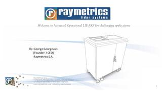
  • 1. 1 Raymetrics S.A. 32 Spartis, Metamorfosis 14452, Athens, Greece T +30 210 6655860 F +30 210 2827217 www.raymetrics.com info@raymetrics.com Dr. George Georgousis (Founder / CEO) Raymetrics S.A.
  • 2. 2 • Founded in Athens, Greece in 2002 –first commercial manufacturer • Background in LIDAR science –key advisor is now President of ICLAS • Manufacturer of backscatter, depolarization and Raman LIDARs • Systems are for atmospheric applications only • Company designs systems (including making optical designs), integrates components, maintains systems and creates software - also services and integration • Client base is traditionally researchers, but now also operational and commercial • More than 50 X installations around the world • Global coverage: Europe, USA, South America, Africa, India, China, Southeast Asia, etc + global network of distributors • Certified ISO 9001:2008, conform to ISO 28902-1:2012 for visual ranging with lidar, conform to EARLINET requirements
  • 3. 3 0 5 10 15 20 25 2011 2012 2013 2014 2015 Number of Sales Per Year
  • 4. 4 Meteorological Agencies Research Institutes Mines and Heavy Industry Aviation 2002... 2016 2017 Military? 2012 2014
  • 5. 5 Met Office (UK) German Weather Service For Changi Airport, Singapore For Heydar Aliyev Airport, Azerbaijan For Italian Environmental Agency European Space Agency German Aerospace Centre For Centre for Atmospheric Studies and Earthquake Research (CASER) Braunschweig airport (testing only)
  • 6. 6 RADAR - Radio Detection And Ranging LIDAR - Light Detection And Ranging LIDAR is a Remote Sensing Technique: • Method of obtaining information about an object or quantity without having the sensor in direct physical-contactwiththe object. • This is as opposed to in-situ methods (e.g. typical thermometers). • For both active and passive remote sensing techniques there is a “medium” which carries the information. For a LIDAR this is light from a laser.
  • 7. 7
  • 10. 10 1. Atmospheric Physics / Meteorology / Pollution Monitoring / Crisis Management (Raymetrics) 2. Aviation / Transportation (Raymetrics) 3. Cultural Heritage 4. Terrain Mapping 5. Automotive (Advanced driver assistance systems-ADAS) The global market for ADAS technology is forecast to grow rapidly to over $60 billion in revenue by 2020. 6. Real-time robotics LIDAR sensors are applied for the odometry and mapping in real-time robotic systems. They navigate robots for obstacle avoidance, sometimes under harsh environments. 7. (Additive) manufacturing: Laser scanners
  • 11. 11 • Backscatter Lidar Elastic-Inelastic Aerosols localization, Aerosol Characterization, Water vapor, Temperature • Differential absorption Lidar (DIAL) Air pollution (O3, CO2, NOx, SO2, HC, Water Vapor) • Lidar Doppler Wind speed, direction
  • 12. 12 • Aerosol Tracing – Backscatter Lidars • Aerosol Characterization – Multiwavelength Depolarization Lidarss • Meteorology – Clouds, PBL – Backscatter lidars • Aviation: Clouds ceiling, Visibility, Fog incoming bang detection – Backscatter lidars • Transportation: Visibility and fog incoming band detection (early warning mechanism) • Crisis Management: Forecasting modelling and plume diffusion (dispersion) models • System for O3 profiling - DIAL • Fluorescence for oil spills and biological agents detection
  • 13. 13 LIDAR Type: Raman depolarization LIDAR Deployment Type: Vertical pointing Model: LR111-D300 Clients: Meteorological Agencies, Environmental Authorities Applications: Volcanic ash detection, aerosol/pollution monitoring, PBL studies, remote humidity (night only) LIDAR Type: Raman, depol and/or backscatter LIDAR Deployment Type: 3D scanning Model: LR111-ESS-D200 Clients: Airports, Aviation Authorities, Meteorological Agencies, Environmental Authorities Applications: Remote visibility, air quality/pollution data, 3D cloud base, fog detection, PBL studies Option 1: Vertical Option 2: 3D Scanning
  • 14. 14 Raymetrics has a background in LIDAR science – still a core market – leading to many options: 1. 3D scanning systems (backscatter, depolarization, Raman) 2. Vertical systems (backscatter, depolarization,Raman, multi-wavelength) 3. Components (telescopes, WSUs, upgrades) 4. Custom systems (DIAL, lidar stations) 5. Services (mining, leasing for research campaigns, installations) Large and small vertical systems 3D scanning systems Telescopes Custom LIDARs
  • 15. 15 • Accuracy – Performance • Reliability – robustness • Automation • User Friendly (Software and Hardware) – Eye Safety • Less complexity • Easy maintenance – From non LIDAR experts • Reasonable cost
  • 16. 16 Rain cover Outer covering (double-walled) Climate control Rain sensor Emergency stop Outdoor-safe connectionsCastors and levelling feet
  • 17. 17 • Several I/O • UPS with automatic shutdown and restart after power outage • Open Hardware and Open Software architecture • Fully remotely controlled • Complete software suite including real-time display and measurement scheduling • Web based platform for real time products and archived data
  • 18. 18 LIDAR Type: Raman depolarization LIDAR Deployment Type: Vertical pointing Model: LR111-D300 Clients: Meteorological Agencies, Environmental Authorities Applications: Volcanic ash detection, aerosol/pollution monitoring, PBL studies, water vapour mixing ratio (night only) • Easy Access to internal Parts • DPSS or Flash Lamp laser option • Different protection mechanism for different environments
  • 19. 19 1. Meteorology/Risk Management • Remote data for air quality/pollution models • Validation of numerical weather forecast models • Planetary Boundary Layer structure - including mixing height, up and down drafts, aerosol load (important for forecasting) • Pollution plume monitoring Runway Visual Range (RVR) Slant Visual Range (SVR) Model LR111-ESS-D200 3D scanning LIDAR 2. Aviation/Transportation - Meteorology • 3D cloud base (or remote cloud base) • Remote visibility measurement • Fog detection (incoming alert or in-situ) • PBL (Planetary Boundary Layer Note: LIDARs are “new” for aviation and meteorology... but the techniques are actually standard (ceilometers use LIDAR technique for cloud base; for visibility and fog detection there is an ISO for calculating MOR, VOR, SOR, SVR, RVR, etc)
  • 20. 20
  • 21. 21 More info you get Better classification
  • 22. 22 Volcanic ash from the Eyjafjallajokull eruption in 2010 detected at heights of 10 km down to 5 km over a 12 hour period with a LIDAR built by Raymetrics for National Technical University of Athens (NTUA) 355nm Co-Polar Night: > 14 km Day: > 12 km 355nm Cross-Polar Night: > 12 km Day: > 11 km 387nm Nitrogen Raman Night: > 12 km Day: > 3 km IMPORTANT: Values above are achievable with Signal to Noise Ratio (SNR) > 10 (i.e. very high quality data)
  • 23. 23 • LIDAR provides high resolution, high quality data to augment current systems • E.g. below were two events (A and B) recorded with different equipment in Brazil. ‘A’ was rain, reaching the ground as light drizzle. ‘B’ was ice clouds and virga. LIDAR data (Raymetrics) recorded clouds and precipitation in high detail Data supplied by CAPES; CHUVA project FAPESP grant 2009/15235-8 X-band RADAR recorded events in low resolution with little cloud structure for event A K-band Micro-Rain RADAR recorded no cloud structure and lost rain at low altitudes (though rain at low altitudes was recorded on a fall velocity profile) Microwave radiometer did not record events (even using different profiles such as relative humidity)
  • 24. 24 • Improve the forecast of PBL mixing height (e.g. for aerosol loads and how close they are to the ground) Data from a Raymetrics LIDAR showing a change in the PBL mixing height (between 18:00 and 19:00) – corroborated by two Radiosondes on weather balloons (red stars). Data supplied by CAPES; CHUVA project FAPESP grant 2009/15235-8
  • 26. 26 • Validate numerical weather forecast models (new field for LIDAR community) – e.g. COSMO (COnsortium for Small-scale MOdelling)*, Weather Research Forecasting model (WRF)** • Validation of 3D air quality models • Improve the forecast of air pollutant 3D dispersion (e.g. particle distinction) Image shows probably mainly marine aerosols (blues) with thin dust layer (green) above and thicker dust close to ground. New automatic particle distinction – particle types are displayed automatically by colour code.
  • 27. 27 Beijing dust storm - satellite imagery (NASA) Right: Database facility for archived data Beijing dust storm - lidar data (Raymetrics) Right: Database facility for archived data Dust Measurement (Vertical Example) Notes: Air quality and pollution is usually only measured in-situ (on the ground). Lidar can offer remote measurement up to 10 or 20 km – pollution altitude - and 3D distribution with scanning lidar.
  • 28. 28 Notes: Met Agencies commonly measure water vapour remotely using radiosondes attached to balloons – expensive! LIDAR can currently only measure humidity from dusk to dawn (due to sunlight masking the signal), and this is only currently available for vertical LIDARs, but this may still provide useful info for Met Agencies. Water VapourProfiling (NEW!) Water vapour (humidity) location in atmosphere from a Raymetrics LIDAR Raymetrics LIDAR data compared to radiosonde (balloon) data
  • 29. 29 • Multiple 3D scans taken at 9 min intervals • Shows time evolution of airborne pollution (3D dust tracking, concentrations and dispersion, plumes) • Data can be geocoded so scans can be viewed in 3D in applications such as Google Earth or GIS Dust Measurement (3D Scanning Example)
  • 30. 30 Runway Visual Range (RVR) Slant Visual Range (SVR) • Backscatter Lidar: Aerosols, water vapor, pollution • Differential absorption Lidar (DIAL) General Air pollution (O3, CO2, NOx, SO2, HC) Raymetrics delivers commercial DIAL Ozone systems for profiling Low Troposphere Middle Troposphere Higher Troposphere And Stratospheric Ozone Other DIAL system upon request
  • 31. 31 ¨ Development of a 6-wavelength lidar system for the retrieval of the microphysical and chemical aerosol particle parametersin the troposphere: Application in the calibration of the satellite-borne CALIPSO lidar system. ¨ Project 06/2006 -12/2007 (Raymetrics, Georgia Institute of Technology , NTUA). ¨ 6-wavelength lidar system coupled with an aerosol model for the retrieval of the microphysical properties, and water content of the aerosol particles in the troposphere. ¨ These data used in the calibration of the satellite-borne CALIPSO lidar system (Calibration and intercomparison for the satellite-borne CALIPSO lidar system in the VIS-NIR spectral region over Athens). CALIPSO combines an active lidar instrument with passive infrared and visible imagers to probe the vertical structure and properties of thin clouds and aerosols over the globe. CALIPSO launched on April 28, 2006 Space Applications: Validation of Satellite data
  • 32. 32 Laser fluorosensors are active sensors that take advantage of the fact that certain compounds in petroleum oils absorb ultraviolet light and become electronically excited. This excitation is rapidly removed through the process of fluorescence emission, primarily in the visible region of the spectrum. Since very few other compounds show this tendency, fluorescence is a strong indication of the presence of oil. Natural fluorescing substances, such as chlorophyll, fluoresce at sufficiently different wavelengths than oil to avoid confusion. As different types of oil yield slightly different fluorescent intensities and spectral signatures, it is possible to differentiatebetween classes of oil under ideal conditions (Brown et al. 2000a; Hengsterman and Reuter 1990; Balick et al. 1997).. Fluorescence Lidar ü Quick Market research: No commercial systems are available yet ü System Design: it depends strongly on the application ü Applications (research, up to now) include: 1. Oil spill detection 2. Sea bathymetry Recent applications (> 2012) include 3. Biological aerosols Depth derived by combined 355 + 450 spectrum
  • 33. 33 Through extensive knowledge of the sector, Raymetrics is able to work with different companies and equipment to provide complete integrated solutions, including: • Wind LIDARs for troposphere and stratosphere • Microwave Radiometers • Sun Photometers • Weather RADARs • Weather stations • Many more
  • 34. 34 Thank you for your attention