NJFuture 2012 Smart Growth Awards Hammonton Form-Based Code
•
2 gostaram•904 visualizações

An innovative update to the town of Hammonton's zoning code that fosters smart growth and downtown revitalization.

Recomendados
Recomendados
Mais conteúdo relacionado
Mais procurados
Mais procurados (12)
Destaque
Destaque (20)
Semelhante a NJFuture 2012 Smart Growth Awards Hammonton Form-Based Code
Semelhante a NJFuture 2012 Smart Growth Awards Hammonton Form-Based Code (20)
Mais de New Jersey Future
Mais de New Jersey Future (20)
Último
Último (8)
NJFuture 2012 Smart Growth Awards Hammonton Form-Based Code
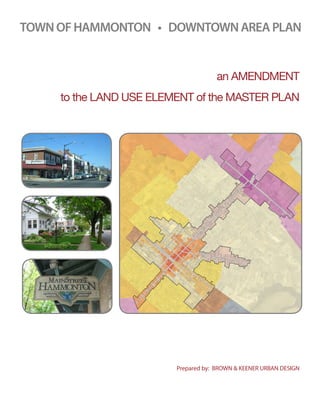
- 1. TOWN OF HAMMONTON • DOWNTOWN AREA PLAN an AMENDMENT to the LAND USE ELEMENT of the MASTER PLAN Prepared by: BROWN & KEENER URBAN DESIGN
- 2. TOWN OF HAMMONTON • DOWNTOWN AREA PLAN AMENDMENT to the LAND USE ELEMENT of the MASTER PLAN Introduction This Downtown Area Plan reflects the importance of Downtown to community life and the appropriateness of articulating specific goals related to the unique land-use and urban design circumstances in this area. The Downtown Area Plan component of the Land Use Element: • Recognizes Hammonton’s pinelands context – a rural geography that surrounds a town that is a center of civic and economic life in the region. • Updates the municipal policy plan for future growth and investment in the downtown • Defines the municipal goals and objectives within the context of an overall vision for the future of downtown • Describes strategic approaches to Land-Use, Urban Design, Historic Preservation, Circulation and Parking, Affordable Housing, and Open Space that support the overall vision for the future of downtown. Downtown Hammonton is not a dense urban place, nor is it purely a village or a suburb; it has always been a classic American town in terms of the character of its buildings and streets, the community and civic life that occurs there, and its economic vitality. The idea of being – and remaining – a town, should be a fundamental guidepost in making decisions about the future. And when this document refers to Hammonton’s “urban design” and “urban character,” it uses those terms to describe downtown’s unique texture — the general scale and pattern of buildings, the layout of streets, the greenery in so many places, and the quality of having been built in small increments over a long period of time. The purpose of this element is to state at the broadest level what Hammonton wants the future of its downtown to be, as well as to set out specific objectives and policy directives that will guide decision–making for Downtown over the coming years. To be fully effective, a range of implementation tools, many of which are described in this element, should support the element. Key initiatives include establishing a zoning framework of distinctive “Character Districts” that reflect the subtle differences in the downtown area blocks, creating more shared and off-site parking mechanisms, and providing more extensive design guidance for new, expanded and renovated buildings. The Downtown Area Plan consists of the following sections: A - Principles, Goals and Objectives B - Land-Use Strategy C - Character Districts Framework D - Urban Design Strategy E - Historic Preservation Strategy F - Circulation and Parking Strategy G - Affordable Housing Strategy H - Open Space Strategy P r o p o s e d A M E N D M E N T t o t h e L A N D U SE E L E M E N T o f t h e M A S T ER P L A N 2
- 3. A - Principles, Goals and Objectives Introduction The following principles have been the consistent themes of plans for downtown, and were amplified and refined through a vision planning process in the fall and winter of 2009: • Downtown is the center, the meeting place, of the entire community — and it should remain that way. • A mix of uses — civic places, shopping places housing and offices — knit together by green, walkable streets are the building blocks of Hammonton’s downtown center. • The downtown is framed by transitional “gateway districts,” where the approach and arrival to downtown play an important role in marketing and promoting Downtown businesses to visitors. Notwithstanding, neighborhoods adjacent to downtown should be respected and their character should be conserved. • Downtown’s valued places and buildings have the special scale of a town, not a city or a suburb, and speak vividly of Hammonton’s accumulated history. • The urban and architectural character of downtown is diverse, and it varies almost on a block- by-block basis. This is a quality that should be reflected in development regulations. • Pedestrian life, not vehicular traffic, should be dominant. However, vehicular traffic should be accommodated within the downtown infrastructure to provide smooth and efficient vehicular access and parking to visitors of the downtown area. • Downtown is an appropriate place for more housing, including affordable housing, that will provide diverse, transit- ccessible, non-auto-dependent housing opportunities and increase a the vitality of the downtown area after business hours. B - LAND USE STRATEGY Introduction In Hammonton’s Downtown Area, there are key places where certain land uses should be encouraged or discouraged, but in general, a mutually-supportive mix of retail, residential, office, service and civic uses should be encouraged. Therefore, the zoning framework should not be overly prescriptive in terms of land use, providing for flexibility while taking care to conserve sensitive areas, such as the Bellevue Avenue retail area. This land-use flexibility should occur within a framework for urban form that carefully reinforces and extends the pattern of the existing town, and considers the impact of development on traffic and parking. Land Use: Retail Space, Business service and office uses, Housing, Retail Activity Downtown retail space, business service and office uses should be concentrated primarily in the ground floor of buildings along Bellevue Avenue between Third Street and West End Avenue, on Central Avenue below Third Street, along the White Horse Pike and in small pockets of neighborhood or transit patron-serving commercial in appropriate areas. Retail space that draws pedestrians away from the shopping environment of Bellevue Avenue should not be allowed, beyond the exceptions noted. Mixed-use buildings along Bellevue Avenue P r o p o s e d A M E N D M E N T t o t h e L A N D U SE E L E M E N T o f t h e M A S T ER P L A N 3
- 4. Housing, including affordable housing, should be allowed and encouraged as a primary use in every zoning district, and a variety of housing types (from twins to multiple dwellings) should be permitted in each district to allow for greater diversity in housing options. Affordable housing would be developed through the Town’s existing inclusionary housing ordinance, which should continue, and other means outlined in the “housing” section of this element and the Master Plan. Nowhere in Downtown should parking be regarded as an acceptable primary use of a private property; it should only be a secondary use. The Town should not permit the demolition of any structure to allow for parking, with the exception of interior block buildings that have no street frontage, and only after consideration is given to the historic value of the building, the impact on neighbors, the impact on circulation, and other issues of public concern. Density / Development Strategy It is important to recognize that Hammonton is not likely to see a great amount of development all at once. Rather, change will occur by way of a constant flow of small, incremental reconfigurations and/or additions to Downtown’s built fabric, at the pace the market can absorb new space and over the course of many decades. Essentially, growth will happen just as the town has grown in the past: as demand warrants additional investment. The slow pace of change will enable the Town to plan for any impacts on municipal infrastructure or services. This is why scale and texture of development that is permitted on any given site is so important; the design of each building will have a more immediate impact on character than the overall development capacity of downtown. C - CHARACTER DISTRICTS FRAMEWORK Introduction Use-based zoning is a successful tool for preserving and creating neighborhoods of a single use type. However, the complexities of downtown areas require zoning districts with an emphasis on form rather than use to protect neighborhood character and achieve other community design and functionality goals. The Character District-based Zoning Framework is intended to give direction for an eventual revision to the Land Development Ordinance. The proposed framework incorporates the following basic approaches and assumptions. Districting strategy Most of the Downtown Area, now generally zoned B-1 and M-D, will is to be reorganized into Downtown Districts. Portions of White Horse Pike that are closest to Downtown, as well as the major connecting route between the two, will be reorganized into Gateway Districts. In general, the new districts are established to reflect the distinct design character of different areas in and around downtown. They tend to be defined by the streets that anchor them, such as Bellevue or White Horse Pike. Generally the character of the zones reflects the current character of the Downtown Area and its surroundings — subtle, block-by-block intensification of scale and use until one reaches the “Main Street” area of Bellevue closest to the train tracks. P r o p o s e d A M E N D M E N T t o t h e L A N D U SE E L E M E N T o f t h e M A S T ER P L A N 4
- 5. District Overview To accomplish the principles, goals, and objectives laid out in this document, the downtown area zoning will be updated to accommodate this new organizing system, while the surrounding Zoning districts will remain as currently zoned. To reflect the subtle changes in character within both the historic central downtown as well as the portions of White Horse Pike nearest the center, a number of distinct Downtown Districts and Gateway Districts are recommended. Gateway Crossroads Gateway Boulevard Gateway Avenue Near Town In Town Railway In Town Downtown Proposed character-based districting strategy 1. Proposed Gateway Districts Gateway Avenue - The areas flanking Bellevue Avenue between the downtown court and White Horse Pike along with the areas flanking Central Avenue between the downtown core and Broadway are currently located in the R-1 and R-2 Zones. This is an important connecting route that runs through residential neighborhoods near the center of Hammonton. They are made up primarily of detached Single-Family Homes on larger lots. GOAL: to preserve residential character, while allowing for some additional flexibility to improve walkability and connections to other “near town” residential neighborhoods. Gateway Boulevard - Made up of the parcels that are currently zoned B-2 “Highway Business” along White Horse Pike between Fairview Avenue and Broadway. Revisions to the B-2 “Highway Business” may be made to create this district, or this smaller area might become a completely new zone. GOAL: to preserve the current commercial character of the B-2 zone, but with added provisions to reflect current community needs. P r o p o s e d A M E N D M E N T t o t h e L A N D U SE E L E M E N T o f t h e M A S T ER P L A N 5
- 6. Gateway Crossroads - Comprising the blocks immediately surrounding the intersection of White Horse Pike, Bellevue Avenue and Route 206, which are currently zoned B-2 “Highway Business.” This area would remain primarily for mid-sized retail and other commerce, but it would expand Building Type options. GOAL: to allow for new development that could be arranged in a way that would signal to those travelling along White Horse Pike that this is the gateway and access point to an important area, and would improve the connection to the Main Street area of Bellevue. 2. Proposed Downtown Districts Near Town - Although made up primarily of detached Single-Family Homes on larger lots, the areas proposed for “Near Town” are currently located in R-1, R-2, B-1, and MD Zones. The new designation will simplify this. GOAL: to preserve the residential character of the blocks involved, while allowing for some additional flexibility to improve walkability and connections to other “near town” residential neighborhoods. In Town, Railway - Made up of the parcels currently zoned MD between 13th and 11th, this district now includes a mix of residential, light industrial, and other commercial uses along the railroad tracks and near the center of town. Despite this distinction, it will be similar character to D3 “In Town,” and will include larger buildings that can host low-impact manufacturing, institutional, and residential uses. GOAL: to expand the options for the commercial employment and light industrial uses that are not appropriate for other Downtown Zones, while also improving options for downtown living. “In Town” (D-3) - Made up of the parcels currently zoned R-1, R-2, and B-1 that surround the Main Street blocks, this district now includes a mix of residential and commercial uses. The “In-Town” zone/district will GOAL: to expand options for retail growth in the center of Hammonton while supporting Main Street activities and improving options for downtown living. Downtown - Historic and cultural heart of Hammonton, this zone/district will consist almost entirely of the mixed-use and commercial properties fronting Bellevue between 3rd and Washington. It should preserve the existing “Main Street” character, so Building Types should be limited. GOAL: to reinforce the main purpose of the area as the shopping and gathering focus of the community. P r o p o s e d A M E N D M E N T t o t h e L A N D U SE E L E M E N T o f t h e M A S T ER P L A N 6
- 7. D - URBAN DESIGN STRATEGY Introduction As of summer 2010, Downtown development is largely regulated by use-based zoning districts whose urban design requirements allow for buildings that do not relate well to the existing texture. One zoning district, B-1, is mapped over large portions of Downtown, allowing, for example, the same urban pattern in the historic heart of town near 2nd & Bellevue as it does around 3rd & Cottage, which have very different physical and economic character. In general, urban design regulations in Downtown should be tailored more specifically to smaller districts. Principles for Urban Design The urban design provisions in each downtown and gateway district should follow the following general principles. 1. The most important relationship to maintain is that of the building to the street. The placement, composition and façade design of buildings should reinforce the walking character of every block in every district downtown. Spaces between buildings and curblines should be kept free of parking, and designed with elements such as greenery, small urban spaces and porches. 2. The massing of buildings should reflect patterns of existing building types, particularly in terms of building shape and composition, as well as the relationship to the street. 3. Front and side setbacks should follow the existing texture, which is characterized by buildings constructed largely to the street-line and with party walls in parts of downtown, then small increments of increased front and side setbacks as one moves away from the center of town. 4. Buildings taller than three stories should not be permitted. 5. Maximum lot, building or façade dimensions should be established in places where long buildings could Examples of walkable downtowns with similar design principles be constructed along public rights-of-way, or where site assemblages are likely. 6. On-site parking should always be placed behind or beneath buildings, never between a building and a street except in designated areas, such as those along White Horse Pike. Curb cuts and drive-through facilities should be minimized; street-facing garage doors should not be allowed. Surface parking should not be visible from the street; covered parking areas (under buildings, in garages) should have doors and walls that close off parked vehicles from view of adjacent properties. Connectivity, especially between parking lots on neighboring properties along White Horse Pike, should be increased. 7. Impervious coverage ratios should be reduced in order to accommodate on-site stormwater management and enhance downtown’s sense of greenery. 8. Adequate transitions should be located between downtown and adjacent residential neighborhoods. These transitions should respect Hammonton’s town-like character. P r o p o s e d A M E N D M E N T t o t h e L A N D U SE E L E M E N T o f t h e M A S T ER P L A N 7
- 8. Basic guidelines for Urban Design, Architecture, and the Public Realm Subsequent to the adoption of this master plan, Hammonton should develop a comprehensive range of design guidance for development. In whatever form this guide takes, it should go beyond what is incorporated in the zoning ordinance in shaping the public realm. In doing this, some of the key issues to address are: 1. Signage design for parking and pedestrian wayfinding 2. A comprehensive strategy for streetscape elements that are part of the public realm. This would include: a. benches b. planters and tree grates c. lighting d. trash and recycling receptacles In addition, there should be guidelines for street elements placed by private businesses, particularly café tables and chairs. Historic residential structures near Downtown Hammonton 1. A comprehensive landscape strategy for streets, pedestrian connections and public spaces 2. A comprehensive lighting strategy for streets, pedestrian connections, public spaces and facades. 3. Guidelines for the design of signs as “Sign Types” 4. Design guidelines for storefronts, lighting, and window displays. 5. Design guidelines for side and rear buffers and screening to allow for appropriate transition between various uses. 6. Architectural types and styles of historic buildings The Town should also develop a range of tools to communicate its design expectations, especially along Bellevue Avenue and White Horse Pike, but also for other downtown streets. Possible tools include: 1. Photo-simulations, 3D models, or illustrations of “before and after” scenarios, which would be annotated with details about how preferred design approaches are incorporated 2. Illustrated “Pattern Book” of acceptable design approaches 3. “On call” architectural assistance These design guidelines and tools could be developed through a collaboration of the Town, Main Street Hammonton, the Chamber of Commerce, Historical Society of Hammonton, and other stakeholder organizations. E - HISTORIC PRESERVATION STRATEGY Introduction Downtown is the historic heart of Hammonton. Although there are no locally-designated historic districts or National Register of Historic Places districts, there are a few individual landmarks and significant buildings throughout this area. P r o p o s e d A M E N D M E N T t o t h e L A N D U SE E L E M E N T o f t h e M A S T ER P L A N 8
- 9. Resources Downtown Hammonton is characterized not so much by a consistent architectural style than by a range of historic styles and building types, added incrementally over the town’s history. Downtown is also characterized by a very legible urban pattern. The area’s significance includes a walkable network of streets and buildings whose scale and relationship to the street usually fall within certain parameters, even though individually they demonstrate great variety in their architectural style and type. The urban texture changes gradually, in small and subtle increments, as one moves from the edge of Downtown to the center—with buildings becoming closer to each other, and closer to the street. F - CIRCULATION AND PARKING STRATEGY Introduction An important goal for Hammonton is to “encourage economic development and vitality for the downtown.” An increase in economic activity, in turn, would likely lead to an increase in transportation activity. The amount of increase could be mitigated by encouraging the use of alternative transportation modes – walking, bicycling, transit – but some increase would be likely regardless. As in any central business district, that will mean careful coordination of the complex layering of users and activities in Hammonton’s Downtown Area. Therefore, circulation and parking issues must be managed in a strategic, comprehensive, balanced and incremental manner to ensure that resources are used to the greatest possible community-wide benefit. The Town should consider a range of approaches to addressing these issues: from new policies to changes to the Land Development Ordinances, from modest improvements that make walking and biking easier to the addition of streets and gateways, and should extra capacity be needed even after initial improvements are made, new parking areas. Principles for Circulation and Parking Improvements In establishing policies and creating improvements (which may be public or private) that involve public streets and parking areas within downtown, the following principles will be followed: 1. Give first priority to enhancing the convenience, safety and comfort of pedestrians, including persons walking from their vehicles, bicycles or transit to downtown destinations. Give second priority to improving the infrastructure for bicycling and transit. 2. Make parking downtown more user-friendly, which is to say that access and availability be improved. Examples of improvement include closer proximity, more pathways, stronger management, new wayfinding signage and meters that are more convenient. 3. Give first priority to parking for the handicapped, then to visitors, residents and employees, in that order. 4. Maintain downtown’s walkability and visual character by locating off-street parking behind buildings. 5. Encourage shared and off-site parking, particularly for properties along Bellevue Avenue and the surrounding blocks. The purpose of this policy is to: a. Reinforce the concentration and continuity of activity that makes downtown walkable b. Address localized parking shortages by making more effective use of existing resources c. Allow for flexibility in land-use, which would rationalize disconnected parking areas and free-up land for infill development that would otherwise be underutilized as parking lots d. Allow for incremental infill development that supports the overall goals for the area. P r o p o s e d A M E N D M E N T t o t h e L A N D U SE E L E M E N T o f t h e M A S T ER P L A N 9
- 10. 6. Encourage the addition of more pedestrian walkways between parking areas and Bellevue Avenue, in order to strengthen the circulation network. 7. Implement traffic calming on the streets surrounding downtown in order to cut down on speeding. Any new streets that are constructed should be designed to accommodate pedestrians on sidewalks and to calm traffic. 8. Encourage the creation of a “gateway” to Downtown Hammonton from White Horse Pike, which will simplify circulation at the intersection where White Horse Pike meets Routes 206 and 54, while also promoting economic development. Gateway concept with possible roadway realignment and closure. Illustration was developed as part of a community visioning excercise, and is included for illustrative purposes only. Should parking infrastructure be required, the following design and policy principles should be followed: 1. New parking should not be visible from the street in downtown districts and properly screened in gateway districts. 2. Do not remove buildings to provide more space for public or private parking, except for interior block buildings, in special circumstances. Phasing of Downtown Circulation and Parking Improvements Change will be approached incrementally, starting with small modifications and improvements, before attempting more expensive solutions. In general, the staged approach will involve: 1. Projects that make downtown circulation and parking more user-friendly for pedestrians, bicyclists and vehicles, and that result in modest increases to parking capacity; 2. Projects that make new connections for pedestrians and policies/projects that maximize the efficiency of existing parking resources through improved meter technology and shared parking; and, 3. Projects that improve vehicular circulation and add significantly to parking capacity. P r o p o s e d A M E N D M E N T t o t h e L A N D U SE E L E M E N T o f t h e M A S T ER P L A N 10
- 11. Parking Requirement In general, residential ratios should be set to Residential Site Improvements Standards. In general, commercial (office, retail) ratios should be set in accordance with the Town of Hammonton Land Development Code, Institute of Transportation Engineers Parking Generation Manual or alternative documented sources. Provision for shared parking arrangements, in keeping with contemporary standards, is encouraged. Opportunities to up to one-third of the requirement achievable through shared parking. This reflects contemporary standards and surveys that found that large numbers of parking spaces are generally underutilized downtown. According to Transportation Analysis work in October 2009, the parking count reveals a high level of vacancy for the majority of on-street spaces and off-street lots. Marked on-street spaces (as opposed to blocks where on-street parking is permitted, but stalls are not striped) had the highest level of occupancy, at 57 percent. The only three blocks to equal or surpass 90 percent occupancy were Front Street; Bellevue Avenue between Central Avenue and 3rd Street; and Horton Street. Parking occupancy in the off-street lots counted averaged only 48 percent, with only one lot – Atlantic County Department of Human Services – regularly exceeding 90 percent occupancy. The three lots counted on the suburban corridor of White Horse Pike had the lowest occupancy, at 26 percent. The parking count thus reveals that there is ample capacity to accommodate some new or redeveloped land uses in the downtown with the existing parking facilities. G - OPEN SPACE STRATEGY Introduction The Downtown Area has few formal open spaces aside from Veterans Park and the school fields at St. Joseph High School. However, it can feel green in many other places, thanks to the sense of openness created by the urban pattern: the width of Bellevue Avenue compared to the relative lowness of the buildings that line it; the generous, green setbacks in front of civic buildings like churches; the pervasiveness of trees along many streets. Downtown Green Priorities The open space strategy should rely on the following goals, which address the public usability of the system, reinforce the scale and rhythm of the downtown fabric, provide a place of community context and to reinforce the benefit of walking: 1. Maintain the sense of openness downtown as established by the historic setbacks of buildings from most streets. 2. Create more pedestrian connections between Bellevue Avenue and rear parking areas. 3. Improve the visual character, greenery, comfort and amenity of pedestrian places, especially the connections to rear parking areas, and of parking areas 4. Make the open spaces that exist more usable in more ways by the general public. Consider creating areas for seating, art displays, etc. 5. Create, where possible, small, usable open spaces in conjunction with private development, such as sitting areas along pedestrian walkways, and to the extent possible make them accessible to the general public. Specific Open Space Strategies In Each District While it is not likely that there will be a major new open space (such as a large square or park) created in the Downtown area, possibilities for such spaces should be explored whenever they arise. P r o p o s e d A M E N D M E N T t o t h e L A N D U SE E L E M E N T o f t h e M A S T ER P L A N 11
- 12. P r o p o s e d A M E N D M E N T t o t h e L A N D U SE E L E M E N T o f t h e M A S T ER P L A N 12