Submit Search
Upload
Lab five us geological survey topographic maps & us public
•
Download as PPT, PDF
•
2 likes
•
2,335 views
L
lschmidt1170
Follow
Education
Report
Share
Report
Share
1 of 28
Download now
Recommended
Us geological survey topographic maps & us public
lschmidt1170
Geography skills handbook1
kjanchild
A map is a symbolic depiction emphasizing relationships between elements of some space, such as objects, regions, or themes. Many maps are static, fixed to paper or some other durable medium, while others are dynamic or interactive.
Map & globes
Map & globes
ashrafulislam293
Map Projections
Map Projections
J. Henry Higgins Middle School
John Hunter: Coordinate Systems and Projections
2018 GIS in the Rockies Workshop: Coordinate Systems and Projections
GIS in the Rockies
2017 GIS in the Rockies presentation
2017 PLSC Track: Fundamentals of Coordinate Systems
GIS in the Rockies
One of most important topics in ArcGIS and GIS, is coordinate system, the slides will cover this topic in order to understand the difference between various coordinate systems.
Coordinate systems
Coordinate systems
Reham Maher El-Safarini
Topographic Maps for Earth Science. F. Martin Brown Ray W Thompson
Topographic Maps for Earth Science
Kolby Kirk
Geographical information systems (GIS)
Projections and coordinate system
Mohsin Siddique
The universal transverse mercator system
Menga Bhaskar
Map projections
Map projections
Shaina Mavreen Villaroza
GIS Map Projection
GIS Map Projection
MUHAMMAD BILAL SALEEM
About map projection in GIS
Map Projection
Map Projection
AvinashAvi110
A map projection is a systematic transformation of the latitudes and longitudes of locations from the surface of a sphere or an ellipsoid into locations on a plane. Maps cannot be created without map projections.
Map projections
Map projections
Shayan Ahmad Yar
This slide contains basics of surveying
Introduction to surveying
Prabhsimransingh12
Review 2a _contour_lines_sc
Lexume1
Mercator & Equal Area Projection
Map Projection
Map Projection
mekinglove
Map projection is a systematic drawing of parallel of latitudes and meridians of longitude on a plane surface for the whole earth or a part of it on a certain scale so that any point on the earth surface may correspond to that on the drawing. Maps cannot be created without map projections. All map projections necessarily distort the surface in some fashion. Depending on the purpose of the map, some distortions are acceptable and others are not; therefore, different map projections exist in order to preserve some properties of the sphere-like body at the expense of other properties. There is no limit to the number of possible map projections.
Map projection
Map projection
kaslinsas
Annamalai university Final year/civil engineering 2012-2016
Seminar
Seminar
Muhire Jacobs Lionel
it contains the details about the map and globe.
Map projection Map and Globe
KaluramChouhan
GIS
datum
datum
Riya Gupta
This Presentation is to made concepts about measuring the earth (to locate position of any person on the whole earth). For this purpose we re going step by step basis in this presentation.These steps are mentioned as contents. After that you may able to learn about measuring a person's position of earth. Thank you!
Earth Coordinate Systems
Sheikh Maryam
Datum is the fundamental of Geomatics and GIS.
Datum
Datum
tushar mehra
Overview of basic coordinate systems.
Coordinate systems (Lecture 3)
Olexiy Pogurelskiy
Differentiation between Global and Local Datum from Different aspect Spatial professionals are required to deal with an increasingly wide range of positioning information obtained from various sources including terrestrial surveying, Global Navigation Satellite System (GNSS) observations and online GNSS processing services. These positions refer to a multitude of local, national, and global datums. A clear understanding of the different coordinate reference systems and datums in use today and the appropriate transformations between these are therefore essential to ensure rigorous consideration of reference frame variations to produce high-quality outcomes in spatial data analysis tasks.
Differentiation between Global and Local Datum from Different aspect
Nzar Braim
for those interested in GIS field
Geographic coordinate system & map projection
vishalkedia119
It deals with the basics of map projection, one of the pillars of scientific cartography.
Map Projections ―concepts, classes and usage
Prof Ashis Sarkar
This presentation is on utm ( universal transverse mercator ) the main content of this presentation are OVERVIEW OF ZONES AND SUBZONES FALSE VALUES OF ORIGIN IDENTIFICATION OF 100*100KM SQ. REGION AND SUB-REGIONS IDENTIFICATION SUMMARY of UTM
UTM UNIVERSAL TRANSVERSE MERCATOR
Muhammad Aamir Manzoor
Lab four isolines and contour lines
lschmidt1170
C:\Fakepath\Earth’S Grid
guestdf739ebb
More Related Content
What's hot
Geographical information systems (GIS)
Projections and coordinate system
Mohsin Siddique
The universal transverse mercator system
Menga Bhaskar
Map projections
Map projections
Shaina Mavreen Villaroza
GIS Map Projection
GIS Map Projection
MUHAMMAD BILAL SALEEM
About map projection in GIS
Map Projection
Map Projection
AvinashAvi110
A map projection is a systematic transformation of the latitudes and longitudes of locations from the surface of a sphere or an ellipsoid into locations on a plane. Maps cannot be created without map projections.
Map projections
Map projections
Shayan Ahmad Yar
This slide contains basics of surveying
Introduction to surveying
Prabhsimransingh12
Review 2a _contour_lines_sc
Lexume1
Mercator & Equal Area Projection
Map Projection
Map Projection
mekinglove
Map projection is a systematic drawing of parallel of latitudes and meridians of longitude on a plane surface for the whole earth or a part of it on a certain scale so that any point on the earth surface may correspond to that on the drawing. Maps cannot be created without map projections. All map projections necessarily distort the surface in some fashion. Depending on the purpose of the map, some distortions are acceptable and others are not; therefore, different map projections exist in order to preserve some properties of the sphere-like body at the expense of other properties. There is no limit to the number of possible map projections.
Map projection
Map projection
kaslinsas
Annamalai university Final year/civil engineering 2012-2016
Seminar
Seminar
Muhire Jacobs Lionel
it contains the details about the map and globe.
Map projection Map and Globe
KaluramChouhan
GIS
datum
datum
Riya Gupta
This Presentation is to made concepts about measuring the earth (to locate position of any person on the whole earth). For this purpose we re going step by step basis in this presentation.These steps are mentioned as contents. After that you may able to learn about measuring a person's position of earth. Thank you!
Earth Coordinate Systems
Sheikh Maryam
Datum is the fundamental of Geomatics and GIS.
Datum
Datum
tushar mehra
Overview of basic coordinate systems.
Coordinate systems (Lecture 3)
Olexiy Pogurelskiy
Differentiation between Global and Local Datum from Different aspect Spatial professionals are required to deal with an increasingly wide range of positioning information obtained from various sources including terrestrial surveying, Global Navigation Satellite System (GNSS) observations and online GNSS processing services. These positions refer to a multitude of local, national, and global datums. A clear understanding of the different coordinate reference systems and datums in use today and the appropriate transformations between these are therefore essential to ensure rigorous consideration of reference frame variations to produce high-quality outcomes in spatial data analysis tasks.
Differentiation between Global and Local Datum from Different aspect
Nzar Braim
for those interested in GIS field
Geographic coordinate system & map projection
vishalkedia119
It deals with the basics of map projection, one of the pillars of scientific cartography.
Map Projections ―concepts, classes and usage
Prof Ashis Sarkar
This presentation is on utm ( universal transverse mercator ) the main content of this presentation are OVERVIEW OF ZONES AND SUBZONES FALSE VALUES OF ORIGIN IDENTIFICATION OF 100*100KM SQ. REGION AND SUB-REGIONS IDENTIFICATION SUMMARY of UTM
UTM UNIVERSAL TRANSVERSE MERCATOR
Muhammad Aamir Manzoor
What's hot
(20)
Projections and coordinate system
The universal transverse mercator system
Map projections
Map projections
GIS Map Projection
GIS Map Projection
Map Projection
Map Projection
Map projections
Map projections
Introduction to surveying
Review 2a _contour_lines_sc
Map Projection
Map Projection
Map projection
Map projection
Seminar
Seminar
Map projection Map and Globe
datum
datum
Earth Coordinate Systems
Datum
Datum
Coordinate systems (Lecture 3)
Differentiation between Global and Local Datum from Different aspect
Geographic coordinate system & map projection
Map Projections ―concepts, classes and usage
UTM UNIVERSAL TRANSVERSE MERCATOR
Viewers also liked
Lab four isolines and contour lines
lschmidt1170
C:\Fakepath\Earth’S Grid
guestdf739ebb
In this presentation, the University of Cagliari presents the solar photovoltaic pilot projects integrated in 5 public buildings in Cagliari (Italy); Alexandria (Egypt); Beirut (Lebanon); Tunis (Tunisia); and Aqaba (Jordan).
FOSTEr in MED Pilot project Conference in Cagliari 28/06/2016: pilots present...
FOSTEr in MED
Earth’S Grid
Earth’S Grid
guestdf739ebb
Lab five us geological survey topographic maps & us public
Lisa Schmidt
Syllabus
Summer 2016 geog 110 schmidt
Lisa Schmidt
Lab two location and time
Lisa Schmidt
Four Seasons
Solstice and equinox
Merlyn Denesia
Topography
Topography powerpoint
Jennifer Bertolino
Thinking about your sales team's goals for 2017? Drift's VP of Sales shares 3 things you can do to improve conversion rates and drive more revenue. Read the full story on the Drift blog here: http://blog.drift.com/sales-team-tips
3 Things Every Sales Team Needs to Be Thinking About in 2017
Drift
Are bloggers thought leaders? Here are some tips on how you can become one. Provide great value, put awesome content out there on a regular basis, and help others.
How to Become a Thought Leader in Your Niche
Leslie Samuel
Viewers also liked
(11)
Lab four isolines and contour lines
C:\Fakepath\Earth’S Grid
FOSTEr in MED Pilot project Conference in Cagliari 28/06/2016: pilots present...
Earth’S Grid
Earth’S Grid
Lab five us geological survey topographic maps & us public
Summer 2016 geog 110 schmidt
Lab two location and time
Solstice and equinox
Topography powerpoint
3 Things Every Sales Team Needs to Be Thinking About in 2017
How to Become a Thought Leader in Your Niche
Similar to Lab five us geological survey topographic maps & us public
Township&ranges
Township&ranges
Joe McClung
Land Navigation Presentation
William Perkins
1. How does a topographic map show the shape of the land surface? For example, how do topographic maps indicate steeper slopes? How are gentler slopes portrayed? How can you identify stream or river valleys on maps? 2. What are contour lines? What is an index contour? 3. Define contour interval. 4. What does a fractional scale of 1:48,000 mean? 5. What is a bar scale and how is it used? 6. The basic unit of latitude and longitude is the degree. How is the degree subdivided? 7. Latitude is measured in degrees N or S of what line? What is the range of possible values (in degrees) for latitude? 8. Longitude is measured in degrees W or E of what line? Where is that line located? What is the range of possible values (in degrees) for longitude? Introduction Topograpbic maps illustrate scale, width, length, and height of landforms. Geologic maps show the distribution of different rock units and geologic features, such as faults, at the surface of the Earth. In this lab you will become familiar with both types of maps which are important tools for anyone studying the earth or its resources. Learning Outcomes - Explain how contours are used to show elevation information and landforms on a map. (questions 13) - Understand and explain different types of map scale, such as fractional scale and bar scale. (questions 4-5) - Explain how latitude and longitude are used to describe location. (questions 6-8) - Draw and use contours to visualize spatial data (such as spot elevations). (question 9) - Find the latitude and longitude of a location on a map. (questions 10, 17, 18) - Read elevation data and interpret contours on a topographic map.(questions 11, 12, 19) - Calculate elevation change and gradient (slope) from topographic maps.(questions 13, 21) - Read distances on a map using a ruler and bar scale.(questions 14-16; 20) - Interpret ages of rock units on a geologic map (questions 22-23) - Identify geologic structures on a geologic map (questions 24-27) - Draw a geologic cross section using locations of contacts and angles of dip on a geologic map (questions 28-30) - Identify types of folds or faults on a geologic cross section (questions 28-30) Map Coordinate Systems A coordinate system allows us to describe the location of any point on the surface of the Earth. Lines of latitude (also known as parallels) are the horizontal lines that circle the globe. These lines are known as parallels because the run in the same direction as (are parallel to) the Equator. The Equator is the imaginary line located at 0 latitude and is halfway between the North Pole and the South Pole, which are 180 apart. This means the South Pole is 90 S and the North Pole is 90N. Lines that run from the North Pole to the South Pole are lines of longitude (also known as meridians). The line at 0 longitude is the prime meridian and runs through the Royal Observatory in Greenwich, England. Meridians are counted east and west from the prime meridian up to a maximum of 180 longitude at the.
1 How does a topographic map show the shape of the land sur.pdf
cbholla1
Other map symbols on topographic maps: Occasionally you will see an elevation listed at a specific spot on a map that is not located on a contour line, commonly on the top of hills. These elevations have been surveyed and are referred to as bench marks. Other standardized symbols and colors used on most government maps include cultural features (made by people) generally drawn in black; forests or woods shown in green; blue is used for bodies of water; and red is used for roads and some land subdivision lines. Contour lines are usually shaded brown. When USGS maps are revised, any new features (e.g. roads, suburbs) are shaded purple. 10. Use the bar scale at the bottom of the map immediately below and determine the distance between X and Y on the map. ( X and Y are underlined in red). km Get a topographic map from your instructor and answer questions 11 through 15. a. What is the name of the topographic map? b. Who published the map? (hint: look at the bottom of the map)Map scales can be thought of as the distance between points on a map corresponding to some true distance on the ground. The ratio of map distance to true distance is scale. There are commonly two types of scales listed on maps: a graphic scale or bar scale, and a fractional scale. A bar scale is a drawn line or bar of some length (Figure 10A ). A fractional scale is expressed as a ratio, e.g. 1:24,000 means one inch on the map equals 24,000 inches on the ground (Figure 9 ). Bar scales can be used to determine straight-line distances between places fairly easily on maps by using a ruler, or by laying the edge of a piece of paper between the points on the map you want to know the distance between. Shift the paper edge to the bar scale and use the scale like a ruler to measure the map distance. Figure 10A. The left end of the bar is not zero; the arrow points to the location of zero miles on the bar scale. The total length of this bar is FIVE miles, one mile to the left of the zero plus four miles to the right of the zero. A common error with bar scales is to treat the left end of the line as zero. Pay attention to where the zero point on the bar is actually located. Measuring distances along curvilinear features, e.g. rivers. You canl u cat a series of straight-line segments as shown in figure (b) and (c). North arrows drawn on a map refer to true geographic north (underlined in red on Figure 9). Compass Magnetic Declination needles do not point toward the geographic north pole at most places on earth, but toward the magnetic pole. The angular distance between true north and magnetic north is called the magnetic declination. A compass must be adjusted for declination at the local area. The magnetic declination on Figure 9 is listed as 20.5 as measured in 1962.in an.
Other map symbols on topographic maps Occasionally you will.pdf
syedabdul78662
elements_surveying
elements_surveying
elements_surveying
Dr.oday Zakariya Jasim
Map is the pillar of foundation. it plays very significant role in our daily life to understand map.
Map Reading Skills.pptx
Abbas Hyder , Assistant Professor
Holt Science & Technology
Maps as Models of Earth
mlong24
Maps as Models of Earth
mlong24
BOLTSS Mapping Geography Acronym: BOLTSS Border - Orientation - Legend - Title -- Scale - Source Six (6) essential features of a MAP.
BOLTSS - Mapping Geography
Yaryalitsa
Geographic Information System
Geographic Information System(GIS).pptx
EllenGracePorras
Interpretation of toposheet
Toposheet interpretation
Pramod Hanamgond
Gives details about maps, projections,their uses and also about data presentation. Made for students for 11th and 12th standard. Also helpful for competitive examinations. This file is made from NCERT books of class 11th and 12th books titled "Practical work in Geography"
Practical work in geography
Shivam Kapri
This presentation will help our young geographers who are on the verge of understanding geographical skills and how do different maps help them to understand different features of the Earth and the area where they live.
The Mapping Skills
The Mapping Skills
Wajeeha Ahmed
Maps And Globes Are Models Of The Earth
mrmartella
you can study about maps and road symbols ,railways symbols etc
maps & symbols which is use in india and other parts of world also
Lakshya Sharma
Geography Skills
Geography Skills
Jeremy Rinkel
Exploring geographic world
valery ann cutaran
Covers lesson 3 of the AAFC FCP syllabus
FCP 3 - Map Reading - CFSGT Putland - Mar 10
715 Squadron
Exploring geography
Exploring geography
Micah Nette Pingawan
Its about the maps . I added many types of maps from googles to make this slides more colorful.
Lecture 03 map
Lecture 03 map
Imran Rakib
Similar to Lab five us geological survey topographic maps & us public
(20)
Township&ranges
Township&ranges
Land Navigation Presentation
1 How does a topographic map show the shape of the land sur.pdf
Other map symbols on topographic maps Occasionally you will.pdf
elements_surveying
elements_surveying
Map Reading Skills.pptx
Maps as Models of Earth
BOLTSS - Mapping Geography
Geographic Information System(GIS).pptx
Toposheet interpretation
Practical work in geography
The Mapping Skills
The Mapping Skills
Maps And Globes Are Models Of The Earth
maps & symbols which is use in india and other parts of world also
Geography Skills
Geography Skills
Exploring geographic world
FCP 3 - Map Reading - CFSGT Putland - Mar 10
Exploring geography
Exploring geography
Lecture 03 map
Lecture 03 map
More from lschmidt1170
How did the magna carta influence the united states bill of rights
lschmidt1170
Sustainable development goals
lschmidt1170
Magna cartas lessons for the me
lschmidt1170
What is the magna carta and why there is a google doodle telegraph
lschmidt1170
Universal declaration of human rights
lschmidt1170
Magna carta and the law of nature
lschmidt1170
King john the most evil monarch in britain's history telegraph
lschmidt1170
How did the magna carta influence the united states bill of rights
lschmidt1170
Constitution bill of rights facts
Constitution billofrightsfacts
lschmidt1170
Feudal strength! henry ii and the struggle for royal control in
lschmidt1170
Constitution
Constitution
Constitution
lschmidt1170
Bill of rights
Bill of rights
Bill of rights
lschmidt1170
A magna carta for the earth
A magna carta for the earth oecd observer
lschmidt1170
Family History
Denis haley catherine douglas geneaology 1793 to 1989
lschmidt1170
North America Map One
Na map 1 with terms
Na map 1 with terms
lschmidt1170
intro
Introfall 2016 14week
lschmidt1170
syllabus
Fall 2016 syllabus geog 110 71
lschmidt1170
intro
Intro fall 2016 geog lab
lschmidt1170
intro
Fall 2016 intro wed
Fall 2016 intro wed
lschmidt1170
intro
Fall 2016 intro mon
Fall 2016 intro mon
lschmidt1170
More from lschmidt1170
(20)
How did the magna carta influence the united states bill of rights
Sustainable development goals
Magna cartas lessons for the me
What is the magna carta and why there is a google doodle telegraph
Universal declaration of human rights
Magna carta and the law of nature
King john the most evil monarch in britain's history telegraph
How did the magna carta influence the united states bill of rights
Constitution billofrightsfacts
Feudal strength! henry ii and the struggle for royal control in
Constitution
Constitution
Bill of rights
Bill of rights
A magna carta for the earth oecd observer
Denis haley catherine douglas geneaology 1793 to 1989
Na map 1 with terms
Na map 1 with terms
Introfall 2016 14week
Fall 2016 syllabus geog 110 71
Intro fall 2016 geog lab
Fall 2016 intro wed
Fall 2016 intro wed
Fall 2016 intro mon
Fall 2016 intro mon
Recently uploaded
Slides from the launch of the final report from our QAA Collaborative Enhancement project, 'When Quality Assurance Meets Innovation in Higher Education' 14 May 2024
When Quality Assurance Meets Innovation in Higher Education - Report launch w...
Gary Wood
THPT QUOC GIA TIENG ANH
Đề tieng anh thpt 2024 danh cho cac ban hoc sinh
leson0603
Transport (British English) or Transportation (American English) ransportation has developed along three basic Mode (Media):- 1. Land Transportation (way)– (a) Road Transportation (b) Rail Transportation 2. Water Transportation 3. Air Transportation Tramway Inland water transport Ocean transport These may be classified as under: (a). Liners (b). Tramps Liners Vs Tramps Figure- Layout airport runway design TRAFFIC SIGNS Types of Traffic Signs: 1. Mandatory/Regulatory Signs 2. Cautionary/Warning Signs 3. Informatory/Guide Signs STOP & Give way sign properties as per IS Code IRC 067: Code of Practice for Road Signs (Third Revision) Causes of road accidents ROAD SAFETY MEASURES (1.) Engineering (2.) Enforcement (3.) Education
Basic Civil Engineering notes on Transportation Engineering, Modes of Transpo...
Denish Jangid
MOOD STABLIZER DRUGS WITH NURSES RESPONCIBILITY
MOOD STABLIZERS DRUGS.pptx
PoojaSen20
Presentation on Hindu texts
An overview of the various scriptures in Hinduism
Dabee Kamal
The Graduate Outcomes survey exists to improve the experience of future students.
Graduate Outcomes Presentation Slides - English (v3).pptx
neillewis46
https://app.box.com/s/z2cfx5b2yooxq1ov1wrd1dezn6af36ux
BỘ LUYỆN NGHE TIẾNG ANH 8 GLOBAL SUCCESS CẢ NĂM (GỒM 12 UNITS, MỖI UNIT GỒM 3...
Nguyen Thanh Tu Collection
Chapter 7 Pharmacosy Traditional System of Medicine & Ayurvedic Preparations (1).pdf notes
Chapter 7 Pharmacosy Traditional System of Medicine & Ayurvedic Preparations ...
Sumit Tiwari
Exploring Gemini AI and Integration with MuleSoft | MuleSoft Mysore Meetup #45 Event Link:- https://meetups.mulesoft.com/events/details/mulesoft-mysore-presents-exploring-gemini-ai-and-integration-with-mulesoft/ Agenda ● Introduction ● Gemini AI & Gemini API ● Features & Capabilities ● MuleSoft Integration with Gemini ● Gemini Custom Connector ● Demo For Upcoming Meetups Join Mysore Meetup Group - https://meetups.mulesoft.com/mysore/ YouTube:- youtube.com/@mulesoftmysore Mysore WhatsApp group:- https://chat.whatsapp.com/EhqtHtCC75vCAX7gaO842N Speaker:- Shubham Chaurasia - https://www.linkedin.com/in/shubhamchaurasia1/ Priya Shaw - https://www.linkedin.com/in/priya-shaw Organizers:- Shubham Chaurasia - https://www.linkedin.com/in/shubhamchaurasia1/ Giridhar Meka - https://www.linkedin.com/in/giridharmeka Priya Shaw - https://www.linkedin.com/in/priya-shaw
Exploring Gemini AI and Integration with MuleSoft | MuleSoft Mysore Meetup #45
MysoreMuleSoftMeetup
In this slide, we'll dive into the "First Expired, First Out" (FEFO) removal strategy in Odoo 17, specifically designed for managing perishable products. We'll explore its benefits, setup process, and how it helps minimize waste and maximize efficiency.
Removal Strategy _ FEFO _ Working with Perishable Products in Odoo 17
Celine George
Odoo Knowledge is a multipurpose productivity app that allows internal users to enrich their business knowledge base and provide individually or collaboratively gathered information.
An Overview of the Odoo 17 Knowledge App
Celine George
STL algorithm SWAP MAX MAX_ELEMENT SORT COUNT COUNT_IF
Stl Algorithms in C++ jjjjjjjjjjjjjjjjjj
Mohammed Sikander
Poster to be presented at Stochastic Numerics and Statistical Learning: Theory and Applications Workshop 2024, Kaust, Saudi Arabia, https://cemse.kaust.edu.sa/stochnum/events/event/snsl-workshop-2024. In this work we have considered a setting that mimics the Henry problem \cite{Simpson2003,Simpson04_Henry}, modeling seawater intrusion into a 2D coastal aquifer. The pure water recharge from the ``land side'' resists the salinisation of the aquifer due to the influx of saline water through the ``sea side'', thereby achieving some equilibrium in the salt concentration. In our setting, following \cite{GRILLO2010}, we consider a fracture on the sea side that significantly increases the permeability of the porous medium. The flow and transport essentially depend on the geological parameters of the porous medium, including the fracture. We investigated the effects of various uncertainties on saltwater intrusion. We assumed uncertainties in the fracture width, the porosity of the bulk medium, its permeability and the pure water recharge from the land side. The porosity and permeability were modeled by random fields, the recharge by a random but periodic intensity and the thickness by a random variable. We calculated the mean and variance of the salt mass fraction, which is also uncertain. The main question we investigated in this work was how well the MLMC method can be used to compute statistics of different QoIs. We found that the answer depends on the choice of the QoI. First, not every QoI requires a hierarchy of meshes and MLMC. Second, MLMC requires stable convergence rates for $\EXP{g_{\ell} - g_{\ell-1}}$ and $\Var{g_{\ell} - g_{\ell-1}}$. These rates should be independent of $\ell$. If these convergence rates vary for different $\ell$, then it will be hard to estimate $L$ and $m_{\ell}$, and MLMC will either not work or be suboptimal. We were not able to get stable convergence rates for all levels $\ell=1,\ldots,5$ when the QoI was an integral as in \eqref{eq:integral_box}. We found that for $\ell=1,\ldots 4$ and $\ell=5$ the rate $\alpha$ was different. Further investigation is needed to find the reason for this. Another difficulty is the dependence on time, i.e. the number of levels $L$ and the number of sums $m_{\ell}$ depend on $t$. At the beginning the variability is small, then it increases, and after the process of mixing salt and fresh water has stopped, the variance decreases again. The number of random samples required at each level was estimated by calculating the decay of the variances and the computational cost for each level. These estimates depend on the minimisation function in the MLMC algorithm. To achieve the efficiency of the MLMC approach presented in this work, it is essential that the complexity of the numerical solution of each random realisation is proportional to the number of grid vertices on the grid levels.
Poster_density_driven_with_fracture_MLMC.pdf
Alexander Litvinenko
Pie
The basics of sentences session 4pptx.pptx
heathfieldcps1
multiple sclerosis (undergraduate)
demyelinated disorder: multiple sclerosis.pptx
Mohamed Rizk Khodair
This is the question set of the IPL Online Quiz organised by Pragya, UEMK Official Quiz Club on 10th May, 2024.
IPL Online Quiz by Pragya; Question Set.
Pragya - UEM Kolkata Quiz Club
https://app.box.com/s/71kthbth9ww0fyjrppmh1p2gasinqj5z
ĐỀ THAM KHẢO KÌ THI TUYỂN SINH VÀO LỚP 10 MÔN TIẾNG ANH FORM 50 CÂU TRẮC NGHI...
Nguyen Thanh Tu Collection
This PowerPoint presentation provides an in-depth analysis of "The Ball Poem" by John Berryman. It covers the poem's themes, literary devices, and the author's background, offering a comprehensive understanding of the text. Ideal for students, teachers, and poetry enthusiasts, this presentation delves into the emotional and philosophical dimensions of the poem, highlighting its relevance to the human experience of loss and resilience. Discussion questions and personal response prompts are included to encourage further engagement and reflection.
The Ball Poem- John Berryman_20240518_001617_0000.pptx
NehaChandwani11
OER Benefits and Challenges by Sbabel
Benefits and Challenges of OER by Shweta Babel.pptx
sbabel
Mastering JNKVV Entrance Exam: Previous Year Question Paper Analysis for MSc Ag Genetics and Plant Breeding Welcome to our comprehensive guide to cracking the JNKVV Entrance Examination for MSc in Agricultural Genetics and Plant Breeding. we'll dive deep into the analysis of previous year question papers, providing you with valuable insights, tips, and strategies to excel in this competitive exam. The Jawaharlal Nehru Krishi Vishwa Vidyalaya (JNKVV) is one of India's premier agricultural universities, and gaining admission to its MSc program in Genetics and Plant Breeding is a significant achievement. This video aims to help you prepare effectively by analyzing past question papers, highlighting important topics, and suggesting the best study strategies. Understanding the Exam Pattern Before we delve into the questions, it's crucial to understand the structure of the JNKVV entrance exam. The exam typically comprises multiple-choice questions (MCQs) that test your knowledge across various domains of genetics and plant breeding. The key areas usually covered include: Fundamentals of Genetics: - Mendelian inheritance - Chromosome structure and function - Genetic variation and mutation Plant Breeding Techniques - Hybridization methods - Selection techniques - Breeding for disease resistance Molecular Genetics - DNA replication, transcription, and translation - Molecular markers in plant breeding - Genomics and genetic engineering 4. Quantitative Genetics: - Heritability and genetic advance - Statistical methods in plant breeding - QTL mapping #### Detailed Question Paper Analysis Now, let's analyze a previous year’s question paper to understand the types of questions asked and the best ways to approach them. Section 1: Fundamentals of Genetics Example Question: Which of the following is NOT a part of Mendel's Laws? - A) Law of Segregation - B) Law of Independent Assortment - C) Law of Dominance - D) Law of Uniformity Analysis: This question tests your basic understanding of Mendelian genetics. To tackle such questions, ensure you are well-versed with the core principles of genetics. Revising basic concepts from standard textbooks like "Principles of Genetics" by Gardner et al. can be highly beneficial. Section 2: Plant Breeding Techniques Example Question: In plant breeding, the method where two plants with desirable traits are crossed is known as: - A) Backcrossing - B) Hybridization - C) Mutation breeding - D) Polyploidy Analysis: Questions in this section often require applied knowledge of breeding techniques. Focus on understanding the different methods of plant breeding, their applications, and examples. Books like "Plant Breeding: Principles and Methods" by B.D. Singh can provide comprehensive coverage of these topics.
MSc Ag Genetics & Plant Breeding: Insights from Previous Year JNKVV Entrance ...
Krashi Coaching
Recently uploaded
(20)
When Quality Assurance Meets Innovation in Higher Education - Report launch w...
Đề tieng anh thpt 2024 danh cho cac ban hoc sinh
Basic Civil Engineering notes on Transportation Engineering, Modes of Transpo...
MOOD STABLIZERS DRUGS.pptx
An overview of the various scriptures in Hinduism
Graduate Outcomes Presentation Slides - English (v3).pptx
BỘ LUYỆN NGHE TIẾNG ANH 8 GLOBAL SUCCESS CẢ NĂM (GỒM 12 UNITS, MỖI UNIT GỒM 3...
Chapter 7 Pharmacosy Traditional System of Medicine & Ayurvedic Preparations ...
Exploring Gemini AI and Integration with MuleSoft | MuleSoft Mysore Meetup #45
Removal Strategy _ FEFO _ Working with Perishable Products in Odoo 17
An Overview of the Odoo 17 Knowledge App
Stl Algorithms in C++ jjjjjjjjjjjjjjjjjj
Poster_density_driven_with_fracture_MLMC.pdf
The basics of sentences session 4pptx.pptx
demyelinated disorder: multiple sclerosis.pptx
IPL Online Quiz by Pragya; Question Set.
ĐỀ THAM KHẢO KÌ THI TUYỂN SINH VÀO LỚP 10 MÔN TIẾNG ANH FORM 50 CÂU TRẮC NGHI...
The Ball Poem- John Berryman_20240518_001617_0000.pptx
Benefits and Challenges of OER by Shweta Babel.pptx
MSc Ag Genetics & Plant Breeding: Insights from Previous Year JNKVV Entrance ...
Lab five us geological survey topographic maps & us public
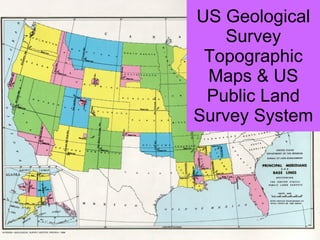
1.
US Geological Survey
Topographic Maps & US Public Land Survey System
2.
3.
4.
5.
6.
7.
8.
9.
10.
11.
12.
13.
14.
15.
16.
17.
18.
19.
20.
21.
22.
23.
24.
25.
26.
27.
28.
Download now