Augmenting the Geotourism Experience through New Digital Technologies
•Download as PPTX, PDF•
0 likes•134 views

In developing a National Geotourism Strategy for Australia, the AGC has recognised that state-based geotourism maps, supplemented by publications, may well be eventually replaced by digital technologies (e.g. 3D visualisation, augmented reality, virtual reality, holograms and live streaming using smartphones and drones) and GIS technologies as a cost effective means of accessing and better communicating geological content for tourists throughout regional Australia.

Recommended
Recommended
More Related Content
What's hot
What's hot (20)
Similar to Augmenting the Geotourism Experience through New Digital Technologies
Similar to Augmenting the Geotourism Experience through New Digital Technologies (20)
More from Leisure Solutions®
More from Leisure Solutions® (13)
Recently uploaded
Recently uploaded (20)
Augmenting the Geotourism Experience through New Digital Technologies
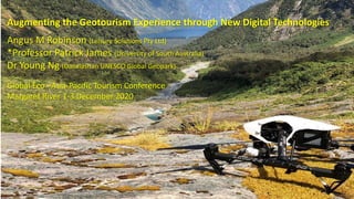
- 1. Augmenting the Geotourism Experience through New Digital Technologies Angus M Robinson (Leisure Solutions Pty Ltd) *Professor Patrick James (University of South Australia) Dr Young Ng (Danxiashan UNESCO Global Geopark) Global Eco –Asia-Pacific Tourism Conference Margaret River 1-3 December 2020
- 2. Augmented Reality (AR) adds digital elements to a live view often by using the camera on a smartphone an interactive experience of a real-world environment where the objects that reside in the real world are enhanced by computer-generated perceptual information. National Geotourism Strategy Goal # 1 - Content using new digital technologies
- 3. Virtual reality (VR) implies a complete immersion experience that shuts out the physical world. National Geotourism Strategy Goal # 7-Training of geologists to improve communication skills for geosite interpretation.
- 4. Augmented Reality and Immersive Virtual Environments (AR®IVE) in SA Famous for its rock formations dating from the birth of complex life on Planet Earth, Witchelina is a 421,000 ha nature reserve in the Willouran Ranges acquired by Nature Foundation SA in 2010. https://www.projectlive.org.au/wicked-witchelina Geotours National Geotourism Strategy Goal # 1 - content developed with new digital technologies
- 5. Ecotourism & Geotourism Ecotourism is practised predominantly in protected areas such as national parks whereas geotourism is undertaken also in all areas where primary industry activities are being carried out. Geotourism is increasingly seen globally as an instrument of regional economic development. National Geotourism Strategy Goal # 6 - Geotourism to strengthen Australia’s international geoscience standing.
- 6. Geotourism • Is NOT Geological Tourism or Tourism for Geologists, • Is “tourism surrounding geology or landscape attractions & destinations” • Holistic • Is (was?) booming globally being a key driver for tourism, esp. Europe and Asia in Global Geoparks • Abiotic – sky, climate & geology, landscape and landforms - GEODIVERSITY. • Biotic –living fauna (animals) and flora (plants) - BIODIVERSITY. • Cultural – past & present, indigenous & post European - HUMAN DIVERSITY
- 7. The Australian Geoscience Council (AGC), the peak Council of geoscientists in Australia is developing a National Geotourism Strategy for major geotourism projects and activities in Australia Australian Geoscience Council See following presentation by Angus M Robinson – “Developing a National Geotourism Strategy for Australia”
- 8. 1. Geotourism content development using new digital technologies 2. Approval pathways for major geotourism projects 3. Creating high quality sustainable geotrails 4. National geoheritage listings for geotourism 5. Geotourism as a key driver for celebrating mining heritage 6. Geotourism to strengthen Australia’s international geoscience standing 7. Training of professionals to improve communication skills for geosite interpretation National Geotourism Strategy – 7 Strategic Goals
- 9. National Geotourism Strategy –Goal #1 – New ICT Content Geotourism celebrating Geodiversity: By expansion of the Geotourism map concept (as developed in NSW) progressively across Australia on a ‘state by state’ basis (both hard copy and online) supplemented by publications. This map shows a range of 96 sites in NSW which are geological wonders, museums or tours. There are short descriptions of the geology with map references and location flags on the map so the sites can be easily found. Size 100cm x 70cm. National Geotourism Strategy Goal # 4 New Geotrail development.
- 10. Danxiashan - DJI (Da-Jiang Innovations) joint project in drone application park management & environmental management since 2016 (DJI- world’s largest drone manufacturer). Continual technical support and advice from DJI drone engineers 10 sets of DJI model Phantom 3 and 4 are ready for use 24/7 (max height 750 m high, flying range 5km, speed 45 km/hr) 8 fully licensed staff received DJI’s theoretical and practical training. Lazhufeng Peak (Candle Rock) is one of the closely monitored sites among the 40 sites of potential geohazard (Category III) National Geotourism Strategy Goal # 1 content developed with new digital technologies
- 11. Danxiashan UNESCO Global Geopark of China– Drone Applications Park management – monitoring conditions and safety of facilities which may require repairs and maintenance, tracks and roads conditions, illegal land use Geohazards – rock falls, landslide, flooding Water pollution – streams and rivers Conservation – monitoring fauna and flora growth, distribution, migration and diseases of fauna and flora, illegal burning and tree-felling; finding new species Tourist control – tourist misbehaviours (graffiti, entry to restricted areas, smoking, damage of facilities etc), tourist number, flow, clusters, traffic and road conditions (especially during peak seasons). Rescue – locating patients, help formulating rescue plan Academic research – geology, geomorphology, ecology, biology, tourism Jinjiang River, the largest river in Danxiashan, - extremely high aesthetic value and any degree of pollution is not acceptable. National Geotourism Strategy Goal # 6 - Geotourism to strengthen Australia’s international geoscience standing.
- 12. Wild and Wicked Witchelina, Willouran Ranges, SA NGS Goal#1 – Using new ICTs (e.g. smartphones, 3D visualisation, panatours, drones, AR & VR), & GIS technologies as a cost-effective means of accessing and better communicating geological content for visitors in regional Australia. https://www.projectlive.org.au/wicked-witchelina
- 13. Langkawi is “- a single unified geographical area where sites and landscapes of international geological significance are managed with a holistic concept of protection, education and sustainable development” National Geotourism Strategy Goal # 6 - Geotourism to strengthen Australia’s international geoscience standing THANK YOU
Editor's Notes
- Pokemon Go
- Augmented and Virtual Reality
- What is Geotourism? comprises the following features of both natural and cultural heritage:
- 99 Islands and red eagles