

Recomendados
Recomendados
Mais conteúdo relacionado
Mais procurados
Mais procurados (20)
Destaque
Destaque (20)
Semelhante a Pedology: The Science of Soil Development
Semelhante a Pedology: The Science of Soil Development (20)
Último
Último (20)
Pedology: The Science of Soil Development
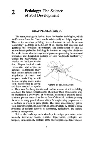
- 1. 2 Pedology: The Science of Soil Development WHAT PEDOLOGISTS DO The term pedology is derived from the Russian pedologiya, which itself comes from the Greek words 1f'f06p (soil) and M'Yo~ (speech). Thus, at its inception, pedology was a discourse on soil. In modern terminology, pedology is the branch of soil science that integrates and quantifies the formation, morphology, and classification of soils as natural landscape bodies. Pedology is foremost an integrative discipline that seeks to elucidate developmental processes governing the observed properties and distribution patterns of soils worldwide (collectively termed the pedosphere) in relation to landform evolu- tion, biogeochemical envi- ronments, and organism habitats. Pedologists study both the mechanisms and the magnitudes of spatial and temporal variability in soil features ranging across scales from microscopic to global and from seasonal to epoch- FACTORS OF SOIL FORMATION al. They look for the systematic and random sources of soil variability as a basis for broad generalizations about how their observations may be interrelated at every level of resolution. Pedologists examine soil as a natural porous material at the surface of the earth, without primary focus on its many practical uses, either for engineering purposes or as a medium in which to grow plants. The basic understanding gained from their investigations, however, is applied widely by others to solve problems of societal concern in commerce, agriculture, and natural resource management. Soil at the landscape scale develops its unique properties under mutually interacting biotic, climatic, topographic, geologic, and temporal influences. By contrast, at the microscopic scale (micrometers 9
- 2. 10 OPPORTUNITIES IN SOIL SCIENCE to centimeters), the soil "architecture" is governed by relationships among porosity, the zonation of inorganic and organic constituents, and the structures of aggregates (heterogeneous masses of solid particles bound together). Water and chemical movement or retention, mineral synthesis or weathering, plant root environments, and microorganism habitats all are influenced strongly by microscale soil architecture. Pedologists are foremost among the basic soil scientists who help to develop integrated-system models to scale knowledge from small samples up to the global pedosphere. Through their knowledge of the sources and magnitudes of soil variability, they serve a pivotal role in broadening the terrestrial information base via an integrative, hierarchi- cal approach. Basic pedological research is directed also at reconstruct- ing past earth surface environments, integrating natural resource databases, and even extending soil development concepts to extraterres- trial systems. SOILS IN THE EARTH SYSTEM We have noted that soils are part of a landscape continuum that varies in space and time. Some of this variability is not easily ex- plained, but many of the gradational features are understood as consequences of interdependent variations in the geologic, climatic, topographic, and biotic factors that affect soil formation through time. A major challenge is to structure basic research so that findings for a soil sample at one location can be extrapolated to an appropriate popula- tion of soils within the continuum as a whole. This kind of understand- ing of soils as a component of earth systems science is made easier if we think in terms of organizational hierarchies. The objects of interest at anyone level of organization provide the environment for objects at the next lower level, and are themselves a component of the objects at the next higher level. This approach can be used to systematize landscapes, to understand the interactions of their components with the oceans or the atmosphere, and to monitor the impacts of human activi- ties, such as agriculture or manufacturing. The highest level of organization, the pedosphere, results from large-scale variations of climate and vegetation. The next level is regional physiography, with specific attributes of topography, water distribution, climate, and geology that have corresponding regional influences on soil-forming processes. Within a physiographic region, local, topographically related assemblages of soils, called topo-
- 3. CHAPTER 2: PEDOLOGY sequences, are the components at the next lower level of organi- zation. They form in response to local changes in soil drain- age, vegetation, parent material,microclimate, and time to yield a characteristic hillslope relationship. Soils with similar properties are comprised in a soil series. They are identi- fied on the basis of the characteristics of their pedons, which are three-dimens ional bodies of soil large enough to encompass soil horizons and their microscopic variabili- *~Pedosphere Regional physiography Toposequence I ~ Mineral structure ~~ (molecular) Pedon 11 ty. The soil profile is an arrangement of soil horizons that represents the results of soil-forming processes with time. Horizons are the components of the soil profile. They, in turn, are composed of aggregates that provide the variety in the size, shape, and arrangement of pores that determines the aeration, water retention, and drainage of soils. At the next lower level of organization, we can identify complexes of minerals, organic matter, and microbial cells that make up soil aggregates. Below this scale, we find the level of molecular structure. The methods used to study these hierarchical levels of organization vary with the levels themselves. Objects at small scales may be studied with spectroscopy and microscopy to infer their form and internal spatial arrangement (for more about this, see Chapters 4 and 5). Objects ....... - - - - - - - - - Hierarchical levels -----------:l.~ Remote sensing Visual ... .. .. Microscopy Crystal Structure Spectroscopy .....
- 4. 12 OPPORTUNITIES IN SOIL SCIENCE at the mesoscale (kilometers) can be viewed directly at a single location or be seen more comprehensively by using satellite-based observation. Data collated from satellites in space allow pedologists to view a large part of our planet, but the image is actually a composite of data representative (at a minimum) of only a few square meters of land surface (more on this in Chapter 5). Everyone recognizes that our planet constitutes one large system of interconnected components, and that no single part - oceans, atmo- sphere, organisms, or soils - can be understood completely by treating it in isolation. Pedologists have special skills to enhance the integration of our knowledge of terrestrial processes and to help predict, alter, or alleviate future environmental changes. As they become more involved in both global and regional change issues, they help to generalize site- specific information (e.g., from a small sample, where plant roots, soil, and microorganisms interact biochemically) to global scales, where "greenhouse gases" that may have originated from interactions in soil can adversely affect the climate of our planet (see Chapter 3). By examining a wider range of environmental variability than is usually considered in land management decisions, we can obtain a better understanding of how soil-landscape systems function and interact. Management decisions then can be made with greater sensitivity to environmental quality, exploration of land-use options, and public participation. (See page 13.) These contributions ofpedologists can be brought into earth systems science in an especially powerful and exciting way through geographic information systems (GIS) analysis. This computer-based technology offers an approach to modeling soil-forming processes, soil properties, and landscapes from geographic databases that simulate the five soil- forming factors. The components ofGIS include data collection, storage and retrieval, analysis, and display. Data collection entails using line digitizers, scanners, and other computer tools to capture and convert information from maps, sensors, and direct field observations into a digital form that is compatible with . GIS . Once data have been so cap- tured and stored,
- 5. CHAPTER1: PEDOLOGY PEDOTECHNOlOGY: PEDOLOGY APPLIED TO SOCIETAL NEEDS . Pedologists usually study natural soils that are influenced relatively little by human beingsexcept fonraditionaLa~ricultur· al or silviculturalpractices. Their studies have led to broad concepts of ~oil·forming processes and factors of soH formation to explain hoiN soils have come into existence and dev~loped through time. But today, pedologists are fully aware that humans have ·major effects on the genesis of soils and are becoming more important in controlling processes that make soils change..SoCiety at large is concerned that human effects on soils · be environmentally acceptable and aesthetically pleasing. Since pedologists know how soil formation occurs, they should be able to predict the influence of human actions on soil. Indeed, pedologists have an obligation to make such predictions to assure a continued abundance of the soil resource in the future. . .Pedology has coined a nar.ne for human impact on the making or modifying of soil which is analogous to the familiar termbiotechn%gy, defined ·a~ follows:.. Pedotechn%gy. Deliberate or planned human involve- ment in the genesis of soils, by assessing and selecting the pool .of materials from which soils are to be created, or by choosing soil manipulation procedures or amend- ments to promote the formation of soil for specifi~ purposes. A major goal of pedotechnology is to avoid undesirable environmental consequences from an ignorance Of basic pedology when the manipulation of earth surface materials occurs in. agriculture·, .waste disposal, mining .. operations, construction of buildings and highways, dredging. operations, etc. Whenever there is large-scale land manipulation, new landscapes are ·needed as well as new soils. For example, with current societal interest in the preservation of wetlands, there is much discussion of how to create new wetlands to improve water quality, to enhance wildlife habitat, or simply to replace wetlands that have been destroyed because of construction or (Continued on next page) ',' ...... .. .. ... . . . 13
- 6. 14 OPPORTUNITIES IN SOIL SCIENCE (continued from previous page) agricultural practices. Pedologists, enQineers, and ecologists working together can learn how to make new wetlands.There a're excellent opportunities for basic pedological'research, with the results 'then applied to improving designs for wetlands; waste-disposal areas, or biological habitats ' accOrding to pedological .principles. How To Make A Wetland? Interdisciplinary collaboration is essential to the success of pedotechnology. Only when field-, laboratory-, and modeling- oriented scientists cooperate to identify appropriate avenues of research will the right types of data be gathered andrele.vant . mathematical models be generated. Some of the projects that tEl"ams of scientists may work on are: • field studies in whichthe applicability.of basic pedology' and ecology to land manipulation is tested during the construction ·of new landscapes; • examination of the taxonomy~base.d · transect .studies currently performed by some soil survey parties in an effort to characterize the map units employed ' in the National Cooperative Soil Survey (a ~once-over" inven- to~y of soils in the United States); • .develOpment of new s;:lmpling techniques and computer software for data collection, statistical analysis, and " efficient selection of field sampling strategies.
- 7. CHAPTER 2: PEDOLOGY GIS software is used to study the relationships be- tween data layers. Soil data and digital elevation models can be combined in GIS with hydrologic and landscape mod- els to generate either visual dis- plays or statistical information con- 15 cerning the complex spatial relationships among a variety of soil variables. For example, soil-landscape relationships can be modeled and landscape processes simulated using digital geographic databases, with the results displayed on color video monitors showing three- dimensional landscape images. Satellite-based Global Positioning Systems can facilitate the rapid geodetic referencing of field sampling sites and remote-sensing products, thus paving the way for the generation of detailed digital elevation models in relation to GIS maps. In agriculture, this innovation will allow more efficient placement of fertilizers based on precise soil management maps derived from a field- scale GIS. Other examples include large-scale (Le., the size of a state) maps that show areas that are vulnerable to erosion, susceptible to the leaching of chemicals to groundwater supplies, or suitable for the production of specific new crops. (See page 16.) The application of GIS to many kinds of land-use questions will be facilitated in the next decade because soil maps of all farmlands and most forest and grasslands in the United States will be completed. Armed with this new information, GIS will provide us with basic knowledge about environmental processes at the field, watershed, and global scales. Building on this knowledge, we can combine interactive "expert systems" that create friendly, easily understood means of presenting soil information to technical personnel and the public with predictive models and GIS software. RECONSTRUCTING PAST EARTH ENVIRONMENTS Paleopedology is the study of soils, (termed paleosols), that have formed on landscapes of the past. These soils are valuable to the study
- 8. 16 OPPORTUNITIES IN SOIL SCIENCE .AGRICUlTURE ON SOilS; NOT FiElDS · Modern agriculture must optimize among c6riflictingissues of environmental protection, sustainabilitY,and profitability. No longer can we indulge past management practicf;ls emphasizing maximum yield with little consideration for I~rger ~cosystem effects. Conventional agriculture .. manages ... croplandCls a spatially homogeneous soil body, using, for example, one fertilizer or one herbicide application rate across an entire field. Soils, however, exhibit spatial variability .as a result ofdiffering parent material, topography, native vegetation, microclimate, age, management practices, and cultural history. As a result, very significant crop yield variability (e.g., from about 60 to 160 bushels per acre for corn) can occur in a typical field under quite uniform fertilizer and pesticide application. Uniform-field management thus creates inefficiencies by overamen'ding some areas and underamending others, thereby unnecessarily increasing total material inputs and energy consumption, . reducing farm profitability, and possibly contributing to the pollution of our water supplies. New technologies, such as GIS, remote sensing techniques; simulationmodeli.ng, and precise application of cheniic?ls, offer farmers new opportunities for managing soils according to their inherent potential as media for pl~nt growth. The conGElpt novv emerging is to optimize field management, on a real-time basis, 200 o UNIFORM MANAGEMENT MAKES CORN YIELDS VARIABLE by varying the agricultural operation as farm equipment travers- . es a field. With a microcomputer, a digitized map of soil conditions, and a guidance system, a chemical spreader can alter fertilizer or herbicide applications as a tractor moves across fCOfltinued on next page) ·
- 9. CHAPTER 2: PEDOLOGY (continued from previouS page) ., ." . . . a field. Recently this approach has been used in the preplant application of anhydrous ammonia (NH3 ) fertilizer, with a·laptop microcomputer controlling the rate of NH3 addition in response to soil conditions, as portrayed by a digital map created from ' soil surveys, aerial photographs, grid-design soil s~'rnpling and geostatistical analysis, historic crop yields, and other 'relevant data. A recent study has compared soil-specific and :co.nvention- al agricultural management in southwestern Minnesota. Thene!.. profit from the soil-specific mana'gement was significantly . higher than the net return from conventional0hole-field management. . Farming by cOmputer-assisted, soil-specific management is ' not limited to spreading preplant fertilizers and chemicals. This approach can also be adapted to other farm operations, such as sidedres$ application of fertilizers or pesticides, seed variety and population control, tillage, and irrigation. The concept of agriculture on soils, not fields offers a significant breakthrough in farm management. Although the technology to realize such precision agriculture is already available, there is still the need for improved basic understanding of soil- landscape relationships to create better databases for the soil mapping unit. When this information is applied to soil-landscape units as they occur in nature, some of the current concerns in the agricultural commu- nity about profitability and environmental protection can be more easily reconciled with societal pressures for less pollution. 17 of biological and physicochemical evolution on Earth. Like modem soils, paleosols are the products of the conditions under which they formed and, depending on their degree of preservation, they can serve as sensitive indicators of former soil environments. Paleosols are abundant in the geological record and types as old as 3100 million years have been identified. The study of paleosols that formed prior to 1.5 million years ago is in its infancy, but it has already offered some fascinating avenues of investigation that address major issues in the history of our planet: the possible origin of life in soil instead of in an aquatic environment, with clay minerals serving as essential templates for the synthesis of biological molecules; the evolution of the atmo- sphere as revealed in paleosols formed from about 3000 to 1000 million years ago, with particular focus on the chemistry and mineralogy of
- 10. 18 OPPORTUNITIES IN SOIL SCIENCE iron (Fe) for assessing primordial levels of oxygen (0); and the long- term control and dynamics of the global environment, either by living organisms defining the material conditions of survival or by the geochemistry of those conditions operating independently of organismal control. The antiquity of large plants and animals on land, their subsequent evolution, and the corresponding diversification of soils also present challenging and fruitful areas for paleopedology research. Significant contributions have been made to the interpretation of geologic fossil records by the provision ofdetailed stratigraphic control, discrimination between in situ and transported fossils, and independent reconstructions that have broader utility than can be developed from examining fossils alone, which often are spatially and temporally constrained. Paleoped- ology also can provide a link between geological and ecological time scales that describe both increases and losses of biological diversifica- tion. Paleopedology has provided unique insights into soil-landscape } modern soil } poleosol in loess deposits dynamics under climatic change. The transition from humid-subhumid conditions with a well- established vegetative cover to drier conditions with a sparse vegetative cover is marked typically by an increase in land- scape instability, mass movement of unconsoli- dated material, and considerable physical disruption ofsoil. Recent studies in regions not } poleosol in Coostol influenced by glaciationPloins deposits during the past 1.5 million years (e.g., the arid southwestern portion of the United States) show that these regions have experienced periods of higher precipitation in the past than occur today. The past wet periods produced increased mineral weathering, biomass production, and soil development relative to modem condi- tions, in which the paucity of vegetation and periodic high-intensity rainstorms contribute to landscape instability and considerable redistri- butioll of materials on the landscape.
- 11. CHAPTER 2: PEDOLOGY 19 The impact of both prehistoric and historic cultures on soil and landscape is well-documented and, in some instances, has been explained in detail through paleopedological studies. The rise and fall of civilizations (e.g., the Sumerian and Phoenician) often has been driven by their utilization and ultimate degradation of soil and water resources. Soil acidification during prehistoric times in western Europe may be the result of deforestation instead of climatic change. These kinds of global issues can be clarified through the detailed examination of paleosols beneath dated archaeological materials. They raise challenging questions concerning the relatively slow but deleterious processes by which certain present-day land-use practices may adversely affect soil and water resources over large areas. Indeed, many of our contemporary environmental problems have ominous parallels in the past. The use of fossil fuels ultimately may produce global changes in climate, which, in tum, may lead to a rising sea level that will impact coastal land areas. Paleosols can yield valuable information about prehistoric climates and their relationship to global changes in sea level. The present-day high position of sea level worldwide is unprecedented, except for during the Sangamon period, approximately 122,000 yr ago, when it was 8 m (26 ft) higher than at present. Detailed studies of Dating Metbod Radioisotopic Microscopicl Cbemical! Geomorphic Correlation Spectroscopic Mineralogical Carbon Fission Track Soil Analyses Soil Development Lithostratigrapbic Potassiwn Luminescence Rock Varnish Landscape Volcanic Ash Uranium Elecuon Spin Obsidian Evolution Fossils Resonance Hydration Weathering Rinds Artifacts Sedimentation Stable Isotopes Rates Type 01 Soil Age Numerical Age ---------.......................... Calibrated Age .................................-----------............................ Relative Age ...............................---------........................ Correlated Age ..............................--------
- 12. 20 OPPORTUNITIES IN SOIL SCIENCE paleosols give us clear evidence of climatic change, and we expect that the study of coastal soils developed during and since the Sangamon period will help us to understand and predict future changes in global climate. Advances in paleopedology will rely on the development of new techniques that better defme, resolve, and measure paleosol attributes (e.g., stable isotope methods). More precise estimates of the geological age and period of formation of paleosols are essential for improving the value of these soils as "chronometers." Models of soil formation rates are now developing broad utility. But a more reliable distinction between features developed during soil formation and those acquired afterward is essential for accurate model interpretations. Analytical techniques that combine microscopy with in situ chemical analysis offer great potential for resolving this dilemma, which generally becomes more serious with increasing age of a paleosol. ISOTOPIC SIGNATURES IN SOIL DEVELOPMENT Isotopes are atoms whose electronic structure (and, therefore, chemical reactivity) is the same, but whose nuclei differ in the number of neutrons (stable neutral particles) present. Stable isotopes are isotopes that do not undergo radioactive decay processes. They exist for a number ofchemical elements commonly found in soil and water (e.g., hydrogen [H], carbon [C], nitrogen [N], 0, and sulfur [S]), and the natural rarity of some of them makes their use as environmental markers or "signatures" of pedological processes of keen interest. Both equilibrium and kinetic factors influence the distribution of stable isotopes among the phases of matter and among different species of living organisms, which means that measurements of the ratios of the concentrations of a pair of stable isotopes for one or more chemical elements can lead to unique information about soil phenomena. This type of measurement has become possible with the development of sophisticated mass spectrometry and attendant sample-preparation methods. The application of stable-isotope studies to pedological research has expanded greatly as awareness of their utility has increased among basic soil scientists. Two approaches utilizing stable isotopes have been used in basic pedological research. The first involves the measurement of naturally occurring isotopes in soil to infer its mode of origin or past environ- ment of formation. The second involves the experimental use of substances which have been enriched or depleted in a particular isotope
- 13. CHAPTER2: PEDOLOGY 21 (e.g., the nitrogen isotope, ISN). When introduced to soil, these substances serve as tracers to identify transformations or transport of components during the course of a soil process (e.g., N cycling). As an example of the first approach, we can tum to the stable C and 0 isotopes in the mineral calcium carbonate (CaC03). Calcium (Ca) and magnesium (Mg) carbonates in soil are sensitive indicators of both water movement and soil formation, because they readily undergo dissolution and precipitation reactions. The isotopic composition of CaC03 formed by soil development (pedogenic carbonate) is known to differ from that of CaC03 formed in geologic materials. Thus we can use isotope measurements to distinguish these two kinds of CaC03, a task that would be difficult, if not impossible, using chemical or microscopic techniques. Carbon and 0 isotope studies of CaC03 have added greatly to our CARBON ISOTOPE RATIOS ARE SIGNATURES OF understanding of the VEGETATION,SOIL,AND GEOLOGIC ENVIRONMENTS rate and extent of C3 PLANTS gpf1=';fri'l! C. PLANTS SOIL HUMUS PEDOGENIC CARBONATE E!;%fr;;m;iiiif1 ANCIENT MARINE CARBONATE I -40 I -30 I -20 I -10 I o S 13C(%0 relative to PDB) I +10 mineral weathering in soils formed on calcar- eous (CaC03-rich) parent materials. Re- cent research has shown that a large proportion of CaC03 in soils formed on lime- stone and related par- ent materials is not inherited, but actually is a weathering product of the original rock. Stable C and 0 isotopes are also used to detect anthropogenic weather- ing of soil minerals by irrigation waters. We have learned from this approach that a significant portion (up to 40%) of the total CaC03 in irrigated soils can dissolve and reprecipitate during <50 yr of water application. Similar to CaC03, during the weathering of silicate (silicon [Si]- and O-containing) minerals through their reaction with percolating natural waters, 0 isotopic differences can be detected between the parent and newly precipitated minerals. These isotopic differences help us study both the mechanism and the degree of silicate weathering under either field or laboratory conditions. Oxygen isotope ratios in silicate minerals are useful also for tracing their geologic sources. Carbon and 0 isotope ratios in soil are strongly influenced by environmental conditions, and many studies have been done to correlate modem temperature to 0 isotope ratios in pedogenic carbonates. Other recent work has shown that there is a relationship between the density
- 14. 22 OPPORTUNITIES IN SOIL SCIENCE and photosynthetic pathway (C3 vs. C4) of plants and the C isotope ratios of pedogenic carbonates. These results, in tum, have led to basic research in arid and semiarid regions of the world to establish the relationship among climate, vegetation, and the C and 0 isotope ratios of pedogenic carbonate. We have now learned that C isotope ratios are influenced both by the photosynthetic pathway and by the density and biological activity of the vegetation, and that 0 isotope ratios of carbonate are related to that of rainfall, which itselfdepends on regional temperature. The door is then wide open for using stable isotopes in paleosols to understand aspects of past climates. A fine example of this kind of application is a recent study of paleosols in the famous Olduvai Gorge in Tanzania. This study demonstrated a trend of increasing aridity and higher temperature during the past million years, based simply on changes in C and 0 isotope ratios in soil carbonate. Stable-isotope studies can be used to add to the information already provided by other approaches in research on C and N cycling in soils (see Chapter 3 for more about C and N cycling). One of the most important repositories of these two chemical elements is in humus, the non-biomass soil organic matter. Changing patterns of land use in the United States necessitate a clearer understanding of the role of humus within soil profiles, particularly in subsurface horizons. We need consider only the problem of land disposal of hazardous wastes to see the relevance of basic knowledge about the movement and stability of such toxic materials and their incorporation into soil humus. Radioac- tive isotopes of C often have been used to investigate the degradation and synthesis of humus and to shed light on its formation and retention in surface soils. Radiocarbon dating techniques have allowed us to estimate the residence time of organic C in soil profiles and the age of humus in paleosols. We have learned that part of soil humus "turns over" quite rapidly, on the order of years to decades, while more resistant humus fractions have residence times on the order of hundreds to thousands of years. Because distinct stable C isotope ratios have now been recognized in the C3 vs. C4 groups of plants, it is also possible to measure these ratios in soil humus to determine the rate at which the decomposition products of plant biomass are incorporated into the soil humus pool. Also, differences in stable N isotope discrimination among biological and chemical transformations in the N cycle make it possible for us to determine, for example, the source of N in nitrate-polluted groundwater (whether from applied fertilizer or degrading soil humus), or the amount of soil N that has been introduced via fixation by legumes.
- 15. CHAPTER2: PEDOLOGY 23 EXTRATERRESTRIAL PEDOLOGY We humans (at least the more adventuresome among us!) often have dreamed about visiting and even living on the Moon, Mars, and other planetary bodies. Now we are entering an era where such dreams can become reality. The National Aeronautics and Space Administration (NASA) is considering several planetary missions as a part of the human exploration of the inner solar system. These missions include expeditions to establish the first human presence on another planet (Mars), establishment of lunar outposts to conduct extraterrestrial science, and evolutionary expansion to establish a self-sufficient human presence beyond our planet. Evolutionary expansion will be a step-by- step program. The first step probably will be the establishment of a lunar outpost that will lead to a self-sufficient human colony. The lunar outpost then will serve to prepare us for the human exploration of Mars. Prior to human exploration, a number of robotic missions will occur on Mars to conduct basic science (e.g., the Mars Rover/Sample Return [MRSR] Mission). These extraterrestrial missions will probably take place in the first two decades ofthe 21st century, so planning for them has to start now. A vast amount of science and technology is necessary to ensure their safety and success, and soil scientists will play an important role. Their research will include the development of extraterrestrial "soils" for plant growth, the study of soil formation on planetary surfaces, and the study of past aqueous weathering on planetary bodies.
- 16. 24 OPPORTUNITIES IN SOIL SCIENCE Self-sufficient bases (Le., bases that do not require continuous resupply from Earth) require the use of on-site planetary materials. One scenario proposed is to use planetary materials as a plant-growth medium to produce food for the base crew. This possibility opens a new research area for pedologists. Some of these materials have never been exposed to water, organic matter, or an 02 atmosphere (e.g., those on the lunar surface) and it will be necessary to understand their solubility reactions in a terrestrial environment before they can be used to sustain plant growth. Because of our extensive knowledge about the lunar surface from past missions, we can design experiments to be conducted in terrestrial laboratories to examine the interaction of simulated lunar materials and water. We shall also need to understand the factors that influence the activity, ecology, and population dynamics of microbes in extraterrestrial materials. Not only will microbes play an important role in converting these materials into productive soils, but they will also be instrumental in the degradation of waste products as part of a regenera- tive life-support system on a planetary base. Aqueous weathering has not played a role in the formation of the lunar surface rock. However, a number of other planetary surfaces have undergone transformations from aqueous weathering (e.g., Mars, asteroids, and comets). Space missions are being planned to study some of these surfaces in detail, including the MRSR and the Comet Rendezvous Asteroid Fly-by (CRAF) Mission, both of which may be conducted by the end of the decade. The basic science expertise - -.... - .
- 17. CHAPTER2: PEDOLOGY 25 required to interpret data from these missions should provide a number of interdisciplinary research opportunities for pedologists when samples are returned from space. The planetary-science community will look to pedologists for help in defining the soil-forming conditions (e.g., past climates) that have affected surface development. Doing pedology on planetary surfaces other than our own also allows us the opportunity to examine the soil-forming factors from an extraterrestrial perspective. For example, because Mars appears to lack biological activity, soil formation may have to be examined without the influence of a biological factor. We may also have to describe minerals or other solid phases that are not found on Earth. These types of research can be very rewarding because they should not only improve our fundamental understanding of soil, but also aid adventuresome people in the colonization of extraterrestrial bodies.