
Recomendados
Mais conteúdo relacionado
Mais procurados
Mais procurados (20)
Destaque
Mais de Julian Swindell
Mais de Julian Swindell (20)
Último
Último (20)
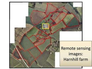
Remote sensing images
- 2. Aerial photograph, 2011 Spatial resolution approx. 0.2m
- 3. GoogleMaps aerial photo, Spatial resolution approx. 1.5m
- 4. Scanned Aerial photograph, 1995 Spatial resolution approx. 2.0m
- 5. Landsat 5 image, circa 2001 Spatial resolution approx. 30m
- 6. LIDAR image, 2011 Spatial resolution approx. 1.0m Vertical resolution approx. 0.001m