SlideShare uma empresa Scribd logo
1 de 62
GPS
Global Positioning System
GPS Basics
• What is GPS?
• How does it work?
What is GPS
• GPS is a satellite-based system, operated
and maintained by the U.S. Department
of Defense (DoD), that provides accurate
location and timing information to people
worldwide.
• The system transmits radio signals that
can be used by GPS receivers to calculate
position, velocity and time anywhere on
earth, any time of day or night, in any
kind of weather
• The NAVSTAR GPS concept was developed in the
early 1970's to meet the U.S. military’s need for
improved navigation and positioning. The first
satellite was launched in 1978 and Full Operational
Capability (FOC) was achieved in April 1995.
• The Global Positioning System is a National resource
and an international utility for positioning, navigation
and timing.
• The NAVSTAR Global
Positioning System
(GPS) is a constellation
of orbiting satellites that
provides navigation data
to military and civilian
users all over the world.
What is GPS?
• NAVSTAR GPS (Navigation Satellite Timing
and Ranging system)
• 24 Satellites orbiting the earth
• Positioning, navigation and timing
• Operates 24 hrs/day, in all weather
• Can be used for any application that requires
location information
THREE SEGMENTS OF GPS
• Space
•Control
•User
SPACE SEGMENT
• The space segment is the satellite
constellation. The first Block I satellite was
launched in early 1978.
• The 1986 Challenger disaster slowed the
GPS constellation development. In February
1989 the first Delta 2 launch took place. The
constellation is now fully operational and
consists of 24 or more satellites.
CONTROL SEGMENT
• The control segment is operated by the
U.S. Department of Defense (DoD)
which tracks and maintains the satellites.
The Department of Transportation (DoT)
now has management responsibility,
along with DoD.
USER SEGMENT
• The user segment consists of both military
and civilian users. Military uses of GPS
include navigation, reconnaissance, and
missile guidance systems.
• Civilian use of GPS developed at the same
time as military use, and has expanded far
beyond anyone's original expectations
GPS Segments
User
Control
Space
Space Segment: GPS Satellites
• Power
– Sun-seeking solar panels
– Ni, Cd batteries
• Timing
– 4 atomic clocks
• The GPS satellites weigh about 900 kg and are about 5 meters
wide with the solar panels fully extended.
• They are built to last about 7.5 years, but many have
outlasted their original estimated life-span.
• The solar panels provide primary power; secondary
power is provided by Nicad batteries. On board each
satellite are four highly accurate atomic clocks.
• As of May 2003, there are 28 usable satellites in place.
Satellite Orbits
• 24 satellites in 6 orbital planes
• Orbit the earth at approx. 20,200 km (11,000
nautical miles)
• Satellites complete an orbit in approximately
12 hours
• Satellites rise (and set) approximately 4
minutes earlier each day
• There are four satellites in each orbit plane,
and each plane is inclined 55 degrees relative
to the equatorial plane (the satellite path
crosses the equator at a 55 degree angle).
• The high altitude ensures that satellite orbits
are stable, precise and predictable, and that the
satellites' motion through space is not affected
by atmospheric drag. It also ensures satellite
coverage over large areas.
Satellite Signals
• GPS satellites broadcast messages via radio
signals on 2 frequencies
– L1: 1575.42 MHz (C/A and P/Y code)
– L2: 1227.60 MHz (P/Y code)
• Two levels of service
– Standard Positioning Service (SPS)
– Precise Positioning Service (PPS)
• The radio signals travel at the speed of light:
300,000 km per second (186,000 miles per
second).
• It takes 6/100ths of a second for a GPS
satellite signal to reach earth. These signals are
transmitted at a very low wattage (about
300-350 watts in the microwave spectrum).
Coarse Acquisition Code
• C/A Code - Coarse/Acquisition Code available
for civilian use on L1 provides 300 m
resolution.
• C/A code (Coarse Acquisition code) is
available to civilians as the Standard
Positioning Service (SPS).
Precise Code
• P Code - Precise Code on L1 and L2 used by
the military provides 3m resolution
• The Precise Positioning Service (PPS),
available only to the military (and other
authorized users), provides higher accuracy
via the P code.
Satellite Signals, cont.
• Radio signals contain
– Unique pseudorandom code
– Ephemeris
– Clock behavior and clock corrections
– System time
– Status messages
– Almanac
Unique pseudorandom code
• Each satellite transmits a radio signal
containing its unique pseudorandom
(appears to be random but is not) code.
• This code identifies the satellite and
distinguishes it from other satellites
• Ephemeris data : The signal also contains the
precise location of the satellite (ephemeris
data).
• Status messages (usually referring to satellite
health).
Almanac Data
• An almanac is also provided which gives the
approximate location data for each active
satellite.
• The almanac is automatically downloaded
from the satellites to the GPS receiver when
the receiver is operating outside.
• It takes about 12 minutes to receive an
almanac. The almanac data can be transferred
to the office computer and used to display a
graphic showing the locations of all satellites.
This information can also be used to predict
satellite availability for a specific mapping
time and date.
Satellite Signals, cont.
• Satellite signals require a direct line to
GPS receivers
• Signals cannot penetrate water, soil, walls
or other obstacles
Satellite Almanac
• Sent along with position and timing messages
• Prediction of all satellite orbits
• Needed to run satellite availability software
• Valid for about 30 days
• The almanac has information about the orbits of all
24 satellites.
• A GPS receiver uses the almanac (for quick
acquisition of satellite positions), along with satellite
data messages, to precisely establish the position of
each satellite it is tracking.
• Satellite availability software uses the almanac to
make graphs of satellite locations overhead and to
calculate the best times to survey in a particular area.
• GPS receivers automatically collect a new almanac
each time they are turned on.
• It is important to use an up-to-date almanac when
viewing satellite availability during mission planning.
• Almanac data are valid for about 30 days, but a new
almanac should be transferred to satellite availability
software as frequently as possible.
GPS ORBITS
Control Segment: US DoD Monitoring
Colorado Springs
Hawaii
Ascension
Diego Garcia
Kwajalein
U.S. DoD Monitoring
• Orbits are precisely measured
• Discrepancies between predicted orbits
(almanac) and actual orbits are transmitted
back to the satellites
User Segment
How Does GPS Work?
Calculating a Position
• GPS receiver calculates
its position by
measuring the distance
to satellites (satellite
ranging)
Measuring Distance to Satellites
1. Measure time for signal to travel from
satellite to receiver
2. Speed of light x travel time = distance
Speed of light (300,000 km/sec)
Trilateration: 3 Distance Measurements
122 mi
80 mi
127 mi
• Here is an example of
trilateration in two
dimensions.
• Three ranges will locate a
point in two-dimensional
space.
• If we know that our location
is 127 miles from Great
Falls, then we are
somewhere on the red circle.
• If we also know that we are
122 miles from Billings,
then our position is
somewhere on the purple
circle, and, if we are 80
miles from Helena, we are
somewhere on the green
circle.
• Considering the three range
measurements together, our
position must be where the
three circles intersect, or,
Bozeman!
Measuring Travel Time of
Satellite Signals
• How do we find the exact time the signal left the
satellite?
• Synchronized codes
Time
difference
• In order to measure the travel time of the
satellite signal, we have to know when the
signal left the satellite AND when the signal
reached the receiver.
• Our receiver "knows" when it receives a
signal, but how does it know when the signal
left the satellite?
• GPS satellites generate a
complicated set of digital
codes (shown red)
• They are "pseudo-random"
sequences that actually
repeat every millisecond.
• The trick is that the GPS
satellites and our
receivers are
synchronized so they're
generating the same code
at exactly the same time.
Time
difference
• The time difference is
how long the signal
took to get from the
satellite to the receiver.
• In other words, the
receiver compares how
"late" the received
satellite code is,
compared to the code
generated by the
receiver itself.
Time
difference
One measurement narrows down our
position to the surface of a sphere
• 12,000 miles is the radius of a sphere centered
on the satellite.
• Our position could be anywhere on the surface
of that sphere.
• The intersection of two spheres is a circle. Now we
know that our position is somewhere on that circle
A second measurement narrows down our
position to the intersection of two spheres
A third measurement narrows down
our position to just two points
• The three spheres intersect at only two points.
Usually we can discard one of the two points because
one point might be nowhere near the earth or it might
be moving at a ridiculous speed.
• The computers in GPS receivers have various
techniques for distinguishing the correct point from
the incorrect one. But there is a reason we need a
fourth measurement...
Correcting for Timing Offset
• The first three measurements narrow down our
position
• A fourth measurement is needed to correct for
timing offset (difference in synchronization
between satellite and receiver clocks)
– Satellites use highly accurate atomic clocks
– Receivers use accurate quartz clocks
• Timing offset refers to the difference in
synchronization between the satellite clock and
the receiver clock.
• Atomic clocks are far too expensive to put in
GPS receivers, so a correction must be applied
to compensate for the difference between the
satellite and receiver clocks.
• In an ideal situation there would be no
timing error.
• Let's say we're 4 seconds from satellite A
and 6 seconds from satellite B.
• Our position is where the 2 circles
intersect.
6 seconds
4 seconds
A
B
• If the receiver clock is one second fast (it's
ahead one second from the satellite clock).
• The receiver will "think" the distance from
satellite A is 5 seconds and the distance
from satellite B is 7 seconds.
• And it "thinks" our position is where the
two dotted circles intersect.
6 seconds
4 seconds
5 seconds
(wrong time)
7 seconds
(wrong time)
A
B
• Back to the ideal situation with no timing
error.
• If we have accurate clocks, and we add a
third measurement, all three circles
intersect at the correct point, because the
circles represent the true ranges from the
three satellites
6 seconds
4 seconds
8 seconds
A
B
C
• But with inaccurate clocks, the circles cannot
intersect: there is no point that can be 5 seconds from
A, 7 seconds from B and 9 seconds from C.
• When the receiver gets a series of measurements that
cannot intersect at a single point, it finds the
adjustment to all measurements that lets the ranges go
through one point. In this example, subtracting 1
second from all three measurements makes the circles
intersect at a point.
5 seconds
(wrong time)
7 seconds
(wrong time)
9 seconds
(wrong time)
B
A
C
What’s wrong with this picture?
5 Things to Take Away Today
1. 3 GPS segments
2. Satellites transmit radio signals containing
– Unique pseudorandom code
– Ephemeris
– Clock behavior and clock corrections
– System time
– Status messages
– Almanac
3. Formula for satellite ranging (D = t ∙ v)
4. 4 satellites to compute an accurate 3-D position (the 4th
measurement is needed to correct for timing offset)

Mais conteúdo relacionado

Semelhante a GPS.ppt

Semelhante a GPS.ppt (20)

Global Positioning System (GPS) in Helthcare
Global Positioning System (GPS) in HelthcareGlobal Positioning System (GPS) in Helthcare
Global Positioning System (GPS) in Helthcare
 
GPS.pptx
GPS.pptxGPS.pptx
GPS.pptx
 
Gps and remote sensing
Gps and remote sensingGps and remote sensing
Gps and remote sensing
 
physics
physicsphysics
physics
 
Global Positioning System
Global Positioning SystemGlobal Positioning System
Global Positioning System
 
How the gps system works
How the gps system worksHow the gps system works
How the gps system works
 
Global Positioning System
Global Positioning SystemGlobal Positioning System
Global Positioning System
 
Global position system
Global position systemGlobal position system
Global position system
 
An Introduction to GNSS(Global Navigation Satellite Systems) .pptx
An Introduction to GNSS(Global Navigation Satellite Systems)  .pptxAn Introduction to GNSS(Global Navigation Satellite Systems)  .pptx
An Introduction to GNSS(Global Navigation Satellite Systems) .pptx
 
Gps
GpsGps
Gps
 
GPS (Global Positioning System)
GPS (Global Positioning System)GPS (Global Positioning System)
GPS (Global Positioning System)
 
Presentationmobilecommunication 150531192712-lva1-app6891
Presentationmobilecommunication 150531192712-lva1-app6891Presentationmobilecommunication 150531192712-lva1-app6891
Presentationmobilecommunication 150531192712-lva1-app6891
 
GPS (Global Positioning System)
GPS (Global Positioning System)GPS (Global Positioning System)
GPS (Global Positioning System)
 
GROUP 3 (GPS).pptxbskfkdkfjndkfkdkfkdksk
GROUP 3 (GPS).pptxbskfkdkfjndkfkdkfkdkskGROUP 3 (GPS).pptxbskfkdkfjndkfkdkfkdksk
GROUP 3 (GPS).pptxbskfkdkfjndkfkdkfkdksk
 
term paper 2
term paper 2term paper 2
term paper 2
 
GPS [ Global Positioning System ]
GPS [ Global Positioning System ]GPS [ Global Positioning System ]
GPS [ Global Positioning System ]
 
Dgps
DgpsDgps
Dgps
 
Ch 5 a gps
Ch 5 a gpsCh 5 a gps
Ch 5 a gps
 
Gps principle and working
Gps principle and workingGps principle and working
Gps principle and working
 
GNSS
GNSSGNSS
GNSS
 

Último

Fertilization: Sperm and the egg—collectively called the gametes—fuse togethe...
Fertilization: Sperm and the egg—collectively called the gametes—fuse togethe...Fertilization: Sperm and the egg—collectively called the gametes—fuse togethe...
Fertilization: Sperm and the egg—collectively called the gametes—fuse togethe...D. B. S. College Kanpur
 
GenAI talk for Young at Wageningen University & Research (WUR) March 2024
GenAI talk for Young at Wageningen University & Research (WUR) March 2024GenAI talk for Young at Wageningen University & Research (WUR) March 2024
GenAI talk for Young at Wageningen University & Research (WUR) March 2024Jene van der Heide
 
Call Girls in Majnu Ka Tilla Delhi 🔝9711014705🔝 Genuine
Call Girls in Majnu Ka Tilla Delhi 🔝9711014705🔝 GenuineCall Girls in Majnu Ka Tilla Delhi 🔝9711014705🔝 Genuine
Call Girls in Majnu Ka Tilla Delhi 🔝9711014705🔝 Genuinethapagita
 
Pests of Blackgram, greengram, cowpea_Dr.UPR.pdf
Pests of Blackgram, greengram, cowpea_Dr.UPR.pdfPests of Blackgram, greengram, cowpea_Dr.UPR.pdf
Pests of Blackgram, greengram, cowpea_Dr.UPR.pdfPirithiRaju
 
The dark energy paradox leads to a new structure of spacetime.pptx
The dark energy paradox leads to a new structure of spacetime.pptxThe dark energy paradox leads to a new structure of spacetime.pptx
The dark energy paradox leads to a new structure of spacetime.pptxEran Akiva Sinbar
 
OECD bibliometric indicators: Selected highlights, April 2024
OECD bibliometric indicators: Selected highlights, April 2024OECD bibliometric indicators: Selected highlights, April 2024
OECD bibliometric indicators: Selected highlights, April 2024innovationoecd
 
PROJECTILE MOTION-Horizontal and Vertical
PROJECTILE MOTION-Horizontal and VerticalPROJECTILE MOTION-Horizontal and Vertical
PROJECTILE MOTION-Horizontal and VerticalMAESTRELLAMesa2
 
THE ROLE OF PHARMACOGNOSY IN TRADITIONAL AND MODERN SYSTEM OF MEDICINE.pptx
THE ROLE OF PHARMACOGNOSY IN TRADITIONAL AND MODERN SYSTEM OF MEDICINE.pptxTHE ROLE OF PHARMACOGNOSY IN TRADITIONAL AND MODERN SYSTEM OF MEDICINE.pptx
THE ROLE OF PHARMACOGNOSY IN TRADITIONAL AND MODERN SYSTEM OF MEDICINE.pptxNandakishor Bhaurao Deshmukh
 
Topic 9- General Principles of International Law.pptx
Topic 9- General Principles of International Law.pptxTopic 9- General Principles of International Law.pptx
Topic 9- General Principles of International Law.pptxJorenAcuavera1
 
Pests of safflower_Binomics_Identification_Dr.UPR.pdf
Pests of safflower_Binomics_Identification_Dr.UPR.pdfPests of safflower_Binomics_Identification_Dr.UPR.pdf
Pests of safflower_Binomics_Identification_Dr.UPR.pdfPirithiRaju
 
Servosystem Theory / Cybernetic Theory by Petrovic
Servosystem Theory / Cybernetic Theory by PetrovicServosystem Theory / Cybernetic Theory by Petrovic
Servosystem Theory / Cybernetic Theory by PetrovicAditi Jain
 
STOPPED FLOW METHOD & APPLICATION MURUGAVENI B.pptx
STOPPED FLOW METHOD & APPLICATION MURUGAVENI B.pptxSTOPPED FLOW METHOD & APPLICATION MURUGAVENI B.pptx
STOPPED FLOW METHOD & APPLICATION MURUGAVENI B.pptxMurugaveni B
 
(9818099198) Call Girls In Noida Sector 14 (NOIDA ESCORTS)
(9818099198) Call Girls In Noida Sector 14 (NOIDA ESCORTS)(9818099198) Call Girls In Noida Sector 14 (NOIDA ESCORTS)
(9818099198) Call Girls In Noida Sector 14 (NOIDA ESCORTS)riyaescorts54
 
REVISTA DE BIOLOGIA E CIÊNCIAS DA TERRA ISSN 1519-5228 - Artigo_Bioterra_V24_...
REVISTA DE BIOLOGIA E CIÊNCIAS DA TERRA ISSN 1519-5228 - Artigo_Bioterra_V24_...REVISTA DE BIOLOGIA E CIÊNCIAS DA TERRA ISSN 1519-5228 - Artigo_Bioterra_V24_...
REVISTA DE BIOLOGIA E CIÊNCIAS DA TERRA ISSN 1519-5228 - Artigo_Bioterra_V24_...Universidade Federal de Sergipe - UFS
 
LIGHT-PHENOMENA-BY-CABUALDIONALDOPANOGANCADIENTE-CONDEZA (1).pptx
LIGHT-PHENOMENA-BY-CABUALDIONALDOPANOGANCADIENTE-CONDEZA (1).pptxLIGHT-PHENOMENA-BY-CABUALDIONALDOPANOGANCADIENTE-CONDEZA (1).pptx
LIGHT-PHENOMENA-BY-CABUALDIONALDOPANOGANCADIENTE-CONDEZA (1).pptxmalonesandreagweneth
 
trihybrid cross , test cross chi squares
trihybrid cross , test cross chi squarestrihybrid cross , test cross chi squares
trihybrid cross , test cross chi squaresusmanzain586
 
GENERAL PHYSICS 2 REFRACTION OF LIGHT SENIOR HIGH SCHOOL GENPHYS2.pptx
GENERAL PHYSICS 2 REFRACTION OF LIGHT SENIOR HIGH SCHOOL GENPHYS2.pptxGENERAL PHYSICS 2 REFRACTION OF LIGHT SENIOR HIGH SCHOOL GENPHYS2.pptx
GENERAL PHYSICS 2 REFRACTION OF LIGHT SENIOR HIGH SCHOOL GENPHYS2.pptxRitchAndruAgustin
 
User Guide: Capricorn FLX™ Weather Station
User Guide: Capricorn FLX™ Weather StationUser Guide: Capricorn FLX™ Weather Station
User Guide: Capricorn FLX™ Weather StationColumbia Weather Systems
 

Último (20)

Let’s Say Someone Did Drop the Bomb. Then What?
Let’s Say Someone Did Drop the Bomb. Then What?Let’s Say Someone Did Drop the Bomb. Then What?
Let’s Say Someone Did Drop the Bomb. Then What?
 
Fertilization: Sperm and the egg—collectively called the gametes—fuse togethe...
Fertilization: Sperm and the egg—collectively called the gametes—fuse togethe...Fertilization: Sperm and the egg—collectively called the gametes—fuse togethe...
Fertilization: Sperm and the egg—collectively called the gametes—fuse togethe...
 
GenAI talk for Young at Wageningen University & Research (WUR) March 2024
GenAI talk for Young at Wageningen University & Research (WUR) March 2024GenAI talk for Young at Wageningen University & Research (WUR) March 2024
GenAI talk for Young at Wageningen University & Research (WUR) March 2024
 
Call Girls in Majnu Ka Tilla Delhi 🔝9711014705🔝 Genuine
Call Girls in Majnu Ka Tilla Delhi 🔝9711014705🔝 GenuineCall Girls in Majnu Ka Tilla Delhi 🔝9711014705🔝 Genuine
Call Girls in Majnu Ka Tilla Delhi 🔝9711014705🔝 Genuine
 
Pests of Blackgram, greengram, cowpea_Dr.UPR.pdf
Pests of Blackgram, greengram, cowpea_Dr.UPR.pdfPests of Blackgram, greengram, cowpea_Dr.UPR.pdf
Pests of Blackgram, greengram, cowpea_Dr.UPR.pdf
 
The dark energy paradox leads to a new structure of spacetime.pptx
The dark energy paradox leads to a new structure of spacetime.pptxThe dark energy paradox leads to a new structure of spacetime.pptx
The dark energy paradox leads to a new structure of spacetime.pptx
 
OECD bibliometric indicators: Selected highlights, April 2024
OECD bibliometric indicators: Selected highlights, April 2024OECD bibliometric indicators: Selected highlights, April 2024
OECD bibliometric indicators: Selected highlights, April 2024
 
PROJECTILE MOTION-Horizontal and Vertical
PROJECTILE MOTION-Horizontal and VerticalPROJECTILE MOTION-Horizontal and Vertical
PROJECTILE MOTION-Horizontal and Vertical
 
THE ROLE OF PHARMACOGNOSY IN TRADITIONAL AND MODERN SYSTEM OF MEDICINE.pptx
THE ROLE OF PHARMACOGNOSY IN TRADITIONAL AND MODERN SYSTEM OF MEDICINE.pptxTHE ROLE OF PHARMACOGNOSY IN TRADITIONAL AND MODERN SYSTEM OF MEDICINE.pptx
THE ROLE OF PHARMACOGNOSY IN TRADITIONAL AND MODERN SYSTEM OF MEDICINE.pptx
 
Volatile Oils Pharmacognosy And Phytochemistry -I
Volatile Oils Pharmacognosy And Phytochemistry -IVolatile Oils Pharmacognosy And Phytochemistry -I
Volatile Oils Pharmacognosy And Phytochemistry -I
 
Topic 9- General Principles of International Law.pptx
Topic 9- General Principles of International Law.pptxTopic 9- General Principles of International Law.pptx
Topic 9- General Principles of International Law.pptx
 
Pests of safflower_Binomics_Identification_Dr.UPR.pdf
Pests of safflower_Binomics_Identification_Dr.UPR.pdfPests of safflower_Binomics_Identification_Dr.UPR.pdf
Pests of safflower_Binomics_Identification_Dr.UPR.pdf
 
Servosystem Theory / Cybernetic Theory by Petrovic
Servosystem Theory / Cybernetic Theory by PetrovicServosystem Theory / Cybernetic Theory by Petrovic
Servosystem Theory / Cybernetic Theory by Petrovic
 
STOPPED FLOW METHOD & APPLICATION MURUGAVENI B.pptx
STOPPED FLOW METHOD & APPLICATION MURUGAVENI B.pptxSTOPPED FLOW METHOD & APPLICATION MURUGAVENI B.pptx
STOPPED FLOW METHOD & APPLICATION MURUGAVENI B.pptx
 
(9818099198) Call Girls In Noida Sector 14 (NOIDA ESCORTS)
(9818099198) Call Girls In Noida Sector 14 (NOIDA ESCORTS)(9818099198) Call Girls In Noida Sector 14 (NOIDA ESCORTS)
(9818099198) Call Girls In Noida Sector 14 (NOIDA ESCORTS)
 
REVISTA DE BIOLOGIA E CIÊNCIAS DA TERRA ISSN 1519-5228 - Artigo_Bioterra_V24_...
REVISTA DE BIOLOGIA E CIÊNCIAS DA TERRA ISSN 1519-5228 - Artigo_Bioterra_V24_...REVISTA DE BIOLOGIA E CIÊNCIAS DA TERRA ISSN 1519-5228 - Artigo_Bioterra_V24_...
REVISTA DE BIOLOGIA E CIÊNCIAS DA TERRA ISSN 1519-5228 - Artigo_Bioterra_V24_...
 
LIGHT-PHENOMENA-BY-CABUALDIONALDOPANOGANCADIENTE-CONDEZA (1).pptx
LIGHT-PHENOMENA-BY-CABUALDIONALDOPANOGANCADIENTE-CONDEZA (1).pptxLIGHT-PHENOMENA-BY-CABUALDIONALDOPANOGANCADIENTE-CONDEZA (1).pptx
LIGHT-PHENOMENA-BY-CABUALDIONALDOPANOGANCADIENTE-CONDEZA (1).pptx
 
trihybrid cross , test cross chi squares
trihybrid cross , test cross chi squarestrihybrid cross , test cross chi squares
trihybrid cross , test cross chi squares
 
GENERAL PHYSICS 2 REFRACTION OF LIGHT SENIOR HIGH SCHOOL GENPHYS2.pptx
GENERAL PHYSICS 2 REFRACTION OF LIGHT SENIOR HIGH SCHOOL GENPHYS2.pptxGENERAL PHYSICS 2 REFRACTION OF LIGHT SENIOR HIGH SCHOOL GENPHYS2.pptx
GENERAL PHYSICS 2 REFRACTION OF LIGHT SENIOR HIGH SCHOOL GENPHYS2.pptx
 
User Guide: Capricorn FLX™ Weather Station
User Guide: Capricorn FLX™ Weather StationUser Guide: Capricorn FLX™ Weather Station
User Guide: Capricorn FLX™ Weather Station
 

GPS.ppt

  • 2. GPS Basics • What is GPS? • How does it work?
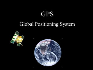
  • 3. What is GPS • GPS is a satellite-based system, operated and maintained by the U.S. Department of Defense (DoD), that provides accurate location and timing information to people worldwide.
  • 4. • The system transmits radio signals that can be used by GPS receivers to calculate position, velocity and time anywhere on earth, any time of day or night, in any kind of weather
  • 5. • The NAVSTAR GPS concept was developed in the early 1970's to meet the U.S. military’s need for improved navigation and positioning. The first satellite was launched in 1978 and Full Operational Capability (FOC) was achieved in April 1995. • The Global Positioning System is a National resource and an international utility for positioning, navigation and timing.
  • 6. • The NAVSTAR Global Positioning System (GPS) is a constellation of orbiting satellites that provides navigation data to military and civilian users all over the world.
  • 7. What is GPS? • NAVSTAR GPS (Navigation Satellite Timing and Ranging system) • 24 Satellites orbiting the earth • Positioning, navigation and timing • Operates 24 hrs/day, in all weather • Can be used for any application that requires location information
  • 8. THREE SEGMENTS OF GPS • Space •Control •User
  • 9. SPACE SEGMENT • The space segment is the satellite constellation. The first Block I satellite was launched in early 1978. • The 1986 Challenger disaster slowed the GPS constellation development. In February 1989 the first Delta 2 launch took place. The constellation is now fully operational and consists of 24 or more satellites.
  • 10. CONTROL SEGMENT • The control segment is operated by the U.S. Department of Defense (DoD) which tracks and maintains the satellites. The Department of Transportation (DoT) now has management responsibility, along with DoD.
  • 11. USER SEGMENT • The user segment consists of both military and civilian users. Military uses of GPS include navigation, reconnaissance, and missile guidance systems. • Civilian use of GPS developed at the same time as military use, and has expanded far beyond anyone's original expectations
  • 13. Space Segment: GPS Satellites • Power – Sun-seeking solar panels – Ni, Cd batteries • Timing – 4 atomic clocks
  • 14. • The GPS satellites weigh about 900 kg and are about 5 meters wide with the solar panels fully extended. • They are built to last about 7.5 years, but many have outlasted their original estimated life-span. • The solar panels provide primary power; secondary power is provided by Nicad batteries. On board each satellite are four highly accurate atomic clocks. • As of May 2003, there are 28 usable satellites in place.
  • 15. Satellite Orbits • 24 satellites in 6 orbital planes • Orbit the earth at approx. 20,200 km (11,000 nautical miles) • Satellites complete an orbit in approximately 12 hours • Satellites rise (and set) approximately 4 minutes earlier each day
  • 16. • There are four satellites in each orbit plane, and each plane is inclined 55 degrees relative to the equatorial plane (the satellite path crosses the equator at a 55 degree angle). • The high altitude ensures that satellite orbits are stable, precise and predictable, and that the satellites' motion through space is not affected by atmospheric drag. It also ensures satellite coverage over large areas.
  • 17. Satellite Signals • GPS satellites broadcast messages via radio signals on 2 frequencies – L1: 1575.42 MHz (C/A and P/Y code) – L2: 1227.60 MHz (P/Y code) • Two levels of service – Standard Positioning Service (SPS) – Precise Positioning Service (PPS)
  • 18. • The radio signals travel at the speed of light: 300,000 km per second (186,000 miles per second). • It takes 6/100ths of a second for a GPS satellite signal to reach earth. These signals are transmitted at a very low wattage (about 300-350 watts in the microwave spectrum).
  • 19. Coarse Acquisition Code • C/A Code - Coarse/Acquisition Code available for civilian use on L1 provides 300 m resolution. • C/A code (Coarse Acquisition code) is available to civilians as the Standard Positioning Service (SPS).
  • 20. Precise Code • P Code - Precise Code on L1 and L2 used by the military provides 3m resolution • The Precise Positioning Service (PPS), available only to the military (and other authorized users), provides higher accuracy via the P code.
  • 21. Satellite Signals, cont. • Radio signals contain – Unique pseudorandom code – Ephemeris – Clock behavior and clock corrections – System time – Status messages – Almanac
  • 22. Unique pseudorandom code • Each satellite transmits a radio signal containing its unique pseudorandom (appears to be random but is not) code. • This code identifies the satellite and distinguishes it from other satellites
  • 23. • Ephemeris data : The signal also contains the precise location of the satellite (ephemeris data). • Status messages (usually referring to satellite health).
  • 24. Almanac Data • An almanac is also provided which gives the approximate location data for each active satellite. • The almanac is automatically downloaded from the satellites to the GPS receiver when the receiver is operating outside.
  • 25. • It takes about 12 minutes to receive an almanac. The almanac data can be transferred to the office computer and used to display a graphic showing the locations of all satellites. This information can also be used to predict satellite availability for a specific mapping time and date.
  • 26. Satellite Signals, cont. • Satellite signals require a direct line to GPS receivers • Signals cannot penetrate water, soil, walls or other obstacles
  • 27. Satellite Almanac • Sent along with position and timing messages • Prediction of all satellite orbits • Needed to run satellite availability software • Valid for about 30 days
  • 28. • The almanac has information about the orbits of all 24 satellites. • A GPS receiver uses the almanac (for quick acquisition of satellite positions), along with satellite data messages, to precisely establish the position of each satellite it is tracking. • Satellite availability software uses the almanac to make graphs of satellite locations overhead and to calculate the best times to survey in a particular area.
  • 29. • GPS receivers automatically collect a new almanac each time they are turned on. • It is important to use an up-to-date almanac when viewing satellite availability during mission planning. • Almanac data are valid for about 30 days, but a new almanac should be transferred to satellite availability software as frequently as possible.
  • 31.
  • 32. Control Segment: US DoD Monitoring Colorado Springs Hawaii Ascension Diego Garcia Kwajalein
  • 33. U.S. DoD Monitoring • Orbits are precisely measured • Discrepancies between predicted orbits (almanac) and actual orbits are transmitted back to the satellites
  • 35. How Does GPS Work? Calculating a Position • GPS receiver calculates its position by measuring the distance to satellites (satellite ranging)
  • 36. Measuring Distance to Satellites 1. Measure time for signal to travel from satellite to receiver 2. Speed of light x travel time = distance Speed of light (300,000 km/sec)
  • 37. Trilateration: 3 Distance Measurements 122 mi 80 mi 127 mi
  • 38. • Here is an example of trilateration in two dimensions. • Three ranges will locate a point in two-dimensional space. • If we know that our location is 127 miles from Great Falls, then we are somewhere on the red circle.
  • 39. • If we also know that we are 122 miles from Billings, then our position is somewhere on the purple circle, and, if we are 80 miles from Helena, we are somewhere on the green circle. • Considering the three range measurements together, our position must be where the three circles intersect, or, Bozeman!
  • 40. Measuring Travel Time of Satellite Signals • How do we find the exact time the signal left the satellite? • Synchronized codes Time difference
  • 41. • In order to measure the travel time of the satellite signal, we have to know when the signal left the satellite AND when the signal reached the receiver. • Our receiver "knows" when it receives a signal, but how does it know when the signal left the satellite?
  • 42. • GPS satellites generate a complicated set of digital codes (shown red) • They are "pseudo-random" sequences that actually repeat every millisecond. • The trick is that the GPS satellites and our receivers are synchronized so they're generating the same code at exactly the same time. Time difference
  • 43. • The time difference is how long the signal took to get from the satellite to the receiver. • In other words, the receiver compares how "late" the received satellite code is, compared to the code generated by the receiver itself. Time difference
  • 44. One measurement narrows down our position to the surface of a sphere
  • 45. • 12,000 miles is the radius of a sphere centered on the satellite. • Our position could be anywhere on the surface of that sphere. • The intersection of two spheres is a circle. Now we know that our position is somewhere on that circle
  • 46. A second measurement narrows down our position to the intersection of two spheres
  • 47. A third measurement narrows down our position to just two points
  • 48. • The three spheres intersect at only two points. Usually we can discard one of the two points because one point might be nowhere near the earth or it might be moving at a ridiculous speed. • The computers in GPS receivers have various techniques for distinguishing the correct point from the incorrect one. But there is a reason we need a fourth measurement...
  • 49. Correcting for Timing Offset • The first three measurements narrow down our position • A fourth measurement is needed to correct for timing offset (difference in synchronization between satellite and receiver clocks) – Satellites use highly accurate atomic clocks – Receivers use accurate quartz clocks
  • 50.
  • 51. • Timing offset refers to the difference in synchronization between the satellite clock and the receiver clock. • Atomic clocks are far too expensive to put in GPS receivers, so a correction must be applied to compensate for the difference between the satellite and receiver clocks.
  • 52. • In an ideal situation there would be no timing error. • Let's say we're 4 seconds from satellite A and 6 seconds from satellite B. • Our position is where the 2 circles intersect.
  • 54. • If the receiver clock is one second fast (it's ahead one second from the satellite clock). • The receiver will "think" the distance from satellite A is 5 seconds and the distance from satellite B is 7 seconds. • And it "thinks" our position is where the two dotted circles intersect.
  • 55. 6 seconds 4 seconds 5 seconds (wrong time) 7 seconds (wrong time) A B
  • 56. • Back to the ideal situation with no timing error. • If we have accurate clocks, and we add a third measurement, all three circles intersect at the correct point, because the circles represent the true ranges from the three satellites
  • 57. 6 seconds 4 seconds 8 seconds A B C
  • 58. • But with inaccurate clocks, the circles cannot intersect: there is no point that can be 5 seconds from A, 7 seconds from B and 9 seconds from C. • When the receiver gets a series of measurements that cannot intersect at a single point, it finds the adjustment to all measurements that lets the ranges go through one point. In this example, subtracting 1 second from all three measurements makes the circles intersect at a point.
  • 59. 5 seconds (wrong time) 7 seconds (wrong time) 9 seconds (wrong time) B A C
  • 60. What’s wrong with this picture?
  • 61. What’s wrong with this picture?
  • 62. 5 Things to Take Away Today 1. 3 GPS segments 2. Satellites transmit radio signals containing – Unique pseudorandom code – Ephemeris – Clock behavior and clock corrections – System time – Status messages – Almanac 3. Formula for satellite ranging (D = t ∙ v) 4. 4 satellites to compute an accurate 3-D position (the 4th measurement is needed to correct for timing offset)