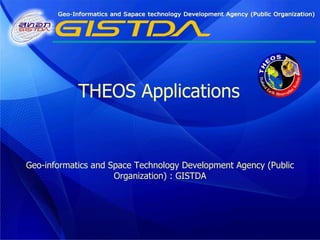
SlideShare a Scribd company logo
1 of 35
Geo-informatics and Space Technology Development Agency (Public Organization) : GISTDA THEOS Applications
THEOS Satellite ,[object Object],[object Object],[object Object],[object Object],[object Object],[object Object],[object Object],[object Object],[object Object],[object Object],[object Object],[object Object],[object Object],S band antenna Star tracker X band antenna Panchromatic telescope Multispectral  camera Solar array Thermal radiator Gyroscopes
Acquisition Capabilities ,[object Object],[object Object],[object Object],[object Object],[object Object]
THEOS Imagery PAN MS Resolution 2m. 15m. Imaging swath 22 x 22 km. 90 x 90 km. Spectral ranges (µm) P: 0.45 - 0.90 B1(blue):0.45-0.52 B2(green):0.53-0.6 B3(red):0.62-0.69 B4(NIR):0.77-0.90
Bangkok and vicinity area Acquisition: 4 December 2008 Panchromatic & Multispectral 90 km. 90 km. 22 km. 22 km.
THEOS Multi-spectral bands ,[object Object],MLA 15 m. Blue Band:  0.45-0.52 Green Band:  0.53-0.6 Red Band:  0.62-0.69 NIR Band: 0.77-0.90
THEOS false & true color composite NIR   Green   Blue Red   Green   Blue
Thailand Areas of THEOS Data Applications ,[object Object],[object Object],[object Object],[object Object],[object Object],[object Object],[object Object],[object Object],[object Object],[object Object],[object Object],New Applications and Focused on National Economic Value & Impact
THEOS data  Applications Agriculture Forestry Hydrology Disasters Oceanography LU/LC Infrastructure
Agriculture: Rice monitoring THEOS_050109_15m. NE - Thailand C GISTDA 2009
SPOT-5_180106_XS_10 m. Total area =  52,486 Rai = 84 sq.km. Agriculture : Orange plantation Map
[object Object],[object Object],[object Object],[object Object],Agriculture : Oil palm & Rubber THEOS 191208 Pan 2 m. Pan-sharpen 2 m. C GISTDA 2008
Agriculture :  Yield prediction of  Oil palm 2,445 oil palm Area = .22 sq.km. 2.7 Ton/1,600 sq.m. /yr THEOS 191208 Pan 2 m. Pan-sharpen 2 m. C GISTDA 2008
Damaged area Agriculture :  Declined area Monitoring of  Oil palm THEOS 191208 Pan 2 m. Pan-sharpen 2 m. C GISTDA 2008
Using geo-informatics technology in the 2nd phase paddy field acreage verification  The government initiated the price scheme for paddy field farmers in 2009/2010, this would enable the farmers in less pricing risk with certain income.  The cabinet resolution on 25 August 2009 proclaimed the committees on the price scheme for the farmer, In 23 February 2010, the resolution accolade  GISTDA/MOST in using GIS in the acreage verification, coupling with the national paddy field database in 2009/2010. So THEOS data were used to determined the number of acreage for reimbursement. Furthermore, the satellite image interpretation process had to be reported on a continually basis, up to the end of July 2010. At present, the 1: 25,000  satellite image of the nationwide paddy field had been archived and reported, with the number of acreage, in the northern and the central regions.
2nd phase paddy field acreage verification
Image Map of paddy field 2009-2010 second phase, Angthong Province
Land use: Mining:Mae Mo mine,  N-Thailand MLA 15 m. C THEOS 2008
Laem Chabang port, Chonburi province, Thailand C THEOS 2008
S - Thailand Aquaculture area monitoring:  Optical data Pan 2 m. C GISTDA 2008
Ben Tre My Tro Go Cong Vung Tau Ba Tri Tra Vinh THEOS - MS 6 February 2009 Red  Green   Blue Mekong Delta 6/02/2009 Paddy Field Sediment Mangrove Forest Aquaculture C GISTDA 2008
True color composite Red  Green   Blue   Forest monitoring Pan-sharpen 2 m. C THEOS 2008
Reforestation Pan-sharpen 2 m. C GISTDA 2008
Mangrove Forest monitoring C GISTDA 2008
Deforestation / Degradation:  shifting cultivation   change detection N-Thailand 18/01/2009 06/03/2009 MS 15 m. C THEOS 2008
Forest Monitoring: Deforestation Vientiane Capital, Lao PDR:  20/01/2009 Agriculture area C GISTDA 2008
Forest de-gradation: forest fire N-Thailand 18/01/2009 06/03/2009 MS 15 m. Burnt area Burnt area Burnt area Burnt area C THEOS 2008
Drought Monitoring 890  ล้าน ลบ . ม . 615  ล้าน ลบ . ม . 243  ล้าน ลบ . ม . 12  เมษายน  2553 8  กุมภาพันธ์  2553 5  ธันวาคม  2552
NE-Thailand Flood damage detection Red   Green   Blue อำเภอเมืองจังหวัดขอนแก่น 28/11/2009 MS 15 m.
THEOS  panchromatic image (2m.) Kim Bai Binh Da Vac Quang Bi 13 November 2008 showing flooded area in Vietnam
GISTDA Flood Map Server
Forest de-gradation: forest fire Kanchana Buri, Thailand MS 15 m. Burnt area Active fire & smoke plume Smoke Smoke Smoke
Perspective THEOS image THEOS pan-sharpened image acquired on 5 January 2009  in the part of Kalasin province Pan-sharpen 2 m.
◙   THEOS, EO satellite data are required for monitoring and mapping agriculture, urban, natural resources management ◙   THEOS best band combination need to be created in order to better understanding, identifying and high accuracy results as well ◙   THEOS, very high and low resolution satellite data along with GIS technology are useful and practical for NRM and EV ◙   THEOS data can be used in monitoring and management, mitigation and recovery efforts.  Conclusion
Shrimp ponds mapping Active ponds Non-active ponds Abandoned ponds Mangrove forest Agricultural area River, waterbody Pan 2 m. C GISTDA 2008

More Related Content

What's hot

Optimization of new collection routes using gis software
Optimization of new collection routes using gis softwareOptimization of new collection routes using gis software
Optimization of new collection routes using gis software
Temitayo Sofeso
 

What's hot (19)

Applications of GIS in Municipal Solid Waste Management
Applications of GIS in Municipal Solid Waste ManagementApplications of GIS in Municipal Solid Waste Management
Applications of GIS in Municipal Solid Waste Management
 
Spce technologies for disaster in thailand
Spce technologies for disaster in thailandSpce technologies for disaster in thailand
Spce technologies for disaster in thailand
 
Ibrahim Wanyama CLIFF Workshop
Ibrahim Wanyama CLIFF WorkshopIbrahim Wanyama CLIFF Workshop
Ibrahim Wanyama CLIFF Workshop
 
Integrating GPS and SR Measures of Land in HH Surveys (Alberto Zezza, World B...
Integrating GPS and SR Measures of Land in HH Surveys (Alberto Zezza, World B...Integrating GPS and SR Measures of Land in HH Surveys (Alberto Zezza, World B...
Integrating GPS and SR Measures of Land in HH Surveys (Alberto Zezza, World B...
 
GSOC17 Introduction, Product specifications, Existing SOC maps and methodologies
GSOC17 Introduction, Product specifications, Existing SOC maps and methodologiesGSOC17 Introduction, Product specifications, Existing SOC maps and methodologies
GSOC17 Introduction, Product specifications, Existing SOC maps and methodologies
 
Soil Organic Carbon Map of Mexico
Soil Organic Carbon Map of MexicoSoil Organic Carbon Map of Mexico
Soil Organic Carbon Map of Mexico
 
Soil Carbon Mapping in Australia
Soil Carbon Mapping in AustraliaSoil Carbon Mapping in Australia
Soil Carbon Mapping in Australia
 
2014 Ministerial Press Briefing by the Office The Surveyor-General Of The Fe...
2014 Ministerial  Press Briefing by the Office The Surveyor-General Of The Fe...2014 Ministerial  Press Briefing by the Office The Surveyor-General Of The Fe...
2014 Ministerial Press Briefing by the Office The Surveyor-General Of The Fe...
 
Aerial Photography in Archaeology
Aerial Photography in ArchaeologyAerial Photography in Archaeology
Aerial Photography in Archaeology
 
Aben, Ilse: Using satellite observations to detect and quantify concentrated ...
Aben, Ilse: Using satellite observations to detect and quantify concentrated ...Aben, Ilse: Using satellite observations to detect and quantify concentrated ...
Aben, Ilse: Using satellite observations to detect and quantify concentrated ...
 
Web-based GIS to support policy and program development for the Amazon
Web-based GIS to support policy and program development for the AmazonWeb-based GIS to support policy and program development for the Amazon
Web-based GIS to support policy and program development for the Amazon
 
Municipal solid waste collection by using gis term paper
Municipal solid waste collection by using gis term paperMunicipal solid waste collection by using gis term paper
Municipal solid waste collection by using gis term paper
 
Introduction to GSOC map
Introduction to GSOC mapIntroduction to GSOC map
Introduction to GSOC map
 
Optimization of new collection routes using gis software
Optimization of new collection routes using gis softwareOptimization of new collection routes using gis software
Optimization of new collection routes using gis software
 
e-SOTER Regional pilot platform as EU contribution to a Global Soil Observing...
e-SOTER Regional pilot platform as EU contribution to a Global Soil Observing...e-SOTER Regional pilot platform as EU contribution to a Global Soil Observing...
e-SOTER Regional pilot platform as EU contribution to a Global Soil Observing...
 
GI2015 ppt hladikova copernicus_agriculture_forestry_lh
GI2015 ppt hladikova copernicus_agriculture_forestry_lhGI2015 ppt hladikova copernicus_agriculture_forestry_lh
GI2015 ppt hladikova copernicus_agriculture_forestry_lh
 
Vegetation monitoring using gpm data over mongolia
Vegetation  monitoring using gpm data over mongoliaVegetation  monitoring using gpm data over mongolia
Vegetation monitoring using gpm data over mongolia
 
Hawaii Pacific GIS Conference 2012: Forestry and Tree Mapping - The Oahu Urba...
Hawaii Pacific GIS Conference 2012: Forestry and Tree Mapping - The Oahu Urba...Hawaii Pacific GIS Conference 2012: Forestry and Tree Mapping - The Oahu Urba...
Hawaii Pacific GIS Conference 2012: Forestry and Tree Mapping - The Oahu Urba...
 
The upgrade of LARI app by MT Abi Saab
The upgrade of LARI app by MT Abi SaabThe upgrade of LARI app by MT Abi Saab
The upgrade of LARI app by MT Abi Saab
 

Similar to Theos applications

WETLAND MAPPING USING RS AND GIS
WETLAND MAPPING USING RS AND GISWETLAND MAPPING USING RS AND GIS
WETLAND MAPPING USING RS AND GIS
Abhiram Kanigolla
 
OnTheUseOfMultitemporalSeriesOfCOSMODataForClassificationAndSurfaceParameterR...
OnTheUseOfMultitemporalSeriesOfCOSMODataForClassificationAndSurfaceParameterR...OnTheUseOfMultitemporalSeriesOfCOSMODataForClassificationAndSurfaceParameterR...
OnTheUseOfMultitemporalSeriesOfCOSMODataForClassificationAndSurfaceParameterR...
grssieee
 
IJCER (www.ijceronline.com) International Journal of computational Engineerin...
IJCER (www.ijceronline.com) International Journal of computational Engineerin...IJCER (www.ijceronline.com) International Journal of computational Engineerin...
IJCER (www.ijceronline.com) International Journal of computational Engineerin...
ijceronline
 
Investigation of the Lake Victoria Region (Africa: Tanzania, Kenya and Uganda)
Investigation of the Lake Victoria Region (Africa: Tanzania, Kenya and Uganda)Investigation of the Lake Victoria Region (Africa: Tanzania, Kenya and Uganda)
Investigation of the Lake Victoria Region (Africa: Tanzania, Kenya and Uganda)
Universität Salzburg
 

Similar to Theos applications (20)

CCAFS meeting Hanoi
CCAFS meeting HanoiCCAFS meeting Hanoi
CCAFS meeting Hanoi
 
Progress of land ecosystem studies with geo information and space technology ...
Progress of land ecosystem studies with geo information and space technology ...Progress of land ecosystem studies with geo information and space technology ...
Progress of land ecosystem studies with geo information and space technology ...
 
Pa Pa Shwe Sin Kyaw.pptx
Pa Pa Shwe Sin Kyaw.pptxPa Pa Shwe Sin Kyaw.pptx
Pa Pa Shwe Sin Kyaw.pptx
 
WETLAND MAPPING USING RS AND GIS
WETLAND MAPPING USING RS AND GISWETLAND MAPPING USING RS AND GIS
WETLAND MAPPING USING RS AND GIS
 
UAS based soil moisture monitoring
UAS based soil moisture monitoringUAS based soil moisture monitoring
UAS based soil moisture monitoring
 
Supervised classification and improved filtering method for shoreline detection.
Supervised classification and improved filtering method for shoreline detection.Supervised classification and improved filtering method for shoreline detection.
Supervised classification and improved filtering method for shoreline detection.
 
LAND SURFACE TEMPERATURE AND ITS CORRELATION WITH VEGETATION COVER USING LAND...
LAND SURFACE TEMPERATURE AND ITS CORRELATION WITH VEGETATION COVER USING LAND...LAND SURFACE TEMPERATURE AND ITS CORRELATION WITH VEGETATION COVER USING LAND...
LAND SURFACE TEMPERATURE AND ITS CORRELATION WITH VEGETATION COVER USING LAND...
 
A knowledge-based model for identifying and mapping tropical wetlands and pea...
A knowledge-based model for identifying and mapping tropical wetlands and pea...A knowledge-based model for identifying and mapping tropical wetlands and pea...
A knowledge-based model for identifying and mapping tropical wetlands and pea...
 
MPE data validation
MPE data validationMPE data validation
MPE data validation
 
Chronological Calibration Methods for Landsat Satellite Images
Chronological Calibration Methods for Landsat Satellite Images Chronological Calibration Methods for Landsat Satellite Images
Chronological Calibration Methods for Landsat Satellite Images
 
OnTheUseOfMultitemporalSeriesOfCOSMODataForClassificationAndSurfaceParameterR...
OnTheUseOfMultitemporalSeriesOfCOSMODataForClassificationAndSurfaceParameterR...OnTheUseOfMultitemporalSeriesOfCOSMODataForClassificationAndSurfaceParameterR...
OnTheUseOfMultitemporalSeriesOfCOSMODataForClassificationAndSurfaceParameterR...
 
Reservoir monitoring using multiple satellite systems
Reservoir monitoring using multiple satellite systems Reservoir monitoring using multiple satellite systems
Reservoir monitoring using multiple satellite systems
 
IJCER (www.ijceronline.com) International Journal of computational Engineerin...
IJCER (www.ijceronline.com) International Journal of computational Engineerin...IJCER (www.ijceronline.com) International Journal of computational Engineerin...
IJCER (www.ijceronline.com) International Journal of computational Engineerin...
 
Investigation of the Lake Victoria Region (Africa: Tanzania, Kenya and Uganda)
Investigation of the Lake Victoria Region (Africa: Tanzania, Kenya and Uganda)Investigation of the Lake Victoria Region (Africa: Tanzania, Kenya and Uganda)
Investigation of the Lake Victoria Region (Africa: Tanzania, Kenya and Uganda)
 
Assessing mangrove deforestation using pixel-based image: a machine learning ...
Assessing mangrove deforestation using pixel-based image: a machine learning ...Assessing mangrove deforestation using pixel-based image: a machine learning ...
Assessing mangrove deforestation using pixel-based image: a machine learning ...
 
Interpretation of Land use and Soil Conservation Measures in the Pan -Third ...
 Interpretation of Land use and Soil Conservation Measures in the Pan -Third ... Interpretation of Land use and Soil Conservation Measures in the Pan -Third ...
Interpretation of Land use and Soil Conservation Measures in the Pan -Third ...
 
IRJET - Normalized Difference Vegetation Index (NDVI) based Land Cover Cl...
IRJET -  	  Normalized Difference Vegetation Index (NDVI) based Land Cover Cl...IRJET -  	  Normalized Difference Vegetation Index (NDVI) based Land Cover Cl...
IRJET - Normalized Difference Vegetation Index (NDVI) based Land Cover Cl...
 
Af sis midterm_review_consortium_presentation_v3
Af sis midterm_review_consortium_presentation_v3Af sis midterm_review_consortium_presentation_v3
Af sis midterm_review_consortium_presentation_v3
 
Afsismidtermreviewconsortiumpresentationv2 110203031825-phpapp02
Afsismidtermreviewconsortiumpresentationv2 110203031825-phpapp02Afsismidtermreviewconsortiumpresentationv2 110203031825-phpapp02
Afsismidtermreviewconsortiumpresentationv2 110203031825-phpapp02
 
a3-4.park.pdf
a3-4.park.pdfa3-4.park.pdf
a3-4.park.pdf
 

More from Institute of Space Knowledge Development

More from Institute of Space Knowledge Development (19)

Flood hazard mapping four provinces of cambodia
Flood hazard mapping four provinces of cambodiaFlood hazard mapping four provinces of cambodia
Flood hazard mapping four provinces of cambodia
 
Future direction of geoinfomatics
Future direction of geoinfomaticsFuture direction of geoinfomatics
Future direction of geoinfomatics
 
Drought risk and crisis management cambodia
Drought risk and crisis management cambodiaDrought risk and crisis management cambodia
Drought risk and crisis management cambodia
 
Rain triggered landslide hazard analysis
Rain triggered landslide hazard analysisRain triggered landslide hazard analysis
Rain triggered landslide hazard analysis
 
Natural disasters reduction in thailand
Natural disasters reduction in thailandNatural disasters reduction in thailand
Natural disasters reduction in thailand
 
Near real time automatic modis fire information
Near real time automatic modis fire informationNear real time automatic modis fire information
Near real time automatic modis fire information
 
Current trends of disasters in the asia pacific region
Current trends of disasters in the asia pacific regionCurrent trends of disasters in the asia pacific region
Current trends of disasters in the asia pacific region
 
Realixing a national disaster risk reduction program
Realixing a national disaster risk reduction programRealixing a national disaster risk reduction program
Realixing a national disaster risk reduction program
 
Summery of project outcome
Summery of project outcomeSummery of project outcome
Summery of project outcome
 
ADRC Activities & Project introduction
ADRC Activities & Project introductionADRC Activities & Project introduction
ADRC Activities & Project introduction
 
Geo informatics for land suitability in growing certain crops
Geo  informatics for land suitability in growing certain cropsGeo  informatics for land suitability in growing certain crops
Geo informatics for land suitability in growing certain crops
 
Accurate satellite mapping for government agricultural management
Accurate satellite mapping for government agricultural managementAccurate satellite mapping for government agricultural management
Accurate satellite mapping for government agricultural management
 
Application of satellite imagery
Application of satellite imageryApplication of satellite imagery
Application of satellite imagery
 
Disease Epidemic and Severity of Rice Blast, Rice Brown Spot and Rice Narrow...
Disease Epidemic and Severity of  Rice Blast, Rice Brown Spot and Rice Narrow...Disease Epidemic and Severity of  Rice Blast, Rice Brown Spot and Rice Narrow...
Disease Epidemic and Severity of Rice Blast, Rice Brown Spot and Rice Narrow...
 
The potential use of theos satellite image for land use survey
The potential use of theos satellite image for land use surveyThe potential use of theos satellite image for land use survey
The potential use of theos satellite image for land use survey
 
An application of theos data for the encroachment of agriculture on forest re...
An application of theos data for the encroachment of agriculture on forest re...An application of theos data for the encroachment of agriculture on forest re...
An application of theos data for the encroachment of agriculture on forest re...
 
Polarization signature analysis of paddy rice in southern china
Polarization signature analysis of paddy rice in southern chinaPolarization signature analysis of paddy rice in southern china
Polarization signature analysis of paddy rice in southern china
 
Agriculture drought with remote sensing
Agriculture drought with remote sensingAgriculture drought with remote sensing
Agriculture drought with remote sensing
 
Approaches to exploring drought using satellite data
Approaches to exploring drought using satellite dataApproaches to exploring drought using satellite data
Approaches to exploring drought using satellite data
 

Recently uploaded

Recently uploaded (20)

PLAI - Acceleration Program for Generative A.I. Startups
PLAI - Acceleration Program for Generative A.I. StartupsPLAI - Acceleration Program for Generative A.I. Startups
PLAI - Acceleration Program for Generative A.I. Startups
 
ERP Contender Series: Acumatica vs. Sage Intacct
ERP Contender Series: Acumatica vs. Sage IntacctERP Contender Series: Acumatica vs. Sage Intacct
ERP Contender Series: Acumatica vs. Sage Intacct
 
TopCryptoSupers 12thReport OrionX May2024
TopCryptoSupers 12thReport OrionX May2024TopCryptoSupers 12thReport OrionX May2024
TopCryptoSupers 12thReport OrionX May2024
 
Working together SRE & Platform Engineering
Working together SRE & Platform EngineeringWorking together SRE & Platform Engineering
Working together SRE & Platform Engineering
 
Google I/O Extended 2024 Warsaw
Google I/O Extended 2024 WarsawGoogle I/O Extended 2024 Warsaw
Google I/O Extended 2024 Warsaw
 
The Metaverse: Are We There Yet?
The  Metaverse:    Are   We  There  Yet?The  Metaverse:    Are   We  There  Yet?
The Metaverse: Are We There Yet?
 
AI presentation and introduction - Retrieval Augmented Generation RAG 101
AI presentation and introduction - Retrieval Augmented Generation RAG 101AI presentation and introduction - Retrieval Augmented Generation RAG 101
AI presentation and introduction - Retrieval Augmented Generation RAG 101
 
WSO2CONMay2024OpenSourceConferenceDebrief.pptx
WSO2CONMay2024OpenSourceConferenceDebrief.pptxWSO2CONMay2024OpenSourceConferenceDebrief.pptx
WSO2CONMay2024OpenSourceConferenceDebrief.pptx
 
Overview of Hyperledger Foundation
Overview of Hyperledger FoundationOverview of Hyperledger Foundation
Overview of Hyperledger Foundation
 
Behind the Scenes From the Manager's Chair: Decoding the Secrets of Successfu...
Behind the Scenes From the Manager's Chair: Decoding the Secrets of Successfu...Behind the Scenes From the Manager's Chair: Decoding the Secrets of Successfu...
Behind the Scenes From the Manager's Chair: Decoding the Secrets of Successfu...
 
Using IESVE for Room Loads Analysis - UK & Ireland
Using IESVE for Room Loads Analysis - UK & IrelandUsing IESVE for Room Loads Analysis - UK & Ireland
Using IESVE for Room Loads Analysis - UK & Ireland
 
Continuing Bonds Through AI: A Hermeneutic Reflection on Thanabots
Continuing Bonds Through AI: A Hermeneutic Reflection on ThanabotsContinuing Bonds Through AI: A Hermeneutic Reflection on Thanabots
Continuing Bonds Through AI: A Hermeneutic Reflection on Thanabots
 
ECS 2024 Teams Premium - Pretty Secure
ECS 2024   Teams Premium - Pretty SecureECS 2024   Teams Premium - Pretty Secure
ECS 2024 Teams Premium - Pretty Secure
 
Secure Zero Touch enabled Edge compute with Dell NativeEdge via FDO _ Brad at...
Secure Zero Touch enabled Edge compute with Dell NativeEdge via FDO _ Brad at...Secure Zero Touch enabled Edge compute with Dell NativeEdge via FDO _ Brad at...
Secure Zero Touch enabled Edge compute with Dell NativeEdge via FDO _ Brad at...
 
TEST BANK For, Information Technology Project Management 9th Edition Kathy Sc...
TEST BANK For, Information Technology Project Management 9th Edition Kathy Sc...TEST BANK For, Information Technology Project Management 9th Edition Kathy Sc...
TEST BANK For, Information Technology Project Management 9th Edition Kathy Sc...
 
Long journey of Ruby Standard library at RubyKaigi 2024
Long journey of Ruby Standard library at RubyKaigi 2024Long journey of Ruby Standard library at RubyKaigi 2024
Long journey of Ruby Standard library at RubyKaigi 2024
 
State of the Smart Building Startup Landscape 2024!
State of the Smart Building Startup Landscape 2024!State of the Smart Building Startup Landscape 2024!
State of the Smart Building Startup Landscape 2024!
 
ASRock Industrial FDO Solutions in Action for Industrial Edge AI _ Kenny at A...
ASRock Industrial FDO Solutions in Action for Industrial Edge AI _ Kenny at A...ASRock Industrial FDO Solutions in Action for Industrial Edge AI _ Kenny at A...
ASRock Industrial FDO Solutions in Action for Industrial Edge AI _ Kenny at A...
 
Your enemies use GenAI too - staying ahead of fraud with Neo4j
Your enemies use GenAI too - staying ahead of fraud with Neo4jYour enemies use GenAI too - staying ahead of fraud with Neo4j
Your enemies use GenAI too - staying ahead of fraud with Neo4j
 
AI mind or machine power point presentation
AI mind or machine power point presentationAI mind or machine power point presentation
AI mind or machine power point presentation
 

Theos applications

  • 1. Geo-informatics and Space Technology Development Agency (Public Organization) : GISTDA THEOS Applications
  • 2.
  • 3.
  • 4. THEOS Imagery PAN MS Resolution 2m. 15m. Imaging swath 22 x 22 km. 90 x 90 km. Spectral ranges (µm) P: 0.45 - 0.90 B1(blue):0.45-0.52 B2(green):0.53-0.6 B3(red):0.62-0.69 B4(NIR):0.77-0.90
  • 5. Bangkok and vicinity area Acquisition: 4 December 2008 Panchromatic & Multispectral 90 km. 90 km. 22 km. 22 km.
  • 6.
  • 7. THEOS false & true color composite NIR Green Blue Red Green Blue
  • 8.
  • 9. THEOS data Applications Agriculture Forestry Hydrology Disasters Oceanography LU/LC Infrastructure
  • 10. Agriculture: Rice monitoring THEOS_050109_15m. NE - Thailand C GISTDA 2009
  • 11. SPOT-5_180106_XS_10 m. Total area = 52,486 Rai = 84 sq.km. Agriculture : Orange plantation Map
  • 12.
  • 13. Agriculture : Yield prediction of Oil palm 2,445 oil palm Area = .22 sq.km. 2.7 Ton/1,600 sq.m. /yr THEOS 191208 Pan 2 m. Pan-sharpen 2 m. C GISTDA 2008
  • 14. Damaged area Agriculture : Declined area Monitoring of Oil palm THEOS 191208 Pan 2 m. Pan-sharpen 2 m. C GISTDA 2008
  • 15. Using geo-informatics technology in the 2nd phase paddy field acreage verification The government initiated the price scheme for paddy field farmers in 2009/2010, this would enable the farmers in less pricing risk with certain income. The cabinet resolution on 25 August 2009 proclaimed the committees on the price scheme for the farmer, In 23 February 2010, the resolution accolade GISTDA/MOST in using GIS in the acreage verification, coupling with the national paddy field database in 2009/2010. So THEOS data were used to determined the number of acreage for reimbursement. Furthermore, the satellite image interpretation process had to be reported on a continually basis, up to the end of July 2010. At present, the 1: 25,000 satellite image of the nationwide paddy field had been archived and reported, with the number of acreage, in the northern and the central regions.
  • 16. 2nd phase paddy field acreage verification
  • 17. Image Map of paddy field 2009-2010 second phase, Angthong Province
  • 18. Land use: Mining:Mae Mo mine, N-Thailand MLA 15 m. C THEOS 2008
  • 19. Laem Chabang port, Chonburi province, Thailand C THEOS 2008
  • 20. S - Thailand Aquaculture area monitoring: Optical data Pan 2 m. C GISTDA 2008
  • 21. Ben Tre My Tro Go Cong Vung Tau Ba Tri Tra Vinh THEOS - MS 6 February 2009 Red Green Blue Mekong Delta 6/02/2009 Paddy Field Sediment Mangrove Forest Aquaculture C GISTDA 2008
  • 22. True color composite Red Green Blue Forest monitoring Pan-sharpen 2 m. C THEOS 2008
  • 23. Reforestation Pan-sharpen 2 m. C GISTDA 2008
  • 24. Mangrove Forest monitoring C GISTDA 2008
  • 25. Deforestation / Degradation: shifting cultivation change detection N-Thailand 18/01/2009 06/03/2009 MS 15 m. C THEOS 2008
  • 26. Forest Monitoring: Deforestation Vientiane Capital, Lao PDR: 20/01/2009 Agriculture area C GISTDA 2008
  • 27. Forest de-gradation: forest fire N-Thailand 18/01/2009 06/03/2009 MS 15 m. Burnt area Burnt area Burnt area Burnt area C THEOS 2008
  • 28. Drought Monitoring 890 ล้าน ลบ . ม . 615 ล้าน ลบ . ม . 243 ล้าน ลบ . ม . 12 เมษายน 2553 8 กุมภาพันธ์ 2553 5 ธันวาคม 2552
  • 29. NE-Thailand Flood damage detection Red Green Blue อำเภอเมืองจังหวัดขอนแก่น 28/11/2009 MS 15 m.
  • 30. THEOS panchromatic image (2m.) Kim Bai Binh Da Vac Quang Bi 13 November 2008 showing flooded area in Vietnam
  • 32. Forest de-gradation: forest fire Kanchana Buri, Thailand MS 15 m. Burnt area Active fire & smoke plume Smoke Smoke Smoke
  • 33. Perspective THEOS image THEOS pan-sharpened image acquired on 5 January 2009 in the part of Kalasin province Pan-sharpen 2 m.
  • 34. THEOS, EO satellite data are required for monitoring and mapping agriculture, urban, natural resources management ◙ THEOS best band combination need to be created in order to better understanding, identifying and high accuracy results as well ◙ THEOS, very high and low resolution satellite data along with GIS technology are useful and practical for NRM and EV ◙ THEOS data can be used in monitoring and management, mitigation and recovery efforts. Conclusion
  • 35. Shrimp ponds mapping Active ponds Non-active ponds Abandoned ponds Mangrove forest Agricultural area River, waterbody Pan 2 m. C GISTDA 2008

Editor's Notes

  1. Regarding flood hazard, an integrated approach with other disciplines, this includes integrated approaches of RS & GIS and hydrological models. This slide showing an example of flood risk area in Chang Mai province, North of Thailand. More dark blue make more risk flood area.