SlideShare a Scribd company logo
1 of 18
Download to read offline
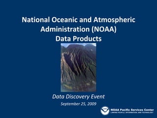
National Oceanic and Atmospheric 
     Administration (NOAA)
          Data Products


        Data Discovery Event
           September 25, 2009
                                NOAA Pacific Services Center
NOAA Agencies
National Ocean Service
   •   Coastal Services Center (CSC)
   •   Pacific Services Center (PSC)
   •   Office of Coast Survey (OCS)
   •   National Geodetic Survey (NGS)
   •   National Marine Sanctuaries
National Marine Fisheries Service
   • Pacific Islands Regional Office (PIRO)
   • Coral Reef Ecosystem Division (CRED)
   • NOAA OceanWatch – Central Pacific
National Environmental Satellite, 
Data, and Information Service
   • Integrated Data and Environmental 
     Applications (IDEA) Center               NOAA Pacific Services Center
Coastal Services Center: Digital Coast
   Turning Data into Information

                     • Data
                     • Tools
                     • Training
                     • Applications
     www.csc.noaa.gov/digitalcoast
                               NOAA Pacific Services Center
Digital Coast
      Data and Data Visualization Tools

                         •   Legislative atlas
                         •   Hurricane tracks
•   Imagery              •   Marine cadastre
•   Elevation            •   Topobathy inventory
•   Benthic
•   Land cover
•   Hydrography
•   Marine Boundaries 
•   Socioeconomics                   NOAA Pacific Services Center
Satellite Imagery


2005 Quickbird
2004-5 IKONOS

                             NOAA Pacific Services Center
Elevation
            IfSAR and Lidar


                          • Digital terrain model
• Digital terrain model   • Digital surface model
• Digital surface model
                                      NOAA Pacific Services Center
• Ortho-rectified image
Coastal‐Change Analysis Program (C‐CAP)
• National coastal land cover and 
  change mapping program

• Inventory produced/updated 
  every 5 years

• Consistent, accurate products 
  with standard data and 
  methods                             “Designed to help improve
                                       understanding of linkages
• Coastal expression of the          between land change and the
                                            environment”
  National Land Cover Database
                                          NOAA Pacific Services Center
Impervious Surfaces


                  NOAA Pacific Services Center
Land Cover


             NOAA Pacific Services Center
Pacific Region C‐CAP Status
Geography         Circa 1947    1992          2000/2001     2005/2006
American Samoa                                              In Progress
State of Hawaii                 In Progress   Complete      In Progress
CNMI              In Progress                               Complete
Guam                                                        Complete


                                                     NOAA Pacific Services Center
Topographic and Bathymetric Inventory
           State of Hawaii
•Shows the extent of 
best available 
topographic and 
bathymetric data
•Identifies up to 20 
attributes about each 
data set
•Provides either a link or 
a point of contact to 
obtain the data
                              NOAA Pacific Services Center
Legislative Atlas
                  State of Hawaii
•Provides a searchable 
database of coastal and 
ocean legislation
•Displays boundaries of 
laws, jurisdictions, 
policies, and more
•Offers ability to access 
and download the laws, 
as spatial data

                                     NOAA Pacific Services Center
Office of Coast Survey

•Coast Pilot updates
   •   Maui County
   •   American Samoa
   •   Guam
   •   CNMI
•Chart updates
   •   SW Coast of Oahu
   •   Kauai
   •   Saipan
   •   American Samoa
                                  NOAA Pacific Services Center
Marine Data Sets

Monument Boundaries
•Papahanaumokuakea
   • Available from Sanctuaries
•Marianas Trench
   • Available from PIRO


Fish Aggregation Devices
•Main Hawaiian Islands
   • Recently updated
   • Available on State GIS site


                                       NOAA Pacific Services Center
Benthic Habitat Mapping 
                Bathymetry
•Surveyed data gaps at 
NE Oahu, between Lanai 
and Molokai, and north 
of Kahului, Maui
•Data included in SOEST's 
MHI synthesis
•Future: Guam, Rota, 
Aguijan, and Western 
Mariana Ridge

                              NOAA Pacific Services Center
NOAA OceanWatch – Central Pacific
       Satellite Data Products
• Sea‐Surface Temperature
  AVHRR‐GAC, Pathfinder, AVHRR‐HRPT, 
  GOES

• Ocean Color
  SeaWiFS, MODIS ‐ Aqua

• Sea‐Surface Height
  TOPEX/Poseidon, Jason‐1 & ‐2

• Ocean Winds
  QuikSCAT


                                        NOAA Pacific Services Center
Pacific Region Integrated Climatology 
        Information Products (PRICIP)
•   A suite of “Strong Winds”, “Heavy Rains”, and “High Seas”
    extremes climatology‐related data products 
•   Based on analyses of historical in‐situ station records collected 
    throughout the Pacific region


                        Preliminary results of these analyses can 
                        be viewed via a beta‐version of a Google 
                        map‐based query utility.  

                                                               NOAA Pacific Services Center
For More Information

Pacific Services Center: Digital Coast      Pacific Islands Regional Office
            www.csc.noaa.gov/digitalcoast               www.fpir.noaa.gov
            Jamie Carter                                Robert O’Conner 
(Jamie.Carter@noaa.gov)                     (robert.oconner@noaa.gov)

Office of Coast Survey                      Coral Reef Ecosystem Division
           www.nauticalcharts.noaa.gov                 www.soest.hawaii.edu/HMRG/
           Jeffrey Taylor                   Multibeam/index.php
(Jeffrey.Taylor@noaa.gov)                              www.soest.hawaii.edu/pibhmc
                                                       Joyce Miller 
National Geodetic Survey                    (Joyce.Miller@noaa.gov)
           www.ngs.noaa.gov
           Ed Carlson                       NOAA OceanWatch
(Ed.Carlson@noaa.gov)                                 http://oceanwatch.pifsc.noaa.go
                                            v
Papahanaumokuakea Marine Nat. Mon.                    Lucas Moxey
          http://papahanaumokuakea.gov      (Lucas.Moxey@noaa.gov)
          Kaylene Keller 
(Kaylene.Keller@noaa.gov)                   IDEA Center: PRICIP
                                                      www.pricip.org/ddp.php
                                                                NOAA Pacific Services Center
                                                      John Marra
                                            (John.Marra@noaa.gov)

More Related Content

What's hot

Catchments.ie Website Overview
Catchments.ie Website OverviewCatchments.ie Website Overview
Catchments.ie Website OverviewPaddy Morris
 
Pillar 4 Information and Data
Pillar 4 Information and DataPillar 4 Information and Data
Pillar 4 Information and DataStankovic G
 
San Francisco Bay Area Upland Habitat Goals Project by Stu Weiss and Ryan Bra...
San Francisco Bay Area Upland Habitat Goals Project by Stu Weiss and Ryan Bra...San Francisco Bay Area Upland Habitat Goals Project by Stu Weiss and Ryan Bra...
San Francisco Bay Area Upland Habitat Goals Project by Stu Weiss and Ryan Bra...OpenSpaceCouncil
 
Groundwater Data to Inform the Clark Fork Plan
Groundwater Data to Inform the Clark Fork PlanGroundwater Data to Inform the Clark Fork Plan
Groundwater Data to Inform the Clark Fork PlanClark Fork Task Force
 
SPATIAL_DATA_INTEGRITY_SIS_A1
SPATIAL_DATA_INTEGRITY_SIS_A1SPATIAL_DATA_INTEGRITY_SIS_A1
SPATIAL_DATA_INTEGRITY_SIS_A1Yudi Syahnur
 
2012 ASPRS Track, Intertidal Coastal Vegetation Mapping, Joe Chuita
2012 ASPRS Track, Intertidal Coastal Vegetation Mapping, Joe Chuita2012 ASPRS Track, Intertidal Coastal Vegetation Mapping, Joe Chuita
2012 ASPRS Track, Intertidal Coastal Vegetation Mapping, Joe ChuitaGIS in the Rockies
 
Headings - 2014 issue 1
Headings - 2014 issue 1Headings - 2014 issue 1
Headings - 2014 issue 1Headings
 
Manuscript_IPA15-E-143
Manuscript_IPA15-E-143Manuscript_IPA15-E-143
Manuscript_IPA15-E-143Yudi Syahnur
 
Easter Desert Project
Easter Desert ProjectEaster Desert Project
Easter Desert ProjectIwl Pcu
 

What's hot (19)

Catchments.ie Website Overview
Catchments.ie Website OverviewCatchments.ie Website Overview
Catchments.ie Website Overview
 
GSA_2015_Scott1
GSA_2015_Scott1GSA_2015_Scott1
GSA_2015_Scott1
 
Pillar 4 Information and Data
Pillar 4 Information and DataPillar 4 Information and Data
Pillar 4 Information and Data
 
Monitoring playa water resources using gis and remote sensing
Monitoring playa water resources using gis and remote sensingMonitoring playa water resources using gis and remote sensing
Monitoring playa water resources using gis and remote sensing
 
Wisconsin Coastal Atlas
Wisconsin Coastal AtlasWisconsin Coastal Atlas
Wisconsin Coastal Atlas
 
San Francisco Bay Area Upland Habitat Goals Project by Stu Weiss and Ryan Bra...
San Francisco Bay Area Upland Habitat Goals Project by Stu Weiss and Ryan Bra...San Francisco Bay Area Upland Habitat Goals Project by Stu Weiss and Ryan Bra...
San Francisco Bay Area Upland Habitat Goals Project by Stu Weiss and Ryan Bra...
 
Groundwater Data to Inform the Clark Fork Plan
Groundwater Data to Inform the Clark Fork PlanGroundwater Data to Inform the Clark Fork Plan
Groundwater Data to Inform the Clark Fork Plan
 
Hydrographic construction Cairo Illinois
Hydrographic construction  Cairo IllinoisHydrographic construction  Cairo Illinois
Hydrographic construction Cairo Illinois
 
KA_Rsm_June2016
KA_Rsm_June2016KA_Rsm_June2016
KA_Rsm_June2016
 
GIS Expo 2014: Hawaiian Islands Orthoimagery Update
GIS Expo 2014: Hawaiian Islands Orthoimagery UpdateGIS Expo 2014: Hawaiian Islands Orthoimagery Update
GIS Expo 2014: Hawaiian Islands Orthoimagery Update
 
NJCCV_2016
NJCCV_2016NJCCV_2016
NJCCV_2016
 
SPATIAL_DATA_INTEGRITY_SIS_A1
SPATIAL_DATA_INTEGRITY_SIS_A1SPATIAL_DATA_INTEGRITY_SIS_A1
SPATIAL_DATA_INTEGRITY_SIS_A1
 
Soderberg Roger_122115
Soderberg Roger_122115Soderberg Roger_122115
Soderberg Roger_122115
 
2012 ASPRS Track, Intertidal Coastal Vegetation Mapping, Joe Chuita
2012 ASPRS Track, Intertidal Coastal Vegetation Mapping, Joe Chuita2012 ASPRS Track, Intertidal Coastal Vegetation Mapping, Joe Chuita
2012 ASPRS Track, Intertidal Coastal Vegetation Mapping, Joe Chuita
 
Headings - 2014 issue 1
Headings - 2014 issue 1Headings - 2014 issue 1
Headings - 2014 issue 1
 
Southern Thomson Project update
Southern Thomson Project updateSouthern Thomson Project update
Southern Thomson Project update
 
Manuscript_IPA15-E-143
Manuscript_IPA15-E-143Manuscript_IPA15-E-143
Manuscript_IPA15-E-143
 
Easter Desert Project
Easter Desert ProjectEaster Desert Project
Easter Desert Project
 
legtc_resume
legtc_resumelegtc_resume
legtc_resume
 

Viewers also liked

IWRM Evaluation Result_LAO PDR
IWRM Evaluation Result_LAO PDRIWRM Evaluation Result_LAO PDR
IWRM Evaluation Result_LAO PDRGWP SOUTHEAST ASIA
 
Module 1 wsa and wsp roles and responsibilities (presentation)
Module 1 wsa and wsp roles and responsibilities (presentation)Module 1 wsa and wsp roles and responsibilities (presentation)
Module 1 wsa and wsp roles and responsibilities (presentation)IRC
 
Water Resources Management Financing in Lao PDR
Water Resources Management Financing in Lao PDRWater Resources Management Financing in Lao PDR
Water Resources Management Financing in Lao PDRGWP SOUTHEAST ASIA
 
Disaster management ppt
Disaster management pptDisaster management ppt
Disaster management pptAniket Pingale
 

Viewers also liked (7)

IWRM Evaluation Result_LAO PDR
IWRM Evaluation Result_LAO PDRIWRM Evaluation Result_LAO PDR
IWRM Evaluation Result_LAO PDR
 
Module 1 wsa and wsp roles and responsibilities (presentation)
Module 1 wsa and wsp roles and responsibilities (presentation)Module 1 wsa and wsp roles and responsibilities (presentation)
Module 1 wsa and wsp roles and responsibilities (presentation)
 
Water Resources Management Financing in Lao PDR
Water Resources Management Financing in Lao PDRWater Resources Management Financing in Lao PDR
Water Resources Management Financing in Lao PDR
 
Project Monitoring and Evaluation
Project Monitoring and EvaluationProject Monitoring and Evaluation
Project Monitoring and Evaluation
 
Coastal zone management
Coastal zone managementCoastal zone management
Coastal zone management
 
Disaster management
Disaster managementDisaster management
Disaster management
 
Disaster management ppt
Disaster management pptDisaster management ppt
Disaster management ppt
 

Similar to NOAA Data Products

PRICIP_poster_2008_Dec
PRICIP_poster_2008_DecPRICIP_poster_2008_Dec
PRICIP_poster_2008_DecLisa Benham
 
NOAA's National Oceanographic Data Center
NOAA's National Oceanographic Data CenterNOAA's National Oceanographic Data Center
NOAA's National Oceanographic Data CenterUserservices
 
Erosion and Sediment Control - Faga’alu, American Samoa
Erosion and Sediment Control - Faga’alu, American SamoaErosion and Sediment Control - Faga’alu, American Samoa
Erosion and Sediment Control - Faga’alu, American SamoaSteven Curtis
 
Final morris esri_nwgis_lidar
Final morris esri_nwgis_lidarFinal morris esri_nwgis_lidar
Final morris esri_nwgis_lidarEric Morris
 
H2O Presentation 26May2011
H2O Presentation 26May2011H2O Presentation 26May2011
H2O Presentation 26May2011Justin Vandever
 
Spatial_data_Doc7_150913
Spatial_data_Doc7_150913Spatial_data_Doc7_150913
Spatial_data_Doc7_150913Jessica Kauzer
 
091913 nk public_mtg
091913 nk public_mtg091913 nk public_mtg
091913 nk public_mtgriseagrant
 
West Maui Watershed CZM
West Maui Watershed CZMWest Maui Watershed CZM
West Maui Watershed CZMchangingtides
 
Ocean Globe, Ocean Geospatial Appliance
Ocean Globe, Ocean Geospatial ApplianceOcean Globe, Ocean Geospatial Appliance
Ocean Globe, Ocean Geospatial ApplianceHigh Tech Maui
 

Similar to NOAA Data Products (20)

Web based Data and Tools for Coastal Management
Web based Data and Tools for Coastal ManagementWeb based Data and Tools for Coastal Management
Web based Data and Tools for Coastal Management
 
Data, Tools, Training, and Technical Assistance
Data, Tools, Training, and Technical AssistanceData, Tools, Training, and Technical Assistance
Data, Tools, Training, and Technical Assistance
 
GIS-Based Approach to Shoreline Access Mapping
GIS-Based Approach to Shoreline Access MappingGIS-Based Approach to Shoreline Access Mapping
GIS-Based Approach to Shoreline Access Mapping
 
PRICIP_poster_2008_Dec
PRICIP_poster_2008_DecPRICIP_poster_2008_Dec
PRICIP_poster_2008_Dec
 
Overview of the Coast Change Analysis Program (C-CAP)
Overview of the Coast Change Analysis Program (C-CAP)Overview of the Coast Change Analysis Program (C-CAP)
Overview of the Coast Change Analysis Program (C-CAP)
 
NOAA's National Oceanographic Data Center
NOAA's National Oceanographic Data CenterNOAA's National Oceanographic Data Center
NOAA's National Oceanographic Data Center
 
Erosion and Sediment Control - Faga’alu, American Samoa
Erosion and Sediment Control - Faga’alu, American SamoaErosion and Sediment Control - Faga’alu, American Samoa
Erosion and Sediment Control - Faga’alu, American Samoa
 
Scenic Hudson Sea Level Rise Mapper - Part 1
Scenic Hudson Sea Level Rise Mapper - Part 1Scenic Hudson Sea Level Rise Mapper - Part 1
Scenic Hudson Sea Level Rise Mapper - Part 1
 
Final morris esri_nwgis_lidar
Final morris esri_nwgis_lidarFinal morris esri_nwgis_lidar
Final morris esri_nwgis_lidar
 
Benthic Habitat Mapping
Benthic Habitat MappingBenthic Habitat Mapping
Benthic Habitat Mapping
 
Land cover change analysis
Land cover change analysisLand cover change analysis
Land cover change analysis
 
Pacific Resources on Digital Coast
Pacific Resources on Digital CoastPacific Resources on Digital Coast
Pacific Resources on Digital Coast
 
H2O Presentation 26May2011
H2O Presentation 26May2011H2O Presentation 26May2011
H2O Presentation 26May2011
 
Spatial_data_Doc7_150913
Spatial_data_Doc7_150913Spatial_data_Doc7_150913
Spatial_data_Doc7_150913
 
091913 nk public_mtg
091913 nk public_mtg091913 nk public_mtg
091913 nk public_mtg
 
Jan Newton presentation on ocean acidification
Jan Newton presentation on ocean acidificationJan Newton presentation on ocean acidification
Jan Newton presentation on ocean acidification
 
West Maui Watershed CZM
West Maui Watershed CZMWest Maui Watershed CZM
West Maui Watershed CZM
 
NOAA's Coastal Change Analysis Program
NOAA's Coastal Change Analysis ProgramNOAA's Coastal Change Analysis Program
NOAA's Coastal Change Analysis Program
 
Ocean Globe, Ocean Geospatial Appliance
Ocean Globe, Ocean Geospatial ApplianceOcean Globe, Ocean Geospatial Appliance
Ocean Globe, Ocean Geospatial Appliance
 
Charting the Arctic
Charting the ArcticCharting the Arctic
Charting the Arctic
 

More from Hawaii Geographic Information Coordinating Council

More from Hawaii Geographic Information Coordinating Council (20)

Taking 3D to the next Level with 3D Streaming Maps
Taking 3D to the next Level with 3D Streaming MapsTaking 3D to the next Level with 3D Streaming Maps
Taking 3D to the next Level with 3D Streaming Maps
 
US Army Real Estate Holdings in Hawaii
US Army Real Estate Holdings in HawaiiUS Army Real Estate Holdings in Hawaii
US Army Real Estate Holdings in Hawaii
 
The ArcGIS Platform: Appyling Geography Everywhere
The ArcGIS Platform: Appyling Geography EverywhereThe ArcGIS Platform: Appyling Geography Everywhere
The ArcGIS Platform: Appyling Geography Everywhere
 
Ecosystem Vulnerability and Cumulative Impacts on th eOceans of hawaii
Ecosystem Vulnerability and Cumulative Impacts on th eOceans of hawaiiEcosystem Vulnerability and Cumulative Impacts on th eOceans of hawaii
Ecosystem Vulnerability and Cumulative Impacts on th eOceans of hawaii
 
Using GIS to Connect Communities
Using GIS to Connect CommunitiesUsing GIS to Connect Communities
Using GIS to Connect Communities
 
Assessing Reef Health Using a Low Altitude Sensing Platform
Assessing Reef Health Using a Low Altitude Sensing PlatformAssessing Reef Health Using a Low Altitude Sensing Platform
Assessing Reef Health Using a Low Altitude Sensing Platform
 
Hawaii DOT Monitoring Stations Versus National Performance Measurement Resear...
Hawaii DOT Monitoring Stations Versus National Performance Measurement Resear...Hawaii DOT Monitoring Stations Versus National Performance Measurement Resear...
Hawaii DOT Monitoring Stations Versus National Performance Measurement Resear...
 
Use of GIS Technology to Inform Planning Efforts Through Visualization of Com...
Use of GIS Technology to Inform Planning Efforts Through Visualization of Com...Use of GIS Technology to Inform Planning Efforts Through Visualization of Com...
Use of GIS Technology to Inform Planning Efforts Through Visualization of Com...
 
Expanding GIS Access to Technical and Non-Technical Users to Enhance Project ...
Expanding GIS Access to Technical and Non-Technical Users to Enhance Project ...Expanding GIS Access to Technical and Non-Technical Users to Enhance Project ...
Expanding GIS Access to Technical and Non-Technical Users to Enhance Project ...
 
STEMworks: K12 Education in Hawaii in Science Technology Engineering and Math
STEMworks: K12 Education in Hawaii in Science Technology Engineering and MathSTEMworks: K12 Education in Hawaii in Science Technology Engineering and Math
STEMworks: K12 Education in Hawaii in Science Technology Engineering and Math
 
Planning for Technological Change
Planning for Technological ChangePlanning for Technological Change
Planning for Technological Change
 
Now & the Future of geodesy in Hawaii for the GIS Users
Now & the Future of geodesy in Hawaii for the GIS UsersNow & the Future of geodesy in Hawaii for the GIS Users
Now & the Future of geodesy in Hawaii for the GIS Users
 
314 woods- uav mapping history
314   woods- uav mapping history314   woods- uav mapping history
314 woods- uav mapping history
 
314 smith 2015 higicc-final
314  smith 2015 higicc-final314  smith 2015 higicc-final
314 smith 2015 higicc-final
 
Real Time Corrections for GNSS Receivers
Real Time Corrections for GNSS ReceiversReal Time Corrections for GNSS Receivers
Real Time Corrections for GNSS Receivers
 
Honolulu Board of Water Supply: Enterprise GIS
Honolulu Board of Water Supply: Enterprise GISHonolulu Board of Water Supply: Enterprise GIS
Honolulu Board of Water Supply: Enterprise GIS
 
State of Hawaii Digital Leveling Project
State of Hawaii Digital Leveling ProjectState of Hawaii Digital Leveling Project
State of Hawaii Digital Leveling Project
 
Urban Tree Canopy Change Assessment for Southern Oahu
Urban Tree Canopy Change Assessment for Southern OahuUrban Tree Canopy Change Assessment for Southern Oahu
Urban Tree Canopy Change Assessment for Southern Oahu
 
The Evolving GIS Enterprise
The Evolving GIS EnterpriseThe Evolving GIS Enterprise
The Evolving GIS Enterprise
 
Successes of the Certificate Competence in GIS in Ecosystem Management Program
Successes of the Certificate Competence in GIS in Ecosystem Management ProgramSuccesses of the Certificate Competence in GIS in Ecosystem Management Program
Successes of the Certificate Competence in GIS in Ecosystem Management Program
 

Recently uploaded

Driving Behavioral Change for Information Management through Data-Driven Gree...
Driving Behavioral Change for Information Management through Data-Driven Gree...Driving Behavioral Change for Information Management through Data-Driven Gree...
Driving Behavioral Change for Information Management through Data-Driven Gree...Enterprise Knowledge
 
Real Time Object Detection Using Open CV
Real Time Object Detection Using Open CVReal Time Object Detection Using Open CV
Real Time Object Detection Using Open CVKhem
 
EIS-Webinar-Prompt-Knowledge-Eng-2024-04-08.pptx
EIS-Webinar-Prompt-Knowledge-Eng-2024-04-08.pptxEIS-Webinar-Prompt-Knowledge-Eng-2024-04-08.pptx
EIS-Webinar-Prompt-Knowledge-Eng-2024-04-08.pptxEarley Information Science
 
Bajaj Allianz Life Insurance Company - Insurer Innovation Award 2024
Bajaj Allianz Life Insurance Company - Insurer Innovation Award 2024Bajaj Allianz Life Insurance Company - Insurer Innovation Award 2024
Bajaj Allianz Life Insurance Company - Insurer Innovation Award 2024The Digital Insurer
 
Boost Fertility New Invention Ups Success Rates.pdf
Boost Fertility New Invention Ups Success Rates.pdfBoost Fertility New Invention Ups Success Rates.pdf
Boost Fertility New Invention Ups Success Rates.pdfsudhanshuwaghmare1
 
A Domino Admins Adventures (Engage 2024)
A Domino Admins Adventures (Engage 2024)A Domino Admins Adventures (Engage 2024)
A Domino Admins Adventures (Engage 2024)Gabriella Davis
 
Tata AIG General Insurance Company - Insurer Innovation Award 2024
Tata AIG General Insurance Company - Insurer Innovation Award 2024Tata AIG General Insurance Company - Insurer Innovation Award 2024
Tata AIG General Insurance Company - Insurer Innovation Award 2024The Digital Insurer
 
Finology Group – Insurtech Innovation Award 2024
Finology Group – Insurtech Innovation Award 2024Finology Group – Insurtech Innovation Award 2024
Finology Group – Insurtech Innovation Award 2024The Digital Insurer
 
Axa Assurance Maroc - Insurer Innovation Award 2024
Axa Assurance Maroc - Insurer Innovation Award 2024Axa Assurance Maroc - Insurer Innovation Award 2024
Axa Assurance Maroc - Insurer Innovation Award 2024The Digital Insurer
 
Powerful Google developer tools for immediate impact! (2023-24 C)
Powerful Google developer tools for immediate impact! (2023-24 C)Powerful Google developer tools for immediate impact! (2023-24 C)
Powerful Google developer tools for immediate impact! (2023-24 C)wesley chun
 
GenCyber Cyber Security Day Presentation
GenCyber Cyber Security Day PresentationGenCyber Cyber Security Day Presentation
GenCyber Cyber Security Day PresentationMichael W. Hawkins
 
Workshop - Best of Both Worlds_ Combine KG and Vector search for enhanced R...
Workshop - Best of Both Worlds_ Combine  KG and Vector search for  enhanced R...Workshop - Best of Both Worlds_ Combine  KG and Vector search for  enhanced R...
Workshop - Best of Both Worlds_ Combine KG and Vector search for enhanced R...Neo4j
 
Strategies for Unlocking Knowledge Management in Microsoft 365 in the Copilot...
Strategies for Unlocking Knowledge Management in Microsoft 365 in the Copilot...Strategies for Unlocking Knowledge Management in Microsoft 365 in the Copilot...
Strategies for Unlocking Knowledge Management in Microsoft 365 in the Copilot...Drew Madelung
 
Presentation on how to chat with PDF using ChatGPT code interpreter
Presentation on how to chat with PDF using ChatGPT code interpreterPresentation on how to chat with PDF using ChatGPT code interpreter
Presentation on how to chat with PDF using ChatGPT code interpreternaman860154
 
08448380779 Call Girls In Diplomatic Enclave Women Seeking Men
08448380779 Call Girls In Diplomatic Enclave Women Seeking Men08448380779 Call Girls In Diplomatic Enclave Women Seeking Men
08448380779 Call Girls In Diplomatic Enclave Women Seeking MenDelhi Call girls
 
04-2024-HHUG-Sales-and-Marketing-Alignment.pptx
04-2024-HHUG-Sales-and-Marketing-Alignment.pptx04-2024-HHUG-Sales-and-Marketing-Alignment.pptx
04-2024-HHUG-Sales-and-Marketing-Alignment.pptxHampshireHUG
 
Artificial Intelligence: Facts and Myths
Artificial Intelligence: Facts and MythsArtificial Intelligence: Facts and Myths
Artificial Intelligence: Facts and MythsJoaquim Jorge
 
Advantages of Hiring UIUX Design Service Providers for Your Business
Advantages of Hiring UIUX Design Service Providers for Your BusinessAdvantages of Hiring UIUX Design Service Providers for Your Business
Advantages of Hiring UIUX Design Service Providers for Your BusinessPixlogix Infotech
 
2024: Domino Containers - The Next Step. News from the Domino Container commu...
2024: Domino Containers - The Next Step. News from the Domino Container commu...2024: Domino Containers - The Next Step. News from the Domino Container commu...
2024: Domino Containers - The Next Step. News from the Domino Container commu...Martijn de Jong
 
How to Troubleshoot Apps for the Modern Connected Worker
How to Troubleshoot Apps for the Modern Connected WorkerHow to Troubleshoot Apps for the Modern Connected Worker
How to Troubleshoot Apps for the Modern Connected WorkerThousandEyes
 

Recently uploaded (20)

Driving Behavioral Change for Information Management through Data-Driven Gree...
Driving Behavioral Change for Information Management through Data-Driven Gree...Driving Behavioral Change for Information Management through Data-Driven Gree...
Driving Behavioral Change for Information Management through Data-Driven Gree...
 
Real Time Object Detection Using Open CV
Real Time Object Detection Using Open CVReal Time Object Detection Using Open CV
Real Time Object Detection Using Open CV
 
EIS-Webinar-Prompt-Knowledge-Eng-2024-04-08.pptx
EIS-Webinar-Prompt-Knowledge-Eng-2024-04-08.pptxEIS-Webinar-Prompt-Knowledge-Eng-2024-04-08.pptx
EIS-Webinar-Prompt-Knowledge-Eng-2024-04-08.pptx
 
Bajaj Allianz Life Insurance Company - Insurer Innovation Award 2024
Bajaj Allianz Life Insurance Company - Insurer Innovation Award 2024Bajaj Allianz Life Insurance Company - Insurer Innovation Award 2024
Bajaj Allianz Life Insurance Company - Insurer Innovation Award 2024
 
Boost Fertility New Invention Ups Success Rates.pdf
Boost Fertility New Invention Ups Success Rates.pdfBoost Fertility New Invention Ups Success Rates.pdf
Boost Fertility New Invention Ups Success Rates.pdf
 
A Domino Admins Adventures (Engage 2024)
A Domino Admins Adventures (Engage 2024)A Domino Admins Adventures (Engage 2024)
A Domino Admins Adventures (Engage 2024)
 
Tata AIG General Insurance Company - Insurer Innovation Award 2024
Tata AIG General Insurance Company - Insurer Innovation Award 2024Tata AIG General Insurance Company - Insurer Innovation Award 2024
Tata AIG General Insurance Company - Insurer Innovation Award 2024
 
Finology Group – Insurtech Innovation Award 2024
Finology Group – Insurtech Innovation Award 2024Finology Group – Insurtech Innovation Award 2024
Finology Group – Insurtech Innovation Award 2024
 
Axa Assurance Maroc - Insurer Innovation Award 2024
Axa Assurance Maroc - Insurer Innovation Award 2024Axa Assurance Maroc - Insurer Innovation Award 2024
Axa Assurance Maroc - Insurer Innovation Award 2024
 
Powerful Google developer tools for immediate impact! (2023-24 C)
Powerful Google developer tools for immediate impact! (2023-24 C)Powerful Google developer tools for immediate impact! (2023-24 C)
Powerful Google developer tools for immediate impact! (2023-24 C)
 
GenCyber Cyber Security Day Presentation
GenCyber Cyber Security Day PresentationGenCyber Cyber Security Day Presentation
GenCyber Cyber Security Day Presentation
 
Workshop - Best of Both Worlds_ Combine KG and Vector search for enhanced R...
Workshop - Best of Both Worlds_ Combine  KG and Vector search for  enhanced R...Workshop - Best of Both Worlds_ Combine  KG and Vector search for  enhanced R...
Workshop - Best of Both Worlds_ Combine KG and Vector search for enhanced R...
 
Strategies for Unlocking Knowledge Management in Microsoft 365 in the Copilot...
Strategies for Unlocking Knowledge Management in Microsoft 365 in the Copilot...Strategies for Unlocking Knowledge Management in Microsoft 365 in the Copilot...
Strategies for Unlocking Knowledge Management in Microsoft 365 in the Copilot...
 
Presentation on how to chat with PDF using ChatGPT code interpreter
Presentation on how to chat with PDF using ChatGPT code interpreterPresentation on how to chat with PDF using ChatGPT code interpreter
Presentation on how to chat with PDF using ChatGPT code interpreter
 
08448380779 Call Girls In Diplomatic Enclave Women Seeking Men
08448380779 Call Girls In Diplomatic Enclave Women Seeking Men08448380779 Call Girls In Diplomatic Enclave Women Seeking Men
08448380779 Call Girls In Diplomatic Enclave Women Seeking Men
 
04-2024-HHUG-Sales-and-Marketing-Alignment.pptx
04-2024-HHUG-Sales-and-Marketing-Alignment.pptx04-2024-HHUG-Sales-and-Marketing-Alignment.pptx
04-2024-HHUG-Sales-and-Marketing-Alignment.pptx
 
Artificial Intelligence: Facts and Myths
Artificial Intelligence: Facts and MythsArtificial Intelligence: Facts and Myths
Artificial Intelligence: Facts and Myths
 
Advantages of Hiring UIUX Design Service Providers for Your Business
Advantages of Hiring UIUX Design Service Providers for Your BusinessAdvantages of Hiring UIUX Design Service Providers for Your Business
Advantages of Hiring UIUX Design Service Providers for Your Business
 
2024: Domino Containers - The Next Step. News from the Domino Container commu...
2024: Domino Containers - The Next Step. News from the Domino Container commu...2024: Domino Containers - The Next Step. News from the Domino Container commu...
2024: Domino Containers - The Next Step. News from the Domino Container commu...
 
How to Troubleshoot Apps for the Modern Connected Worker
How to Troubleshoot Apps for the Modern Connected WorkerHow to Troubleshoot Apps for the Modern Connected Worker
How to Troubleshoot Apps for the Modern Connected Worker
 

NOAA Data Products

  • 1. National Oceanic and Atmospheric  Administration (NOAA) Data Products Data Discovery Event September 25, 2009 NOAA Pacific Services Center
  • 2. NOAA Agencies National Ocean Service • Coastal Services Center (CSC) • Pacific Services Center (PSC) • Office of Coast Survey (OCS) • National Geodetic Survey (NGS) • National Marine Sanctuaries National Marine Fisheries Service • Pacific Islands Regional Office (PIRO) • Coral Reef Ecosystem Division (CRED) • NOAA OceanWatch – Central Pacific National Environmental Satellite,  Data, and Information Service • Integrated Data and Environmental  Applications (IDEA) Center NOAA Pacific Services Center
  • 3. Coastal Services Center: Digital Coast Turning Data into Information • Data • Tools • Training • Applications www.csc.noaa.gov/digitalcoast NOAA Pacific Services Center
  • 4. Digital Coast Data and Data Visualization Tools • Legislative atlas • Hurricane tracks • Imagery  • Marine cadastre • Elevation • Topobathy inventory • Benthic • Land cover • Hydrography • Marine Boundaries  • Socioeconomics NOAA Pacific Services Center
  • 5. Satellite Imagery 2005 Quickbird 2004-5 IKONOS NOAA Pacific Services Center
  • 6. Elevation IfSAR and Lidar • Digital terrain model • Digital terrain model • Digital surface model • Digital surface model NOAA Pacific Services Center • Ortho-rectified image
  • 7. Coastal‐Change Analysis Program (C‐CAP) • National coastal land cover and  change mapping program • Inventory produced/updated  every 5 years • Consistent, accurate products  with standard data and  methods “Designed to help improve understanding of linkages • Coastal expression of the  between land change and the environment” National Land Cover Database NOAA Pacific Services Center
  • 8. Impervious Surfaces NOAA Pacific Services Center
  • 9. Land Cover NOAA Pacific Services Center
  • 10. Pacific Region C‐CAP Status Geography Circa 1947 1992 2000/2001 2005/2006 American Samoa In Progress State of Hawaii In Progress Complete In Progress CNMI In Progress Complete Guam Complete NOAA Pacific Services Center
  • 11. Topographic and Bathymetric Inventory State of Hawaii •Shows the extent of  best available  topographic and  bathymetric data •Identifies up to 20  attributes about each  data set •Provides either a link or  a point of contact to  obtain the data NOAA Pacific Services Center
  • 12. Legislative Atlas State of Hawaii •Provides a searchable  database of coastal and  ocean legislation •Displays boundaries of  laws, jurisdictions,  policies, and more •Offers ability to access  and download the laws,  as spatial data NOAA Pacific Services Center
  • 13. Office of Coast Survey •Coast Pilot updates • Maui County • American Samoa • Guam • CNMI •Chart updates • SW Coast of Oahu • Kauai • Saipan • American Samoa NOAA Pacific Services Center
  • 14. Marine Data Sets Monument Boundaries •Papahanaumokuakea • Available from Sanctuaries •Marianas Trench • Available from PIRO Fish Aggregation Devices •Main Hawaiian Islands • Recently updated • Available on State GIS site NOAA Pacific Services Center
  • 15. Benthic Habitat Mapping  Bathymetry •Surveyed data gaps at  NE Oahu, between Lanai  and Molokai, and north  of Kahului, Maui •Data included in SOEST's  MHI synthesis •Future: Guam, Rota,  Aguijan, and Western  Mariana Ridge NOAA Pacific Services Center
  • 16. NOAA OceanWatch – Central Pacific Satellite Data Products • Sea‐Surface Temperature AVHRR‐GAC, Pathfinder, AVHRR‐HRPT,  GOES • Ocean Color SeaWiFS, MODIS ‐ Aqua • Sea‐Surface Height TOPEX/Poseidon, Jason‐1 & ‐2 • Ocean Winds QuikSCAT NOAA Pacific Services Center
  • 17. Pacific Region Integrated Climatology  Information Products (PRICIP) • A suite of “Strong Winds”, “Heavy Rains”, and “High Seas” extremes climatology‐related data products  • Based on analyses of historical in‐situ station records collected  throughout the Pacific region Preliminary results of these analyses can  be viewed via a beta‐version of a Google  map‐based query utility.   NOAA Pacific Services Center
  • 18. For More Information Pacific Services Center: Digital Coast Pacific Islands Regional Office www.csc.noaa.gov/digitalcoast www.fpir.noaa.gov Jamie Carter  Robert O’Conner  (Jamie.Carter@noaa.gov) (robert.oconner@noaa.gov) Office of Coast Survey Coral Reef Ecosystem Division www.nauticalcharts.noaa.gov www.soest.hawaii.edu/HMRG/ Jeffrey Taylor  Multibeam/index.php (Jeffrey.Taylor@noaa.gov) www.soest.hawaii.edu/pibhmc Joyce Miller  National Geodetic Survey (Joyce.Miller@noaa.gov) www.ngs.noaa.gov Ed Carlson  NOAA OceanWatch (Ed.Carlson@noaa.gov) http://oceanwatch.pifsc.noaa.go v Papahanaumokuakea Marine Nat. Mon. Lucas Moxey http://papahanaumokuakea.gov (Lucas.Moxey@noaa.gov) Kaylene Keller  (Kaylene.Keller@noaa.gov) IDEA Center: PRICIP www.pricip.org/ddp.php NOAA Pacific Services Center John Marra (John.Marra@noaa.gov)