gison3dmap - A unique geographic communication tool
•Download as PPT, PDF•
1 like•320 views

gison3dmap is a geographic communication tool which combines solid terrain models (3D maps) with the video projection of GIS data on the 3D map surface. ArcGIS and Powerpoint are used for immediate system operation. Using multimedia applications, GIS data projections can be easilly synchronized with image and video presentations.
![[object Object],[object Object],[object Object],CCCGeomática uses 3D maps produced by Solid Terrain Modeling Inc.](data:image/gif;base64,R0lGODlhAQABAIAAAAAAAP///yH5BAEAAAAALAAAAAABAAEAAAIBRAA7)
Recommended
More Related Content
What's hot
What's hot (10)
Similar to gison3dmap - A unique geographic communication tool
Similar to gison3dmap - A unique geographic communication tool (20)
More from gison3dmap by CCCGeo
More from gison3dmap by CCCGeo (6)
Recently uploaded
Recently uploaded (20)
gison3dmap - A unique geographic communication tool
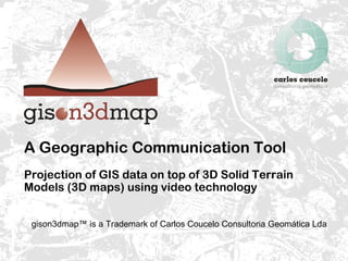
- 1. A Geographic Communication Tool Projection of GIS data on top of 3D Solid Terrain Models (3D maps) using video technology gison3dmap™ is a Trademark of Carlos Coucelo Consultoria Geomática Lda
- 5. gis on3d map projection examples Guimarães Master Plan revision
- 6. gis on3d map projection examples Sintra 3D - Geology map
- 7. The Sintra 3D gis on3d map system
- 8. The Sintra 3D gis on3d map system installation
- 11. gis on3d map Architecture There is no limit to the number of projectors that can be used with gis on3d map Clients submit drawing requests to the system Controller dispatches and synchronizes client requests Calibrator is used to configure and calibrate the system Displays control the graphic outputs used by the system for 3D map projection (P) or multimedia (M)
- 12. Controller and Display Windows The Controller window echoes configuration, licensing and client requests The Display window has a tab for each Display output and echoes display configuration and drawing errors
- 14. Calibrator Map Separator Digital Terrain Model Calibration Points Map Windows shapefile Opacity Mask shapefile Controler Host Calibrator Menu Map with data selected
- 15. Calibrator Host Separator Display Separators Display Status Map Window Selection Projector Data Map Window and Calibration Points Calibration Targets Setup
- 16. A 3D map projection using the ArcGIS 10 client
- 17. A Unique Geographic Communication Tool Developed by CCCGeomática gison3dmap™ is a Trademark of Carlos Coucelo Consultoria Geomática Lda