2. HOW ?
THE ANSWER IS
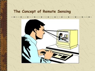
A physical quantity (light) emanates from the
screen, which is a source of radiation. The
radiated light passes over a distance, and thus is
"remote" to some extent,
As you view the screen of your computer
monitor, you are actively engaged in remote
sensing.
3. until it encounters and is captured by a sensor (your
eyes). Each eye sends a signal to a processor (your
brain) which records the data and interprets this into
information
Of our five senses (sight, hearing, taste, smell, touch),
three may be considered forms of "remote sensing", where
the source of information is at some distance. The other
two rely on direct contact with the source of information -
which are they?
4. What is remote sensing used for?
Remote sensing is a method for getting
information about of different objects on the
planet, without any physical contacts with it.
Image Source: cimss.ssec.wisc.edu
5. Advantages of Remote Sensing
Provides a view for the large region
Offers Geo-referenced information and
digital information
Most of the remote sensors operate in every
season, every day, every time and even in
real tough weather
7. Satellite pictures
Satellite imagery consists of
photographs from which
collected by satellites.
Image Source: www.wonderwhizkids.com
Image Source: www.loneotaku.net
Japan Satellite View
8. Satellites offer a Global View
What does satellite imagery give you?
-Information on land cover, land use, habitats,
landscape and infrastructure
-multiple engagements by time series
-Mapping and monitoring changes and predict
future
9. Remote Sensing
“the measurement or
acquisition of
information of some
property of an object or
phenomenon, by a
recording device that is
not in physical or
intimate contact with
the object or
phenomenon under
study” (Colwell, 1997).
10. ASPRS( American Society for Photogrammetry and
Remote Sensing)
adopted a combined formal definition of
photogrammetry and remote sensing as:
“the art, science, and technology of
obtaining reliable information about
physical objects and the environment,
through the process of recording,
measuring and interpreting imagery and
digital representations of energy patterns
derived from no contact sensor systems”
11. What is remote sensing?
Definition 1 – Remote sensing is acquiring information
about an object or scene without touching it through
using electromagnetic energy.
Most technique makes use of the electromagnetic spectrum.
Instrument can include Cameras, Spectrometers and Radar.
This is done by sensing and recording reflected or emitted
energy and processing, analyzing & applying that information.
a. RS deals with systems whose data can be used to
recreate images
13. A Remote Sensing System
◼ Energy source
◼ platform
◼ sensor
◼ data recording / transmission
◼ ground receiving station
◼ data processing
◼ expert interpretation / data users
14. FUNDAMENTALS OF HOW REMOTE
SENSING SYSTEM WORKS
1. Energy Source or Illumination (A) – the first
requirement for remote sensing is to have an energy
source which illuminates or provides electromagnetic
energy to the target of interest.
2. Radiation and the Atmosphere (B) – as the energy
travels from its source to the target, it will come in
contact with and interact with the atmosphere it passes
through. This interaction may take place a second time
as the energy travels from the target to the sensor.
15. 3. Interaction with the Target (C) - once the
energy makes its way to the target through the
atmosphere, it interacts with the target depending
on the properties of both the target and the
radiation.
4.Recording of Energy by the Sensor (D) - after
the energy has been scattered by, or emitted from
the target, we require a sensor (remote - not in
contact with the target) to collect and record the
electromagnetic radiation.
16. 5. Transmission, Reception, and Processing
(E) - the energy recorded by the sensor has to be
transmitted, often in electronic form, to a receiving
and processing station where the data are
processed into an image (hardcopy and/or digital).
6. Interpretation and Analysis (F) - the
processed image is interpreted, visually and/or
digitally or electronically, to extract information
about the target which was illuminated.
17. 7. Application (G) - the final element of the
remote sensing process is achieved when we
apply the information we have been able to extract
from the imagery about the target in order to
better understand it, reveal some new information,
or assist in solving a particular problem.
These seven elements comprise the
remote sensing process from beginning to
end.
18.
19. Principles of Remote Sensing
Interaction between incident radiation and the targets of interest
Everything in nature has its own unique
distribution of reflected, emitted and
absorbed radiation (spectral signature)
These spectral characteristics, can be
used to distinguish one thing from
another or to obtain information about
shape, size and other physical
properties
20. Electromagnetic Radiation
As was noted in the previous section,
the first requirement for remote
sensing is to have an energy source
to illuminate the target (unless the
sensed energy is being emitted by the
target). This energy is in the form
Electromagnetic Radiation.
21. Two characteristics of E.M.R. are
particularly important for understanding
remote sensing
Wavelength – the wavelength is the length of one wave
cycle & can be measured as the distance between
successive wave crests, it is measured in meters or
some factors of meters such as nanometer.
Velocity of E.M. waves is equal to the speed of light.
2. Frequency refers to the no. of cycles of waves
passing a fixed point per unit of time, it is measured in
Hz, equivalent to one cycle per second. Both are related
in the following manner
22. Electromagnetic waves are radiated through space. When
the energy encounters an object, even a very tiny one like a
molecule of air, one of three reactions occurs.
The radiation will either be reflected off the object,
absorbed by the object, or transmitted through the
object. The total amount of radiation that strikes an
object is referred to as the incident radiation.
INCIDENT ENERGY =
reflected radiation + absorbed radiation + transmitted
radiation
In remote sensing, we are largely
concerned with REFLECTED RADIATION.
This is the radiation that causes our eyes
to see colors.
23. Most sensors record within the visible and near
infrared (VNIR) and within the shortwave
infrared (SWIR).
400 500 600 800 900 nm
VISIBLE
700
NIR SWIR
1000
Electromagnetic Spectrum -: it is an array of all Electromagnetic
radiation characterized by wavelength & frequencies ranging from
cosmic short waves of high freq. at one end to long radio waves of low
freq. at the other end.
24. Its nothing but sequence of EM energy arranged
according to wavelength & frequency from long
radio waves to the short x-rays and gamma rays.
Note that the portion of the electromagnetic
spectrum we can detect with our eyes (the visible
portion) in fact constitutes a very small portion of
the electromagnetic spectrum. This is the part
that covers wavelengths from 0.4 to 0.7 µm, or
visible light.
25.
26. These varying wavelengths of light are detected by
the human eye and translated into a color by the
brain.
Common wavelengths of what we perceive as particular
colors from the visible portion of the spectrum are listed
below. It is important to note that this is the only portion of
the spectrum we can associate with the concept of
colors.
➢Violet: 0.4 - 0.446 μm
➢Blue: 0.446 - 0.500 μm
➢Green: 0.500 - 0.578 μm
➢Yellow: 0.578 - 0.592 μm
➢Orange: 0.592 - 0.620 μm
➢Red: 0.620 - 0.7 μm
27. Emission of Electromagnetic Energy:
All matter at temperatures greater than
absolute zero (0 Kelvin, -273 C)
continuously emits (gives off)
electromagnetic radiation. Generally, the
hotter an object, the higher its energy level
and the more it radiates. The reverse is
also true, the colder a material, the lower
its energy level.
28. All materials in the universe emit energy
of some form. A material that emits no
radiation at all is known as a black body,
which is a theoretical concept and does
not exist in nature
32. Blue, green, and red are the primary colors or
wavelengths of the visible spectrum. They are defined as
such because no single primary color can be created
from the other two, but all other colors can be formed by
combining blue, green, and red in various proportions.
Although we see sunlight as a uniform or homogeneous
color,
it is actually composed of various wavelengths of radiation
in primarily the ultraviolet, visible and infrared portions of the
spectrum. The visible portion of this radiation can be shown
in its component colors when sunlight is passed through a
prism, which bends the light in differing amounts according
to wavelength.
33.
34. Radiation – Target Interaction:
Radiation that is not absorbed or scattered in the
atmosphere reach and interact with the Earth's surface.
There are three (3) forms of interaction that can take place
when energy strikes.
1) - Absorption (A)
2) - Transmission (T)
3) - Reflection (R)
Absorption (A) occurs when radiation (energy) is absorbed into the
target while transmission (T) occurs when radiation passes through a
target. Reflection (R) occurs when radiation "bounces" off the target
and is redirected. In remote sensing, we are most interested in
measuring the radiation reflected from targets
35. There are two types of reflection,which represent the two
extreme ends of the way in which energy is reflected
from a target.
1) - Specular reflection:
When a surface is smooth we get
specular or mirror-like reflection where
all (or almost all) of the energy is
directed away from the surface in a
single direction.
2) - Diffuse reflection:
occurs when the surface is rough and
the energy is reflected almost uniformly
in all directions.
37. Applications: Forestry
Forest type maps - sometimes down to
species level
Appraisal of damage due to fire, insects,
and disease
Timber volume estimates
Wildlife habitat management
38. Natural resource Management
Forestry: biodiversity, forest, deforestation
Water source management
Habitat analysis
Environmental assessment
Pest/disease outbreaks
Impervious surface mapping
Hydrology
Mineral province
Geomorphology
Application of Remote Sensing
Md. Bodruddoza Mia
39. Types of Satellites
Geostationary
Satellites
A geostationary satellite is
one of the satellites which is
getting remotely sense data
and located satellite at an
altitude of approximately
36000 kilometres and
directly over the equator. Image Source: cimss.ssec.wisc.edu
40. Polar-Orbiting
Satellites
A polar orbit is a
satellite which is
located near to above
of poles. This satellite
mostly uses for earth
observation by time.
Types of Satellites
Image Source: globalmicrowave.org
42. Why use satellite RS ?
Remotely sensed data acquired by the Earth observation satellites
provides a number of benefits for studying the Earth's surface,
including:
•continuous acquisition of data
•regular revisit capabilities (resulting in up-to-date information)
•broad regional coverage
•good spectral resolution (including infra-red bands)
•good spatial resolution
•ability to manipulate/enhance digital data
43. •ability to combine satellite digital data with other digital data
•cost effective data
•map-accurate data
•possibility of stereo viewing
•large archive of historical data
44. But….
•Remote sensing has various issues
–Can be expensive
–Can be technically difficult
–NOT direct
•measure surrogate variables