SlideShare uma empresa Scribd logo
1 de 15
Groundwater Data
            To Inform the Clark Fork Plan
                                John LaFave
                        Ground Water Assessment Program
                         MT Bureau of Mines and Geology

                               “The science of hydrology
                              would be relatively simple if
                             water were unable to penetrate
                               below the earth’s surface.”


Clark Fork Task Force
  October 23, 2012
Montana Bureau of Mines and Geology
          a department of Montana Tech

• Established in 1919 to provide reliable and
  unbiased earth science information
• Non regulatory, applied research
  – Geologic Mapping
  – Earthquake Studies
  – Small Miners
  – Environmental Assessment
  – Ground Water
• Web: http://www.mbmg.mtech.edu/
Montana Ground Water Assessment
               Program
“…systematically assess and monitor the state’s
ground water and to disseminate the information…”
85-2-902(2) MCA


            • Ground-Water Characterization
                  – systematic data collection and interpretation.

            • Ground-Water Monitoring
                  – long term records of water levels and quality.

            • Ground-Water Information Center
                  – data dissemination.
Montana Bureau of Mines and Geology                      Montana Ground-Water Assessment Program
Ground Water Characterization
                                                     28 Areas
 Scheduled


               Field work
               Complete


                                           Field work
                                           Complete
                                                                                                       Field work
             Field work                                                                                Complete
             Complete
                          Field work
                          Complete
                                                                             Field work
                                                                             Complete
                                                        Field work
                                                         starting
                                        Field work              Field work
                                       Wrapping up              Complete


Montana Bureau of Mines and Geology                                             Montana Ground-Water Assessment Program
Ground Water Characterization
                                Main product -- the data


                                                 More than:
                                             ~ 3,000 inventories
                                             ~ 900 full analyses


Montana Bureau of Mines and Geology                      Montana Ground-Water Assessment Program
Ground Water Characterization
                                      24 maps, 5 reports
                                                                   Groundwater Quality Maps
                                                Reports


                                         Geologic Framework Maps


                                                                   Groundwater Flow Maps


Montana Bureau of Mines and Geology                                 Montana Ground-Water Assessment Program
Ground Water Monitoring


                           215 wells in the State-Wide Network
Montana Bureau of Mines and Geology                        Montana Ground-Water Assessment Program
Ground Water Information Center
                                  mbmggwic.mtech.edu


 Products:
      Well Logs           Water Quality   Hydrographs   Maps & Repts        Project data


Montana Bureau of Mines and Geology                             Montana Ground-Water Assessment Program
Ground Water Information Center


Montana Bureau of Mines and Geology   Montana Ground-Water Assessment Program
Montana Ground Water
                         Investigation Program
“…gather data, compile existing information, conduct field
studies, and prepare a detailed hydrogeologic assessment
report …and a hydrogeologic model… ”
85-2-525 (1) MCA

   • Investigates critical and specific groundwater questions
   • Results provide scientific basis for water-management
         –   Stream depletion related to groundwater development
         –   Impacts to aquifers: increasing demand; changing land use
         –   Protection of senior water rights (groundwater and surface water)
         –   Water quality impacts such as septic effluent
         –   Cumulative effects of water development
         –   Aquifer Storage and Recovery (ASR) in Montana
         –   Any Other Subjects that may be identified

Montana Bureau of Mines and Geology                       Montana Ground-Water Investigation Program
Ground Water Investigation Program
             Ongoing and proposed (unscheduled) projects
                                      Flathead Valley - Recharge/discharge relationships and
                                            long-term sustainability of the deep aquifer.


                                                 Florence – Depletion rates and timing from
                                                 groundwater development in Eightmile and
                                                           Threemile drainages


                                                             Florence – Eightmile Creek


   Stevensville-
Conversion of surface
  To groundwater
      Hamilton-
   Conversion of
 Irrigated ag land
    to residential

Montana Bureau of Mines and Geology                                  Montana Ground-Water Assessment Program
Contact Information:
                   Ground-Water Information Center:
                     http://mbmggwic.mtech.edu/

            Montana Bureau of Mines and Geology:
                    http://www.mbmg.mtech.edu/
                                          John LaFave
                                            496-4306
                                      jlafave@mtech.edu


Montana Bureau of Mines and Geology                       Montana Ground-Water Assessment Program
Groundwater Data to Inform the Clark Fork Plan

Mais conteúdo relacionado

Mais procurados

Spatial analysis of dissolved oxygen levels using Ordinary Kriging methods ne...
Spatial analysis of dissolved oxygen levels using Ordinary Kriging methods ne...Spatial analysis of dissolved oxygen levels using Ordinary Kriging methods ne...
Spatial analysis of dissolved oxygen levels using Ordinary Kriging methods ne...Jacqueline L. Frank
 
Discharge and Sediment Transport Modeling Buck Creek Proposal
Discharge and Sediment Transport Modeling Buck Creek ProposalDischarge and Sediment Transport Modeling Buck Creek Proposal
Discharge and Sediment Transport Modeling Buck Creek ProposalJames Blumenschein
 
2015 Broken Hill Resources Investment Symposium - Geological Survey of South ...
2015 Broken Hill Resources Investment Symposium - Geological Survey of South ...2015 Broken Hill Resources Investment Symposium - Geological Survey of South ...
2015 Broken Hill Resources Investment Symposium - Geological Survey of South ...Symposium
 
Headings - 2014 issue 1
Headings - 2014 issue 1Headings - 2014 issue 1
Headings - 2014 issue 1Headings
 
Catchments.ie Website Overview
Catchments.ie Website OverviewCatchments.ie Website Overview
Catchments.ie Website OverviewPaddy Morris
 
Aldergrove Aquifer Issues
Aldergrove Aquifer IssuesAldergrove Aquifer Issues
Aldergrove Aquifer Issuesjgabateman
 
Integration of Seismic Inversion, Pore Pressure Prediction, and TOC Predictio...
Integration of Seismic Inversion, Pore Pressure Prediction, and TOC Predictio...Integration of Seismic Inversion, Pore Pressure Prediction, and TOC Predictio...
Integration of Seismic Inversion, Pore Pressure Prediction, and TOC Predictio...Andika Perbawa
 
2015 Booklet 1st Proof
2015 Booklet 1st Proof2015 Booklet 1st Proof
2015 Booklet 1st ProofJessica Han
 
News Release: Lakeland Resources Reports Uranium Values at the Gibbons Creek...
News Release:  Lakeland Resources Reports Uranium Values at the Gibbons Creek...News Release:  Lakeland Resources Reports Uranium Values at the Gibbons Creek...
News Release: Lakeland Resources Reports Uranium Values at the Gibbons Creek...Lakeland Resources Inc. (TSXv: LK)
 
SPATIAL_DATA_INTEGRITY_SIS_A1
SPATIAL_DATA_INTEGRITY_SIS_A1SPATIAL_DATA_INTEGRITY_SIS_A1
SPATIAL_DATA_INTEGRITY_SIS_A1Yudi Syahnur
 
Velocity analysis and depth conversion in the offshre kaboudia permit
Velocity analysis and depth conversion in the offshre kaboudia permitVelocity analysis and depth conversion in the offshre kaboudia permit
Velocity analysis and depth conversion in the offshre kaboudia permitGuizani Aymen
 

Mais procurados (20)

James riverpartnership2003
James riverpartnership2003James riverpartnership2003
James riverpartnership2003
 
James River Partnership 2013
James River Partnership 2013James River Partnership 2013
James River Partnership 2013
 
Spatial analysis of dissolved oxygen levels using Ordinary Kriging methods ne...
Spatial analysis of dissolved oxygen levels using Ordinary Kriging methods ne...Spatial analysis of dissolved oxygen levels using Ordinary Kriging methods ne...
Spatial analysis of dissolved oxygen levels using Ordinary Kriging methods ne...
 
Discharge and Sediment Transport Modeling Buck Creek Proposal
Discharge and Sediment Transport Modeling Buck Creek ProposalDischarge and Sediment Transport Modeling Buck Creek Proposal
Discharge and Sediment Transport Modeling Buck Creek Proposal
 
Biondic n zrnovnica
Biondic n zrnovnicaBiondic n zrnovnica
Biondic n zrnovnica
 
2015 Broken Hill Resources Investment Symposium - Geological Survey of South ...
2015 Broken Hill Resources Investment Symposium - Geological Survey of South ...2015 Broken Hill Resources Investment Symposium - Geological Survey of South ...
2015 Broken Hill Resources Investment Symposium - Geological Survey of South ...
 
Belmont (BEA-TXV) #lithium #Nevada PPP 2018
Belmont (BEA-TXV) #lithium #Nevada PPP 2018Belmont (BEA-TXV) #lithium #Nevada PPP 2018
Belmont (BEA-TXV) #lithium #Nevada PPP 2018
 
Groundwater Quality mapping
Groundwater Quality mappingGroundwater Quality mapping
Groundwater Quality mapping
 
MDE_Projects_history_2016
MDE_Projects_history_2016MDE_Projects_history_2016
MDE_Projects_history_2016
 
Headings - 2014 issue 1
Headings - 2014 issue 1Headings - 2014 issue 1
Headings - 2014 issue 1
 
NOAA Data Products
NOAA Data ProductsNOAA Data Products
NOAA Data Products
 
Catchments.ie Website Overview
Catchments.ie Website OverviewCatchments.ie Website Overview
Catchments.ie Website Overview
 
Resume
ResumeResume
Resume
 
Aldergrove Aquifer Issues
Aldergrove Aquifer IssuesAldergrove Aquifer Issues
Aldergrove Aquifer Issues
 
Integration of Seismic Inversion, Pore Pressure Prediction, and TOC Predictio...
Integration of Seismic Inversion, Pore Pressure Prediction, and TOC Predictio...Integration of Seismic Inversion, Pore Pressure Prediction, and TOC Predictio...
Integration of Seismic Inversion, Pore Pressure Prediction, and TOC Predictio...
 
2015 Booklet 1st Proof
2015 Booklet 1st Proof2015 Booklet 1st Proof
2015 Booklet 1st Proof
 
Gec 1997
Gec 1997Gec 1997
Gec 1997
 
News Release: Lakeland Resources Reports Uranium Values at the Gibbons Creek...
News Release:  Lakeland Resources Reports Uranium Values at the Gibbons Creek...News Release:  Lakeland Resources Reports Uranium Values at the Gibbons Creek...
News Release: Lakeland Resources Reports Uranium Values at the Gibbons Creek...
 
SPATIAL_DATA_INTEGRITY_SIS_A1
SPATIAL_DATA_INTEGRITY_SIS_A1SPATIAL_DATA_INTEGRITY_SIS_A1
SPATIAL_DATA_INTEGRITY_SIS_A1
 
Velocity analysis and depth conversion in the offshre kaboudia permit
Velocity analysis and depth conversion in the offshre kaboudia permitVelocity analysis and depth conversion in the offshre kaboudia permit
Velocity analysis and depth conversion in the offshre kaboudia permit
 

Destaque

Unleash Your Inner Unicorn
Unleash Your Inner UnicornUnleash Your Inner Unicorn
Unleash Your Inner UnicornMatt Baxter
 
Viewing the World Cup in Uganda
Viewing the World Cup in UgandaViewing the World Cup in Uganda
Viewing the World Cup in UgandaMr Hunt
 
Data conference 081108
Data conference 081108Data conference 081108
Data conference 081108Ecoshare
 
Lewis and Clark CUP Presentation
Lewis and Clark CUP PresentationLewis and Clark CUP Presentation
Lewis and Clark CUP PresentationEcoshare
 
USBR 2013 Operations for Western Montana Reservoirs
USBR 2013 Operations for Western Montana Reservoirs USBR 2013 Operations for Western Montana Reservoirs
USBR 2013 Operations for Western Montana Reservoirs Clark Fork Task Force
 
National Weather Service's Montana Water Supply and Moisture Status
National Weather Service's Montana Water Supply and Moisture Status National Weather Service's Montana Water Supply and Moisture Status
National Weather Service's Montana Water Supply and Moisture Status Clark Fork Task Force
 
(Ximb) sustainability brewing industry
(Ximb) sustainability brewing industry(Ximb) sustainability brewing industry
(Ximb) sustainability brewing industrySustainabilityXIMB
 
「INFOGRAPHIC」 The Great 21st Century North American War: Unicorns vs Narwhals
「INFOGRAPHIC」 The Great 21st Century North American War: Unicorns vs Narwhals「INFOGRAPHIC」 The Great 21st Century North American War: Unicorns vs Narwhals
「INFOGRAPHIC」 The Great 21st Century North American War: Unicorns vs Narwhalsdomain .ME
 
Compensation Management
Compensation ManagementCompensation Management
Compensation ManagementFarhan Akhtar
 

Destaque (17)

Unleash Your Inner Unicorn
Unleash Your Inner UnicornUnleash Your Inner Unicorn
Unleash Your Inner Unicorn
 
B e
B eB e
B e
 
Viewing the World Cup in Uganda
Viewing the World Cup in UgandaViewing the World Cup in Uganda
Viewing the World Cup in Uganda
 
Data conference 081108
Data conference 081108Data conference 081108
Data conference 081108
 
Confluence.water wednesday
Confluence.water wednesdayConfluence.water wednesday
Confluence.water wednesday
 
Lewis and Clark CUP Presentation
Lewis and Clark CUP PresentationLewis and Clark CUP Presentation
Lewis and Clark CUP Presentation
 
USBR 2013 Operations for Western Montana Reservoirs
USBR 2013 Operations for Western Montana Reservoirs USBR 2013 Operations for Western Montana Reservoirs
USBR 2013 Operations for Western Montana Reservoirs
 
National Weather Service's Montana Water Supply and Moisture Status
National Weather Service's Montana Water Supply and Moisture Status National Weather Service's Montana Water Supply and Moisture Status
National Weather Service's Montana Water Supply and Moisture Status
 
North Dakota
North DakotaNorth Dakota
North Dakota
 
(Ximb) sustainability brewing industry
(Ximb) sustainability brewing industry(Ximb) sustainability brewing industry
(Ximb) sustainability brewing industry
 
Pmmm final
Pmmm finalPmmm final
Pmmm final
 
Transducers
TransducersTransducers
Transducers
 
Steam Turbines
Steam TurbinesSteam Turbines
Steam Turbines
 
「INFOGRAPHIC」 The Great 21st Century North American War: Unicorns vs Narwhals
「INFOGRAPHIC」 The Great 21st Century North American War: Unicorns vs Narwhals「INFOGRAPHIC」 The Great 21st Century North American War: Unicorns vs Narwhals
「INFOGRAPHIC」 The Great 21st Century North American War: Unicorns vs Narwhals
 
Free radicals
Free radicalsFree radicals
Free radicals
 
Compensation Management
Compensation ManagementCompensation Management
Compensation Management
 
Transducers
TransducersTransducers
Transducers
 

Semelhante a Groundwater Data to Inform the Clark Fork Plan

C2VSim Workshop 1 - Introduction
C2VSim Workshop 1 - IntroductionC2VSim Workshop 1 - Introduction
C2VSim Workshop 1 - IntroductionCharlie Brush
 
H2O Presentation 26May2011
H2O Presentation 26May2011H2O Presentation 26May2011
H2O Presentation 26May2011Justin Vandever
 
DSD-INT 2018 Tidal propagation and salt intrusion in the multi-channel estuar...
DSD-INT 2018 Tidal propagation and salt intrusion in the multi-channel estuar...DSD-INT 2018 Tidal propagation and salt intrusion in the multi-channel estuar...
DSD-INT 2018 Tidal propagation and salt intrusion in the multi-channel estuar...Deltares
 
Com'è cambiato il Delta del Po
Com'è cambiato il Delta del PoCom'è cambiato il Delta del Po
Com'è cambiato il Delta del PoAlessiaDeMarchi2
 
Delta del Po e cambiamento climatico, lo studio della Regione
Delta del Po e cambiamento climatico, lo studio della RegioneDelta del Po e cambiamento climatico, lo studio della Regione
Delta del Po e cambiamento climatico, lo studio della RegioneAlessiaDeMarchi2
 
NATCL Biopile Management Plan Dec 2014 - IFU
NATCL  Biopile Management Plan Dec 2014 - IFUNATCL  Biopile Management Plan Dec 2014 - IFU
NATCL Biopile Management Plan Dec 2014 - IFUStacey O'Sullivan
 
Introduction to the U.S. Geological Survey and USGS-GCD Cooperative Studies, ...
Introduction to the U.S. Geological Survey and USGS-GCD Cooperative Studies, ...Introduction to the U.S. Geological Survey and USGS-GCD Cooperative Studies, ...
Introduction to the U.S. Geological Survey and USGS-GCD Cooperative Studies, ...Texas Alliance of Groundwater Districts
 
Advanced Survey of Groundwater Resources of Northern and Central Turkana Coun...
Advanced Survey of Groundwater Resources of Northern and Central Turkana Coun...Advanced Survey of Groundwater Resources of Northern and Central Turkana Coun...
Advanced Survey of Groundwater Resources of Northern and Central Turkana Coun...WaterCap
 
Measuring Success of Targeted BMP Implementation, and Getting Smarter about E...
Measuring Success of Targeted BMP Implementation, and Getting Smarter about E...Measuring Success of Targeted BMP Implementation, and Getting Smarter about E...
Measuring Success of Targeted BMP Implementation, and Getting Smarter about E...National Institute of Food and Agriculture
 
Identification of Groundwater Potential Zones in Vaippar Basin, Tamil Nadu, I...
Identification of Groundwater Potential Zones in Vaippar Basin, Tamil Nadu, I...Identification of Groundwater Potential Zones in Vaippar Basin, Tamil Nadu, I...
Identification of Groundwater Potential Zones in Vaippar Basin, Tamil Nadu, I...SagarChougule11
 
Mesopotamia geoarcaheology jaafar jotheri
Mesopotamia geoarcaheology   jaafar jotheriMesopotamia geoarcaheology   jaafar jotheri
Mesopotamia geoarcaheology jaafar jotheriDurham University
 
Water Board Update to Moffett RAB
Water Board Update to Moffett RABWater Board Update to Moffett RAB
Water Board Update to Moffett RABSteve Williams
 
Preliminary Technical Evaluation of Three Reports by U.S. Environmental Prote...
Preliminary Technical Evaluation of Three Reports by U.S. Environmental Prote...Preliminary Technical Evaluation of Three Reports by U.S. Environmental Prote...
Preliminary Technical Evaluation of Three Reports by U.S. Environmental Prote...LPE Learning Center
 
Cv pictures Geological Engineer_francisco lucena
Cv pictures Geological Engineer_francisco lucenaCv pictures Geological Engineer_francisco lucena
Cv pictures Geological Engineer_francisco lucenaFrancisco Lucena Gómez
 
Potential Recharge Zones.pptx
Potential Recharge Zones.pptxPotential Recharge Zones.pptx
Potential Recharge Zones.pptxQasimHaider4
 

Semelhante a Groundwater Data to Inform the Clark Fork Plan (16)

C2VSim Workshop 1 - Introduction
C2VSim Workshop 1 - IntroductionC2VSim Workshop 1 - Introduction
C2VSim Workshop 1 - Introduction
 
H2O Presentation 26May2011
H2O Presentation 26May2011H2O Presentation 26May2011
H2O Presentation 26May2011
 
DSD-INT 2018 Tidal propagation and salt intrusion in the multi-channel estuar...
DSD-INT 2018 Tidal propagation and salt intrusion in the multi-channel estuar...DSD-INT 2018 Tidal propagation and salt intrusion in the multi-channel estuar...
DSD-INT 2018 Tidal propagation and salt intrusion in the multi-channel estuar...
 
Com'è cambiato il Delta del Po
Com'è cambiato il Delta del PoCom'è cambiato il Delta del Po
Com'è cambiato il Delta del Po
 
Delta del Po e cambiamento climatico, lo studio della Regione
Delta del Po e cambiamento climatico, lo studio della RegioneDelta del Po e cambiamento climatico, lo studio della Regione
Delta del Po e cambiamento climatico, lo studio della Regione
 
NATCL Biopile Management Plan Dec 2014 - IFU
NATCL  Biopile Management Plan Dec 2014 - IFUNATCL  Biopile Management Plan Dec 2014 - IFU
NATCL Biopile Management Plan Dec 2014 - IFU
 
Introduction to the U.S. Geological Survey and USGS-GCD Cooperative Studies, ...
Introduction to the U.S. Geological Survey and USGS-GCD Cooperative Studies, ...Introduction to the U.S. Geological Survey and USGS-GCD Cooperative Studies, ...
Introduction to the U.S. Geological Survey and USGS-GCD Cooperative Studies, ...
 
Advanced Survey of Groundwater Resources of Northern and Central Turkana Coun...
Advanced Survey of Groundwater Resources of Northern and Central Turkana Coun...Advanced Survey of Groundwater Resources of Northern and Central Turkana Coun...
Advanced Survey of Groundwater Resources of Northern and Central Turkana Coun...
 
Measuring Success of Targeted BMP Implementation, and Getting Smarter about E...
Measuring Success of Targeted BMP Implementation, and Getting Smarter about E...Measuring Success of Targeted BMP Implementation, and Getting Smarter about E...
Measuring Success of Targeted BMP Implementation, and Getting Smarter about E...
 
Identification of Groundwater Potential Zones in Vaippar Basin, Tamil Nadu, I...
Identification of Groundwater Potential Zones in Vaippar Basin, Tamil Nadu, I...Identification of Groundwater Potential Zones in Vaippar Basin, Tamil Nadu, I...
Identification of Groundwater Potential Zones in Vaippar Basin, Tamil Nadu, I...
 
Mesopotamia geoarcaheology jaafar jotheri
Mesopotamia geoarcaheology   jaafar jotheriMesopotamia geoarcaheology   jaafar jotheri
Mesopotamia geoarcaheology jaafar jotheri
 
Water Board Update to Moffett RAB
Water Board Update to Moffett RABWater Board Update to Moffett RAB
Water Board Update to Moffett RAB
 
Preliminary Technical Evaluation of Three Reports by U.S. Environmental Prote...
Preliminary Technical Evaluation of Three Reports by U.S. Environmental Prote...Preliminary Technical Evaluation of Three Reports by U.S. Environmental Prote...
Preliminary Technical Evaluation of Three Reports by U.S. Environmental Prote...
 
Cv pictures Geological Engineer_francisco lucena
Cv pictures Geological Engineer_francisco lucenaCv pictures Geological Engineer_francisco lucena
Cv pictures Geological Engineer_francisco lucena
 
Ground water prospects map
Ground water prospects mapGround water prospects map
Ground water prospects map
 
Potential Recharge Zones.pptx
Potential Recharge Zones.pptxPotential Recharge Zones.pptx
Potential Recharge Zones.pptx
 

Mais de Clark Fork Task Force

USGS Spring Clark Fork River Water Outlook 2013
USGS  Spring Clark Fork River Water Outlook 2013USGS  Spring Clark Fork River Water Outlook 2013
USGS Spring Clark Fork River Water Outlook 2013Clark Fork Task Force
 
Montana Fire Season Official Outlook 2013
Montana Fire Season Official Outlook 2013 Montana Fire Season Official Outlook 2013
Montana Fire Season Official Outlook 2013 Clark Fork Task Force
 
Montana Reservoir Water Outlook 2013
Montana Reservoir Water Outlook 2013 Montana Reservoir Water Outlook 2013
Montana Reservoir Water Outlook 2013 Clark Fork Task Force
 
Clark Fork River: Current Stream Flow Conditions
Clark Fork River: Current Stream Flow ConditionsClark Fork River: Current Stream Flow Conditions
Clark Fork River: Current Stream Flow ConditionsClark Fork Task Force
 
Operations for Hungry Horse and Lake Como
Operations for Hungry Horse and Lake Como Operations for Hungry Horse and Lake Como
Operations for Hungry Horse and Lake Como Clark Fork Task Force
 
Reservoir Storage: Clark Fork River Basin
Reservoir Storage: Clark Fork River Basin Reservoir Storage: Clark Fork River Basin
Reservoir Storage: Clark Fork River Basin Clark Fork Task Force
 
2012 fire season wrap up & 2013 outlook - Clark Fork Basin
2012 fire season wrap up & 2013 outlook - Clark Fork Basin2012 fire season wrap up & 2013 outlook - Clark Fork Basin
2012 fire season wrap up & 2013 outlook - Clark Fork BasinClark Fork Task Force
 

Mais de Clark Fork Task Force (11)

USGS Spring Clark Fork River Water Outlook 2013
USGS  Spring Clark Fork River Water Outlook 2013USGS  Spring Clark Fork River Water Outlook 2013
USGS Spring Clark Fork River Water Outlook 2013
 
Montana Fire Season Official Outlook 2013
Montana Fire Season Official Outlook 2013 Montana Fire Season Official Outlook 2013
Montana Fire Season Official Outlook 2013
 
Montana Snow Survey Data
Montana Snow Survey Data Montana Snow Survey Data
Montana Snow Survey Data
 
Montana Drought Analysis
Montana Drought Analysis Montana Drought Analysis
Montana Drought Analysis
 
Montana Fire Season Outlook 2013
Montana Fire Season Outlook 2013 Montana Fire Season Outlook 2013
Montana Fire Season Outlook 2013
 
Montana Reservoir Water Outlook 2013
Montana Reservoir Water Outlook 2013 Montana Reservoir Water Outlook 2013
Montana Reservoir Water Outlook 2013
 
Clark Fork River: Current Stream Flow Conditions
Clark Fork River: Current Stream Flow ConditionsClark Fork River: Current Stream Flow Conditions
Clark Fork River: Current Stream Flow Conditions
 
Weather, Climate, & Stream Volumes
Weather, Climate, & Stream Volumes Weather, Climate, & Stream Volumes
Weather, Climate, & Stream Volumes
 
Operations for Hungry Horse and Lake Como
Operations for Hungry Horse and Lake Como Operations for Hungry Horse and Lake Como
Operations for Hungry Horse and Lake Como
 
Reservoir Storage: Clark Fork River Basin
Reservoir Storage: Clark Fork River Basin Reservoir Storage: Clark Fork River Basin
Reservoir Storage: Clark Fork River Basin
 
2012 fire season wrap up & 2013 outlook - Clark Fork Basin
2012 fire season wrap up & 2013 outlook - Clark Fork Basin2012 fire season wrap up & 2013 outlook - Clark Fork Basin
2012 fire season wrap up & 2013 outlook - Clark Fork Basin
 

Groundwater Data to Inform the Clark Fork Plan

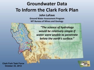
  • 1. Groundwater Data To Inform the Clark Fork Plan John LaFave Ground Water Assessment Program MT Bureau of Mines and Geology “The science of hydrology would be relatively simple if water were unable to penetrate below the earth’s surface.” Clark Fork Task Force October 23, 2012
  • 2. Montana Bureau of Mines and Geology a department of Montana Tech • Established in 1919 to provide reliable and unbiased earth science information • Non regulatory, applied research – Geologic Mapping – Earthquake Studies – Small Miners – Environmental Assessment – Ground Water • Web: http://www.mbmg.mtech.edu/
  • 3. Montana Bureau of Mines and Geology a department of Montana Tech • Established in 1919 to provide reliable and unbiased earth science information • Non regulatory, applied research – Geologic Mapping – Earthquake Studies – Small Miners – Environmental Assessment – Ground Water • Web: http://www.mbmg.mtech.edu/
  • 4. Montana Bureau of Mines and Geology a department of Montana Tech • Established in 1919 to provide reliable and unbiased earth science information • Non regulatory, applied research – Geologic Mapping – Earthquake Studies – Small Miners – Environmental Assessment – Ground Water • Web: http://www.mbmg.mtech.edu/
  • 5. Montana Ground Water Assessment Program “…systematically assess and monitor the state’s ground water and to disseminate the information…” 85-2-902(2) MCA • Ground-Water Characterization – systematic data collection and interpretation. • Ground-Water Monitoring – long term records of water levels and quality. • Ground-Water Information Center – data dissemination. Montana Bureau of Mines and Geology Montana Ground-Water Assessment Program
  • 6. Ground Water Characterization 28 Areas Scheduled Field work Complete Field work Complete Field work Field work Complete Complete Field work Complete Field work Complete Field work starting Field work Field work Wrapping up Complete Montana Bureau of Mines and Geology Montana Ground-Water Assessment Program
  • 7. Ground Water Characterization Main product -- the data More than: ~ 3,000 inventories ~ 900 full analyses Montana Bureau of Mines and Geology Montana Ground-Water Assessment Program
  • 8. Ground Water Characterization 24 maps, 5 reports Groundwater Quality Maps Reports Geologic Framework Maps Groundwater Flow Maps Montana Bureau of Mines and Geology Montana Ground-Water Assessment Program
  • 9. Ground Water Monitoring 215 wells in the State-Wide Network Montana Bureau of Mines and Geology Montana Ground-Water Assessment Program
  • 10. Ground Water Information Center mbmggwic.mtech.edu Products: Well Logs Water Quality Hydrographs Maps & Repts Project data Montana Bureau of Mines and Geology Montana Ground-Water Assessment Program
  • 11. Ground Water Information Center Montana Bureau of Mines and Geology Montana Ground-Water Assessment Program
  • 12. Montana Ground Water Investigation Program “…gather data, compile existing information, conduct field studies, and prepare a detailed hydrogeologic assessment report …and a hydrogeologic model… ” 85-2-525 (1) MCA • Investigates critical and specific groundwater questions • Results provide scientific basis for water-management – Stream depletion related to groundwater development – Impacts to aquifers: increasing demand; changing land use – Protection of senior water rights (groundwater and surface water) – Water quality impacts such as septic effluent – Cumulative effects of water development – Aquifer Storage and Recovery (ASR) in Montana – Any Other Subjects that may be identified Montana Bureau of Mines and Geology Montana Ground-Water Investigation Program
  • 13. Ground Water Investigation Program Ongoing and proposed (unscheduled) projects Flathead Valley - Recharge/discharge relationships and long-term sustainability of the deep aquifer. Florence – Depletion rates and timing from groundwater development in Eightmile and Threemile drainages Florence – Eightmile Creek Stevensville- Conversion of surface To groundwater Hamilton- Conversion of Irrigated ag land to residential Montana Bureau of Mines and Geology Montana Ground-Water Assessment Program
  • 14. Contact Information: Ground-Water Information Center: http://mbmggwic.mtech.edu/ Montana Bureau of Mines and Geology: http://www.mbmg.mtech.edu/ John LaFave 496-4306 jlafave@mtech.edu Montana Bureau of Mines and Geology Montana Ground-Water Assessment Program