3D Scanning Basics for Printing and Immersive Technologies

3D scanning may be riding on the coattails of 3D design and printing technologies, but it has had a long history of useful applications. For thousands of years, people have developed tools and skills to help replicate objects in the real world. Today, there are still many reasons to do 3D scanning. For example, the Innovation Lab, a community-driven solution space located in the Seminole Community Library at St. Petersburg College, has been working on some 3D scanning projects like digitizing real dinosaur bones to bring to schools and shared as holograms, helping a local glass museum import objects into virtual and augmented reality spaces, and more. In this webinar, Understand how 3D scanning works in a variety of industries, Learn about a variety of 3D scanners (software and hardware) currently on the market, Discover how 3D scanning can be used in libraries, museums, schools, and other institutions, Explore the future of 3D scanning and how it will enhance immersive technologies. Audio/Slides are available at https://floridalibrarywebinars.org/.

Recommended
Recommended
More Related Content
More from St. Petersburg College
More from St. Petersburg College (20)
Recently uploaded
Recently uploaded (20)
3D Scanning Basics for Printing and Immersive Technologies
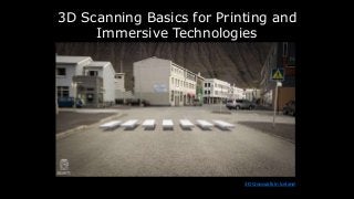
- 1. 3D Scanning Basics for Printing and Immersive Technologies 3D Crosswalk in Iceland
- 2. Agenda: • Understand how 3D scanning works in a variety of industries. • Learn about a variety of 3D scanners (software and hardware) currently on the market. • Discover how 3D scanning can be used in libraries, museums, schools, and other institutions. • Explore the future of 3D scanning and how it will enhance immersive technologies.
- 3. Archaic 3D Modeling? Source: www.si.edu
- 4. Types of 3D Scanning
- 5. Laser Scanning Combines two sets of information to create a point cloud of an object’s surface: data from a laser being shone on the object, and data from another sensor (typically a moving camera, or two stationary ones). The scanning software stitches these data sets together using the known distance between the camera’s position and the laser’s source to generate a model’s points. Source: https://bit.ly/2JhPgfs
- 6. Stereo Vision and Photogrammetry Stereo Vision creates a 3D model using images of an object from two camera positions, mimicking the stereo vision of human eyes. Photogrammetry is the science of making measurements from photographs. It adds more camera positions to 3D capture objects. There is Aerial Photogrammetry and Terrestrial and Close- range Photogrammetry. Source: https://bit.ly/2JhPgfs
- 7. Select Photogrammetry Applications (Free) COLMAP Aerial, Close-Range ply, vrml Windows, macOS, Linux Free Meshroom Aerial, Close-Range abc, obj Windows, Linux Free MicMac Aerial, Close-Range geotiff, ply, xml Windows, macOS, Linux Free Regard3D Aerial, Close-Range obj, ply Windows, macOS, Linux Free VisualSFM Aerial, Close-Range ply Windows, macOS, Linux Free OpenMVG Aerial, Close-Range - Linux, Windows, MacOS Free Source: https://bit.ly/2VHxoS4 12 Best Photogrammetry Software For 3D Mapping Using Drones, https://bit.ly/2HSe8d7
- 8. Structured Light Scanning Source: https://bit.ly/2JhPgfs One of the camera positions used in stereo vision and laser scanning is replaced by a projector that projects different light patterns (providing its own texture) onto an object’s surface and recording how the object distorts those patterns. It is used in facial recognition technology, reverse engineering, design, manufacturing, and remote environment recognition (e.g., mapping the seafloor railway tunnel inspections).
- 9. Time of Flight (ToF) Source: https://bit.ly/2JhPgfs Also known as laser pulse scanning. This technique produces a 3D model scan by timing how long it takes a laser’s beam to reach the object and bounce off, traveling back to the laser’s source. Fairly sophisticated and expensive. TeraRanger One, lightweight and low-cost ToF distance sensor for mobile robotics and automation applications
- 10. Light Detection and Ranging (LIDAR) is a remote sensing method used to examine the surface of the Earth. Source: https://bit.ly/2xsGjtG
- 11. Video: https://youtu.be/X2kfyl1ERm8 Chouette drone uses ToF (Time of Flight) cameras to surveil vineyards.
- 12. These phones have a ToF camera to detect depth! Source: https://bit.ly/2vX5lhQ Huawei P30 Pro Samsung Galaxy S10 5G / Ultimate Edition Oppo RX17 Pro Honor View 20 LG G8 ThinQ iPhone 2020
- 13. Mobile 3D Scanner! Source: https://bit.ly/2gMAiAZ
- 14. Some Select 3D Scanners/Applications
- 15. Shining 3D Einscan Pro 2X -- $6,900
- 16. Shining 3D EinScan-SE -- $2,600
- 17. FARO FocusS 350 -- $25,000
- 21. Matter & Form Mfs1V2 3D Scanner -- $750
- 22. First Scanning Attempt With Matter and Form, 2015 Video: https://bit.ly/2Js2jKO
- 23. Digital Scanning DIY-Style with Eureka Factory! Sketchfab Try it! https://goo.gl/dByASn
- 24. How to 3D Scan With Skanect using a Microsoft Kinect Source: https://bit.ly/2YuJGtU
- 25. KinectVR – room scale full-body tracking
- 28. Using Structure Sensor with Skanect/Sketchfab Video: https://bit.ly/2WEAvGs
- 29. Upload using a Sketchfab API Token
- 31. itSeez3D + Structure Sensor https://itseez3d.com/ Video: https://youtu.be/yv_WLBRpu80
- 35. .occipital.com
- 36. 3D File Formats you may encounter while scanning • .OBJ – Object file that includes 3D coordinates, texture maps, polygonal faces, and other object information. • .MTL – Material Template Library. Material settings are stored with an .OBJ file and describes how textures are applied to the object. It includes the name of texture bitmap files as well as the 3D positioning of the textures. • .glTF (GL Transmission Format) is a file format for 3D scenes and models. It is sometimes referred to as the "JPEG of 3D.“ • COLLADA (COLLAborative Design Activity) is an interchange file format for interactive 3D applications. • 3DS retains only the most basic information about geometry, appearance, scene, and animation. • VRML (Virtual Reality Modeling Language) files store 3D interactive vector graphics, designed particularly for the WWW and/or color 3D prints. Other formats: https://bit.ly/2LAJgjW
- 37. Partnering with Museums! 360° and 3D scanning project, Seminole Historical Society 3D scanned object in VR, prototype for Imagine Museum. Sam inside a MERGE Cube. Showing artist/philanthropist, Trish Duggan, what is possible using Magic Leap. A meeting about VR inside VR. Holograms via MERGE Cube
- 39. MERGE Cube: https://bit.ly/2Vp1c5I and https://bit.ly/2Yiqm2R.
- 40. Scanning with Structure Sensor + itSeez 3D
- 41. MERGE Cube Issues with 3D scans
- 42. Texture Files Coro Catedral de Mexico (photogrammetry + LIDAR) View at https://skfb.ly/6KtPo
- 43. Watch at: https://youtu.be/BkOxvT_esQo Qlone – 3D scanning tool using an AR dome
- 44. Qlone App for iOS and Android
- 45. Exporting
- 46. Measurements are not 100% accurate, but are close.
- 47. www.trnio.com Weird scans: http://trn.io/y/ydPtOLRI1R/ and http://trn.io/8/8S3an4zv5q/
- 48. 3D Scanning Issues • Lighting must be bright and fairly consistent. • Slight movements can make the scan look weird. • Metallic/shiny, transparent, furry etc. objects are difficult to scan. • If using entry level equipment, patience is key and you must have a steady hand.
- 49. Fortunately, there are incredible 3D scans of Notre Dame Source: https://bit.ly/2PhDjqj
- 50. Laser Scanning Reveals Cathedral’s Mysteries Video: https://youtu.be/jAi29udFMKw
- 51. Inside Google Earth VR Inside Google Earth VR
- 52. Photogrammetry is the art and science of making measurements from photographs, especially for recovering the exact positions of surface points. Source: https://skfb.ly/6ByOW
- 53. Light Field Imagery Source: https://youtu.be/Y4XnjQL1wHg
- 55. Intel Studios: A Home for Volumetric Video Capture and Creation Source: https://youtu.be/nd6vrSL7i1s
- 56. Contact me!