Smallholder Farms Reduce Deforestation
•
1 gostou•880 visualizações

Presentation for CCAFS - FAO workshop Smallholder Mitigation: Whole Farm and Landscape Accounting 27 - 28 October 2011

Recomendados
Recomendados
Mais conteúdo relacionado
Mais procurados
Mais procurados (20)
Semelhante a Smallholder Farms Reduce Deforestation
Semelhante a Smallholder Farms Reduce Deforestation (20)
Mais de CCAFS | CGIAR Research Program on Climate Change, Agriculture and Food Security
Mais de CCAFS | CGIAR Research Program on Climate Change, Agriculture and Food Security (20)
Último
Último (20)
Smallholder Farms Reduce Deforestation
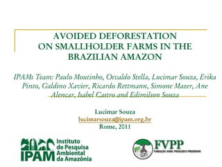
- 1. AVOIDED DEFORESTATION ON SMALLHOLDER FARMS IN THE BRAZILIAN AMAZON IPAMs Team: Paulo Moutinho, Osvaldo Stella, Lucimar Souza, Erika Pinto, Galdino Xavier, Ricardo Rettmann, Simone Mazer, Ane Alencar, Isabel Castro and Edimilson Souza Lucimar Souza lucimarsouza@ipam.org.br Rome, 2011
- 2. Lucimar Souza lucimarsouza@ipam.org.br I was born in a small farmer in the Amazon I took Psychology at Federal University of Pará Started working at IPAM as a trainer in a fire management project I took Master´s degree at University of Florida in the Tropical Conservation and Development Program
- 3. BACKGROUND OF THE PROJECT THE DESIGN OF THIS PROJECT RESULTS FROM THE EXPERIENCE GAINED UNDER A BRAZILIAN GOVERNMENTAL PROGRAM CALLED PROAMBIENTE. PROAMBIENTE RESULTED FROM A LARGE DEMANDA FROM SOCIAL MOVEMENTS THAT CALLED, SINCE 2000, FOR RECOGNITION OF THE IMPORTANCE OF PROMOTING SMALL AND FAMILY-BASED PRODUCTION ASSOCI¬ATED WITH SOCIAL INCLUSION , ENVIRONMENTAL CONSERVATION, AND THE VALUING OF ENVIRONMENTAL SERVICES PROVIDED BY SMALLHOLDERS. PROAMBIENTE BECAME A PUBLIC POLICY OF BRAZILIAN FEDERAL GOVERNMENT IN 2004 WITH THE TECHNICAL SUPPORT OF IPAM AND FVPP. IT WAS NOT EFFECTIVELY IMPLEMENTED DUE TO THE LACK OF A LEGAL FRAMEWORK IN BRAZIL THAT RECOGNIZES ENVIRONMENTAL SERVICES, THEIR VALUATION OR PAYMENT, AMONG OTHER REASONS
- 4. AREA MUNICIPALITIES: 32,092 Kkm2 AREA = 31,745 ha 350 SMALLHOLDERS PROPERTIES – AVERAGE AREA = 90,7 ha: 55% STANDING FORESTS 30% PASTURE 9% SECONDARY FORESTS 4% PERENNIAL CROPS OR AGROFORESTRY SYSTEMS 2% ANNUAL CROPS ANNUAL DEFORESTATION RATES: 4,8% CARBON STOCKS = 126 tC/ha TOTAL ANNUAL EMISSIONS DUE TO DEFORESTATION: 387,4 MtCO2 MUNICIPALITIES: ANAPU, PACAJÁ AND SENADOR JOSÉ PORFÍRIO (PARA STATE, BRAZIL)
- 5. Considering the Methods used in the project… The following steps were considered extremely important to compose the landscape-based approach to mitigation of GHG involving smallholders of Amazon by IPAM team and partners
- 6. 1) Involvement of key-actors several meeting involving local smallholders, leaderships and grassroots organizations in order to raise awareness about the relationship between regional vulnerability to climate change potential impacts, drivers of deforestation and low-emission alternative production systems. The key stakeholders demanded support from IPAM to access financial incentives that make feasible to reduce deforestation, while promoting a new model of rural development. Thus, IPAM initiated a study on the regional potential for avoided deforestation with direct participation of the smallholders’ leaderships.
- 7. 2) Data survey: Data collection in the field covered 304 from the 350 families in 2007. In these visits IPAM’s technicians, with support from rural leaderships, updated the Plans of Use of Rural Proprieties that were first developed in 2005 as a requirement for the participation of families in the program PROAMBIENTE The diagnosis of the properties situation allowed analyzes on the following: profile of land use of properties, socioeconomic profile of producers, agricultural production and profitability, and perspective of producers in relation to the properties productivity at medium and long-term.
- 8. Use Plan of a Rural Propriety Current Productive System (diagnosis) Productive System after the project (future view) Use Plan
- 9. 3) Baseline of deforestation: To characterize the dynamics of deforestation in the region and calculate the baseline scenarios for deforestation, satellite images made available online by the Brazilian National Institute for Space Research (INPE) from 1998 to 2008 were used (INPE, 2009). A historic deforestation rate of 4.8% per year was estimated for the region of the project’s implementation and used as a baseline.
- 10. 4) Carbon stocks: The models and studies developed to estimate the biomass and carbon stocks in the Amazon biome (Saatchi et al. 2007, Soares-Filho et al. 2006, Fearnside et al. 1997) attribute values that vary from 60 to more than 200 tons of carbon per hectare. For regional scale projects, more precise analysis can be made based on local characteristics. Thus, a model for the specific focus region was generated counting the average amount of carbon per hectare, based on Saatchi et al. (2007).
- 11. 4) Carbon stocks: This model indicates an average stock of 126 tons of carbon per hectare for the project forest area; a stock ranging from 30 tons for agroforestry; and 6 tons for pasture. Currently we in partnership with Federal University are carrying a research to verify the contribution of SAFS based in cacao production
- 12. 5) Sustainability: The project is especially focused on: promoting changes in land-use patterns, which are based on slash-and-burn agriculture and extensive pasture. The goal is to reduce deforestation through: increasing the productivity and profitability of the areas already cleared with adoption of new technologies;
- 13. 5) Sustainability: developing forest management plans; strengthening local supply chains, cooperatives and associations, and addressing land tenure regularization-related issues (partnership with INCRA – National Institute for Colonization and Agrarian Reform).
- 14. 6) Compensating efforts for reducing deforestation the project aims the establishment of a payment for avoided deforestation to the 350 families initially involved in the program Proambiente and that have historically promoted efforts to adopt sustainable production practices.
- 15. 6) Compensating efforts for reducing deforestation Such compensation for maintaining the forest standing was based on opportunity costs, which was defined in the project as a value that can be generated with productive activities, considering that most of the income the producer obtains in their plots comes from animal grazing and slash- and-burn agriculture, which (then) the communities gave up in order to keep the forests standing.
- 16. 6) Compensating efforts for reducing deforestation Thus, the choice of not deforesting at the beginning of the project, while alternative practices are still under establishment, should be at least as economically attractive as the conventional land uses (historically the largest drivers of deforestation in small rural properties).
- 17. 7) Monitoring: High resolution Spot Images will be used for evaluating the lost and recovery of carbon stocks through the monitoring of deforestation and the rate of forest regeneration of 350 smallholders proprieties. It will allow mapping the individual properties land use in order to evaluate the accomplishment of the negotiated Plans of Use of Rural Proprieties.
- 18. 7) Monitoring: Also, a comprehensive database of the Plans of Use of Rural Proprieties will be built to facilitate the evaluation of negotiated individual deforestation reduction and recovery targets; provide a diagnostic of the individual properties zones and legal reserves to identify the level of legislation compliance; and evaluate the carbon stock enhancement through agroforestry systems and regrowth.
- 19. 7) Monitoring: The Spot images will be used to generate high definition land use maps which will be the main source of validation and monitoring of the properties. Part of the Use Plans of Rural Proprieties information, as well as GPS points collected in the field, will be used to train the classifier, while the remaining part of the Use Plans information will be used to validate the accuracy of the classification.
- 20. 7) Monitoring: This classification routine will be done for every period of the project, making possible the monitoring of the project indicators implementation such as carbon losses by deforestation and carbon sink due to regrowth. A database using geographic information system (GIS) will allow analysis of the individual properties’ legal reserves integrity, including the permanent protected area (APP), as well as the evolution of their low carbon land use practices.
- 21. 7) Monitoring: CIFOR is carrying an independent monitoring research in the project also.
- 22. 8) Regional strategy – increasing the scale of the project the original proposal involving 350 families of Transamazônica region has been redesigned and submitted to the Amazon Fund. The goal is to create a methodology to promote socio-economic and environmental improvements in agrarian reform settlements of Amazon, ensuring its sustainability in the long term, under a new development model based on low carbon emissions.
- 23. 8) Regional strategy – increasing the scale of the project For that, besides the 350 families involved in the project initially, will also be included in a regional strategy in partnership with the INCRA, 21 settlements in three regions of the State of Para (Transamazônica, BR 163 and Lower Amazon region). These settlements totaling an area of 514,158 hectares, comprising 5,720 families.
- 24. The project did not start. The plan is to have it aproved by Amazon Fund this end of year and start it in the beginning of 2012. There are many points still to be decided, and we are looking and building partnership to cover all the points. Thank you very much!