![What is an LRS ,[object Object],[object Object],[object Object],[object Object],[object Object],[object Object],[object Object],[object Object],[object Object],[object Object]](data:image/gif;base64,R0lGODlhAQABAIAAAAAAAP///yH5BAEAAAAALAAAAAABAAEAAAIBRAA7)
Recommended
More Related Content
What's hot
What's hot (19)
Similar to Using Utah's Linear Referencing GIS Layer: SGID93.Transportation.UDOTRoutes_LRS
Similar to Using Utah's Linear Referencing GIS Layer: SGID93.Transportation.UDOTRoutes_LRS (20)
More from Bert Granberg
More from Bert Granberg (9)
Recently uploaded
Recently uploaded (20)
Using Utah's Linear Referencing GIS Layer: SGID93.Transportation.UDOTRoutes_LRS
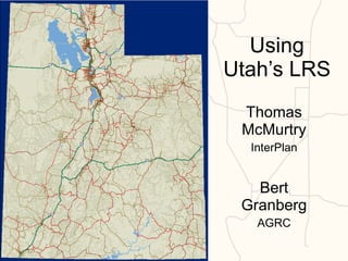
- 1. Using Utah’s LRS Thomas McMurtry InterPlan Bert Granberg AGRC 4/7/2011 Thomas McMurtry
- 7. Building Utah State Route 137
- 8. 1. SELECT Participating Centerlines
- 9. 2. ATTRIBUTE Road Features w/ RtName & RtPart_Nbr 0137P Part 1 0137P Part 2 0137P Part 3
- 10. 3. MERGE Road Features Into Route Parts 0137P Part 1 0137P Part 2 0137P Part 3
- 11. 4. CALIBRATE Route M Coordinates at Endpoints
- 12. 2.314 8.801 5. ADD INTERMEDIATE CALIBRATION Where Needed
- 13. 6. MERGE Parts Into Single PolylineM Feature
- 24. Example 4/7/2011 Thomas McMurtry
- 27. Example 4/7/2011 Thomas McMurtry
- 29. Example 4/7/2011 Thomas McMurtry
- 30. Final Product 4/7/2011 Thomas McMurtry
- 32. Example 4/7/2011 Thomas McMurtry
- 35. Example 4/7/2011 Thomas McMurtry
- 39. Value of LRS Tools 4/7/2011 Thomas McMurtry
Editor's Notes
- Other examples may include local address point data