
Recomendados
Recomendados
Mais conteúdo relacionado
Mais de Zurich_R_User_Group
Mais de Zurich_R_User_Group (9)
Último
Último (20)
Visualization Challenge: Mapping Health During Travel
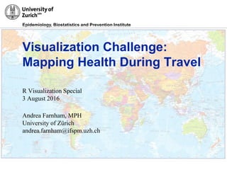
- 1. Epidemiology, Biostatistics and Prevention Institute 31/3/2016 Visualization Challenge: Mapping Health During Travel R Visualization Special 3 August 2016 Andrea Farnham, MPH University of Zürich andrea.farnham@ifspm.uzh.ch
- 2. Epidemiology, Biostatistics and Prevention Institute How can we detect patterns in health behaviors, health outcomes, and environmental cues in travelers using a combination of streaming data and traditional questionnaires?
- 3. Epidemiology, Biostatistics and Prevention Institute
- 4. Epidemiology, Biostatistics and Prevention Institute R Code library("ggmap") travel_data <- data.frame(lon = heidifigure_locationpoints$longitude, lat = heidifigure_locationpoints$latitude, label=heidifigure_locationpoints$event, day=heidifigure_locationpoints$day) thailand <- get_map(location = c(96.2, 3.7, 107.5, 22.1), source="stamen", maptype="toner") ggmap(thailand) + geom_point(data = travel_data, aes(x = lon, y = lat), shape=1, color="red", size=1.4, alpha=.5) + geom_label_repel(data = travel_data, aes(x = lon, y = lat, label = label), size = 3) Create data frame of latitude and longitude points Call up map of Thailand Map points on map of Thailand Add data labels
- 5. Epidemiology, Biostatistics and Prevention Institute 2 Step Process • Download and format map image using get_map • Plot additional layer(s) of data or statistics with ggmap Source: https://www.r-bloggers.com/google-maps-and-ggmap/ maptype = "satellite" maptype = “roadmap"maptype = “terrain"
- 6. Epidemiology, Biostatistics and Prevention Institute Thank you! Contact information Andrea Farnham, MPH Epidemiology, Biostatistics and Prevention Institute (EBPI) University of Zurich Hirschengraben 84 CH-8001 Zurich Phone +41 44 634 54 37 andreacarol.farnham@uzh.ch www.ebpi.uzh.ch