(AISHA) Ambegaon Khurd Call Girls Just Call 7001035870 [ Cash on Delivery ] P...
City of Concord Complete Streets Study
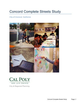
1. Concord Complete Streets Study Page | 1
Concord Complete Streets Study
City of Concord, California
City & Regional Planning
2. Concord Complete Streets Study Page | 2
Primary Authors
William Riggs, PhD
Assistant Professor of City and Regional Planning
Charlie Coles
Student Project Manager
Megyn Rugh
Research Assistant
Camille Jackson
Research Assistant
Project Team Members
Forrest Chamberlain
Nora Chin
Evan Evangelopoulos
Fabian Gallardo
Sam Gross
Lance Knox
Brian Rodriguez
Tessa Salzman
Andrew Scales
Kelsey Steffen
Richard Williams
Thanks
City of Concord: Carol Johnson; Andy Mogensen
Contra Costa Health Services: Will Dominie; Coire Reilly
Place It: James Rojas
3. Concord Complete Streets Study Page | 3
Executive Summary
A team of City and Regional Planning and Transportation Engineering masters’ students from
California Polytechnic, San Luis Obispo developed a complete streets study for the City of
Concord. Complete streets are roadways, which are designed to accommodate the needs of all
users and all ages and abilities. With the guidance of Dr. William Riggs, the project commenced
in April, 2014, was sent to the City of Concord for reviews in September, then finalized and
submitted by October, 2014. The purpose of this report is to summarize the data collected as a
part of this study and to provide the City with preliminary support in the progress to construct a
safer, more bike and pedestrian friendly Concord.
The study involved a review of existing data accompanied by a field analysis involving
pedestrian and bicycle counts which were manually gathered at twelve selected intersections
over a two day period. As part of the study, each intersection was assessed individually and
compiled into a complete streetscape assessment, provided in this document as Volume 1.
Based on the available data, observations of the environment and findings from the study, a
series of suggested treatments are provided for each intersection as Volume 2. These
conceptual ideas are intended to facilitate discussion in the development of design guidelines
that can help to inform an eventual plan.
Additionally, as part of the planning process, a public outreach event was held to further
understand how the suggested roadway treatments meet the desires of the community. The
developments and visions found in this study provide a platform for continued discussion on
creating a more pedestrian and bicycle friendly environment that encourages other forms of
transportation and provides alternatives to a dependency on private automobiles.
4. Concord Complete Streets Study Page | 4
Table of Contents
Executive Summary .......................................................................................................3
Table of Contents ...........................................................................................................4
List of Figures.................................................................................................................6
VOLUME 1
1 Introduction ...............................................................................................................9
Methodology ................................................................................................................. 101.1
2 Existing Conditions ................................................................................................11
Downtown Specific Plan Summary - January 10, 2014 ................................................. 112.1
Fehr and Peers Preliminary Traffic Assessment Summary............................................ 182.2
Concord Reuse Project Area Plan Summary: Concord Naval Weapons Station........... 192.3
Concord Technical Assistance Panel (TAP) Presentation Summary............................. 252.4
Trails Master Plan Summary.......................................................................................... 292.5
Transportation Injury Mapping System (TIMS) Analysis ................................................ 302.6
3 Field Analysis and Traffic Counts.........................................................................35
Salvio Street / Galindo Street......................................................................................... 383.1
Babel Lane / Cowell Road.............................................................................................. 403.2
Meadow Lane / Monument Boulevard............................................................................ 423.3
Clayton Road / The Alameda ......................................................................................... 463.4
Willow Pass Road / Diamond Boulevard........................................................................ 503.5
Clayton Road / Fry Way ................................................................................................. 523.6
Willow Pass Road / Galindo Street ................................................................................ 543.7
Galindo Street / Laguna Street....................................................................................... 573.8
Mt Diablo Street / Oakland Ave...................................................................................... 613.9
Mt Diablo Street / Mesa Street ..................................................................................... 633.10
Clayton Road / Grant Street......................................................................................... 653.11
Panoramic Drive / Port Chicago Highway .................................................................... 683.12
Automated Counts........................................................................................................ 703.13
VOLUME 2
4 Proposed Treatments .............................................................................................74
Salvio Street / Galindo Street......................................................................................... 754.1
Babel Lane / Cowell Road.............................................................................................. 764.2
Meadow Lane / Monument Boulevard............................................................................ 784.3
Clayton Road / The Alameda ......................................................................................... 804.4
Willow Pass Road / Diamond Boulevard........................................................................ 824.5
Clayton Road / Fry Way ................................................................................................. 844.6
Willow Pass Road / Galindo Street ................................................................................ 864.7
5. Concord Complete Streets Study Page | 5
Galindo Street / Laguna Street....................................................................................... 884.8
Mt Diablo Street / Oakland Ave and Mt Diablo Street / Mesa Street.............................. 904.9
Clayton Road / Grant Street......................................................................................... 924.10
Panoramic Drive/Port Chicago Highway ...................................................................... 944.11
5 Educational Workshop Public Outreach – July 31st
............................................96
6 Conclusions & Next Steps .....................................................................................99
7 Appendix................................................................................................................100
Public Outreach Boards ............................................................................................... 1007.1
Eco-Counter Summary Report..................................................................................... 1047.2
Concord Complete Streets Data Consolidation............................................................ 1067.3
6. Concord Complete Streets Study Page | 6
List of Figures
Figure 1-1: Complete Streets Studio Work ................................................................................... 9
Figure 2-1: Project Area Map (Source: DSP).............................................................................. 11
Figure 2-2: Downtown Zoning Framework (Source: DSP).......................................................... 12
Figure 2-3: Walking Radius from BART Station (Source: DSP) ................................................. 13
Figure 2-4: BART Station Opportunity Area................................................................................ 14
Figure 2-5: Bicycle Circulation (Source: DSP)............................................................................ 16
Figure 2-6: Pedestrian Circulation (Source: DSP) ...................................................................... 16
Figure 2-7: Transit (Source: DSP) .............................................................................................. 17
Figure 2-8: Development Districts and Conservation, Open Space, and Recreation Lands
(Source: Reuse Plan) .......................................................................................................... 20
Figure 2-9: Transit Oriented Districts (Source: Reuse Plan)....................................................... 21
Figure 2-10: Complete Street Network (Source: Reuse Plan).................................................... 22
Figure 2-11: Transit Network (Source: Reuse Plan)................................................................... 23
Figure 2-12: Bicycle Network (Source: Reuse Plan)................................................................... 24
Figure 2-13: TIMS Analysis Collision Severity City of Concord 2008-2012................................ 30
Figure 2-18: TIMS Analysis Collision Cluster Map City of Concord 2008-2012 ......................... 33
Figure 3-1: Concord Complete Streets Study Intersection Locations......................................... 36
Figure 3-4: Salvio and Galindo Volumes .................................................................................... 39
Figure 3-5: Babel and Cowell...................................................................................................... 40
Figure 3-6: Four Corners Intersection at Meadow Lane / Monument Boulevard........................ 42
Figure 3-7: Facing the northeast corner of Meadow Lane / Monument Boulevard, Four Corners
Union 76 gas station at corner............................................................................................. 44
Figure 3-8: Facing the northwest corner of Meadow Lane / Monument Boulevard, Best Burger at
far end corner ...................................................................................................................... 44
Figure 3-10: Comparing Travel Times of Different Modes of Transportation ............................. 45
Figure 3-11: Clayton Road / The Alameda Intersection.............................................................. 46
Figure 3-12: The Alameda Trail Looking Southeast ................................................................... 47
7. Concord Complete Streets Study Page | 7
Figure 3-13: Alameda Trail Volumes .......................................................................................... 48
Figure 3-14: The Alameda Trail Crossing................................................................................... 49
Figure 3-15: Willow Pass Road / Diamond Boulevard Facing Northwest................................... 50
Figure 3-16: Willow Pass Road / Diamond Boulevard Facing the Southeast............................. 50
Figure 3-17: Clayton and Fry Volumes ....................................................................................... 53
Figure 3-18: Willow Pass Road and Galindo Street Sidewalk .................................................... 54
Figure 3-19: Willow Pass Road and Galindo Street Protected Right Turn Lane ........................ 55
Figure 3-20: Willow Pass and Galindo Volumes......................................................................... 56
Figure 3-21: Vacant Lot Galindo and Laguna Street .................................................................. 57
Figure 3-22: Laguna and Galindo Volumes ................................................................................ 58
Figure 3-23: Pedestrians Crossing Leg C Galindo and Laguna Street during Peak PM ............ 59
Figure 3-24: Bicyclist Crossing Leg C Galindo and Laguna Street............................................. 60
Figure 3-25: Mount Diablo and Oakland Volumes...................................................................... 61
Figure 3-26: Mount Diablo and Mesa Volumes .......................................................................... 63
Figure 3-27: Clayton Road and Grant Street Intersection .......................................................... 65
Figure 3-28: Clayton and Grant Volumes ................................................................................... 66
Figure 3-29: Panoramic Drive and Port Chicago Highway Intersection...................................... 68
Figure 3-30: Panoramic and PCH Volumes................................................................................ 69
Figure 3-31: Eco-counter Location (Northbound designated as ‘Out’ direction)......................... 70
Figure 3-32: Average Daily Volumes .......................................................................................... 71
Figure 3-33: Average Hourly Volumes........................................................................................ 72
Figure 3-34: Traffic by Day (July 2014)....................................................................................... 73
Figure 4-1: Galindo Street and Salvio Street Intersection .......................................................... 75
Figure 4-2: Babel Lane and Cowell Road Intersection ............................................................... 77
Figure 4-3: Monument Boulevard, Meadow Lane and Oak Grove Road Intersection ................ 79
Figure 4-4: Clayton Road & Alameda Intersection ..................................................................... 81
8. Concord Complete Streets Study Page | 8
Figure 4-5: Willow Pass Road and Diamond Boulevard Intersection ......................................... 83
Figure 4-6: Clayton Road and Fry Way Intersection................................................................... 85
Figure 4-7: Willow Pass Road and Galindo Street Intersection.................................................. 87
Figure 4-8: Galindo Street and Laguna Street Intersection Options 1 and 2.............................. 89
Figure 4-10: Mt. Diablo Street and Oakland Ave Intersection .................................................... 91
Figure 4-11: Clayton Road and Grant Street Intersection .......................................................... 93
Figure 4-12: Panoramic Drive and Port Chicago Highway Intersection...................................... 95
Figure 5-1: “What Do You Like Most” City of Concord, California August 7, 2014 Results ........ 98
9. Concord Complete Streets Study Page | 9
VOLUME 1
1 Introduction
The City of Concord, located in Contra
Costa County, faces a number of
challenges in providing safe and accessible
biking and walking facilities. Positioned as a
major regional suburban East Bay center
within the San Francisco Bay Area, Concord
has access to three BART stations: North
Concord/Martinez, Downtown Concord and
Pleasant Hill/Contra Costa Centre. Much of
Concord’s growth in the 20th
century was
auto-centric and has met the needs of a
populace that has concentrated on issues
related to affordability, disability, or age-
related mobility limitations, underscoring the
need for safe and context sensitive bicycle
and pedestrian designs.
In 2013, the City applied for a Safe Routes
to Transit (SR2T) grant entitled, “The
Concord Bike and Pedestrian Access to
Transit Project.” The project aimed to improve non-motorized access to the three BART stations
in order to begin addressing many of the non-automotive accessibility issues in Concord. The
project is located within the city limits of Concord, California; more specifically, this study
focused on the portions of the City located within a two-mile bike shed from each of the three
BART stations.
The purpose of this study is to provide preliminary support in starting the process of creating a
safer, bike friendly, walkable and livable Concord. The study involved five key tasks including: 1)
data analysis; 2) field analysis and counts; 3) a streetscape assessment; 4) proposed
intersection treatments; and 5) an educational workshop. These tasks were completed as a part
of the California Polytechnic, San Luis Obispo, Bicycle and Pedestrian Planning Studio (CRP
470) during the spring and summer quarters of 2014. The three first tasks are presented in this
report as Volume 1, which is comprised of Chapters 1-3 along with detailed data provided
Appendices. These are intended to offer raw data that can inform future planning in the City.
Volume 2, comprised of chapters 4 through 6, is designed to discuss other tasks completed as a
part of this effort including design proposals and visioning sessions, which aimed to identify
policies and design elements the residents of Concord would value most within their city. It is
envisioned that the conceptual street treatments provided can guide Concord’s short-term future
investments in bicycle and pedestrian infrastructure improvements and programs – noting that
Figure
1-‐1:
Complete
Streets
Studio
Work
10. Concord Complete Streets Study Page | 10
they are illustrative in nature and designed to promote thought and discussion in future planning
efforts.
Methodology1.1
The project began with an analysis of all existing data and documents available from the City of
Concord and other accessible resources, which were used to guide this study and ensure
precision in the process and results. More specifically, this study evaluated Concord’s:
• Downtown Specific Plan
• Existing Zoning Maps
• Bike Lanes and Path Maps
• Trails Master Plan
• Traffic Volumes, Peak Hours Level of Service, and Preliminary Traffic Assessment
• Local Transportation Injury Mapping System (TIMS) Data
• Naval Weapons Reuse Project Area Plan
• The Urban Land Institute’s Technical Assistance Panel Presentation
A summary of the findings and key sources of information that would define the study’s primary
focus areas are found in this report. The available resources listed above were blended with a
combination of quantitative and qualitative methods to identify possible data collection points for
the streetscape assessment. After looking at the local planning documents and volume data, we
overlaid the bicycle and pedestrian collision information from TIMS. We then asked for City staff
for additional advice in narrowing the target intersections based on local knowledge and with an
eye for geographic equity. This analysis identified 12 intersections, these included:
• Salvio Street / Galindo Street
• Babel Lane / Cowell Road
• Meadow Lane / Monument Boulevard
• Clayton Road / The Alameda
• Willow Pass Road / Diamond Boulevard
• Clayton Road / Fry Way
• Willow Pass Road / Galindo Street
• Galindo Street / Laguna Street
• Mt Diablo Street / Oakland Ave
• Mt Diablo Street / Mesa Street
• Clayton Road / Grant Street
• Panoramic Drive / Port Chicago Highway
Each of the 12 intersections were examined through a walking audit and field review of the
intersection and adjacent areas accompanied with two days of pedestrian and bicycle counts
completed manually for both AM and PM peak periods. Additionally, in order to complement the
manual data collection method, an “Eco-counter,” or automated infrared bicycle and pedestrian
counter, was installed on the light post located at the Concord and Canal Train multiuse path.
Using the data collected, we then developed an existing conditions summary and streetscape
study. This included potential opportunity sites and suggested treatments based on the data
collected.
11. Concord Complete Streets Study Page | 11
2 Existing Conditions
Downtown Specific Plan Summary - January 10, 20142.1
Based on the Downtown Specific Plan (DSP) Downtown Concord is envisioned as a modern
and vibrant place that is infused with its heritage, and allows people to live and work within the
downtown through transit-centered development and accessible modes of transportation. The
plan has been created to communicate the City's need to revitalize the Downtown,
accommodate growth in a future population and employment base combined with a real
transportation and urban design vision for the future. The plan includes both short and long
term strategies for accomplishing these goals.
• Builds upon the Concord 2030 General Plan, adopted by Council on October 2, 2007 and
sets forth policies to be carried out in the next 20-30 years.
• Enhance the character of the Downtown.
• Preserve environmental resources, promote transit, and minimize hazards.
• Covers approximately 617 acres.
Figure 2-1: Project Area Map (Source: DSP)
12. Concord Complete Streets Study Page | 12
2.1.1 Important Features of Downtown
• Historic Downtown Core/Todos Santos Plaza which is a major focal point and provides an
important sense of place for the entire city.
• A major Bay Area Rapid Transit (BART) station directly adjacent to the downtown with
transit connections.
• Large Class A office buildings (providing approximately 1.5 million square feet of office
space) and higher density zoning near the BART station with ease of access to major
highways.
• A diversity of adjoining neighborhoods such as historic North Todos Santos defined by its
small scale historic houses.
• Ellis Lake Park, the historic nearby Galindo House, and offers many historic sites/buildings
that are dispersed throughout the project area.
• Entertainment such as movie theaters and restaurants that are very accessible and offer
more opportunities for activity both during the day and evening.
• Great diversity in housing, from single family to multi-family/high-density, including
developments for senior housing and the developmentally disabled.
• Higher density office/commercial zoning near the BART station and along major arterials
that connect directly to the highway.
• Walkable and identifiable street grid that defines distinct neighborhoods and districts within
the City.
Figure 2-2: Downtown Zoning Framework (Source: DSP)
Downtown Concord was designated as a ‘Priority Development Area’ (PDA) in early 2012, by
the Metropolitan Transportation Commission, to promote transit-oriented development. The
vision for the Downtown Concord BART Station Priority Development Area (PDA) is to promote
13. Concord Complete Streets Study Page | 13
Downtown Concord as the historic, economic, and cultural heart of the City in such a way that
enhances its strong business climate and bolsters the City’s high quality of life.
2.1.2 Downtown Goals and Objectives
1. Increasing job creation.
2. Enhancing the business climate and expanding the economic base.
3. Intensification of uses and densities from current built levels.
4. Increasing BART ridership and efficiency of multi-modal connections.
5. Constructing housing projects for a mix of housing types and income levels.
6. Promoting mid and high-density housing.
Figure 2-3: Walking Radius from BART Station (Source: DSP)
2.1.3 Major Issues
• Grant Street allows both one way and two way traffic as it passes from the BART station to
Todos Santos Plaza.
• Clayton Road, Willow Pass Road, Concord Avenue, and Galindo Street are designed for
high volume traffic and truck routes making pedestrian crossing challenging.
• Galindo Street, a wide thoroughfare carrying high levels of traffic, impedes pedestrian
access between the Todos Santos Plaza area and the west portion of the project area.
• The higher density commercial/office buildings near the BART station limit pedestrian
access to the downtown.
14. Concord Complete Streets Study Page | 14
• The street grid provides identifiable neighborhoods in most areas, but this identity is lost
where the regular street grid shifts and Port Chicago Highway bisects Willow Pass Road
and Concord Boulevard at an angle.
• The overall quality of the street scape is inconsistent and varies from excellent where new
development has occurred, to virtually no pedestrian sidewalks/curbs in some key locations.
• Limited designated bike paths exist in the project area.
• The BART station and associated track creates a significant divide within the urban form of
the city, where higher density commercial programs exist on the northern side, while single
family residential exists to the south. The length of the station platform and associated track
way limits good connections between these two distinct portions of the project area.
• All major streetscape improvement sites: Grants Street, Salvio Street, Willow Pass Road
2.1.4 Major Opportunities
• There are already identifiable neighborhoods such as North Todos Santos to help attract
new residents to the downtown.
• Access to the Downtown BART Station is available within a short walk along Grant Street.
• There is an opportunity to help make the station entrance more visible and accessible for
pedestrians walking to BART.
• Other transit opportunities (buses and shuttles) are situated near BART and provide key
access to other parts of the City and surrounding area.
• Given the pedestrian scale street grid that exists throughout much of the project area, new
street scape and bike pathways/networks could be implemented to improve accessibility
within the downtown.
Figure 2-4: BART Station Opportunity Area
2.1.5 Urban Design Strategies
• Develop mixed use, high density near BART station.
15. Concord Complete Streets Study Page | 15
• Redevelop Grant Street as key linkage between BART and Todos Santos Plaza.
• Develop area below BART tracks with new bike/pedestrian path to increase connectivity to
downtown.
2.1.6 Circulation and Transportation Overview
Bicycle Circulation
• Potential enhancements to the downtown bicycle network have been developed through the
specific plan process , which includes:
o Installation of buffered bike lanes on Concord Boulevard and Clayton Road between
Sutter Street and Grant Street.
o Addition of Class II bike lanes on Grant Street between Concord Boulevard and
Grant Street
o Provision of Class II bike lanes along the majority of the Detroit Avenue corridor
(between Clayton Road and Via Del Monte, 0.7 miles) and Class 3 bike routes with
sharrows where right of way is constrained (NB between Oakmead Drive and Lynn
Avenue; both directions between Via Del Monte and Monument Boulevard; at the NB
intersection approach at Clayton Road, 0.2 miles total).
o Installation of Class 3 bicycle route signage/pavement markings on portions of Grant
Street and Salvio Street.
o Modifications to the un-signalized intersection of Grant Street/Oak Street, adjacent to
the BART station area, to a raised intersection with vehicular stop control.
o Reconfiguration of Oakland Avenue from four- lanes to three between Mount Diablo
Street and Clayton Road with Class II bike lanes in both directions to provide last
mile connections to BART.
o Designation of Mount Diablo Street from Oakland Avenue to the BART Bus Access
Roadway to a Class III route with sharrows to direct bicyclists from the Class I path
paralleling Mesa Street to the bike path parallel to the BART Bus Access road,
connecting to the BART bike parking area.
o Installation of eight additional long-term bicycle parking at the BART station.
Pedestrian Circulation
• Rehabilitation of approximately 30 crosswalks in the downtown area, including the
replacement of non-ADA compliant curb ramps and installation of decorative pavement.
• Signalization of the Clayton Road at Sutter Street and Detroit Avenue at Laguna Street
intersections to better facilitate pedestrian crossings.
• Intersection enhancements at the Detroit Avenue at Laguna Street intersection to provide
ADA ramps, curb extensions, and advanced stop bars.
• Replacement of sidewalk on the north side of Willow Pass Road between Sutter Street and
Gateway Boulevard to provide a wider sidewalk, a seat-wall and replacement of non-ADA
compliant curb ramps.
• Evaluating a reduction in cycle lengths throughout the Downtown area to decrease
pedestrian wait time at all signalized intersections, particularly on weekends, and off- peak
times.
16. Concord Complete Streets Study Page | 16
• Enhancements to the existing high-visibility crosswalks at Oakland Avenue/Prospect Street
and Oakland Avenue/Atlantic -Street with a pedestrian crossing warning system (e.g. RRFB
or LED blinker signs).
Figure 2-5: Bicycle Circulation (Source: DSP)
Figure 2-6: Pedestrian Circulation (Source: DSP)
Proposed Vehicular Improvements
17. Concord Complete Streets Study Page | 17
• Signalization of the Clayton Road at Sutter Street and Detroit Avenue at Laguna Street
intersections to better facilitate pedestrian crossings Modifications to the Grant Street at
Clayton Road signal to provide a protected southbound left-turn pocket.
• Elimination of one vehicle travel lane on Clayton Road and Concord Boulevard between
Sutter Street and Grant Street to provide buffered bike lanes. Level of service analysis
indicates that operations for vehicles would not degrade below the established benchmark
under existing or projected future conditions.
• Reconfiguration of Oakland Avenue between Mount Diablo Street and Clayton Road from
four vehicle lanes to three to provide Class II bicycle lanes in each direction, proving last
mile connections to the BART station.
• Traffic management along the Willow Pass Road corridor through measures such as traffic
signal timing to moderate travel speeds through the corridor.
• Installation of all-way stop-control at the Oak Street/ Grant Street intersection and
conversion to a raised intersection to better prioritize pedestrian travel to the BART station.
Transit
The study area is served by BART, County Connection (CCCTA), and Tri-Delta Transit. A
neighborhood shuttle connecting the Monument Corridor to the BART station and downtown is
scheduled to launch in September 2013. BART service provides regional connections to
downtown Concord and CCCTA and other transit providers provide more local service.
However, many of the bus routes tend to have destinations outside the Specific Plan Area with
30 to 90 minute headways and fares that discourage short trips within the Study Area.
Figure 2-7: Transit (Source: DSP)
Accessibility and Parking
18. Concord Complete Streets Study Page | 18
The City has two public parking structures downtown that provide a significant amount of public
parking within the study area. On-street parking and other off-street lots, including numerous
private parking garages, are also located within the plan area. The existing parking supply is
sufficient to accommodate some redevelopment without the need to provide additional off-street
parking supplies.
Fehr and Peers Preliminary Traffic Assessment Summary2.2
The Fehr and Peers traffic memo1
with attached vehicle counts has some use to our project, but
is limited in its scope. As part of the City of Concord Downtown Specific Plan the focus of this
analysis is on Concord / Galindo Street. This street is located to the west of the BART line in the
downtown area. As mentioned in the report, all the intersections along Galindo Street operate at
acceptable vehicle service levels.
Willow Pass Road, Clayton Boulevard, and Concord Road all operate at a level of service (LOS)
D. It should be noted that this LOS only applies to the streets west of Grant Street, and outside
of this area the exact LOS is unknown. It should also be noted that in this study area Concord
Road and Clayton Road act as one way divided street that combine on either side of the study
area as a single Clayton Road.
The memo identifies that all the studied intersections have the capacity to support
enhancements that improve the LOS for other modes. Of the three roads that were studied,
road diets for Clayton and Concord are recommended, but not for Willow Pass due to high
vehicle demand on this road. If a road diet were put into place on Willow Pass a reasonable
assumption is that traffic on this street would then divert to other streets, and reduce the LOS on
those streets. Road diets on Concord and Clayton are a good idea for improving the overall
connectivity of Concord’s bike network, but are not ideal for enhancing access to the downtown
BART station. Using a lower volume street to the south of Clayton would be better for access to
the BART station from the west and using existing and proposed trails in conjunction with class
3 bicycle routes on low volume streets from the east would likely lead to a more direct and less
stressful commute to the BART station.
In regards to intersections outside of the downtown specific plan study area, this study does not
have enough information to make more than reasonable assumptions on what intersections are
suited for bicycle and pedestrian enhancements. As a result, this study should be able to make
these decisions following a site investigation.
1
Kaing, E & Tellez, K. (2013, June 20). Downtown Concord Specific Plan – Existing Traffic
Conditions. Fehr and Peers.
2
City of Concord. (Adopted 2012, January 24). Concord reuse project area plan. Book one:
19. Concord Complete Streets Study Page | 19
Concord Reuse Project Area Plan Summary: Concord Naval Weapons2.3
Station
The inland portion of the Concord Naval Weapons Station was designated closed in 2005 by the
Base Realignment and Closure (BRAC) process which deemed the base underutilized and no
longer necessary for the United States Military. The Concord Reuse Project Area2
offers a vision
for approximately 5,000 acres complete with a set of standards developed by community
members during a one-year public outreach process conducted by the City of Concord. The
plan focuses heavily on Transit Oriented Developments around existing transportation stations,
mixed-use development, maintaining open spaces, and providing multi-modal transportation
alternatives. The project aligns with the objectives set forth by the California Senate Bill 375
(Sustainable Communities and Climate Protection Act of 2008) which focuses on the reduction
of greenhouse emissions from passenger vehicles.
The area involved in the Concord Reuse Project is partly overlaps the area assignment to the
Concord Complete Streets Study. Research identified the planned developments within the
Project Area Plan to support many of the goals and objectives in this study. Ideally, the two
areas would work together in order to develop a transportation network which seeks to balance
ridership among the North Concord / Martinez and Concord BART stations. Reviewing the
information provided in the Concord Reuse Project Area Plan accompanied this study by
helping to identify important intersections and strong connection lines between the two areas,
along with development guidelines the City plans to follow in the future.
The following presents a summary of land-use zoning, open-space conservation and circulation
elements planned for the project area.
2.3.1 Area Plan
• Boundaries include 5,046 acres (only the inland decommissioned zone not tidal portion).
• Over sixty percent of the site—approximately 2,715 acres—will be preserved as open
space.
• As many as 12,200 housing units may be built in the CRP area.
• 6.1 million square feet of commercial space.
• 28,800 residents and 26,530 jobs can be accommodated on site.
• Between 2015 and 2035, as much as 10 percent of Contra Costa County’s growth could
occur on the site.
2
City of Concord. (Adopted 2012, January 24). Concord reuse project area plan. Book one:
vision and standards. Retrieved from: http://www.concordreuseproject.org/pdf/CRPAreaPlan.pdf
20. Concord Complete Streets Study Page | 20
Figure 2-8: Development Districts and Conservation, Open Space, and Recreation Lands (Source: Reuse Plan)
2.3.2 North Concord TOD (dark purple)
• The North Concord/Martinez BART Station acts as a focal point for the Area Plan.
• With the highest densities in the Planning Area, mid-rise Office buildings, structured parking,
and streets designed for shopping and strolling, this walkable district will have a downtown
feel.
• The district features Class A office space complemented by retail, services and public
gathering places, as well as bus, bike, shuttle, and car-share connections.
2.3.3 North Concord TOD Neighborhoods (light purple)
• The mix of uses may include housing, plazas, community facilities, and offices, creating an
“urban neighborhood” quality.
• The northern TOD neighborhood will have a unique character that includes hillside housing
and parks tailored to the site’s topography.
• Of all the neighborhoods in the Plan Area, the TOD Neighborhoods offer the greatest
opportunity for transit-oriented living and walkability.
21. Concord Complete Streets Study Page | 21
Figure 2-9: Transit Oriented Districts (Source: Reuse Plan)
2.3.4 Central Neighborhoods
• These neighborhoods feature vertical mixed-use development, which means that in some
locations—particularly near bus or shuttle stops—shopping, dining and services may locate
on the ground floor of buildings that have offices and/or housing on the upper stories.
• Housing may include attached single unit residential, live/work units, and multi-unit
buildings.
2.3.5 Village Neighborhoods and Centers
• Quarter-mile neighborhood blocks with village centers.
• Village Neighborhoods will have dense Village Centers with community facilities, local
serving retail, and transit hubs while Village Neighborhoods will have a mix of lower-dense
housing.
• Villages are surrounded by neighborhood frame-open space offering biking and walking
facilities.
2.3.6 Commercial Flex District
• Research and development, light industry, offices, and larger retail establishments could all
be appropriate.
• Likely to be a more auto oriented district than the rest of the site.
22. Concord Complete Streets Study Page | 22
2.3.7 Campus District
• 120 acres to accommodate a range of educational, research, and development, cultural,
and health care uses.
2.3.8 Open Space-Conservation and Recreation
• Regional Park: This 2,537-acre area is reserved, first and foremost, for resource
conservation. Trails and facilities for other low impact recreational activities will be included;
to the extent they are compatible with that primary aim.
• Mt. Diablo Creek Corridor: Mt. Diablo Creek is a primary feature of the site, influencing its
hydrology, vegetation and habitat.
• Greenways: Connected network of linear open spaces or greenways integrated with
pedestrian and bicycle paths. Provide areas for picnics, community gardens, and play fields.
2.3.9 Circulation (Complete Streets, Transit and Bicycle Networks)
• Through streets offer moderate-speed that act as spine of TOD and all other development
(up to 25 mph auto)
• Collector streets offer low-to moderate speed (20-25 mph)
• Local streets (not pictured below) link internal areas to collector streets (5-25 mph)
Figure 2-10: Complete Street Network (Source: Reuse Plan)
25. Concord Complete Streets Study Page | 25
Concord Technical Assistance Panel (TAP) Presentation Summary2.4
A technical assistance panel (TAP) was hired by the City of Concord to provide expert,
multidisciplinary advice on resolving the complex land use and real estate issues the City faces.
The Urban Land Institute (ULI), a nonprofit education and research institute with over 30,000
members worldwide – 2,000 located in the greater San Francisco Bay Area, organized the
panel to produce a final report. The TAP process involves a review of background materials, a
sponsor presentation and tour, stakeholder interviews, along with a consideration of data, frame
issues and recommendations organized in a single presentation.
2.4.1 Panel Assignment
1) What Strategies and implementation measures are most important to include in the
Downtown?
a. How can Concord attract a more diverse range of housing?
b. How can Concord make Downtown attractive to a broad range of retail?
c. How can Concord leverage the uniqueness of the Park’nShop commercial
center?
2) Near-term implementation
2.4.2 Concord Today
• Tremendous interest in living in downtown mixed-use environments.
• Economic resurgence is now heading towards the East Bay Area.
• City of Concord has a Draft Downtown Specific Plan.
2.4.3 What We Heard
• Young and diverse demographics moving to Concord
• Bring more Bay Area visitors to Concord
• Concord community supports higher-density growth
• Community wants downtown to become a vibrant destination
• Todos Santos Plaza gets a “wow” factor from first time visitors
2.4.4 Strengths
• Authentic place and vibe
• Sensitive infill development (Park Central/Renaissance/Santo Pacheco Square)
• BART Station
• Todos Santos at core (great program/market/events)
• Good Walkability Score (85)
• Plenty of Parking
• Sophisticated business owners in key sites
• Strategically located publically controlled parcels
• Pro-development community
2.4.5 Challenges
• What is downtown Concord?
o Unclear brand
o Boundaries not defined
o Contradictory personality (suburban enclave or emerging place)
o Where is the core?
26. Concord Complete Streets Study Page | 26
• Been half a step behind in policy and planning steps. Time to catch up and move
ahead.
• Car-centric traffic movement vs. pedestrian/bicycle connections and safety serving
the downtown.
• Safety perceptions regarding homeless and property crime.
• Poor way-finding
• Lack of rooftops and disposable income to support current and additional retail
• Lack of clear connections from BART to downtown and to other nearby
neighborhoods.
• Office market not likely to drive new investments in near-term
• Pending development and competition from Concord Reuse Project Area.
2.4.6 Perceptions
• Perceived mixed personality (Suburbia vs. walkable, mixed-use)
• Perceived traffic issues/timing/bunching
• Perceived lack of sufficient parking
• Perceived safety/homeless enclave
• Perceived inactivity during off-peak hours and weekends
• Perceived lack of openness to new, younger residents’ interests
• Perceived lack of interest by younger residents to locate here
• Perceived lower quality of school district compared to neighboring communities
• Misperception of Concord’s assets and therefore lack of interest by developers
2.4.7 Regional Market Context
• Macro forces favor development in highly amenitized inner suburban communities
like Concord.
• Strong demand on inner East Bay communities over next 3-5 years.
• Central Contra Costa County’s proximity and excellent transportation centers of
employment are well poised to benefit from demand.
• Concord is unique in having excellent infrastructure for the creation of an
urban/suburban live/work/play/shop environment that is highly desired by the market,
while also having attractive development sites and a community receptive to
development.
• Concord needs to take advantage of the current favorable development
environment.
• Immediate focus on downtown development potentials will avoid the diversion of
attention that will come from development implementation of the former Concord
Naval Weapons Station.
2.4.8 Where to Start (Short-term)
• Define downtown Concord and create new brand
o Push BART to fund Station Way-finding Concept Plan to better connect
neighborhoods and downtown district
o Highlight downtown with directional auto and pedestrian signs
o Integrate art
o New downtown graphic / web
• Improve access and orientation for auto drivers, pedestrians, and bicyclists
o Re-signal the timing through streets
o Fill in deficient / missing sidewalks
27. Concord Complete Streets Study Page | 27
o Provide pedestrian access to Parkn’Shop off Salvio Street
o Demonstration bike lanes and connections as economic development -
@ConcordBoulevard
• Form parking/downtown improvement district
o Leverage existing parking spaces
o Offer shuttle with 15 minute headways linking destinations between BART
station, Todos Santos, John Muir Medical complex, and Diablo Valley College
o Ombudsperson from homeless population
• Increase activity and destinations in downtown
o Create pop-up retail program with short term leases near Swift Plaza and
Grant Street
o Retail kiosk
o Target new unique restaurants
o Add more programming in park (farmer’s market on weekends)
• Located Justice Center to existing vacant building near Police station
2.4.9 Development Priorities
• Immediate Market Opportunities
o Renaissance Phase 2
o Swift Plaza (2 sites)
o Small scale infill
o RREEF site on Grant Street
o Grant Street kiosk
o Marginal Properties Site
• Successor Agency
o Masonic Temple Site
o Oak Street
o Concord Avenue
• Additional Opportunities
o Park and Shop:
§ Renovation of existing center to clean up image and strengthen ties to
Salvio pedestrian path to Plaza.
o Wells Fargo site:
§ Vibrant commercial building increasing the shops / dining on Todos
Santos Plaza
§ Building and sidewalk serve as the focal point and entry to the plaza
for the office buildings and BART station uses to the South.
o Bart Station
§ The City can begin to set parameters for future development on BART
site.
o Petsmart block
2.4.10 Bicycle Priorities
• Bike lanes
o Concord Blvd from Oakhurst to Detroit
o Clayton Rd and Sunset from Detroit to Concord Blvd
o Detroit Ave from Concord to Contra Costa Canal Trail Spur
o Salvio from Port Chicago Highway Path to Olivero and Reuse Project
o Grant Street from BART station to Willow Pass Rd
• Bike Paths:
28. Concord Complete Streets Study Page | 28
o Port Chicago from Salvio to Sunset
o Contra Costa Canal Trail to Detroit Ave
o BART ROW from Systron to BART Station to Port Chicago Highway path
• Neighborhood Greenways
o Oak and Laguna between Detroit and BART station
o Salvio Street from Port Chicago to Fry’s
2.4.11 Pedestrian Priorities
• Focus on activating Grant through coffee carts, outdoor seating, kiosk retail
• Allow pedestrians to walk down Grant without having to push button to cross
street
• Accommodate pedestrian crossings in all signal phases in Specific Plan area, at
least during daytime.
2.4.12 Roadway Priorities
• Retime signals for quicker cycle and better progression
• Convert Grant and Mt Diablo to two way between Concord and Salvio
• Adopt NACTO Urban Street Design Guide for use on all streets
• Eliminate LOS thresholds for downtown environmental analysis
• Extend Salvio to Fry
2.4.13 Parking Priorities
• Allow off-site parking arrangements to meet any commercial parking requirements
administratively
• Delegate authority to Downtown / Todos Santos Business Association management of
parking
• Lease surplus parking from private owners and make available to public
• Valet parking for Thursday evening peak
• Install parking way-finding and real-time availability information
• No need for any additional parking
2.4.14 Station Priorities
• Partner with BART to get Concord Station prioritized in upcoming round of major station
improvements
• Prioritize pedestrian arrival at Grant
2.4.15 Transit Priorities
• Partner with Diablo Valley College, John Muir Medical Center, Todos Santos Business
Association and County Connection to rebrand and improve frequency on Line 20
• Run every 15 minutes all day to match BART schedule
• Consider rerouting Line 314 between John Muir Medical Center, Concord BART and
Pleasant Hill BART via Monument Blvd and improve headway to match BART schedule
29. Concord Complete Streets Study Page | 29
Trails Master Plan Summary2.5
The purpose of the Concord Trails Master Plan3
is to provide framework for the future of
planning trails in the city of Concord. The goal of this plan is to create a network for recreation
and alternative transportation modes. The trails are for hiking, biking, and equestrian use. In
order to create a comprehensive plan the city enlisted the Trails Advisory Group. This group
was created with the purpose of representing the needs of the public through special interest
groups. These groups included the East Bay Bicycle Coalition, Commission on Aging, Diablo
Road Runners, Chamber of Commerce, and Friends of Parks, Recreation, and Open Space.
The plan recommends the trail network provide access to BART plus historic walking tours. The
plan identifies the need for new bridges and filling roadway gaps. It includes the plans for a
pedestrian underpass under highway 242 and includes trails within the naval weapons station
development. The plan also presents the regional connectors to Walnut Creek, Pleasant Hill,
Clayton, Martinez, and East Bay Regional Parks.
According to the plan, the trails are intended for outdoor recreation and transportation
(commuters to get to work and school), public health, education, social and economic well-being
(increase economic benefit and property value), alternative emergency access and egresses.
The plan details bike parking, and bus and BART bicycle access coupled with the suggestion for
promotional materials such as bikeway mapping, way-finding, and basic information. The
community has school bicycle safety education through the police department and through
school newspaper some 1st
– 3rd
grade classes have in class presentations. Bicycle rodeo is a
new proposal in this plan, as is school district programing, along with a recommendation for
police officers on bikes. There seems to be a large need and lack thereof for auto trip reduction
programs, adult bicycle safety and education programs.
The plan presents a List of trail amenities and further class 1 facility designs including street
crossings, water management, signage, and engineering specifications. The implementation
program calls for $51,000,000 in order to implement the improvement project under the Capital
Improvement Program. The program calls for Class 3A bike ways in residential areas. Class 3A
is defined in this report as shared lanes. The program also calls for Class 3B bike routes on
arterials, which is defined as a 4 foot wide bike lane.
3
Concord Trails Master Plan. (2002, September). City of Concord. Retrieved from:
http://www.cityofconcord.org/pdf/dept/planning/plng-trails-master-map.pdf
30. Concord Complete Streets Study Page | 30
Transportation Injury Mapping System (TIMS) Analysis2.6
Roadway safety concerns are powerful hindrances for walking and bicycling in any city. This
section utilizes the Transportation Injury Mapping System (TIMS) for analyzing pedestrian and
bicycle collisions for the five most recent years of data available ranging from January 1, 2008
to December 31, 2012.4
It must be stated that there are many factors to consider when
interpreting the results of collision data analysis; road conditions, weather, other parties
involved, volume of traffic at given time and location, site characteristics and many other types
of factors may contribute to these collisions. As a result, this section is intended to provide the
information that was accessible to the team and support the process used when identifying the
12 target intersections focused on in this study.
Pedestrian and bicycle collision data was an importation component of this study because it
helped identify specific locations throughout the city where safety improvements are needed.
The SWITRS Query and Map tool, found on the TIMS website, was used for this research. The
data that was pulled specifically looked at pedestrian and bicycle collision factors for the City of
Concord in Contra Costa County.
Figure 2-13: TIMS Analysis Collision Severity City of Concord 2008-2012
Figure 2-14: TIMS Analysis Vehicle Involvement City of Concord 2008-2012
Figure 2-13 identifies 428 collisions invloving a bicyclists or pedestrian documented in the City
of Concord from 2008 to 2012. According to Figure 2-14, approximatley 44% of collisions
invloved pedestrians and 56% involved bicyclists. Of the total 428 collisions, 12 were fatal, 33
were severly injuered, 179 were injured with visible wounds, and 204 were injured with a
complaint of pain.
4
Date Pulled: September 30, 2014, Date Range: January 1, 2008 to December 31, 2012
Selected Factors: Pedestrian Collision and Bicycle Collision
Fatal 12 2.8%
Injury (Severe) 33 7.7%
Injury (Other Visible) 179 41.8%
Injury (Complaint of Pain) 204 47%
Percent
of
Injuries
NumberCOLLISION
SEVERITY
Pedestrian Collision 190 44.40%
Bicycle Collision 240 56.10%
Motorcycle Collision 2 0.50%
Truck Collision 3 0.7
VEHICLE
INVOLVEMENT Number
Percent
of
Injuries
31. Concord Complete Streets Study Page | 31
Figure 2-15: TIMS Analysis Type of Collision City of Concord 2008-2012
Figure 2-15 identifies the types of collisions observed in the City of Concord during the five year
time period. The top three most recorded bicycle and pedestrian collisions were characterized
as vehicle/pedestrian conflicts (40%), broadside collisions (35%) and other collisions (9%). This
data suggests that of the total recorded collisions, a significant percentage occur when vehicles
are turning, thus causing broadside collisions, or when vehicles interfere with the pedestrians’
right-of-way. This assumption is further supported from the data provided in Figure 2-16.
32. Concord Complete Streets Study Page | 32
Figure 2-16: TIMS Analysis Violation City of Concord 2008-2012
Figure 2-16 presents the types of violations in order from most to least occurring in terms of
percent of injuries. The data identifies wrong side of the road, pedestrian right of way,
pedestrian violation, and automobile right of way to make up the top four highest percentages
on violations in the City. The number of violations associated with right of way and wrong side of
the road suggests improper usage of pedestrian and bicycle facilities, or rather submits
possibilities that the bicycle and pedestrian infrastructure is unclear throughout the City of
Concord.
Figure 2-17: TIMS Analysis Pedestrian and Bicycle Collisions by Day of the Week City of Concord 2008-2012
Figure 2-17 identifies the number of bicycle and pedestrian collisions in the City based on the
day of the week. There appears to be a smaller concentration of bicycle and pedestrian
collisions on Saturday and Sunday compared with the rest of the week. While this data is
encouraging to suggest many travelers walk of bike to work, there are many other factors to
Wrong Side of Road 91 21.3%
Pedestrian Right of Way 79 18.5%
Pedestrian Violation 58 13.6%
Automobile Right of Way 44 10.3%
Traffic Signals and Signs 27 6.3%
Not Stated 23 5.4%
Unknown 19 4.4%
Other Hazardous Violation 18 4.2%
Improper Turning 16 3.7%
Unsafe Speed 13 3.0%
Driving or Bicycling Under the Influence of Alcohol or Drug 10 2.3%
Other Improper Driving 9 2.1%
Other Than Driver (or Pedestrian) 8 1.9%
Unsafe Starting or Backing 8 1.9%
Improper Passing 4 0.9%
Unsafe Lane Change 1 0.2%
VIOLATION Number
Percent
of
Injuries
33. Concord Complete Streets Study Page | 33
consider before that assumption can be made. Furthermore, this information may be useful to
future research interested in gathering more information on bicycle and pedestrian collisions in
the City of Concord by focusing on Wednesdays, Thursdays and Fridays since these three days
appear to have the highest numbers of conflicts during the week.
Figures 2-18 and 2-19 present the bicycle and pedestrian collision data respectively using a
collision and heat map city overlay. The major corridors of Clayton Road, Concord Avenue,
Monument Boulevard and Willow Pass Roads were observed to have the highest
concentrations of pedestrian and bicyclist collisions. Furthermore, a high concentration of
pedestrian and bicycle accidents where observed to occur where Clayton Road, a 6-lane
highway with two turning lanes, intersects with four other roadways, including East Street. The
two pedestrian crosswalks where Clayton meets Park and East Streets, along with Clayton and
Oakland Avenue where a driveway for a commercial parking lot, and the four demarcated
crosswalks with a pedestrian island, which splits Clayton Road into East Street is the area within
the City of Concord with the most pedestrian and bicyclist collisions. Monument Boulevard at
Meadow Lane specifically stands as an area with a relatively higher concentration of pedestrian
and bicycle collisions. The collision information presented in these maps provided by TIMS
helped the team identify key areas for concern which contributed significantly in the
intersections and corridors focused on in this study.
Summary Results: 428 Collisions
Results Map: 408 of 428 (95.3%) Collisions Mapped
Figure 2-14: TIMS Analysis Collision Cluster Map City of Concord 2008-2012
34. Concord Complete Streets Study Page | 34
Figure 2-19: TIMS Analysis Collision Heat Map City of Concord 2008-2012
35. Concord Complete Streets Study Page | 35
3 Field Analysis and Traffic Counts
Manual traffic counts and observations were made on Wednesday, May 7th
and Thursday, May
8th
, 2014 during morning peak period (7am-9am) and afternoon peak period (5pm-7pm). On
Wednesday, temperature and weather conditions ranged from 50 degrees in the morning to 68
degrees in the afternoon and described by all observers as clear skies and sunny. On Thursday,
temperature and weather conditions ranged from 53 degrees in the morning to 65 degrees in
the afternoon and described by all observers as cloudy, overcast and windy.
Although limited impressions on our counts, it should be noted that Thursday, May 8th
, 2014
was “Bike to Work Day” as dictated by Bike East Bay, the San Francisco Bicycle Coalition and
Silicon Valley Bicycle Coalition. Additionally, the City of Concord recognizes a Farmer’s Market
which is held every Thursday from the end of April until the end of October from 4 to 8pm in the
Todos Santos Plaza.
The following twelve intersections where selected for manual data collection and analysis:
• Salvio Street / Galindo Street
• Babel Lane / Cowell Road
• Meadow Lane / Monument Boulevard
• Clayton Road / The Alameda
• Willow Pass Road / Diamond Boulevard
• Clayton Road / Fry Way
• Willow Pass Road / Galindo Street
• Galindo Street / Laguna Street
• Mt Diablo Street / Oakland Ave
• Mt Diablo Street / Mesa Street
• Clayton Road / Grant Street
• Panoramic Drive / Port Chicago Highway
Figure 3-1 provides the location of each intersection in the City of Concord to be referred to
while reviewing this report. Documented observations and findings are recorded for each
intersection under their relative heading. Additionally, intersection location, description, condition
assessments and volume information are presented in the sections that follow.
36. Concord Complete Streets Study Page | 36
Figure 3-1: Concord Complete Streets Study Intersection Locations
Consolidated bicycle and pedestrian counts for each intersection is available in Appendices 7.3.
Summary of the data is presented in the map below and is available publically at:
https://mapsengine.google.com/map/edit?mid=zUgcypEGSusE.kTpGu2CWK_OE
More detailed data available at:
https://docs.google.com/spreadsheets/d/13Z9vVB9OaRkM_UCetqXgRAkuSdUhT7Qi1EdiNQCu
0CQ/edit?usp=sharing
37. Concord Complete Streets Study Page | 37
Figure 3-2: Average AM Pedestrian Volume by Intersection
Figure 3-3: Average AM Bicycle Volume by Intersection
38. Concord Complete Streets Study Page | 38
Salvio Street / Galindo Street3.1
3.1.1 Conditions
The Salvio and Galindo Street intersection is located one block away from the Todos Santos
Plaza with retail, restaurants and offices in three corners accompanied with a movie theater
occupying the south corner of the intersection. The four-way signalized intersection is in the
downtown area of Concord and connects with Galindo Street, Concord Avenue and Salvio
Street at this intersection. At this point, Galindo Street changes name and continues as Concord
Avenue to the northwest. A large shopping center with many stores including food, restaurant
and electronics lies only 1/4 mile away.
The pedestrian crossing distance is 98’ on the Concord side and 96’ wide on the Galindo side.
At the accepted 3.5’ per second it takes 27 to 28 seconds for pedestrians to cross the
intersection. If the ADA accepted 3’ per second speed is used then crossing time increases to
between 32 and 33 seconds. Salvio is a narrower street with crossings of 48 and 60’ length
requiring between 16 and 20 seconds to cross at 3 feet per second.
Figure 3-4: View of Salvio and Galindo Intersection from Salvio Street, looking southwest.
39. Concord Complete Streets Study Page | 39
3.1.2 Volumes
In total, 326 pedestrians crossed the intersection on
Wednesday and 406 on Thursday. Afternoon
volumes were much higher than morning volumes
on both days. Average for the day on Wednesday
was 162.5 pedestrians and 203 on Thursday. The
morning average for both days was 77.5 while the
evening average was 288 pedestrians. The bicyclist
volumes were much lower with a high percentage
riding on the sidewalk. 42 bicyclists used the
intersection on Wednesday and 48 on Thursday.
The average on Wednesday was 21 bicyclists and
24 on Thursday. The morning average for both
days was 14 in the morning and 31 in the
afternoon.
For pedestrians and bicyclists, afternoon volumes
were higher compared in the morning. The
presence of a theater at the corner and the
shopping mall 1/4 mile southwest of the intersection
provides a destination for pedestrians, cyclists and
motor-vehicle drivers alike. Todos Santos Plaza
and a farmers’ market on Thursday resulted in an
observable increase of pedestrian volumes late
afternoon. Salvio Street connects Todos Santos
Plaza to the large shopping center to the southeast.
Pedestrians currently cross 98’ of open roadway surface on Galindo Street at the busiest part of
the intersection walking from the mall or theater to the plaza and vice versa. Furthermore, 58
out of the 2-day total of 90 bicyclists were observed riding on the sidewalk while only 14 out of
90 were wearing helmets.
3.1.3 Opportunities and Constraints
• Mitigating the downtown splitting effect Galindo Street and Concord Avenue create thus
improving connectivity.
• Improving the pedestrian connection between the Movie Theater and shopping mall with
Todos Santos Plaza to the northeast.
• Adopting a complete streets treatment along Galindo Street to improve safety for bicyclists
and pedestrians.
• Improving pedestrian and bicycle access from adjacent residential neighborhoods to the
Movie Theater, shopping mall and Todos Santos Plaza.
Figure
3-‐2:
Salvio
and
Galindo
Volumes
40. Concord Complete Streets Study Page | 40
Babel Lane / Cowell Road3.2
3.2.1 Conditions
The three-way intersection at Babel at Cowell Streets meets at a Y-shape. Each street is a 2-
way street with a left turn lane. There are two crosswalks which form a V-shape for pedestrians
to cross. There is a demarcation of a bike route which is used as both a bike lane and
pedestrian walkway as there is no grade-separated sidewalk. In terms of physical controls, there
are a total of five pedestrian lights at each crossing. There are a total of nine traffic lights to
control the traffic flow of the intersection. The speed limit is 35 miles per hour and there is no
parking anytime or anywhere along Babel and Cowell.
The neighborhood is largely residential with a front-facing parking lot at a Thai Temple
accompanied with residential land use and a parking lot. Cowell Street appears to be tree-lined.
Land-use appears to be mostly single-family residential.
Figure 3-3: Babel and Cowell
There were observed cyclists and pedestrians within this intersection. Most cycling and
walking/jogging were recreational in nature. Most cyclists wore helmets. With the rare sighting of
a commuter cyclist, he usually rode on the sidewalk and did not wear a helmet. On occasion, a
41. Concord Complete Streets Study Page | 41
family with a child rode their bicycles together through this intersection. The signalized
pedestrian lights were used to cross the intersection. Notably, a jogger lost patience waiting for
the pedestrian light to change and decided to change the direction of her route. Cyclists,
pedestrians and joggers used the demarcated bike route as a sidewalk.
3.2.2 Volumes
There were a total of one pedestrian during the AM peak on the first day with as many as 6
cyclists during this same period. Evening volumes were observed similar in pedestrian and
bicyclists’ traffic counts. There were as many as eight pedestrians and six cyclists at this
intersection in the evening peak hour. These activities appeared very recreational in nature.
3.2.3 Opportunities and Constraints
The demarcation of a bike route already provides a bike path for recreationalists. By providing a
clear indication of a bike path with a new coat of paint and a bike chevron, the route can easily
become a Class 2 lane. However, because of a lack of a grade-separated sidewalk, this
particular route is used as both a sidewalk for joggers and pedestrians. With a front-facing
parking lot there is opportunity and space to add a separated pedestrian path.
The automobile traffic volumes are high. If the goal is to create safe bike paths and pedestrian
walkways, there may be a need for traffic calming treatments and a change of specific
infrastructure. However, Cowell appears to be a major connector for the community and slowing
down these high volumes can divert traffic further down the residential streets by Cowell and
Babel. The signalized intersection provides some respite for pedestrians and cyclists as it allows
them to cross the intersection instead of sharing the road with drivers.
42. Concord Complete Streets Study Page | 42
Meadow Lane / Monument Boulevard3.3
3.3.1 Conditions
The four way signalized intersection of Monument Blvd and Meadow Lane/Oak Grove Road,
also known as the Four Corners, is located on the southern part of Concord. Monument
Boulevard is one of the main thoroughfares in Concord that connects the downtown with the
Interstate 680 and the neighboring city of Pleasant Hill. Monument carries large volumes of
vehicular traffic and can be noticed by the geometry of its wide streets, the number of vehicular
lanes, and bus routes 14 and 16. The intersection is surrounded by commercial properties and
large off street parking. Without a doubt this intersection serves mostly vehicular traffic.
Figure 3-4: Four Corners Intersection at Meadow Lane / Monument Boulevard
43. Concord Complete Streets Study Page | 43
Table 3-1: Number of Lanes, Meadow and Monument
Number of Lane(s) on Corridor Intersection
Street Name Direction Right Turn Through Left Turn Total # of Lanes
Meadow Lane Northbound 0 2 0
7Southbound 1 2 2
Oak Grove Road Northbound 0 2 2
6Southbound 0 2 0
East side Monument
Blvd. Eastbound 0 3 0
8Westbound 0 3 2
West side Monument
Blvd. Eastbound 1 3 2
9Westbound 0 3 0
Meadow Ln has a class II (dedicated) bike lane for a short period and then goes back to class III
bike (friendly) route/road. Oak Grove Rd has a class III bike route. Currently there are no bike
facilities on the Monument Blvd corridor. Being that Monument Blvd is an important connection
to the Concord Bart Station and, through observation, many bicyclists use this corridor, it has
the potential to get a road diet to allow for a class II bike lane through its corridor and fulfill the
sustainable mode of transportation demand of pedestrians, cyclists, and transit users.
44. Concord Complete Streets Study Page | 44
Figure 3-5: Facing the northeast corner of Meadow Lane / Monument Boulevard, Four Corners Union 76 gas station
at corner
Figure 3-6: Facing the northwest corner of Meadow Lane / Monument Boulevard, Best Burger at far end corner
45. Concord Complete Streets Study Page | 45
3.3.2 Volumes
The morning pedestrian counts concluded a lower number
than evening counts. During the morning peak periods, this
intersection was observed to serve students and parents
traveling to school. Pedestrians with backpacks were
observed multiple times throughout the morning peak
periods. During the evening peak period, pedestrians were
seen walking to the commercial centers surrounding the
intersection. Pedestrians had baskets or strollers for their
groceries, some of which were observed walking to the
nearby bus stops. All pedestrian peak counts show
consistency which concludes that not one crossing is more
favorably used over another.
Bicycle activity shows that most cyclists were making
through movements rather than turning left or right at the
intersection. Being that the intersection serves lots of lanes
for automobiles this can discourage cyclists to use the left
turn lanes through the intersection. Again what is noticed
here is the consistence of bicyclists using the intersection
evenly. One crossing is not favorable over another.
3.3.3 Opportunities and Constraints
There is a recognizable opportunity to fashion Monument Boulevard into a complete street
corridor and connect it to the nearest Concord BART station which is approximately 1.5 miles
away from the Meadow Lane / Monument Boulevard intersection. Research suggests a
commuter has an option of getting to the Concord BART Station through the following modes of
transportation:
• Driving (approx. 5 minutes)
• Public Transit (approx. 17 minutes)
• Walking (approx. 29 minutes)
• Biking (approx. 12 minutes)
Figure 3-7: Comparing Travel Times of Different Modes of Transportation
Figure
3-‐9:
Monument
and
Meadow
Volumes
46. Concord Complete Streets Study Page | 46
Clayton Road / The Alameda3.4
3.4.1 Conditions
The intersection at Clayton and The Alameda is a three way auto intersection, with The Alameda
bicycle and pedestrian trail crossing Clayton Road, as part of the East Bay Regional Trails
network. Clayton Road has two lanes of traffic traveling each direction; only the west bound
traffic can turn right onto the Alameda Way, which runs parallel to the trail. The Alameda trail
has both pedestrian crossing and bicycling crossing infrastructure, with a pedestrian refuge in
the center of Clayton Road. There are a total of four traffic signals at this intersection and one
stop sign on The Alameda for traffic moving onto Clayton Road. The Leg A crossing does not
cross vehicular traffic; this crossing is for pedestrian crossing over the Alameda trail crossing
before Clayton Rd.
Figure 3-8: Clayton Road / The Alameda Intersection
This section of Clayton Rd is mostly residential connecting, with the Alameda trail traveling into
residential neighborhoods on either side. Clayton Road has a heavy flow of automobile traffic
with a speed limit of 40 miles per hour. There are no marked bike lanes on Clayton Road so
majority of cyclists traveling along this road used the sidewalk. Many of the cyclists on Clayton
were observed traveling the opposite direction of traffic while riding on the sidewalks.
Pedestrian use of Clayton was minimal, even though Clayton can be seen as one of the first
routes toward the Concord BART station. The County Connection 10 bus line runs along
Clayton and stops about a block away from the intersection. Bicycle and pedestrian traffic along
the Alameda trail was mainly for recreational use.
48. Concord Complete Streets Study Page | 48
3.4.2 Volumes
Pedestrian volumes were primarily observed
to take place along the Alameda Trail.
Volumes in the morning peak hours on day
one were 42 and 65 on day two. PM peak
hour volumes were 66 on day one and 49.
The bicyclist volumes for day one and day
two were consistent. The majority of the
cycling was along the Alameda trail as well;
both pedestrians and cyclists were observed
using the trail for recreational use.
There were more cyclists than pedestrians
traveling along Clayton Road on both days,
though majority of the cyclists used the
sidewalk rather than the roadway due to the
lack of bike infrastructure along this corridor.
Pedestrian sidewalk facilities were perceived
to be narrow and obstructed. Large volumes
of vehicle traffic along the roadway did cause
a back-up of cars on Clayton Road, blocking
the crosswalk for pedestrians and cyclists.
Figure
3-‐10:
Alameda
Trail
Volumes
49. Concord Complete Streets Study Page | 49
Figure 3-11: The Alameda Trail Crossing
3.4.3 Opportunities and Constrains
The Alameda Trail is an opportunity to create connections with other trail networks around the
city. It is heavily used by recreational pedestrians and cyclists, but has the potential to serve as
a commuter pathway with the right connections. Clayton Road is a direct connection through
town to the Downtown Concord BART Station. Although there is heavy traffic along this
corridor, designated Class II bike lanes may help cyclists travel more easily along this roadway.
Bike lanes may also deter bicycles from traveling on the sidewalk, or in the opposite direction of
traffic and as a result increase safety of cyclists and pedestrians alike. The traffic on Clayton
Road during these peak hours may be a constraint. This corridor may need to remain vehicle
roadway to keep traffic flowing smoothly during these peak hours. Bicycle traffic may be better
served by establishing a Bike Boulevard network along less automotive-heavy residential
streets.
50. Concord Complete Streets Study Page | 50
Willow Pass Road / Diamond Boulevard3.5
3.5.1 Conditions
The intersection of Diamond Boulevard and Willow Pass Road is located near a major freeway
entrance, where most of the city of Concord’s auto dealerships are located, and within a five
minute walk of a local elementary school. The northeast corner of the intersection is anchored
by a Denny’s restaurant, very popular with seniors in the early morning and nearby office
employee’s picking up office breakfast. The northwest corner is anchored by a local dentist
group and Elephant Bar restaurant. The southwest corner is currently vacant, but there is
signage up announcing an opening soon Hobby Lobby craft store. The southeast corner is
anchored by several different office spaces.
Figure 3-12: Willow Pass Road / Diamond Boulevard Facing Northwest
Figure 3-13: Willow Pass Road / Diamond Boulevard Facing the Southeast
The intersection is composed of turning lanes in all directions, pedestrian crossings up to 200
feet, and the intersection is observed to be primarily designed for high volumes of automobile
51. Concord Complete Streets Study Page | 51
traffic. There is an absence of bicycle lanes in any direction, along with observed travel
behaviors, all bicycle users riding on sidewalks and using pedestrian and the timer is set for 35
seconds.
3.5.2 Volumes
The Diamond and Willow Pass intersection had relatively low pedestrian counts during the two-
day analysis when compared to the other intersections in the study. 15 pedestrians used the
intersection during first day morning counts; this was on a sunny day, with optimal outside
conditions. The second day, which had relatively poorer quality weather, experienced a lower
count, around 12 pedestrians during peak morning travel time. Afternoon use of the intersection
by pedestrians showed a strong climb the first day, 58, but a less strong climb the second, when
only 29 pedestrians used the intersection. The less favorable weather of day two and the
evening time-conflict with the city of Concord’s Farmers Market Thursday event occurring down
the street at the nearby Todos Santos Plaza reduced pedestrian counts strongly on the evening
of day two.
Bicycle activity was strongest in the morning peak hours. There were 33 recorded morning
riders on the first day, compared to 23 afternoon cyclists. Day two saw 30 morning riders
compared to 22 cyclists. The drop in ridership is most likely due to the recording of our
afternoon counts. Most of the morning ridership was observed to be young people on their way
to the nearby school. The afternoon recording time was from 5-7pm, a time typically reserved
for work commuters and excluding students. The school children were recorded earlier in the
day were most likely home by the time we arrived to the intersection to begin afternoon
recordings. Research suggests future count times should be coordinated with local schools and
activity centers to collect more accurate data.
3.5.3 Opportunities and Constraints
Observations and professional opinions suggest the opportunities in the area to improve
pedestrian and bicycle facilities are immense. The streets at this intersection can be reduced in
size through a road diet with the objective to decrease lane widths and decrease automobile
speeds, making automobile drivers more aware of pedestrians and bicyclists, and help bicyclists
feel more comfortable on the road. The wide auto lanes suggest an opportunity to implement
Class I or II bicycle lanes throughout the corridor. If accompanied with an additional reduction in
overall auto lane width, there would be more incentive for residents to bicycle.
The lack of bicycle facilities, far setbacks pushing buildings deep into properties and absence of
pedestrian amenities provide many constraints. In order for the area to see an increase in
bicycle traffic bicycle facilities must be introduced. Bicycle parking at key activity centers like
the Denny’s, the new Hobby Lobby, and the office parks would give local users even more
incentive to travel by bicycle. Pedestrians face large sidewalks without much shading or
barriers between them and very fast moving automobiles. Studies suggest the introduction of
trees between pedestrians and auto drivers will create perceived safer routes for pedestrians, is
recommended to achieve the objectives of a complete street. Finally, the City should begin to
make changes to zoning in the area to allow for greater mix-use, smaller setback requirements
to push buildings forward, and reduce parking requirements.
52. Concord Complete Streets Study Page | 52
Clayton Road / Fry Way3.6
3.6.1 Conditions
The intersection at Clayton Road and Fry Way is the primary access point to the shopping mall
along Willow Pass from the south. At the intersection is JK Cleaning Company (laundry mat) on
the NW corner, the back alley of the Pic-n-Pac Liquors/PetSmart buildings on the NE corner,
and the Sunset Pines Apartments on the southern length. The southward continuation of Fry
Way, across Clayton Rd turns into a restricted access private parking lot for the apartments,
which is exit only. Despite a curb cut for cars exiting the lot, there is no light for this side of the
roadway. Though there are four legs coming off of this intersection, the infrastructure and
current uses make it a T-intersection. Other notable land uses in this area are the Concord
Gateway office buildings and Highway 242 to the west and Ellis Lake Park to the southeast.
Each direction of traffic (with the exception of the abovementioned parking lot) is controlled by
traffic signals. Automobile traffic traveling along Clayton Road is separated by a median, with
cuts for left turns onto Fry Way. Traffic along Fry Way is separated by a painted divider at the
intersection which turns into a built median after roughly 20 yards. There are no bicycle lanes,
sharrows or any designated bicycle infrastructure along the roadway. The traffic lanes that
converge at this intersection are:
• Westbound Clayton Road: two straight, one straight/right turn lane
• Eastbound Clayton Road: three straight, one left turn lane
• Southbound Fry Way: one right turn, one left turn lane
Pedestrians at this intersection have designated crosswalks along Clayton’s westbound lanes
crossing Fry Way, and crossing Clayton Road on the west edge. The southern edge of Clayton
Road is sidewalk, with a curb cut for the parking lot. There are signs that restrict pedestrians
from crossing Clayton on the east side of the intersection. Each designated crossing has
pedestrian buttons and crossing lights.
53. Concord Complete Streets Study Page | 53
3.6.2 Volumes
Clayton Road is a primary arterial, and thus has high
vehicular traffic volumes. Along with these traffic volumes
there are bus stops on either side of the road near the
intersections along both Clayton and Fry Way. Along
Clayton Road (both sides) busses hit these stops every 20
minutes to unload and board passengers. Along Fry Way,
busses stop every 40 minutes. Based on observations, the
close proximity of these stops to the intersection has a
large impact on the pedestrians traversing through the
area.
The major pedestrian crossing action is moving along Leg
B, the westernmost length crossing Clayton. Pedestrians
were funneled onto this crosswalk as it is the only legal
way for them to cross Clayton (this still did not stop people
from crossing illegally on the other side of the intersection).
The number of pedestrians was higher during the PM peak
hours for each day, while the highest overall counts
occurred during the Wednesday evening peak.
3.6.3 Opportunities and Constraints
There is typically a queue of 3 to 5 pedestrians waiting to cross on either end of the Clayton
Road crossing. The cycle for this light goes through all the traffic maneuvers before beginning
the pedestrian maneuvers. This traffic cycle can take up to 2.5 minutes, leaving pedestrians to
wait that long before they can cross the street. Even while pedestrians are allowed their
crossing times, cars are still allowed to drive in certain, primarily non-conflicting, maneuvers.
The bus lines that stop in this area unload up to 10 passengers at each time, while also
boarding roughly the same amount. Many people are using this area due to the proximity to the
bus line, yet the area is not very welcoming for pedestrian use. Many pedestrians jaywalk
across the street immediately after exiting the bus on the eastbound stop along Clayton.
Additionally, there are uses nearby that attract much pedestrian use. These include the large
apartment complex and residential areas immediately south of the intersection, and the
shopping mall along nearby Willow Pass.
The area is not heavily used by bicyclists, but research suggests this may be attributed to the
lack of bike infrastructure. Observations identified bike infrastructure at a minimum to non-
existent anywhere near this intersection. A large majority of the bicyclists that crossed this
intersection did so from sidewalk to sidewalk, using the crosswalks during pedestrian crossing
times. The few bicyclists who were riding on the road with traffic looked to be only experienced
bicyclists who were very comfortable in that environment.
Figure
3-‐14:
Clayton
and
Fry
Volumes
54. Concord Complete Streets Study Page | 54
Willow Pass Road / Galindo Street3.7
3.7.1 Conditions
Observations identified an eclectic mix of users including pedestrians, cyclists, persons with
disabilities, skateboarders, children being pushed in strollers and dog walkers using the Willow
Pass Road and Galindo Street intersection. Pedestrian crosswalk facilities were perceived long
in distance as they crossed between 5-7 lanes of traffic. Pedestrians were seen crossing in the
middle of roadway and chose not to use the crosswalks available at the intersection.
Additionally, longer wait times for pedestrians were observed for pedestrians using crosswalks
to cross the intersection. Major points of conflicts occurred in multiple occasions as pedestrians
were observed being cut-off by vehicles attempting to cross because of left turning green light
priority received by vehicles turning left onto Galindo St. There were multiple occasions where
pedestrians were forced to stop for traffic still navigating the intersection after pedestrian signal
had turned. Overall, pedestrian infrastructure was observed to be very wide and pedestrian
friendly sidewalks with what appeared to be ADA compliant curb cuts throughout the
intersection and surrounding corridors.
There were witnessed to be no designated bicycle infrastructure within this intersection and
surrounding corridors. Cyclists were mainly observed riding on the sidewalks and using the
crosswalks which should be primarily used for pedestrians. Additionally, cyclists where
observed riding in the wrong direction on the street. Cyclists looking to make a left turn were
seen making “L-shaped” crossings using the crosswalks at the intersection. Bikers were
perceived to be riding dangerously as they attempted to cross an intersection especially with
vehicles attempting to make right turns. Only two female bikers were seen riding through this
intersection all day.
Figure 3-15: Willow Pass Road and Galindo Street Sidewalk
55. Concord Complete Streets Study Page | 55
A few cyclists wearing helmets were seen riding on the roadway compared with individuals
riding without helmets who were mostly seen riding on the sidewalk. There were a few cyclists
seen navigating the intersection with automobile traffic without helmets; however, the mass
majority where observed riding on the sidewalks. Many bikers were witnessed riding with
headphones in both ears and they attempted to cross the busy intersection. There were
observed to be no public bus access or lines running along this corridor. Mount Diablo Unified
School District buses were seen using this route with limited riders observed to be on the buses.
Figure 3-16: Willow Pass Road and Galindo Street Protected Right Turn Lane
The protected left-turn vehicular signal along Willow Pass Road for vehicles turning onto
Galindo Street caused multiple conflicts. Vehicles would regularly honk at the vehicles not
noticing the protected left-turn arrow that would allow only 3-5 vehicles per rotation of protected
left turns. After the protected left turning signal, the green light signal would allow vehicles to
yield to oncoming traffic. As a result, vehicles attempting to make the light would often turn well
after yellow signalization, which caused overlapping traffic to interfere with pedestrian crossings.
This signalization timing caused drivers to accelerate quickly in order to make the protected left-
turn which resulted in multiple pedestrian and vehicular conflicts and created unsafe conditions.
During peak hours, traffic was seen backed up at adjacent intersections and spilling over into
the Willow Pass Road and Galindo Street intersection and pedestrian crosswalk facilities.
56. Concord Complete Streets Study Page | 56
3.7.2 Volumes
Pedestrian traffic was observed throughout the peak
two-hour AM and PM periods. There were seen to be
significantly more pedestrians using this intersection
in the PM peak period compared with the AM peak
periods during both days. Additionally, bicycle traffic
was seen to follow a work commute trend where the
number of cyclists traveling along Galindo Street
would alternate between AM and PM peak times as
travelers commuted to and from work.
3.7.3 Opportunities and Constraints
Although there appear to be many negative aspects
of this intersection, there are some great
opportunities to make improvements that will
increase pedestrian and bicycle safety while
improving clarity and navigation for automobiles.
Opportunities:
• Signalization order and timing to favor pedestrian
crossings improve safety and limit confusion among
vehicular travelers.
• Reconsider the Galindo Street signal setup as
traveling along Willow Pass Road to reduce vehicle
conflicts with pedestrians, bicyclists and other
vehicles.
• Bicycle infrastructure that encourages proper riding
techniques and improves safety for all users.
• Public and school bus routes and stops.
• Connection to BART stations.
• Adjacent Todos Santos Plaza and surrounding commercial amenities encourage trips made
waling or cycling as amenities are closer to the home or office.
• A good quality roadway with wide designated street lanes leaves opportunities for road
diets.
• Restriping street designs to accommodate bicyclist infrastructure while thinning traffic lanes.
Constraints:
• High traffic volumes.
• High traffic speeds.
• Bicyclists’ improper usage of roadway infrastructure.
Figure
3-‐17:
Willow
Pass
and
Galindo
Volumes
57. Concord Complete Streets Study Page | 57
Galindo Street / Laguna Street3.8
3.8.1 Conditions
The four-way intersection at Galindo and Laguna streets is located south of downtown Concord,
close to the Concord BART station. Galindo Street is a thoroughfare that connects residential
neighborhoods in the Monument community with downtown Concord, while Laguna Street
connects residential neighborhoods with access to the BART station. West of Galindo Street,
Laguna Street intersects with Oak Street, leading to the BART station. Galindo has four lanes
(two traveling south and two traveling north) that are divided by a landscaped median. Laguna
and Oak Street have two lanes, one traveling east and one west. There are no bicycle lanes on
Galindo, Laguna or Oak Streets. Leg C (crossing Galindo Street on the Southern portion of the
intersection) is the only crosswalk that allows for east – west pedestrian access through the
intersection. Pedestrians who crossed Galindo Street at leg A were doing so illegally. There are
signalized pedestrian crosswalks at legs B, C and D.
The residential neighborhoods on Laguna Street east of Galindo Street primarily consist of
multi-family apartment blocks. Many of the pedestrians that were observed walking east from
Laguna Street were accompanying young children. There are two four story residential buildings
located on the western side of Galindo Street from Clayton to Laguna Street. The block on the
eastern side of Galindo Street (bounded by Laguna, Oak and Mount Diablo streets) is a vacant
lot that many pedestrians cut through to reach the BART station. Large commercial buildings
and a parking garage are located on the eastern side of Galindo Street north of the vacant lot,
between Oak Street and Clayton Road. There are few buildings along Galindo Street south of
Laguna Street, except for a police station and several vacant buildings.
Figure 3-18: Vacant Lot Galindo and Laguna Street
58. Concord Complete Streets Study Page | 58
3.8.2 Volumes
On May 7th
during the AM peak (from 7 to 9
AM) 157 pedestrians were counted in total.
33 bicyclists were counted in total, 16
during the first hour and 13 during the
second hour. On May 7th
during the PM
peak (from 6 to 8 PM) 164 pedestrians
were counted in total. 34 bicyclists were
counted in total, 15 during the first hour and
19 during the second hour.
On May 8th
during the AM peak 163
pedestrians were counted in total. 24
bicyclists were counted in total, 16 during
the first hour and 8 during the second hour.
During the PM peak 147 pedestrians were
counted in total. 22 bicyclists were counted
in total, 8 during the first hour and 14 during
the second hour.
On both days leg C was the most heavily
trafficked leg by pedestrians. The majority
of pedestrians crossed leg C heading east
towards the BART station in the morning,
and during the evening the majority of
pedestrians travelled west from the BART
station on leg C to residential
neighborhoods. The majority of bicyclists
crossed leg D heading west during the
morning, and crossed leg B heading east
during the evening. Almost all bicyclists used
crosswalks and waited for walk signals. Very
few bicyclists rode in the street with automobile
traffic.
3.8.3 Opportunities and Constraints
Almost all pedestrians who used leg C coming to and from the BART station cut through the
vacant lot on the western side of Galindo Street rather than use the sidewalk on Laguna and
Oak streets. This presents an opportunity to possibly widen the sidewalk to accommodate for
pedestrian use, or to use the vacant lot as a temporary pathway before development occurs.
The crosswalk on leg C seemed very narrow considering the heavy amount of pedestrian and
bicycle traffic. Many pedestrians and bicyclists were observed walking/biking outside of the
white lines, and few used the curb cuts on either side Galindo Street. There is an opportunity for
pedestrian safety measures on leg C (widening the crosswalk and curb cuts, bulb-outs, etc.).
Many pedestrians were also observed jaywalking on legs B, C and D because of long wait times
during the Don’t Walk phase of the traffic signal. This presents an opportunity to improve signal
timing to better accommodate pedestrian mobility.
Figure
3-‐19:
Laguna
and
Galindo
Volumes
59. Concord Complete Streets Study Page | 59
Figure 3-20: Pedestrians Crossing Leg C Galindo and Laguna Street during Peak PM
The majority of bicyclists used crosswalks rather than travel on streets, likely due to the heavy
amount of automobile traffic on both Galindo and Laguna Street. There are currently four lanes
on Galindo Street dedicated to automobile traffic travelling north and south. There is an
opportunity for a road diet on Galindo Street to support bicycle infrastructure. Bicyclists who did
travel in the street were dangerously close to fast-moving automobiles. There is also an
opportunity for bicycle infrastructure on Laguna Street heading to and from the BART station, as
the majority of bicyclists did not travel in the street.
Several pedestrians were observed crossing Galindo Street at leg A despite the fact that it is
lacking in a cross walk. Most pedestrians who crossed leg A did so by walking over the
landscape median further north of the traffic light. Because of the way the intersection is
currently designed, there may be difficulty in creating a cross walk at leg A. Automobile traffic
volumes are very high on Galindo Street relative to bicycle traffic volumes. This could present
difficulties in justifying the need for a road diet to support bicycle infrastructure.
60. Concord Complete Streets Study Page | 60
Figure 3-21: Bicyclist Crossing Leg C Galindo and Laguna Street
61. Concord Complete Streets Study Page | 61
Mt Diablo Street / Oakland Ave3.9
3.9.1 Conditions
Mount Diablo and Oakland is a T-intersection with Mount Diablo on approach legs A and C, and
Oakland on approach leg D. There is no approach leg B, and instead is a single family home.
There is a single family neighborhood on approach leg A with relatively low volumes of vehicles.
Mount Diablo is marked as a bicycle route along approach leg A. There is a park-and-ride lot for
the downtown Concord BART station located at the corner of approach legs A and C. Almost all
the pedestrians crossing this intersection came from or went to approach leg A and crossed
Oakland when going to or coming from the BART station.
The majority of vehicles going through this intersection came from Oakland and turned right
onto Mount Diablo. These cars then turned left onto Mesa to continue going through. In essence
these two T-intersection streets acted as one large 4-way intersection. Given the location of the
BART station the majority of pedestrian crossings occurred at Oakland as mentioned above,
and approach leg C for the intersection of Mount Diablo and Mesa.
Most of the bicyclists were observed using the sidewalks and crosswalks while riding, while a
few rode in the lanes to make their turns. Like the vehicles most of the bicyclists were heading
to or from Mesa.
3.9.2 Volumes
Over the two hour am peak there was an average
of 37 pedestrians crossing leg D; most of whom
went to the BART station. An average of 8
pedestrians crossed leg A, but that is because
most pedestrians walked down Mount Diablo for a
bit before doing a midblock crossing. During the
two hour pm peak there was an average of 22
pedestrians crossed leg D; most of whom were
leaving the BART station. An average of 13
pedestrians crossed leg A. These numbers would
suggest that we did not fully capture all the
morning pedestrians during our pm peak study.
Over the two hour am peak period, an average of
15 bicyclists used this intersection. The majority of
bicyclists rode on the sidewalks and rode on the
crosswalks to make turns. These bicyclists did not
have helmets. A few bicyclists did ride on the
streets, and these bicyclists had helmets. The
most popular movements for bicyclists was either
to turn left onto Oakland from approach leg C, or to
turn right or go through from approach leg A. Over
the two hour pm peak an average of 11 bicyclists
used this intersection. The majority of movements
were from approach leg D turning left or right, or
from approach leg C turning left. These movements
coincide with how vehicle traffic used this
intersection.
Figure
3-‐22:
Mount
Diablo
and
Oakland
Volumes