
Recomendados
Mais conteúdo relacionado
Mais procurados
Mais procurados (20)
Destaque
Destaque (20)
Semelhante a З.Батжаргал "Уур амьсгалын өөрчлөлт, тогтвортой хөгжлийн асуудлууд"
Semelhante a З.Батжаргал "Уур амьсгалын өөрчлөлт, тогтвортой хөгжлийн асуудлууд" (20)
Mais de Unuruu Dear
Mais de Unuruu Dear (20)
З.Батжаргал "Уур амьсгалын өөрчлөлт, тогтвортой хөгжлийн асуудлууд"
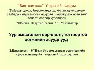
- 1. “Бид хамтдаа” Үндэсний Форум “Байгаль орчин, Ногоон хөгжил, Аялал жуулчлалын салбарын тулгамдсан асуудал, шийдвэрлэх арга зам” сэдэвт салбар хуралдаан 2015 оны 10 дугаар сарын 27. Улаанбаатар Уур амьсгалын өөрчлөлт, тогтвортой хөгжлийн асуудлууд З.Батжаргал, НҮБ-ын Уур амьсгалын өөрчлөлтийн суурь конвенцийн Үндэсний зохицуулагч
- 2. Ярилцах цаг: Уур амьсгалын өөрчлөлт Монголд тийм халтай юмуу? Тогтвортой хөгжилд тэгж их сөргөөр нөлөөлөх юмуу?
- 3. Гадаргын температурын өөрчлөлт, 1901-2012 он
- 4. Хур тунадасны өөрчлөлт, өнгөрсөн 110 жилд болон сүүлийн 60 жилд All Figures © IPCC 2013
- 5. Агаарын жилийн дундаж температур Munkhbat, Natsagdorj 2013
- 6. Агаарын жилийн дундаж температур: өвөл, зун Source: Munkhbat, Natsagdorj2013 Нэгдүгээр сар Долдугаар сар
- 7. Жилийн дундаж хур тунадас Source: Munkhbat, Natsagdorj 2013
- 8. Жилийн дундаж ууршилт Source: Munkhbat, Natsagdorj 2013
- 9. Ус- чандмань эрдэнэ Annual total river flow variation in Mongolia, cub.km/year Source: Davaa G., 2014 0 10 20 30 40 50 60 70 80 90 1975 1985 1995 2005 2015 V,cub.km Long-term average V, cub.km/year
- 10. Алтай Таван богдын мөсөн голууд 100 жилийн дараа буюу өнгөрсөн болон энэ зууны эхэнд Potanin and Aleksandr glaciers .Source: MARCC 2104 Photo made in1905, by V.V. Sapojnikov Photo made in September, 2009 by G.Davaa
- 11. Цаг агаарын гаралтай аюул гамшиг ( 1989-2013 онд) Source: NAMEM/NEMA
- 12. Байгалийн гамшиг дэд бүтцэд Source: MEGD 2013
- 13. Говь-Алтай аймгийн Цээл сумын нутаг, 2009 оны 7-р сарын 16 , уулын үер. Source: NAMEM
- 14. Хуурайшил, ган гачигийн үр дагавар Wild fire in the spring of 2015 destroyed pasture grass in 12 aimags 51 soums covering 5.4 mln hectars of land Severe drought occurred over 70% of the Mongolian territory in the summer of 2002
- 15. Энэ жилийн хаврын түймэр
- 16. Газрын элэгдэл, цөлжилт 2010 оны байдлаар. Source: EIC/IMH 77.8 % affected by degradation : 35.3 % - slightly, 25.9 % - moderately, 6.7 % - severely , 9.9 % - extremely degraded
- 17. SHSH Source: present-day monsoonSource: present-day monsoon limit after Herzschuh (2006)limit after Herzschuh (2006)
- 18. Хүлэмжийн хийний хэмжээ, гадаргын температур, хур тунадасны болзошгүй өөрчлөлт өнгөрсөн болон энэ зууны сүүлийн 20 жилд
- 19. Уур амьсгалын өөрчлөлт: өнөө хүртэл ба цаашид 2020 2040 2060 2080 2100 Temperaturechange, 0 C -6 -4 -2 0 2 4 6 8 10 12 RCP8.5 RCP4.5 RCP2.6 2020 2040 2060 2080 2100 Temperaturechange, 0 C -6 -4 -2 0 2 4 6 8 10 12 RCP8.5 RCP4.5 RCP2.6 2020 2040 2060 2080 2100 Precpitationchange,% -50 0 50 100 150 RCP8.5 RCP4.5 RCP2.6 2020 2040 2060 2080 2100 Precipitationchange,% -50 0 50 100 150 RCP8.5 RCP4.5 RCP2.6 winter summer Annual precipitationAnnual mean temperature Өнөө хүртэл агаарын жилийн дундаж температур 2.070 C -аар нэмэгдсэн (Source: MARCC 14). Цаашид буюу 21-р зуунд гарч болзошгүй өөрчлөлт
- 20. Уур амьсгалын өөрчлөлтийн эерэг үр дагавар Монголд • Өвлийн хүйтний эрч сулрана • Хавар эрт эхлэж намар оройтно. • Гол горхи, нуур цөөрөм орой хөлдөж эрт гэснэ • Ургамлын ургах боломжит хугацаа уртасна • Дулаасаг мод бут, өвс ургамал нутагших нь ихсэнэ • Таримал ургамлын төрөл нэмэгдэнэ • Нүүдлийн ан амьтад, шувууд буудаллах, байрших хугацаа сунгуу болно
- 21. Уур амьсгалын өөрчлөлтийн сөрөг үр дагавар Монголд: байгалийн цаг хугацааны хэмжээст үзэгдэл • Өвөл үе үе эрчимтэй хүйтэрнэ • Зуны халуун өдөр олширно • Хур тунадас нэмэгдэх, буурах үе ээлжлэх боловч дүндээ бол төдий л өсөхгүй. • Ууршил эрчимшиж газрын хөрсөнд чийг хуримтлах хэмжээ буурна • Зуны хур тунадас татарч тэхдээ шиврээ биш аадар хэлбэрээр орох нь зонхилно • Хур тунадасны улиралын шилжилт болж өвөл орох цасны хэмжээ нэмэгдэнэ. Хөрсний чийгийн жилийн дүн буурна. Гол горхийн урсац бүрэлдэхэд сөргөөр нөлөөлнө.
- 22. Уур амьсгалын өөрчлөлтийн сөрөг үр дагавар Монголд: байгалийн орон зайн хэмжээст үзэгдэл • Байгалийн бүс хойшоо шилжиж , бүслүүр дээшээ огшино • Ойн бүс хойт хил рүү шахагдаж уулын царамд тулж талбай хумигдаж болзошгүй. • Говь цөлийн бүс хойшоо тэлж ургамал нөмрөг сэмэрч эхэлж болзошгүй • Бэлчээрийн ургамлын зүйлийн бүрдэлд өөрчлөлт орж мал бэлчээрлэлтийн ачаалал даах чадавхи сульдаж болзошгүй • Бэлчээрийн ургамлын ургалтын үе шатанд өөрчлөлт орж мал давжаарч ашиг шим нь буурч болзошгүй • Дулаан бүсийн харь ургамал “түрэмгийлэн” эзлэх тохиолдол элбэгшиж болзошгүй
- 23. Уур амьсгалын өөрчлөлтийн сөрөг үр дагавар Монголд: Эдийн засгийн салбар • Өвлийн улиралд мал бэлчээрлэлт хүндэрнэ, Цагаан зуд, Мөсөн зуд • Мөнх цас, мөсөн голын хайлалтын улмаас гол горхи, бүлаг шандын урсац өөрчлөгдөж уламжлалт зуслангийн нутаг хуурайшна • Газар тариалангийн эрсдэл нэмэгдэнэ • Эдийн засгийн бүсчилсэн хөгжлийн төлөвлөлтөд усны нөөцийн өөрчлөлтийн хамаарал нэмэгдэнэ • Дэд бүтэц, эрчим хүчний шугам сүлжээ, авто зам, төмөр замын өргөтгөл, хот суурины байршлын өнөөгийн төлөвлөлтийг эргэж нягтлах шаардлага гарна
- 24. Уур амьсгалын өөрчлөлтийн сөрөг үр дагавар Монголд: Нийгмийн салбар, эрүүл мэнд • Усны чанарын өөрчлөлтөөс хамаарах өвчлөл нэмэгдэх магадлал тал хээр, говийн бүс нутагт ихсэнэ • Дулаан бүсийн нутагшмал өвчин тээгчид түрэн орж ирэх магадлал ихсэнэ • Монгол орны оршин суугчдын дархлаагүй дулаан болон халуун бүсийн нутагшмал өвчин гарах магадлал нэмэгдэнэ • Хуурайшил, хүний үйл ажиллагааны хам нөлөөний улмаас агаарын тоосжилт нэмэгдэж амьсгалын замын өвчин ихсэнэ • Агаарын бохирдлын байгалийн шалтгаан зарим бүс нутагт нэмэгдэнэ
- 25. Уур амьсгалын өөрчлөлт ба даяаршлын хам нөлөө Уур амьсгалын өөрчлөлт(УАӨ)-ийн үр дагавар бол зөвхөн агаарын температур, хур тунадасны өөрчлөлтөөс үүдэлтэй биш байгаль, эдийн засаг, нийгмийн хавсарсан хүчин зүйлсийн илрэл юм. Монгол орны УАӨ- ийн нөлөөний талаар ярихдаа даян дэлхийн дулааралт, дэлхий нийтииг хамарсан даяаршилын үйл яцыг хамтад нь авч үзэх шаардлагатай
- 26. Монгол: Шилжилтийн өмнө, одоо ба дараах үеийн ДНБ Source: World Bank
- 27. Монгол: Шилжилтийн өмнө, одоо ба дараах үеийн нэг хүнд оногдох ДНБ Source: World Bank
- 28. УАӨ-тийн улмаас тулгарч буй болон болзошгүй бэрхшээлээс гарах арга зам Юуны өмнө айлаас эрэхээр авдраа уудлацгаая Бусдаас бас суралцая Авах гээхийн ухаанаар хандацгаая
- 29. Тогтвортой хөгжил, Монгол ахуй амьдрал Нүүдлийн мал аж ахуй түшсэн амьдрах арга: ЭТДЗ арга мөн үү? o элдэв дайн самуун,нийгмийн хямрал самуурал, эдийн засгийн доройтол o уур амьсгалын хэлбэлзэл зэргийг даван туулж o амьдралын үндсэн хэрэгцээг хангаж харин амьдрах жимийн босгыг алхаагүй .
- 30. Байгалийн мөчлөгтэй нийцсэн амьдралын хэмнэл
- 31. ”Нийтийн эзэмшлийн эмгэнэл”-гүйгээр нийтэд хүртээлтэй бэлчээр ашиглалт Дөрвөн улирлын бэлчээр сэлгэлт: аргагүй эрхэнд хийж буй нүүдэл боловч давуу тал ихтэй Хаяа багтвал бууна, хушуу багтвал иднэ. Удирдлагын зардал, захиргаадалтын гажиг, танил тал, хээл хахуулийн шалтаг байхгүй. Байгалийн нөөцийн орон зайн ялгаа, улиралын сэлгэлт бэрхшээлийг давуу тал болгон ашиглаж олзоо нэмэгдүүлж олсноо арвижуулж, гамшгаас сэргийлж гайгаас зайлсхийх боломж
- 32. Хязгаарлагдмал нөөцийн үр ашигтай хэрэглээ Байгаль дахь бодис эргэлтийн зүй тогтолд нийцсэн “хаядалгүй технологи” бүрэн утгаараа хэрэгжиж байсан Хүн нэг бүрийн чадавхи, айл өрх бүрийн хэрэгцээ, нутаг усны боломжийн хүрээнд эрвийх дэрвийхээрээ хөдөлж хөдөлмөрөө хорших зарчим Хүн нэмэгдвэл хүнс нэмэгдэнэ Нийтэд хүртээлтэй экосистемийн үйлчилгээний чадамж бүхий нийгэм- экологийн тогтолцоог бий болгох үүнийг үлгэрчлэх загвар бий болгож боломжит сонголтууд гаргах хэрэгцээ
- 33. Монгол ахуй амьдрал, 3Да зарчим, биогеохимийн бүтэн эргэлт байгалийн эргэж сэргэх нөөц байгалийн аясаар задарч уусах сав баглаа боодол, хаягдал байгалийн эргэлт тасалдахгүй түгжрэхгүй. 3 ДА зарчим: Дахин багасгах, Дахин ашиглах, Дахин эргэлдүүлэх, Дорнын ихэнх улс гүрэн, тэр дунд Монголд амьдралын зарчим
- 34. Ногоон эдийн засаг, Ногоон хөгжлийн үзэл баримтлал Урагшаа явах уу, Эргээд харах уу Байгалийн эргэн сэргэх нөөцөд түшиглэсэн үйлдвэрлэл, хаягдалгүйгээр бүтэн эргэлдүүлэх хэрэглээний зарчим дээр тулгуурласан монгол түмний уламжлалт амьдралын хэвшил нь үйлдвэрлэл хэрэглээний өнөөгийн зөрчлөөс бүрэн ангид, өнөөгийн ногоон эдийн засгийн үзэл баримтлалтай бүрэн нийцэж байсан. Ногоон хөгжлийн бодлого (Монгол улсын Их хурал, 2014)
- 35. Бодлого, хөтөлбөр Монгол улсын ногоон хөгжлийн бодлого, 2014 (2014-2030) Уур амьсгалын өөрчлөлтийн үндэсний хөтөлбөр, 2011 (2011- 2021) Төрөөс Эрчим хүчний талаар баримтлах бодлого, 2015 (2015- 2030) Төрөөс Хүнс, хөдөө аж ахуйн талаар баримтлах бодлого, 2010 (2010-2021) Төрөөс Ойн талаар баримтлах бодлого, 2015 (2016-2030) Монгол улсын мянганы хөгжлийн зорилтод суурилсан үндэсний хөгжлийн цогц бодлого, 2008 (2008-2021) Сэргээгдэх эрчим хүчний тухай хууль, 2015 Эрчим хүчний тухай хууль, 2015
- 36. Эрчим хүч (Цахилгаан дулаан) 1 Улсын цахилгаан эрчим хүч үйлдвэрлэх нийт суурилагдсан чадалд сэргээгдэх эрчим хүчний эх үүсвэрийн эзлэх хувийг 2020 онд 20%, 2030 онд 30% болгож нэмэгдүүлэх 2 Цахилгаан эрчим хүч дамжуулах, түгээх үеийн алдагдал 2012 онд 13.7% байсан ба түүнийг 2020 онд 10.8%, 2030 онд 7.8% хүртэл тус тус бууруулах 3 Хуучин барилгуудын дулааны алдагдлыг 2012 оны түвшингээс 2020 онд 20%, 2030 онд 40%-иар бууруулах 4 ДЦС-уудын дотоод хэрэглээ 2012 онд 14.4% байсан ба түүнийг 2020 онд 11.5%, 2030 онд 9.14% хүртэл тус тус бууруулах 5 Шинээр барих нүүрсний ДЦС-уудад уурын өндөр болон хэт өндөр параметрын технологи ашиглах замаар цахилгаан эрчим хүчний үйлдвэрлэлийн түлшний зарцуулалтыг 20%- иар бууруулах
- 37. Аж үйлдвэр Д/ д Арга хэмжээ Бодлого, хөтөлбөр 1 2012-2030 онд цементийн үйлдвэрүүдэд дэвшилтэт хуурай технологи нэвтрүүлэх замаар хүлэмжийн хийг ялгарал (ХХЯ)-ыг бууруулах - УАӨҮХ, - НАМА - 2012 оны Засгийн газрын 171-р тогтоол: Барилгын материал үйлдвэрлэлийн хөтөлбөр
- 38. Хөдөө аж ахуй Д/ д Арга хэмжээ Бодлого, хөтөлбөр 1 Малын тоо толгойг хязгаарлах (2008 онд 43,3 сая мал байсныг 2021 онд 36.5 сая болтол бууруулах зорилт тавьсан) Монгол мал үндэсний хөтөлбөр, 2010
- 39. Хүлэмжийн хийн ялгарлыг бууруулах зорилт
- 40. Тогтвортой хөгжлийн үзэл баримтлал, хэрэгжүүлэх боломж 2030 он хүртлэх улс орны хөгжлийн бодлогын бичиг баримтад тогтвортой хөгжлийн шинэчилсэн үзэл баримтлалыг суулгах Хөгжлийн болон уур амьсгалын талаарх ихэнх бодлого 2016-2020 хүртэлх хугацаатай байна. Иймд 2030 он хүртэлх хугацаанд холбогдох бодлого, хөтөлбөрийг шинэчлэн боловсруулж бүх түвшинд баталгаажуулах, хэрэгжих нөхцөл бүрдүүлэх – Жишээ: Уур амьсгалын өөрчлөлтийг сааруулахад оруулах хувь нэмрийг хэрэгжүүлэхэд 2030 он хүртэл 3,5 тэрбум ам. доллар хөрөнгө шаардана – Олон Улсын Ногоон уур амьсгалын сан, Хамтарсан кредит олгох механизм...
- 41. Ярилцах цаг: Уур амьсгалын өөрчлөлт Монголд тийм халтай юмуу? Тогтвортой хөгжилд тэгж их сөргөөр нөлөөлөх юмуу?
Notas do Editor
- Figure SPM.1, Panel b Complete caption of Figure SPM.1: Figure SPM.1 | (a) Observed global mean combined land and ocean surface temperature anomalies, from 1850 to 2012 from three data sets. Top panel: annual mean values. Bottom panel: decadal mean values including the estimate of uncertainty for one dataset (black). Anomalies are relative to the mean of 1961−1990. (b) Map of the observed surface temperature change from 1901 to 2012 derived from temperature trends determined by linear regression from one dataset (orange line in panel a). Trends have been calculated where data availability permits a robust estimate (i.e., only for grid boxes with greater than 70% complete records and more than 20% data availability in the first and last 10% of the time period). Other areas are white. Grid boxes where the trend is significant at the 10% level are indicated by a + sign. For a listing of the datasets and further technical details see the Technical Summary Supplementary Material. {Figures 2.19–2.21; Figure TS.2}
- Figure SPM.2 | Maps of observed precipitation change from 1901 to 2010 and from 1951 to 2010 (trends in annual accumulation calculated using the same criteria as in Figure SPM.1) from one data set. For further technical details see the Technical Summary Supplementary Material. {TS TFE.1, Figure 2; Figure 2.29}
- Figure SPM.8, Panels a and b Complete caption of Figure SPM.8: Figure SPM.8 | Maps of CMIP5 multi-model mean results for the scenarios RCP2.6 and RCP8.5 in 2081–2100 of (a) annual mean surface temperature change, (b) average percent change in annual mean precipitation, (c) Northern Hemisphere September sea ice extent, and (d) change in ocean surface pH. Changes in panels (a), (b) and (d) are shown relative to 1986–2005. The number of CMIP5 models used to calculate the multi-model mean is indicated in the upper right corner of each panel. For panels (a) and (b), hatching indicates regions where the multi-model mean is small compared to natural internal variability (i.e., less than one standard deviation of natural internal variability in 20-year means). Stippling indicates regions where the multi-model mean is large compared to natural internal variability (i.e., greater than two standard deviations of natural internal variability in 20-year means) and where at least 90% of models agree on the sign of change (see Box 12.1). In panel (c), the lines are the modelled means for 1986−2005; the filled areas are for the end of the century. The CMIP5 multi-model mean is given in white colour, the projected mean sea ice extent of a subset of models (number of models given in brackets) that most closely reproduce the climatological mean state and 1979 to 2012 trend of the Arctic sea ice extent is given in light blue colour. For further technical details see the Technical Summary Supplementary Material. {Figures 6.28, 12.11, 12.22, and 12.29; Figures TS.15, TS.16, TS.17, and TS.20}