NE Temperate Network Google Earth Guidance
•
1 gostou•1,150 visualizações

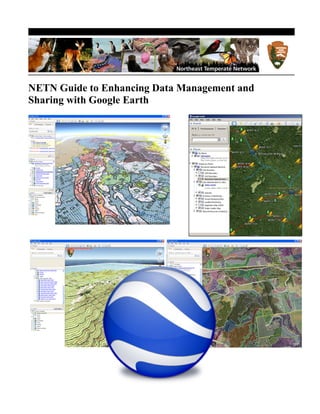
This document provides guidance on enhancing data management and sharing with Google Earth. It outlines methods for converting ArcGIS shapefiles to Google Earth layers (KML files) using free Shape2KML software. Detailed steps are provided on installing Shape2KML, using it to convert shapefiles, and editing the resulting KML files in Google Earth. Advanced editing techniques like adding custom icons, images, and photos are also described. The document aims to promote consistent standards for NETN modules in Google Earth.

Recomendados
Recomendados
Mais conteúdo relacionado
Semelhante a NE Temperate Network Google Earth Guidance
Semelhante a NE Temperate Network Google Earth Guidance (20)
Mais de Teaching the Hudson Valley
Mais de Teaching the Hudson Valley (20)
Último
Último (20)
NE Temperate Network Google Earth Guidance
- 1. NETN Guide to Enhancing Data Management and Sharing with Google Earth
- 3. Enhancing Data Management and Sharing with Google Earth Ed Sharron and Adam Kozlowski National Park Service Northeast Temperate Network 54 Elm Street Woodstock, VT 05091 July 2011 U.S. Department of the Interior National Park Service Northeast Temperate Network
- 4. Contents Page Purpose............................................................................................................................................ v Definitions....................................................................................................................................... v Introduction ..................................................................................................................................... 1 Methods........................................................................................................................................... 2 Converting ArcGIS shapefiles to Google Earth layers ............................................................ 2 Installing Shape2KML software into ArcMap ........................................................................ 2 1. Installing the command. .................................................................................................. 2 Using Shape2KML to Convert a Shapefile ............................................................................. 2 Open Shapefiles in ArcMap ................................................................................................ 2 Altitude ............................................................................................................................... 3 Name and Description......................................................................................................... 4 Style Settings ...................................................................................................................... 4 Set Save Location ............................................................................................................... 5 Viewing and Editing KML in Google Earth ................................................................................... 6 Opening KML.......................................................................................................................... 6 Editing your KML within Google Earth .................................................................................. 7 Change the fill of polygon layers ........................................................................................ 7 Create a Placemark ............................................................................................................. 7 Position the Earth to contain the spot you want to placemark by click-and- dragging and zooming. Choose any one of the following methods:................................... 7 Advanced Editing of your Google Earth Module ......................................................................... 11 Create custom icon ................................................................................................................ 11 Fixed image overlay .............................................................................................................. 12 Photographs ........................................................................................................................... 13 ii
- 5. Saving your Work ......................................................................................................................... 15 Organization .......................................................................................................................... 15 Set the Fly To height, position, and angle ............................................................................. 15 Saving your Module .............................................................................................................. 15 Uploading to the Web ................................................................................................................... 15 To Explore Further ........................................................................................................................ 16 Online Help Community........................................................................................................ 16 Troubleshooting ............................................................................................................................ 17 Here are a few common problems you may encounter when using Google Earth and there solutions. .............................................................................................................................. 17 If getting error message when trying to view PDF’s in GE’s built in browser ................ 17 If getting error message with Google Earth’s built-in browser ........................................ 17 iii
- 6. iv
- 7. Purpose This guidance document outlines the methods and standards used by Northeast Temperate Network (NETN) staff when building KMZ modules in Google Earth. Step-by-step instructions are included on how to create, modify, and post spatial data to the web with or without using ArcGIS and Google Earth. Following these standards promotes a consistent look and feel of NETN modules. This guidance manual makes the following assumptions: • Users of this manual have basic computer literacy • Users have Google Earth installed on their computer and a general knowledge of how to use navigation controls. To download the latest version, go to: http://www.google.com/earth/index.html • For the parts that use ArcGIS - the user has ArcMap installed on their computer. Definitions KML: 'Keyhole Markup Language' is an XML grammar and file format for modeling and storing geographic features such as points, lines, images, polygons, and models for display in Google Earth, Google Maps and other applications. KML’s can be used to share places and information with other users of these applications. KMZ: A KMZ file consists of a main KML file and supporting files that are packaged using a Zip utility into one unit, called an archive. The KMZ file can then be stored and emailed as a single entity. SHP: Shapefile - the native file format for ArcGIS. v
- 8. vi
- 9. Introduction The free and user friendly Google Earth interface provides a quick and easy way to distribute and browse spatial data without relying on the costly and complicated ArcGIS platform. Google Earth allows the overlaying of park data sets onto the latest color imagery and the ability to turn- back-the-clock to view historical imagery. User can quickly zoom to numerous areas of interest or parks, view multiple data layers at once, view attributes, take measurements, capture screen shots, post pictures, and provide maps for citizen scientists all on the web. This procedure walks through the steps for converting any ArcGIS shapefile to a KML file, post-process it in Google Earth, and post it to your website. If you have the shapefiles, you can have something basic up and running for your program in less than a day. Although this procedure focuses mostly on natural resource data, it is equally applicable to any spatial data (cultural resources, trails, management areas, partners, law enforcement, etc.) 1
- 10. Methods Converting ArcGIS shapefiles to Google Earth layers These instructions explain one way of using ArcGIS software to convert shapefiles (SHP) to Google Earth layers (KML). Note that there are many different free and pay tools that can do this, this method outlines a free and easy option to use called Shape2KML. We recommend researching other software (Xtools Pro, Export to KML, etc.) to find the one that best suits your needs. To convert shapefiles to Google Earth layers, you will have to download the free Shape2KML program available at ESRI’s website (http://arcscripts.esri.com/details.asp?dbid=15698). Once you have downloaded and unzipped the file, open the Setup folder, and double-click the “Shape2KML.msi” icon to begin the installation process. If this program does not work or for more detailed instructions, open the “Shape2KML Readme” folder and open the pdf file contained within. This will explain how to install and use the tool. Installing Shape2KML software into ArcMap This information is also available in the pdf file located in the Shape2KML Readme folder. Installing the command. To install the command and add it to an ArcMap toolbar do the following: -open the ArcMap Application -Click Tools Customize - Go to the Commands Tab -Click the “shapetokml” command in the Categories list. -Drag and drop the Sahpe2kml file from the Commands list to any toolbar in ArcMap. -T he command now appears on the toolbar. Using Shape2KML to Convert a Shapefile Open Shapefiles in ArcMap With ArcMap open, click on the “+” sign with the yellow square behind it (typically found in the upper toolbar). This will open the Add Data dialog box. Browse to the folder where the shapefile(s) you want to convert to Google Earth KML(s) is and open in ArcMap. With your layer(s) displayed in ArcMap’s left window, right-click on one and choose Open Attribute Table. The Shape2KML converter allows you to pick two descriptors from the attribute table that will appear in the Google Earth KML. Make note of the two that best describe what you are trying to show (Note: some shapefiles may not have an 2
- 11. attribute table or you may not want or need to pick any, in which case, ignore these steps) and close the attribute table. If you have more than one layer you are converting, do this for all of them. Once you have made note of the attributes you want to display, click on the Shape2KML icon you just installed to open its dialog box. You should see the layer(s) you chose in the left Select Layers to Export box. You can either select all layers by clicking the "Select All" button or select individual layers by clicking on the square next to the layer name. In the Layer dropdown menu in the upper left, choose one of the layers by clicking on it. This will allow you to pick the details of how the KML will be displayed in Google Earth. The Altitude, Name and Description selection can be different for each selected layer. You can also change some of these setting within Google Earth itself later. Altitude You can select the following altitude modes (if available): Clamp to ground: Places the feature directly on the ground. Absolute: Places the feature at an absolute level. This can be taken from a value field in the Attribute table or inserted manually. Relative: Places the feature relative to ground level. The same as above, you can get the value from a field or insert it manually. 3
- 12. Name and Description You can choose two descriptors to help provide more information about your KML when it is viewed in Google Earth by choosing options for the Name and Description drop down boxes. Use the dropdown menus to choose the two descriptors you made note of earlier while viewing the shapefile’s attribute table. Choose carefully since these particular settings cannot be changed once the KML is created (though you can always re-convert the shapefile again choosing different settings). Style Settings The Style selection allows you to set properties for the way features will be shown in Google Earth. Do not worry too much about these settings because they can all easily be adjusted within Google Earth itself. Fill Color: choose the fill color for polygons. Icon Color: choose the color for selected icon in the ‘Choose Default Icon’ section. 4
- 13. Set Save Location To choose the location where your KML will be saved, click the "Select..." button and browse to the appropriate folder. Change the file name from “Export.kml” to a more descriptive title in the File name: box. After setting the options, click the Create KML button to create the document at the specified location. 5
- 14. Viewing and Editing KML in Google Earth From this point forward - ArcMap is not needed and all edits and creation can be performed within Google Earth itself Opening KML Browse to the location where you saved the KML and double-click it to automatically open it in Google Earth. Note that the folder structure you set up in Shape2KML should be displayed in the Places menu in the left of the Google Earth interface. If you decide that you don’t like the way the folder structure is, the only way to change is to recreate the KML with Shape2KML and choose different Name and Description options. 6
- 15. Editing your KML within Google Earth Change the fill of polygon layers To change the fill color, line color and opacity of polygon layers, right click on the layer name in the Places menu and left-click on Properties. Note that you can usually see the changes you make update live on the Google Earth map. Click the Style, Color tab Under the Lines category. click the Color: box and choose the color you want from the presented options. Change the Width: of your lines by clicking the up or down arrows. To change the opacity of the lines, use the up or down arrows next to the Opacity: box or type a percentage directly into the box. To change the fill color click the Color: box beneath the Area category and choose from the presented colors. If you have a polygon that you want to be broken up into many different colors (see the Vegetation Map layers for most NETN park modules), click the Random check-box and Google Earth will choose the colors for you. If you do not want a filled polygon, click the arrow next to the box that currently has Filled + Outlined in it and choose the Outlined option. If you have a polygon filled in with color, you can change the opacity of the color by clicking the arrow next to the Opacity box or by typing a percentage directly into the box. Create a New Placemark ArcMap is not needed to create new placemarks within Google Earth itself. To do so, position the Earth to contain the spot you want to placemark by click-and-dragging and zooming. Choose any one of the following methods: o Select Placemark from the 'Add' Menu. 7
- 16. o Click the Placemark icon on the toolbar menu at the top of the screen The 'New Placemark' dialog box appears and a 'New Placemark' icon is centered in the viewer inside a flashing yellow square. Position the placemark by moving the cursor over the placemark until the cursor changes to a pointing finger and click-and-drag it to the desired location. The cursor changes to a finger pointing icon to indicate that you can move the placemark. If you have the exact GPS Latitude and Longitude for you Placemark from a handheld GPS or other device, you can type them directly into the dialog box. Latitude and Longitude values can be set using the following notations: • Decimal Degrees (DDD) - In this notation, decimal precision is set in the 'degree' coordinate. For example, 49.11675953666N. • Degrees, Minutes, and Seconds (DMS) - In this notation, decimal precision is set in the 'seconds' coordinate. For example, 49 7'20.06"N. • Degrees, Minutes with Decimal Seconds (DMM) - In this notation, decimal precision is set in the 'minutes' coordinate. For example, 49 7.0055722"N. (Here, 20.06 seconds above is divided by 3600 to get the decimal minute value for 20.06 seconds.) Latitude and Longitude syntax is specified as follows: • Numeric Values - Simply separate each coordinate notation with a white space and the entry will be recognized correctly. For example, you can indicate a DMS notation as: 37 24 23.3. You could indicate a DMM notation as 49 7.0055722. You can also use the single quote mark (') for minutes and the double quote mark (") for 8
- 17. seconds, as follows: 49 7'20.06" Alternatively, you can use the Character Map utility in Windows to copy the degree symbol and paste it into the Latitude/Longitude input boxes. To do this, select Start - All Programs - Accessories - System Tools, and then click Character Map. The degree symbol with Arial font is the second entry past the registration symbol. Click on the symbol, click the Copy button and paste it into the input box. • Direction Notation (North/South, East/West) Use 'N', 'S', 'E', or 'W' to indicate direction. The letter can be entered either upper or lower case and it can be placed before or after the coordinate value. For example: N 37 24 23.3 is the same as 37 24 23.3 N You can also use the minus sign (-) to indicate a westerly or southerly position. When you use this kind of notation, do not specify a letter symbol. Additionally, you do not need to use a plus sign (+) to indicate northerly/easterly directions. So, for example this is a valid entry: 37 25 19.07, -122 05 08.40 The following is NOT a valid entry: 37 25 19.07 N, -122 05 08.40 • Entering Latitude, Longitude Pairs When entering latitudinal or longitudinal pairs, the first coordinate is interpreted as latitude unless you use a direction letter to clarify (E or W). For example, you can enter longitude first as: 122 05 08.40 W 37 25 19.07 N However, you cannot use the minus sign to enter longitude first: -122 05 08.40 37 25 19.07 You can separate pair entries with a space, a comma, or a slash: 37.7 N 122.2 W 37.7 N,122.2 W 37.7 N/122.2 W Note: You can convert UTM coordinates and other measurements to lat and long quickly and easily by going to the University of Wisconsin website: http://www.uwgb.edu/dutchs/usefuldata/ConvertUTMNoOZ.HTM 9
- 18. Set the following properties for the new placemark: o Name for the placemark o Description, including HTML text of desired o Style, Color - Choose a color, scale (size) and opacity for the placemark icon o View - Choose a position for the placemark. For explanation of terms in this tab, mouse over each field. Click Snapshot current view to apply the current view (altitude and camera angle) to this placemark. o Altitude - Choose the height of the placemark as it appears over terrain with a numeric value or the slider. Choose 'Extend to ground' to show the placemark attached to a line anchored to the ground. o (Icon) - Click the icon for the placemark (top right corner of the dialog box) to choose an alternate icon. 2. Click OK to apply the information you entered in the placemark dialog box. Your placemark appears in the 3D viewer and as an entry in the selected folder. Once you save this placemark, you can always change its position and properties later by right-clicking on the Placemark title and selecting Properties. 10
- 19. Advanced Editing of your Google Earth Module Create custom icon A map uses icons to communicate to its user what types of data it displays. A good map uses icons that are intuitive. Although there are many standard icons made available through Google Earth, there are also times when a custom icon is preferable. Custom icon images can come in a variety of formats, though either PNG’s or GIF’s are recommended because they allow for transparency of the background (no filled white box surrounding icon image). Adobe Photoshop and other image editing software allows for the saving of images in either format (through the use of the “Save As” command). As a general rule, the smaller the file size of the icon the better. This will allow Google Earth to quickly load and display the icon on the map. Therefore, the physical size of the icon will also be small. Most icons should fall somewhere near the vicinity of 150 x 150 pixels, which should put it in the range of a 5 - 10 kilobyte image. Once the custom icon has been created and you will be sharing it with other on the internet, you will need to upload it to the server where your website is located. It is recommended that you create a “Google_Earth” folder within your website structure, and an “icons” folder within that to have a consistent place to put all custom icons. If you are only using your icon on your local computer and/or will be emailing your KMZ to others later, just save your icon somewhere on your local computer/network. To place your new custom icon on your map, right-click on the individual layer you want to replace the icon for (or the entire folder if you want to replace all the icons) and select Properties. In the Edit Placemark window click on the image of the icon you want to replace and in the next window click ‘Add Custom Icon’ in the lower left. Browse to the location where you saved your custom icon (either on the web or on your local computer/network). Click OK and your new icon should appear in the list of choices. Click on it and you will see it replace the old icon on the screen. You can adjust the Scale and Opacity of your icon by manipulating the up or down arrows at the top of the Icon dialog box. 11
- 20. You can also control how the icon will be viewed by visitors to your map by adjusting the Altitude tab. If “Clamped to Ground” is chosen, then the icon will ‘stick’ to the ground of the map and will be visible no matter at what height the virtual camera of Google Earth is at. If you want the icon to move out of the way as the user zooms in to the map (the same way park labels do on all of NETN’s Google Earth park modules), then choose the “Reltaive to Ground” option in the drop down menu and adjust the altitude of the icon to the appropriate height (NETN use 250m for all park labels). Fixed image overlay Being able to show an image on the screen that stays fixed in place even as the user moves around the map can be useful. Uses include using it like a watermark (e.g. project’s icon) or providing information about a particular data layer (e.g. legend for a map image overlay). Fixed image overlays (FIO) must be written directly into the coding of existing KML layers. To add an FIO to your module, you will need an HTML editor of some kind (e.g. Adobe Dreamweaver, there are also several free programs available). If you are working on a KMZ module, you will need to save it as a KML to edit the HTML. To do this, in Google Earth, right-click on your KMZ module and select ‘Save Place As’. In the ‘Save as type’ dropdown menu select KML. You may want to create a new folder to save in as splitting your KMZ into a KML Click to create new folder will likely create many files that were zipped inside the KMZ. Once you’ve saved as a KML, open it in the HTML editor of your choice. To add the screen overlay, use the following syntax (note you will need to change <name> and <Icon> information to your image and to where you saved it). <ScreenOverlay> <name>NPS Logo</name> <Icon> <href>http://science.nature.nps.gov/im/units/NETN/googleMaps/images/NPS_logo.png</href> </Icon> <overlayXY x="0" y="1" xunits="fraction" yunits="fraction"/> <screenXY x="0" y="1" xunits="fraction" yunits="fraction"/> <rotationXY x="0" y="0" xunits="fraction" yunits="fraction"/> <size x="0.1100000000000001" y="0" xunits="fraction" yunits="fraction"/> </ScreenOverlay> 12
- 21. The above coding will give you the result shown below. You will likely need to tweak the x= and y= coordinates based on the size of your image. Adding Photographs to Your Placemark Bubble NETN has chosen to make photographs accessible from within its Google Earth placemarks both as a thumbnail image and a hyperlink to a larger format image. The hyperlinks can either reference local files on your computer or files on a web server. Hyperlinks to local files can only be seen by local users of the KMZ file so their use is limited. Photographs stored and linked to KMZ files through a web server are accessible by a much wider audience. Either situation is accomplished by inserting HTML code into a placemark’s Description field, although the examples provided here deal exclusively with linking to photo files on a web server. Although photographs are not embedded directly in the KMZ file (but instead linked), performance can still be slow if photographs are not formatted for use on the web. 13
- 22. NETN Formatting standards for photographs for use in Google Earth: 1) Open Photoshop 2) Image Image size… a. Resolution: 72 pixels/inch b. Width: 1200 pixels; Height: 900 pixels (reverse values for vertical photo) 3) File ‘Save for Web & Devices…’ JPEG format. 4) Rename file by adding the suffix “_web” Save 5) The photograph must now be moved to the appropriate web server so Google Earth can access it. This is typically the same address where the rest of the organization’s website building blocks are located. Path for NETN: Inp2300fcsdepo1imunitsnetngoogleMapsimagesPhotos Embedding photographs in Google Earth placemarks: 1) Right click on the placemark you wish to add a photograph to and select ‘Properties’. 2) On the Description tab insert the following code: <br> Insert description of the photograph (e.g. location, subject, date)<br> <a href="insert path to photo file that hyperlink points to”"><img src="insert path to photo file to be viewed as thumbnail image" width="300" height="200"></a> Click image to see larger version<br> Example code for NETN: <br> East Primrose Brook water quality monitoring site, 2006<br> <a href="http://science.nature.nps.gov/im/units/NETN/googleMaps/images/Photos/MOR R_WQ/MORRSA_2006_web.jpg"><img src="http://science.nature.nps.gov/im/units/NETN/googleMaps/images/Photos/MOR R_WQ/MORRSA_2006_web.jpg" width="300" height="200"></a> Click image to see larger version<br> 14
- 23. Saving your Work Organization It is important to organize your layers and folders in the left-hand Places window in a logical format. You can add folders to you KMZ by right-clicking the layer you want to further organize and selecting Add Folder Type in a title for your folder and make sure ‘Allow this folder to be expanded’ is checked. Click OK. Drag the folders and/or layers you want into your newly created folder. Use the small + or - symbols next to your folders to expand or compact your folders. Note that the way you save you module is the way that it will open and be displayed by others when it is opened by them. Set the Fly To height, position, and angle Google Earth allows you to set how your module will be zoomed into from outer space when it is opened by a viewer. To do this, simply position the view of you map by clicking, dragging, and rotating your view with the mouse and/or navigation controls in the upper right of the screen. When you have the map set just how you want it, right click the highest order folder of you KMZ module and click Snapshot View. Saving your Module When you are ready to save your work, again right-click the highest-order folder of your module and select ‘Save As’. In the ‘Save file…’window, browse to where you want to save your file, give it a proper name and make sure you have ‘Kmz’ selected from the ‘Save as type:, drop- down box. Uploading to the Web In order to share your Google Earth module with other on the internet, you must upload the KMZ to the webserver where your website is stored. You can hyperlink to KMZ files in your website and they will automatically open in Google Earth if it is installed on the downloader’s computer. 15
- 24. To Explore Further Online Help Community Google Earth has many dedicated users and a large online community that likely has the answer to any questions you may have about Google Earth or editing KML’s/KMZ’s. A good place to start is Google official online help website at: http://code.google.com/apis/kml/ Another option is to just ‘google’ your question/s with the phrase ‘google earth’ enclosed in quotation marks: 16
- 25. Troubleshooting Here are a few common problems you may encounter when using Google Earth and there solutions. If getting error message when trying to view PDF’s in GE’s built in browser Do the following: Minimize GE and open up Adobe Reader • First make sure you have the latest version by clicking Help Check for Updates • Once latest updates have installed click Edit Preferences • Click ‘Internet’ option in left-hand column and the make sure ‘Display PDF in browser’ is checked If getting error message with Google Earth’s built-in browser If you continue getting error message with GE’s browser that automatically slides in from the right whenever you click on a hyperlink, you can always turn that feature off. To do so: • In Google Earth, click Tools Options. • Under the General tab, make sure the ‘Show web results in external browser’ is unchecked. From now on hyperlinks will open in you default web browser. 17
- 26. National Park Service U.S. Department of the Interior