[ArcFM™ Solution] ArcFM

Visibility. It’s the key to maintaining your utility’s infrastructure. Because you need a clear picture of your assets at all times, Schneider Electric offers ArcFM. With it, you can visualize, navigate, and manage your utility network’s assets in one reliable application. At Schneider Electric, we designed our ArcFM to be a powerful extension of Esri’s ArcGIS® platform — providing a graphical, data-rich environment that displays the information you need to maximize reliability and efficiency. Developed as a complete enterprise solution for your entire organization, it offers a map-centric, intuitive way to model, design, maintain, and manage your facility and land-based information. Because geographical information is built into your map data, your asset changes and updates are more apt to operate appropriately under the conditions in the geography, reducing the chance of outages and increasing reliability for your customers. Learn more: 1. Download this file to learn more on ArcFM™ 2. Request a FREE online demo clicking here: http://goo.gl/1xpTgl

Recommended
Recommended
More Related Content
More from Schneider Electric
More from Schneider Electric (20)
Recently uploaded
Recently uploaded (20)
[ArcFM™ Solution] ArcFM
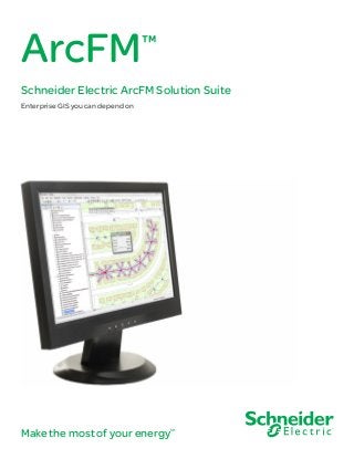
- 1. Make the most of your energySM ArcFM™ Schneider Electric ArcFM Solution Suite Enterprise GIS you can depend on
- 2. ArcFM Visibility. It’s the key to maintaining your utility’s infrastructure. Because you need a clear picture of your assets at all times, Schneider Electric offers ArcFM. With it, you can visualize, navigate, and manage your utility network’s assets in one reliable application. At Schneider Electric, we designed our ArcFM to be a powerful extension of Esri’s ArcGIS® platform — providing a graphical, data-rich environment that displays the information you need to maximize reliability and efficiency. Developed as a complete enterprise solution for your entire organization, it offers a map-centric, intuitive way to model, design, maintain, and manage your facility and land-based information. Because geographical information is built into your map data, your asset changes and updates are more apt to operate appropriately under the conditions in the geography, reducing the chance of outages and increasing reliability for your customers. Make the most of your data ArcFM fits into the overall information technology vision of today’s modern utilities through the use of open databases, industry-standard programming environments, and component object model (COM) architecture. Thanks to its open architecture, the system is highly configurable and easily adapted for multiple uses. Plus, it’s scalable, so you can use it in a single department, or as a multi-departmental enterprise tool for creating, managing, and disseminating your utility information. With the integration and single geodatabase behind ArcFM, you’ll have one version of the truth, reliably informing you through a variety of critical functions, such as dispatching, troubleshooting, engineering analysis, planning, reporting, customer service, and even media relations during outages. Add optional extensions and ArcFM can be taken into the field by your technicians on their mobile devices. This allows them to note any changes in geographical features, such as new housing developments and road construction — and they can make immediate updates for up-to-the-minute accuracy. 02 | ArcFM ArcFM offers a map-centric, intuitive way to model, design, maintain, and manage facility and land-based information
- 3. ArcFM’s open database can also link to other customer information systems (CIS) and enterprise resource planning (ERP) solutions, such as SAP and traditional business software — making it an invaluable resource for better understanding your utility assets. Schneider Electric is the industry leader in GIS solutions for the industry, with ArcFM deployed at some of the largest and smallest utilities in the world. We’ll help you integrate ArcFM into your operations, smoothly and efficiently — ensuring that it’s deployed to optimal scale and functionality, giving you the most impact for your investment. ArcFM | 03
- 4. ©2013SchneiderElectric.Allrightsreserved. Schneider Electric USA, Inc. 4701 Royal Vista Circle Fort Collins, CO 80528 Phone: 1-866-537-1091 Fax: 1-970-223-5577 www.schneider-electric.com/us August 2013