The presses and pulses wright morton & olson
•
0 likes•154 views

71st SWCS International Annual Conference July 24-27, 2016 Louisville, KY

Recommended
Recommended
More Related Content
What's hot
What's hot (11)
Viewers also liked
Viewers also liked (20)
Similar to The presses and pulses wright morton & olson
Similar to The presses and pulses wright morton & olson (20)
More from Soil and Water Conservation Society
More from Soil and Water Conservation Society (20)
Recently uploaded
Recently uploaded (20)
The presses and pulses wright morton & olson
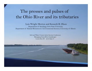
- 1. The presses and pulses of the Ohio River and its tributaries Lois Wright Morton and Kenneth R. Olson Department of Sociology, Iowa State University Department of Natural Resources & Environmental Sciences, University of Illinois Soil and Water Conservation Society Conference Managing Great River Landscapes Louisville, KY 2016 July 27
- 2. Ohio River Basin Upper Mississippi River Tennesse River Cumberland River Wabash River Ohio River Ohio River Ohio River Lower Mississippi River Rivers Legend 1900 km State Borders N Illinois Indiana Ohio West Virginia Virginia Pennsylvania Tennesse North Carolina South Carolina Alabama Mississippi Georgia Virginia Kentucky Ohio River Basin Mainstem Ohio River runs 981 miles from Pittsburgh, PA to Cairo, IL confluence with Mississippi River Encompasses 204,000 sq mi Home to 25 million people
- 3. Presses and pulses of river systems Presses alter the structure of the river in small increments e.g. upland soil erosion; bank erosion from river current; river sedimentation; wetland and backwater vegetation; trees (snags) fall into the river; temperature (ice formation) and “normal” rain and snow events; human settlements and land uses ……………
- 4. Dredging Ohio River at Metropolis August 2006 port and channel siltation; channel erosion and incremental path shifts; changes in hydrology; water velocity; replenishment of nutrients in river wetlands and backwaters
- 5. 2016 June 23rd < 10 inches of rain over West Virginia Elk River, West Virginia record 33.37 feet 23 people dead Elk River, mountain headwaters of the Kanawha River; main tributary of the Ohio River Pulses transform the social & river ecosystem functions suddenly eg. Floods; drought; invasive species tipping points (Asian flying carp); river basin land use/development; climate tipping points (glacial ice dams; sea level rise)
- 6. Falls of Ohio Clarksville, IN October 2015 Historical presses and pulses impact Ohio River navigation
- 7. Navigating the Ohio River When Lewis and Clark traveled down the Ohio River in 1803 the water depth was very low and they had to portage around the “Falls of Ohio River”. The Louisville portage. Steam boats had to drop off passengers and freight on one end of falls, transport them overland, and then load back on a different steam boat. 1824 US. Congress authorized the systematic removal of snags and other obstructions 1825 construction began on canal with 3 locking chambers around the “Great Falls of Ohio River” near Louisville, Kentucky. 1830 Steam boats could travel through the canal even in droughts.
- 8. Presses. Trade, economic, political, social, ecological…connecting the US east to west
- 9. The Ohio River, National Road, Baltimore & Ohio Railroad Gateway to the west Wheeling Virginia (WV)
- 10. Pulses. Record setting floods The Great Flood of 1937; 4 weeks of back to back storms, 1000 year flood; worst disaster to strike the Ohio River Valley on record Major Flood Stage 1937 Crest Record Flood Crest 2011 Flood Feet Feet Year Feet Feet Pittsburg, PA 28.5 35.0 1936 46.4 26.6 Confluence Allegheny, Monongahela, Ohio Parkersburg, WV 42.0 55.4 1913 58.9 30.0 Cincinnati, OH 65.0 80.0 1884 71.1 55.4 Louisville, KY 57.1 Downstream McAlpine 73.0 85.4 1945 74.4 62.9 McAlpine upper 38.0 52.2 1945 42.1 31.1 Evansville, IN 52.0 54.0 1913 48.4 46.8 Paducah, KY 52.0 60.8 1913 54.3 55.0 Cairo, IL 53.0 59.5 1975 56.5 61.7 Confluence Mississippi, Ohio
- 11. Managing river presses and pulses Locks and dams; Reservoirs; Flood walls; Wetlands & backwaters; Climate science, weather forecasts; Engineering structures; Upland land and bottomland management; Settlement and development patterns; Agricultural raw and finished products; Coal, iron ore, steel; Industrial siting; Drinking water; Water quality; Recreation National priorities: navigation, flood control, economic development
- 12. State Borders Legend 160 km N Rivers Locks and dams Kentucky West Virginia PennsylvaniaOhioIndianaIllinois Missouri Cairo Olmsted Newburgh Cannelton Smithland John T. Meyers 53 52 Cities McAlpine Louisville Markland Greenup Captain Anthony Meldahl RC Byrd Racine Bellville Willow Island Pike Island Wheeling New Cumberland Montgomery Island Dashields Pittsburgh Cincinnati Hannibal Emsworth 20 locks and dams on Ohio River in 2016 Lock and dam system on entire length of Ohio River; 9 foot deep shipping channel; 51 movable dams with wooden wickets & lock 600 x110 foot chambers (by 1929); length of the locks doubled in 1950s 1910 Rivers and Harbors Act
- 13. Louisville Kentucky July 2016
- 14. McAlpine Dam at Louisville October 2015 Navigating the Falls of Ohio
- 15. Flood Control US government responsible for planning, financing and operating flood control structures. Flood control investments in levees, floodwalls, and storage reservoirs to better manage river flooding Paducah, Kentucky 2015 1937 60.8’ 1884 54.2’ 1913 54.3’
- 16. Kentucky and Barkley reservoirs on the Cumberland and Tennessee rivers USACE can maintain 3.3 feet of additional water over the 9 foot Ohio River shipping canals as a result of the Kentucky and Barkley reservoirs during a drought As a result of the Kentucky and Barkley reservoirs the New Madrid floodway (built between 1928 and 1932) was not open of 74 years (between 1937 and 2011).
- 17. Presses and pulses of the future 3rd US National Climate Assessment
- 18. People and places The Ohio River at Wheeling, West Virginia October 2015 The river is a source of social, economic, cultural and political vitality
- 19. Pittsburgh, Pennsylvania 2015 Ohio River port cities …inland waterway to New Orleans, Panama Canal…the world
- 20. New Cumberland, West Virginia 2015
- 23. Lower Ohio River navigation. Locks and dams, No. 52 and No. 53 are currently being replaced No. 52
- 24. Olmstead lock and dam 5 Tainter gates; 1400 foot navigable pass; steel wicket gates & fixed weir; locks 110’ wide x1200’ long
- 25. River backwaters, main channel, islands, wetlands, rock ledges, mud flats, river bottoms home to diversity of fish, plants and animals adapted to seasonal wet and dry, hot and cold Need to develop metrics of value; and monitor changes to the river ecosystem and adjacent land uses Challenges to the river ecosystem 125 species of fish in the Ohio River 270 different species of birds at the Falls of Ohio
- 26. Morning mist on the Ohio River
- 27. Smithland lock and dam October 22, 2014