SlideShare a Scribd company logo
1 of 2
ã2017 California Institute of Technology. Government sponsorship acknowledged.
NISAR: The NASA-ISRO SAR Mission
Monitoring Volcanic Activity with Radar
Many volcanic eruptions are preceded by surface
deformation induced by moving magma beneath the
ground. Measuring this deformation is key to
understanding the potential for future eruptions. Radar
observations from NISAR and other satellite missions can
play a direct role in helping to monitor volcanoes and
assess associated hazards, both during periods of unrest
and during ensuing eruptions.
Monitoring Volcanic
Hazards
Earth is home to about 1,500 volcanoes that have erupted in the past 10,000
years, and today volcanic activity affects the lives and livelihoods of a rapidly
growing number of people around the globe. Volcanic eruptions destroy cities and
towns, eject ash clouds that disrupt air travel, and impact regional agriculture.
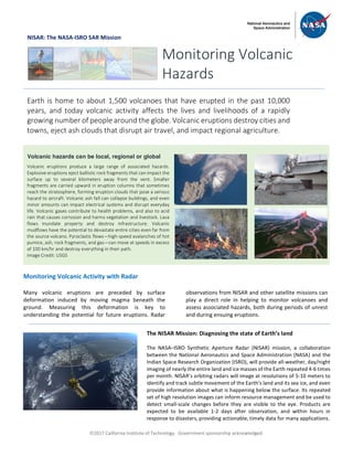
Volcanic hazards can be local, regional or global
Volcanic eruptions produce a large range of associated hazards.
Explosive eruptions eject ballistic rock fragments that can impact the
surface up to several kilometers away from the vent. Smaller
fragments are carried upward in eruption columns that sometimes
reach the stratosphere, forming eruption clouds that pose a serious
hazard to aircraft. Volcanic ash fall can collapse buildings, and even
minor amounts can impact electrical systems and disrupt everyday
life. Volcanic gases contribute to health problems, and also to acid
rain that causes corrosion and harms vegetation and livestock. Lava
flows inundate property and destroy infrastructure. Volcanic
mudflows have the potential to devastate entire cities even far from
the source volcano. Pyroclastic flows—high-speed avalanches of hot
pumice, ash, rock fragments, and gas—can move at speeds in excess
of 100 km/hr and destroy everything in their path.
Image Credit: USGS
The NISAR Mission: Diagnosing the state of Earth’s land
The NASA–ISRO Synthetic Aperture Radar (NISAR) mission, a collaboration
between the National Aeronautics and Space Administration (NASA) and the
Indian Space Research Organization (ISRO), will provide all-weather, day/night
imaging of nearly the entire land and ice masses of the Earth repeated 4-6 times
per month. NISAR’s orbiting radars will image at resolutions of 5-10 meters to
identify and track subtle movement of the Earth’s land and its sea ice, and even
provide information about what is happening below the surface. Its repeated
set of high resolution images can inform resource management and be used to
detect small-scale changes before they are visible to the eye. Products are
expected to be available 1-2 days after observation, and within hours in
response to disasters, providing actionable, timely data for many applications.
ã2017 California Institute of Technology. Government sponsorship acknowledged.
Continued from front page
Data from NISAR and other radar missions allow us to
identify and monitor surface deformation at quiescent
and active volcanoes through the use of radar
interferometry (InSAR). Only InSAR has the capability for
monitoring deformation at virtually all of the world’s
potentially active volcanoes on land. InSAR observations
allow us to build models of subsurface magma movement
preceding, accompanying, and following eruptions –
information that is critically important to understand the
state of activity and anticipated hazards. Radar images
that allow us to monitor and characterize volcanic
processes are also used to map the extent of eruptive
products, like lava and ash, during an eruption. When
combined with other measurements of volcanic activity,
data from NISAR will facilitate the development of more
realistic depictions of active volcanoes, which are critical
for eruption foresting.
All NISAR data products, including the InSAR results, will
be freely available through a web portal. This way, the
nation’s investment in land surveys remotely acquired
from space can be widely used by a variety of agencies and
individuals to monitor volcanic processes and mitigate
associated hazards.
National Aeronautics and Space Administration For more information, visit http://nisar.jpl.nasa.gov/applications
Jet Propulsion Laboratory / California Institute of Technology / Pasadena, California / www.jpl.nasa.gov
Map showing areas of volcanoes in the world
[Global Volcano Program/Smithsonian
Institution; US Center for Disease Control]
More than 50 volcanoes in the United States have erupted one or more times in
the past 200 years. The most volcanically active regions of the nation are in
Alaska, Hawaii, California, Oregon, Washington, and Wyoming. Unlike other
techniques that rely on measurements at a few points, InSAR produces a map of
ground deformation that covers a very large spatial area with centimeter- to
millimeter-scale accuracy, even over remote areas with no ground-based
monitoring resources. The figure to the right shows uplift (depicted as colored
fringes) of the Three Sisters Wilderness in Oregon during 1995-2001, which was
discovered by InSAR and would not otherwise have been known. The InSAR data
indicated the intrusion of about 20 million cubic meters of magma about 5 km
beneath the ground. The last eruption in this region was about 1500 years ago,
and there will certainly be another eruption in the area in the future. Advanced
knowledge of magma accumulation allowed for a better ground-based
monitoring network to be installed, and for better communication of potential
hazards to the local population. Image Credit: USGS
Monitoring Volcanoes with InSAR

More Related Content

Similar to NISAR NASA-ISRO Synthetic Aperture Radar (NISAR) Volcanic Hazards

NISAR NASA-ISRO Synthetic Aperture Radar (NISAR) Marine Hazards
NISAR NASA-ISRO Synthetic Aperture Radar (NISAR) Marine HazardsNISAR NASA-ISRO Synthetic Aperture Radar (NISAR) Marine Hazards
NISAR NASA-ISRO Synthetic Aperture Radar (NISAR) Marine HazardsDr. Pankaj Dhussa
 
NISAR NASA-ISRO Synthetic Aperture Radar (NISAR) Earthquake! Tracking Locatio...
NISAR NASA-ISRO Synthetic Aperture Radar (NISAR) Earthquake! Tracking Locatio...NISAR NASA-ISRO Synthetic Aperture Radar (NISAR) Earthquake! Tracking Locatio...
NISAR NASA-ISRO Synthetic Aperture Radar (NISAR) Earthquake! Tracking Locatio...Dr. Pankaj Dhussa
 
NISAR NASA-ISRO Synthetic Aperture Radar (NISAR) Earthquake
NISAR NASA-ISRO Synthetic Aperture Radar (NISAR) EarthquakeNISAR NASA-ISRO Synthetic Aperture Radar (NISAR) Earthquake
NISAR NASA-ISRO Synthetic Aperture Radar (NISAR) EarthquakeDr. Pankaj Dhussa
 
NISAR NASA-ISRO Synthetic Aperture Radar (NISAR) Flood Forecasting
NISAR NASA-ISRO Synthetic Aperture Radar (NISAR)  Flood ForecastingNISAR NASA-ISRO Synthetic Aperture Radar (NISAR)  Flood Forecasting
NISAR NASA-ISRO Synthetic Aperture Radar (NISAR) Flood ForecastingDr. Pankaj Dhussa
 
NISAR NASA-ISRO Synthetic Aperture Radar (NISAR) Damage Mapping
NISAR NASA-ISRO Synthetic Aperture Radar (NISAR) Damage MappingNISAR NASA-ISRO Synthetic Aperture Radar (NISAR) Damage Mapping
NISAR NASA-ISRO Synthetic Aperture Radar (NISAR) Damage MappingDr. Pankaj Dhussa
 
NISAR Oil, Gas, and Water Underground Reservoirs
NISAR Oil, Gas, and Water Underground ReservoirsNISAR Oil, Gas, and Water Underground Reservoirs
NISAR Oil, Gas, and Water Underground ReservoirsDr. Pankaj Dhussa
 
NISAR NASA-ISRO Synthetic Aperture Radar (NISAR) Coastal Land Loss
NISAR NASA-ISRO Synthetic Aperture Radar (NISAR) Coastal Land LossNISAR NASA-ISRO Synthetic Aperture Radar (NISAR) Coastal Land Loss
NISAR NASA-ISRO Synthetic Aperture Radar (NISAR) Coastal Land LossDr. Pankaj Dhussa
 
NISAR NASA-ISRO Synthetic Aperture Radar (NISAR) Food Security
NISAR NASA-ISRO Synthetic Aperture Radar (NISAR) Food SecurityNISAR NASA-ISRO Synthetic Aperture Radar (NISAR) Food Security
NISAR NASA-ISRO Synthetic Aperture Radar (NISAR) Food SecurityDr. Pankaj Dhussa
 
Seminar report on GPS based Space Debris Removal System
Seminar report on GPS based Space Debris Removal SystemSeminar report on GPS based Space Debris Removal System
Seminar report on GPS based Space Debris Removal SystemSunil Ds
 
NISAR NASA-ISRO Synthetic Aperture Radar (NISAR) Fire Management
NISAR NASA-ISRO Synthetic Aperture Radar (NISAR) Fire ManagementNISAR NASA-ISRO Synthetic Aperture Radar (NISAR) Fire Management
NISAR NASA-ISRO Synthetic Aperture Radar (NISAR) Fire ManagementDr. Pankaj Dhussa
 
Remote sensing in Disaster management
Remote sensing in Disaster managementRemote sensing in Disaster management
Remote sensing in Disaster managementDebasis Ray
 
Presentation: Volcanic Monitoring with GPS--An Alaskan Example
Presentation: Volcanic Monitoring with GPS--An Alaskan ExamplePresentation: Volcanic Monitoring with GPS--An Alaskan Example
Presentation: Volcanic Monitoring with GPS--An Alaskan ExampleSERC at Carleton College
 
NISAR NASA-ISRO Synthetic Aperture Radar (NISAR) Timber and Forest Disturbance
NISAR NASA-ISRO Synthetic Aperture Radar (NISAR) Timber and Forest DisturbanceNISAR NASA-ISRO Synthetic Aperture Radar (NISAR) Timber and Forest Disturbance
NISAR NASA-ISRO Synthetic Aperture Radar (NISAR) Timber and Forest DisturbanceDr. Pankaj Dhussa
 
TRACKING ANALYSIS OF HURRICANE GONZALO USING AIRBORNE MICROWAVE RADIOMETER
TRACKING ANALYSIS OF HURRICANE GONZALO USING AIRBORNE MICROWAVE RADIOMETERTRACKING ANALYSIS OF HURRICANE GONZALO USING AIRBORNE MICROWAVE RADIOMETER
TRACKING ANALYSIS OF HURRICANE GONZALO USING AIRBORNE MICROWAVE RADIOMETERjmicro
 
DISASTER PREDICTION
DISASTER PREDICTIONDISASTER PREDICTION
DISASTER PREDICTIONLibcorpio
 

Similar to NISAR NASA-ISRO Synthetic Aperture Radar (NISAR) Volcanic Hazards (20)

NISAR NASA-ISRO Synthetic Aperture Radar (NISAR) Marine Hazards
NISAR NASA-ISRO Synthetic Aperture Radar (NISAR) Marine HazardsNISAR NASA-ISRO Synthetic Aperture Radar (NISAR) Marine Hazards
NISAR NASA-ISRO Synthetic Aperture Radar (NISAR) Marine Hazards
 
NISAR NASA-ISRO Synthetic Aperture Radar (NISAR) Earthquake! Tracking Locatio...
NISAR NASA-ISRO Synthetic Aperture Radar (NISAR) Earthquake! Tracking Locatio...NISAR NASA-ISRO Synthetic Aperture Radar (NISAR) Earthquake! Tracking Locatio...
NISAR NASA-ISRO Synthetic Aperture Radar (NISAR) Earthquake! Tracking Locatio...
 
NISAR NASA-ISRO Synthetic Aperture Radar (NISAR) Earthquake
NISAR NASA-ISRO Synthetic Aperture Radar (NISAR) EarthquakeNISAR NASA-ISRO Synthetic Aperture Radar (NISAR) Earthquake
NISAR NASA-ISRO Synthetic Aperture Radar (NISAR) Earthquake
 
NISAR NASA-ISRO Synthetic Aperture Radar (NISAR) Flood Forecasting
NISAR NASA-ISRO Synthetic Aperture Radar (NISAR)  Flood ForecastingNISAR NASA-ISRO Synthetic Aperture Radar (NISAR)  Flood Forecasting
NISAR NASA-ISRO Synthetic Aperture Radar (NISAR) Flood Forecasting
 
NISAR NASA-ISRO Synthetic Aperture Radar (NISAR) Damage Mapping
NISAR NASA-ISRO Synthetic Aperture Radar (NISAR) Damage MappingNISAR NASA-ISRO Synthetic Aperture Radar (NISAR) Damage Mapping
NISAR NASA-ISRO Synthetic Aperture Radar (NISAR) Damage Mapping
 
NISAR Oil, Gas, and Water Underground Reservoirs
NISAR Oil, Gas, and Water Underground ReservoirsNISAR Oil, Gas, and Water Underground Reservoirs
NISAR Oil, Gas, and Water Underground Reservoirs
 
NASA EarthDay 2023
NASA EarthDay 2023NASA EarthDay 2023
NASA EarthDay 2023
 
Discover the world around you.
Discover the world around you.Discover the world around you.
Discover the world around you.
 
NISAR NASA-ISRO Synthetic Aperture Radar (NISAR) Coastal Land Loss
NISAR NASA-ISRO Synthetic Aperture Radar (NISAR) Coastal Land LossNISAR NASA-ISRO Synthetic Aperture Radar (NISAR) Coastal Land Loss
NISAR NASA-ISRO Synthetic Aperture Radar (NISAR) Coastal Land Loss
 
Earthquakes
EarthquakesEarthquakes
Earthquakes
 
NISAR NASA-ISRO Synthetic Aperture Radar (NISAR) Food Security
NISAR NASA-ISRO Synthetic Aperture Radar (NISAR) Food SecurityNISAR NASA-ISRO Synthetic Aperture Radar (NISAR) Food Security
NISAR NASA-ISRO Synthetic Aperture Radar (NISAR) Food Security
 
Seminar report on GPS based Space Debris Removal System
Seminar report on GPS based Space Debris Removal SystemSeminar report on GPS based Space Debris Removal System
Seminar report on GPS based Space Debris Removal System
 
NISAR NASA-ISRO Synthetic Aperture Radar (NISAR) Fire Management
NISAR NASA-ISRO Synthetic Aperture Radar (NISAR) Fire ManagementNISAR NASA-ISRO Synthetic Aperture Radar (NISAR) Fire Management
NISAR NASA-ISRO Synthetic Aperture Radar (NISAR) Fire Management
 
Remote sensing in Disaster management
Remote sensing in Disaster managementRemote sensing in Disaster management
Remote sensing in Disaster management
 
Earthquake mixon
Earthquake mixonEarthquake mixon
Earthquake mixon
 
Presentation: Volcanic Monitoring with GPS--An Alaskan Example
Presentation: Volcanic Monitoring with GPS--An Alaskan ExamplePresentation: Volcanic Monitoring with GPS--An Alaskan Example
Presentation: Volcanic Monitoring with GPS--An Alaskan Example
 
Gripping the Hurrincane
Gripping the HurrincaneGripping the Hurrincane
Gripping the Hurrincane
 
NISAR NASA-ISRO Synthetic Aperture Radar (NISAR) Timber and Forest Disturbance
NISAR NASA-ISRO Synthetic Aperture Radar (NISAR) Timber and Forest DisturbanceNISAR NASA-ISRO Synthetic Aperture Radar (NISAR) Timber and Forest Disturbance
NISAR NASA-ISRO Synthetic Aperture Radar (NISAR) Timber and Forest Disturbance
 
TRACKING ANALYSIS OF HURRICANE GONZALO USING AIRBORNE MICROWAVE RADIOMETER
TRACKING ANALYSIS OF HURRICANE GONZALO USING AIRBORNE MICROWAVE RADIOMETERTRACKING ANALYSIS OF HURRICANE GONZALO USING AIRBORNE MICROWAVE RADIOMETER
TRACKING ANALYSIS OF HURRICANE GONZALO USING AIRBORNE MICROWAVE RADIOMETER
 
DISASTER PREDICTION
DISASTER PREDICTIONDISASTER PREDICTION
DISASTER PREDICTION
 

More from Dr. Pankaj Dhussa

NASA Public Perception: Community Response to X-59 Quesst Mission: Phase 3
NASA Public Perception: Community Response to X-59 Quesst Mission: Phase 3NASA Public Perception: Community Response to X-59 Quesst Mission: Phase 3
NASA Public Perception: Community Response to X-59 Quesst Mission: Phase 3Dr. Pankaj Dhussa
 
NASA Overcoming the 50-Year Ban History of the Ban on Commercial Supersonic F...
NASA Overcoming the 50-Year Ban History of the Ban on Commercial Supersonic F...NASA Overcoming the 50-Year Ban History of the Ban on Commercial Supersonic F...
NASA Overcoming the 50-Year Ban History of the Ban on Commercial Supersonic F...Dr. Pankaj Dhussa
 
NASA Flight Demonstration and Capabilities Quesst Phase 3 Flight Operations
NASA Flight Demonstration and Capabilities Quesst Phase 3 Flight OperationsNASA Flight Demonstration and Capabilities Quesst Phase 3 Flight Operations
NASA Flight Demonstration and Capabilities Quesst Phase 3 Flight OperationsDr. Pankaj Dhussa
 
NASA Carbon Fiber Composites (CFC) Recycling Technology Enabled by the TuFF T...
NASA Carbon Fiber Composites (CFC) Recycling Technology Enabled by the TuFF T...NASA Carbon Fiber Composites (CFC) Recycling Technology Enabled by the TuFF T...
NASA Carbon Fiber Composites (CFC) Recycling Technology Enabled by the TuFF T...Dr. Pankaj Dhussa
 
NASA Urban Air Mobility Fatigue Prediction Aaron Crawford – NASA ULI Innovati...
NASA Urban Air Mobility Fatigue Prediction Aaron Crawford – NASA ULI Innovati...NASA Urban Air Mobility Fatigue Prediction Aaron Crawford – NASA ULI Innovati...
NASA Urban Air Mobility Fatigue Prediction Aaron Crawford – NASA ULI Innovati...Dr. Pankaj Dhussa
 
NASA Automated Repair Approaches for AAM
NASA Automated Repair Approaches for AAMNASA Automated Repair Approaches for AAM
NASA Automated Repair Approaches for AAMDr. Pankaj Dhussa
 
NASA Multiscale Analysis Tool (NASMAT) Robust, Integrated, Physics-based, Non...
NASA Multiscale Analysis Tool (NASMAT) Robust, Integrated, Physics-based, Non...NASA Multiscale Analysis Tool (NASMAT) Robust, Integrated, Physics-based, Non...
NASA Multiscale Analysis Tool (NASMAT) Robust, Integrated, Physics-based, Non...Dr. Pankaj Dhussa
 
NASA Materials Informatics Enables Rapid Materials Discovery
NASA Materials Informatics Enables Rapid Materials DiscoveryNASA Materials Informatics Enables Rapid Materials Discovery
NASA Materials Informatics Enables Rapid Materials DiscoveryDr. Pankaj Dhussa
 
NASA CFD Vision 2030: The Power of Exascale Computing
NASA CFD Vision 2030: The Power of Exascale ComputingNASA CFD Vision 2030: The Power of Exascale Computing
NASA CFD Vision 2030: The Power of Exascale ComputingDr. Pankaj Dhussa
 
NASA High Lift Common Research Model (CRM-HL) Ecosystem
NASA High Lift Common Research Model (CRM-HL) EcosystemNASA High Lift Common Research Model (CRM-HL) Ecosystem
NASA High Lift Common Research Model (CRM-HL) EcosystemDr. Pankaj Dhussa
 
NASA Aviary Open-source software tool for optimizing next-generation aircraft...
NASA Aviary Open-source software tool for optimizing next-generation aircraft...NASA Aviary Open-source software tool for optimizing next-generation aircraft...
NASA Aviary Open-source software tool for optimizing next-generation aircraft...Dr. Pankaj Dhussa
 
NASA Aircraft Certification by Analysis (CbA) 20-year Vision for Virtual Flig...
NASA Aircraft Certification by Analysis (CbA) 20-year Vision for Virtual Flig...NASA Aircraft Certification by Analysis (CbA) 20-year Vision for Virtual Flig...
NASA Aircraft Certification by Analysis (CbA) 20-year Vision for Virtual Flig...Dr. Pankaj Dhussa
 
NASA Self-Aligned Focusing Schlieren (SAFS) Flow Visualization Technique
NASA Self-Aligned Focusing Schlieren (SAFS) Flow Visualization TechniqueNASA Self-Aligned Focusing Schlieren (SAFS) Flow Visualization Technique
NASA Self-Aligned Focusing Schlieren (SAFS) Flow Visualization TechniqueDr. Pankaj Dhussa
 
NASA DECO CAS Research into a New Operating Mode for Digitally Enabled Cooper...
NASA DECO CAS Research into a New Operating Mode for Digitally Enabled Cooper...NASA DECO CAS Research into a New Operating Mode for Digitally Enabled Cooper...
NASA DECO CAS Research into a New Operating Mode for Digitally Enabled Cooper...Dr. Pankaj Dhussa
 
NASA Advanced Exploration of Reliable Operation at low Altitudes: meteorology...
NASA Advanced Exploration of Reliable Operation at low Altitudes: meteorology...NASA Advanced Exploration of Reliable Operation at low Altitudes: meteorology...
NASA Advanced Exploration of Reliable Operation at low Altitudes: meteorology...Dr. Pankaj Dhussa
 
NASA Self-Adaptation of Loosely Coupled Systems across a System of Small Uncr...
NASA Self-Adaptation of Loosely Coupled Systems across a System of Small Uncr...NASA Self-Adaptation of Loosely Coupled Systems across a System of Small Uncr...
NASA Self-Adaptation of Loosely Coupled Systems across a System of Small Uncr...Dr. Pankaj Dhussa
 
NASA Safety Case Approach for Automated Flight Authorization System
NASA Safety Case Approach for Automated Flight Authorization SystemNASA Safety Case Approach for Automated Flight Authorization System
NASA Safety Case Approach for Automated Flight Authorization SystemDr. Pankaj Dhussa
 
NASA RealWindDroneSim (RWDS) Enhancing Simulation Fidelity of small Uncrewed ...
NASA RealWindDroneSim (RWDS) Enhancing Simulation Fidelity of small Uncrewed ...NASA RealWindDroneSim (RWDS) Enhancing Simulation Fidelity of small Uncrewed ...
NASA RealWindDroneSim (RWDS) Enhancing Simulation Fidelity of small Uncrewed ...Dr. Pankaj Dhussa
 
NASA ARMD Test Data Portal (ATDP) Agile Development Method Introduction of an...
NASA ARMD Test Data Portal (ATDP) Agile Development Method Introduction of an...NASA ARMD Test Data Portal (ATDP) Agile Development Method Introduction of an...
NASA ARMD Test Data Portal (ATDP) Agile Development Method Introduction of an...Dr. Pankaj Dhussa
 
NASA ARMD Test Data Portal (ATDP) he ARMD Test Data Portal (ATDP) is a secure...
NASA ARMD Test Data Portal (ATDP) he ARMD Test Data Portal (ATDP) is a secure...NASA ARMD Test Data Portal (ATDP) he ARMD Test Data Portal (ATDP) is a secure...
NASA ARMD Test Data Portal (ATDP) he ARMD Test Data Portal (ATDP) is a secure...Dr. Pankaj Dhussa
 

More from Dr. Pankaj Dhussa (20)

NASA Public Perception: Community Response to X-59 Quesst Mission: Phase 3
NASA Public Perception: Community Response to X-59 Quesst Mission: Phase 3NASA Public Perception: Community Response to X-59 Quesst Mission: Phase 3
NASA Public Perception: Community Response to X-59 Quesst Mission: Phase 3
 
NASA Overcoming the 50-Year Ban History of the Ban on Commercial Supersonic F...
NASA Overcoming the 50-Year Ban History of the Ban on Commercial Supersonic F...NASA Overcoming the 50-Year Ban History of the Ban on Commercial Supersonic F...
NASA Overcoming the 50-Year Ban History of the Ban on Commercial Supersonic F...
 
NASA Flight Demonstration and Capabilities Quesst Phase 3 Flight Operations
NASA Flight Demonstration and Capabilities Quesst Phase 3 Flight OperationsNASA Flight Demonstration and Capabilities Quesst Phase 3 Flight Operations
NASA Flight Demonstration and Capabilities Quesst Phase 3 Flight Operations
 
NASA Carbon Fiber Composites (CFC) Recycling Technology Enabled by the TuFF T...
NASA Carbon Fiber Composites (CFC) Recycling Technology Enabled by the TuFF T...NASA Carbon Fiber Composites (CFC) Recycling Technology Enabled by the TuFF T...
NASA Carbon Fiber Composites (CFC) Recycling Technology Enabled by the TuFF T...
 
NASA Urban Air Mobility Fatigue Prediction Aaron Crawford – NASA ULI Innovati...
NASA Urban Air Mobility Fatigue Prediction Aaron Crawford – NASA ULI Innovati...NASA Urban Air Mobility Fatigue Prediction Aaron Crawford – NASA ULI Innovati...
NASA Urban Air Mobility Fatigue Prediction Aaron Crawford – NASA ULI Innovati...
 
NASA Automated Repair Approaches for AAM
NASA Automated Repair Approaches for AAMNASA Automated Repair Approaches for AAM
NASA Automated Repair Approaches for AAM
 
NASA Multiscale Analysis Tool (NASMAT) Robust, Integrated, Physics-based, Non...
NASA Multiscale Analysis Tool (NASMAT) Robust, Integrated, Physics-based, Non...NASA Multiscale Analysis Tool (NASMAT) Robust, Integrated, Physics-based, Non...
NASA Multiscale Analysis Tool (NASMAT) Robust, Integrated, Physics-based, Non...
 
NASA Materials Informatics Enables Rapid Materials Discovery
NASA Materials Informatics Enables Rapid Materials DiscoveryNASA Materials Informatics Enables Rapid Materials Discovery
NASA Materials Informatics Enables Rapid Materials Discovery
 
NASA CFD Vision 2030: The Power of Exascale Computing
NASA CFD Vision 2030: The Power of Exascale ComputingNASA CFD Vision 2030: The Power of Exascale Computing
NASA CFD Vision 2030: The Power of Exascale Computing
 
NASA High Lift Common Research Model (CRM-HL) Ecosystem
NASA High Lift Common Research Model (CRM-HL) EcosystemNASA High Lift Common Research Model (CRM-HL) Ecosystem
NASA High Lift Common Research Model (CRM-HL) Ecosystem
 
NASA Aviary Open-source software tool for optimizing next-generation aircraft...
NASA Aviary Open-source software tool for optimizing next-generation aircraft...NASA Aviary Open-source software tool for optimizing next-generation aircraft...
NASA Aviary Open-source software tool for optimizing next-generation aircraft...
 
NASA Aircraft Certification by Analysis (CbA) 20-year Vision for Virtual Flig...
NASA Aircraft Certification by Analysis (CbA) 20-year Vision for Virtual Flig...NASA Aircraft Certification by Analysis (CbA) 20-year Vision for Virtual Flig...
NASA Aircraft Certification by Analysis (CbA) 20-year Vision for Virtual Flig...
 
NASA Self-Aligned Focusing Schlieren (SAFS) Flow Visualization Technique
NASA Self-Aligned Focusing Schlieren (SAFS) Flow Visualization TechniqueNASA Self-Aligned Focusing Schlieren (SAFS) Flow Visualization Technique
NASA Self-Aligned Focusing Schlieren (SAFS) Flow Visualization Technique
 
NASA DECO CAS Research into a New Operating Mode for Digitally Enabled Cooper...
NASA DECO CAS Research into a New Operating Mode for Digitally Enabled Cooper...NASA DECO CAS Research into a New Operating Mode for Digitally Enabled Cooper...
NASA DECO CAS Research into a New Operating Mode for Digitally Enabled Cooper...
 
NASA Advanced Exploration of Reliable Operation at low Altitudes: meteorology...
NASA Advanced Exploration of Reliable Operation at low Altitudes: meteorology...NASA Advanced Exploration of Reliable Operation at low Altitudes: meteorology...
NASA Advanced Exploration of Reliable Operation at low Altitudes: meteorology...
 
NASA Self-Adaptation of Loosely Coupled Systems across a System of Small Uncr...
NASA Self-Adaptation of Loosely Coupled Systems across a System of Small Uncr...NASA Self-Adaptation of Loosely Coupled Systems across a System of Small Uncr...
NASA Self-Adaptation of Loosely Coupled Systems across a System of Small Uncr...
 
NASA Safety Case Approach for Automated Flight Authorization System
NASA Safety Case Approach for Automated Flight Authorization SystemNASA Safety Case Approach for Automated Flight Authorization System
NASA Safety Case Approach for Automated Flight Authorization System
 
NASA RealWindDroneSim (RWDS) Enhancing Simulation Fidelity of small Uncrewed ...
NASA RealWindDroneSim (RWDS) Enhancing Simulation Fidelity of small Uncrewed ...NASA RealWindDroneSim (RWDS) Enhancing Simulation Fidelity of small Uncrewed ...
NASA RealWindDroneSim (RWDS) Enhancing Simulation Fidelity of small Uncrewed ...
 
NASA ARMD Test Data Portal (ATDP) Agile Development Method Introduction of an...
NASA ARMD Test Data Portal (ATDP) Agile Development Method Introduction of an...NASA ARMD Test Data Portal (ATDP) Agile Development Method Introduction of an...
NASA ARMD Test Data Portal (ATDP) Agile Development Method Introduction of an...
 
NASA ARMD Test Data Portal (ATDP) he ARMD Test Data Portal (ATDP) is a secure...
NASA ARMD Test Data Portal (ATDP) he ARMD Test Data Portal (ATDP) is a secure...NASA ARMD Test Data Portal (ATDP) he ARMD Test Data Portal (ATDP) is a secure...
NASA ARMD Test Data Portal (ATDP) he ARMD Test Data Portal (ATDP) is a secure...
 

Recently uploaded

Repurposing LNG terminals for Hydrogen Ammonia: Feasibility and Cost Saving
Repurposing LNG terminals for Hydrogen Ammonia: Feasibility and Cost SavingRepurposing LNG terminals for Hydrogen Ammonia: Feasibility and Cost Saving
Repurposing LNG terminals for Hydrogen Ammonia: Feasibility and Cost SavingEdi Saputra
 
GenAI Risks & Security Meetup 01052024.pdf
GenAI Risks & Security Meetup 01052024.pdfGenAI Risks & Security Meetup 01052024.pdf
GenAI Risks & Security Meetup 01052024.pdflior mazor
 
Exploring the Future Potential of AI-Enabled Smartphone Processors
Exploring the Future Potential of AI-Enabled Smartphone ProcessorsExploring the Future Potential of AI-Enabled Smartphone Processors
Exploring the Future Potential of AI-Enabled Smartphone Processorsdebabhi2
 
Strategies for Landing an Oracle DBA Job as a Fresher
Strategies for Landing an Oracle DBA Job as a FresherStrategies for Landing an Oracle DBA Job as a Fresher
Strategies for Landing an Oracle DBA Job as a FresherRemote DBA Services
 
presentation ICT roal in 21st century education
presentation ICT roal in 21st century educationpresentation ICT roal in 21st century education
presentation ICT roal in 21st century educationjfdjdjcjdnsjd
 
Mastering MySQL Database Architecture: Deep Dive into MySQL Shell and MySQL R...
Mastering MySQL Database Architecture: Deep Dive into MySQL Shell and MySQL R...Mastering MySQL Database Architecture: Deep Dive into MySQL Shell and MySQL R...
Mastering MySQL Database Architecture: Deep Dive into MySQL Shell and MySQL R...Miguel Araújo
 
TrustArc Webinar - Stay Ahead of US State Data Privacy Law Developments
TrustArc Webinar - Stay Ahead of US State Data Privacy Law DevelopmentsTrustArc Webinar - Stay Ahead of US State Data Privacy Law Developments
TrustArc Webinar - Stay Ahead of US State Data Privacy Law DevelopmentsTrustArc
 
Data Cloud, More than a CDP by Matt Robison
Data Cloud, More than a CDP by Matt RobisonData Cloud, More than a CDP by Matt Robison
Data Cloud, More than a CDP by Matt RobisonAnna Loughnan Colquhoun
 
Cloud Frontiers: A Deep Dive into Serverless Spatial Data and FME
Cloud Frontiers:  A Deep Dive into Serverless Spatial Data and FMECloud Frontiers:  A Deep Dive into Serverless Spatial Data and FME
Cloud Frontiers: A Deep Dive into Serverless Spatial Data and FMESafe Software
 
Why Teams call analytics are critical to your entire business
Why Teams call analytics are critical to your entire businessWhy Teams call analytics are critical to your entire business
Why Teams call analytics are critical to your entire businesspanagenda
 
ProductAnonymous-April2024-WinProductDiscovery-MelissaKlemke
ProductAnonymous-April2024-WinProductDiscovery-MelissaKlemkeProductAnonymous-April2024-WinProductDiscovery-MelissaKlemke
ProductAnonymous-April2024-WinProductDiscovery-MelissaKlemkeProduct Anonymous
 
Apidays New York 2024 - The Good, the Bad and the Governed by David O'Neill, ...
Apidays New York 2024 - The Good, the Bad and the Governed by David O'Neill, ...Apidays New York 2024 - The Good, the Bad and the Governed by David O'Neill, ...
Apidays New York 2024 - The Good, the Bad and the Governed by David O'Neill, ...apidays
 
Apidays Singapore 2024 - Modernizing Securities Finance by Madhu Subbu
Apidays Singapore 2024 - Modernizing Securities Finance by Madhu SubbuApidays Singapore 2024 - Modernizing Securities Finance by Madhu Subbu
Apidays Singapore 2024 - Modernizing Securities Finance by Madhu Subbuapidays
 
Artificial Intelligence Chap.5 : Uncertainty
Artificial Intelligence Chap.5 : UncertaintyArtificial Intelligence Chap.5 : Uncertainty
Artificial Intelligence Chap.5 : UncertaintyKhushali Kathiriya
 
Strategies for Unlocking Knowledge Management in Microsoft 365 in the Copilot...
Strategies for Unlocking Knowledge Management in Microsoft 365 in the Copilot...Strategies for Unlocking Knowledge Management in Microsoft 365 in the Copilot...
Strategies for Unlocking Knowledge Management in Microsoft 365 in the Copilot...Drew Madelung
 
MS Copilot expands with MS Graph connectors
MS Copilot expands with MS Graph connectorsMS Copilot expands with MS Graph connectors
MS Copilot expands with MS Graph connectorsNanddeep Nachan
 
EMPOWERMENT TECHNOLOGY GRADE 11 QUARTER 2 REVIEWER
EMPOWERMENT TECHNOLOGY GRADE 11 QUARTER 2 REVIEWEREMPOWERMENT TECHNOLOGY GRADE 11 QUARTER 2 REVIEWER
EMPOWERMENT TECHNOLOGY GRADE 11 QUARTER 2 REVIEWERMadyBayot
 
Boost Fertility New Invention Ups Success Rates.pdf
Boost Fertility New Invention Ups Success Rates.pdfBoost Fertility New Invention Ups Success Rates.pdf
Boost Fertility New Invention Ups Success Rates.pdfsudhanshuwaghmare1
 
AWS Community Day CPH - Three problems of Terraform
AWS Community Day CPH - Three problems of TerraformAWS Community Day CPH - Three problems of Terraform
AWS Community Day CPH - Three problems of TerraformAndrey Devyatkin
 

Recently uploaded (20)

Repurposing LNG terminals for Hydrogen Ammonia: Feasibility and Cost Saving
Repurposing LNG terminals for Hydrogen Ammonia: Feasibility and Cost SavingRepurposing LNG terminals for Hydrogen Ammonia: Feasibility and Cost Saving
Repurposing LNG terminals for Hydrogen Ammonia: Feasibility and Cost Saving
 
GenAI Risks & Security Meetup 01052024.pdf
GenAI Risks & Security Meetup 01052024.pdfGenAI Risks & Security Meetup 01052024.pdf
GenAI Risks & Security Meetup 01052024.pdf
 
Exploring the Future Potential of AI-Enabled Smartphone Processors
Exploring the Future Potential of AI-Enabled Smartphone ProcessorsExploring the Future Potential of AI-Enabled Smartphone Processors
Exploring the Future Potential of AI-Enabled Smartphone Processors
 
Strategies for Landing an Oracle DBA Job as a Fresher
Strategies for Landing an Oracle DBA Job as a FresherStrategies for Landing an Oracle DBA Job as a Fresher
Strategies for Landing an Oracle DBA Job as a Fresher
 
presentation ICT roal in 21st century education
presentation ICT roal in 21st century educationpresentation ICT roal in 21st century education
presentation ICT roal in 21st century education
 
+971581248768>> SAFE AND ORIGINAL ABORTION PILLS FOR SALE IN DUBAI AND ABUDHA...
+971581248768>> SAFE AND ORIGINAL ABORTION PILLS FOR SALE IN DUBAI AND ABUDHA...+971581248768>> SAFE AND ORIGINAL ABORTION PILLS FOR SALE IN DUBAI AND ABUDHA...
+971581248768>> SAFE AND ORIGINAL ABORTION PILLS FOR SALE IN DUBAI AND ABUDHA...
 
Mastering MySQL Database Architecture: Deep Dive into MySQL Shell and MySQL R...
Mastering MySQL Database Architecture: Deep Dive into MySQL Shell and MySQL R...Mastering MySQL Database Architecture: Deep Dive into MySQL Shell and MySQL R...
Mastering MySQL Database Architecture: Deep Dive into MySQL Shell and MySQL R...
 
TrustArc Webinar - Stay Ahead of US State Data Privacy Law Developments
TrustArc Webinar - Stay Ahead of US State Data Privacy Law DevelopmentsTrustArc Webinar - Stay Ahead of US State Data Privacy Law Developments
TrustArc Webinar - Stay Ahead of US State Data Privacy Law Developments
 
Data Cloud, More than a CDP by Matt Robison
Data Cloud, More than a CDP by Matt RobisonData Cloud, More than a CDP by Matt Robison
Data Cloud, More than a CDP by Matt Robison
 
Cloud Frontiers: A Deep Dive into Serverless Spatial Data and FME
Cloud Frontiers:  A Deep Dive into Serverless Spatial Data and FMECloud Frontiers:  A Deep Dive into Serverless Spatial Data and FME
Cloud Frontiers: A Deep Dive into Serverless Spatial Data and FME
 
Why Teams call analytics are critical to your entire business
Why Teams call analytics are critical to your entire businessWhy Teams call analytics are critical to your entire business
Why Teams call analytics are critical to your entire business
 
ProductAnonymous-April2024-WinProductDiscovery-MelissaKlemke
ProductAnonymous-April2024-WinProductDiscovery-MelissaKlemkeProductAnonymous-April2024-WinProductDiscovery-MelissaKlemke
ProductAnonymous-April2024-WinProductDiscovery-MelissaKlemke
 
Apidays New York 2024 - The Good, the Bad and the Governed by David O'Neill, ...
Apidays New York 2024 - The Good, the Bad and the Governed by David O'Neill, ...Apidays New York 2024 - The Good, the Bad and the Governed by David O'Neill, ...
Apidays New York 2024 - The Good, the Bad and the Governed by David O'Neill, ...
 
Apidays Singapore 2024 - Modernizing Securities Finance by Madhu Subbu
Apidays Singapore 2024 - Modernizing Securities Finance by Madhu SubbuApidays Singapore 2024 - Modernizing Securities Finance by Madhu Subbu
Apidays Singapore 2024 - Modernizing Securities Finance by Madhu Subbu
 
Artificial Intelligence Chap.5 : Uncertainty
Artificial Intelligence Chap.5 : UncertaintyArtificial Intelligence Chap.5 : Uncertainty
Artificial Intelligence Chap.5 : Uncertainty
 
Strategies for Unlocking Knowledge Management in Microsoft 365 in the Copilot...
Strategies for Unlocking Knowledge Management in Microsoft 365 in the Copilot...Strategies for Unlocking Knowledge Management in Microsoft 365 in the Copilot...
Strategies for Unlocking Knowledge Management in Microsoft 365 in the Copilot...
 
MS Copilot expands with MS Graph connectors
MS Copilot expands with MS Graph connectorsMS Copilot expands with MS Graph connectors
MS Copilot expands with MS Graph connectors
 
EMPOWERMENT TECHNOLOGY GRADE 11 QUARTER 2 REVIEWER
EMPOWERMENT TECHNOLOGY GRADE 11 QUARTER 2 REVIEWEREMPOWERMENT TECHNOLOGY GRADE 11 QUARTER 2 REVIEWER
EMPOWERMENT TECHNOLOGY GRADE 11 QUARTER 2 REVIEWER
 
Boost Fertility New Invention Ups Success Rates.pdf
Boost Fertility New Invention Ups Success Rates.pdfBoost Fertility New Invention Ups Success Rates.pdf
Boost Fertility New Invention Ups Success Rates.pdf
 
AWS Community Day CPH - Three problems of Terraform
AWS Community Day CPH - Three problems of TerraformAWS Community Day CPH - Three problems of Terraform
AWS Community Day CPH - Three problems of Terraform
 

NISAR NASA-ISRO Synthetic Aperture Radar (NISAR) Volcanic Hazards

  • 1. ã2017 California Institute of Technology. Government sponsorship acknowledged. NISAR: The NASA-ISRO SAR Mission Monitoring Volcanic Activity with Radar Many volcanic eruptions are preceded by surface deformation induced by moving magma beneath the ground. Measuring this deformation is key to understanding the potential for future eruptions. Radar observations from NISAR and other satellite missions can play a direct role in helping to monitor volcanoes and assess associated hazards, both during periods of unrest and during ensuing eruptions. Monitoring Volcanic Hazards Earth is home to about 1,500 volcanoes that have erupted in the past 10,000 years, and today volcanic activity affects the lives and livelihoods of a rapidly growing number of people around the globe. Volcanic eruptions destroy cities and towns, eject ash clouds that disrupt air travel, and impact regional agriculture. Volcanic hazards can be local, regional or global Volcanic eruptions produce a large range of associated hazards. Explosive eruptions eject ballistic rock fragments that can impact the surface up to several kilometers away from the vent. Smaller fragments are carried upward in eruption columns that sometimes reach the stratosphere, forming eruption clouds that pose a serious hazard to aircraft. Volcanic ash fall can collapse buildings, and even minor amounts can impact electrical systems and disrupt everyday life. Volcanic gases contribute to health problems, and also to acid rain that causes corrosion and harms vegetation and livestock. Lava flows inundate property and destroy infrastructure. Volcanic mudflows have the potential to devastate entire cities even far from the source volcano. Pyroclastic flows—high-speed avalanches of hot pumice, ash, rock fragments, and gas—can move at speeds in excess of 100 km/hr and destroy everything in their path. Image Credit: USGS The NISAR Mission: Diagnosing the state of Earth’s land The NASA–ISRO Synthetic Aperture Radar (NISAR) mission, a collaboration between the National Aeronautics and Space Administration (NASA) and the Indian Space Research Organization (ISRO), will provide all-weather, day/night imaging of nearly the entire land and ice masses of the Earth repeated 4-6 times per month. NISAR’s orbiting radars will image at resolutions of 5-10 meters to identify and track subtle movement of the Earth’s land and its sea ice, and even provide information about what is happening below the surface. Its repeated set of high resolution images can inform resource management and be used to detect small-scale changes before they are visible to the eye. Products are expected to be available 1-2 days after observation, and within hours in response to disasters, providing actionable, timely data for many applications.
  • 2. ã2017 California Institute of Technology. Government sponsorship acknowledged. Continued from front page Data from NISAR and other radar missions allow us to identify and monitor surface deformation at quiescent and active volcanoes through the use of radar interferometry (InSAR). Only InSAR has the capability for monitoring deformation at virtually all of the world’s potentially active volcanoes on land. InSAR observations allow us to build models of subsurface magma movement preceding, accompanying, and following eruptions – information that is critically important to understand the state of activity and anticipated hazards. Radar images that allow us to monitor and characterize volcanic processes are also used to map the extent of eruptive products, like lava and ash, during an eruption. When combined with other measurements of volcanic activity, data from NISAR will facilitate the development of more realistic depictions of active volcanoes, which are critical for eruption foresting. All NISAR data products, including the InSAR results, will be freely available through a web portal. This way, the nation’s investment in land surveys remotely acquired from space can be widely used by a variety of agencies and individuals to monitor volcanic processes and mitigate associated hazards. National Aeronautics and Space Administration For more information, visit http://nisar.jpl.nasa.gov/applications Jet Propulsion Laboratory / California Institute of Technology / Pasadena, California / www.jpl.nasa.gov Map showing areas of volcanoes in the world [Global Volcano Program/Smithsonian Institution; US Center for Disease Control] More than 50 volcanoes in the United States have erupted one or more times in the past 200 years. The most volcanically active regions of the nation are in Alaska, Hawaii, California, Oregon, Washington, and Wyoming. Unlike other techniques that rely on measurements at a few points, InSAR produces a map of ground deformation that covers a very large spatial area with centimeter- to millimeter-scale accuracy, even over remote areas with no ground-based monitoring resources. The figure to the right shows uplift (depicted as colored fringes) of the Three Sisters Wilderness in Oregon during 1995-2001, which was discovered by InSAR and would not otherwise have been known. The InSAR data indicated the intrusion of about 20 million cubic meters of magma about 5 km beneath the ground. The last eruption in this region was about 1500 years ago, and there will certainly be another eruption in the area in the future. Advanced knowledge of magma accumulation allowed for a better ground-based monitoring network to be installed, and for better communication of potential hazards to the local population. Image Credit: USGS Monitoring Volcanoes with InSAR