Collaboration for Conservation
•Transferir como PPTX, PDF•
0 gostou•20 visualizações

From the 2022 NACD Annual Meeting. Partnerships are incredibly important in putting conservation on the ground. In this session, you’ll learn about the Ohio Agriculture Conservation Initiative (OACI), a partnership between agriculture, conservation, environmental and research communities that provides the resources and education that farmers need to proactively employ modern, science-based practices on their farms and better demonstrate how those efforts are improving water quality over time. You’ll also hear from the Sublette County Conservation District on how they’ve built a bridge between various stakeholders to restore a degraded watershed.

Recomendados
Recomendados
Mais conteúdo relacionado
Semelhante a Collaboration for Conservation
Semelhante a Collaboration for Conservation (20)
Mais de National Association of Conservation Districts
Mais de National Association of Conservation Districts (20)
Último
Último (20)
Collaboration for Conservation
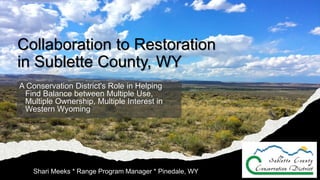
- 1. Collaboration to Restoration in Sublette County, WY A Conservation District's Role in Helping Find Balance between Multiple Use, Multiple Ownership, Multiple Interest in Western Wyoming Shari Meeks * Range Program Manager * Pinedale, WY
- 2. The Road to Restoration • Inception of the Range Program • Attributes of the La Barge Landscape • Project-level collaboration • Insights from partners along the way
- 3. Where in the heck is Sublette County?
- 6. What does our Range Program do? The Range Program provides technical assistance to private landowners and land management agencies (both federal and state) throughout the year. Team members strive to meet the needs of a community which relies on a multiple use and a predominantly federally managed landscape, while also promoting private property rights. Range staff strive to create positive, long term, cooperative relationships between the Conservation District, Sublette County landowners, and land management agency personnel.
- 8. What makes the area so unique? • Natural Resources • Multiple Use • Multiple Ownership • Multiple Interest
- 10. Landscape Natural Features & Resources
- 11. Multiple Use
- 13. Livestock Grazing Permittees Recreation Interests
- 15. Federal Regulations that Impact Management • Federal Land Policy & Management Act • BLM Pinedale Field Office Resource Management Plan • BLM Pinedale Field Office Coordinating Activity Plan • USFS Land Resource Management Plan • Sage Grouse Amendments • Taylor Grazing Act • WDEQ Water Requirements • Frail Lands Policy • Colorado River Basin Salinity Control Act of 1974 • Wyoming Office of State Lands & Investments Policies
- 16. So, How Did We Get From Here… To Here…
- 17. Significant (repeated) Erosion Events
- 18. Unraveling of a Frail Landscape 1700’s Land Acquisition 1860’s Homesteadi ng the West 1907 First Drilling in La Barge Area 1920 Mineral Leasing Act 1935 Taylor Grazing Act 1950’s Sagebrush Spraying 1960’s Range Surveys – 1961- 62 NEPA - 1969 1967-72 Grazing Authorizations AUM reductions 1976 FLPMA 1988 RMP 1991 Big Piney-La Barge CAP 2008 Update d RMP
- 19. The way to get started is to quit talking and begin doing. Walt Disney
- 20. Restoration of an Unraveling Landscape 2006 Highway Dept Replace Culverts Mule Deer Project 2008 Riparian Assessments & Rangeland Health 2009 Grazing NEPA - remanded 2016 Big Erosion Events 2016 Rangeland Health Assessment Grant – Phase I 2017 Culvert Inventor y Initiated 2018 Ecological Site Inventory 2018 Rangeland Health Assessment Grant – Phase II 2020 Decommissionin g Wells and Reclamation 2021 Disturbanc e Inventory
- 21. Collaboration = Restoration Wildlife Habitat Habitat Inventory (2006) Wyoming Range Mule Deer Project Development Habitat Improvement Projects (2013-present) Livestock Grazing On the landscape since the 1900’s A lengthy history of management RHAP Phase I (2016-2018) RHAP Phase 2 (2019-2021) Project Implementation and Adaptive Management (2021 to future) Excessive Erosion C&D Livestock (Spring 2016) Highway Department Culvert Issues (Spring 2006, 2016) BLM & SCCD Culvert Inventory (2017-2019) Engineering (2018-2021) Restoration Project Implementation (2021-future) La Barge Platform Oldest oil and gas field in Wyoming BLM & SCCD Culvert Inventory (2017-2019) Reclamation and Infrastructure Improvements Rangeland Health ID Team Assessed Rangeland Health for Permit Renewal (2009) Stream Dynamics Tour (2020) Ecological Site Inventory (2018- 2021) Disturbance Inventory (2021-2022) 2006 2022 Present Day
- 22. Erosion Concerns in the La Barge Platform Wildlife Habitat Habitat Inventory (2006?) Wyoming Range Mule Deer Project Development (YR) Habitat Improvement Projects (2013-present) Livestock Grazing On the landscape since the 1900’s A lengthy history of management RHAP Phase I (2016-2018) RHAP Phase 2 (2019-2021) Project Implementation and Adaptive Management (2021 to future) Excessive Erosion C&D Livestock (Spring 2016) Highway Department Culvert Issues (Spring 2006, 2016) BLM & SCCD Culvert Inventory (2017-2019) Engineering (2018-2021) Restoration Project Implementation (2021-future) La Barge Platform Oldest oil and gas field in Wyoming BLM & SCCD Culvert Inventory (2017-2019) Reclamation and Infrastructure Improvements Rangeland Health ID Team Assessed Rangeland Health for Permit Renewal (2009) Stream Dynamics Tour (2020) Ecological Site Inventory (2018- 2021) Disturbance Inventory (2021-2022) 2009 (or whatever early date) 2022 Present Day
- 23. Disturbed Acres
- 25. Addressing Excessive Erosion Within the La Barge Platform This Photo by Unknown Author is licensed under CC BY-SA-NC
- 28. Watershed Inventory Attributes Culverts Intersect Streams 1. Culvert Type 2. Culvert Diameter 3. Culvert Length 4. Channel Above Culvert 5. Erosion Below Culvert 6. Drop Length 7. Photos 8. Notes 9. Culvert Function 10. Inlet Occluded 11. Outlet Occluded Incisements Headcuts Culverts Intersect Roads 1. Stream Type 2. Culvert Type 3. Culvert Material 4. Culvert Condition 5. Culvert Diameter 6. Culvert Length 7. Inlet Protection 8. Channel Above Culvert 9. Outlet Protection 10. Erosion Below Culvert 12. Culvert Function 13. Occlusion Location 14. Obstruction Type 15. Occlusion Extent 16. Road Surface 17. Road Drainage 18. Barrow Ditches 19. Threats to the Road 20. Photos 1. Location 2. Channel Attributes 3. Fish Passage 4. Notes 5. Culvert Influence 6. Incisement Depth 7. Photos 1. Culvert Influence 2. Resistance 3. Drop Type 4. Drop Length 5. Notes 6. Photos
- 29. Pictures Speak 1000 Words Above Culvert Inlet Culvert Inlet Below Culvert Outlet Culvert Outlet Subsequent Incisement
- 30. Big Piney – La Barge Watershed Restoration Project >3000 Culverts Inventoried 13% Functioning 50% Contributing to incised channels below culverts.
- 31. Erosion Concerns in the La Barge Platform Partners • Bureau of Land Management • Oil & Gas Operators • Grazing Permittees SCCD’S Role • Resource Expertise • Assist with Implementation • ID Team Member • Grant Acquisition & Management
- 32. Wildlife Habitat Wildlife Habitat Habitat Inventory (2006) Wyoming Range Mule Deer Project Development Habitat Improvement Projects (2013-present) Livestock Grazing On the landscape since the 1900’s A lengthy history of management RHAP Phase I (2016-2018) RHAP Phase 2 (2019-2021) Project Implementation and Adaptive Management (2021 to future) Excessive Erosion C&D Livestock (Spring 2016) Highway Department Culvert Issues (Spring 2006, 2016) BLM & SCCD Culvert Inventory (2017-2019) Engineering (2018-2021) Restoration Project Implementation (2021-future) La Barge Platform Oldest oil and gas field in Wyoming BLM & SCCD Culvert Inventory (2017-2019) Reclamation and Infrastructure Improvements Rangeland Health ID Team Assessed Rangeland Health for Permit Renewal (2009) Stream Dynamics Tour (2020) Ecological Site Inventory (2018- 2021) Disturbance Inventory (2021-2022) 2006 2022 Present Day
- 34. Big Game Crucial Winter Range Designations
- 36. Wyoming Range Mule Deer Project Partners • Teton Science School • Bureau of Land Management • Wyoming Game and Fish Department • Natural Resources Conservation Service • Livestock Grazing Permittees SCCD’S Role • Resource Expertise • Manage funds • Contract riders for project success • Assist with implementation
- 37. Rangeland Health Wildlife Habitat Habitat Inventory (2006?) Wyoming Range Mule Deer Project Development (YR) Habitat Improvement Projects (2013-present) Livestock Grazing On the landscape since the 1900’s A lengthy history of management RHAP Phase I (2016-2018) RHAP Phase 2 (2019-2021) Project Implementation and Adaptive Management (2021 to future) Excessive Erosion C&D Livestock (Spring 2016) Highway Department Culvert Issues (Spring 2006, 2016) BLM & SCCD Culvert Inventory (2017-2019) Engineering (2018-2021) Restoration Project Implementation (2021-future) La Barge Platform Oldest oil and gas field in Wyoming BLM & SCCD Culvert Inventory (2017-2019) Reclamation and Infrastructure Improvements Rangeland Health ID Team Assessed Rangeland Health for Permit Renewal (2009) Stream Dynamics Tour (2020) Ecological Site Inventory (2018- 2021) Disturbance Inventory (2021-2022) 2009 (or whatever early date) 2022 Present Day
- 39. Ecological Site Inventory Plan & Field Procedures
- 40. Line 1 Line 2 Line 3
- 42. Ecological Site Inventory SCCD’S Role • Hire & Supervise inventory crew • Collaboration with BLM, NRCS, WGFD, Permittees • Manage the finances • Collect, Compile and QC the data • Write and Distribute the Final Report
- 44. Disturbance Inventory Plan & Field Procedures
- 45. Line 1 Line 2 Line 3
- 46. Disturbance Inventory SCCD’S Role • Hire & Supervise inventory crew • Collaboration with BLM, NRCS, O&G Operators • Manage the finances • Collect, Compile and QC the data • Write and Distribute the Final Report
- 47. Livestock Grazing Wildlife Habitat Habitat Inventory (2006?) Wyoming Range Mule Deer Project Development (YR) Habitat Improvement Projects (2013-present) Livestock Grazing On the landscape since the 1900’s A lengthy history of management RHAP Phase I (2016-2018) RHAP Phase 2 (2019-2021) Project Implementation and Adaptive Management (2021 to future) Excessive Erosion C&D Livestock (Spring 2016) Highway Department Culvert Issues (Spring 2006, 2016) BLM & SCCD Culvert Inventory (2017-2019) Engineering (2018-2021) Restoration Project Implementation (2021-future) La Barge Platform Oldest oil and gas field in Wyoming BLM & SCCD Culvert Inventory (2017-2019) Reclamation and Infrastructure Improvements Rangeland Health ID Team Assessed Rangeland Health for Permit Renewal (2009) Stream Dynamics Tour (2020) Ecological Site Inventory (2018- 2021) Disturbance Inventory (2021-2022) 2009 (or whatever early date) 2022 Present Day
- 48. Timeline of Livestock Grazing on Landscape
- 49. Rangeland Health Assessment Program (RHAP) This Photo by Unknown Author is licensed under CC BY
- 51. NLBC RHAP – Phase 1 Range Improvement Inventory
- 52. NLBC RHAP – Phase 1 Monitoring Plan and Site Book
- 53. NLBC RHAP – Phase 1 Annual Monitoring Reports
- 54. NLBC RHAP – Phase 1 Stream Dynamics Tour
- 55. NLBC RHAP – Phase 2 Building a Grazing Plan • Education! Education! Education! • Agenda’s and Note Pages • Create a Folder for Everyone to Keep Documentation • Distribute Meeting Notes • Hold People Accountable • Always Tie Back to the Common Goals and Objectives • Homework • “In Meeting” Group Projects
- 56. NLBC RHAP – Phase 2 Building a Grazing Plan
- 57. Meeting 1 (Establishing Common Ground) Define Common Values, Goals and Objectives among the group. Make sure we all understand what the process is. Meeting 2 (State of the Range – Trend and RIPS) Review Session 1 Range Improvement Inventory Vegetation Trend Analysis Homework Meeting 3 (State of the Range ESI and Treatments) Turn in Homework, Review Session 2 Wildlife Habitat Resource Information Vegetation Treatments Ecological Site Inventory Results Homework Meeting 4 (Putting It All Together) Turn in Homework, Review Session 3 Review Ecological Site Concepts Identify Issues on the Landscape Together A History Review and Recommendation for Moving Forward Homework Meeting 5 (Strategy Building 1) Answering Common Questions Among Stakeholders Review of Most Recent Environmental Assessment Review of Most Recent Standards and Guidelines Review of Existing AMP Develop Livestock Rotations that Meet Current Mgmt. Concerns Homework Meeting 6 (Strategy Building 2) Review Rotations Developed at Last Meeting Review Slope/Distance to Water Analysis Create a List of RIPS Needed to Implement Each Rotation Meeting 7 (Strategy Building 3) Determine Rotations and RIPS that Fall in Line with Initial Goals State Lands RIPS Information BLM RIPS Information Development Strategy (Funding & Prioritization) Mini Meetings to ID Projects for 2021 Meeting 8 (Fall Grazing Season & Future Strategy) 2021 Monitoring Results & Grazing Season Discussion Wildlife Projects Update RHAP Review and Comments Grazing Plan Review Implementation Strategy Next Steps – Coordinate with O&G NLBC RHAP – Phase 2 Building a Grazing Plan
- 58. Grazing Plan
- 61. Livestock Grazing - RHAP Partners • 6 Permittees • United States Forest Service • Bureau of Land Management • Natural Resources Conservation Service • Wyoming Game and Fish Department • University of Wyoming • Wyoming Office of State Lands & Investments SCCD’S Role • Resource Expertise • Facilitator
- 62. So, That’s How We Got From Here… To Here…
- 63. Two things catapult the District’s ability to be at the table…
- 65. Cooperating Agency Status Defining Cooperating Agency Any Federal, State, or Local agency that has jurisdiction by law or special expertise (40CFR 1508.5). Jurisdiction by law means the agency has authority to approve a proposal. Federal Land Management Planning - BLM Resource Management Plans - USFS Forest Plans - Travel Management Plans - Permit Renewal (grazing, recreation/special use, etc) - Watershed Projects - …and others such as Oil and Gas Development Pre- and Post-Decision Involvement • NEPA Process Support through providing data collection and/or documentation • Environmental Assessment or Environmental Impact Statement Scoping, Review & Commenting • Alternative or Preferred Action Development submitted to the Agency • ID Team Member, Leader involved in development of NEPA document • Protest/Appeal or Objection of NEPA document
- 67. Wyoming Game and Fish Department Troy Fieseler – Habitat Biologist Luke Schultz – Fisheries Biologist Bureau of Land Management Mark Thonhoff– Wildlife Biologist Janet Bellis – Hydrogeologist Kelsey Smith – Natural Resource Specialist Amber Robbins – Range Specialist Doug Linn & Travis Chewning - Managers
- 68. United States Forest Service Chad Hayward – BTNF Range Program Supervisor Buck Draney – Range Technician Natural Resources Conservation Service Jennifer Hayward – District Conservationist Karen Clause – Area Range Specialist Dillon Gray – Soil Survey Lead Bryan Christensen – Ecological Site Specialist
- 69. Oil & Gas Operators Williams EOG Resources Inc. Hilcorp Energy Company Wexpro Company Exxon Livestock Grazing Permittees Sims Ranch Mosquito Creek Ranch JF Ranch Milleg Ranch Rockin’ Chair Cattle Co. C&D Livestock Wyoming State Lands & Investments A’Lisa Hoffman - Specialist
- 70. Project Contractors DOWL River Design Group Jakola Engineering Range Riders Teton Science School University of Wyoming – Facilitation Mary Jones Stream Dynamics Wyoming Dept. of Agriculture Justin Caudill – District Liaison
- 71. Funding Sources Jonah Interagency Office – Mitigation Fund Natural Resources Conservation Service – EQIP, SGI Livestock Grazing Board Wyoming State Lands & Investments Bureau of Land Management Wyoming Water Development Commission Wyoming Wildlife Natural Resources Trust Wyoming Game and Fish Department Wyoming Landscape Conservation Initiative Permittees Oil & Gas Industry
- 73. The Road to Restoration • Inception of the Range Program • Attributes of the La Barge Landscape • Project-level collaboration • Insights from partners along the way
- 74. Thank you Shari Meeks Range Program Manager Sublette County Conservation District Pinedale, WY smeeks@sublettecd.com
Notas do Editor
- So, this is the story about how we got from here, to here.
- As we started to look at the area further, we noticed sediment moving everywhere, not just in the alluvial fans, where you would expect it.
- These are typical photos of our inventory
- Using the BLM Technical Reference for Ecological Site Inventory, we developed Plan and Procedures for consistency. In 2018, SCCD hired 3 technicians and 1 project lead to collect vegetation data on 120 points over the course of 2 years. The points were stratified based on ecological site.
- Second, the BLM obtained funding to better understand the ecological integrity of its reclaimed lands. In 2020, SCCD hired 1 technician for project support and completed the data collection on 35 sites. We were then responsible for compiling the data and writing the report.
- We designed the project collaboratively with BLM, NRCS, and Oil & Gas companies while also communicating with Permittees. We completed a similar protocol as the Ecological Site Inventory so we could eventually develop relationships between datasets, if possible in the future.
- We are still compiling the data and will have the report finalized by the end of this year.
- Switching gears now to Livestock grazing. Livestock grazing on this landscape dates back to the early late 1800’s to the early 1900’s when homesteaders started moving out west on the likes of the Oregon Trail. As we learned earlier, settlement was encouraged throughout the West through various acts and provisions made by our young US government.
- Over the years, folks have desired to complete permit renewal to improve flexibility of permit holders and to improve range condition. That said, during those processes, there have been many ideas on “how” to improve range condition under grazing. In 2009, SCCD was approached by the BLM to assist them with implementing riparian health assessments and rangeland health assessments, which were intended to inform a subsequent EA and grazing authorization. Soon after, the EA was out for public comment. Permittees were not happy with the DRAFT EA and neither were the likes of non-profits that didn’t want livestock in the area. Period. This EA quickly got remanded due to the contention. In 2016, a new Range Specialist for the area asked the SCCD to assist them with developing a monitoring plan and working with the permittees. And here is where our story starts with the graziers.
- The State of Wyoming is fortunate to have a legislature that understands the importance of collaboration and rangeland health. Here we get the privilege fo hearing from Justin Caudill, about the Rangeland Health Assessment Program, which has enabled our Range Program to engage in the request from the BLM.
- We were funded for what we call Phase 1. Of which we did a lot of inventory! Livestock grazing infrastructure were inventoried so we knew what was on the ground.
- We created a monitoring plan – of which we create these “site books”. They indicate the site chosen, its background, correlation to ecological site, and the goals and objectives- and what method was agreed upon to inform those goals and objectives. Then we set up a schedule for monitoring.
- On an annual basis, a monitoring report is then created for all partners to help inform them of the conditions that year, utilization on the landscape, and to see where we are in terms of meeting our goals and objectives.
- Because resource concerns had been identified on the ladncsape prior to the RHAP- we had set aside some of the funds to bring in an outside opinion or a resource expert. We asked Van Clothier with Stream Dynamics to come and help us understand the landscape better and how we need to make changes to keep water on the landscape.
- We then had a foundation built where we could then start developing a grazing plan that was agreeable to all partners. We met several times, I gave out homework and then we had group projects where we interacted at different meetings. They were meant to be dynamic, helpful, and to encourage the group to identify resource concerns and how to address them. Everyone had the opportunity to participate.
- We started with identifying values on the landscape – and then the goals and objectives for each value. We kept coming back to this during every meeting, to maintain our trajectory.
- We oftentimes had anywhere from 12-20 people engaged at our meetings. The meetings were progressive. At every meeting there was an education component, a group project, and homework to reflect on what was learned. Each group project and homework assignment actively informed the writing of the final grazing plan.
- The final result is a DRAFT grazing and implementation plan. In order to implement deferment or rest on the allotment, water must be reliable. Now we are applying for grants to help write the NEPA in order to drill several strategically placed wells to promote flexibility in livestock grazing for the future.
- It took some poking and prodding, but we had two producers that were willing to reflect on the process.
- As a non-regulatory agency, so, what was the key to SCCD’s involvement? The SCCD has been a very pro-active district for many years. Much of that is due to the intertwined land ownership of public and private lands throughout Sublette County. We not only assist with private land management through Conservation Planning with our Sister Agency NRCS, but we have also found that there are many benefits to being involved in the federal NEPA processes with BLM and USFS. These benefits do not only benefit the District and its mission, but it also has many direct benefits relating to our constituents as I will get to later. What we have found over the years, and has really become apparent to me in my short time at SCCD, is that there are 2 things that really can catapult your Districts’ ability to be an effective participant in public land management.
- Relationships – these can either be pre-existing or as developed through projects or even perhaps community involvement or other interaction – As relationships are cultivated, it creates an atmosphere of respect where all partner inputs are valued Relationships built on positive interactions are very helpful in collaboration and projects tend to make exponentially greater progress toward solutions and achievement of boots-on-the-ground But what if those relationships don’t exist? I would love to tell you just to go make friends with agency staff and you will be invited to everything they are ever doing…but that’s really not the case either… Cooperating Agency Status- is the other key to unlocking the door for invitation into the NEPA process with federal agencies. Cooperating Agency Status provides the ability to get your foot in the door even if you don’t know a soul in the room.
- Cooperating Agency Status is a benefit of being an entity of local government. The Code of Federal Regulations gives local agencies, such as Conservation Districts, the ability to be on the front lines of Federal land use planning. Cooperating Agency Status gives you the ability to review documents and decisions before they go to the public comment period for any projects that require NEPA. 2) Districts can be involved at any level they want…from attending scoping meetings, to Cooperating Agency review of DRAFTS to attending more in depth planning meetings and having conversations to participation in alternative development…you may even have the opportunity to go as far as having a seat on the ID Team. 3) The limiting factor is just how much time you can commit to the planning of any one project or multiple projects. As mentioned before, Cooperating Agency Status, is an opportunity that gives your District a seat at the table prior to any decisions going public. If you are interested, you have to request from the Agency, Status as Cooperating Agency on projects. You can do this on a project by project basis, as well as blanket MOU’s such as requesting Cooperating Agency Status on all grazing permit renewals for a certain field office.
- A few parting words from our partners…
- While the road is long, its honestly the relationships built along the way that matter the most when on the road to restoration.
- Even building this presentation was collaborative! I would be remiss if I didn’t give credit to these ladies right here. The neighboring, Teton Conservation District provided filming equipment and expertise from Phoebe Coburn. Jessica Artz on the left, ensured recording success and provided for the editing of all interviews.