Generation of short_duration_isohyetal_maps_for_raichur_district_karnataka_ijariie10185
•
0 gostou•46 visualizações

In raichur district log normal distribution is used to estimate the rainfall depth using 25 raingauge stations with nineteen years of rainfall data and isohyetal maps were generated for duration of 5,10,15,30,60,120,720 and 1440 minutes of different return period.
![Vol-5 Issue-2 2019 IJARIIE-ISSN(O)-2395-4396
10185 www.ijariie.com 3235
The Study area Raichur District, Karnataka is located between 76°14'3.36"E to 77°35'32.20"E and
15°32'31.78"N to 16°33'26.46"N. Twenty five rainguage station namely Chandrabanda, Maski, Raichur Obsy,
Raichur Railway, Lingasugur, Deodurga, Askihal, Gabbur, Hatti, Mudgal, Kurdi, Kallur, Kavatal, Sirwar,
Yermarus, Sindnoor Pwd, Manvi, , Deosugur,Yergera, Jagarkal, Kalmala, Salgunda, Turvihal, Jawalgere,
Kunnatgi, And Maski has been taken From 1998 to 2016. It is located at north western part of Karnataka.
2.2 Methodology
Fig 2 Methodology adopted for Isohyetal maps
Data collection – Daily rainfall data for stations for the years 1998 to 2016
Estimation of Missing rainfall values by Normal Ratio Method ) Px = 1/M [P1 + P2 + ….. + Pm]
The maximum 24 hour rainfall data for each year was selected
Maximum short duration rainfall for various return periods are calculated using Log normal Distribution
The rainfall depth is estimated
Development of Isohyetal maps
3 Results and Discussions
3.1 Estimation of Short Duration Rainfall
Indian Meteorological Department (IMD) use an empirical reduction formula (Equation 3.1) for estimation of
various duration like 1-hr, 2-hr, 3-hr, 5-hr, 8-hr rainfall values from annual maximum values.
𝑃𝑡 = 𝑃24 (
𝑡
24
)
1
3
(3.1)
where, Pt is the required rainfall depth in mm at t-hr duration,
P24 is the daily rainfall in mm and t is the duration of rainfall for which the rainfall depth is required in hr.
Short duration rainfall by using IMD empirical formula for Mudgal station is tabulated in Table 1.
Similarly short duration rainfall for remaining stations is calculated mean and standard deviation is determined.](data:image/gif;base64,R0lGODlhAQABAIAAAAAAAP///yH5BAEAAAAALAAAAAABAAEAAAIBRAA7)
Recomendados
Recomendados
Mais conteúdo relacionado
Semelhante a Generation of short_duration_isohyetal_maps_for_raichur_district_karnataka_ijariie10185
Semelhante a Generation of short_duration_isohyetal_maps_for_raichur_district_karnataka_ijariie10185 (20)
Mais de Mohammed Badiuddin Parvez
Mais de Mohammed Badiuddin Parvez (20)
Último
Último (20)
Generation of short_duration_isohyetal_maps_for_raichur_district_karnataka_ijariie10185
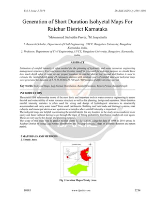
- 1. Vol-5 Issue-2 2019 IJARIIE-ISSN(O)-2395-4396 10185 www.ijariie.com 3234 Generation of Short Duration Isohyetal Maps For Raichur District Karnataka 1 Mohammed Badiuddin Parvez, 2 M .Inayathulla 1. Research Scholar, Department of Civil Engineering ,UVCE, Bangalore University, Bangalore ,Karnataka, India. 2. Professor, Department of Civil Engineering ,UVCE, Bangalore University, Bangalore ,Karnataka, India. ABSTRACT Estimation of rainfall intensity is often needed for the planning of hydraulic and water resources engineering management structures. Everyone knows that it rains, runoff is generated for a design purpose we should know how much depth often it rains on our project location. In raichur district log normal distribution is used to estimate the rainfall depth using 25 raingauge stations with nineteen years of rainfall data and isohyetal maps were generated for duration of 5,10,15,30,60,120,720 and 1440 minutes of different return period. Key words: Isohyetal Maps, Log Normal Distribution, Rainfall Duration, Return Period, Rainfall Depth INTRODUCTION The rainfall IDF relationship in one of the most basic and important tools in water resource engineering to assess the risk and vulnerability of water resource structure as well as for planning, design and operation. Short-duration rainfall intensity statistics is often used for sizing and design of hydrological structures to structurally accommodate and carry water runoff from small catchments. Building roof rain loads and drainage systems, road culverts, and municipal storm sewer systems are examples where rainfall intensity is important. The isohyetal maps are helpful in estimating the rainfall depth for any location in the study area considered more easily and faster without having to go through the rigor of fitting probability distribution models all over again. These are very useful for design and planning purposes. The scope of this study was to predict rainfall depth for the stations using the data of 1998 to 2016 spread in Raichur District by using Log Normal distribution and Develop Isohyetal Maps of different duration and return period. 2 MATERIALS AND METHODS 2.1 Study Area Fig 1 Location Map of Study Area
- 2. Vol-5 Issue-2 2019 IJARIIE-ISSN(O)-2395-4396 10185 www.ijariie.com 3235 The Study area Raichur District, Karnataka is located between 76°14'3.36"E to 77°35'32.20"E and 15°32'31.78"N to 16°33'26.46"N. Twenty five rainguage station namely Chandrabanda, Maski, Raichur Obsy, Raichur Railway, Lingasugur, Deodurga, Askihal, Gabbur, Hatti, Mudgal, Kurdi, Kallur, Kavatal, Sirwar, Yermarus, Sindnoor Pwd, Manvi, , Deosugur,Yergera, Jagarkal, Kalmala, Salgunda, Turvihal, Jawalgere, Kunnatgi, And Maski has been taken From 1998 to 2016. It is located at north western part of Karnataka. 2.2 Methodology Fig 2 Methodology adopted for Isohyetal maps Data collection – Daily rainfall data for stations for the years 1998 to 2016 Estimation of Missing rainfall values by Normal Ratio Method ) Px = 1/M [P1 + P2 + ….. + Pm] The maximum 24 hour rainfall data for each year was selected Maximum short duration rainfall for various return periods are calculated using Log normal Distribution The rainfall depth is estimated Development of Isohyetal maps 3 Results and Discussions 3.1 Estimation of Short Duration Rainfall Indian Meteorological Department (IMD) use an empirical reduction formula (Equation 3.1) for estimation of various duration like 1-hr, 2-hr, 3-hr, 5-hr, 8-hr rainfall values from annual maximum values. 𝑃𝑡 = 𝑃24 ( 𝑡 24 ) 1 3 (3.1) where, Pt is the required rainfall depth in mm at t-hr duration, P24 is the daily rainfall in mm and t is the duration of rainfall for which the rainfall depth is required in hr. Short duration rainfall by using IMD empirical formula for Mudgal station is tabulated in Table 1. Similarly short duration rainfall for remaining stations is calculated mean and standard deviation is determined.
- 3. Vol-5 Issue-2 2019 IJARIIE-ISSN(O)-2395-4396 10185 www.ijariie.com 3236 . Year Rainfall (mm) 𝑃𝑡 = 𝑃24 ( 𝑡 24 ) 1 3 in mm where, time t is in hours Duration in Minutes 5 10 15 30 60 120 720 1440 1998 60.0000 9.0856 11.4472 13.1037 16.5096 20.8008 26.2074 47.6220 60.0000 1999 100.0000 15.1427 19.0786 21.8395 27.5161 34.6681 43.6790 79.3701 100.0000 2000 112.0000 16.9598 21.3680 24.4603 30.8180 38.8282 48.9205 88.8945 112.0000 2001 73.4000 11.1147 14.0037 16.0302 20.1968 25.4464 32.0604 58.2576 73.4000 2002 51.0000 7.7228 9.7301 11.1382 14.0332 17.6807 22.2763 40.4787 51.0000 2003 110.0000 16.6569 20.9864 24.0235 30.2677 38.1349 48.0469 87.3071 110.0000 2004 65.0000 9.8427 12.4011 14.1957 17.8854 22.5342 28.3914 51.5905 65.0000 2005 155.0000 23.4711 29.5718 33.8512 42.6499 53.7355 67.7025 123.0236 155.0000 2006 66.0000 9.9941 12.5919 14.4141 18.1606 22.8809 28.8282 52.3842 66.0000 2007 90.0000 13.6284 17.1707 19.6556 24.7645 31.2013 39.3111 71.4330 90.0000 2008 55.0000 8.3285 10.4932 12.0117 15.1338 19.0674 24.0235 43.6535 55.0000 2009 220.0000 33.3138 41.9729 48.0469 60.5353 76.2697 96.0939 174.6141 220.0000 2010 130.0000 19.6854 24.8022 28.3914 35.7709 45.0685 56.7827 103.1811 130.0000 2011 35.0000 5.2999 6.6775 7.6438 9.6306 12.1338 15.2877 27.7795 35.0000 2012 73.0000 11.0541 13.9274 15.9428 20.0867 25.3077 31.8857 57.9401 73.0000 2013 67.0000 10.1456 12.7827 14.6325 18.4358 23.2276 29.2649 53.1779 67.0000 2014 46.5000 7.0413 8.8715 10.1554 12.7950 16.1206 20.3107 36.9071 46.5000 2015 82.6000 12.5078 15.7589 18.0394 22.7283 28.6358 36.0789 65.5597 82.6000 2016 47.7000 7.2230 9.1005 10.4174 13.1252 16.5367 20.8349 37.8595 47.7000 Table1 Short duration rainfall for Mudgal 3.2 Development of Isohyetal Maps The Isohyetal maps were generated for Raichur considering 25 stations with 19 years data, for various selected return periods such as 25, 50, 75 and 100 years based on design requirements. Considering lower return periods might not be appropriate considering the fact that, generally the life of a structure is more than 25 years. The short durations of 5, 10, 15, 30, 60. 120, 720 and 1440 minutes isohyetal maps were generated as the intensity decreases with the increase in duration. 3.3 Log Normal Distribution Table 2 Rainfall depth in mm for 25 years return period Sl No Raingauge Station Time (t )in minutes 5 10 15 30 60 120 720 1440 1 Chandrabanda 14.2698 17.9789 20.5807 25.9300 32.6698 41.1614 74.7951 94.2360 2 Yergera 17.4266 21.9562 25.1336 31.6663 39.8971 50.2672 91.3416 115.0832 3 Raichur railway 16.5250 20.8203 23.8333 30.0280 37.8329 47.6665 86.6158 109.1291
- 4. Vol-5 Issue-2 2019 IJARIIE-ISSN(O)-2395-4396 10185 www.ijariie.com 3237 4 Askihal 17.1483 21.6055 24.7321 31.1606 39.2598 49.4643 89.8826 113.2450 5 Raichur 16.0651 20.2408 23.1700 29.1923 36.7800 46.3399 84.2052 106.0920 6 Yermarus 17.8866 22.5358 25.7970 32.5022 40.9502 51.5940 93.7525 118.1208 7 Jagerkal 12.7696 16.0887 18.4169 23.2038 29.2350 36.8338 66.9315 84.3284 8 Deosugur 16.7005 21.0414 24.0864 30.3469 38.2348 48.1728 87.5357 110.2881 9 Kalmala 15.9501 20.0959 23.0040 28.9833 36.5166 46.0081 83.6022 105.3322 10 Gabbur 16.8482 21.2275 24.2994 30.6153 38.5729 48.5988 88.3099 111.2635 11 Deodurg 17.5715 22.1388 25.3426 31.9296 40.2288 50.6851 92.1010 116.0400 12 Kallur 12.1718 15.3356 17.5549 22.1177 27.8666 35.1097 63.7986 80.3812 13 Kurdi 17.6578 22.2475 25.4670 32.0864 40.4263 50.9339 92.5531 116.6096 14 Manvi 17.4059 21.9300 25.1036 31.6286 39.8495 50.2072 91.2326 114.9459 15 Sirwar 15.7136 20.1636 23.3418 28.7887 35.9751 45.3258 82.3625 103.7702 16 Kavatal 17.4824 22.0265 25.2140 31.7676 40.0247 50.4280 91.6337 115.4513 17 Jawalagera 20.1279 25.3597 29.0296 36.5749 46.0815 58.0591 105.5004 132.9222 18 Salgunda 14.9179 18.7954 21.5153 27.1076 34.1535 43.0307 78.1919 98.5157 19 Sindanoor pwd 20.5132 25.8451 29.5853 37.2751 46.9637 59.1705 107.5200 135.4667 20 Kunnatgi 17.6310 22.2138 25.4284 32.0378 40.3650 50.8568 92.4129 116.4329 21 Turvihal 13.1867 16.6143 19.0186 23.9619 30.1902 38.0372 69.1182 87.0835 22 Maski 13.5372 17.0558 19.5240 24.5988 30.9925 39.0481 70.9551 89.3978 23 Mudgal 14.6723 18.4860 21.1612 26.6614 33.5913 42.3223 76.9048 96.8940 24 Hatti 19.6381 24.7425 28.3231 35.6848 44.9601 56.6462 102.9329 129.6873 25 Lingasugur 14.0183 17.6619 20.2178 25.4729 32.0938 40.4357 73.4765 92.5746 Table 3 Rainfall depth in mm for 50 years return period Sl No Raingauge Station Time (t )in minutes 5 10 15 30 60 120 720 1440 1 Chandrabanda 14.3095 18.0289 20.6379 26.0022 32.7607 41.2759 75.0033 94.4982 2 Yergera 17.4694 22.0101 25.1953 31.7441 39.9950 50.3906 91.5658 115.3657 3 Raichur railway 16.5669 20.8730 23.8936 30.1041 37.9287 47.7872 86.8351 109.4054 4 Askihal 17.1967 21.6665 24.8019 31.2484 39.3706 49.6038 90.1361 113.5644 5 Raichur 16.1029 20.2884 23.2244 29.2610 36.8665 46.4489 84.4032 106.3414 6 Yermarus 17.9323 22.5933 25.8629 32.5852 41.0548 51.7258 93.9920 118.4224 7 Jagerkal 12.8074 16.1364 18.4715 23.2727 29.3217 36.9431 67.1300 84.5786 8 Deosugur 16.7389 21.0897 24.1417 30.4167 38.3226 48.2834 87.7368 110.5415 9 Kalmala 15.9942 20.1514 23.0676 29.0633 36.6175 46.1352 83.8332 105.6232 10 Gabbur 16.9038 21.2975 24.3795 30.7162 38.7000 48.7590 88.6009 111.6302 11 Deodurg 17.6072 22.1838 25.3940 31.9945 40.3105 50.7881 92.2881 116.2757 12 Kallur 12.1924 15.3615 17.5845 22.1550 27.9136 35.1689 63.9062 80.5167 13 Kurdi 17.7143 22.3186 25.5484 32.1890 40.5556 51.0968 92.8491 116.9825 14 Manvi 17.4484 21.9836 25.1649 31.7058 39.9468 50.3298 91.4554 115.2266 15 Sirwar 15.7537 20.2216 23.4145 28.8661 36.0671 45.4416 82.5730 104.0354
- 5. Vol-5 Issue-2 2019 IJARIIE-ISSN(O)-2395-4396 10185 www.ijariie.com 3238 16 Kavatal 17.5393 22.0981 25.2960 31.8710 40.1549 50.5920 91.9319 115.8269 17 Jawalagera 20.1866 25.4336 29.1142 36.6816 46.2159 58.2284 105.8079 133.3097 18 Salgunda 14.9530 18.8396 21.5659 27.1714 34.2338 43.1319 78.3758 98.7473 19 Sindanoor pwd 20.5742 25.9219 29.6731 37.3858 47.1032 59.3463 107.8393 135.8690 20 Kunnatgi 17.6786 22.2737 25.4971 32.1243 40.4741 50.9941 92.6624 116.7474 21 Turvihal 13.2120 16.6461 19.0550 24.0078 30.2479 38.1100 69.2505 87.2501 22 Maski 13.5662 17.0924 19.5659 24.6515 31.0589 39.1318 71.1071 89.5894 23 Mudgal 14.7014 18.5226 21.2031 26.7142 33.6578 42.4062 77.0572 97.0860 24 Hatti 19.6810 24.7965 28.3849 35.7627 45.0582 56.7698 103.1576 129.9704 25 Lingasugur 14.0439 17.6943 20.2549 25.5196 32.1526 40.5098 73.6111 92.7442 Table 4 Rainfall depth in mm for 75 years return period Sl No Raingauge Station Time (t )in minutes 5 10 15 30 60 120 720 1440 1 Chandrabanda 14.3226 18.0454 20.6568 26.0259 32.7906 41.3136 75.0718 94.5845 2 Yergera 17.4835 22.0279 25.2156 31.7697 40.0273 50.4312 91.6396 115.4587 3 Raichur railway 16.5807 20.8904 23.9135 30.1291 37.9603 47.8270 86.9073 109.4964 4 Askihal 17.2126 21.6865 24.8249 31.2774 39.4070 49.6497 90.2196 113.6695 5 Raichur 16.1153 20.3041 23.2424 29.2836 36.8950 46.4848 84.4684 106.4235 6 Yermarus 17.9473 22.6123 25.8846 32.6125 41.0892 51.7691 94.0708 118.5218 7 Jagerkal 12.8199 16.1521 18.4895 23.2954 29.3503 36.9791 67.1954 84.6609 8 Deosugur 16.7515 21.1057 24.1599 30.4396 38.3515 48.3199 87.8030 110.6249 9 Kalmala 16.0087 20.1697 23.0885 29.0897 36.6507 46.1770 83.9092 105.7190 10 Gabbur 16.9221 21.3205 24.4059 30.7495 38.7419 48.8117 88.6968 111.7509 11 Deodurg 17.6190 22.1986 25.4110 32.0158 40.3374 50.8220 92.3496 116.3532 12 Kallur 12.1991 15.3700 17.5942 22.1673 27.9290 35.1884 63.9416 80.5613 13 Kurdi 17.7329 22.3420 25.5752 32.2228 40.5982 51.1505 92.9466 117.1054 14 Manvi 17.4623 22.0012 25.1851 31.7312 39.9789 50.3702 91.5287 115.3190 15 Sirwar 15.7669 20.2407 23.4384 28.8916 36.0973 45.4798 82.6423 104.1227 16 Kavatal 17.5580 22.1217 25.3230 31.9050 40.1978 50.6461 92.0300 115.9506 17 Jawalagera 20.2059 25.4579 29.1420 36.7167 46.2601 58.2841 105.9092 133.4373 18 Salgunda 14.9645 18.8541 21.5826 27.1924 34.2602 43.1652 78.4364 98.8236 19 Sindanoor pwd 20.5942 25.9472 29.7021 37.4223 47.1491 59.4041 107.9445 136.0015 20 Kunnatgi 17.6943 22.2935 25.5197 32.1528 40.5099 51.0393 92.7446 116.8509 21 Turvihal 13.2203 16.6566 19.0670 24.0229 30.2670 38.1340 69.2940 87.3050 22 Maski 13.5758 17.1044 19.5796 24.6688 31.0808 39.1593 71.1572 89.6524 23 Mudgal 14.7110 18.5347 21.2169 26.7316 33.6797 42.4338 77.1073 97.1491 24 Hatti 19.6951 24.8143 28.4052 35.7884 45.0905 56.8105 103.2315 130.0636 25 Lingasugur 14.0524 17.7049 20.2671 25.5349 32.1720 40.5341 73.6554 92.8000
- 6. Vol-5 Issue-2 2019 IJARIIE-ISSN(O)-2395-4396 10185 www.ijariie.com 3239 Table 5 Rainfall depth in mm for 100 years return period Sl No Raingauge Station Time (t )in minutes 5 10 15 30 60 120 720 1440 1 Chandrabanda 14.3291 18.0535 20.6661 26.0377 32.8054 41.3322 75.1057 94.6272 2 Yergera 17.4905 22.0366 25.2256 31.7823 40.0432 50.4513 91.6761 115.5046 3 Raichur railway 16.5875 20.8989 23.9233 30.1415 37.9759 47.8466 86.9430 109.5413 4 Askihal 17.2205 21.6965 24.8362 31.2917 39.4251 49.6725 90.2608 113.7215 5 Raichur 16.1215 20.3118 23.2512 29.2947 36.9090 46.5025 84.5006 106.4641 6 Yermarus 17.9548 22.6216 25.8953 32.6260 41.1062 51.7906 94.1097 118.5708 7 Jagerkal 12.8261 16.1599 18.4984 23.3066 29.3644 36.9969 67.2278 84.7017 8 Deosugur 16.7578 21.1135 24.1689 30.4509 38.3658 48.3379 87.8357 110.6661 9 Kalmala 16.0158 20.1787 23.0989 29.1027 36.6671 46.1977 83.9468 105.7663 10 Gabbur 16.9311 21.3319 24.4189 30.7659 38.7626 48.8378 88.7442 111.8106 11 Deodurg 17.6248 22.2059 25.4194 32.0264 40.3507 50.8387 92.3801 116.3916 12 Kallur 12.2025 15.3742 17.5990 22.1734 27.9367 35.1980 63.9590 80.5833 13 Kurdi 17.7421 22.3536 25.5885 32.2395 40.6192 51.1770 92.9948 117.1661 14 Manvi 17.4693 22.0099 25.1951 31.7438 39.9947 50.3901 91.5650 115.3646 15 Sirwar 15.7735 20.2501 23.4503 28.9042 36.1123 45.4986 82.6765 104.1659 16 Kavatal 17.5673 22.1334 25.3364 31.9219 40.2190 50.6728 92.0786 116.0117 17 Jawalagera 20.2155 25.4700 29.1558 36.7340 46.2820 58.3116 105.9593 133.5003 18 Salgunda 14.9702 18.8613 21.5908 27.2027 34.2733 43.1817 78.4663 98.8613 19 Sindanoor pwd 20.6042 25.9597 29.7164 37.4403 47.1718 59.4327 107.9965 136.0670 20 Kunnatgi 17.7021 22.3033 25.5308 32.1668 40.5277 51.0617 92.7852 116.9021 21 Turvihal 13.2244 16.6617 19.0729 24.0304 30.2763 38.1458 69.3155 87.3321 22 Maski 13.5805 17.1104 19.5865 24.6774 31.0916 39.1729 71.1819 89.6836 23 Mudgal 14.7157 18.5406 21.2237 26.7402 33.6905 42.4474 77.1321 97.1804 24 Hatti 19.7020 24.8231 28.4153 35.8010 45.1065 56.8306 103.2681 130.1096 25 Lingasugur 14.0566 17.7102 20.2731 25.5425 32.1815 40.5462 73.6773 92.8276
- 7. Vol-5 Issue-2 2019 IJARIIE-ISSN(O)-2395-4396 10185 www.ijariie.com 3240
- 8. Vol-5 Issue-2 2019 IJARIIE-ISSN(O)-2395-4396 10185 www.ijariie.com 3241 Figure 3 Isohyetal Maps for different duration and return period Table 6 Rainfall depth values for curve values given in figure 3 Curve Value Duration ‘t’ in minutes 5 10 15 30 60 120 720 1440 1 12.17- 13.22 15.53- 16.65 17.55- 19.05 22.11- 24.01 27.86- 30.25 35.11- 38.11 63.80- 69.26 80.38- 87.27 2 13.22- 14.26 16.65- 17.96 19.05- 20.56 24.01- 25.90 30.25- 32.64 38.11- 41.12 69.26- 74.73 87.27- 94.15 3 14.26- 17.96- 20.56- 22.06 25.90- 27.80 32.64- 35.02 41.12- 44.13 74.73- 80.19 94.15- 101.03
- 9. Vol-5 Issue-2 2019 IJARIIE-ISSN(O)-2395-4396 10185 www.ijariie.com 3242 15.3 19.27 4 15.3- 13.64 19.27- 20.59 22.06- 23.56 27.80- 29.69 35.02- 37.41 44.13- 47.13 80.19- 85.65 101.03- 107.92 5 16.34- 17.38 20.59- 21.90 23.56- 25.07 29.69- 31.59 37.41- 39.80 47.13- 50.14 85.65- 91.12 107.92- 114.80 6 17.38- 18.43 21.90- 23.21 25.07- 26.57 31.59- 33.48 39.80- 42.18 50.14- 53.15 91.12- 96.58 114.80- 121.68 7 18.43- 19.47 23.21- 24.52 26.57- 28.07 33.48- 35.37 42.18- 44.57 53.15- 56.15 96.58- 102.01 121.68- 128.57 8 19.47-21 24.52- 26.0 28.07- 30 35.37- 37.50 44.57- 47.5 56.15- 59.50 102.04- 108.00 128.57- 135.80 CONCLUSIONS Isohyetal maps were developed for the Raichur district, considering the depth calculated from log-normal probability distribution for various standard return periods for the 25 stations with 19 years rainfall data. From the Isohyetal maps, rainfall depth for any location (longitude and latitude) in Raichur district may be estimated more easily and faster without having to go through the rigor of fitting probability distribution models all over again. These are very useful for design and planning purposes. References 1. Bell F. C., 1969, “Generalized rainfall-duration-frequency relationship”, ASCE J. Hydraulic Eng., 95, 311– 327. 2. Bhaskar, N. R.; Parida, B. P.; Nayak, A. K. 1997. Flood Estimation for Ungauged Catchments Using the GIUH. Journal of Water Resources Planning and Management., ASCE 123(4): 228-238. 3. Chow V.T., D.R. Maidment and L.W.Mays, 1988, “Applied Hydrology”, McGraw- Hill, Chapter 10 – Probability, Risk and Uncertainty Analysis for Hydrologic and Hydraulic Design: 361 – 398. 4. Hershfield, D. M. (1961). Rainfall frequency atlas of the United States for durations from 30 minutes to 24 hours and return periods from 1 to 100 years. U. S. D. o. C. Weather Bureau Technical Paper 40. Washington D.C. http://nptel.iitm.ac.in/courses/105108079/module6/lecture24.pdf 5. Mohammed Badiuddin Parvez, M Inayathulla “Generation Of Intensity Duration Frequency Curves For Different Return Period Using Short Duration Rainfall For Manvi Taluk Raichur District Karnataka”, International Research Journal of Engineering and Management Studies (IRJEMS), Volume: 03 Issue: 04 | April -2019. 6. Mohammed Badiuddin Parvez, M .Inayathulla "MODELLING OF SHORT DURATION ISOPLUVIAL MAP FOR RAICHUR DISTRICT KARNATAKA" International Journal for Science and Advance Research In Technology, 5(4)