Georeferencing is the name given to the process of transforming a scanned map or aerial photograph so it appears “in place” in GIS. By associating features on the scanned image with real world x and y coordinates, the software can progressively warp the image so it fits to other spatial datasets.
2. CONTENT
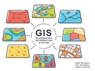
• Introduction to GIS
• Applications of GIS
• Importance of GIS in Architectural Education
• Introduction to town/city
• Contours in Gis
3 Contour maps of different intervals
• Georeferencing
Georeferenced map
• Digitization
Digitized Map
3. INTODUCTION TO GIS
• A Geographic Information System is a multi-component
environment used to create, manage, visualize and analyze data
and its spatial counterpart.
• It’s important to note that most datasets you will encounter in
your lifetime can all be assigned a spatial location whether on
the earth’s surface or within some arbitrary coordinate system
(such as a soccer field or a gridded petri dish).
• GIS technology applies geographic science with tools for
understanding and collaboration. It helps people reach a
common goal: to gain actionable intelligence from all types of
data.
4. INTODUCTION TO GIS
• GIS software
• Many GIS software applications are available–both
commercial and open source. Two popular applications
are ArcGIS and QGIS.
5. INTODUCTION TO GIS
ArcGIS
• A popular commercial GIS software is ArcGIS developed
by ESRI (ESRI, pronounced ez-ree),was once a small
land-use consulting firm which did not start developing
GIS software until the mid 1970s.
• The ArcGIS desktop environment encompasses a suite of
applications which include ArcMap, ArcCatalog,
ArcScene and Arc Globe.
GIS mapping produces visualizations of
geospatial information. The 4 main ideas of
Geographic Information Systems (GIS) are:
•Create geographic data.
•Manage it in a database.
•Analyze and find patterns.
•Display it on a map.
It helps us understand what is where. The
analysis becomes simple.
MAPS
DATA
ANALYSIT APPS
6. APPLICATION OF GIS
• GIS in Mapping: Mapping is a central function of Geographic Information
System, which provides a visual interpretation of data. GIS store data in
database and then represent it visually in a mapped format. People from
different professions use map to communicate. It is not necessary to be a
skilled cartographer to create maps. Google map, Bing map, Yahoo map are
the best example for web based GIS mapping solution.
• Telecom and Network services: GIS can be a great planning and decision
making tool for telecom industries. GDi GISDATA enables wireless
telecommunication organizations to incorporate geographic data in to the
complex network design, planning, optimization, maintenance and activities.
This technology allows telecom to enhance a variety of application
like engineering application, customer relationship management and
location based services.
7. APPLICATION OF GIS
• Accident Analysis and Hot Spot Analysis: GIS can be used as a key tool to
minimize accident hazard on roads, the existing road network has to be
optimized and also the road safety measures have to be improved. This can be
achieved by proper traffic management. By identifying the accident locations,
remedial measures can be planned by the district administrations to minimize
the accidents in different parts of the world. Rerouting design is also very
convenient using GIS.
•
4. Urban Planning: GIS technology is used to analyze the urban growth and its
direction of expansion, and to find suitable sites for further urban development.
In order to identify the sites suitable for the urban growth, certain factors have to
consider which is: land should have proper accessibility, land should be more or
less flat, land should be vacant or having low usage value presently and
it should have good supply of water.
8. APPLICATION OF GIS
• Transportation Planning: GIS can be used in managing
transportation and logistical problems. If transport department is
railway or a road route then this can be performed by adding
topographical data into the GIS platform. This will easily output
transportation based on the criteria like flattest route, least
disturbance from local people. GIS can also help in monitoring rail
conditions.
• 6. Environmental Impact Analysis: EIA is an important policy
initiative to conserve natural resources and environment. Many
potential adverse environmental effects which include the
highways, rail roads, pipelines, airports, radioactive waste
Environmental impact statements are usually required to contain
the magnitude and characteristics of environmental impact. The
efficiently by the help of GIS, by integrating various GIS layers,
features can be performed.
9. APPLICATION OF GIS
• Agricultural Applications: GIS can be used to create more effective and
efficient farming techniques. It can also analyze soil data and to determine:
what are the best crop to plant?, where they should go? how to maintain
nutrition levels to best benefit crop to plant?. It is fully integrated and widely
accepted for helping government agencies to manage programs that
support farmers and protect the environment. This could increase food
production in different parts of the world so the world food crisis could be
avoided.
• Disaster Management and Mitigation: Today a well-developed GIS systems
are used to protect the environment. It has become an integrated, well
developed and successful tool in disaster management and mitigation. GIS
can help with risk management and analysis by displaying which areas are
likely to be prone to natural or man-made disasters. When such disasters
are identified, preventive measures can be developed.
10. APPLICATION OF GIS
• Landslide Hazard Zonation using GIS: Landslide hazard
zonation is the process of ranking different parts of an area
of actual or potential hazard from landslides. The evaluation of
complex task. It has become possible to efficiently collect,
variety of spatial data such as geological, structural, surface
characteristics of an area, which can be used for hazard
said layer can well integrate using GIS and weighted analysis is
Landslide prone area. By the help of GIS we can do risk
the losses of life and property.
• Determine land use/land cover changes: Land cover means the
feature that is covering the barren surface .Land use means the
utilized for particular use. The role of GIS technology in land
applications is that we can determine land use/land cover
areas. Also it can detect and estimate the changes in the land
within time. It enables to find out sudden changes in land use
by natural forces or by other activities like deforestation.
11. IMPORTANCE OF GIS IN
ARCHITECTURAL EDUCATION
• GIS has many potential uses in architectural research and practice,
especially in the the areas of urban design, community planning,
and the site selection process.
• One of the main areas where architecture and GIS overlap is in the
digital representation of real world objects.
• Architectural projects tend to be site specific but many projects
will incorporate ancillary local and regional scale datasets and GIS is
a valuable source for such information and for the digital features
necessary to render them in site drawings.
• GIS can also be used in conjunction with other visualization tools,
such as AutoCAD, Google Earth, Adobe Illustrator, and Google
Sketchup, to create dynamic and complex drawings. An
additional benefit of GIS lies in its analytical capabilities, wherein
multiple phenomena can be linked by location and viewed through a
spatial lens.
• Information on an area's geology, soil type, infrastructure, and
demographic information, for example, can all be taken into
consideration when planning a structure or selecting a site and
these types of data are commonly available in GIS formats.
13. INTRODUCTION TO THE CITY
• The capital of Karnataka State, Bengaluru, also known
as the 'City of Gardens', is one of the most attractive
cities in India with its beautiful parks, avenues and
impressive buildings.
• Historically known as Bengaluru, Bendakaluru (village
of boiled beans) and as the anglicized Bangalore,
Bengaluru has moved to be city that is cosmopolitan in
nature and a nerve center of the Arts and Culture as
well.
• The once-sedate cantonment settlement of the British
has now spread way beyond the mud fort and the four
towers constructed by Kempe Gowda in 1537.
• With its booming economy and racy lifestyle, the capital
of Karnataka has metamorphosed from a sleepy
Garden City into one of India's fastest growing,
accommodating and cosmopolitan cities.
12.9716° N, 77.5946° E
14. CONTOURS IN GIS
STEPS :
• In order to create contours, you will need to enable the Spatial
Analyst toolbar, which can be found by going to Customize >
Toolbars > Spatial Analyst.
• Open the search bar. You can do this by clicking Windows >
Search, or by clicking on the search icon
• In the search bar type Contour, and select Contour (Spatial
Analyst) from the search results list.
• Add the file location and enter the contour interval
• The generated contours will automatically be added to the map.
15.
16.
17.
18. GEOREFERENCING
• Georeferencing means that the internal coordinate system
of a digital map or aerial photo can be related to a ground
system of geographic coordinates.
• Google >taxa library toposheet<India Pakistan ams
topographic map> BANGLORE>
• ARCGIS>view>data frame properties>projected
coordinated system>UTM>northern hemisphere>zone
43N.
• Mark 4 latitudes and longitudes clockwise.
• Customise>toolbars> georeferencing
• Add control points>input DMS>enter coordinates.
19.
20. DIGITIZATION
• Digitizing in GIS is the process of converting
geographic data either from a hardcopy or a scanned
image into vector data by tracing the features. During
the digitizing process, features from the traced map or
image are captured as coordinates in either point, line,
or polygon format.
• CatLog>connected folder>personal data base>
rename.
• New>featured class>select feature>link to the
georeferencing>finish.
• Layer>edit features>Start editing>Create
Features>Select layer>Select construction tool
>Draw> save editing>Stop editing.