1. ND GIS Users Workshop Bismarck, ND October 24-26, 2005ND GIS Users Workshop Bismarck, ND October 24-26, 2005
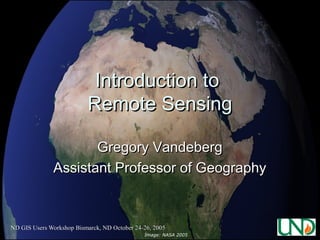
Introduction toIntroduction to
Remote SensingRemote Sensing
Gregory VandebergGregory Vandeberg
Assistant Professor of GeographyAssistant Professor of Geography
Image: NASA 2005
2. ND GIS Users Workshop Bismarck, ND October 24-26, 2005
OutlineOutline
Remote Sensing DefinedRemote Sensing Defined
ResolutionResolution
Electromagnetic Energy (EMR)Electromagnetic Energy (EMR)
TypesTypes
InterpretationInterpretation
ApplicationsApplications
3. ND GIS Users Workshop Bismarck, ND October 24-26, 2005
Remote Sensing DefinedRemote Sensing Defined
Remote Sensing is:Remote Sensing is:
““The art and science of obtaining informationThe art and science of obtaining information
about an object without being in direct contact withabout an object without being in direct contact with
the object” (Jensen 2000).the object” (Jensen 2000).
There is a medium of transmission involved.There is a medium of transmission involved.
4. ND GIS Users Workshop Bismarck, ND October 24-26, 2005
5. ND GIS Users Workshop Bismarck, ND October 24-26, 2005
Remote Sensing DefinedRemote Sensing Defined
EnvironmentalEnvironmental Remote Sensing:Remote Sensing:
…… the collection of information about Earth surfacesthe collection of information about Earth surfaces
and phenomena using sensors not in physical contactand phenomena using sensors not in physical contact
with the surfaces and phenomena of interest.with the surfaces and phenomena of interest.
We will focus on data collected from an overheadWe will focus on data collected from an overhead
perspective via transmission of electromagneticperspective via transmission of electromagnetic
radiation.radiation.
7. ND GIS Users Workshop Bismarck, ND October 24-26, 2005
Remote Sensing DefinedRemote Sensing Defined
Remote Sensing Includes:Remote Sensing Includes:
A) The mission plan and choice of sensors;A) The mission plan and choice of sensors;
B) The reception, recording, and processing of theB) The reception, recording, and processing of the
signal data; andsignal data; and
C) The analysis of the resultant data.C) The analysis of the resultant data.
8. ND GIS Users Workshop Bismarck, ND October 24-26, 2005
Energy Source or Illumination (A)
Radiation and the Atmosphere (B)
Interaction with the Target (C)
Recording of Energy by the Sensor (D)
Transmission, Reception, and Processing (E)
Interpretation and Analysis (F)
Application (G)
Source: Canadian Centre for Remote Sensing
Remote Sensing Process Components
9. ND GIS Users Workshop Bismarck, ND October 24-26, 2005
ResolutionResolution
AllAll remote sensing systems haveremote sensing systems have four typesfour types ofof
resolution:resolution:
SpatialSpatial
SpectralSpectral
TemporalTemporal
RadiometricRadiometric
10. ND GIS Users Workshop Bismarck, ND October 24-26, 2005
High vs. Low?
Spatial Resolution
Source: Jensen (2000)
12. ND GIS Users Workshop Bismarck, ND October 24-26, 2005
Temporal Resolution
Time
July 1 July 12 July 23 August 3
11 days
16 days
July 2 July 18 August 3
13. ND GIS Users Workshop Bismarck, ND October 24-26, 2005
Radiometric Resolution
6-bit range
0 63
8-bit range
0 255
0
10-bit range
1023
17. ND GIS Users Workshop Bismarck, ND October 24-26, 2005
Types of Remote SensingTypes of Remote Sensing
Aerial PhotographyAerial Photography
MultispectralMultispectral
Active and Passive Microwave and LIDARActive and Passive Microwave and LIDAR
19. ND GIS Users Workshop Bismarck, ND October 24-26, 2005
20. ND GIS Users Workshop Bismarck, ND October 24-26, 2005
MultispectralMultispectral
NOAA-AVHRR (1100 m)NOAA-AVHRR (1100 m)
GOES (700 m)GOES (700 m)
MODIS (250, 500, 1000 m)MODIS (250, 500, 1000 m)
Landsat TM and ETM (30 – 60 m)Landsat TM and ETM (30 – 60 m)
SPOT (10 – 20 m)SPOT (10 – 20 m)
IKONOS (4, 1 m)IKONOS (4, 1 m)
Quickbird (0.6 m)Quickbird (0.6 m)
21. ND GIS Users Workshop Bismarck, ND October 24-26, 2005
AVHRR (Advanced Very HighAVHRR (Advanced Very High
Resolution Radiometer) NASAResolution Radiometer) NASA
22. ND GIS Users Workshop Bismarck, ND October 24-26, 2005
GOES (Geostationary OperationalGOES (Geostationary Operational
Environmental Satellites) IR 4Environmental Satellites) IR 4
23. ND GIS Users Workshop Bismarck, ND October 24-26, 2005
MODIS (250 m)MODIS (250 m)
24. ND GIS Users Workshop Bismarck, ND October 24-26, 2005
Landsat TMLandsat TM
(False Color Composite)(False Color Composite)
25. ND GIS Users Workshop Bismarck, ND October 24-26, 2005
SPOT (2.5 m)SPOT (2.5 m)
26. ND GIS Users Workshop Bismarck, ND October 24-26, 2005
QUICKBIRD (0.6 m)QUICKBIRD (0.6 m)
27. ND GIS Users Workshop Bismarck, ND October 24-26, 2005
IKONOS (4 m Multispectral)IKONOS (4 m Multispectral)
28. ND GIS Users Workshop Bismarck, ND October 24-26, 2005
IKONOS (1 m Panchromatic)IKONOS (1 m Panchromatic)
29. ND GIS Users Workshop Bismarck, ND October 24-26, 2005
RADARRADAR
(Radio Detection and Ranging)(Radio Detection and Ranging)
Image: NASA 2005
30. ND GIS Users Workshop Bismarck, ND October 24-26, 2005
LIDARLIDAR
(Light Detection and Ranging)(Light Detection and Ranging)
Image: Bainbridge Island,
WA courtesy Pudget Sound
LIDAR Consortium, 2005
31. ND GIS Users Workshop Bismarck, ND October 24-26, 2005
Elements of Image InterpretationElements of Image Interpretation
Shape:Shape:
Many natural and human-made features haveMany natural and human-made features have
unique shapes.unique shapes.
Often used are adjectives like linear,Often used are adjectives like linear,
curvilinear, circular, elliptical, radial, square,curvilinear, circular, elliptical, radial, square,
rectangular, triangular, hexagonal, star,rectangular, triangular, hexagonal, star,
elongated, and amorphous.elongated, and amorphous.
33. ND GIS Users Workshop Bismarck, ND October 24-26, 2005
Elements of Image InterpretationElements of Image Interpretation
Shadow:Shadow:
Shadow reduction is of concern in remote sensingShadow reduction is of concern in remote sensing
because shadows tend to obscure objects thatbecause shadows tend to obscure objects that
might otherwise be detected.might otherwise be detected.
However, the shadow cast by an object may beHowever, the shadow cast by an object may be
the only real clue to its identity.the only real clue to its identity.
Shadows can also provide information on theShadows can also provide information on the
height of an object either qualitatively orheight of an object either qualitatively or
quantitatively.quantitatively.
35. ND GIS Users Workshop Bismarck, ND October 24-26, 2005
Elements of Image InterpretationElements of Image Interpretation
Tone and Color:Tone and Color:
AA bandband of EMR recorded by a remote sensingof EMR recorded by a remote sensing
instrument can be displayed on an image ininstrument can be displayed on an image in
shades of gray ranging from black to white.shades of gray ranging from black to white.
These shades are called “tones”, and can beThese shades are called “tones”, and can be
qualitatively referred to as dark, light, orqualitatively referred to as dark, light, or
intermediate (humans can see 40-50 tones).intermediate (humans can see 40-50 tones).
Tone is related to the amount of light reflectedTone is related to the amount of light reflected
from the scene in a specific wavelength intervalfrom the scene in a specific wavelength interval
(band).(band).
36. ND GIS Users Workshop Bismarck, ND October 24-26, 2005
Jensen (2000)
Tone and ColorTone and Color
37. ND GIS Users Workshop Bismarck, ND October 24-26, 2005
Elements of Image InterpretationElements of Image Interpretation
Texture:Texture:
Texture refers to the arrangement of tone or colorTexture refers to the arrangement of tone or color
in an image.in an image.
Useful because Earth features that exhibit similarUseful because Earth features that exhibit similar
tones often exhibit different textures.tones often exhibit different textures.
Adjectives include smooth (uniform,Adjectives include smooth (uniform,
homogeneous), intermediate, and rough (coarse,homogeneous), intermediate, and rough (coarse,
heterogeneous).heterogeneous).
39. ND GIS Users Workshop Bismarck, ND October 24-26, 2005
Elements of Image InterpretationElements of Image Interpretation
Pattern:Pattern:
Pattern is the spatial arrangement of objects onPattern is the spatial arrangement of objects on
the landscape.the landscape.
General descriptions include random andGeneral descriptions include random and
systematic; natural and human-made.systematic; natural and human-made.
More specific descriptions include circular, oval,More specific descriptions include circular, oval,
curvilinear, linear, radiating, rectangular, etc.curvilinear, linear, radiating, rectangular, etc.
41. ND GIS Users Workshop Bismarck, ND October 24-26, 2005
Elements of Image InterpretationElements of Image Interpretation
Height and Depth:Height and Depth:
As discussed, shadows can often offer clues to theAs discussed, shadows can often offer clues to the
height of objects.height of objects.
In turn, relative heights can be used to interpretIn turn, relative heights can be used to interpret
objects.objects.
In a similar fashion, relative depths can often beIn a similar fashion, relative depths can often be
interpreted.interpreted.
Descriptions include tall, intermediate, and short;Descriptions include tall, intermediate, and short;
deep, intermediate, and shallow.deep, intermediate, and shallow.
42. ND GIS Users Workshop Bismarck, ND October 24-26, 2005
Height and DepthHeight and Depth
43. ND GIS Users Workshop Bismarck, ND October 24-26, 2005
Elements of Image InterpretationElements of Image Interpretation
Association:Association:
This isThis is veryvery important when trying toimportant when trying to
interpret an object or activity.interpret an object or activity.
AssociationAssociation refers to the fact that certainrefers to the fact that certain
features and activities are almost alwaysfeatures and activities are almost always
related to the presence of certain otherrelated to the presence of certain other
features and activities.features and activities.
45. ND GIS Users Workshop Bismarck, ND October 24-26, 2005
46. ND GIS Users Workshop Bismarck, ND October 24-26, 2005
47. ND GIS Users Workshop Bismarck, ND October 24-26, 2005
Imaging Tools and DataImaging Tools and Data
Google EarthGoogle Earth
ERDAS ImagineERDAS Imagine
Digital Northern GreatDigital Northern Great
PlainsPlains
48. ND GIS Users Workshop Bismarck, ND October 24-26, 2005ND GIS Users Workshop Bismarck, ND October 24-26, 2005
Case Study 1:Case Study 1:
Identification andIdentification and
Characterization of MiningCharacterization of Mining
Waste Using Landsat TMWaste Using Landsat TM
Imagery, Cherokee County,Imagery, Cherokee County,
KSKS
Gregory S. VandebergGregory S. Vandeberg
49. ND GIS Users Workshop Bismarck, ND October 24-26, 2005
ProblemProblem
Mining, milling andMining, milling and
smelting have disturbedsmelting have disturbed
more than 240,000 kmmore than 240,000 km22
earth’s surface (Mooreearth’s surface (Moore
and Luoma 1990)and Luoma 1990)
100,000 – 500,000100,000 – 500,000
abandoned mine lands inabandoned mine lands in
U.S. (Hauff 2000)U.S. (Hauff 2000)
Mapping andMapping and
characterization of thesecharacterization of these
areas problematicareas problematic
Source: http://www.cma.junta-
andalucia.es/guadiamar/accidente_aznalcollar/
aznalcollar_1.html
50. ND GIS Users Workshop Bismarck, ND October 24-26, 2005
HypothesesHypotheses
Metal miningMetal mining
wastes/tailings inwastes/tailings in
Cherokee County, KSCherokee County, KS
can be identified andcan be identified and
mapped using Landsatmapped using Landsat
TM imageryTM imagery
Landsat TM data can alsoLandsat TM data can also
be used to characterizebe used to characterize
the mineralogy of thesethe mineralogy of these
wasteswastes
51. ND GIS Users Workshop Bismarck, ND October 24-26, 2005
Previous StudiesPrevious Studies
Use of aerial photographs to identify abandonedUse of aerial photographs to identify abandoned
coal mine lands in KS (Kenny and McCauley,coal mine lands in KS (Kenny and McCauley,
1982), and WV (Peplies et al. 1982)1982), and WV (Peplies et al. 1982)
Use of Landsat TM imagery and other remoteUse of Landsat TM imagery and other remote
sensing techniques (e.g. AVIRIS) to recognizesensing techniques (e.g. AVIRIS) to recognize
mining wastes in Cripple Creek Mining District,mining wastes in Cripple Creek Mining District,
CO (Peters et al. 1996, Peters and Hauff 2000)CO (Peters et al. 1996, Peters and Hauff 2000)
Use of Landsat TM imagery to monitorUse of Landsat TM imagery to monitor
vegetation and mining in Sudbury, Canadavegetation and mining in Sudbury, Canada
(Singhroy 2000)(Singhroy 2000)
52. ND GIS Users Workshop Bismarck, ND October 24-26, 2005
Tri-State Mining DistrictTri-State Mining District
Lead and zinc ores minedLead and zinc ores mined
from 1848-1968from 1848-1968
Legacy of mine tailings,Legacy of mine tailings,
metal-contaminated soils,metal-contaminated soils,
surface water andsurface water and
groundwatergroundwater
Over 3 billion metric tonsOver 3 billion metric tons
of mine tailings producedof mine tailings produced
in district (often referredin district (often referred
to as chat)to as chat)
More than 17 historicalMore than 17 historical
smelter sitessmelter sites
3 Superfund Sites3 Superfund Sites
62. ND GIS Users Workshop Bismarck, ND October 24-26, 2005
(Photo: Charles Martin, Kansas State)
63. ND GIS Users Workshop Bismarck, ND October 24-26, 2005
(Photo: Charles Martin, Kansas State)
64. ND GIS Users Workshop Bismarck, ND October 24-26, 2005
MethodsMethods
Supervised and Unsupervised Classification ofSupervised and Unsupervised Classification of
mining waste and tailings using Landsat 5mining waste and tailings using Landsat 5
Thematic Mapper image (Path 26 and Row 34,Thematic Mapper image (Path 26 and Row 34,
acquired June 27, 1992)acquired June 27, 1992)
Geometrically rectified to UTM Zone 15 WGS 84Geometrically rectified to UTM Zone 15 WGS 84
using 11 ground control points and first orderusing 11 ground control points and first order
polynomial equation (ERDAS Imagine) afterpolynomial equation (ERDAS Imagine) after
subsetting image to county boundariessubsetting image to county boundaries
Radiometric and atmospheric correction usingRadiometric and atmospheric correction using
Chavez (1996) COST model (Skirvin 2000)Chavez (1996) COST model (Skirvin 2000)
Use of band ratios to identify broadUse of band ratios to identify broad
mineralogical types (Peters and Hauff 2000)mineralogical types (Peters and Hauff 2000)
66. ND GIS Users Workshop Bismarck, ND October 24-26, 2005
False Color TM Image ofFalse Color TM Image of
Cherokee County, KS (4-3-2)Cherokee County, KS (4-3-2)
67. ND GIS Users Workshop Bismarck, ND October 24-26, 2005
False Color TM Image (7-4-2)False Color TM Image (7-4-2)
68. ND GIS Users Workshop Bismarck, ND October 24-26, 2005
Unsupervised ClassificationUnsupervised Classification
False Color (7-4-2) Unsupervised
72. ND GIS Users Workshop Bismarck, ND October 24-26, 2005
Accuracy AssessmentAccuracy Assessment
Conducted using orthophotos from sameConducted using orthophotos from same
year with recognition of waste inyear with recognition of waste in
piles/barren areaspiles/barren areas
Mining and milling wastes wereMining and milling wastes were
incorporated into roads, foundations, etc.incorporated into roads, foundations, etc.
so accuracy rates are likely higher thanso accuracy rates are likely higher than
presentedpresented
73. ND GIS Users Workshop Bismarck, ND October 24-26, 2005
Mineralogy (3/4-3/1-5/7)Mineralogy (3/4-3/1-5/7)
Iron oxidesIron oxides
74. ND GIS Users Workshop Bismarck, ND October 24-26, 2005
Bands 3/1-5/4-5/7Bands 3/1-5/4-5/7
Iron oxides vs. Ferrous/ClayIron oxides vs. Ferrous/Clay
76. ND GIS Users Workshop Bismarck, ND October 24-26, 2005
ConclusionsConclusions
Mining wastes/tailings are recognizableMining wastes/tailings are recognizable
using Landsat TM imagery, but includeusing Landsat TM imagery, but include
many other classes (nonwaste).many other classes (nonwaste).
Only iron oxide minerals readilyOnly iron oxide minerals readily
identifiable from Landsat TM imagery foridentifiable from Landsat TM imagery for
areaarea
Editor's Notes
Information usually gathered from spacecraft or an airplane, but can be a handheld or boom-mounted device. Originally defined in 1960’s according to Jensen, to encompass photogrammertry and information gathered from nonphotometric sources.
All things above absolute freezing (absolute K) transmit electromagnetic radiation, and most absorb and/or reflect electromagnetic radiation from other sources
The sun is the prime source of electromagnetic radiation on the earth’s surface, which is primarily shortwave radiation, and the earth transmits back longwave radiation.
Electromagnetic radiation behaves differently depending upon the material as shown in this slide. For instance, water reflects very little EMR, while soil and vegetation reflect EMR under different wavelengths. We can use these properties to help differentiate between various elements.
Aerial photographs range from panchromatic to color and infrared Multispectral range within and outside visible spectrum to near and middle infrared Active and Passive Microwave (RADAR – radio detection and ranging) and LIDAR (Light Detection and Ranging)
Nader (Gaspard Felix Tournachon) 1858 Paris photographer went up in balloons. Also used during American Civil War. Arthur Batut, French Kite photographer published book in 1890 Julius Neubronner patented breast mounted cameras on pigeons (1903) Photo reconnaissance in WWI for mapping terrain and troop movements WWII troop movements, V-2 rocket facilities
GOES operated by NOAA, multispectral scanners used by National Weather Service, developed for meteorological data, geostationary orbit, so rotate at same speed as earth, 35,790 km orbit above equator, also sounds atmosphere for thermal and water vapor structure.
October 23, 2005 Dust storm in Chad at 250 m resolution, MODIS (Moderate Resolution Imaging Spectroradiometer) NASA Moderate Resolution Imaging Spectrometer, 705 km, sun-synchronous orbit, 1-2 day for all of earth, 250 m, 500 m, 1000 m resolution. NASA
30 m resolution and 60 m resolution (thermal), 705 km orbit, 7 bands including thermal infrared, Manhattan, KS. Image, 2000 (USGS-EROS)
Canberra, Australia February 2003 SPOT Imagery (2.5 m), first launched in 1986 by French Centre National d’Etudes Spatiales (CNES) with Belgium and Sweden, 10m and 20 m resolution, $2000 per image (panchromatic) and > $4000 multispectral, sun-synchronous, near polar orbit at 832 km
Canyon Lands, UT (0.6 m resolution) April 20, 2003. Launched in 2001, operated by DIGITALGLOBE, 450 km orbit, sun-synchronous, 1-3.5 day revisit period, 0.6 m panchromatic, 2.44 m multispectral.
Launched by Space Imaging in 1999, 1 m panchromatic and 4 m multispectral resolution, 681 km orbit, crosses equator between 10 and 11 am daily, revisit 1.5-3 days.
SLAR (Side looking Airborne Radar) developed by military in 1950’s, and SAR (Synthetic aperture radar), Image is NASA TOPSAR of Pasadena valley, CA.
Aznalcollar mine near Seville, Spain spilled metal-rich pyrite ore and acid water into Agrio and Guadiamar rivers affecting more than 4400 ha of area, threatened Donana National Park. Recognition of abandoned mine lands and characterization of wastes problematic due to widespread distribution, and removal of tailings/waste from original mine site for processing.
Remote sensing refers to gather information about the land surface without being in direct contact with it. Kenny and McCauley (1982) first used black and white aerial photos to inventory abandoned coal mine lands in north and central portions of Cherokee County, KS. Peplies conducted similar investigations in the Tug Fork Basin of West Virginia (1982). Much work has been done by Peters and Hauff (2000) on the recognition and characterization of mining waste using remote sensing. Landsat TM imagery has been useful in identifying wastes in the Cripple Creek, CO area, and higher resolution AVIRIS data is helping to identify individual mineralogies. Finally, Singhroy (2000) has used Landsat TM imagery to monitor vegetation and mining expansion in Sudbury Canada.
Cherokee county is in the western portion of the Tri-State Mining district of Southeastern Kansas, Southwestern Missouri, and northeastern Oklahoma. The was mined from 1848 to 1968 (1970) for initially lead (galena mineral) including bullets for Civil war, and then for zinc (sphalerite). The mining has left a legacy of mine wastes and environmental problems Chat refers to coarse-grained (“pea size” tailings) removed from jig flow by “chatters and resent to crushers. Superfund sites include Tar Creek Site in Oklahoma (tops list as first superfund site)., Cherokee County site, KS and Oronogo-Duenweg Mining belt.
The Tri-State Mining district extends for about 160 km in an east-west direction, and 48 km north and south. In the Cherokee Lowlands and Ozark Plateau Physiographic regions. It can be divided into three areas including the Joplin, Missouri (Ooronogo-Duenweg mining belt), Galena, Kansas and Miami-Picher field, Oklahoma and Kansas Major drainages include the Spring River and its tributaries on the eastern part, and the Neosho River on the western part. Major towns include Joplin, Galena, Miami, Picher, Baxter Springs. Most founded due to mining.
Cherokee County had a population of > 22,000 (1998), located in Cherokee lowlands, with portion in Ozark Highlands. Populations in Galena around 3,800 and < 3000 in Baxter Springs (60,000 people in entire Tri-State area)
Geology consists of Mississippian age limestone (360-330 million years ago) Ore is found in the Boone formation which is limestone with secondary hydrothermal implacement of the ore bodies (Missississippi Valley type deposits as in NE Iowa, SW Wisconsin).
Typical photo showing milling site, with many exploration pits around the area. Mining confined to leases (avg. 16 hectacres) whereby the landowner received 10% royalty payment. Lease system based on U.S. law passed in 1807 which reserved all mineral lands within Louisiana Purchase for Government with 10% royalty. Most of the development on leased land. Many lease agreements required mills erected on property only be used for ore from that lease, and not other tracts. Mining was mostly underground, and milling was consolidated after 1930.
Chat piles in area. Note crops growing. (1930’s)
Chat piles and mined areas.
Water in mined area.
Tailings, Baxter Springs, KS
Reclaimed area near Picher, OK
Willow Cr, KS
Contaminants of concern include cadmium, lead and zinc. Shallow aquifer is contaminated with two new wells drilled to deeper aquifer with 500 residences hooked up (1993). 602 residential properties have been remediated due to high lead levels (1997-1999; 1,500 to 500 mg/kg lead depending upon blood lead levels).
Nearest neighbor used to classify image from trained data due to skewed nature of histograms -ISODATA used for unsupervised classification
Bands 4 (near infrared, 3-red, 2-green) raw image without radiometric correction. June 27, 1992.
False color map of area :7 Mid IR for mineral and rock types, moisture; 4= near IR vegetation and soil moisture; 2 = vegetation reflectance vigor, cultural features.
ISODATA in Erdas Imagine used to perform 30 initial clusters, eventually reduced to two classes.Unclassified clusters were masked, and additional unsupervised classification (cluster busting was used to try and differentiate similar reflectance values from mine waste)
Accuracy was assessed using randomly generated control points from digital orthophoto quads using a minimum of 50 randomly selected sample points for wastes and other classes. Error matrix shows that for waste, 83.3% accuracy (Type I) with 16.7% omission error. Users Accuracy is assessed from row totals (10/50 = 20%) as commission error of 80% (including other classes into mine waste). Khat is a discrete multivariat technique to measure KAPPA which includes errors of omission and commission for all classes.
Supervised classification of metal mine waste/tailings and other land cover. Mining waste appears in yellow. Spectral signatures of know waste piles used to identify waste. Histogram stretching used to enhance identification (may have reduced signature too much).
Accuracy was assessed using randomly generated control points from digital orthophoto quads (50 wastes, 50 other) High percentage of waste recognition, but also classified other land forms as waste.
¾-3/1-5/7 Green-yellow appearance of waste material suggests iron oxides or iron oxide coatings such as goethite, much noise in image. ERDAS has specific band selections for looking at mineral types. Bands from Peters and Hauff 2000)
3/1 5/4 5/7 Attempt to separate iron oxides from clay minerals (weathered vs. not weathered) Yellow indicates clay and/or carbonates. Blue is hydrothermal?
5/7 3/1 4/3 red color is likely dominated by carbonates. Identified wastes mostly oxides?
Wastes recognized, but included many other classes. May be more appropriate technique where country rock is much different from ore bodies (e.g. Montana). Mineral identification is limited benefits in agricultural areas, may be better in undistrubed areas.