SlideShare uma empresa Scribd logo
1 de 13
Rotor Air Cam, LLC
125 Newtown Road, Suite 100
Plainview, NY 11803
(800) 934-3945
connect@RotorAirCam.com
www.RotorAirCam.comRotor Air Cam, LLC
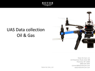
UAS Data collection
Oil & Gas
Two Categories:
1. Fixed Wing
– Longer flight time, faster air speed
– Allows large area coverage in a
single flight
2. Rotary Wing
– Less flight time
– Potentially lower altitudes, higher
final ground resolution
– Allows for confined space access,
takeoffs and landings
Types of Commercial UAVs
Rotor Air Cam, LLC 211/24/2015
FAA Requirements to Fly Commercially
• Any business decision made from data collected is considered commercial
operation in the eyes of the FAA.
• There are presently two main methods of gaining FAA approval:
1. Certificates of Waiver or Authorization (COA) for public aircraft
2. Section 333 Exemption
• Ensures safe compliance with all set forth regulations
– A drone is equivalent to a manned aircraft
– Policy and procedures from manned aircraft implemented in the use of drones
Rotor Air Cam, LLC 311/24/2015
UAV Service Descriptions
• Aerial Inspections
• Focus on particular features or problem areas
– Well Pad, Flare Stack, Pipeline, Right-of-Ways
• Visual Ultra-High Res Video/Photographic, Infrared capability
• Second operator controls camera / records data
• Monitor live HD image with inspector / client
• Up to date image captures, Change-over-time
Rotor Air Cam, LLC 411/24/2015
UAV Service Descriptions
• Aerial Survey, Mapping and Modeling
• Pre-programmed, autonomous repeatable flight paths
• Detailed, current Orthomosaics using photogrammetry
• 3D point cloud modeling
• Scheduled, repeatable change-over-time maps
• Volumetric studies
• Topographic Maps
Rotor Air Cam, LLC 511/24/2015
UAV Service Descriptions
• Specialized Aerial Sensors
• LiDAR
• Infrared and Near Infrared
• Gas Detection
• Thermal
• Applications: Leak Surveys, Vegetation Analysis, Heat Loss Detection
Rotor Air Cam, LLC 611/24/2015
Summary
Sensors
• More weight equals less flight time, exponentially decreasing with weight.
• Examples: DSLR camera, Near IR, IR/Thermal, LiDAR, Gas Detector.
Rotor Air Cam, LLC 711/24/2015
Case Studies
Rotor Air Cam, LLC 8
Case Study – Quarry Scans
Rotor was approached by a major engineering firm with the request to
create unmanned aerial photographic mapping in support of ALTA/ACSM
Boundary Scans for five of their larger gravel and rock quarry properties,
from 250-550 acres each.
11/24/2015
9
Rotor utilized a fully automated fixed-wing
drone, using a single 'static point' (GCP) to
capture each quarry site with high-resolution
orthomosaics at 4-5 cm accuracy. The scanning
was completed in 5 days.
The Aerial Solution
Case Studies
Rotor Air Cam, LLC11/24/2015
Sample Deliverables
Rotor Air Cam, LLC 10
3D Point Cloud
11/24/2015
Post Processing
Rotor Air Cam, LLC 1111/24/2015
3D Rendered Mesh
Summary
Summary
• Meeting all required safety, training and operational requirements, Rotor
can be your UAV service provider.
• Communicate your project and data collection needs
• Coordinate with provider to develop the most cost effective solution
Rotor Air Cam, LLC 1211/24/2015
David Sanders
President
David@RotorAirCam.com
631-988-1619
New York
Kevin Pomaski
President Geospatial
Kevin@RotorAirCam.com
832-799-4087
New Jersey
Rotor Air Cam, LLC 1312/07/2015

Mais conteúdo relacionado

Mais procurados

Download-manuals-surface water-manual-surfacewatero&m-norms
 Download-manuals-surface water-manual-surfacewatero&m-norms Download-manuals-surface water-manual-surfacewatero&m-norms
Download-manuals-surface water-manual-surfacewatero&m-normshydrologyproject0
 
IGARSS 2011 - RCM, The Making of (AC) (Short).ppt
IGARSS 2011 - RCM, The Making of (AC) (Short).pptIGARSS 2011 - RCM, The Making of (AC) (Short).ppt
IGARSS 2011 - RCM, The Making of (AC) (Short).pptgrssieee
 
Evaluating AERMOD and Wind Tunnel Derived Equivalent Building Dimensions
Evaluating AERMOD and Wind Tunnel Derived Equivalent Building DimensionsEvaluating AERMOD and Wind Tunnel Derived Equivalent Building Dimensions
Evaluating AERMOD and Wind Tunnel Derived Equivalent Building DimensionsSergio A. Guerra
 
Sneak preview - SMM presentation
Sneak preview - SMM presentationSneak preview - SMM presentation
Sneak preview - SMM presentationdkane27
 
EFFECTS OF MET DATA PROCESSING IN AERMOD CONCENTRATIONS
EFFECTS OF MET DATA PROCESSING IN AERMOD CONCENTRATIONSEFFECTS OF MET DATA PROCESSING IN AERMOD CONCENTRATIONS
EFFECTS OF MET DATA PROCESSING IN AERMOD CONCENTRATIONSSergio A. Guerra
 
CAMS General Assembly Chabrillat
CAMS  General Assembly ChabrillatCAMS  General Assembly Chabrillat
CAMS General Assembly ChabrillatCopernicus ECMWF
 
Download-manuals-surface water-manual-sw-volume4fieldmanualhydrometrypartvi
 Download-manuals-surface water-manual-sw-volume4fieldmanualhydrometrypartvi Download-manuals-surface water-manual-sw-volume4fieldmanualhydrometrypartvi
Download-manuals-surface water-manual-sw-volume4fieldmanualhydrometrypartvihydrologyproject001
 
Download-manuals-surface water-manual-sw-volume4fieldmanualhydrometrypartii
 Download-manuals-surface water-manual-sw-volume4fieldmanualhydrometrypartii Download-manuals-surface water-manual-sw-volume4fieldmanualhydrometrypartii
Download-manuals-surface water-manual-sw-volume4fieldmanualhydrometrypartiihydrologyproject001
 
Complying with EPA's Guidance for SO2 Designations
Complying with EPA's Guidance for SO2 DesignationsComplying with EPA's Guidance for SO2 Designations
Complying with EPA's Guidance for SO2 DesignationsSergio A. Guerra
 
Korea and norway maritime opportunities and challenges in the high north
Korea and norway maritime opportunities and challenges in the high northKorea and norway maritime opportunities and challenges in the high north
Korea and norway maritime opportunities and challenges in the high northInnovation Norway
 
Evaluation of the Theoretical Problems with Building Downwash Using A New Met...
Evaluation of the Theoretical Problems with Building Downwash Using A New Met...Evaluation of the Theoretical Problems with Building Downwash Using A New Met...
Evaluation of the Theoretical Problems with Building Downwash Using A New Met...Sergio A. Guerra
 
Using Physical Modeling to Refine Downwash Inputs to AERMOD at a Food Process...
Using Physical Modeling to Refine Downwash Inputs to AERMOD at a Food Process...Using Physical Modeling to Refine Downwash Inputs to AERMOD at a Food Process...
Using Physical Modeling to Refine Downwash Inputs to AERMOD at a Food Process...Sergio A. Guerra
 
AERMET's Beta u-star Option
AERMET's Beta u-star OptionAERMET's Beta u-star Option
AERMET's Beta u-star OptionSergio A. Guerra
 
Download-manuals-surface water-manual-sw-volume4fieldmanualhydrometrypartviii
 Download-manuals-surface water-manual-sw-volume4fieldmanualhydrometrypartviii Download-manuals-surface water-manual-sw-volume4fieldmanualhydrometrypartviii
Download-manuals-surface water-manual-sw-volume4fieldmanualhydrometrypartviiihydrologyproject001
 
Probabilistic Analysis of a Desalination Plant with Major and Minor Failures ...
Probabilistic Analysis of a Desalination Plant with Major and Minor Failures ...Probabilistic Analysis of a Desalination Plant with Major and Minor Failures ...
Probabilistic Analysis of a Desalination Plant with Major and Minor Failures ...Waqas Tariq
 

Mais procurados (19)

Max Gap Tim Final
Max Gap Tim FinalMax Gap Tim Final
Max Gap Tim Final
 
Download-manuals-surface water-manual-surfacewatero&m-norms
 Download-manuals-surface water-manual-surfacewatero&m-norms Download-manuals-surface water-manual-surfacewatero&m-norms
Download-manuals-surface water-manual-surfacewatero&m-norms
 
1569909951 (2)
1569909951 (2)1569909951 (2)
1569909951 (2)
 
IGARSS 2011 - RCM, The Making of (AC) (Short).ppt
IGARSS 2011 - RCM, The Making of (AC) (Short).pptIGARSS 2011 - RCM, The Making of (AC) (Short).ppt
IGARSS 2011 - RCM, The Making of (AC) (Short).ppt
 
2014 Wind Turbine Blade Workshop- Johansen
2014 Wind Turbine Blade Workshop- Johansen2014 Wind Turbine Blade Workshop- Johansen
2014 Wind Turbine Blade Workshop- Johansen
 
Evaluating AERMOD and Wind Tunnel Derived Equivalent Building Dimensions
Evaluating AERMOD and Wind Tunnel Derived Equivalent Building DimensionsEvaluating AERMOD and Wind Tunnel Derived Equivalent Building Dimensions
Evaluating AERMOD and Wind Tunnel Derived Equivalent Building Dimensions
 
Sneak preview - SMM presentation
Sneak preview - SMM presentationSneak preview - SMM presentation
Sneak preview - SMM presentation
 
EFFECTS OF MET DATA PROCESSING IN AERMOD CONCENTRATIONS
EFFECTS OF MET DATA PROCESSING IN AERMOD CONCENTRATIONSEFFECTS OF MET DATA PROCESSING IN AERMOD CONCENTRATIONS
EFFECTS OF MET DATA PROCESSING IN AERMOD CONCENTRATIONS
 
CAMS General Assembly Chabrillat
CAMS  General Assembly ChabrillatCAMS  General Assembly Chabrillat
CAMS General Assembly Chabrillat
 
Download-manuals-surface water-manual-sw-volume4fieldmanualhydrometrypartvi
 Download-manuals-surface water-manual-sw-volume4fieldmanualhydrometrypartvi Download-manuals-surface water-manual-sw-volume4fieldmanualhydrometrypartvi
Download-manuals-surface water-manual-sw-volume4fieldmanualhydrometrypartvi
 
Download-manuals-surface water-manual-sw-volume4fieldmanualhydrometrypartii
 Download-manuals-surface water-manual-sw-volume4fieldmanualhydrometrypartii Download-manuals-surface water-manual-sw-volume4fieldmanualhydrometrypartii
Download-manuals-surface water-manual-sw-volume4fieldmanualhydrometrypartii
 
Complying with EPA's Guidance for SO2 Designations
Complying with EPA's Guidance for SO2 DesignationsComplying with EPA's Guidance for SO2 Designations
Complying with EPA's Guidance for SO2 Designations
 
Korea and norway maritime opportunities and challenges in the high north
Korea and norway maritime opportunities and challenges in the high northKorea and norway maritime opportunities and challenges in the high north
Korea and norway maritime opportunities and challenges in the high north
 
Evaluation of the Theoretical Problems with Building Downwash Using A New Met...
Evaluation of the Theoretical Problems with Building Downwash Using A New Met...Evaluation of the Theoretical Problems with Building Downwash Using A New Met...
Evaluation of the Theoretical Problems with Building Downwash Using A New Met...
 
Using Physical Modeling to Refine Downwash Inputs to AERMOD at a Food Process...
Using Physical Modeling to Refine Downwash Inputs to AERMOD at a Food Process...Using Physical Modeling to Refine Downwash Inputs to AERMOD at a Food Process...
Using Physical Modeling to Refine Downwash Inputs to AERMOD at a Food Process...
 
AERMET's Beta u-star Option
AERMET's Beta u-star OptionAERMET's Beta u-star Option
AERMET's Beta u-star Option
 
Silviu Livescu
Silviu LivescuSilviu Livescu
Silviu Livescu
 
Download-manuals-surface water-manual-sw-volume4fieldmanualhydrometrypartviii
 Download-manuals-surface water-manual-sw-volume4fieldmanualhydrometrypartviii Download-manuals-surface water-manual-sw-volume4fieldmanualhydrometrypartviii
Download-manuals-surface water-manual-sw-volume4fieldmanualhydrometrypartviii
 
Probabilistic Analysis of a Desalination Plant with Major and Minor Failures ...
Probabilistic Analysis of a Desalination Plant with Major and Minor Failures ...Probabilistic Analysis of a Desalination Plant with Major and Minor Failures ...
Probabilistic Analysis of a Desalination Plant with Major and Minor Failures ...
 

Semelhante a Presentation

Timmins how would you like to use ua vs
Timmins how would you like to use ua vsTimmins how would you like to use ua vs
Timmins how would you like to use ua vsGeCo in the Rockies
 
Sensor Integration and Data Fusion from a High Definition Helicopter Mapping ...
Sensor Integration and Data Fusion from a High Definition Helicopter Mapping ...Sensor Integration and Data Fusion from a High Definition Helicopter Mapping ...
Sensor Integration and Data Fusion from a High Definition Helicopter Mapping ...MattBethel1
 
CASSIS Controlled Time of Arrival Flight Trials: Results and Analysis Present...
CASSIS Controlled Time of Arrival Flight Trials: Results and Analysis Present...CASSIS Controlled Time of Arrival Flight Trials: Results and Analysis Present...
CASSIS Controlled Time of Arrival Flight Trials: Results and Analysis Present...Bruce Ware, PMI Certified PM Professional
 
The WMO AMDAR Observing System
The WMO AMDAR Observing SystemThe WMO AMDAR Observing System
The WMO AMDAR Observing Systembancha kaewngam
 
DDI Aircraft OML Scanning and Modeling Presentation Oct 2009
DDI Aircraft OML Scanning and Modeling Presentation Oct 2009DDI Aircraft OML Scanning and Modeling Presentation Oct 2009
DDI Aircraft OML Scanning and Modeling Presentation Oct 2009Direct Dimensions, Inc.
 
DDI Aircraft OML Scanning and Modeling Presentation Oct 2009
DDI Aircraft OML Scanning and Modeling Presentation Oct 2009DDI Aircraft OML Scanning and Modeling Presentation Oct 2009
DDI Aircraft OML Scanning and Modeling Presentation Oct 2009Direct Dimensions, Inc.
 
Dhruv Drone Thesis FInal PPT
Dhruv Drone Thesis FInal PPTDhruv Drone Thesis FInal PPT
Dhruv Drone Thesis FInal PPTDhruv Tandon
 
Total Control Eddyfi Tank Inspections workshop 2022
Total Control Eddyfi Tank Inspections workshop 2022Total Control Eddyfi Tank Inspections workshop 2022
Total Control Eddyfi Tank Inspections workshop 2022argebit
 
Application of Drones for Mining Ooperations
Application of Drones for Mining OoperationsApplication of Drones for Mining Ooperations
Application of Drones for Mining OoperationsDr. Alex Vyazmensky
 
An Update on A400M Testing, May 2013
An Update on A400M Testing, May 2013An Update on A400M Testing, May 2013
An Update on A400M Testing, May 2013ICSA, LLC
 
Mock can i collect it can i use it
Mock can i collect it can i use itMock can i collect it can i use it
Mock can i collect it can i use itGeCo in the Rockies
 

Semelhante a Presentation (20)

Aerospace and UAV
Aerospace and UAVAerospace and UAV
Aerospace and UAV
 
Timmins how would you like to use ua vs
Timmins how would you like to use ua vsTimmins how would you like to use ua vs
Timmins how would you like to use ua vs
 
Sensor Integration and Data Fusion from a High Definition Helicopter Mapping ...
Sensor Integration and Data Fusion from a High Definition Helicopter Mapping ...Sensor Integration and Data Fusion from a High Definition Helicopter Mapping ...
Sensor Integration and Data Fusion from a High Definition Helicopter Mapping ...
 
2014 PV Reliability, Operations & Maintenance Workshop: HelioSpec by DreamQii...
2014 PV Reliability, Operations & Maintenance Workshop: HelioSpec by DreamQii...2014 PV Reliability, Operations & Maintenance Workshop: HelioSpec by DreamQii...
2014 PV Reliability, Operations & Maintenance Workshop: HelioSpec by DreamQii...
 
DRONE.pptx
DRONE.pptxDRONE.pptx
DRONE.pptx
 
CASSIS Controlled Time of Arrival Flight Trials: Results and Analysis Present...
CASSIS Controlled Time of Arrival Flight Trials: Results and Analysis Present...CASSIS Controlled Time of Arrival Flight Trials: Results and Analysis Present...
CASSIS Controlled Time of Arrival Flight Trials: Results and Analysis Present...
 
The WMO AMDAR Observing System
The WMO AMDAR Observing SystemThe WMO AMDAR Observing System
The WMO AMDAR Observing System
 
Wind Turbine Inspection
Wind Turbine InspectionWind Turbine Inspection
Wind Turbine Inspection
 
UAVs: Understanding Unmanned Aerial Systems (UAS) and Potential Applications
UAVs: Understanding Unmanned Aerial Systems (UAS) and Potential ApplicationsUAVs: Understanding Unmanned Aerial Systems (UAS) and Potential Applications
UAVs: Understanding Unmanned Aerial Systems (UAS) and Potential Applications
 
New ideas for trimming O&M costs
New ideas for trimming O&M costsNew ideas for trimming O&M costs
New ideas for trimming O&M costs
 
DDI Aircraft OML Scanning and Modeling Presentation Oct 2009
DDI Aircraft OML Scanning and Modeling Presentation Oct 2009DDI Aircraft OML Scanning and Modeling Presentation Oct 2009
DDI Aircraft OML Scanning and Modeling Presentation Oct 2009
 
DDI Aircraft OML Scanning and Modeling Presentation Oct 2009
DDI Aircraft OML Scanning and Modeling Presentation Oct 2009DDI Aircraft OML Scanning and Modeling Presentation Oct 2009
DDI Aircraft OML Scanning and Modeling Presentation Oct 2009
 
Dhruv Drone Thesis FInal PPT
Dhruv Drone Thesis FInal PPTDhruv Drone Thesis FInal PPT
Dhruv Drone Thesis FInal PPT
 
Total Control Eddyfi Tank Inspections workshop 2022
Total Control Eddyfi Tank Inspections workshop 2022Total Control Eddyfi Tank Inspections workshop 2022
Total Control Eddyfi Tank Inspections workshop 2022
 
A400 m flight_test
A400 m flight_testA400 m flight_test
A400 m flight_test
 
Application of Drones for Mining Ooperations
Application of Drones for Mining OoperationsApplication of Drones for Mining Ooperations
Application of Drones for Mining Ooperations
 
ACARP wall -flow DFP project - Coplin
ACARP wall -flow DFP project - Coplin ACARP wall -flow DFP project - Coplin
ACARP wall -flow DFP project - Coplin
 
An Update on A400M Testing, May 2013
An Update on A400M Testing, May 2013An Update on A400M Testing, May 2013
An Update on A400M Testing, May 2013
 
14 599
14 59914 599
14 599
 
Mock can i collect it can i use it
Mock can i collect it can i use itMock can i collect it can i use it
Mock can i collect it can i use it
 

Presentation

  • 1. Rotor Air Cam, LLC 125 Newtown Road, Suite 100 Plainview, NY 11803 (800) 934-3945 connect@RotorAirCam.com www.RotorAirCam.comRotor Air Cam, LLC UAS Data collection Oil & Gas
  • 2. Two Categories: 1. Fixed Wing – Longer flight time, faster air speed – Allows large area coverage in a single flight 2. Rotary Wing – Less flight time – Potentially lower altitudes, higher final ground resolution – Allows for confined space access, takeoffs and landings Types of Commercial UAVs Rotor Air Cam, LLC 211/24/2015
  • 3. FAA Requirements to Fly Commercially • Any business decision made from data collected is considered commercial operation in the eyes of the FAA. • There are presently two main methods of gaining FAA approval: 1. Certificates of Waiver or Authorization (COA) for public aircraft 2. Section 333 Exemption • Ensures safe compliance with all set forth regulations – A drone is equivalent to a manned aircraft – Policy and procedures from manned aircraft implemented in the use of drones Rotor Air Cam, LLC 311/24/2015
  • 4. UAV Service Descriptions • Aerial Inspections • Focus on particular features or problem areas – Well Pad, Flare Stack, Pipeline, Right-of-Ways • Visual Ultra-High Res Video/Photographic, Infrared capability • Second operator controls camera / records data • Monitor live HD image with inspector / client • Up to date image captures, Change-over-time Rotor Air Cam, LLC 411/24/2015
  • 5. UAV Service Descriptions • Aerial Survey, Mapping and Modeling • Pre-programmed, autonomous repeatable flight paths • Detailed, current Orthomosaics using photogrammetry • 3D point cloud modeling • Scheduled, repeatable change-over-time maps • Volumetric studies • Topographic Maps Rotor Air Cam, LLC 511/24/2015
  • 6. UAV Service Descriptions • Specialized Aerial Sensors • LiDAR • Infrared and Near Infrared • Gas Detection • Thermal • Applications: Leak Surveys, Vegetation Analysis, Heat Loss Detection Rotor Air Cam, LLC 611/24/2015
  • 7. Summary Sensors • More weight equals less flight time, exponentially decreasing with weight. • Examples: DSLR camera, Near IR, IR/Thermal, LiDAR, Gas Detector. Rotor Air Cam, LLC 711/24/2015
  • 8. Case Studies Rotor Air Cam, LLC 8 Case Study – Quarry Scans Rotor was approached by a major engineering firm with the request to create unmanned aerial photographic mapping in support of ALTA/ACSM Boundary Scans for five of their larger gravel and rock quarry properties, from 250-550 acres each. 11/24/2015
  • 9. 9 Rotor utilized a fully automated fixed-wing drone, using a single 'static point' (GCP) to capture each quarry site with high-resolution orthomosaics at 4-5 cm accuracy. The scanning was completed in 5 days. The Aerial Solution Case Studies Rotor Air Cam, LLC11/24/2015
  • 10. Sample Deliverables Rotor Air Cam, LLC 10 3D Point Cloud 11/24/2015
  • 11. Post Processing Rotor Air Cam, LLC 1111/24/2015 3D Rendered Mesh
  • 12. Summary Summary • Meeting all required safety, training and operational requirements, Rotor can be your UAV service provider. • Communicate your project and data collection needs • Coordinate with provider to develop the most cost effective solution Rotor Air Cam, LLC 1211/24/2015
  • 13. David Sanders President David@RotorAirCam.com 631-988-1619 New York Kevin Pomaski President Geospatial Kevin@RotorAirCam.com 832-799-4087 New Jersey Rotor Air Cam, LLC 1312/07/2015