University: The Bartlett School of Architecture, UCL
Degree: Spatial Design: Architecture & Cities MSc
As part of the Space Syntax Methodology and Analytical Design module, students were tasked with applying the techniques learnt throughout term one on a practical project. This year’s project required reviewing a City of London Area Enhancement Strategy and examining the built environment from a macro to a micro scale.
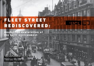
Fleet Street Rediscovered: Analytical Exploration of the Built Environment
1. F L E E T S T R E E T
R E D I S C O V E R E D :
A n a l y t i c a l e x p l o r a t i o n o f
t h e b u i l t e n v i r o n m e n t
SPACE SYNTAX METHODOLOGY & ANALYTICAL DESIGN
JANUARY 2017 - FINAL REPORT
JORDAN JONES, YIGONG ZHANG, BENEDIKT STOLL & HUIYING JIANG
GROUP FIVE_FLEET STREET & LANES
2. INTRODUCTION
AspartoftheSpaceSyntaxMethodologyandAnalyticalDesignmodule,
students were tasked with applying the techniques learnt throughout
term one on a practical project. This years project required reviewing
a City of London Area Enhancement Strategy and examining the built
environment from a macro to a micro scale.
Groups were created and each allocated a specific strategy as their
project. Yigong Zhang, Jordan Jones, Benedikt Stoll and Huiying Jiang
formed group five, tasked with the Fleet Street and Lanes strategy.
RESEARCH QUESTIONS
Space Syntax theory is built on two fundamental principles; firstly that
space and society are in an inherent relationship, and secondly that
space is fundamentally configurational (Hillier and Vaughan, 2007,
205-230).
Three specific research questions under these principals have been
developed aligning to the macro, meso and micro scales, validating
the Area Enhancement Strategy whilst constructing an evidence-
based understanding of the built environment.
The macro scale examines how the social role evolved over time in
relation to the spatial structure of Fleet Street. The research identifies
and defines its significance, and how it performs within the city,
providing insight into the intrinsic link between space and society.
The City of London Local Plan (Great Britain. City of London, 2015)
highlights Fleet Street as a principal shopping district containing
key cultural attractions. In return the meso scale explores how the
land uses respond to the spatial network and how tourist activity is
supported. The research tests the principal shopping district theory
whilst analysing how different demographics are navigating the
spatial network.
The micro scale investigates how the key heritage sites and public
realm spaces within Fleet Street perform as cultural destinations. The
research focuses on two key cultural locations and investigates their
usage patterns and spatial properties.
METHODOLOGY
The methodology was constructed under two categories, using both
quantitative and qualitative techniques.The first contained background
studies such as; previous reports, local plans and strategies, historic
timelines, key buildings, landmarks, land uses, opening times and a
guided tour by Footprints of London.
The second category contained Space Syntax methods split into two
analytical lenses, spatial and social. The spatial lens includes segment
analysis, visibility field studies and visual graph analysis. The social
lens includes gate counts, observations, movement traces, activity
mapping and static snapshots.
KEY FINDINGS
MACRO SCALE: How has the social role evolved over time in relation to
the spatial structure of Fleet Street?
Fleet Street has played a significant role since the roman period
both socially and spatially. It originally served as a key thoroughfare
between settlements and today still retains its importance connecting
congress to the West with commerce to the East. It has served the
clergy, printing, legal and commercial professions and survived the
Great Fire of London and World Wars after withstanding extensive
damage. Over time Fleet Street has become more integrated whereas
its background network of lanes has become more segregated
providing limited choice for movement.
MESO SCALE: How do the land uses respond to the spatial network
and how does this support tourist activity?
Fleet Street is full of historic buildings that are the cultural memory of
the past, acting as token reminders for future generations. Yet these
significant cultural interests that represent a historic social timeline
are hidden within a segregated background network. Whilst retail
shops are plotted along the most integrated route, Fleet Street, their
opening hours align to the office working hours with a staggering drop
in shops open over the weekend. The sum of these realities provide
an environment that is commercially dominated and supported,
neglecting tourist activity and refutes the idea of being a principal
shopping district as labelled by the City of London Local Plan.
MICRO SCALE: How are the key heritage sites and public realm spaces
performing as cultural destinations?
Two key sites form the focus of study, Dr Johnson’s House and St
Bride’s Church. There is a strong correlation between movement,
visibility lines, choice and integration. As a result they are hidden in an
unintelligible background network and complex structure.
STRATEGIC INTERVENTIONS
As a result of the findings a ‘Big Idea’ was formed to create a new
cultural heart in the centre of Fleet Street. It would be a hub for
tourists and visitors connecting all of the cultural destinations, and
supporting navigation of the segregated network, to overcome the
spatial constraints whilst retaining the local character and charm.
In order to achieve the ‘Big Idea’ it is necessary to exercise four
essential strategies. Strategy one requires a clear and immersive
wayfinding scheme with a story connecting people to space. The use of
lighting, signage, paving materials, overhead installations and digital
enablement should be used to created an immersive and seamless
experience. Strategy two advises the repositioning of key pedestrian
crossings and upgrades to improve connectivity between the North
and South of Fleet Street. Strategy three recommends the opening up
of a key ground floor buildings to widen routes improving lines of sight
and integration. Strategy four proposes the upgrading of the public
realm spaces creating satellite destinations around the new Fleet
Street Cultural Hub that better support rest and encounters.
By carrying out the ‘Big Idea’ initiative and its supporting strategies,
would result in reconnecting the key historic buildings and upgrading
the public spaces to bring cultural heritage back to the foreground
network. This would shift the area from being a commercially
dominated thoroughfare to a cultural destination.
EVALUATION
The following presentation was delivered to lecturers, peers and
industry professionals, including representatives from the City of
London on 20th December 2016. The feedback received was positive
noting particular emphasis on the delivery, graphics, content and
narrative. Constructive feedback was provided around the data
analysis, whilst a qualitative correlation of data is satisfactory, it would
have been much better to have carried out a statistical correlation to
add extra credibility to the findings.
REFERENCES
Great Britain. City of London (2015) The Local Plan [Online]. Available at: https://
www.cityoflondon.gov.uk/services/environment-and-planning/planning/
planning-policy/local-plan/Pages/default.aspx (Accessed: 25 October 2016)
Hillier, B. Vaughan, L. (2007) ‘The city as one thing’. Progress in Planning, 67 (3)
pp. 205-230.
Karimi, K. (2016) Space Syntax Methodologies and Analytical Research Design
[Lecture to MSc SDAC]. 4 October.
PROJECT SYNOPSIS BY JORDAN JONES F L E E T S T R E E T R E D I S C O V E R E D
3. FLEET STREET REDISCOVERED CONTENTS
ANALYTICAL EXPLORATION OF THE
BUILT ENVIRONMENT:
SECTION ONE SECTION TWO SECTION THREE SECTION FOUR SECTION FIVE
EXECUTIVE
SUMMARY
• The Team
• Site Location
• Project Brief
• Research Questions
• Space Syntax
• Methodology
• The Process
MACRO
SCALE
• The Macro Question
• Social Timeline
• Spatial Timeline
• All Line Axial Analysis
• Listed Buildings
• Blue Plaque Study
• Segment Analysis
• Findings Summary
MESO
SCALE
• The Meso Question
• The Local Plan
• Land Use Overview
• Open Times Study
• Visual Graph Analysis
• Gate Counts
• Demographic Study
• Findings Summary
MICRO
SCALE
• The Micro Question
• Key Locations
• Dr Johnson’s House
• St Bride’s Church
• Temple Church
• New Junction
• Navigating Isovists
• Findings Summary
STRATEGIC
INTERVENTIONS
• The Big Idea
• Key Strategies
• Wayfinding
• Crossings
• Building Openings
• Public Spaces
• Proposal Summary
F L E E T S T R E E T R E D I S C O V E R E D
5. EXECUTIVE SUMMARY THE TEAM
YIGONG ZHANG
URBAN DESIGN MRes
ARCHITECTURE B.Arch
BENEDIKT STOLL
URBAN DESIGN MRes
ARCHITECTURE Dipl.-Ing
HUIYING JIANG
URBAN DESIGN MRes
ART DESIGN B.E
JORDAN JONES
SPATIAL DESIGN: ARCHITECTURE & CITIES M.Sc
ARCHITECTURAL TECHNOLOGY B.Sc
We are a strong interdisciplinary team made up of
architects, planners, designers, strategists that bring a
holistic view and multidisciplinary approach to the project.
F L E E T S T R E E T R E D I S C O V E R E D
6. 0 100 200 300 400 500 600 700 800 900 1000 m
Fleet Street
Oct 25, 2016 08:48
UCL
Scale 1:10000
Crown copyright and database rights 2016 Ordnance Survey (Digimap Licence). FOR EDUCATIONAL USE ONLY.
EXECUTIVE SUMMARY SITE LOCATION
0 100 200 300 400 500 600 700 800 900 1000 m
Fleet Street
Oct 25, 2016 08:48
UCL
Scale 1:10000
Crown copyright and database rights 2016 Ordnance Survey (Digimap Licence). FOR EDUCATIONAL USE ONLY.
Fleet Street & Lanes
The Square Mile Boundary
(Great Britian. City of London, 2015)
F L E E T S T R E E T R E D I S C O V E R E D
7. EXECUTIVE SUMMARY PROJECT BRIEF
Explore Fleet Street from
a ‘micro’ to a ‘macro’
scale validating the Area
Enhancement Strategy.
Apply the analytical techniques of spatial modelling and
observing human behaviour to construct an evidence-based
understanding of the built environment.
F L E E T S T R E E T R E D I S C O V E R E D
8. EXECUTIVE SUMMARY RESEARCH QUESTIONS
MACRO
DEFINE PERFORMANCE OF
FLEET STREET
MESO
TEST PRINCIPAL
SHOPPING DISTRICT
MICRO
REVEAL HIDDEN
CULTURAL DESTINATION
How has the social role
evolved over time in relation
to the spatial structure of
fleet street?
How do the land uses
respond to the spatial
network and how does this
support tourist activity?
How are the key heritage
sites and public realm spaces
performing as cultural
destinations?
F L E E T S T R E E T R E D I S C O V E R E D
9. EXECUTIVE SUMMARY SPACE SYNTAX
Space and society are in
an inherent relationship.
Space is fundamentally
configurational.
(Hillier and Vaughan, 2007, 205-230)
The two fundamental principles and the lens of Space Syntax theory.
F L E E T S T R E E T R E D I S C O V E R E D
10. EXECUTIVE SUMMARY METHODOLOGY
MACRO MESO MICRO
HISTORIC TIMELINE
& BUILDINGS
Identify historic buildings of
interest and their significance past
and present.
BACKGROUND
REVIEW
Read up on previous reports and
literature regarding Fleet Street in
order to define research questions.
PAST & PRESENT
SEGMENT ANALYSIS
A segment analysis of the past and
present maps of Fleet Street to
identify significant routes and role.
LAND USE, LANDMARKS
& POINTS OF INTEREST
Locate any landmarks and points
of interest cross the region, and
property land use values.
GATE COUNTS &
OBSERVATIONS
Movement counts that pass
through predefined hypothetical
gates and observations.
VISIBILITY FIELD STUDY
(AKA ISOVISTS)
The visual field from a vantage
point, assessing the visibility when
navigating the network.
RETAIL OPENING
HOURS STUDY
Data collected on Fleet Street retail
opening times providing an insight
into the local activity times.
VISUAL GRAPH
ANALYSIS (VGA)
An analysis of the visual properties
within a given spatial environment
highlighting highly visible areas.
MOVEMENT
TRACES & MAPPING
Movement traces and mapping
as people navigate in and around
Fleet Street.
STATIC
SNAPSOTS
Static snapshots that provide
an overview of activities and
movement at a point in time.
STRUCTURED
LOCATION TOURS
Participate in local walks by tour
guides to generate a deeper
understanding of Fleet Street.
LOCAL PLAN &
REGEN. STRATEGY
Review the current Local Plan and
most recent Regeneration Strategy
to identify opportunities and vision.
BACKGROUND STUDIES SPACE SYNTAX METHODS
spatialanalysissocialanalysis
F L E E T S T R E E T R E D I S C O V E R E D
11. EXECUTIVE SUMMARY PROJECT PROCESS
01: SET-UP
REVIEW MATERIAL
DEVELOP QUESTIONS
BUILD METHODOLOGY
PILOT STUDY
OBSERVATIONS
DATA COLLECTION
DATA ANALYSIS
VALIDATE FINDINGS
FORM EVIDENCE
DEVELOP SOLUTIONS
REPORT FINDINGS
STORYTELLING
EVALUATE SOLUTIONS
TEST RECOMMENDATIONS
PRESENT INTERVENTIONS
02: RESEARCH 03: ANALYSIS 04: SYNTHESIS 05: REVIEW
‘A sequence of events which involves steps and
decisions to achieve a goal’
(Karimi, 2016)
F L E E T S T R E E T R E D I S C O V E R E D
13. MACRO SCALE
HOW HAS THE SOCIAL ROLE EVOLVED
OVER TIME IN RELATION TO THE SPATIAL
STRUCTURE OF FLEET STREET?
WHY?
To identify and define the significance of Fleet Street and how it performs within the city.
This provides insight into the intrinsic link between spatial and social relations.
#DEFINE PERFORMANCE OF FLEET STREET
F L E E T S T R E E T R E D I S C O V E R E D
14. MACRO SCALE SOCIAL TIMELINE
CLERGY
14th Century
Post Roman Period
PRINTING
17th Century
Great Fire of London
LEGAL
20th Century
World War I & II Modern Day
COMMERCIAL
Today...
(Footprints of London, 2016)
F L E E T S T R E E T R E D I S C O V E R E D
15. MACRO SCALE SOCIAL TIMELINE
CLERGY
14th Century
Post Roman Period
PRINTING
17th Century
Great Fire of London
LEGAL
20th Century
World War I & II Modern Day
COMMERCIAL
Today...
Figure 1: Knight Templars
F L E E T S T R E E T R E D I S C O V E R E D
16. MACRO SCALE SOCIAL TIMELINE
CLERGY
14th Century
Post Roman Period
PRINTING
17th Century
Great Fire of London
LEGAL
20th Century
World War I & II Modern Day
COMMERCIAL
Today...
Figure 2: Illustration of Fleet
Street 1653 celebration.
F L E E T S T R E E T R E D I S C O V E R E D
18. MACRO SCALE SOCIAL TIMELINE
CLERGY
14th Century
Post Roman Period
PRINTING
17th Century
Great Fire of London
LEGAL
20th Century
World War I & II Modern Day
COMMERCIAL
Today...
Figure 4: Photograph of daily life
along Fleet Street in 2016.
F L E E T S T R E E T R E D I S C O V E R E D
19. MACRO SCALE SPATIAL TIMELINE
CLERGY
14th Century
Post Roman Period
NOTE:
We used all line axial analysis to demonstrate true linearity. We opted not to use a visual graph
analysis as it may be misleading when public spaces are included within the network.
(Great Britain. City of London, 2015) All Line Axial Analysis
F L E E T S T R E E T R E D I S C O V E R E D
20. MACRO SCALE SPATIAL TIMELINE
PRINTING
17th Century
Great Fire of London
NOTE:
We used all line axial analysis to demonstrate true linearity. We opted not to use a visual graph
analysis as it may be misleading when public spaces are included within the network.
(Great Britain. City of London, 2015) All Line Axial Analysis
F L E E T S T R E E T R E D I S C O V E R E D
21. MACRO SCALE SPATIAL TIMELINE
LEGAL
20th Century
World War I & II
NOTE:
We used all line axial analysis to demonstrate true linearity. We opted not to use a visual graph
analysis as it may be misleading when public spaces are included within the network.
(Great Britain. City of London, 2015) All Line Axial Analysis
F L E E T S T R E E T R E D I S C O V E R E D
22. 0 50 100 150 200 250 300 350 400 450 500 m
Fleet Street
Oct 25, 2016 08:41
UCL
Projection: British National Grid
Scale 1:5000
vey (Digimap Licence). FOR EDUCATIONAL USE ONLY.
MACRO SCALE SPATIAL TIMELINE
COMMERCIAL
Today...
Modern Day
NOTE:
We used all line axial analysis to demonstrate true linearity. We opted not to use a visual graph
analysis as it may be misleading when public spaces are included within the network.
(Ordnance Survey, 2016) All Line Axial Analysis
F L E E T S T R E E T R E D I S C O V E R E D
23. 14th Century 17th Century
20th Century Today...
MACRO SCALE ALL LINE AXIAL COMPARISON
Fleet street historically and today remains an important thoroughfare route with high connectivity. This
foreground network has become more integrated over time whilst the background network of alleyways has
become more complex and segregated.
F L E E T S T R E E T R E D I S C O V E R E D
24. MACRO SCALE LISTED BUILDING SCHEDULE
GRADE I LISTED
GRADE II LISTED
GRADE II* LISTED
CONSERVATION AREA
SCHEDULED ANCIENT M.
(Great Britain. City of London, 2015)
F L E E T S T R E E T R E D I S C O V E R E D
25. MACRO SCALE BLUE PLAQUES AND BUILDINGS OF SIGNIFICANCE
Dr Johnson’s House
J
St Bride’s Church
B
Temple Area
T
Blue plaques are the
cultural memory of
the past, as token
reminders for
future generations.
F L E E T S T R E E T R E D I S C O V E R E D
26. 14th Century 17th Century
20th Century Today...
MACRO SCALE KEY GRADE I LISTED BUILDING TIMELINE
T
B
B
J
B
B
J
J
T
T
T
12th Century
Temple Church
T7th Century
St Bride’s Church
B 17th Century
Dr Johnson’s House
J
F L E E T S T R E E T R E D I S C O V E R E D
27. 0 50 100 150 200 250 300 350 400 450 500 m
Fleet Street
Oct 25, 2016 08:41
UCL
Scale 1:5000
Crown copyright and database rights 2016 Ordnance Survey (Digimap Licence). FOR EDUCATIONAL USE ONLY.
MACRO SCALE KEY BUILDINGS & ATTRACTIONS
Royal Courts of Justice
St Paul’s Cathedral
Guildhall
The Old Bailey
Museum of London
Dr Johnson’s House
St Bride’s Church
Temple Area
Somerset House
Sir John Soane’s Museum
Hunterian Museum
(Ordnance Survey, 2016)
T
B
J
F L E E T S T R E E T R E D I S C O V E R E D
28. Fleet Street
Old Street
Bank Liverpool
Street Station
SouthwarkWaterloo
Leicester
Square
City of London
INTEGRATION R=800m
MACRO SCALE SEGMENT ANALYSIS [NORMALISED] F L E E T S T R E E T R E D I S C O V E R E D
29. Fleet Street
Old Street
Bank Liverpool
Street Station
SouthwarkWaterloo
Leicester
Square
City of London
Highly integrated and permeable
structures around London...
vs
Fleet Street as a segregated and linear
stucture for thoroughfare movement...
MACRO SCALE SEGMENT ANALYSIS [NORMALISED] F L E E T S T R E E T R E D I S C O V E R E D
30. Fleet Street
Old Street
Bank Liverpool
Street Station
SouthwarkWaterloo
Leicester
Square
City of London
CHOICE R=800m
MACRO SCALE SEGMENT ANALYSIS [NORMALISED] F L E E T S T R E E T R E D I S C O V E R E D
31. Fleet Street
Old Street
Bank Liverpool
Street Station
SouthwarkWaterloo
Leicester
Square
City of London
MACRO SCALE SEGMENT ANALYSIS [NORMALISED]
Higher choice with multiple short routes
to get to a destination across London...
vs
Fleet Street with limited short and direct
routes providing less choice...
F L E E T S T R E E T R E D I S C O V E R E D
32. (Great Britain. Westminster City, 2016)
MACRO SCALE FINDINGS SUMMARY
F L E E T S T R E E T
£ £ £
COMMERCE
waterloo
farringdonholborn
westminster the city
CONGRESS
The structure remains a key thoroughfare
with a segregated ancillary network and
limited choice for movement.
F L E E T S T R E E T R E D I S C O V E R E D
33. D R J O H N S O N ’ S H S E
T E M P L E A R E A S T B R I D E ’ S
F L E E T S T R E E T
CLERGY
PRINTING
LEGAL
COMMERCIAL
?
MACRO SCALE FINDINGS SUMMARY F L E E T S T R E E T R E D I S C O V E R E D
34. D R J O H N S O N ’ S H S E
T E M P L E A R E A S T B R I D E ’ S
F L E E T S T R E E T
CLERGY
PRINTING
LEGAL
COMMERCIAL
?
MACRO SCALE FINDINGS SUMMARY
R I C H C U LT U R A L H I S T O R Y
T O B E R E D I S C O V E R E D
F L E E T S T R E E T R E D I S C O V E R E D
36. MESO SCALE
HOW DO THE LAND USES RESPOND TO THE
SPATIAL NETWORK AND HOW DOES THIS
SUPPORT TOURIST ACTIVITY?
WHY?
To increase people’s awareness of the rich history that lies around and behind Fleet Street, and promote
navigation through the background network improving accessibility.
#TEST PRINCIPAL SHOPPING DISTRICT
F L E E T S T R E E T R E D I S C O V E R E D
37. (Great Britain. City of London, 2015)Normalised Segment Analysis - Choice 800
MESO SCALE LOCAL PLAN 2015
City of LondonFleet Street
RETAIL STRATEGY
NETWORKFleet street is identified as one of the major
principle retail area in the City of London.
LINEAR
F L E E T S T R E E T R E D I S C O V E R E D
38. (Great Britain. City of London, 2015)
OVERVIEW
Train Station
Residential
Culture
Retail
Commercial
MESO SCALE LAND USES
Retail
distribution
aligns to the
most integrated
route
F L E E T S T R E E T R E D I S C O V E R E D
39. MESO SCALE RETAIL: SHOP OPENING TIMES
WEEKDAYS SATURDAY
21:00 21:00
13:30 13:30
06:00 06:00
SHOPS & STORES
F L E E T S T R E E T R E D I S C O V E R E D
40. MESO SCALE RETAIL: CAFES & RESTAURANTS OPENING TIMES
WEEKDAYS SATURDAY
21:00 21:00
13:30 13:30
06:00 06:00
CAFES & RESTAURANTS
F L E E T S T R E E T R E D I S C O V E R E D
41. MESO SCALE RETAIL COMPARISON
WEEKDAYS
SHOPS CAFE / RESTAURANTS
SATURDAY
21:00 21:00
13:30 13:30
06:00 06:00
21:00 21:00
13:30 13:30
06:00 06:00
Retail opening hours align
to core business hours
F L E E T S T R E E T R E D I S C O V E R E D
COREBUSINESSHOURSCOREBUSINESSHOURS
42. Gate Counts - Demographic Split
MESO SCALE DEMOGRAPHIC MOVEMENT
Weekday Weekend
Suits wearing business attire etc.
Tourists with maps, cameras, guided groups etc.
Visitors neither of the above / London residents.
F L E E T S T R E E T R E D I S C O V E R E D
43. CHOICE R=800m
High
Local scale
Spatial accessibility
Low
MESO SCALE SEGMENT ANALYSIS [NORMALISED]
Shortest route
movement from
all spaces to all
other spaces.
F L E E T S T R E E T R E D I S C O V E R E D
47. MESO SCALE VISUAL GRAPH ANALYSIS
High
Local scale
Visual Integration
Low
Visual field from
all spaces to all
other spaces.
F L E E T S T R E E T R E D I S C O V E R E D
48. MESO SCALE VISUAL GRAPH ANALYSIS
Most visually
segregated
Most visually
integrated
F L E E T S T R E E T R E D I S C O V E R E D
50. MESO SCALE COMPARISON
There is a strong
correlation between
movement, visibility
lines, choice and
integration.
F L E E T S T R E E T R E D I S C O V E R E D
51. Segment Analysis Normalised - Choice 800
MESO SCALE LOCATION ANALYSIS
Listed Building Grade 1 Listed Building Grade 2*
Conservation AreaListed Building Grade 2 Blue Plaque
Our historic culture is lost within a segregated network
F L E E T S T R E E T R E D I S C O V E R E D
52. MESO SCALE FINDINGS SUMMARY
C O M M E R C I A L O F F I C E S
D R J O H N S O N ’ S H S E
T E M P L E A R E A S T B R I D E ’ S
F L E E T S T R E E T
C O M M E R C I A L O F F I C E S
CLERGY
PRINTING
LEGAL
COMMERCIAL
?
O F F I C E W O R K E R S
O F F I C E W O R K E R S
F L E E T S T R E E T R E D I S C O V E R E D
53. MESO SCALE FINDINGS SUMMARY
C O M M E R C I A L O F F I C E S
D R J O H N S O N ’ S H S E
T E M P L E A R E A S T B R I D E ’ S
F L E E T S T R E E T
C O M M E R C I A L O F F I C E S
CLERGY
PRINTING
LEGAL
COMMERCIAL
?
O F F I C E W O R K E R S
O F F I C E W O R K E R S
C O M M E R C I A L LY D O M I N AT E D &
S U P P O R T E D S Y S T E M
F L E E T S T R E E T R E D I S C O V E R E D
55. MICRO SCALE
HOW ARE THE KEY HERITAGE SITES AND
PUBLIC REALM SPACES PERFORMING AS
CULTURAL DESTINATIONS?
WHY?
To enhance the connectivity between the public realm spaces, buildings of significance and Fleet Street to
facilitate movement whilst creating affordance for rest and encounters.
#REVEAL HIDDEN CULTURAL DESTINATION
F L E E T S T R E E T R E D I S C O V E R E D
56. DRJOH
NSON’S
HOUSE
NE
W
JUNCTI
ON
STBR
IDE’S CH
URCH
TEM
PLE CHU
RCH
GRADE I LISTEDKEY:
GRADE II LISTED
GRADE II* LISTED
CONSERVATION AREA
Listed Building Locations (Great Britain. City of London, 2015) Visual Graph Analysis
MICRO SCALE KEY AREAS
Areas of significant cultural interest...
F L E E T S T R E E T R E D I S C O V E R E D
57. Visual Graph AnalysisListed Building Locations (Great Britain. City of London, 2015)
DRJOH
NSON’S
HOUSE
NE
W
JUNCTI
ON
STBR
IDE’S CH
URCH
TEM
PLE CHU
RCH
GRADE I LISTEDKEY:
GRADE II LISTED
GRADE II* LISTED
CONSERVATION AREA
MICRO SCALE KEY AREAS
...representing a historic social timeline.
F L E E T S T R E E T R E D I S C O V E R E D
58. MICRO SCALE SITE PHOTOS
TEMPLE AREA
NEW JUNCTION
ST BRIDE’S CHURCH
DR JOHNSON’S HOUSE
F L E E T S T R E E T R E D I S C O V E R E D
59. MICRO SCALE DR JOHNSON’S HOUSE
VISUAL INTEGRATION
WORKER LUNCH BREAKS STRUCTURED TOURS
STATIC MAPPING & MOVEMENT TRACES
SNAPSHOTS
_SITTING _PLAYING_SOCIAL _TOURING_STANDING _WALKING
F L E E T S T R E E T R E D I S C O V E R E D
60. MICRO SCALE ST BRIDE’S CHURCH
VISUAL INTEGRATION
STREET WONDERERS EVENING PUB ACTIVITY
STATIC MAPPING & MOVEMENT TRACES
SNAPSHOTS
_SITTING _PLAYING_SOCIAL _TOURING_STANDING _WALKING
F L E E T S T R E E T R E D I S C O V E R E D
61. MICRO SCALE TEMPLE CHURCH
VISUAL INTEGRATION
STRUCTURED TOURS LOCAL RESIDENTS
STATIC MAPPING & MOVEMENT TRACES
SNAPSHOTS
_SITTING _PLAYING_SOCIAL _TOURING_STANDING _WALKING
F L E E T S T R E E T R E D I S C O V E R E D
62. MICRO SCALE NEW JUNCTION
VISUAL INTEGRATION
THOROUGHFARE PHOTO OPPORTUNITY
STATIC MAPPING & MOVEMENT TRACES
SNAPSHOTS
_SITTING _PLAYING_SOCIAL _TOURING_STANDING _WALKING
F L E E T S T R E E T R E D I S C O V E R E D
63. MICRO SCALE VISIBILITY FIELD STUDY (ISOVISTS)
F L E E T S T R E E T ( N O R T H S I D E )
_HIGH STEP DEPTHLOW STEP DEPTH_
F L E E T S T R E E T R E D I S C O V E R E D
64. _HIGH STEP DEPTHLOW STEP DEPTH_
MICRO SCALE VISIBILITY FIELD STUDY (ISOVISTS)
D
R
JOHNSON’S HOUS
E
F L E E T S T R E E T ( N O R T H S I D E )F L E E T S T R E E T ( N O R T H S I D E )
NEW JUNCTION
F L E E T S T R E E T ( N O R T H S I D E )F L E E T S T R E E T ( N O R T H S I D E )
F L E E T S T R E E T R E D I S C O V E R E D
Dr Johnson’s House is
deep within the network,
whereas New Junction area
has direct lines of sight.
65. F L E E T S T R E E T T R A N S F O R M E D
F L E E T S T R E E T ( S O U T H S I D E )
MICRO SCALE VISIBILITY FIELD STUDY (ISOVISTS)
_HIGH STEP DEPTHLOW STEP DEPTH_
F L E E T S T R E E T R E D I S C O V E R E D
66. _HIGH STEP DEPTHLOW STEP DEPTH_
MICRO SCALE VISIBILITY FIELD STUDY (ISOVISTS)
ST BRIDE’S CHURCH
F L E E T S T R E E T R E D I S C O V E R E D
St. Bride’s Church has a
narrow line of sight from
Fleet Street, and is restricted
by various topography levels.
67. F L E E T S T R E E T ( S O U T H S I D E )
_HIGH STEP DEPTHLOW STEP DEPTH_
MICRO SCALE VISIBILITY FIELD STUDY (ISOVISTS) F L E E T S T R E E T R E D I S C O V E R E D
RESTRICTED / LIMITED ACCESS
68. _HIGH STEP DEPTHLOW STEP DEPTH_
TEMPLE AREA
MICRO SCALE VISIBILITY FIELD STUDY (ISOVISTS) F L E E T S T R E E T R E D I S C O V E R E D
Temple Church is visible
within a couple of turns,
depending on open
access routes
69. MICRO SCALE FINDINGS SUMMARY
C O M M E R C I A L O F F I C E S
D R J O H N S O N ’ S H S E
T E M P L E A R E A S T B R I D E ’ S
F L E E T S T R E E T
C O M M E R C I A L O F F I C E S
?
O F F I C E S W O R K E R S
O F F I C E S W O R K E R S
CLERGYLEGAL
COMMERCIALPRINTING
S E G R E G AT E D
L O C AT I O N
L O C AT I O N
O P P O R T U N I T Y
C O N T R O L L E D
A C C E S S
P O O R
V I S I B I L I T Y
F L E E T S T R E E T R E D I S C O V E R E D
70. CLERGYLEGAL
COMMERCIALPRINTING
S E G R E G AT E D
L O C AT I O N
L O C AT I O N
O P P O R T U N I T Y
C O N T R O L L E D
A C C E S S
P O O R
V I S I B I L I T Y
C O M M E R C I A L O F F I C E S
D R J O H N S O N ’ S H S E
T E M P L E A R E A S T B R I D E ’ S
F L E E T S T R E E T
C O M M E R C I A L O F F I C E S
?
O F F I C E S W O R K E R S
O F F I C E S W O R K E R S
A H I D D E N U N I N T E L L I G I B L E
B A C K G R O U N D N E T W O R K
MICRO SCALE FINDINGS SUMMARY F L E E T S T R E E T R E D I S C O V E R E D
72. MACRO:
Key thoroughfare, segregated background
network, limited choice for movement.
MESO:
A commercially dominated area supporting
worker activities, not tourism or shopping.
MICRO:
A rich cultural and historic area lost in an
unintelligible and complex structure.
STRATEGIC INTERVENTIONS FINDINGS SUMMARY F L E E T S T R E E T R E D I S C O V E R E D
74. STRATEGIC INTERVENTIONS THE BIG IDEA
C O M M E R C I A L O F F I C E S
D R J O H N S O N ’ S H S E N E W AT T R A C T I O N
T E M P L E A R E A S T B R I D E ’ S
F L E E T S T R E E T
C O M M E R C I A L O F F I C E S
CLERGY
PRINTING
LEGAL
COMMERCIAL
O F F I C E W O R K E R S
O F F I C E W O R K E R S
F L E E T S T R E E T R E D I S C O V E R E D
75. C O M M E R C I A L O F F I C E S
D R J O H N S O N ’ S H S E N E W AT T R A C T I O N
T E M P L E A R E A S T B R I D E ’ S
F L E E T S T R E E T
C O M M E R C I A L O F F I C E S
CLERGY
PRINTING
LEGAL
COMMERCIAL
O F F I C E W O R K E R S
O F F I C E W O R K E R S
A N E W C U LT U R A L H E A R T A N D
H U B F O R F L E E T S T R E E T
STRATEGIC INTERVENTIONS THE BIG IDEA F L E E T S T R E E T R E D I S C O V E R E D
76. How do we get there?
1. WAYFINDING STRATEGY // 2. IMPROVE CROSSINGS & CONNECTIONS
3. BUILDING OPENINGS // 4. UPGRADE PUBLIC SPACES
STRATEGIC INTERVENTIONS THE BIG IDEA F L E E T S T R E E T R E D I S C O V E R E D
78. STRATEGY 01
A clear and
immersive
wayfinding
strategy with a
story & connects
people to space.
STRATEGIC INTERVENTIONS THE PROPOSAL F L E E T S T R E E T R E D I S C O V E R E D
79. 1. LIGHTING 2. SIGNAGE 3. PAVING 4. CEILINGS 5. DIGITAL
Lighting could lead people
to go inside small lanes,
which help people easily
to identify their locations
and provide an attractive
visual feature. Also it
could ensure the safety of
pedestrians.
Signage is not clear during
our observation. Signage
should be shown up in
important spaces after
isovist analysis, which
enables people to find the
landmarks directly.
Changing the pavement
of each important alley
and the intersection of
the main fleet street,
which could draw people’s
attention to visit these
alleys.
Lighting could lead people
to go inside small lanes,
which help people easily
to identify their locations
and provide an attractive
visual feature. Also it
could ensure the safety of
pedestrians.
Apps also are a excellent
strategies for people to
find interesting spaces in
these alleys. (Tripadvisor,
pokémon go and so forth)
STRATEGIC INTERVENTIONS WAYFINDING STRATEGY F L E E T S T R E E T R E D I S C O V E R E D
81. F L E E T S T R E E T R E D I S C O V E R E DSTRATEGIC INTERVENTIONS LIGHTING STRATEGY
FLEET STREET
Change in visual field
*based on isovist
analysis of most
complex routes and
access to key cultural
destinations.
CLERGY
PRINTING
LEGAL
COMMERCIAL
82. FLEET STREET
STRATEGIC INTERVENTIONS SIGNAGE STRATEGY
Change in visual field
*based on isovist
analysis, movement
traces, observations and
ethnographic studies.
CLERGY
PRINTING
LEGAL
COMMERCIAL
F L E E T S T R E E T R E D I S C O V E R E D
83. STRATEGIC INTERVENTIONS DIGITAL STRATEGY
Free local wifi pushing traffic to a Fleet Street app
will provide an immersive digital experience, with
self guided tours and augmented reality.
F L E E T S T R E E T R E D I S C O V E R E D
85. STRATEGY 02
Repositioning
the location of
key crossings
to improve
connectivity
between the
North and South.
STRATEGIC INTERVENTIONS CROSSING STRATEGY F L E E T S T R E E T R E D I S C O V E R E D
86. (Great Britain. City of London, 2015)
Existing Strategy
Enhancement and widening of walkways.
STRATEGIC INTERVENTIONS CROSSING STRATEGY F L E E T S T R E E T R E D I S C O V E R E D
87. FLEET STREET
Remove Crossing
Upgrade Crossing
Create Crossing
*based on informal
crossings and seamless
connections between
North and South.
F L E E T S T R E E T R E D I S C O V E R E DSTRATEGIC INTERVENTIONS CROSSING STRATEGY
88. NACTO Urban Street Design Guideline
Justison Landing, Wilmington, Del.
NACTO Urban Street Design Guideline
F L E E T S T R E E T R E D I S C O V E R E DSTRATEGIC INTERVENTIONS CROSSING STRATEGY
89. Axial Analysis - Pedestrian Movement
BEFORE AFTER
STRATEGIC INTERVENTIONS CROSSING STRATEGY F L E E T S T R E E T R E D I S C O V E R E D
90. STRATEGY 03
Open up ground
floors of key
buildings to
widen routes
and improve
lines of sight
/ integration
to cultural
destinations.
STRATEGIC INTERVENTIONS BUILDING OPENINGS F L E E T S T R E E T R E D I S C O V E R E D
91. STRATEGIC INTERVENTIONS BUILDING OPENINGS F L E E T S T R E E T R E D I S C O V E R E D
Chelsea Market - New York Kensington St - Australia
Margate - UK
92. THE CULTURAL HUB
ST JOHNSON’S HOUSE
TEMPLE CHURCH
ST BRIDE’S CHURCH
NEW JUNCTION
STRATEGIC INTERVENTIONS BUILDING OPENINGS F L E E T S T R E E T R E D I S C O V E R E D
FLEET STREET
93. EXISTING LOCATION
EXISTING GROUND LEVEL
STRATEGIC INTERVENTIONS BUILDING OPENINGS
Key site in the heart
of Fleet Street for
new Cultural Hub
F L E E T S T R E E T R E D I S C O V E R E D
97. STRATEGY 04
Upgrade public
realm spaces
as satellite
destinations
that better
support rest and
encounters.
STRATEGIC INTERVENTIONS PUBLIC REALM STRATEGY F L E E T S T R E E T R E D I S C O V E R E D
99. Visual Graph Analysis Proposed Artist Impression
STRATEGIC INTERVENTIONS PUBLIC REALM STRATEGY
Removing vehicular access and creating a feature
floor that celebrates the printing and publishing
heritage and Dr Johnson’s legacy.
F L E E T S T R E E T R E D I S C O V E R E D
100. DR JOHNSON’S HOUSE
In the square we propose to use
different materials and removable
shading / screening solutions to add
a point of interest reminiscent of
the publishing period. New seating
and interactive elements provide an
affordances for rest and encounters.
STRATEGIC INTERVENTIONS PUBLIC REALM STRATEGY
Proposed Artist Impression
F L E E T S T R E E T R E D I S C O V E R E D
Existing Site Photo
101. F L E E T S T R E E T R E D I S C O V E R E DSTRATEGIC INTERVENTIONS PUBLIC REALM STRATEGY
SALISBURY SQUARE
ST BRIDE’S PASSAGE
BRIDE LANE
EXISTING STRATEGY
?
102. STRATEGIC INTERVENTIONS PUBLIC REALM STRATEGY F L E E T S T R E E T R E D I S C O V E R E D
High integrated visibility
core around Salisbury
Sq but with segregated
visibility in and around St
Bride’s.
Narrow passages and
various topology levels.
Existing - Visual Graph Analysis
103. STRATEGIC INTERVENTIONS PUBLIC REALM STRATEGY F L E E T S T R E E T R E D I S C O V E R E D
New Proposed StrategyExisting Strategy
104. STRATEGIC INTERVENTIONS PUBLIC REALM STRATEGY
Elongate the visibility
integrated core into St
Bride’s Passage and open
up accessibility around St
Bride’s church. Using steps
to direct movement to
Bride Lane
F L E E T S T R E E T R E D I S C O V E R E D
Proposed - Visual Graph Analysis
105. STRATEGIC INTERVENTIONS PUBLIC REALM STRATEGY F L E E T S T R E E T R E D I S C O V E R E D
Proposed - Visual Graph AnalysisExisting - Visual Graph Analysis
106. STRATEGIC INTERVENTIONS PUBLIC REALM STRATEGY
ST. BRIDE’S PASSAGE
By opening up the space removing the
surrounding wall and repositioning the
secure line we create a shared space
for the public and the church with clear
visibility lines creating an active space.
Existing Site Photo
F L E E T S T R E E T R E D I S C O V E R E D
108. STRATEGIC INTERVENTIONS CONCLUSION
Reconnecting key
historic buildings
and upgrading
public spaces to
bring cultural
heritage back to
the foreground
network.
F L E E T S T R E E T R E D I S C O V E R E D
109. Moving from a
commercially dominated
thoroughfare to a
cultural destination
STRATEGIC INTERVENTIONS CONCLUSION F L E E T S T R E E T R E D I S C O V E R E D
111. A clear and immersive wayfinding strategy with a
story & connects people to space.
Repositioning the location of key crossings to
improve connectivity between the North and South.
Open up ground floors of key buildings to widen
routes and improve lines of sight and integration.
Upgrade public realm spaces as satellite
destinations that better support activity.
STRATEGIC INTERVENTIONS CONCLUSION F L E E T S T R E E T R E D I S C O V E R E D
112. THE END :
THANK YOU FOR LISTENING
F L E E T S T R E E T R E D I S C O V E R E D
113. Footprint of London (2016) Publish &
Be Damned: Fleet Street History. City of
London [Walking Tour]. 30 October
Great Britain. City of London (2015)
Fleet Street Area Enhancement
Strategy [Online]. Available at: https://
www.cityoflondon.gov.uk/services/
environment-and-planning/city-public-
realm/public-consultations/Pages/fleet-
street-area-strategy.aspx (Accessed: 12
October 2016).
Great Britain. City of London (2015) The
Local Plan [Online]. Available at: https://
www.cityoflondon.gov.uk/services/
environment-and-planning/planning/
planning-policy/local-plan/Pages/
default.aspx (Accessed: 25 October 2016)
Great Britain. Westminster City (2016)
Westminster City Plan [Online]. Available
at: https://www.westminster.gov.uk/
westminsters-city-plan-strategic-policies
(Accessed: 30 November 2016)
Hillier, B. (1996) Space is the Machine.
Cambridge: Cambridge University Press.
Hillier, B. and Hanson, J. (1984) The
Social Logic of Space. Cambridge:
Cambridge University Press.
Hillier, B. Vaughan, L. (2007) ‘The city as
one thing’. Progress in Planning, 67 (3)
pp. 205-230.
Karimi, K. (2016) Space Syntax
Methodologies and Analytical Research
Design [Lecture to MSc SDAC]. 4 October.
Ordnance Survey (2016) Fleet Street,
London, 1:2500. Digimap [Online].
Available at: https://digimap.edina.ac.uk/
(Accessed: 25 October 2016).
BIBLIOGRAPHY REFERENCED MATERIAL & RESOURCES F L E E T S T R E E T R E D I S C O V E R E D
115. In 2016, the city of London has conducted the Area Enhancement
Strategy for Fleet Street. In the document, it analyses the public
realm and transportation network within the area, identifies current
problems and sets out a framework for future improvement.
Based on the Area Enhancement Strategy, our group carried out a
detailed study applying the analytical techniques of spatial modeling
and observing human behaviour and constructed an evidence-based
research of the Fleet Street area. Our goal is to explore the Fleet Street
from a ‘macro’ to ‘micro’ scale, validating the Area Enhancement
Strategy and purpose strategic interventions to build a holistic vision
for the future development of the area.
Our research questions are set out in three different but interconnected
scales,
Macro scale:
Look for the position of the Fleet Street through the historic lens and
discover how has the social role evolved over time in relation to the
spatial structure of Fleet Street.
Meso scale:
Test the performance of the principal shopping district and investigate
how does the land use respond to the spatial network and how does
this support tourist activity.
Micro scale:
Reveal the hidden value of the area and examine how are the key
heritage sites and public realm performing as cultural destinations.
Our methodology throughout the research builds on the fundamental
principles of Space Syntax theory in which Space and Society are
considered to be in an inherent relationship (Hillier and Vaughan,
2007).
We conduct a comprehensive background study including a review of
the Local Plan, historic timeline, land use analysis, retail study and
interaction with the local community which gives us an insight into the
unique character of the area. In combination with this, we exam the
spatial configuration using space syntax methods including past and
present segment analysis,visibility field study,visual graph analysis as
well as gate counts observations, movement tracing, activity mapping
and static snapshots. In my point of view, the combined process is
the key method and sets up the foundational layer for the analysis
of observations, validation of findings, development of solutions and
evaluation of interventions.
In macro scale, we look at the social timeline of Fleet Street. The Fleet
Street has transformed from the clergy period in the 14th century, the
prosperity of printing industry in the 17th century, the legal era in the
20th century to a commercially dominated environment nowadays.
However, through spatial analysis, we find out that Fleet Street
remains an important thoroughfare with high connectivity and has
become more integrated over time whilst the background network
becoming more complex and segregated.
The historic buildings remind through time in the background and
form a network together with other significant buildings in the City
of London. However, in my opinion, compare to the highly integrated
and permeable structures around the City of London, the linearity of
the spatial structure of foreground of Fleet Street has caused the lack
of choice in the background network. This then provides us an insight
into looking at the forgotten history and rediscover the value of Fleet
Street.
Inmesoscale,wezoomintotheFleetStreetarea.Throughobservations
and investigation of the performance, we find out that although as
identified a principal retail area in the Local Plan, the retail is mainly
supporting the business activities during core business hours and the
demographic movements are mainly workers together with a very
small portion of tourists. I think this is a very key and unique finding
for us move forward to look at the spatial structure and discover the
reason behind this.
Through syntactic analysis, we identify that the area has a prominent
foreground structure formed by Fleet Street and a least accessible
background structure deep within the network adjacent to Fleet
Street. However, this segregated background network is where the
rich history lies, it has been completely forgotten from both spatial
and social point of view and the area has become a commercially
dominated and supported system. This brings us the opportunity
to look at the forgotten background and examine the potential of
daylighting the rich history.
Inmicroscale,welookattheperformanceoffourkeyheritagesitesand
public spaces, St bride’s church, Dr. Johnson’s house, Temple church
and the new junction on Shoe Lane. Each of these areas represents
a significant social era of the Fleet Street in history, respectively the
Clergy, Printing, Legal, and Commercial. Through spatial analysis
and on-site observations, we find out that these four areas sit in the
forgotten background but in different ways. The St bride’s church
is restricted by various topography levels with poor visibility. Dr.
Johnson’s house is deep and hidden within the network and uneasy
to navigate. The Temple church has controlled access gates. The new
junction on Shoe Lane has good visibility but has a lack of interests.
The findings lead us to the conclusion that Fleet Street has a hidden
and unintelligible background network with complex structure. This
gives us the support to develop our strategic interventions.
Our proposal positions Fleet Street as a unified and active cultural
hub and we set up four levels of interventions to achieve the goal.
We propose a clear and immersive way-finding strategy with links
to historic stories connecting people with space. We then look at the
repositioning of key crossings which will improve connectivity between
the north and south. By opening up ground floors of key buildings, we
can widen routes and improve lines of sight and integrations as well as
provide a central hub space for the area. At last, we upgrade key public
realm spaces through urban design and landscape strategies, build
up satellite destinations that could better support tourist activities.
Through our interventions, we imagine the Fleet Street to be
transformed from a commercially dominated thoroughfare to a
cultural destination and contributes to the wider context of the City of
London.
We hope that our proposal could bring a new meaning to the area and
thecity.Weareverykeentocontinueworkingonamorecomprehensive
analysis, further develop our ideas and be engaged in the community
and future development of the area.
PROJECT SYNOPSIS BY YIGONG ZHANG F L E E T S T R E E T R E D I S C O V E R E D
116. PROJECT SYNOPSIS
Divided in five sections, our project consists of an executive summary,
three major research questions in the macro, meso and micro scale
and four subsequent strategic interventions as final conclusions.
THE PROCESS
SET-UP
Through our strong multidisciplinary backgrounds in architecture,
design and strategic planning, we developed a holistic approach to the
project brief. Our task to explore the “Fleet streets and lanes” area in
The Square Mile from macro to micro scale was addressed with the
following research questions:
MACRO: How has the social role evolved over time in relation to the
spatial structure of fleet street?
MESO: How do the land uses respond to the spatial network and how
does this support tourist activity?
MICRO: How are the key heritage sites and public realm spaces
performing as cultural destinations?
These questions are based on the excising background information
of the Area Enhancement Strategy through the lens of Space Syntax
theory, that rely on the inherent relationship between space and
society and the configurational logic of space itself.
On these grounds, we built up our methodology from a wide range
of background studies (literature review, historic development, land
use and landmarks, Local Plan & Regenerative Strategy, retail opening
hours, guided tour) to Space Syntax methods in spatial (segment
analysis, visibility fields, visual graphs) and social analysis (gate
counts observations, pedestrian movement tracing and mapping,
static snapshots).
RESEARCH
To identify and define the significance of Fleet Street and how it
performs within the city, we started with a pilot study, observations
and data collection.
Regarding the social timeline, we identified four main periods between
the 14th century and today,that showed clearly the cultural importance
of the area throughout history. From the rise of the clergy in the post
Roman era to a major European hub for printing and publishing in the
17th century,Fleet Street became a centre of legal businesses after the
two World Wars and is nowadays primarily dominated by commercial
activities. Overlaying the listed building schedule with blue plaques
and buildings of significance from the Local Plan emphasized its
cultural heritage – even in the wider network of attractions in the city.
To analyse people’s awareness of the rich history that lies around
and behind Fleet Street, we eventually wanted to test the supposed
principal shopping district.
As declared in the Local Plan, the area is a major retail area, which
was illustrated as a linear structure and not a network of streets as
other shopping centres. This was supported by the distribution of
retail aligned to the main road. The comparison of the retail opening
hours even highlighted that they match with the core business hours
and most shops and cafes are closed on weekends. Moreover, the
demographic split of pedestrian movement underlined a division of
mostly workers during weekdays and tourists and passing visitors on
weekends. The gate count observation also showed that the area was
mostly used as a thoroughfare and very little people moved through
its narrow network of alleyways.
ANALYSIS
Analysing our findings with spatial analysis should eventually provide
an insight into the intrinsic link between the social and spatial relations
and form the evidence for our strategic interventions.
In terms of the spatial timeline, we focused on the evolution of the
street layout to correlate it with the mentioned social developments.
The all line axial comparison illustrated clearly that Fleet Street has
historically been a major thoroughfare route with high connectivity
until today. Furthermore, a more and more integrated foreground
network evolved whereas the background network of alleyways
became even more complex and segregated. Showing our area in the
wider context of the city, we used segment analysis to illustrate that all
local centres around Fleet Street are highly permeable and integrated
networks which offer high choices for multiple short routes to other
destinations whereas our area is the direct opposite. The following
visual graph analysis emphasised this finding by underlining the most
integrated foreground and segregated background network, which
also matched the intensity of pedestrian movement.
All in all, we could conclude a strong visual correlation between
movement, visibility, choice and integration. Beyond that, our findings
could not only contradict the cities’ retail strategy, they also spotlight
the rich cultural heritage of Fleet Street, which seems to be lost in
the segregated background in a primarily commercial dominated and
supported system.
To eventually reveal these hidden cultural destinations and enhance
the connectivity between the public realm spaces, buildings of
significance and Fleet Street, we choose to investigate four key sites
which represented the four eras of the historic social timeline (clergy,
printing & publishing, legal and commercial businesses). These sites
were characterised through snapshots, static mapping and movement
tracing as well as analysed in terms of their visual integration and
visibility field depth.
SYNTHESIS
Basedonourfindingsthatexposedanhiddenunintelligiblebackground
network in particular the segregated location, controlled access and
poor visibility as well as an space for new opportunities in our key
sites, we developed four strategic interventions and a contemporary
storyline for Fleet Street.
The big idea was to create a new cultural hub with an intelligible and
multidimensional wayfinding system by reconnecting key historic
buildings and upgrading public spaces to bring cultural heritage back
to the foreground network. This included more obvious signage and a
common digital platform, the repositioning and elevation of crossings,
the opening of ground floors of key buildings and more accessible
public spaces.
Thereby we could suggest to transform Fleet Street from a
commercially dominated thoroughfare to a cultural destination and
rediscover its former and almost lost historic significance in the City
of London.
REVIEW
Last but not least, we evaluated our design proposals and tested them
with spatial analysis to assure the increased integration, accessibility
and visibility of our key sites. Thus, the Area Enhancement Strategy
of the City of London was validated by applying analytical techniques
of spatial modelling and observing human behaviour to construct an
evidence-based understanding of the built environment.
PROJECT SYNOPSIS BY BENEDIKT STOLL F L E E T S T R E E T R E D I S C O V E R E D
117. Fleet Street has a profound history and plays an important role in the
City of London, situated with the Bank to the east, Convert Garden and
Soho to the west, and adjacent to Royal Courts of Justice and St. Paul’s
Cathedral. We argue that Fleet Street is not only a thoroughfare but
also a historical culture hub by connecting landmarks and redesigning
the public spaces.
METHODOLOGY:
Through site observations (stationary activities, ethnographic
observations, gate counts and traces) and space syntax methodology
(spatial graph analysis, axial analysis, segmental-angular analysis,
isovists analysis and VGA analysis), conclusions and strategies are
conducted after consulting literature review and related planning
documents.
Macro: How has the social role evolved over time in relation to the
spatial structure of Fleet Street?
From 200 AD, Fleet Street was established as a thoroughfare in Roman
London. Afterwards, the eastern part of the street was destroyed by
the Great Fire of London in 1666. Next to the first issue of London’s
first daily newspaper was published in 1702 and Fleet Street and
the surrounding was dominated by the national press and related
industries by the 20th century. Despite the domination of the print
industry, Fleet Street is associated with the investment banking, law,
legal and accountancy professions now.
Compared segment analysis in Fleet Street with other places in
London such as Leicester square, Fleet Street has a segregated and
linear structure for thoroughfare movement and the limited short and
direct routes providing less choice, while other attractive places have
more highly intergraded and permeable structures and high choice
with multiple short routes to get to a destination.
Zooming in Fleet Street, we can find that this foreground network has
become more integrated over time whilst the background network of
alleyways has become more complex and segregated. However, the
cultural memory of the past such as blue plaques and listed buildings,
as reminders for future generations, is in the background network of
alleyways, which has been forgotten and need us to rediscover these
interesting places. So, Fleet Street historically and today remains an
important thoroughfare route with high rich cultural history, but with a
segregated ancillary network and limited choice for movement.
Meso: How do the land use respond to the spatial network and how
does this support tourist activity?
The local plan of City of London regards Fleet Street as one of the
major principle retail areas. However, according to our research on
the types and open times of shops and detailed spatial structures of
Fleet Street, Fleet Street is not suitable for retail simply because it
has lots of ancillary background structures and not many accessible
background structures deep within the network, which are most
visually segregated, although Fleet Street has the prominent road as
foreground structure. The intensity of movement also links to visual
integration. According to research on macro and meso, we find that the
historic culture is lost within a segregated network and Fleet Street
should not be the commercially dominated and supported system.
Micro: How are the key heritage sites and public realm spaces
performing as cultural destinations?
Four key areas come from the key cultural areas of the local plan,Gorgh
Square, Temple Church, new junction and St. Bridge Church, which
represent a historic social timeline and also 4 different backgrounds
as printing in the 17th century, commercial in the 21th century, clergy
in the 14th century and legal in the 20th century.
Gorgh Square is in front of the Dr. Johnson’s House (listed buildings
and tourist interests) with deep cultural impression surrounded
by companies. We found that workers enjoy their lunch break and
make cigarettes in the open space on weekdays. A group of tourists
facilitated by guides just passed by the square and visited the Dr.
Johnson’s House. And vehicles are always parking in the square which
also shows that the square is not in good use.
St. Bridge Church The north part of the church is not connected well to
the south part where large public space is without good use because
of the segregated wall. Most people visit the church from the entrance
on the Fleet Street and turned back.
Temple Church has its opportunity with high visibility, high activity
mainly by workers in the temple and surroundings, tourists and
neighbors. However, through static mapping and movement tracing,
the doors on the Fleet Street is closed on weekdays, which is not
convenient for tourist to go inside and visit the church.
The Junction is a high thoroughfare in the northeast of our site,
intersected by 5 roads, surrounded by business companies, which has
the most obvious opportunity. Although VGA shows that the center of
the junction has the best view of surrounding and also the shortest
line to go to offices, but Workers just pass by the areas, and there is no
space for them to engage in anything.
We navigate the network of the whole site through isovists analysis and
found several distinguish characteristics in the system. Dr. Johnson’s
house is deep within the network whereas new junction has the direct
lines of sights. St. Bridge Church is narrow and is restricted by various
topography levels. And temple church is visible within a couple of
turns, depending on open access routes.
According to the findings, we need to resort the segregated space in
the Gorgh Square and relieve the network control of temple church,
improve the visibility of St. Bride’s church and propose a nice public
spaceinthenewjunctionsoastoconnectahiddenculturalbackground
network.
STRATEGIC INTERVENTIONS:
1. wayfinding strategies
Lighting, signage, paving, ceilings and digitals can help people identify
their locations clearly, connect the spaces and provide an immersive
visual feature. Those locations of equipment should be considered
according to isovists analysis, especially for the lighting and signage.
2. Repositioning the location of key crossings and improve connectivity
between the North and the South.
3. Opening up ground floors of key buildings to widen routes and
improve lines of sight and integration.
4. Upgrade public realm spaces.
Overall, Fleet Street is moving from a commercially dominated
thoroughfare to a cultural destination. Fleet Street will have the better
future through our interventions!
PROJECT SYNOPSIS BY HUIYING JIANG F L E E T S T R E E T R E D I S C O V E R E D
![INTRODUCTION
AspartoftheSpaceSyntaxMethodologyandAnalyticalDesignmodule,
students were tasked with applying the techniques learnt throughout
term one on a practical project. This years project required reviewing
a City of London Area Enhancement Strategy and examining the built
environment from a macro to a micro scale.
Groups were created and each allocated a specific strategy as their
project. Yigong Zhang, Jordan Jones, Benedikt Stoll and Huiying Jiang
formed group five, tasked with the Fleet Street and Lanes strategy.
RESEARCH QUESTIONS
Space Syntax theory is built on two fundamental principles; firstly that
space and society are in an inherent relationship, and secondly that
space is fundamentally configurational (Hillier and Vaughan, 2007,
205-230).
Three specific research questions under these principals have been
developed aligning to the macro, meso and micro scales, validating
the Area Enhancement Strategy whilst constructing an evidence-
based understanding of the built environment.
The macro scale examines how the social role evolved over time in
relation to the spatial structure of Fleet Street. The research identifies
and defines its significance, and how it performs within the city,
providing insight into the intrinsic link between space and society.
The City of London Local Plan (Great Britain. City of London, 2015)
highlights Fleet Street as a principal shopping district containing
key cultural attractions. In return the meso scale explores how the
land uses respond to the spatial network and how tourist activity is
supported. The research tests the principal shopping district theory
whilst analysing how different demographics are navigating the
spatial network.
The micro scale investigates how the key heritage sites and public
realm spaces within Fleet Street perform as cultural destinations. The
research focuses on two key cultural locations and investigates their
usage patterns and spatial properties.
METHODOLOGY
The methodology was constructed under two categories, using both
quantitative and qualitative techniques.The first contained background
studies such as; previous reports, local plans and strategies, historic
timelines, key buildings, landmarks, land uses, opening times and a
guided tour by Footprints of London.
The second category contained Space Syntax methods split into two
analytical lenses, spatial and social. The spatial lens includes segment
analysis, visibility field studies and visual graph analysis. The social
lens includes gate counts, observations, movement traces, activity
mapping and static snapshots.
KEY FINDINGS
MACRO SCALE: How has the social role evolved over time in relation to
the spatial structure of Fleet Street?
Fleet Street has played a significant role since the roman period
both socially and spatially. It originally served as a key thoroughfare
between settlements and today still retains its importance connecting
congress to the West with commerce to the East. It has served the
clergy, printing, legal and commercial professions and survived the
Great Fire of London and World Wars after withstanding extensive
damage. Over time Fleet Street has become more integrated whereas
its background network of lanes has become more segregated
providing limited choice for movement.
MESO SCALE: How do the land uses respond to the spatial network
and how does this support tourist activity?
Fleet Street is full of historic buildings that are the cultural memory of
the past, acting as token reminders for future generations. Yet these
significant cultural interests that represent a historic social timeline
are hidden within a segregated background network. Whilst retail
shops are plotted along the most integrated route, Fleet Street, their
opening hours align to the office working hours with a staggering drop
in shops open over the weekend. The sum of these realities provide
an environment that is commercially dominated and supported,
neglecting tourist activity and refutes the idea of being a principal
shopping district as labelled by the City of London Local Plan.
MICRO SCALE: How are the key heritage sites and public realm spaces
performing as cultural destinations?
Two key sites form the focus of study, Dr Johnson’s House and St
Bride’s Church. There is a strong correlation between movement,
visibility lines, choice and integration. As a result they are hidden in an
unintelligible background network and complex structure.
STRATEGIC INTERVENTIONS
As a result of the findings a ‘Big Idea’ was formed to create a new
cultural heart in the centre of Fleet Street. It would be a hub for
tourists and visitors connecting all of the cultural destinations, and
supporting navigation of the segregated network, to overcome the
spatial constraints whilst retaining the local character and charm.
In order to achieve the ‘Big Idea’ it is necessary to exercise four
essential strategies. Strategy one requires a clear and immersive
wayfinding scheme with a story connecting people to space. The use of
lighting, signage, paving materials, overhead installations and digital
enablement should be used to created an immersive and seamless
experience. Strategy two advises the repositioning of key pedestrian
crossings and upgrades to improve connectivity between the North
and South of Fleet Street. Strategy three recommends the opening up
of a key ground floor buildings to widen routes improving lines of sight
and integration. Strategy four proposes the upgrading of the public
realm spaces creating satellite destinations around the new Fleet
Street Cultural Hub that better support rest and encounters.
By carrying out the ‘Big Idea’ initiative and its supporting strategies,
would result in reconnecting the key historic buildings and upgrading
the public spaces to bring cultural heritage back to the foreground
network. This would shift the area from being a commercially
dominated thoroughfare to a cultural destination.
EVALUATION
The following presentation was delivered to lecturers, peers and
industry professionals, including representatives from the City of
London on 20th December 2016. The feedback received was positive
noting particular emphasis on the delivery, graphics, content and
narrative. Constructive feedback was provided around the data
analysis, whilst a qualitative correlation of data is satisfactory, it would
have been much better to have carried out a statistical correlation to
add extra credibility to the findings.
REFERENCES
Great Britain. City of London (2015) The Local Plan [Online]. Available at: https://
www.cityoflondon.gov.uk/services/environment-and-planning/planning/
planning-policy/local-plan/Pages/default.aspx (Accessed: 25 October 2016)
Hillier, B. Vaughan, L. (2007) ‘The city as one thing’. Progress in Planning, 67 (3)
pp. 205-230.
Karimi, K. (2016) Space Syntax Methodologies and Analytical Research Design
[Lecture to MSc SDAC]. 4 October.
PROJECT SYNOPSIS BY JORDAN JONES F L E E T S T R E E T R E D I S C O V E R E D](data:image/gif;base64,R0lGODlhAQABAIAAAAAAAP///yH5BAEAAAAALAAAAAABAAEAAAIBRAA7)