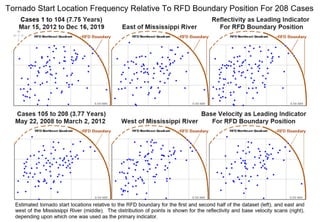
Estimated tornado start locations relative to the RFD boundary for the first and second half of the dataset (left), and east and west of the Mississippi River (middle). The distribution of points is shown for the reflectivity and base velocity scans (right), depending upon which one was used as the primary indicator.