Landscape design for multimodal transport corridors
•
8 likes•2,603 views

Dissertation on Landscape design for Multimodal Transport Corridors with regards to Chennai

Recommended
More Related Content
What's hot
What's hot (20)
Similar to Landscape design for multimodal transport corridors
Similar to Landscape design for multimodal transport corridors (20)
More from Geeva Chandana
More from Geeva Chandana (20)
Recently uploaded
Recently uploaded (20)
Landscape design for multimodal transport corridors
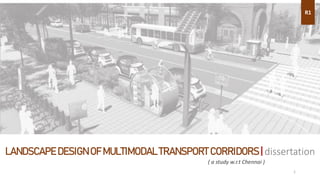
- 1. LANDSCAPE DESIGN OF MULTIMODAL TRANSPORT CORRIDORS | dissertation R1 1 ( a study w.r.t Chennai )
- 2. 2 STRUCTURE OF THE DISSERTATION | research process INTRODUCTION OF THE PROBLEM DATA COLLECTION ANALYSIS & FINDINGS CONCLUSION & INTERPREATATION 1. ABOUT MULTIMODAL TRANSIT CORRIDORS 2. ADVANTAGES & DISADVANTAGES 3. AIM 4. OBJECTIVE 5. NEED FOR STUDY AND ITS SIGNIFICANCE 6. POTENTIAL OF LANDSCAPE IN MULTIMODAL TRANSPORT CORRIDORS 1. TRANSIT SYSTEMS IN CHENNAI 2. USERS OF PUBLIC TRANSPORT SYSTEMS 3. ISSUES FACED IN TRANSIT SYSTEMS 4. IDENTIFICATION OF POTENTIAL NODES 5. CHALLENGES IN LANDSCAPE DESIGN 1. CASE STUDIES OF MULTIMODAL TRANSIT SYSTEMS – INDIA & ABROAD 2. COMPARISON OF PROJECTS IN DIFFERENT COUNTRIES 3. PROJECT SUCCESS COMPARISON IN INDIAN CITIES 4. LANDSAPING POTENTIAL & INFLUENCE IN THESE PROJECTS
- 3. 3 RESEARCH PROCESS | data collection DATA COLLECTION LITERATURE REVIEW ARTICLES & RESEARCH WORKS STANDARDS CASE STUDY LITERATURE CASE STUDY QUESTIONNAIRE LIVE CASE STUDY SECONDARY DATA STUDY SIMILAR PROJECTS IN INDIA AND ABROAD PRIMARY DATA • INTERACTION WITH THE PUBLIC – TO ANALYSE THE ISSUES • VISIT DIFFERENT TRANSIT CORRIDORS TO UNDERSTAND THE EXISTING SCENARIO • INTERVIEWS WITH THE FIELD EXPERTS DISCUSSING THE FUTURE PROPOSALS IN CHENNAI • RESEARCH WORKS ON MULTIMODAL TRANSIT SYSTEMS • UNDERSTANDING THE TRAFFIC FLOW, USAGE, DESIGN, PATTERN • UNDERSTANDING BYE LAWS ON THE DESIGN OF TRANSIT SYSTEMS POTENTIALOFLANDSCAPEINMULTIMODALTRANSITSYSTEM CASE STUDY AND MIXED METHOD OF RESEARCH
- 4. 4 AIM OBJECTIVE • This study aims to project the need for landscapes in multimodal transit corridors, which improves the aesthetics, prevents illegal activities and makes more usable public spaces. • This study also analyses efficient methods to achieving the same through existing case studies and proposals. • This study also aims to understand the factors influencing imageability of a city and to study in detail about the elements contributing to the image of the city. • And to analyze the methods to enhance these elements – nodes, path and edges which is our transport corridors. • This study also analyses sustainable contexts in urban landscape design, usage of local materials, techniques and skills to make it an eco-friendly design. • This study analyses various road transport corridors of different contexts, and understand different approaches towards landscape architecture in these corridors. • The study limits it to different road transit systems like roadways, railways, pedestrian ways, and flyover system of transport. • This study also looks upon local regulations, bylaws, recommendations and standards which can be adapted in revitalization. Also analyses how landscape can be efficiently used in these projects. • This study also analyses plant species which are suitable for this design, and various elements of landscape which can be used in the design.
- 5. 5 WHAT ARE MULTI – MODAL TRANSPORT CORRIDORS • Multi Modal Transportation System (MMTS) explores the co-ordinated use of two or more modes of transport for speedy, safe, pleasant and comfortable movement of passengers in urban areas. It provides convenient and economical connection of various modes to make complete journey from origin to destination. • Generally, MMTS has been characterized by increased capacity, efficient access and better location of both integration and nodes. • Public transport is an important constituent of multi–modal transportation system and hence local and regional public transportation system must be as integral part of the same.
- 6. 6 S W O T STRENGTH WEAKNESS OPPORTUNITY THREAT • Providing reliable and affordable public transport • Improving transportation safety • Developing transportation legislations • Integration of various transport corridors • Cleanliness and improved legibility • Managing traffic congestion • Discouraging the use of cars and encouraging the use of public transport. • Providing access to passengers with special needs • Protecting the environment • Improve imageability of the city • Remove hawkers / encroachments • Large areas of land needed • Cost of construction is more • Maintenance is more • Cannot be applied in less traffic area • Cannot be applied in cities with no road widening options / historic cities • If the project is not used to its fullest capacity, large acres of land in high economic areas are wasted. • If the design or planning is not efficient, it may lead to squatters, encroachments or illegal activities. • If not designed efficiently, it spoils the imageability of the city.
- 7. 7 SIGNIFICANCE OF THE STUDY • Most of the people observe the city when travelling. Thus what they see, they picture a mental map of the city. • Unfortunately, in most of the cities, this is ignored and it results in unutilized or underutilized spaces. As these are large open spaces, landscape can be a vital tool to solve this issue. • A good image of the city should portray its evolution, culture, and should be a balance between global and local environment. Thus landscape plays a vital role in narration of this history. • The multimodal transit corridors which are not effectively designed, creates a lot of negative impacts in the city. • Since the transport corridors include large piece of lands, if it’s not planned, hectares of land in a high economic area is wasted. • When the city itself is lacking proper open spaces or space for recreation, these pockets which are negatively used spoils the cityscape. • These spaces which are underutilized is occupied by squatters and used as encroachments. Or these are used for criminal activities, by street hawkers, and makes it unsafe for the public. • It creates undesirable views, often littered and becomes area of garbage disposal. • Thus making the neighborhood unfit for living and promotes development of slums.
- 8. 8 NEED FOR STUDY • Though the city has great infrastructural advancement, if the viewers don’t get the intended imageability of the city, the design will not be successful. • And in the need for expansion of the transit corridors and development of the transport systems in three dimension in the form of flyovers and metro lanes, the imageability is affected all the more. Since most of these transport systems causes infrastructural voids below or adjacent to the development. • This inturn results in illegal usage, encroachments and by hawkers. Even the smaller lanes – streets are affected if it’s unplanned. • Most of the pedestrian walkways in the city is either occupied by the hawkers or used by the motor vehicles. • The dead zones form the dump yard of the city. • Thus proper care should be taken while planning these areas. Since the city is moving towards a sustainable development, landscape can play a key role in this process.
- 9. 9 POTENTIAL OF SPACE IN MULTIMODAL CORRIDOR • The space in the multimodal transit corridors is not always programmed, it doesn’t have a territory and it’s used by different people at different point of time. • Thus in city, this can be used as a place for public gathering. It can either be formal or informal public space. • This portion of urban land is generally free from tenure disputes, real estate and politics. Thus this can become a breathing area in an urban space. • The transport corridors and pedestrian walkways are often neglected from landscape. Thus the negative impacts produced by these underutilized spaces in transport corridors can be reduced through careful landscape design and efficient incorporation of spaces in their surrounding urban environment. • With the increased need for landscaping due to environmental changes, there is also a need for sustainable transport systems. Thus this in turn reduces the effects of pollution. • Thus this study brings out different context and solution through landscape design.
- 10. 10 CASE STUDY STRUCTURE CASESTUDIES INDIAN 1. Mumbai Multimodal Corridor 2. Rainbow BRT, Pune 3. Bangalore Metro INTERNATIONAL 1. Hong Kong, China 2. Singapore 3. Dubai SITE STUDIES 1. OMR Corridor - road 2. MRTS Corridor - rail 3. CMRL Corridor - metro ChennaiAsian
- 11. 11 CHENNAI | multimodal transit system study
- 12. 12 CHENNAI TODAY Source: CMRL presentation on challenges in multimodal transportation in Chennai City • TOTAL VEHICLE POPULATION: 33.75 lakhs • Registered vehicles increased 5 times during last 16 years • Around 2 lakh vehicle registration per year • Compound Annual Average Growth Rate: 12.5% • Bus / Lakh Population remained almost stagnant – 1981 – 2008 • Metropolitan Transport Corporation (MTC) operates – Bus Routes – 640 Fleet Size – 3300 • BUS – 58 lakhs trips / day • SUB URBAN RAIL – 9 lakh trips / day • MRTS – 1 lakhs trips / day GeminiFlyover
- 13. 13 COMPARISON OF MODAL TRANSPORT BETWEEN CITIES Source: MoUD, Traffic & Transportation Policies and Strategies in Urban Areas in India, 2008 Chennai 30% 14% 7% 2.5% 4% Source: Traffic & Transportation Policies and Strategies in Urban Areas in India, adjusted data from 1990’s Chennai 38% PUBLIC TRANSPORT SHARE DRASTICALLY REDUCED FROM 54% (1970) TO 31% (2008) in Chennai
- 14. 14 EXISTING TRANSPORTATION STUDY Road classifications in CMA Type of Junctions in CMA Source: Chennai Comprehensive Transportation Study, CMDA, 2010
- 15. 15 FUTURE PROJECTION Goals achievable by implementing the multimodal transport schemes Source: Chennai Comprehensive Transportation Study, CMDA, 2010
- 16. 16 DATA COLLECTION | questionnaires
- 17. 17 For what purpose you use the OMR & Sardar Patel road? What mode of Transportation you use? Source: Based on Questionnaire after surveying 100 people in Madhya Kailash Junction 76% 16% 8% TRIP PURPOSE WORK / BUSSINESS EDUCATION SOCIAL 47% 22% 14% 11% 1%5% TRANSPORT TYPE BIKE / CAR (OWN) BUS MRTS OLA / UBER / AUTO CYCLE OTHERS QUESTIONNAIRE | Survey
- 18. 18 QUESTIONNAIRE | Survey What do you want to change about transit systems in the city? What comes to your mind when you think about Chennai’s transport? Source: Based on Questionnaire after surveying 100 people & Architects opinion 13% 9% 7% 11% 25% 5% 26% 4% CHANGES NEEDED WIDER ROADS DESIGNATED WALKWAYS REMOVE HAWKERS CLEANLINESS SHADE LIGHTING LESS TRAFFIC OTHERS 33% 28% 15% 19% 5% IMAGEABILITY CONGESTED / TRAFFIC GOOD INFRASTRUCTURE CLEANLINESS GARBAGE DISPOSAL OTHERS
- 19. 19 What's is your opinion on importance of landscaping the transit corridors? What’s your opinion on multimodal transit system? Source: Based on Questionnaire after surveying 100 people & Architects opinion 64% 20% 7% 9% NECESSITY OF LANDSCAPE VERY ESSENTIAL DESIRABLE NOT REQUIRED NO IDEA 23% 13% 12% 28% 7% 17% MULTIMODAL TRANSIT REDUCE CONGESTION INCREASE ACCESSIBILITY IMPROVED SAFETY REDUCED TRAVEL TIME LESS FUEL CONSUMPTION LESS TRAVEL EXPENDITURE ECO FRIENDLY QUESTIONNAIRE | Survey
- 20. 20 What amenities / spaces do you want to be integrated in a transit corridor? Do you need a separate Cycle Track? Source: Based on Questionnaire after surveying 100 people & Architects opinion 43% 29% 19% 9% NECESSITY OF CYCLE TRACK VERY ESSENTIAL DESIRABLE NOT REQUIRED NO IDEA 25% 14% 13%7% 11% 6% 4% 3% 4% 2% 11% AMENITIES TREES / SHADE SEATING SEPARATE WALKWAYS LIGHTING OPEN SPACE / GATHERING SPACE RECREATIONAL WATER FEATURE / STATUES SEPARATE CYCLE TRACKS CROSSINGS GOOD FRONTAGE PARKING SPACE QUESTIONNAIRE | Survey
- 21. 21 DATA COLLECTION | live case study in OMR - MRTS Corridor
- 22. 22 OMR CORRIDOR | live case study • Rajiv Gandhi Salai is a major road connecting Chennai with Mamallapuram in Tamil Nadu. • It is 45 km long and was earlier known as the Old Mahabalipuram Road (OMR). • The road starts from Madhya Kailash Temple Junction on Sardar Patel Road in south-east Chennai and terminates on East Coast Road near Mamallapuram. • The TIDEL Park , home to a number of BPO and IT/ITES companies and many other major IT/ITES Companies in the country are situated along the Rajiv Gandhi Salai. Prominent technical and educational Institutions, national research laboratories are also located along the Corridor. Source: Chennai Comprehensive Transportation Study, CMDA, 2010
- 23. 23 NEED FOR THE PROJECT • Due to heavy movement of traffic and on account of poor soil condition, the pavement of the Corridor had deteriorated. • The opening of the Mass Rapid Transit Line along the three km stretch and the presence of densely populated residential areas along the Kottivakkam-Perungudi stretch had also led to congestion and accidents. • The IT Corridor Project aimed at improving the Corridor to a world-class facility in tune with the progressive and IT/ITES friendly image of Tamil Nadu. PROJECT PHASING • The Rajiv Gandhi Salai Project is being implemented in two phases. Phase-I between Madhya Kailash Temple Junction and Siruseri and Phase-II between Siruseri and Mahabalipuram. • The 2.1 km long ECR Link Road connecting Rajiv Gandhi Salai at Sholinganallur and East Coast Road at Kudumiyandithoppu is also included in Phase-I. OMR CORRIDOR | live case study Source: Chennai Comprehensive Transportation Study, CMDA, 2010
- 24. 24 PROJECT FEATURES • In Phase-I, the 20.1 km stretch between Madhya Kailash Temple Junction to Siruseri is widened to dual three lane carriageway with median, service road, pedestrian footpath and planter strip. • The ECR Link Road has also been improved to dual two lane carriageway. • Another significant feature of the Project is the construction of service trenches/ducts for conveying utility lines including electrical, telephony and optic fibre cables/wires so as to avoid digging in future. The water and sewer lines are also being conveyed under the footpath. • Landscaping and arboriculture, road side arts and sculpture works and value added services have also been undertaken. • A twelve lane state-of-the-art toll plaza has been located at Perungudi with a modern Toll Administration-cum-Office along with four satellite plazas at Pallavaram road, ECR Link road, Medavakkam road and Exit plaza at Navalur. OMR CORRIDOR | live case study Source: Chennai Comprehensive Transportation Study, CMDA, 2010
- 25. 25 OMR – SARDAR PATEL ROAD - TRANSIT CORRIDOR OMRcorridor-Planned Source: Live Case Study
- 26. 26 OMR corridor - Planned OMR corridor - Planned OMR – MRTS TRANSIT CORRIDOR Source: Live Case Study
- 27. 27 OMR corridor - Planned OMR corridor - Planned OMR – MRTS TRANSIT CORRIDOR Source: Live Case Study
- 28. 28 MRTS corridor - UnplannedOMR corridor - Planned OMR – MRTS TRANSIT CORRIDOR Source: Live Case Study
- 29. 29 MRTS corridor - UnplannedOMR corridor - Planned OMR – MRTS TRANSIT CORRIDOR Source: Live Case Study
- 30. 30 OMR corridor - Planned MRTS corridor - Unplanned OMR – MRTS TRANSIT CORRIDOR Source: Live Case Study
- 31. 31 Buckingham Canal - Unplanned Buckingham Canal - Unplanned OMR – MRTS TRANSIT CORRIDOR Source: Live Case Study
- 32. 32 DATA COLLECTION | case study on multimodal proposal in metro corridor
- 33. 33 CMRL NETWORK • Chennai Metro Rail – Improve the Public Transport share with the mission of convenient, fast, economical and reliable • Total Length – 45.1 Km • Corridor 1- 23.1Km • Corridor 2 – 22.0Km • No. of Stations – 32 Nos • No of Interchanges – 2Nos • It is running along the major arterial roads and connecting important places such as Airport, Chennai Central station, Egmore Station, Chennai Mofussil Bus Terminus (CMBT) etc. • About 55% of the corridors in Phase 1 is underground and the remaining is elevated Source: CMRL report on challenges in multimodal transportation in Chennai City
- 34. 34 CMRL NETWORK | intermodal integration Source: CMRL report on challenges in multimodal transportation in Chennai City
- 35. 35 CMRL NETWORK CONCEPT • Integrating various available modes of transport to make it complementary to each other modes so as to ensure the optimal functioning of the existing transportation system. • Providing easy access across various modes at the Metro stations – Seamless Travel TYPES • PHYSICAL INTEGRATION Integrating various modes through Physical Structures • SYSTEM INTEGRATION Integrating various modes through system such as common ticketing system, unlimited passes. Source: CMRL report on challenges in multimodal transportation in Chennai City
- 36. 36 CMRL NETWORK | intermodal integration Source: CMRL report on challenges in multimodal transportation in Chennai City
- 37. 37 ALANDUR METRO STATION LocationCMRL NETWORK | intermodal integration Source: CMRL report on challenges in multimodal transportation in Chennai City
- 38. 38 Concept ALANDUR METRO STATION CMRL NETWORK | intermodal integration Source: CMRL report on challenges in multimodal transportation in Chennai City
- 39. 39 Concept ALANDUR METRO STATION CMRL NETWORK | intermodal integration Source: CMRL report on challenges in multimodal transportation in Chennai City
- 40. 40 Concept ALANDUR METRO STATION CMRL NETWORK | intermodal integration Source: CMRL report on challenges in multimodal transportation in Chennai City
- 41. 41 Concept ALANDUR METRO STATION CMRL NETWORK | intermodal integration Source: CMRL report on challenges in multimodal transportation in Chennai City
- 42. 42 Existing condition ALANDUR METRO STATION CMRL NETWORK | intermodal integration Source: CMRL report on challenges in multimodal transportation in Chennai City
- 43. 43 Proposed corridor ALANDUR METRO STATION CMRL NETWORK | intermodal integration Source: CMRL report on challenges in multimodal transportation in Chennai City
- 44. 44 CASE STUDY | inference COMPONENTS TO BE CONSIDRED BEFORE DESIGNING LANDSCAPE IN MULTIMODAL CORRIDOR • Identification of Station influence area • Pedestrian access / dispersal proposal • Public transportation pick up & drop off facility • Intermediate public transportation pick up & drop off facility • Identification of feeder routes • Parking demand assessment • Enhance existing connectivity • Identification of missing links • Preparation of concept plan
- 45. 45 CASE STUDY | inference CHALLENGES IN DESIGNING LANDSCAPE IN MULTIMODAL CORRIDOR • Stakeholders involvements and ownership • Coordination activity between various stakeholders • Institutional / regulatory setup • Land availability – Provision of facility within available land • Implementation of various schemes / proposals • Rationalization of existing public transport systems • Common ticketing solutions and revenue sharing mechanisms
- 46. 46 PROPOSED INTERMODAL INTEGRATION WITH PUBLIC TRANSPORT • Washermanpet – Link with Washermanpet sub urban station & Mini Bus Station • Central – Interchange with Central SR, Moore Market Suburban, Park Station and MRTS Station • High Court – with Broadway bus stand • Egmore – Intercity and Suburban • CMBT – Intercity Bus Terminus • Alandur & Central – Interchange • St. Thomas Mount – with MRTS, Suburban • Airport Source: CMRL report on challenges in multimodal transportation in Chennai City
- 47. 47 INDIAN CASE STUDIES | pune, bengaluru & mumbai
- 48. 48 PUNE | bus rapid transit system in pimpri chinchwad Proposed corridor • Corridor Length: BRT Network -118.5 km connecting two cities • Riders per Day: 120,000 • Notable Strengths: The Rainbow BRT system introduced BRT in a challenging transportation context. • PCMC prepared the Comprehensive Mobility Plan in 2006 & Identified 10 BRT corridors of 130 km. Source: Pimpri Chinchwad Municipal Corporation
- 49. 49 PUNE | bus rapid transit system in pimpri chinchwad Source: Pimpri Chinchwad Municipal Corporation
- 50. 50 Proposed corridorPUNE | bus rapid transit system in pimpri chinchwad Source: Pimpri Chinchwad Municipal Corporation
- 51. 51 Proposed corridorPUNE | bus rapid transit system in pimpri chinchwad Source: Pimpri Chinchwad Municipal Corporation
- 52. 52 PUNE | bus rapid transit system in pimpri chinchwad Source: Pimpri Chinchwad Municipal Corporation
- 53. 53 PUNE | bus rapid transit system in pimpri chinchwad Source: Pimpri Chinchwad Municipal Corporation
- 54. 54 PUNE | bus rapid transit system in pimpri chinchwad Source: Pimpri Chinchwad Municipal Corporation
- 55. 55 Proposed corridorPUNE | bus rapid transit system in pimpri chinchwad Source: Pimpri Chinchwad Municipal Corporation
- 56. 56 PUNE | bus rapid transit system in pimpri chinchwad Source: Pimpri Chinchwad Municipal Corporation
- 57. 57 Existing HT Towers in the centre of the road have been retained in the BRT corridor. Median Stations constructed in the existing divider with landscaping. PUNE | bus rapid transit system in pimpri chinchwad Source: Pimpri Chinchwad Municipal Corporation
- 58. 58 Median Stations constructed in the existing divider with landscaping Dedicated One Way ROW: median bus lanes on NH (Mumbai-Pune) PUNE | bus rapid transit system in pimpri chinchwad Source: Pimpri Chinchwad Municipal Corporation
- 59. 59 MUMBAI | multi-modal corridor from virar to alibaug Proposed corridor • Length of 140 km (Approx.) • 4+4 lanes (other traffic including BRTS) +Service Roads • Metro (In middle of the Corridor) • Utility Corridor (Under ground) • Non Motorized Transport (Cycles) lane • Estimated Cost : INR 100 billion FEATURES • Metro Rail Corridor: 30m wide, • Access Control Highway for BRT and other traffic: 4 + 4 lane (each 16.5m wide) • Pedestrian footpath with Storm Water Drain: 2.5m each side • Service Road (2 lane): 7m each side • Parking/non-motorized/utility: 8.5m each side Source: Transport & Communications Division, Mumbai Metropolitan Region Development Authority
- 60. 60 Proposed corridor COMPONENTS • Access Controlled Highway • Service Roads • Metro Rail • Bus Rapid Transit • Non-Motorized Traffic Lanes • Pedestrian Foot Paths and Parking • Utilities BENEFITS • High speed movement between the MMR regions • Choice of multiple modes to travel • Easy and fast transfer between modes • Cost savings over development of separate corridors for each transportation mode • As the comprehensive transportation study recommendations for the MMR MUMBAI | multi-modal corridor from virar to alibaug Source: Transport & Communications Division, Mumbai Metropolitan Region Development Authority
- 61. 61 Proposed corridorMUMBAI | multi-modal corridor from virar to alibaug Source: Transport & Communications Division, Mumbai Metropolitan Region Development Authority
- 62. 62 Proposed corridorMUMBAI | multi-modal corridor from virar to alibaug Source: Transport & Communications Division, Mumbai Metropolitan Region Development Authority
- 63. 63 Proposed corridorMUMBAI | multi-modal corridor from virar to alibaug Source: Transport & Communications Division, Mumbai Metropolitan Region Development Authority
- 64. 64 INTERNATIONAL CASE STUDIES | dubai, singapore & china
- 65. 65 SINGAPORE | a city in a garden Proposed corridor • Population (million): 4.16 • Area (km2): 685 • Population density (per km2):6075 • Private car ownership (/1000): 113 • Public transport modal share % of total motorised trips: 63% MEASURES FOR MULTIMODAL TRANSPORT • Physical integration • Network integration • Fare integration • Information integration • Institutional integration Network of Mass Rapid Transit (MRT) and Light Rail Transit (LRT)
- 66. 66 SINGAPORE | a city in a garden
- 67. 67 SINGAPORE | a city in a garden
- 68. 68 SINGAPORE | a city in a garden
- 69. 69 Then Now SINGAPORE | a city in a garden
- 70. 70 SINGAPORE | a city in a garden
- 71. 71 HONG KONG | multimodal transit system Proposed corridor • Population (million): 6.79 • Area (km2): 1100 • Population density (per km2): 6300 • Private car ownership (/1000): 50 • Public transport modal share % of total motorised trips: 90%
- 72. 72 HONG KONG | multimodal transit system
- 73. 73 HONG KONG | multimodal transit system
- 74. 74 HONG KONG | multimodal transit system
- 75. 75 HONG KONG | multimodal transit system
- 76. 76 Proposed corridor • Population (million): 3.102 • Area (km2): 4,114 km2 • The Public Bus Transport system in Dubai is run by the RTA. • The bus system services 140 routes and transported over 109 million people in 2008. DUBAI | multimodal transit system
- 77. 77 OBJECTIVE • Managing traffic congestion • Providing reliable and affordable public transport • Improving transportation safety • Discouraging the use of cars and encouraging the use of public transport. • Bringing a behavioural change in a car-dominated society, where average vehicle occupancy is 1.7 passengers per vehicle • Providing access to passengers with special needs • Developing transportation legislations • Protecting the environment DUBAI | multimodal transit system
- 78. 78 DUBAI | multimodal transit system
- 79. 79 DUBAI | multimodal transit system
- 80. 80 DUBAI | multimodal transit system
- 81. 81 DUBAI | multimodal transit system
- 82. 82 GUIDELINES | for design of multimodal transit corridors
- 83. 83 GENERAL PRINCIPLES IN DESIGNING A MULTIMODAL TRANSIT CORRIDOR Source: Transit Oriented Design Standard, Institute for Transportation and Development Policy, 2017
- 84. 84 GENERAL PRINCIPLES IN DESIGNING A MULTIMODAL TRANSIT CORRIDOR Source: Transit Oriented Design Standard, Institute for Transportation and Development Policy, 2017
- 85. 85 GENERAL PRINCIPLES IN DESIGNING A MULTIMODAL TRANSIT CORRIDOR Source: Transit Oriented Design Standard, Institute for Transportation and Development Policy, 2017
- 86. 86 GENERAL PRINCIPLES IN DESIGNING A MULTIMODAL TRANSIT CORRIDOR Source: Transit Oriented Design Standard, Institute for Transportation and Development Policy, 2017
- 87. 87 GENERAL PRINCIPLES IN DESIGNING A MULTIMODAL TRANSIT CORRIDOR Source: Transit Oriented Design Standard, Institute for Transportation and Development Policy, 2017
- 88. 88 GENERAL PRINCIPLES IN DESIGNING A MULTIMODAL TRANSIT CORRIDOR Source: Transit Oriented Design Standard, Institute for Transportation and Development Policy, 2017
- 89. 89 GENERAL PRINCIPLES IN DESIGNING A MULTIMODAL TRANSIT CORRIDOR Source: Transit Oriented Design Standard, Institute for Transportation and Development Policy, 2017
- 90. 90 FOR NEXT REVIEW… DATACOLLECTION DETAILED CASE STUDIES – INDIAN & INTERNATIONAL STUDY OF DEVELOPMENT RULES STUDY OF LANDSCAPE DESIGN PRINCIPLES DETAILED STUDY ON PLANT SPECIES FOR TRANSIT CORRIDORS IN CHENNAI PLANT HEIGHTS & COMPOSTION ANALYSIS&FINDINGS COMPARISON OF MULTIMODAL TRANSPORT SYSTEMS IN DIFFERENT CITIES ANALYSIS OF LANDSCAPE DESIGN SUGGESTIONS OF PLANT SPECIES GUIDELINES FOR LANDSCAPE DEVELOPMENT IN TRANSIT CORRIDORS IN CHENNAI INTERPREATIONOF COLLECTEDDATA INTERPRETATION THROUGH CHARTS, TABLES AND GRAPHS SOLUTIONS FOR ISSUES FACED IN CHENNAI FINAL GUIDELINES FOR LANDSCAPE DEVELOPMENT AND MANAGEMENT IN CHENNAI PROPOSALS FOR LANDSCAPE DESIGN IN MULTIMODAL TRANSIT CORRIDORS IN CHENNAI
- 91. 91 | GEEVA CHANDANA |