SlideShare uma empresa Scribd logo
1 de 29
Baixar para ler offline
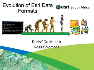
Evolution of Esri Data
       Formats


            Rudolf De Munnik
             Ross Solomons
Seminar Outline
 • Introduction

 • Legacy Formats
 • Demonstration

 • Current Formats
 • BREAK (15min)
 • Demonstration

 • Future Formats
 • Demonstration

 • Questions / Discussions
Introduction
• Purpose of the seminar:
 − History of formats.
 − Awareness to the optimal usage of the
   software and data formats.
 − Purpose, advantages and disadvantages of
   formats
 − What the future holds…
History Timeline


 1982(ArcInfo)          1986(PC ArcInfo)   1991(ArcInfo)    1991(ArcCAD)
  Coverages                Coverages          GRID              CAD


1991(ArcView 1)   1994(ArcInfo) 1995(ArcSDE)    1996        1999(ArcView 3.2)
  Shapefiles        ArcStorm       RDBMS     (MapObjects)   Models, Extensions


1997(ArcView IMS) 1999(ArcIMS)     2001(ArcGIS 8.1)     2006      ArcGIS 10.1
  Map Services    Map Services      Geodatabase (ArcGIS Server 9.2)  2012
                                                    Map Services     Cloud
Legacy Formats
• Organizational use:
 − Projects and Departments
• Users:
 − Data capturing and storage


 Project   Department
Legacy Formats
• ArcInfo Coverages:


                       Topology:
                       - Build command
                       - Clean command

                       Model for the
                       Geodatabase
                       Feature Dataset
ArcInfo Workstation
Legacy Formats
• ArcStorm:
 −   Central storage and checkout editing
 −   Coverage based
 −   Tile structure
 −   Pessimistic locking of Tiles
 −   Checked out Tiles not available to other users
 −   Mapped network drives
 −   No Relational database
 −   Initial concepts for SDE
Legacy Formats
• ArcSDE:
 −   Store Spatial data in a Relational Database
 −   Oracle, Informix, DB2
 −   Utilise Spatial Types (OGC)
 −   No Geodatabase functions
 −   No Feature Datasets
 −   Allow raster storage
 −   Rasters fast, but large.
 −   Raster duplication.
Legacy Formats
• Shapefile legacy:
 − Simple geographic data
   format
 − Big Demand for simple
   storage
 − Open Exchange format
 − Adopted as standard
 − Interoperability buzzword
 − Point, Line and Polygon only
Demonstration
• ArcInfo Workstation
• ArcView 3.2
Current Formats Overview
• Organization:
    − Projects, Departments, Enterprise
• User:
    − Analysis and Consume

•   Shapefile limitations
•   Geodatabase advantages
•   Services
•   Mobile
•   Cloud
Organizational Use
• Projects
 − Shapefiles and File Geodatabase
• Departments
 − Geodatabase (Oracle, SQL…)
• Enterprise
 − Geodatabase (Oracle, SQL…)
 − Services  (ArcGIS Server)


 Project     Department
                          Enterprise
Shape file Limitations
•   No Topology
•   No Attribute validation
•   Size limitation (2GB)
•   No complex geometry
•   No multiuser editing
                                  To Geodatabase
•   No Annotation


                                     Shapefile
•   DBF Limitations
    − Data types e.g. date/time
    − Field names 10 chars                       Shapefile

    − Blobs
Not using full potential of ArcGIS
Geodatabase Advantages
• What is a Geodatabase?
 − Central storage and management location for
   rich collection of spatial data,
 − Sophisticated rules and relationships.
 − Geoprocessing and symbology.
Geodatabase Advantages
• Why use a Geodatabase?
 −   Integration with RDBMS (Oracle, SQL..)
 −   Multi-user editing (versions)
 −   Topology rules and behavior
 −   Attribute validation (domains)
 −   Greater storage capacity
 −   Lower storage requirements
 −   Optimized performance
 −   Scalable (File GDB, SQL Express, Enterprise)

 Leverage full potential of ArcGIS!!
Geodatabase elements
Geodatabase                        Tables
Feature dataset
                                   Raster datasets
   Spatial reference

                                   Raster mosaic
 Feature classes
    Polygon            Route       Additional geodatabase elements
    Line               Dimension   Survey datasets   Terrain datasets
    Point
                                   GPS Datasets      Schematics
    Annotation
                                   Network datasets Representations
 Relationship classes
                                   Toolboxes
 Geometric networks                      Tool           Model           Script
 Topology                          Behavior
                                   Attribute defaults       Connectivity rules
 Network datasets                  Attribute domains        Relationship rules
                                   Split/Merge policy       Topology rules
Geodatabase Design
• Domains, Attachments and Aliases
 −   Utilize on multiple platforms
 −   Design for editing in Desktop
 −   Design for Server applications
 −   Design for Mobile
                                     Validation in Attributes dialog box
     Validation in attribute table
Feature Dataset defined
• Logical grouping of Feature Classes that
  participate in a behavioral function e.g.
  Topology.
• Common coordinate system for all contained
  Feature Classes.
• User permission set on Feature Dataset level.
• Feature Class name unique in Geodatabase,
  not in Feature Dataset.
• Not to be used to organize data – not a
  directory!
Services
• Dynamic Services
  − Live content from Geodatabase
  − View updates
  − Interrogate data

• Cached Services
  − Predefined Tile schema at
    various scales
  − Stored as images in Tile
    structure

• Image Services
  − Single or mosaic images served
Mobile
• Mobile (GPS)
  −   High accuracy devices
  −   Data capture
  −   Ruggedized
  −   Purpose driven
  −   Workflow
  −   Geodatabase design

• Mobile (Smartphone)
  −   Windows, Apple, Android
  −   Executive monitoring
  −   Planning
  −   Geodatabase design
Online (Cloud) content
• Online content
  − Image and Street
  − Desktop, Server, Mobile
  − Online access control

• Subscription
  −   Personal
  −   Organization
  −   Upload data/proc
  −   Applications and
      Dashboards
BREAK
• 15 Minute Break
Demonstration
• Geodatabase:
 −   Elements
 −   Topology
 −   Network analysis
 −   Domains
 −   Representations
 −   Annotation

 − Attachments
 − Geometric Networks
Demonstration
• Services
• Mobile
• Online content
Future Formats
• Organizational use:
 − Projects, Departments, Enterprise
 − Societal
• Users
 − Everyone


 Project   Department                  Societal
                         Enterprise
Demonstration
• Social Media
• 3D Web Viewer (Braamfontein)
• 3D Web Viewer (Airport )
Questions & Discussions

Thank You !

Mais conteúdo relacionado

Mais procurados

Applications of Arc GIS
Applications of Arc GISApplications of Arc GIS
Applications of Arc GISExtraPDFs
 
Digital image classification22oct
Digital image classification22octDigital image classification22oct
Digital image classification22octAleemuddin Abbasi
 
Atmospheric correction albufera_web
Atmospheric correction albufera_webAtmospheric correction albufera_web
Atmospheric correction albufera_webGabriel Parodi
 
GEOGRAPHICAL INFORMATION SYSTEM (GIS)
GEOGRAPHICAL INFORMATION SYSTEM (GIS)GEOGRAPHICAL INFORMATION SYSTEM (GIS)
GEOGRAPHICAL INFORMATION SYSTEM (GIS)MAHENDRA PRATAP SWAIN
 
Commonly used ground truth equipments
Commonly used ground truth equipmentsCommonly used ground truth equipments
Commonly used ground truth equipmentsHimangshuKalita10
 
Radar remote sensing, P K MANI
Radar remote sensing, P K MANIRadar remote sensing, P K MANI
Radar remote sensing, P K MANIP.K. Mani
 
Digital image classification
Digital image classificationDigital image classification
Digital image classificationAleemuddin Abbasi
 
Digital image processing 1
Digital  image processing 1Digital  image processing 1
Digital image processing 1Dhaval Jalalpara
 
Remote Sensing in Digital Model Elevation
Remote Sensing in Digital Model ElevationRemote Sensing in Digital Model Elevation
Remote Sensing in Digital Model ElevationShishir Meshram
 
Geodatabase: The ArcGIS Mechanism for Data Management
Geodatabase: The ArcGIS Mechanism for Data ManagementGeodatabase: The ArcGIS Mechanism for Data Management
Geodatabase: The ArcGIS Mechanism for Data ManagementEsri South Africa
 
Photogrammetry - Space Resection by Collinearity Equations
Photogrammetry - Space Resection by Collinearity EquationsPhotogrammetry - Space Resection by Collinearity Equations
Photogrammetry - Space Resection by Collinearity EquationsAhmed Nassar
 
Geospatial Data ppt.pptx
Geospatial Data ppt.pptxGeospatial Data ppt.pptx
Geospatial Data ppt.pptxDhanya184890
 
GPS (GLOBAL POSITIONING SYSTEM)
GPS (GLOBAL POSITIONING SYSTEM)GPS (GLOBAL POSITIONING SYSTEM)
GPS (GLOBAL POSITIONING SYSTEM)Abdul mannan Karim
 
Geographic coordinate system & map projection
Geographic coordinate system & map projectionGeographic coordinate system & map projection
Geographic coordinate system & map projectionvishalkedia119
 

Mais procurados (20)

Applications of Arc GIS
Applications of Arc GISApplications of Arc GIS
Applications of Arc GIS
 
Digital image classification22oct
Digital image classification22octDigital image classification22oct
Digital image classification22oct
 
Atmospheric correction albufera_web
Atmospheric correction albufera_webAtmospheric correction albufera_web
Atmospheric correction albufera_web
 
Gis functions
Gis functionsGis functions
Gis functions
 
GEOGRAPHICAL INFORMATION SYSTEM (GIS)
GEOGRAPHICAL INFORMATION SYSTEM (GIS)GEOGRAPHICAL INFORMATION SYSTEM (GIS)
GEOGRAPHICAL INFORMATION SYSTEM (GIS)
 
Commonly used ground truth equipments
Commonly used ground truth equipmentsCommonly used ground truth equipments
Commonly used ground truth equipments
 
Remote Sensin
Remote SensinRemote Sensin
Remote Sensin
 
Orthomaps and photomap
Orthomaps and photomapOrthomaps and photomap
Orthomaps and photomap
 
Radar remote sensing, P K MANI
Radar remote sensing, P K MANIRadar remote sensing, P K MANI
Radar remote sensing, P K MANI
 
Digital image classification
Digital image classificationDigital image classification
Digital image classification
 
Digital image processing
Digital image processingDigital image processing
Digital image processing
 
Digital image processing 1
Digital  image processing 1Digital  image processing 1
Digital image processing 1
 
Remote Sensing in Digital Model Elevation
Remote Sensing in Digital Model ElevationRemote Sensing in Digital Model Elevation
Remote Sensing in Digital Model Elevation
 
Geodatabase: The ArcGIS Mechanism for Data Management
Geodatabase: The ArcGIS Mechanism for Data ManagementGeodatabase: The ArcGIS Mechanism for Data Management
Geodatabase: The ArcGIS Mechanism for Data Management
 
Photogrammetry - Space Resection by Collinearity Equations
Photogrammetry - Space Resection by Collinearity EquationsPhotogrammetry - Space Resection by Collinearity Equations
Photogrammetry - Space Resection by Collinearity Equations
 
Thermal remote sensing
Thermal remote sensingThermal remote sensing
Thermal remote sensing
 
Geospatial Data ppt.pptx
Geospatial Data ppt.pptxGeospatial Data ppt.pptx
Geospatial Data ppt.pptx
 
LANDSAT
LANDSATLANDSAT
LANDSAT
 
GPS (GLOBAL POSITIONING SYSTEM)
GPS (GLOBAL POSITIONING SYSTEM)GPS (GLOBAL POSITIONING SYSTEM)
GPS (GLOBAL POSITIONING SYSTEM)
 
Geographic coordinate system & map projection
Geographic coordinate system & map projectionGeographic coordinate system & map projection
Geographic coordinate system & map projection
 

Semelhante a Evolution of Esri Data Formats Seminar

Data managing and Exchange GDB
Data managing and Exchange GDB Data managing and Exchange GDB
Data managing and Exchange GDB Esri
 
Arc gis desktop_and_geoprocessing
Arc gis desktop_and_geoprocessingArc gis desktop_and_geoprocessing
Arc gis desktop_and_geoprocessingEsri
 
Materi Geodatabase Management - Fellowship 2022.pdf
Materi Geodatabase Management - Fellowship 2022.pdfMateri Geodatabase Management - Fellowship 2022.pdf
Materi Geodatabase Management - Fellowship 2022.pdfsakinatunnajmi
 
Ozri 2013 Brisbane, Australia - Geodatabase Efficiencies
Ozri 2013 Brisbane, Australia - Geodatabase EfficienciesOzri 2013 Brisbane, Australia - Geodatabase Efficiencies
Ozri 2013 Brisbane, Australia - Geodatabase EfficienciesWalter Simonazzi
 
Architecting the ArcGIS Platform
Architecting the ArcGIS PlatformArchitecting the ArcGIS Platform
Architecting the ArcGIS PlatformEsri UK
 
Enterprise geodatabase sql access and administration
Enterprise geodatabase sql access and administrationEnterprise geodatabase sql access and administration
Enterprise geodatabase sql access and administrationbrentpierce
 
NDGeospatialSummit2019 - ArcGIS Pro – Next-Generation Desktop GIS
NDGeospatialSummit2019 - ArcGIS Pro – Next-Generation Desktop GISNDGeospatialSummit2019 - ArcGIS Pro – Next-Generation Desktop GIS
NDGeospatialSummit2019 - ArcGIS Pro – Next-Generation Desktop GISNorth Dakota GIS Hub
 
GWT 2014: Emergency Conference - 02 le soluzioni geospaziali per la gestione ...
GWT 2014: Emergency Conference - 02 le soluzioni geospaziali per la gestione ...GWT 2014: Emergency Conference - 02 le soluzioni geospaziali per la gestione ...
GWT 2014: Emergency Conference - 02 le soluzioni geospaziali per la gestione ...Planetek Italia Srl
 
NAPSG 2010 Fire/EMS Conference - Data Sharing Basics
NAPSG 2010 Fire/EMS Conference - Data Sharing BasicsNAPSG 2010 Fire/EMS Conference - Data Sharing Basics
NAPSG 2010 Fire/EMS Conference - Data Sharing Basicspdituri
 
Arc gis introduction-ppt
Arc gis introduction-pptArc gis introduction-ppt
Arc gis introduction-pptAshok Peddi
 
GWT 2014: Energy Conference - 02 Le soluzioni Geospaziali per il mondo energy
GWT 2014: Energy Conference - 02 Le soluzioni Geospaziali per il mondo energyGWT 2014: Energy Conference - 02 Le soluzioni Geospaziali per il mondo energy
GWT 2014: Energy Conference - 02 Le soluzioni Geospaziali per il mondo energyPlanetek Italia Srl
 
Presentation MIG-T GeoPackage.pdf
Presentation MIG-T GeoPackage.pdfPresentation MIG-T GeoPackage.pdf
Presentation MIG-T GeoPackage.pdfssusera932351
 
Building good web_maps, Esri, Joris Bak
Building good web_maps, Esri, Joris BakBuilding good web_maps, Esri, Joris Bak
Building good web_maps, Esri, Joris BakEsri Nederland
 
2016 workshops: understanding the language of gis and cad by warren geissler
2016 workshops:  understanding  the language  of gis and cad by warren geissler2016 workshops:  understanding  the language  of gis and cad by warren geissler
2016 workshops: understanding the language of gis and cad by warren geisslerGIS in the Rockies
 
Apdm 101 Arc Gis Pipeline Data Model (1)
Apdm 101 Arc Gis Pipeline Data Model  (1)Apdm 101 Arc Gis Pipeline Data Model  (1)
Apdm 101 Arc Gis Pipeline Data Model (1)David Nichter, GISP
 
Development of a Prototype Web GIS Server for HDF-EOS Data based on OGC Web M...
Development of a Prototype Web GIS Server for HDF-EOS Data based on OGC Web M...Development of a Prototype Web GIS Server for HDF-EOS Data based on OGC Web M...
Development of a Prototype Web GIS Server for HDF-EOS Data based on OGC Web M...The HDF-EOS Tools and Information Center
 
Lecture 1b introduction to arc gis
Lecture 1b  introduction to arc gisLecture 1b  introduction to arc gis
Lecture 1b introduction to arc gisAbir Mohammad
 

Semelhante a Evolution of Esri Data Formats Seminar (20)

Data managing and Exchange GDB
Data managing and Exchange GDB Data managing and Exchange GDB
Data managing and Exchange GDB
 
Arc gis desktop_and_geoprocessing
Arc gis desktop_and_geoprocessingArc gis desktop_and_geoprocessing
Arc gis desktop_and_geoprocessing
 
Materi Geodatabase Management - Fellowship 2022.pdf
Materi Geodatabase Management - Fellowship 2022.pdfMateri Geodatabase Management - Fellowship 2022.pdf
Materi Geodatabase Management - Fellowship 2022.pdf
 
Ozri 2013 Brisbane, Australia - Geodatabase Efficiencies
Ozri 2013 Brisbane, Australia - Geodatabase EfficienciesOzri 2013 Brisbane, Australia - Geodatabase Efficiencies
Ozri 2013 Brisbane, Australia - Geodatabase Efficiencies
 
Architecting the ArcGIS Platform
Architecting the ArcGIS PlatformArchitecting the ArcGIS Platform
Architecting the ArcGIS Platform
 
Enterprise geodatabase sql access and administration
Enterprise geodatabase sql access and administrationEnterprise geodatabase sql access and administration
Enterprise geodatabase sql access and administration
 
NDGeospatialSummit2019 - ArcGIS Pro – Next-Generation Desktop GIS
NDGeospatialSummit2019 - ArcGIS Pro – Next-Generation Desktop GISNDGeospatialSummit2019 - ArcGIS Pro – Next-Generation Desktop GIS
NDGeospatialSummit2019 - ArcGIS Pro – Next-Generation Desktop GIS
 
GWT 2014: Emergency Conference - 02 le soluzioni geospaziali per la gestione ...
GWT 2014: Emergency Conference - 02 le soluzioni geospaziali per la gestione ...GWT 2014: Emergency Conference - 02 le soluzioni geospaziali per la gestione ...
GWT 2014: Emergency Conference - 02 le soluzioni geospaziali per la gestione ...
 
Geoservices Activities at EDINA
Geoservices Activities at EDINAGeoservices Activities at EDINA
Geoservices Activities at EDINA
 
ArcGIS10 Land Records Mgmt (EPAN 2010)
ArcGIS10 Land Records Mgmt (EPAN 2010)ArcGIS10 Land Records Mgmt (EPAN 2010)
ArcGIS10 Land Records Mgmt (EPAN 2010)
 
NAPSG 2010 Fire/EMS Conference - Data Sharing Basics
NAPSG 2010 Fire/EMS Conference - Data Sharing BasicsNAPSG 2010 Fire/EMS Conference - Data Sharing Basics
NAPSG 2010 Fire/EMS Conference - Data Sharing Basics
 
Arc gis introduction-ppt
Arc gis introduction-pptArc gis introduction-ppt
Arc gis introduction-ppt
 
GWT 2014: Energy Conference - 02 Le soluzioni Geospaziali per il mondo energy
GWT 2014: Energy Conference - 02 Le soluzioni Geospaziali per il mondo energyGWT 2014: Energy Conference - 02 Le soluzioni Geospaziali per il mondo energy
GWT 2014: Energy Conference - 02 Le soluzioni Geospaziali per il mondo energy
 
Presentation MIG-T GeoPackage.pdf
Presentation MIG-T GeoPackage.pdfPresentation MIG-T GeoPackage.pdf
Presentation MIG-T GeoPackage.pdf
 
Bb geodatabase
Bb geodatabaseBb geodatabase
Bb geodatabase
 
Building good web_maps, Esri, Joris Bak
Building good web_maps, Esri, Joris BakBuilding good web_maps, Esri, Joris Bak
Building good web_maps, Esri, Joris Bak
 
2016 workshops: understanding the language of gis and cad by warren geissler
2016 workshops:  understanding  the language  of gis and cad by warren geissler2016 workshops:  understanding  the language  of gis and cad by warren geissler
2016 workshops: understanding the language of gis and cad by warren geissler
 
Apdm 101 Arc Gis Pipeline Data Model (1)
Apdm 101 Arc Gis Pipeline Data Model  (1)Apdm 101 Arc Gis Pipeline Data Model  (1)
Apdm 101 Arc Gis Pipeline Data Model (1)
 
Development of a Prototype Web GIS Server for HDF-EOS Data based on OGC Web M...
Development of a Prototype Web GIS Server for HDF-EOS Data based on OGC Web M...Development of a Prototype Web GIS Server for HDF-EOS Data based on OGC Web M...
Development of a Prototype Web GIS Server for HDF-EOS Data based on OGC Web M...
 
Lecture 1b introduction to arc gis
Lecture 1b  introduction to arc gisLecture 1b  introduction to arc gis
Lecture 1b introduction to arc gis
 

Mais de Esri South Africa

Esri South Africa ArcGIS 10.2 Rollout
Esri South Africa ArcGIS 10.2 Rollout Esri South Africa ArcGIS 10.2 Rollout
Esri South Africa ArcGIS 10.2 Rollout Esri South Africa
 
Esri Africa User Conference 2014
Esri Africa User Conference 2014Esri Africa User Conference 2014
Esri Africa User Conference 2014Esri South Africa
 
The Gauteng City Region keynote address
The Gauteng City Region keynote addressThe Gauteng City Region keynote address
The Gauteng City Region keynote addressEsri South Africa
 
GIS as a Platform by Sam Viana (Esri Inc)
GIS as a Platform by Sam Viana (Esri Inc)GIS as a Platform by Sam Viana (Esri Inc)
GIS as a Platform by Sam Viana (Esri Inc)Esri South Africa
 
Data Interoperabilty Extension
Data Interoperabilty Extension Data Interoperabilty Extension
Data Interoperabilty Extension Esri South Africa
 
Esri South Africa Python for Everyone
Esri South Africa Python for EveryoneEsri South Africa Python for Everyone
Esri South Africa Python for EveryoneEsri South Africa
 
Esri South Africa GIS In The Cloud
Esri South Africa GIS In The CloudEsri South Africa GIS In The Cloud
Esri South Africa GIS In The CloudEsri South Africa
 
Licensing in ArcGIS 10.0 and 10.1
Licensing in ArcGIS 10.0 and 10.1Licensing in ArcGIS 10.0 and 10.1
Licensing in ArcGIS 10.0 and 10.1Esri South Africa
 

Mais de Esri South Africa (12)

Esri South Africa ArcGIS 10.2 Rollout
Esri South Africa ArcGIS 10.2 Rollout Esri South Africa ArcGIS 10.2 Rollout
Esri South Africa ArcGIS 10.2 Rollout
 
Esri Africa User Conference 2014
Esri Africa User Conference 2014Esri Africa User Conference 2014
Esri Africa User Conference 2014
 
The Gauteng City Region keynote address
The Gauteng City Region keynote addressThe Gauteng City Region keynote address
The Gauteng City Region keynote address
 
Esri Mobility Basics 2013
Esri Mobility Basics 2013Esri Mobility Basics 2013
Esri Mobility Basics 2013
 
GIS as a Platform by Sam Viana (Esri Inc)
GIS as a Platform by Sam Viana (Esri Inc)GIS as a Platform by Sam Viana (Esri Inc)
GIS as a Platform by Sam Viana (Esri Inc)
 
Data Interoperabilty Extension
Data Interoperabilty Extension Data Interoperabilty Extension
Data Interoperabilty Extension
 
Esri South Africa Python for Everyone
Esri South Africa Python for EveryoneEsri South Africa Python for Everyone
Esri South Africa Python for Everyone
 
Whats New in ArcGIS 10.1
Whats New in ArcGIS 10.1Whats New in ArcGIS 10.1
Whats New in ArcGIS 10.1
 
Esri South Africa GIS In The Cloud
Esri South Africa GIS In The CloudEsri South Africa GIS In The Cloud
Esri South Africa GIS In The Cloud
 
Licensing in ArcGIS 10.0 and 10.1
Licensing in ArcGIS 10.0 and 10.1Licensing in ArcGIS 10.0 and 10.1
Licensing in ArcGIS 10.0 and 10.1
 
Aligning data
Aligning dataAligning data
Aligning data
 
Gis without the_box_may2012
Gis without the_box_may2012Gis without the_box_may2012
Gis without the_box_may2012
 

Último

Passkey Providers and Enabling Portability: FIDO Paris Seminar.pptx
Passkey Providers and Enabling Portability: FIDO Paris Seminar.pptxPasskey Providers and Enabling Portability: FIDO Paris Seminar.pptx
Passkey Providers and Enabling Portability: FIDO Paris Seminar.pptxLoriGlavin3
 
New from BookNet Canada for 2024: BNC CataList - Tech Forum 2024
New from BookNet Canada for 2024: BNC CataList - Tech Forum 2024New from BookNet Canada for 2024: BNC CataList - Tech Forum 2024
New from BookNet Canada for 2024: BNC CataList - Tech Forum 2024BookNet Canada
 
Unraveling Multimodality with Large Language Models.pdf
Unraveling Multimodality with Large Language Models.pdfUnraveling Multimodality with Large Language Models.pdf
Unraveling Multimodality with Large Language Models.pdfAlex Barbosa Coqueiro
 
Digital Identity is Under Attack: FIDO Paris Seminar.pptx
Digital Identity is Under Attack: FIDO Paris Seminar.pptxDigital Identity is Under Attack: FIDO Paris Seminar.pptx
Digital Identity is Under Attack: FIDO Paris Seminar.pptxLoriGlavin3
 
Merck Moving Beyond Passwords: FIDO Paris Seminar.pptx
Merck Moving Beyond Passwords: FIDO Paris Seminar.pptxMerck Moving Beyond Passwords: FIDO Paris Seminar.pptx
Merck Moving Beyond Passwords: FIDO Paris Seminar.pptxLoriGlavin3
 
The Fit for Passkeys for Employee and Consumer Sign-ins: FIDO Paris Seminar.pptx
The Fit for Passkeys for Employee and Consumer Sign-ins: FIDO Paris Seminar.pptxThe Fit for Passkeys for Employee and Consumer Sign-ins: FIDO Paris Seminar.pptx
The Fit for Passkeys for Employee and Consumer Sign-ins: FIDO Paris Seminar.pptxLoriGlavin3
 
Anypoint Exchange: It’s Not Just a Repo!
Anypoint Exchange: It’s Not Just a Repo!Anypoint Exchange: It’s Not Just a Repo!
Anypoint Exchange: It’s Not Just a Repo!Manik S Magar
 
Transcript: New from BookNet Canada for 2024: Loan Stars - Tech Forum 2024
Transcript: New from BookNet Canada for 2024: Loan Stars - Tech Forum 2024Transcript: New from BookNet Canada for 2024: Loan Stars - Tech Forum 2024
Transcript: New from BookNet Canada for 2024: Loan Stars - Tech Forum 2024BookNet Canada
 
Take control of your SAP testing with UiPath Test Suite
Take control of your SAP testing with UiPath Test SuiteTake control of your SAP testing with UiPath Test Suite
Take control of your SAP testing with UiPath Test SuiteDianaGray10
 
The State of Passkeys with FIDO Alliance.pptx
The State of Passkeys with FIDO Alliance.pptxThe State of Passkeys with FIDO Alliance.pptx
The State of Passkeys with FIDO Alliance.pptxLoriGlavin3
 
DevoxxFR 2024 Reproducible Builds with Apache Maven
DevoxxFR 2024 Reproducible Builds with Apache MavenDevoxxFR 2024 Reproducible Builds with Apache Maven
DevoxxFR 2024 Reproducible Builds with Apache MavenHervé Boutemy
 
How AI, OpenAI, and ChatGPT impact business and software.
How AI, OpenAI, and ChatGPT impact business and software.How AI, OpenAI, and ChatGPT impact business and software.
How AI, OpenAI, and ChatGPT impact business and software.Curtis Poe
 
"Subclassing and Composition – A Pythonic Tour of Trade-Offs", Hynek Schlawack
"Subclassing and Composition – A Pythonic Tour of Trade-Offs", Hynek Schlawack"Subclassing and Composition – A Pythonic Tour of Trade-Offs", Hynek Schlawack
"Subclassing and Composition – A Pythonic Tour of Trade-Offs", Hynek SchlawackFwdays
 
How to write a Business Continuity Plan
How to write a Business Continuity PlanHow to write a Business Continuity Plan
How to write a Business Continuity PlanDatabarracks
 
(How to Program) Paul Deitel, Harvey Deitel-Java How to Program, Early Object...
(How to Program) Paul Deitel, Harvey Deitel-Java How to Program, Early Object...(How to Program) Paul Deitel, Harvey Deitel-Java How to Program, Early Object...
(How to Program) Paul Deitel, Harvey Deitel-Java How to Program, Early Object...AliaaTarek5
 
SALESFORCE EDUCATION CLOUD | FEXLE SERVICES
SALESFORCE EDUCATION CLOUD | FEXLE SERVICESSALESFORCE EDUCATION CLOUD | FEXLE SERVICES
SALESFORCE EDUCATION CLOUD | FEXLE SERVICESmohitsingh558521
 
Use of FIDO in the Payments and Identity Landscape: FIDO Paris Seminar.pptx
Use of FIDO in the Payments and Identity Landscape: FIDO Paris Seminar.pptxUse of FIDO in the Payments and Identity Landscape: FIDO Paris Seminar.pptx
Use of FIDO in the Payments and Identity Landscape: FIDO Paris Seminar.pptxLoriGlavin3
 
unit 4 immunoblotting technique complete.pptx
unit 4 immunoblotting technique complete.pptxunit 4 immunoblotting technique complete.pptx
unit 4 immunoblotting technique complete.pptxBkGupta21
 
Ensuring Technical Readiness For Copilot in Microsoft 365
Ensuring Technical Readiness For Copilot in Microsoft 365Ensuring Technical Readiness For Copilot in Microsoft 365
Ensuring Technical Readiness For Copilot in Microsoft 3652toLead Limited
 
What is DBT - The Ultimate Data Build Tool.pdf
What is DBT - The Ultimate Data Build Tool.pdfWhat is DBT - The Ultimate Data Build Tool.pdf
What is DBT - The Ultimate Data Build Tool.pdfMounikaPolabathina
 

Último (20)

Passkey Providers and Enabling Portability: FIDO Paris Seminar.pptx
Passkey Providers and Enabling Portability: FIDO Paris Seminar.pptxPasskey Providers and Enabling Portability: FIDO Paris Seminar.pptx
Passkey Providers and Enabling Portability: FIDO Paris Seminar.pptx
 
New from BookNet Canada for 2024: BNC CataList - Tech Forum 2024
New from BookNet Canada for 2024: BNC CataList - Tech Forum 2024New from BookNet Canada for 2024: BNC CataList - Tech Forum 2024
New from BookNet Canada for 2024: BNC CataList - Tech Forum 2024
 
Unraveling Multimodality with Large Language Models.pdf
Unraveling Multimodality with Large Language Models.pdfUnraveling Multimodality with Large Language Models.pdf
Unraveling Multimodality with Large Language Models.pdf
 
Digital Identity is Under Attack: FIDO Paris Seminar.pptx
Digital Identity is Under Attack: FIDO Paris Seminar.pptxDigital Identity is Under Attack: FIDO Paris Seminar.pptx
Digital Identity is Under Attack: FIDO Paris Seminar.pptx
 
Merck Moving Beyond Passwords: FIDO Paris Seminar.pptx
Merck Moving Beyond Passwords: FIDO Paris Seminar.pptxMerck Moving Beyond Passwords: FIDO Paris Seminar.pptx
Merck Moving Beyond Passwords: FIDO Paris Seminar.pptx
 
The Fit for Passkeys for Employee and Consumer Sign-ins: FIDO Paris Seminar.pptx
The Fit for Passkeys for Employee and Consumer Sign-ins: FIDO Paris Seminar.pptxThe Fit for Passkeys for Employee and Consumer Sign-ins: FIDO Paris Seminar.pptx
The Fit for Passkeys for Employee and Consumer Sign-ins: FIDO Paris Seminar.pptx
 
Anypoint Exchange: It’s Not Just a Repo!
Anypoint Exchange: It’s Not Just a Repo!Anypoint Exchange: It’s Not Just a Repo!
Anypoint Exchange: It’s Not Just a Repo!
 
Transcript: New from BookNet Canada for 2024: Loan Stars - Tech Forum 2024
Transcript: New from BookNet Canada for 2024: Loan Stars - Tech Forum 2024Transcript: New from BookNet Canada for 2024: Loan Stars - Tech Forum 2024
Transcript: New from BookNet Canada for 2024: Loan Stars - Tech Forum 2024
 
Take control of your SAP testing with UiPath Test Suite
Take control of your SAP testing with UiPath Test SuiteTake control of your SAP testing with UiPath Test Suite
Take control of your SAP testing with UiPath Test Suite
 
The State of Passkeys with FIDO Alliance.pptx
The State of Passkeys with FIDO Alliance.pptxThe State of Passkeys with FIDO Alliance.pptx
The State of Passkeys with FIDO Alliance.pptx
 
DevoxxFR 2024 Reproducible Builds with Apache Maven
DevoxxFR 2024 Reproducible Builds with Apache MavenDevoxxFR 2024 Reproducible Builds with Apache Maven
DevoxxFR 2024 Reproducible Builds with Apache Maven
 
How AI, OpenAI, and ChatGPT impact business and software.
How AI, OpenAI, and ChatGPT impact business and software.How AI, OpenAI, and ChatGPT impact business and software.
How AI, OpenAI, and ChatGPT impact business and software.
 
"Subclassing and Composition – A Pythonic Tour of Trade-Offs", Hynek Schlawack
"Subclassing and Composition – A Pythonic Tour of Trade-Offs", Hynek Schlawack"Subclassing and Composition – A Pythonic Tour of Trade-Offs", Hynek Schlawack
"Subclassing and Composition – A Pythonic Tour of Trade-Offs", Hynek Schlawack
 
How to write a Business Continuity Plan
How to write a Business Continuity PlanHow to write a Business Continuity Plan
How to write a Business Continuity Plan
 
(How to Program) Paul Deitel, Harvey Deitel-Java How to Program, Early Object...
(How to Program) Paul Deitel, Harvey Deitel-Java How to Program, Early Object...(How to Program) Paul Deitel, Harvey Deitel-Java How to Program, Early Object...
(How to Program) Paul Deitel, Harvey Deitel-Java How to Program, Early Object...
 
SALESFORCE EDUCATION CLOUD | FEXLE SERVICES
SALESFORCE EDUCATION CLOUD | FEXLE SERVICESSALESFORCE EDUCATION CLOUD | FEXLE SERVICES
SALESFORCE EDUCATION CLOUD | FEXLE SERVICES
 
Use of FIDO in the Payments and Identity Landscape: FIDO Paris Seminar.pptx
Use of FIDO in the Payments and Identity Landscape: FIDO Paris Seminar.pptxUse of FIDO in the Payments and Identity Landscape: FIDO Paris Seminar.pptx
Use of FIDO in the Payments and Identity Landscape: FIDO Paris Seminar.pptx
 
unit 4 immunoblotting technique complete.pptx
unit 4 immunoblotting technique complete.pptxunit 4 immunoblotting technique complete.pptx
unit 4 immunoblotting technique complete.pptx
 
Ensuring Technical Readiness For Copilot in Microsoft 365
Ensuring Technical Readiness For Copilot in Microsoft 365Ensuring Technical Readiness For Copilot in Microsoft 365
Ensuring Technical Readiness For Copilot in Microsoft 365
 
What is DBT - The Ultimate Data Build Tool.pdf
What is DBT - The Ultimate Data Build Tool.pdfWhat is DBT - The Ultimate Data Build Tool.pdf
What is DBT - The Ultimate Data Build Tool.pdf
 

Evolution of Esri Data Formats Seminar

  • 1. Evolution of Esri Data Formats Rudolf De Munnik Ross Solomons
  • 2. Seminar Outline • Introduction • Legacy Formats • Demonstration • Current Formats • BREAK (15min) • Demonstration • Future Formats • Demonstration • Questions / Discussions
  • 3. Introduction • Purpose of the seminar: − History of formats. − Awareness to the optimal usage of the software and data formats. − Purpose, advantages and disadvantages of formats − What the future holds…
  • 4. History Timeline 1982(ArcInfo) 1986(PC ArcInfo) 1991(ArcInfo) 1991(ArcCAD) Coverages Coverages GRID CAD 1991(ArcView 1) 1994(ArcInfo) 1995(ArcSDE) 1996 1999(ArcView 3.2) Shapefiles ArcStorm RDBMS (MapObjects) Models, Extensions 1997(ArcView IMS) 1999(ArcIMS) 2001(ArcGIS 8.1) 2006 ArcGIS 10.1 Map Services Map Services Geodatabase (ArcGIS Server 9.2) 2012 Map Services Cloud
  • 5. Legacy Formats • Organizational use: − Projects and Departments • Users: − Data capturing and storage Project Department
  • 6. Legacy Formats • ArcInfo Coverages: Topology: - Build command - Clean command Model for the Geodatabase Feature Dataset
  • 8.
  • 9. Legacy Formats • ArcStorm: − Central storage and checkout editing − Coverage based − Tile structure − Pessimistic locking of Tiles − Checked out Tiles not available to other users − Mapped network drives − No Relational database − Initial concepts for SDE
  • 10. Legacy Formats • ArcSDE: − Store Spatial data in a Relational Database − Oracle, Informix, DB2 − Utilise Spatial Types (OGC) − No Geodatabase functions − No Feature Datasets − Allow raster storage − Rasters fast, but large. − Raster duplication.
  • 11. Legacy Formats • Shapefile legacy: − Simple geographic data format − Big Demand for simple storage − Open Exchange format − Adopted as standard − Interoperability buzzword − Point, Line and Polygon only
  • 13. Current Formats Overview • Organization: − Projects, Departments, Enterprise • User: − Analysis and Consume • Shapefile limitations • Geodatabase advantages • Services • Mobile • Cloud
  • 14. Organizational Use • Projects − Shapefiles and File Geodatabase • Departments − Geodatabase (Oracle, SQL…) • Enterprise − Geodatabase (Oracle, SQL…) − Services (ArcGIS Server) Project Department Enterprise
  • 15. Shape file Limitations • No Topology • No Attribute validation • Size limitation (2GB) • No complex geometry • No multiuser editing To Geodatabase • No Annotation Shapefile • DBF Limitations − Data types e.g. date/time − Field names 10 chars Shapefile − Blobs Not using full potential of ArcGIS
  • 16. Geodatabase Advantages • What is a Geodatabase? − Central storage and management location for rich collection of spatial data, − Sophisticated rules and relationships. − Geoprocessing and symbology.
  • 17. Geodatabase Advantages • Why use a Geodatabase? − Integration with RDBMS (Oracle, SQL..) − Multi-user editing (versions) − Topology rules and behavior − Attribute validation (domains) − Greater storage capacity − Lower storage requirements − Optimized performance − Scalable (File GDB, SQL Express, Enterprise) Leverage full potential of ArcGIS!!
  • 18. Geodatabase elements Geodatabase Tables Feature dataset Raster datasets Spatial reference Raster mosaic Feature classes Polygon Route Additional geodatabase elements Line Dimension Survey datasets Terrain datasets Point GPS Datasets Schematics Annotation Network datasets Representations Relationship classes Toolboxes Geometric networks Tool Model Script Topology Behavior Attribute defaults Connectivity rules Network datasets Attribute domains Relationship rules Split/Merge policy Topology rules
  • 19. Geodatabase Design • Domains, Attachments and Aliases − Utilize on multiple platforms − Design for editing in Desktop − Design for Server applications − Design for Mobile Validation in Attributes dialog box Validation in attribute table
  • 20. Feature Dataset defined • Logical grouping of Feature Classes that participate in a behavioral function e.g. Topology. • Common coordinate system for all contained Feature Classes. • User permission set on Feature Dataset level. • Feature Class name unique in Geodatabase, not in Feature Dataset. • Not to be used to organize data – not a directory!
  • 21. Services • Dynamic Services − Live content from Geodatabase − View updates − Interrogate data • Cached Services − Predefined Tile schema at various scales − Stored as images in Tile structure • Image Services − Single or mosaic images served
  • 22. Mobile • Mobile (GPS) − High accuracy devices − Data capture − Ruggedized − Purpose driven − Workflow − Geodatabase design • Mobile (Smartphone) − Windows, Apple, Android − Executive monitoring − Planning − Geodatabase design
  • 23. Online (Cloud) content • Online content − Image and Street − Desktop, Server, Mobile − Online access control • Subscription − Personal − Organization − Upload data/proc − Applications and Dashboards
  • 25. Demonstration • Geodatabase: − Elements − Topology − Network analysis − Domains − Representations − Annotation − Attachments − Geometric Networks
  • 27. Future Formats • Organizational use: − Projects, Departments, Enterprise − Societal • Users − Everyone Project Department Societal Enterprise
  • 28. Demonstration • Social Media • 3D Web Viewer (Braamfontein) • 3D Web Viewer (Airport )