More Related Content
Similar to Data Appliance for ArcGIS (20)
Data Appliance for ArcGIS
- 1. Data Appliance for ArcGIS
®
Data Appliance for ArcGIS®
is an enterprise, scalable solution of
hardware and data that provides the performance and security
you need. It includes an array of global basemaps to help you
start building mission-critical GIS applications immediately.
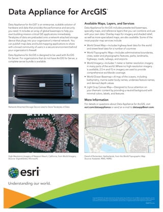
Terabytes of data are preloaded onto a network-attached storage
device that plugs into your organization’s internal network. You
can publish map data and build mapping applications to share
with a broad community of users in a secure environment behind
your organization’s firewall.
Data Appliance for ArcGIS is designed to be used with ArcGIS
for Server. For organizations that do not have ArcGIS for Server, a
complete server bundle is available.
Network-Attached Storage Device Used to Store Terabytes of Data
High-Resolution Imagery of Newport Beach, California, from World Imagery
(Source: DigitalGlobe, Microsoft)
Copyright © 2014 Esri. All rights reserved. Esri, the Esri globe logo, ArcGIS, esri.com, and @esri.com are trademarks, services
marks, or registered marks, Esri in the United States, the European Community, or certain other jurisdictions. Other companies
and products mentioned herein may be trademarks, services marks, or registered marks of their respective mark owners.
G64713 6/14tk
Available Maps, Layers, and Services
Data Appliance for ArcGIS includes preselected basemaps,
specialty maps, and reference layers that you can combine and use
with your own data. Overlay maps for imagery and shaded relief,
as well as more specialized maps, are also available. Some of the
most popular map services include
• World Street Map—Includes highway-level data for the world
and street-level data for a number of countries
• World Topographic Map—Includes administrative boundaries,
cities, water and physiographic features, parks, landmarks,
highways, roads, railways, and airports
• World Imagery—Includes 1 meter or better resolution imagery
in many parts of the world. Where no high-resolution imagery
is available, 2.5 m and 15 m imagery are used to provide
comprehensive worldwide coverage.
• World Ocean Basemap—A map of the oceans, including
bathymetry, marine water body names, undersea feature names,
and derived depth values
• Light Gray Canvas Map—Designed to focus attention on
your thematic content by providing a neutral background with
minimal colors, labels, and features
More Information
For details or questions about Data Appliance for ArcGIS, visit
esri.com/dataappliance or send an e-mail to dataapp@esri.com.
Detail of Rotterdam, Netherlands, from the World Topographic Map
(Source: Kadaster, RWS, HERE)