SlideShare uma empresa Scribd logo
1 de 8
Baixar para ler offline
PORTS HARBORS & BEACHES
2016
PORTS HARBORS & BEACHES
Since 1970, CSA has provided support to local municipalities;
county, state, and federal agencies; dredging contractors; port
authorities; shipping companies; and private industry clients in
preparing environmental assessment documents and mitigation
plans, performing marine habitat mapping and data collection
surveys, developing and conducting monitoring programs, and
assessing impacts of marine activities.
CSA’s scientific and technical staff design and perform mitigation
programs associated with port and harbor development, including
seagrass and coral colony relocation from impact footprints
to adjacent locations. CSA also conducts long-term biological
monitoring programs associated with beach restoration and
nourishment projects.
Our staff are highly experienced in a wide variety of environmental
disciplines: biological, chemical, and physical oceanography;
marine ecology; coral reef and seagrass ecology; and marine
mammals and endangered species. Because of the extensive
diversity and experience of in-house personnel, CSA is able
to competitively and efficiently meet our clients’ needs while
maintaining our internal standards of excellence.
•• Bathymetric and geophysical
surveys
•• Current meter studies to support
modeling
•• Physical and biological
monitoring
•• Damage or injury assessments
•• Negotiation with resource
agencies
DREDGING
•• Feasibility studies
•• Preliminary site surveys
•• Modeling analyses
•• Negotiation with state and
federal agencies
•• Mitigation plan development
•• Coral and seagrass relocation
LNG/O&G TERMINALS
•• Damage assessments
•• Habitat Equivalency Analysis
(HEA)
•• Spill cleanup
•• Substrate stabilization
•• Coral and seagrass restoration
•• Monitoring to measure habitat
recovery
SHIPPING/CRUISE SHIPS
•• Biological monitoring
programs
•• Nearshore hardbottom
surveys
•• Pre- and post-construction
surveys
•• Pipeline clearance surveys
BEACH NOURISHMENT
REPRESENTATIVE PROJECT
PROJECT OVERVIEW
CSA conducted pre-construction (2007, 2008), immediate post-
construction (2010), and 5 years of annual post-construction (2011 to
2015) biological monitoring surveys of nearshore hardbottom offshore
northern Indian River County, Florida, for the Sector 3 Beach and Dune
Restoration Project.
CSA RESPONSIBILITIES
Twenty-one permanent cross-shore monitoring transects were installed,
maintained, and monitored in both project and reference areas. CSA
scientists collected quantitative and qualitative video data along each
transect to determine percent cover of substrate types, wormrock,
macroalgae, corals, sponges, and other benthic fauna. Percent cover
of the benthic groups were also visually estimated in situ by sampling
0.25-m2
quadrats at 12 locations along each transect. In addition, sediment
depth was measured at pre-determined locations along each transect. The
landward edge of exposed hardbottom was mapped to document position
relative to the shoreline to monitorpotential cross-shore transport ofbeach
fill as well as to document potential changes in the benthic community
along the edge. Lastly, aerial imagery was analyzed via classification of
spectral bands and ground-truth verification to produce a habitat map
identifying hardbottom cover within the survey area.
SUMMARY
•• Prepared annual biological montoring reports as well as
comprehensive data deliverables pursuant to FDEP requirements.
•• Mapped, characterized, and quantified hardbottom resources.
•• Assessed potential sedimentation impacts to hardbottom.
CLIENT Indian River County Public Works under subcontract to Ecological Associates, Inc.
LOCATION Indian River County, Florida
START DATE 2007 COMPLETION DATE Ongoing
NEARSHORE HARDBOTTOM MONITORING FOR THE
IRC SECTOR 3 BEACH AND DUNE RESTORATION PROJECT
KEY ELEMENTS
•• Nearshore hardbottom resources
•• Beach nourishment
•• Pre- and post-construction surveys
KEY PERSONNEL
•• Keith Spring
•• Chip Baumberger
•• Erin Hodel
REPRESENTATIVE PROJECT
PROJECT OVERVIEW
CSA provided marine environmental services for addressing potential
coral and seagrass impacts as part of environmental mitigation activities
associated with the Miami Harbor Construction Dredging (Phase 3) Project.
The Phase 3 dredging consisted of federally authorized improvements to
Miami Harbor, including deepening and widening of several features of the
existing federal channel and berthing areas for the local sponsor, the Port
of Miami. The project was conducted by the U.S. Army Corps of Engineers
(USACE) and the local sponsor, the Port of Miami.
CSA RESPONSIBILITIES
CSA conducted natural resource surveys of coral habitats prior to the
development and approval of a coral relocation plan; conducted pre-
construction seagrass surveys in the ingress/egress routes surrounding
the Julia Tuttle Mitigation Site and Lummus Island Turning Basin staging
area; and created a seagrass transplantation plan for review and approval
by the Client and the USACE. CSA relocated Acropora cervicornis (staghorn
coral) colonies, a species listed as threatened and protected under the ESA,
and non-Acropora hard coral colonies to a hardbottom reef south of the
Miami Harbor Channel. A newly constructed artificial reef also was created
for the project. CSA harvested seagrass from an approved donor area
and transplanted over 115,000 seagrass plants into the 17-acre seagrass
mitigation site. As advanced compensatory mitigation, 644 hard corals
and octocorals as well as 50 barrel sponges were relocated or donated to
the Patricia and Phillip Frost Museum of Science.
SUMMARY
•• Relocated 38 Acropora cervicornis (staghorn coral) colonies.
•• Relocated 924 non-Acropora hard coral colonies.
•• Relocated or donated 644 additional hard corals and octocorals as
well as 50 barrel sponges.
•• Transplanted more than 7 acres of seagrass within the 17-acre
seagrass mitigation site.
CLIENT Great Lakes Dredge and Dock, LLC LOCATION Miami, Florida
START DATE 2013 COMPLETION DATE 2015
MIAMI HARBOR CONSTRUCTION DREDGING (PHASE 3) PROJECT
CORAL AND SEAGRASS MITIGATION
KEY ELEMENTS
•• Pre-dredging surveys
•• Acropora coral relocation
•• Barrel sponge relocation
•• Coral and seagrass mitigation
KEY PERSONNEL
•• Dr. Mark Fonseca
•• Anne McCarthy
•• Danielle Medellin
•• Keith Spring
REPRESENTATIVE PROJECT
PROJECT OVERVIEW
The marine resource assessment conducted for the U.S. Navy under
subcontract to HDR, Inc. consisted of a series of diver surveys to collect
data regarding marine resources in Apra Harbor, Guam. The collected data
were used to assess the impacts of a proposed dredging project on marine
resources and was evaluated for input into a Compensatory Mitigation
Plan for Clean Water Act Section 404 and Rivers and Harbors Act permits.
CSA RESPONSIBILITIES
Marine resource surveys consisted of 5 main tasks:
1.	 Collection of data at over 100 sites to characterize coral reef
communities within the dredging footprint.
2.	 Collection and processing of soft bottom samples from 55 sites to
characterize benthic infaunal communities.
3.	 Characterization of fish and turtle abundance and diversity during
two rounds of surveys at 34 sites. Sea turtles were also censused
during dive scooter surveys throughout the harbor.
4.	 Reconnaissance of 10 potential reef mitigation sites to provide
information on the relative condition of resources and suitability for
recovery/enhancement.
5.	 A laboratory dose-response experiment to test sedimentation
impacts on four species of stony corals in Apra Harbor. Tissue
and cellular signs of sedimentation stress were assessed using
histopathological methods.
SUMMARY:
•• Comprehensive characterization of coral, reef fish, sea turtle, and
benthic infauna populations within and adjacent to the dredge
footprint.
•• Assessment of mitigation sites.
•• Identification of sedimentation thresholds for the four most prevalent
species of stony coral.
CLIENT U.S. Navy under subcontract to HDR, Inc. LOCATION Apra Harbor, Guam
START DATE 2010 COMPLETION DATE 2014
IN SITU ASSESSMENT OF MARINE RESOURCES
WITHIN APRA HARBOR, GUAM, FOR THE U.S. NAVY
KEY ELEMENTS
•• Harbor dredging
•• Coral reef characterization surveys
•• Coral sedimentation experiment
KEY PERSONNEL
•• William Sloger
•• Keith Spring
•• Erin Hodel
•• David Snyder
CSA’s Marine Sciences team
provides a wide range of services
for federal, state, regional,
county, local, and international
governments as well as for a
variety of commercial and industrial
customers, from the intertidal zone
and estuarine environments to the
open ocean.
•• Permitting
•• Environmental Impact
Assessments (EIAs)
•• Environmental Impact
Statements (EISs)
•• Environmental Baseline Studies
(EBSs)
•• Environmental, Social, and
Health Impact Assessments
(ESHIAs)
•• Natural Resources Assessment,
Mitigation, and Restoration
(NRAMR)
•• Marine Environmental Services
for Spill Response (MESSR)
•• Risk compliance and
management
•• Ocean sound and marine
mammal monitoring, study, and
mitigation
•• In-house research services
MARINE SCIENCES
•• Physical sampling
•• Sediment profiling
•• Water chemistry and analysis
•• Biological data collection
•• Remote sensing and monitoring
•• Geophysical surveying
•• Visual imaging
•• Metocean data collection
•• Acoustic data collection
CSA’s staff have extensive
operational experience collecting
comprehensive environmental
survey data from coastal to offshore
habitats.
MARINE OPERATIONS
CSA’s Environmental Data and
Geospatial Services (EDGS)
provide solutions for centralizing,
accessing, visualizing, and sharing
environmental data and information
as consumable web-based map
services.
ENVIRONMENTAL DATA
& GEOSPATIAL SERVICES
•• Geospatial analysis
•• Data centralization, integration,
and management
•• GeoPortal design
•• Web-based mapping
applications
•• Secure online access
•• Consumable environmental
content for Common Operating
Platforms (COPs)
•• Cloud computing
•• Customized cartography
•• Environmental Sensitivity Index
(ESI) mapping
•• Geospatial application
development
•• Desktop environmental
baseline studies
•• Esri Business Partner status
OUR SERVICES
CSA supports international, federal, state, and
local government agencies in the United States
and throughout the world to provide marine
environmental consulting expertise. We specialize in
multidisciplinary projects involving the assessment of
potential environmental impacts in coastal and marine
ecosystems and offer a wide variety of scientific
analysis and field survey services to support our
government clients worldwide.
GOVERNMENT
CSA focuses on providing marine environmental
consulting services associated with the sustainable
exploration, production, and research of energy
resources. Although much of CSA’s activities are
concentrated within the oil and gas industry, we are
experiencing a growing demand for services to support
the expanding technology and regulations associated
with renewable alternative energy sources such as
wind, tidal, solar, and hydroelectric.
OTHER CORE MARKETS
ENERGY
CSA has supported numerous infrastructure projects
in southeast Florida and the Gulf of Mexico since the
early 1970s and has expanded efforts to international
sites, including the Caribbean, Central and South
America, Africa, the Mediterranean, Arabian Gulf,
Southeast Asia, and Polynesia. Through a philosophy
of careful selection of personnel and controlled
growth, CSA has built an efficient professional team
with the expertise to provide the most effective
infrastructure-related programs for clients. These
programs have involved permit feasibility and
acquisition, baseline environmental assessment,
environmental management plans, impact monitoring,
and mitigation/restoration activities.
INFRASTRUCTURE
w w w . c s a o c e a n . c o m
U S A | T r i n i d a d | B r a z i l | C y p r u s | Q a t a r | S i n g a p o r e | A u s t r a l i a

Mais conteúdo relacionado

Mais procurados

Navy Region Northwest/ NAVFAC NW
Navy Region Northwest/ NAVFAC NWNavy Region Northwest/ NAVFAC NW
Navy Region Northwest/ NAVFAC NWBryanHall58
 
Navy Region Mid Atlantic
Navy Region Mid AtlanticNavy Region Mid Atlantic
Navy Region Mid AtlanticBryanHall58
 
Navy Region Southwest/ NAVFAC SW
Navy Region Southwest/ NAVFAC SWNavy Region Southwest/ NAVFAC SW
Navy Region Southwest/ NAVFAC SWBryanHall58
 
Intro parcmarin amp2010-anglais
Intro parcmarin amp2010-anglaisIntro parcmarin amp2010-anglais
Intro parcmarin amp2010-anglaiscwfli2010
 
Overview of the Saguenay-St.Lawrence Marine Park
Overview of the Saguenay-St.Lawrence Marine ParkOverview of the Saguenay-St.Lawrence Marine Park
Overview of the Saguenay-St.Lawrence Marine ParkFrédéric Dufour
 
Sweetwater Reservoir Habitat Recovery Plan Risk Assessment
Sweetwater Reservoir Habitat Recovery Plan Risk AssessmentSweetwater Reservoir Habitat Recovery Plan Risk Assessment
Sweetwater Reservoir Habitat Recovery Plan Risk Assessmentmsweesy
 
Résumé-Kenin R. Greer
Résumé-Kenin R. GreerRésumé-Kenin R. Greer
Résumé-Kenin R. GreerKenin Greer
 
ESTABLISHING OFFSHORE SHELLFISH AQUACULTURE IN FEDERAL WATERS OF THE ATLANTIC
ESTABLISHING OFFSHORE SHELLFISH AQUACULTURE IN FEDERAL WATERS OF THE ATLANTICESTABLISHING OFFSHORE SHELLFISH AQUACULTURE IN FEDERAL WATERS OF THE ATLANTIC
ESTABLISHING OFFSHORE SHELLFISH AQUACULTURE IN FEDERAL WATERS OF THE ATLANTICTedManey
 
Wetland Delineation of Neslon Reservoir
Wetland Delineation of Neslon Reservoir Wetland Delineation of Neslon Reservoir
Wetland Delineation of Neslon Reservoir Mackenzie Taggart
 
The Story of Joint Region Marianas INRMP
The Story of Joint Region Marianas INRMPThe Story of Joint Region Marianas INRMP
The Story of Joint Region Marianas INRMPBryanHall58
 
Barna Jeff_Portland - July 2016
Barna Jeff_Portland - July 2016Barna Jeff_Portland - July 2016
Barna Jeff_Portland - July 2016Jeff Barna
 
SLIPP Shoreline Care Contractors Outreach Meeting 24 November 2011
SLIPP Shoreline Care Contractors Outreach Meeting 24 November 2011SLIPP Shoreline Care Contractors Outreach Meeting 24 November 2011
SLIPP Shoreline Care Contractors Outreach Meeting 24 November 2011Erin Vieira
 

Mais procurados (20)

Navy Region Northwest/ NAVFAC NW
Navy Region Northwest/ NAVFAC NWNavy Region Northwest/ NAVFAC NW
Navy Region Northwest/ NAVFAC NW
 
Navy Region Mid Atlantic
Navy Region Mid AtlanticNavy Region Mid Atlantic
Navy Region Mid Atlantic
 
Navy Region Southwest/ NAVFAC SW
Navy Region Southwest/ NAVFAC SWNavy Region Southwest/ NAVFAC SW
Navy Region Southwest/ NAVFAC SW
 
Pcra lecture (camotes pcra orientation)
Pcra lecture (camotes pcra orientation)Pcra lecture (camotes pcra orientation)
Pcra lecture (camotes pcra orientation)
 
Intro parcmarin amp2010-anglais
Intro parcmarin amp2010-anglaisIntro parcmarin amp2010-anglais
Intro parcmarin amp2010-anglais
 
2015_annualreport-SONGS_wetland_mitigation
2015_annualreport-SONGS_wetland_mitigation2015_annualreport-SONGS_wetland_mitigation
2015_annualreport-SONGS_wetland_mitigation
 
Marine Biology
Marine BiologyMarine Biology
Marine Biology
 
Overview of the Saguenay-St.Lawrence Marine Park
Overview of the Saguenay-St.Lawrence Marine ParkOverview of the Saguenay-St.Lawrence Marine Park
Overview of the Saguenay-St.Lawrence Marine Park
 
NAVFAC Far East
NAVFAC Far EastNAVFAC Far East
NAVFAC Far East
 
Sweetwater Reservoir Habitat Recovery Plan Risk Assessment
Sweetwater Reservoir Habitat Recovery Plan Risk AssessmentSweetwater Reservoir Habitat Recovery Plan Risk Assessment
Sweetwater Reservoir Habitat Recovery Plan Risk Assessment
 
Résumé-Kenin R. Greer
Résumé-Kenin R. GreerRésumé-Kenin R. Greer
Résumé-Kenin R. Greer
 
Mississippi
MississippiMississippi
Mississippi
 
Zultner kate
Zultner kateZultner kate
Zultner kate
 
ESTABLISHING OFFSHORE SHELLFISH AQUACULTURE IN FEDERAL WATERS OF THE ATLANTIC
ESTABLISHING OFFSHORE SHELLFISH AQUACULTURE IN FEDERAL WATERS OF THE ATLANTICESTABLISHING OFFSHORE SHELLFISH AQUACULTURE IN FEDERAL WATERS OF THE ATLANTIC
ESTABLISHING OFFSHORE SHELLFISH AQUACULTURE IN FEDERAL WATERS OF THE ATLANTIC
 
Wetland Delineation of Neslon Reservoir
Wetland Delineation of Neslon Reservoir Wetland Delineation of Neslon Reservoir
Wetland Delineation of Neslon Reservoir
 
BEAMR
BEAMRBEAMR
BEAMR
 
The Story of Joint Region Marianas INRMP
The Story of Joint Region Marianas INRMPThe Story of Joint Region Marianas INRMP
The Story of Joint Region Marianas INRMP
 
Barna Jeff_Portland - July 2016
Barna Jeff_Portland - July 2016Barna Jeff_Portland - July 2016
Barna Jeff_Portland - July 2016
 
SLIPP Shoreline Care Contractors Outreach Meeting 24 November 2011
SLIPP Shoreline Care Contractors Outreach Meeting 24 November 2011SLIPP Shoreline Care Contractors Outreach Meeting 24 November 2011
SLIPP Shoreline Care Contractors Outreach Meeting 24 November 2011
 
Texas
TexasTexas
Texas
 

Destaque

Our Florida Reefs - Your Voice, Our Future
Our Florida Reefs - Your Voice, Our FutureOur Florida Reefs - Your Voice, Our Future
Our Florida Reefs - Your Voice, Our Futuredawillison
 
Coral bleaching response guide 2016 (Western Indian Ocean)
Coral bleaching response guide 2016 (Western Indian Ocean)Coral bleaching response guide 2016 (Western Indian Ocean)
Coral bleaching response guide 2016 (Western Indian Ocean)David Obura
 
About the Bahamas Coral Reefs
About the Bahamas Coral ReefsAbout the Bahamas Coral Reefs
About the Bahamas Coral ReefsThe Student Shed
 
Climate change in 2016: an Eyewitness Account from the Tropical Pacific
Climate change in 2016:  an Eyewitness Account from the Tropical PacificClimate change in 2016:  an Eyewitness Account from the Tropical Pacific
Climate change in 2016: an Eyewitness Account from the Tropical PacificKim Cobb
 
Ocean Acidification: Cause, Impact and mitigation
Ocean Acidification: Cause, Impact and mitigationOcean Acidification: Cause, Impact and mitigation
Ocean Acidification: Cause, Impact and mitigationIIT Kanpur
 

Destaque (9)

Our Florida Reefs - Your Voice, Our Future
Our Florida Reefs - Your Voice, Our FutureOur Florida Reefs - Your Voice, Our Future
Our Florida Reefs - Your Voice, Our Future
 
Coral bleaching response guide 2016 (Western Indian Ocean)
Coral bleaching response guide 2016 (Western Indian Ocean)Coral bleaching response guide 2016 (Western Indian Ocean)
Coral bleaching response guide 2016 (Western Indian Ocean)
 
About the Bahamas Coral Reefs
About the Bahamas Coral ReefsAbout the Bahamas Coral Reefs
About the Bahamas Coral Reefs
 
Coral Reefs
Coral ReefsCoral Reefs
Coral Reefs
 
WHAT IS CLIMATE CHANGE? -
WHAT IS CLIMATE CHANGE? - WHAT IS CLIMATE CHANGE? -
WHAT IS CLIMATE CHANGE? -
 
Climate change in 2016: an Eyewitness Account from the Tropical Pacific
Climate change in 2016:  an Eyewitness Account from the Tropical PacificClimate change in 2016:  an Eyewitness Account from the Tropical Pacific
Climate change in 2016: an Eyewitness Account from the Tropical Pacific
 
Ocean acidification
Ocean acidificationOcean acidification
Ocean acidification
 
Ocean Acidification: Cause, Impact and mitigation
Ocean Acidification: Cause, Impact and mitigationOcean Acidification: Cause, Impact and mitigation
Ocean Acidification: Cause, Impact and mitigation
 
Coral reef presentation
Coral reef presentationCoral reef presentation
Coral reef presentation
 

Semelhante a PortsHarborsBeaches_Capabilities_Statement

Peter Phippen Sandy Update - November 2015
Peter Phippen Sandy Update - November 2015Peter Phippen Sandy Update - November 2015
Peter Phippen Sandy Update - November 2015greenbelt82
 
Regueroetal_ReEng_Reefs_2015
Regueroetal_ReEng_Reefs_2015Regueroetal_ReEng_Reefs_2015
Regueroetal_ReEng_Reefs_2015Borja G. Reguero
 
Lipuma-Giuliano HRES
Lipuma-Giuliano HRESLipuma-Giuliano HRES
Lipuma-Giuliano HRESSarah Lipuma
 
NOAA Aquaculture Program and Industry Trends in the Greater Atlantic Region
NOAA Aquaculture Program and Industry Trends in the Greater Atlantic RegionNOAA Aquaculture Program and Industry Trends in the Greater Atlantic Region
NOAA Aquaculture Program and Industry Trends in the Greater Atlantic RegionTedManey
 
Jamaica Bay Task Force2- 10May22.pdf
Jamaica Bay Task Force2- 10May22.pdfJamaica Bay Task Force2- 10May22.pdf
Jamaica Bay Task Force2- 10May22.pdfecowatchers
 
Army Corps of Engineers Report on Restoration Planning in Jamaica bay
Army Corps of Engineers Report on Restoration Planning in Jamaica bayArmy Corps of Engineers Report on Restoration Planning in Jamaica bay
Army Corps of Engineers Report on Restoration Planning in Jamaica bayecowatchers
 
Phippen castonguay gmrp gmc slr symposium 2
Phippen castonguay gmrp gmc slr symposium 2Phippen castonguay gmrp gmc slr symposium 2
Phippen castonguay gmrp gmc slr symposium 2greenbelt82
 
Planning for the Future: Sea Level Rise in California
Planning for the Future: Sea Level Rise in CaliforniaPlanning for the Future: Sea Level Rise in California
Planning for the Future: Sea Level Rise in CaliforniaLaura Rinaldi
 
Surfrider Foundation - Draft Environmental Impact Report Comments - Hermosa B...
Surfrider Foundation - Draft Environmental Impact Report Comments - Hermosa B...Surfrider Foundation - Draft Environmental Impact Report Comments - Hermosa B...
Surfrider Foundation - Draft Environmental Impact Report Comments - Hermosa B...StopHermosaBeachOil
 
SLIPP All-Committee Meeting: Shoreline Update 12-April-2012
SLIPP All-Committee Meeting: Shoreline Update 12-April-2012SLIPP All-Committee Meeting: Shoreline Update 12-April-2012
SLIPP All-Committee Meeting: Shoreline Update 12-April-2012Erin Vieira
 
LIDDLE - Project-Related Work Experience
LIDDLE - Project-Related Work ExperienceLIDDLE - Project-Related Work Experience
LIDDLE - Project-Related Work ExperienceGeorge Liddle
 
Marine Zoning Works For Me Zoning Presentation
Marine Zoning Works For Me Zoning PresentationMarine Zoning Works For Me Zoning Presentation
Marine Zoning Works For Me Zoning PresentationMZWM
 
Environmental Health and Safety Survey Vanier Park 2019
Environmental Health and Safety Survey Vanier Park 2019Environmental Health and Safety Survey Vanier Park 2019
Environmental Health and Safety Survey Vanier Park 2019LOWaterkeeper
 
Fall 2023 JBTF presentation on Additional HRE project areas. .pptx
Fall 2023 JBTF presentation on Additional HRE project areas. .pptxFall 2023 JBTF presentation on Additional HRE project areas. .pptx
Fall 2023 JBTF presentation on Additional HRE project areas. .pptxecowatchers
 
LCW Conceptual Restoration Workshop #2
LCW Conceptual Restoration Workshop #2LCW Conceptual Restoration Workshop #2
LCW Conceptual Restoration Workshop #2TidalInlfluence
 
2016 Geo Field Tech C.V. PDF
2016 Geo Field Tech C.V. PDF2016 Geo Field Tech C.V. PDF
2016 Geo Field Tech C.V. PDFJeremiah Brower
 
Coastal Resource Management
Coastal Resource ManagementCoastal Resource Management
Coastal Resource ManagementMarcelo Yarte
 

Semelhante a PortsHarborsBeaches_Capabilities_Statement (20)

Peter Phippen Sandy Update - November 2015
Peter Phippen Sandy Update - November 2015Peter Phippen Sandy Update - November 2015
Peter Phippen Sandy Update - November 2015
 
Orlando 2015
Orlando 2015Orlando 2015
Orlando 2015
 
Regueroetal_ReEng_Reefs_2015
Regueroetal_ReEng_Reefs_2015Regueroetal_ReEng_Reefs_2015
Regueroetal_ReEng_Reefs_2015
 
Lipuma-Giuliano HRES
Lipuma-Giuliano HRESLipuma-Giuliano HRES
Lipuma-Giuliano HRES
 
BSantelik_resume
BSantelik_resumeBSantelik_resume
BSantelik_resume
 
NOAA Aquaculture Program and Industry Trends in the Greater Atlantic Region
NOAA Aquaculture Program and Industry Trends in the Greater Atlantic RegionNOAA Aquaculture Program and Industry Trends in the Greater Atlantic Region
NOAA Aquaculture Program and Industry Trends in the Greater Atlantic Region
 
Jamaica Bay Task Force2- 10May22.pdf
Jamaica Bay Task Force2- 10May22.pdfJamaica Bay Task Force2- 10May22.pdf
Jamaica Bay Task Force2- 10May22.pdf
 
Army Corps of Engineers Report on Restoration Planning in Jamaica bay
Army Corps of Engineers Report on Restoration Planning in Jamaica bayArmy Corps of Engineers Report on Restoration Planning in Jamaica bay
Army Corps of Engineers Report on Restoration Planning in Jamaica bay
 
Phippen castonguay gmrp gmc slr symposium 2
Phippen castonguay gmrp gmc slr symposium 2Phippen castonguay gmrp gmc slr symposium 2
Phippen castonguay gmrp gmc slr symposium 2
 
Planning for the Future: Sea Level Rise in California
Planning for the Future: Sea Level Rise in CaliforniaPlanning for the Future: Sea Level Rise in California
Planning for the Future: Sea Level Rise in California
 
Surfrider Foundation - Draft Environmental Impact Report Comments - Hermosa B...
Surfrider Foundation - Draft Environmental Impact Report Comments - Hermosa B...Surfrider Foundation - Draft Environmental Impact Report Comments - Hermosa B...
Surfrider Foundation - Draft Environmental Impact Report Comments - Hermosa B...
 
SLIPP All-Committee Meeting: Shoreline Update 12-April-2012
SLIPP All-Committee Meeting: Shoreline Update 12-April-2012SLIPP All-Committee Meeting: Shoreline Update 12-April-2012
SLIPP All-Committee Meeting: Shoreline Update 12-April-2012
 
LIDDLE - Project-Related Work Experience
LIDDLE - Project-Related Work ExperienceLIDDLE - Project-Related Work Experience
LIDDLE - Project-Related Work Experience
 
James riverpartnership2003
James riverpartnership2003James riverpartnership2003
James riverpartnership2003
 
Marine Zoning Works For Me Zoning Presentation
Marine Zoning Works For Me Zoning PresentationMarine Zoning Works For Me Zoning Presentation
Marine Zoning Works For Me Zoning Presentation
 
Environmental Health and Safety Survey Vanier Park 2019
Environmental Health and Safety Survey Vanier Park 2019Environmental Health and Safety Survey Vanier Park 2019
Environmental Health and Safety Survey Vanier Park 2019
 
Fall 2023 JBTF presentation on Additional HRE project areas. .pptx
Fall 2023 JBTF presentation on Additional HRE project areas. .pptxFall 2023 JBTF presentation on Additional HRE project areas. .pptx
Fall 2023 JBTF presentation on Additional HRE project areas. .pptx
 
LCW Conceptual Restoration Workshop #2
LCW Conceptual Restoration Workshop #2LCW Conceptual Restoration Workshop #2
LCW Conceptual Restoration Workshop #2
 
2016 Geo Field Tech C.V. PDF
2016 Geo Field Tech C.V. PDF2016 Geo Field Tech C.V. PDF
2016 Geo Field Tech C.V. PDF
 
Coastal Resource Management
Coastal Resource ManagementCoastal Resource Management
Coastal Resource Management
 

PortsHarborsBeaches_Capabilities_Statement

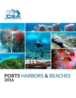
  • 1. PORTS HARBORS & BEACHES 2016
  • 2. PORTS HARBORS & BEACHES Since 1970, CSA has provided support to local municipalities; county, state, and federal agencies; dredging contractors; port authorities; shipping companies; and private industry clients in preparing environmental assessment documents and mitigation plans, performing marine habitat mapping and data collection surveys, developing and conducting monitoring programs, and assessing impacts of marine activities. CSA’s scientific and technical staff design and perform mitigation programs associated with port and harbor development, including seagrass and coral colony relocation from impact footprints to adjacent locations. CSA also conducts long-term biological monitoring programs associated with beach restoration and nourishment projects. Our staff are highly experienced in a wide variety of environmental disciplines: biological, chemical, and physical oceanography; marine ecology; coral reef and seagrass ecology; and marine mammals and endangered species. Because of the extensive diversity and experience of in-house personnel, CSA is able to competitively and efficiently meet our clients’ needs while maintaining our internal standards of excellence. •• Bathymetric and geophysical surveys •• Current meter studies to support modeling •• Physical and biological monitoring •• Damage or injury assessments •• Negotiation with resource agencies DREDGING •• Feasibility studies •• Preliminary site surveys •• Modeling analyses •• Negotiation with state and federal agencies •• Mitigation plan development •• Coral and seagrass relocation LNG/O&G TERMINALS •• Damage assessments •• Habitat Equivalency Analysis (HEA) •• Spill cleanup •• Substrate stabilization •• Coral and seagrass restoration •• Monitoring to measure habitat recovery SHIPPING/CRUISE SHIPS •• Biological monitoring programs •• Nearshore hardbottom surveys •• Pre- and post-construction surveys •• Pipeline clearance surveys BEACH NOURISHMENT
  • 3. REPRESENTATIVE PROJECT PROJECT OVERVIEW CSA conducted pre-construction (2007, 2008), immediate post- construction (2010), and 5 years of annual post-construction (2011 to 2015) biological monitoring surveys of nearshore hardbottom offshore northern Indian River County, Florida, for the Sector 3 Beach and Dune Restoration Project. CSA RESPONSIBILITIES Twenty-one permanent cross-shore monitoring transects were installed, maintained, and monitored in both project and reference areas. CSA scientists collected quantitative and qualitative video data along each transect to determine percent cover of substrate types, wormrock, macroalgae, corals, sponges, and other benthic fauna. Percent cover of the benthic groups were also visually estimated in situ by sampling 0.25-m2 quadrats at 12 locations along each transect. In addition, sediment depth was measured at pre-determined locations along each transect. The landward edge of exposed hardbottom was mapped to document position relative to the shoreline to monitorpotential cross-shore transport ofbeach fill as well as to document potential changes in the benthic community along the edge. Lastly, aerial imagery was analyzed via classification of spectral bands and ground-truth verification to produce a habitat map identifying hardbottom cover within the survey area. SUMMARY •• Prepared annual biological montoring reports as well as comprehensive data deliverables pursuant to FDEP requirements. •• Mapped, characterized, and quantified hardbottom resources. •• Assessed potential sedimentation impacts to hardbottom. CLIENT Indian River County Public Works under subcontract to Ecological Associates, Inc. LOCATION Indian River County, Florida START DATE 2007 COMPLETION DATE Ongoing NEARSHORE HARDBOTTOM MONITORING FOR THE IRC SECTOR 3 BEACH AND DUNE RESTORATION PROJECT KEY ELEMENTS •• Nearshore hardbottom resources •• Beach nourishment •• Pre- and post-construction surveys KEY PERSONNEL •• Keith Spring •• Chip Baumberger •• Erin Hodel
  • 4. REPRESENTATIVE PROJECT PROJECT OVERVIEW CSA provided marine environmental services for addressing potential coral and seagrass impacts as part of environmental mitigation activities associated with the Miami Harbor Construction Dredging (Phase 3) Project. The Phase 3 dredging consisted of federally authorized improvements to Miami Harbor, including deepening and widening of several features of the existing federal channel and berthing areas for the local sponsor, the Port of Miami. The project was conducted by the U.S. Army Corps of Engineers (USACE) and the local sponsor, the Port of Miami. CSA RESPONSIBILITIES CSA conducted natural resource surveys of coral habitats prior to the development and approval of a coral relocation plan; conducted pre- construction seagrass surveys in the ingress/egress routes surrounding the Julia Tuttle Mitigation Site and Lummus Island Turning Basin staging area; and created a seagrass transplantation plan for review and approval by the Client and the USACE. CSA relocated Acropora cervicornis (staghorn coral) colonies, a species listed as threatened and protected under the ESA, and non-Acropora hard coral colonies to a hardbottom reef south of the Miami Harbor Channel. A newly constructed artificial reef also was created for the project. CSA harvested seagrass from an approved donor area and transplanted over 115,000 seagrass plants into the 17-acre seagrass mitigation site. As advanced compensatory mitigation, 644 hard corals and octocorals as well as 50 barrel sponges were relocated or donated to the Patricia and Phillip Frost Museum of Science. SUMMARY •• Relocated 38 Acropora cervicornis (staghorn coral) colonies. •• Relocated 924 non-Acropora hard coral colonies. •• Relocated or donated 644 additional hard corals and octocorals as well as 50 barrel sponges. •• Transplanted more than 7 acres of seagrass within the 17-acre seagrass mitigation site. CLIENT Great Lakes Dredge and Dock, LLC LOCATION Miami, Florida START DATE 2013 COMPLETION DATE 2015 MIAMI HARBOR CONSTRUCTION DREDGING (PHASE 3) PROJECT CORAL AND SEAGRASS MITIGATION KEY ELEMENTS •• Pre-dredging surveys •• Acropora coral relocation •• Barrel sponge relocation •• Coral and seagrass mitigation KEY PERSONNEL •• Dr. Mark Fonseca •• Anne McCarthy •• Danielle Medellin •• Keith Spring
  • 5. REPRESENTATIVE PROJECT PROJECT OVERVIEW The marine resource assessment conducted for the U.S. Navy under subcontract to HDR, Inc. consisted of a series of diver surveys to collect data regarding marine resources in Apra Harbor, Guam. The collected data were used to assess the impacts of a proposed dredging project on marine resources and was evaluated for input into a Compensatory Mitigation Plan for Clean Water Act Section 404 and Rivers and Harbors Act permits. CSA RESPONSIBILITIES Marine resource surveys consisted of 5 main tasks: 1. Collection of data at over 100 sites to characterize coral reef communities within the dredging footprint. 2. Collection and processing of soft bottom samples from 55 sites to characterize benthic infaunal communities. 3. Characterization of fish and turtle abundance and diversity during two rounds of surveys at 34 sites. Sea turtles were also censused during dive scooter surveys throughout the harbor. 4. Reconnaissance of 10 potential reef mitigation sites to provide information on the relative condition of resources and suitability for recovery/enhancement. 5. A laboratory dose-response experiment to test sedimentation impacts on four species of stony corals in Apra Harbor. Tissue and cellular signs of sedimentation stress were assessed using histopathological methods. SUMMARY: •• Comprehensive characterization of coral, reef fish, sea turtle, and benthic infauna populations within and adjacent to the dredge footprint. •• Assessment of mitigation sites. •• Identification of sedimentation thresholds for the four most prevalent species of stony coral. CLIENT U.S. Navy under subcontract to HDR, Inc. LOCATION Apra Harbor, Guam START DATE 2010 COMPLETION DATE 2014 IN SITU ASSESSMENT OF MARINE RESOURCES WITHIN APRA HARBOR, GUAM, FOR THE U.S. NAVY KEY ELEMENTS •• Harbor dredging •• Coral reef characterization surveys •• Coral sedimentation experiment KEY PERSONNEL •• William Sloger •• Keith Spring •• Erin Hodel •• David Snyder
  • 6. CSA’s Marine Sciences team provides a wide range of services for federal, state, regional, county, local, and international governments as well as for a variety of commercial and industrial customers, from the intertidal zone and estuarine environments to the open ocean. •• Permitting •• Environmental Impact Assessments (EIAs) •• Environmental Impact Statements (EISs) •• Environmental Baseline Studies (EBSs) •• Environmental, Social, and Health Impact Assessments (ESHIAs) •• Natural Resources Assessment, Mitigation, and Restoration (NRAMR) •• Marine Environmental Services for Spill Response (MESSR) •• Risk compliance and management •• Ocean sound and marine mammal monitoring, study, and mitigation •• In-house research services MARINE SCIENCES •• Physical sampling •• Sediment profiling •• Water chemistry and analysis •• Biological data collection •• Remote sensing and monitoring •• Geophysical surveying •• Visual imaging •• Metocean data collection •• Acoustic data collection CSA’s staff have extensive operational experience collecting comprehensive environmental survey data from coastal to offshore habitats. MARINE OPERATIONS CSA’s Environmental Data and Geospatial Services (EDGS) provide solutions for centralizing, accessing, visualizing, and sharing environmental data and information as consumable web-based map services. ENVIRONMENTAL DATA & GEOSPATIAL SERVICES •• Geospatial analysis •• Data centralization, integration, and management •• GeoPortal design •• Web-based mapping applications •• Secure online access •• Consumable environmental content for Common Operating Platforms (COPs) •• Cloud computing •• Customized cartography •• Environmental Sensitivity Index (ESI) mapping •• Geospatial application development •• Desktop environmental baseline studies •• Esri Business Partner status OUR SERVICES
  • 7. CSA supports international, federal, state, and local government agencies in the United States and throughout the world to provide marine environmental consulting expertise. We specialize in multidisciplinary projects involving the assessment of potential environmental impacts in coastal and marine ecosystems and offer a wide variety of scientific analysis and field survey services to support our government clients worldwide. GOVERNMENT CSA focuses on providing marine environmental consulting services associated with the sustainable exploration, production, and research of energy resources. Although much of CSA’s activities are concentrated within the oil and gas industry, we are experiencing a growing demand for services to support the expanding technology and regulations associated with renewable alternative energy sources such as wind, tidal, solar, and hydroelectric. OTHER CORE MARKETS ENERGY CSA has supported numerous infrastructure projects in southeast Florida and the Gulf of Mexico since the early 1970s and has expanded efforts to international sites, including the Caribbean, Central and South America, Africa, the Mediterranean, Arabian Gulf, Southeast Asia, and Polynesia. Through a philosophy of careful selection of personnel and controlled growth, CSA has built an efficient professional team with the expertise to provide the most effective infrastructure-related programs for clients. These programs have involved permit feasibility and acquisition, baseline environmental assessment, environmental management plans, impact monitoring, and mitigation/restoration activities. INFRASTRUCTURE
  • 8. w w w . c s a o c e a n . c o m U S A | T r i n i d a d | B r a z i l | C y p r u s | Q a t a r | S i n g a p o r e | A u s t r a l i a