2. Mexico or New Spain. Made for L’Histoire de L’Amérique by Dr. William Robertson, 1795.
Mexico Collection, Texas General Land Office, Austin
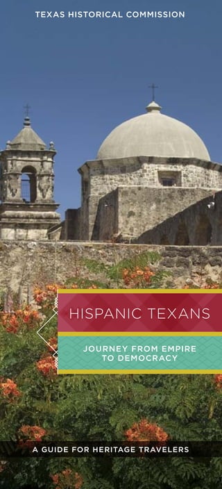
3www.Texastimetravel.com
all have been valid terms for Texans who traced their roots
to the Iberian Peninsula or Mexico. In the last 50 years,
cultural identity has become even more complicated. The
arrival of Cubans in the early 1960s, Puerto Ricans in
the 1970s, and Central Americans in the 1980s has made
for increasing diversity of the state’s Hispanic, or Latino,
population. However, the Mexican branch of the Hispanic
family, combining Native, European, and African elements,
has left the deepest imprint on the Lone Star State.
The state’s name—pronounced Tay-hahs in Spanish—
derives from the old Spanish spelling of a Caddo word for
friend. Since the state was named Tejas by the Spaniards,
it’s not surprising that many of its most important
geographic features and locations also have Spanish names.
Major Texas waterways from the Sabine River to the Rio
Grande were named, or renamed, by Spanish explorers and
Franciscan missionaries.
Although the story of Texas stretches back millennia
into prehistory, its history begins
with the arrival of Spanish
conquistadors in the early 16th
century. Cabeza de Vaca and his
companions in the 1520s and
1530s were followed by the
expeditions of Coronado and De
Soto in the early 1540s. In 1598, Juan de Oñate, on his
way to conquer the Pueblo Indians of New Mexico,
crossed the Rio Grande in the El Paso area. Because a
Mass of thanksgiving was celebrated for their safe arrival,
El Paso claims the first North American Thanksgiving.
In East Texas, another community with Spanish colonial
roots claims to be the state’s oldest settlement. Nacogdoches
was originally the site of a Caddo Indian community dating
to the 13th century. When permanent Spanish occupation of
Texas began in 1716, Friar Antonio Margil de Jesús founded
Mission Nuestra Señora de Guadalupe de los Nacogdoches
near the Indian village. The mission was officially abandoned
in 1773, but six years later the Nacogdoches area became
home to a group of Tejanos led by Antonio Gil Ybarbo.
In the last 50 years,
cultural identity
has become even
more complicated.
Hispanic, Spanish,
Spanish American, Mexican,
Mexican American, Mexicano,
Latino, Chicano, Tejano—
3. 4 5www.Texastimetravel.comTexas Historical commission
About 300 miles southwest, another Spanish-era
settlement stakes a major claim. Two years after
the occupation of East Texas, Gov. Martín Alarcón
founded a mission-presidio (garrison) complex in
1718 at the headwaters of the San Antonio River. By
1731, the community had grown to five missions
and the military post, and was augmented with the
arrival of migrants from the Canary Islands who had
permission from the Crown to establish their own
local government. Thus, with the founding of San
Fernando de Béxar—today’s San Antonio—Texas
gained its first chartered civil government.
Along the Texas coastal plain, a third area of
Spanish settlement developed. Originally founded in
1721 at Matagorda Bay on the remains of La Salle’s Fort
St. Louis, Presidio La Bahía and Mission Espíritu Santo
moved twice. A permanent
home was later established
on the lower San Antonio
River in present-day Goliad.
Although the vastness of
North America ultimately
proved an insurmountable
challenge for a Spanish empire
spread thin, Spaniards sought
to colonize “on the cheap” by
relying on missionaries to
assimilate Indians into
Hispanic society. The Spanish
empire also looked to expand
in the region through ranching,
an economic activity well
suited to the immense
grasslands. The southern tip—
the last part of Texas to be occupied during the Spanish
colonial era—was settled by cattle and sheep ranchers.
Rosa María Hinojosa de Ballí, for whose Catholic-priest
son Padre Island is named, was the first “cattle queen” of
Texas, at one time controlling more than a million acres
in South Texas.
An extensive network of trails and unimproved roads,
often built on pre-existing Indian routes, connected all
the Spanish settlements and many Indian communities.
El Camino Real de Tierra Adentro in the El Paso area
and El Camino Real de los Tejas (which spanned Texas,
extending from Mexico City to Robeline, Louisiana)
today form part of the national historic trails system.
José Antonio Navarro cenotaph,
Texas State Cemetery, Austin
They provide reminders of centuries-old migration and
commerce routes, connecting not only countries and states
but peoples and cultures.
In the early 19th century, Texas played an important
role in Mexico’s war for independence. Fought between
royalists and insurgents near El Camino Real south of
San Antonio, the Battle of Medina on August 18, 1813, is
regarded as the bloodiest fight in the state’s history. Pirates,
filibusters, and French Napoleonic exiles all challenged
Spanish control of Texas in the 1810s.
The history of Texas after Mexican independence in
1821 is a significant Hispanic story. Tejano elites were eager
to support Anglo-American settlement following a decade of
violence. Leaders such as Erasmo Seguín and José Antonio
Saucedo counseled Stephen F. Austin on managing his
colony and organizing San Felipe de
Austin.
During the Texas Revolution in
1835–36, Tejanos participated on the
battlefield and in government. The
Texas Declaration of Independence
was signed by Francisco Ruiz and
José Antonio Navarro, natives
of San Antonio who also helped draft the Republic’s
constitution at Washington-on-the-Brazos. Tejanos
participated in every major action of the revolution
after Gonzales—most prominent was Juan Seguín,
who later directed the burial of the Alamo dead.
The following decades were turbulent for Tejanos. When
Texas exercised control of the land between the Nueces
Map of El Camino Real de los Tejas
Tejanos
participated
in every major
action of the
revolution after
Gonzales.
NationalParkService
4. TxDOT
6 7www.Texastimetravel.comTexas Historical commission
River and Rio Grande as a result of the U.S.–Mexico
War in 1846–48, Mexican residents of the region
had to choose between American citizenship and
abandoning their homes. These new Tejanos were
subjected to discrimination and violence. By the 1850s,
Tejanos were chased out of some counties altogether.
Despite circumstances, Tejanos maintained
communities, ran farms and ranches, worked on
railroads, and operated businesses. After the Civil War,
Tejanos and Mexican migrants joined the agricultural
labor force in increasing numbers. In
the early 20th century, developing urban
centers such as Houston and Dallas
also welcomed them for manual labor.
Regarded as cheap labor, Hispanics
were subjected to many of the Jim
Crow practices that discriminated
against African Americans. Tejanos and
immigrants from Mexico often went to
Mexican schools, were prevented from eating in main
dining rooms of restaurants, and were systematically
excluded from jury service. Very few had access to higher
education, and Tejanos could only attain public office
along the overwhelmingly Hispanic border region.
Nevertheless, Mexican Americans absorbed
American ideals and worked against the forces of
bigotry. League of United Latin American Citizens
founders J.T. Canales of Nueces County and Alonso
Perales of Alice had to move away from Texas to obtain
a graduate education. American GI Forum founder
Dr. Hector García graduated from the University of
Texas Medical School on the eve of World War II, but
Postcard of Alamo Plaza, 1917
This travel guide
serves as an
introduction to the
first 500 years
of the rich and
colorful Hispanic
experience in Texas.
Robert Casillas performs at the International Accordion Festival, San Antonio
no Texas hospital would grant him residency.
Emma Tenayuca’s working class origins led her
to labor activism, particularly in organizing
workers in the pecan shelling industry in
the early years of the Great Depression.
The struggle for a piece of the American
Dream took a major turn during the Civil
Rights Era. Organized by Tejanos, Viva
Kennedy clubs helped the Kennedy-Johnson
ticket win Texas in the 1960 election, a
success that led to more political engagement.
Educational opportunities increased by
the 1970s in response to young Chicano
activists, returning Vietnam veterans, and
victories stretching back to the 1930s. These
included the appearance of Mexican American studies
programs in colleges and universities around the state.
In the 1960s, Texas began to experience a significant
influx of non-Mexican Hispanic immigrants. Cubans,
Puerto Ricans, and Central Americans have made
important contributions to the state’s cultural and
economic development. Their story rests largely outside
the scope of this guidebook. This travel guide serves as an
introduction to the first 500 years of the rich and colorful
Hispanic experience in Texas, and a starting point for all
Texans to better appreciate the role of Tejanos in the
making of the Lone Star State.
UniversityofHoustonLibraries
5. 8 9www.Texastimetravel.comTexas Historical commission
About this guide
The sites featured in this educational travel guide are organized according
to the 10 heritage regions in theTexas Historical Commission’s nationally
award-winning tourism initiative, theTexas HeritageTrails Program. The
cultural and historic sites are listed alphabetically within the heritage
region in which they are located. There is no recommended sequence in
which to visit these sites; city numbers on the map follow the order in
which they appear in the guide.
1
1
1 11
1
1
1
1
1
1
1
1
1
1
1
1
Throughout the text, the following abbreviations note a site’s
historical significance with national and/or state designations
and/or markers.
Key
NHL Designated a National Historic Landmark
NR Listed in the National Register of Historic Places
RTHL Designated a Recorded Texas Historic Landmark
SAL Designated a State Antiquities Landmark
SM Texas Historical Subject Marker
HTC Designated a Historic Texas Cemetery
Denotes Texas Historical Commission historic sites
Brazos Trail Region
(Page 18)
1 | Fort Hood
2 | Rockdale
3 | Temple
Forest Trail Region
(Page 20)
4 | Grapeland
5 | Nacogdoches
6 | San Augustine
Forts Trail Region (Page 24)
7 | Mason
8 | Menard
9 | San Angelo
Hill Country Trail Region
(Page 28)
10 | Austin
Independence Trail
Region (Page 34)
11 | Fannin
12 | Goliad
13 | Houston
14 | La Porte
15 | San Antonio*
16 | Seguin
17 | Victoria
18 | Wallisville
Lakes Trail Region (Page 48)
19 | Dallas
20 | Fort Worth
Mountain Trail Region
(Page 54)
21 | Big Bend National Park
22 | El Paso
23 | Guadalupe Mountains
National Park
24 | Presidio
25 | San Elizario
26 | Socorro
27 | Terlingua
Pecos Trail Region
(Page 66)
28 | Balmorhea
29 | Brackettville
30 | Comstock
31 | Del Rio
32 | Toyahvale
Plains Trail Region
(Page 70)
33 | Boys Ranch
34 | Canyon
35 | Floydada
36 | Los Ybañez
37 | Lubbock
38 | Plainview
Tropical Trail Region
(Page 78)
39 | Alice
40 | Benavides
41 | Brownsville
42 | Corpus Christi
43 | Cotulla
44 | Edinburg
45 | Falfurrias
46 | Harlingen
47 | Hebbronville
48 | Hidalgo
49 | Kingsville
50 | Laredo
51 | Mission
52 | Rio Grande City
53 | Roma
54 | San Benito
55 | San Diego
56 | San Juan
57 | San Manuel-Linn
58 | San Ygnacio
59 | Sarita
60 | Weslaco
61 | Zapata
* Also a part of the Texas Hill Country Region
6. Ysleta Mission, El Paso
Álvar Núñez Cabeza de Vaca
Col. Santos Benavides
LaredoPublicLibraryArchivesandRecordsProgram,
TexasGeneralLandOffice,Austin
1 0 1 1www.Texastimetravel.comTexas Historical commissionTexas Historical commission
1 6 0 0
1 5 1 0 s – 1 5 4 0 s
Early Spanish explorations lead
to documented accounts of Texas.
Álvarez de Pineda creates the first
map of the Texas coastline, and
Álvar Núñez Cabeza de Vaca writes
La Relacíon, the first written account
of the people and land of Texas.
1 6 8 0 s
Corpus Christi de la Ysleta and
Nuestra Señora de la Limpia
Concepción del Socorro, near
present-day El Paso, are among
the earliest occupied missions
in what is now Texas.
1 5 1 0 – 1 8 6 5
1 7 0 0
1 7 1 6 – 1 7 5 0 s
Mission Nuestra Señora de
Guadalupe de los Nacogdoches
is founded near present-
day Nacogdoches in 1716,
marking the first permanent
era of Spanish occupation of
Texas. Other communities
develop around San Antonio,
Goliad, and Laredo.
1 7 5 8 – 5 9
The destruction of Mission
San Sabá, near Menard,
marks the limits of Spanish
advance in Texas.
1 7 9 0
Rosa Hinojosa de Ballí (1752-1803)
inherits land left by her late husband
and father. By the time of her death,
her ranch lands had grown to more
than one million acres in what is
now South Texas. She is remembered
as the first “cattle queen” of Texas.
1 8 1 0
On September 16, Father Hidalgo
issues his Grito de Dolores, a
statement for Mexico’s independence
from Spain. More than a decade of
rebellion ensues, with many Tejanos
fighting for an independent Texas
within a new Republic of Mexico.
TIMELINE: 500 Years
of Hispanic Heritage in Texas
1 8 3 5 – 3 6
Tejanos play integral
roles in the war for Texas
independence. Significant
individuals sign the Texas
Declaration of Independence,
help draft the new
constitution, serve in military
units, defend the Alamo, help
defeat Santa Anna at San
Jacinto, and hold important
offices in the new government.
1 8 0 0 – 1 8 6 0
1 8 2 1
With the entry of Agustín de
Iturbide’s Army into Mexico
City on September 27, 1821,
Mexico’s independence from
Spain is proclaimed, which
includes the three guarantees
of independence, exclusivity
of the Catholic Church, and
equality among all citizens.
1 8 2 3 – 2 4
A series of Mexican laws formally
opens Texas to colonization.
Empresarios present land grants
to individuals and encourage
settlement of remote territories.
Empresario Martín De León’s
colony of Victoria primarily
recruits Mexican settlers, while
others include mostly U.S. settlers.
1 8 6 1 – 6 5
Thousands of Tejanos join the
ranks of the Confederacy or the
Union during the Civil War,
including Col. Santos Benavides,
the highest ranking Mexican
American to serve the Confederacy.
He leads the defense of Laredo,
his home town, in 1864.
1510–1865
Land grant to José Antonio Navarro for parcel in Bastrop County
1 8 4 6 – 4 8
With the annexation of Texas,
the U.S. claims the Rio Grande
as Texas’ boundary, provoking
a dispute with Mexico, which
claims it is the Nueces River.
A skirmish near Brownsville
launches the U.S.-Mexico War.
The Treaty of Guadalupe Hidalgo
establishes the Rio Grande as the
southern boundary, impacting the
citizenship of Tejanos living in the
disputed area, some of whom have
lived there for generations.
1 5 0 0
7. TheArhoolieFoundation,
www.arhoolie.org
TexasA&MUniversity-CorpusChristi,
MaryandJeffBellLibrary
1 9 3 1
In the midst of intensifying
anti-immigrant sentiment
nationally, deportation
and repatriation rates peak.
Hundreds of thousands of
men, women, and children
of Mexican descent—some
of them U.S. citizens—leave
Texas for Mexico. Efforts
escalate to segregate Hispanics
in public institutions such as
schools, parks, and restaurants.
Jovita González
1 2 1 3www.Texastimetravel.comTexas Historical commission
1 8 7 0 1 8 8 0 1 8 9 0 1 9 0 0
1 8 7 7 – 1 9 3 5
1 9 3 4
Lydia Mendoza, “Lark of the
Border,” records “Mal Hombre” in
San Antonio. The hit launches her
long and distinguished career as
a Spanish-language musician. A
Conjunto Musical Hall of Fame
inductee, she is awarded the
National Medal of Arts in 1999.
1 9 3 5
Accordionist Narciso Martínez
and bajo sexto player Santiago
Almeida record “La Chicharronera,”
and establish a new, modern sound
for conjunto.
1 9 3 0
Martínez and Santiago, 1936
1877–1935
1 9 1 0 1 9 2 0
Texas Historical commission
1 9 2 9
The League of United Latin
American Citizens (LULAC)
is founded in Corpus Christi.
It is the first nationwide
civil rights organization for
Mexican Americans.
1 9 3 0
Folklorist and historian Jovita
González becomes the first
Mexican American president of
the Texas Folklore Society. She
dedicates her life to preserving
the culture of South Texas.
1 9 2 4
Mexican artisan Dionicio
Rodríguez immigrates to Texas.
His specialty is faux bois, concrete
sculptures that imitate the natural
forms and textures of rocks and
wood. Over the next 30 years,
demand for his work leads to
commissions across the U.S.
1 8 7 7
Riots erupt in and around
San Elizario over ownership
and control of the nearby
salt flats, forcing many
Mexican American families
to flee their homes. With
new property laws in effect
after annexation, their rights
to the previously communal
land are challenged, dealing
them a serious economic
and cultural blow.
1 8 8 1
Don Pedrito Jaramillo relocates
from Mexico to a ranch
near present-day Falfurrias.
He establishes himself as a
trusted curandero and becomes
the most well-known faith
healer in South Texas.
1 9 0 1
A misinterpretation between Gregorio
Cortez and a Karnes County sheriff
leaves the sheriff dead and leads to
a violent manhunt that includes
the Texas Rangers and vigilante
posses. The incident, immortalized
in a traditional corrido, or ballad,
symbolizes the racial and cultural
tensions prevalent in the border region.
1 9 1 1 – 2 0
Mexican civil war encroaches on U.S.
soil with refugees fleeing Mexico and
seeking safety in Texas settlements.
Raids conducted from both sides of
the border incite widespread panic
and violent acts of discrimination.
1 8 9 7
Trinidad Concha, a shoe cobbler by
trade, organizes Concha’s Mexican
Concert Band in El Paso. Concha’s
compositions—a synthesis of
traditional folk and contemporary
orchestra—influence the music of the
Southwest through the early 1930s.
In Re Ricardo Rodríguez is decided
by a federal judge and grants
Rodríguez, a Mexican immigrant
living in San Antonio, the rights
to citizenship and to vote. This
landmark civil rights case sparks legal
action to disenfranchise Tejanos.
Don Pedrito Jaramillo Shrine, Falfurrias
1 9 1 7 – 1 8
Many Tejanos enlist in the
U.S. military during World War
I. Among them is Laredo native
David Cantú Barkley, who is
awarded the Congressional Medal
of Honor posthumously in 1919.
1 9 1 8
Miguel Martínez, who fled Mexico
during the revolution, opens
Martínez Café (later El Fenix
Restaurant) in Dallas’ “Little
Mexico,” becoming one of the first
Hispanic entrepreneurs in the city.
Japanese Tea Garden, San Antonio
Pancho Villa and Mexican fighters
LibraryofCongress
8. HoustonPublicLibrary,HMRC
DolphBriscoeCenterforAmericanHistory
1 4 1 5www.Texastimetravel.comTexas Historical commission
1 9 3 9
Henry Guerra is the first
Mexican American radio
announcer to use his own
name on a major English-only
station in Texas—San Antonio’s
WOAI. Ten years later, he
becomes the city’s first Mexican
American television announcer.
1 9 4 2
The U.S. and Mexican
governments sign the Mexican
Farm Labor Program Agreement
(commonly known as the Bracero
Program), which legalizes and
protects Mexican migrant
farmworkers. By the time it
concludes in 1964, millions of
braceros have entered the U.S.
under the program’s contracts.
1 9 4 5
Macario García is awarded
the Congressional Medal of
Honor for his U.S. Army service
during World War II. A month
later, he is denied service at
a Richmond-area restaurant
because he is Hispanic, and
is ultimately arrested. The
charges are finally dropped,
but the incident galvanizes
civil rights organizations.
1 9 4 8
After witnessing discrimination
against Hispanic soldiers
being treated at the Veterans
Administration in Corpus Christi,
Dr. Hector P. García organizes
the American GI Forum. The
organization becomes influential
in the larger civil rights movement,
particularly after its involvement
in the Longoria Affair.
On behalf of Minerva Delgado
and others, LULAC files a lawsuit
against Bastrop Independent
School District, challenging
long-standing practices that
segregate Hispanic students at
inferior campuses. The court
decides in favor of Delgado,
but still permits separate
classrooms for non-English
speaking first graders.
1 9 3 9 – 2 0 1 2
1 9 5 4
In Hernández v. State of Texas
the U.S. Supreme Court
recognizes Mexican Americans
as an ethnic class whose civil
rights have been violated
through Jim Crow practices.
1 9 5 6
State senators Henry B. González
and Abraham Kazen mount a
36-hour filibuster, successfully
defeating eight of 10 racial
segregation bills designed
to circumvent the Brown v.
Board of Education decision.
President Truman awarding
Macario García the Medal of Honor
Dr. Hector P. García in his
GI Forum cap
1 9 4 0 1 9 5 0
TexasA&MUniversity-Corpus
Christi,MaryandJeffBellLibrary
1 9 6 8
The Mexican American Legal
Defense and Educational Fund is
incorporated in San Antonio.
1 9 6 1
Henry B. González becomes
the first Mexican American
from Texas elected to the U.S.
House of Representatives.
1 9 7 0
Cisneros v. Corpus Christi
Independent School District
recognizes Mexican Americans
as an identifiable ethnic group
entitled to equal protection
of the law under the 14th
Amendment, ultimately ending
the practice of combining
Hispanics and blacks to meet
integration requirements.
1 9 7 1
Born to migrant farm workers
in Crystal City, Tomás Rivera is
the first recipient of the Quinto
Sol Literary Award for his novel
…y no se lo tragó la tierra (…and
the Earth Did Not Devour Him),
which depicts the experiences
of migrant workers in Texas.
1 9 7 6
Irma Rangel, a Kingsville
attorney, is the first Tejana
elected to the Texas Legislature.
1 9 8 6
Dr. Juliet V. García becomes
the first Mexican American
woman to become president
of a U.S. college or university
when she takes the position
at Texas Southmost College.
1 9 8 9
Brownsville native Américo
Paredes, a pioneer in the field
of Mexican American studies,
receives the prestigious Charles
Frankel Prize from the National
Endowment for the Humanities.
2 0 1 0
The U.S. Census records
nearly 9.5 million people of
Hispanic descent living in
Texas, representing 38 percent
of the state’s total population.
2 0 1 2
The Tejano Monument, a tribute
to Tejanos’ contributions to
Texas history, is dedicated on the
south lawn of the State Capitol.
Henry B. González
Tejano Monument on the State Capitol grounds, Austin
1939–2012
1 9 7 01 9 6 0 1 9 8 0 2 0 1 0
Texas Historical commission
1 9 3 0
9. 1 6 texas historical commission 1 7www.Texastimetravel.com
Mission San José, San Antonio
spanishsettlement
Texas’ recorded history begins in the early 1500s
when the Spanish staked claim to it as part of the new
empire in North America. But these expeditions didn’t
lead to permanent occupation until 1716. Evidence of
Spanish exploration and colonization endures along
routes established by Indians and honed by Spanish
travelers, and in Texas cities built upon Spanish villas.
Spain’s initial strategy relied heavily on missions,
presidios, and the ranchos that supported them.
Missionaries sought to convert natives to Catholicism
and into loyal subjects who would populate and defend
Spain’s new territories. The missions’ vast land holdings
served as ranchos, supporting livestock that made
the missions self-sufficient. Nearby presidios provided
protection to these communities from threats, especially
raids by Apaches and Comanches, who fiercely resisted
settlement efforts. The relative stability of presidios and
adjoining missions attracted settlers and stimulated
economic and population growth in the far reaches of
New Spain.
Some of these mission complexes along the caminos
reales remain visible on the landscape today, such as
Missions San Antonio de Valero (the Alamo), San José,
Concepción, San Juan, and Espada, which form the San
Antonio Missions National Historical Park. Others, like
Rancho de las Cabras near Floresville, are remnants of
the vast ranches they once were. Originally home to
fortifications and a chapel, the archeological remains of
Rancho de las Cabras illustrate how integral they were
to colonization.
The population remained sparse, largely because
of harsh frontier conditions. By 1800, the settled
population of what is now Texas was about 5,000, with
nearly all settlers located in the “urban” centers of San
Antonio, Goliad, Nacogdoches, and Laredo. The Hispanic
population included mostly American-born Spaniards,
Indo-mestizos and Afro-mestizos, and assimilated Indians.
Their existence on the frontier, far from the center
of government, instilled in Tejanos a unique spirit of
self-reliance and autonomy. Growing dissatisfaction
with Spanish rule led some to join the insurgent
movements in Texas between 1811 and 1813, briefly
liberating the Texas capital of San Antonio from Spanish
rule. When Mexico finally gained its independence from
Spain in 1821, Texas was in chaos. Its people began to
rebuild, now citizens of the new nation of Mexico, but
with a Tejano cultural identity.
Spanish
Settlement
of Texas
10. 1 8 1 9www.Texastimetravel.comBrazos Trail Region
Brazos
Brazos
Trail Region
www.texasbrazostrail.com
1 | Fort Hood
1st Cavalry Division Museum (SM)
Building 2218, Battalion Avenue, Fort Hood, TX 76544
254.287.3626
Activated by the U.S. government in 1921, the 1st Cavalry Division
is also known as “The First Team.” Initially stationed at El Paso’s
Fort Bliss, the first assignment of the mounted force was to patrol
the U.S.-Mexico border after the Mexican Revolution. In the
decades since, cavalry troops, including Hispanic men and women,
have served in World War II, Korea, Vietnam, the Persian Gulf,
Bosnia, and Iraq.
Visit the Martin Leath Visitors Center for a day pass before
entering the well-appointed museum that outlines the 1st Cavalry
Division’s long history, its officers and troopers, and the division’s
many Medal of Honor recipients. A permanent exhibit details the
history of the 1st Cavalry Division, a temporary exhibit changes
regularly, and a large outdoor yard features several tanks, helicopters,
and other equipment.
2 | Rockdale
Milam County El Camino Real de los Tejas Sites (NR, SM)
Apache Pass, 9112 N. FM 908, Rockdale, TX 76567
Contact the El Camino Real de los Tejas Austin Office
512.850.9073
www.texasbrazostrail.com/milamcounty-elcaminoreal
This lesser-known mission chain along the legendary El Camino
Real de los Tejas includes three former mission sites (San Francisco
Xavier de Horcasitas, San Ildefonso, and Nuestra Señora de la
Candelaria), Apache Pass, and the natural lookout, Sugarloaf
Mountain. A presidio (San Francisco Xavier de Gigedo) and an
Indian village are also part of the area’s history.
THC historical markers and National Park Service signs guide
visitors to the general locations of the three missions. The mission
lands, as well as the red sandstone Sugarloaf Mountain just north
of Gause, are on private property today. Now a popular local venue,
Apache Pass was once a river crossing for missionaries, settlers, and
soldiers along the 2,500-mile route from Mexico to present-day
Louisiana. Modern travelers of the historic trail can catch glimpses
of what their 18th-century counterparts might have experienced.
3 | Temple
Little Joe y La Familia Museum
2903 S. General Bruce Dr., Temple, TX 76504
254.773.1775
www.littlejoeylafamilia.com
Fans of Tejano music or Texas music history should visit this
museum operated by “la familia.” Vintage photos adorn the walls of
the Little Joe y La Familia Museum, which documents its subject’s
life, family (he’s one of 13 children), and decades-long career. Born
Jose Maria DeLeon Hernandez, Little Joe (and predecessor Beto
Villa) turned traditional conjunto music on its head. His music
paid homage to his Mexican heritage while embracing a range of
Americanized styles, from blues and jazz to country. Little Joe’s
music was an integral part of the Chicano movement and earned
him the nickname “King of the Brown Sound.”
In 1992, Little Joe y La Familia won a Grammy Award for
the album “Diez y Seis de Septiembre.” The gold statue is proudly
displayed along with Hernandez’s honors from the Tejano Music
Awards and the Texas Governor’s Award.
1st Cavalry Division Museum, Fort Hood
11. 2 0 2 1www.Texastimetravel.comForest Trail Region
Forest
Forest
Trail Region
www.texasforesttrail.com
4 | Grapeland
Mission Tejas State Park
120 State Park Rd. 44, Grapeland, TX 75844
936.687.2394
www.tpwd.state.tx.us/state-parks/mission-tejas
This 660-acre park contains a replica of Mission San Francisco de losTejas,
the first Spanish mission in EastTexas. The modest mission was originally
established in 1690 along El Camino Real de losTejas by Spanish explorer
Alonso de León and four Franciscan priests. It was built in just three days
for the purpose of converting Native Americans. Three years later, a priest
preempted a rumored Indian attack by burying the cannon, mission
bells, and other items before setting fire to the mission. The Spanish
abandoned and reestablished it twice before finally closing it in 1730.
Though the original mission is long gone, a replica of the simple,
one-room log structure was built by the Civilian Conservation Corps
in the 1930s on a secluded hilltop surrounded by towering pines. Inside,
contrasting flagstones lead to a petrified-wood fireplace, with log pews
for quiet reflection.
Don’t miss the park’s Rice Family Log Home. Originally located
about 16 miles southwest, the house provides a glimpse into life on
the Texas frontier. Constructed in 1828 as a single room and expanded
later, it was a waypoint for travelers along El Camino Real de los Tejas.
5 | Nacogdoches
Old Stone Fort Museum (SM, RTHL)
Stephen F. Austin University,
1808 Alumni Dr. N., Nacogdoches, TX 75962
936.468.2408
www.sfasu.edu/stonefort/
When Antonio Gil Ybarbo laid out the town of Nacogdoches on El
Camino Real de los Tejas in 1779, he also built a two-story stone
structure as his home, storehouse, and trading post. It remained
one of the largest buildings in town for nearly a century and was
used as a fort, courthouse, and saloon. During the early 1800s, the
Stone House was headquarters for two early efforts to proclaim
Texas independence from Mexico—one by the Gutierrez-Magee
expedition and another by James Long. The house was torn down
in 1901, and a replica was constructed for the Texas Centennial in
1936 using the original stones. Located on the Stephen F. Austin
University campus, the Old Stone Fort Museum features permanent
and rotating exhibits.
6 | San Augustine
Mission Dolores Visitor Center (NR, SM)
701 S. Broadway St., San Augustine, TX 75972
936.275.3815
visit.sanaugustinetx.com/sites/md.html
Established by Franciscans for the native Ais people of the Ayish
Bayou, Mission Nuestra Señora de los Dolores de los Ais was
one of six missions built by Spain in 1716–17 to expand its
influence. The French reacted to the expansion with hostility,
resulting in closure of the mission two years later before reopening
in 1722. Although a handful of priests and soldiers occupied the
mission for the next 60 years, the Ais mostly refused to live there.
Abandoned in 1773, evidence of the mission slowly disappeared
until even its location was in dispute by the mid-20th century.
In the 1970s, excavations uncovered the lost mission, and
the museum tells the story revealed through archeological
investigations and research. Shards of recovered Native American,
Spanish, and French pottery indicate mission occupants traded
with the French in nearby Natchitoches, although such trade
was forbidden by Spanish law. A short film and diorama of the
mission complex bring to life the results of ongoing site research.
Mission Dolores Visitor Center, San Augustine
12. 2 2 texas historical commission 2 3www.Texastimetravel.com
loscaminosreales
The renowned El Camino Real brims with Texas lore
and history. Although often thought of as a single
road—El Camino Real—there were actually multiple
routes with this designation—los caminos reales. Each
one consisted of a network of trails with different
routes used at different times. These so-called “king’s
highways” or “royal ways” were integral in facilitating
the economic and demographic development of Texas,
as well as dispersing a variety of cultural traditions,
helping to create a more diverse heritage for the state.
Officially, los caminos reales connected Spanish
capital cities or other crown-sponsored locales. The trails
often traced long-used Native American trade routes.
Several routes in the modern-day U.S. were designated
caminos reales, including two in Texas that are now
National Historic Trails. The road from Mexico City to
Santa Fe, New Mexico, referred to as El Camino Real de
Tierra Adentro, traversed the far western tip of Texas,
near El Paso. Perhaps more recognized, however, is its
companion route to the east—what most Texans think of
as El Camino Real.
During its earliest years, the 2,500-mile El Camino Real
de los Tejas route began in Mexico City, crossed the Rio
Grande at several locations near modern-day Guerrero,
and ran to Los Adaes (now Robeline, Louisiana), the then-
capital of the Texas province. Eventually, the road and its
many offshoots connected a series of Spanish missions
and posts throughout south, central, and east Texas. Most
of Texas’ earliest communities were established on or near
the trail, and the early travelers became some of the first
Tejano settlers.
El Camino Real de los Tejas was also a key route
connecting Texas to the rest of the world. The road
linked the territory to trade goods, information, and even
military protection coming from Mexico. The route acted
as a conduit for migration into the state and enabled
trade between the Spanish, French, Native Americans,
and Americans. As these groups of people traveled the
road and exchanged ideas and material goods, Texas
quickly became home to a convergence of cultures.
Even after the Spanish colonial era ended and
settlement expanded to other parts of Texas, the
networks of roads known as El Camino Real de los Tejas
continued to be an important transportation corridor.
Today, SH 21 roughly follows part of the old royal road,
and the National Park Service links many of the sites
together on El Camino Real de los Tejas National
Historic Trail.
El Camino Real de los Tejas National Historic Trail route, Milam County
El Camino Real de los Tejas National Historic Trail Association
los caminos
reales
13. 2 4 2 5www.Texastimetravel.comforts Trail Region
Forts
Forts
Trail Region
www.texasfortstrail.com
7 | Mason
St. Joseph’s Catholic Church (SM)
216 Ave. B, Mason, TX 76856
325.347.6932
This modest church atop a hill in the Central Texas city of Mason
has been serving the Catholic community for more than a century.
Built in 1876 of red sandstone quarried from the area, St. Joseph’s
was originally a small, one-room chapel that has since expanded to
include a parish hall and classrooms for religious education. A
grotto shrine of Our Lady of Guadalupe, the patron saint of the
Americas, greets visitors.
Club Victoria members Rene and Robert Gonzales, Menard
The sky blue ceiling was originally painted by parishioner
Manuel López in the early 1900s. For decades, the doves and angels,
meant to represent the Holy Spirit in traditional Spanish Baroque
style, were covered with acoustic ceiling tiles. They were only
discovered after a tornado tore away the church roof in 1989.
The ceiling has been carefully restored, adding a touch of elegance
commonly found in historic churches throughout Mexico. As the
church does not hold regular visitation hours outside its Mass
schedule, please call the number provided to schedule a time to
view the church.
8 | Menard
Club Victoria
806 Frisco Ave., Menard, TX 76859
Due to its proximity to Fort McKavett, Presidio de San Sabá, and
the San Saba River, the Menard area has a rich, multi-generational
history of Mexican American families. Club Victoria holds
decades of memories for local Tejanos beginning during World
War II. As area Tejanos responded to the call to service, an old
barracks was put to use when locals, friends, and family members
gathered to celebrate the successful return of the Hispanic
community from the war and mourn those lost. The club honored
groups during a period of segregation when Mexican Americans
could not go to other clubs. Now a large events center, the club
exhibits the history and fosters the same spirit of community
by hosting celebratory gatherings such as reunions and parties.
Presidio de San Sabá (NR, SAL, SM)
191 Presidio Rd., Menard, TX 76859
325.396.4682
www.presidiodesansaba.com
Marking the farthest extent of Spanish penetration into Apache
and Comanche territory, this short-lived presidio is strategically
located on the San Saba River about two miles west of Menard.
Presidio de San Sabá, Menard
14. 2 6 2 7www.Texastimetravel.comforts Trail Region
Forts
The first structure was a timber fort named Presidio San Luis de las
Amarillas. In 1761, it was renamed and replaced by a stone structure.
Native landscaping and the partial walls that once formed the
captain’s quarters, guardhouse, and chapel provide a glimpse into the
original installation. During its operation, the presidio defended the
Mission Santa Cruz de San Sabá about four miles downriver, where
priests served the community and worked to convert Lipan Apaches.
Sacred Heart Catholic Church (RTHL)
609 Ellis St. (Highway 83), Menard, TX 76859
325.396.4906
www.menardchamber.com
Now known in Menard as the “old Catholic church,” the original
Sacred Heart Catholic Church is a few blocks away from its 1955
replacement. Before its construction along the Ditch Walk acequia,
local Catholics could only celebrate Mass when a traveling priest
came through town. But in 1899, Father Baudrillard directed the
construction of this church, using limestone quarried by hand and
transported via horse and wagon. By 1955, the congregation had
outgrown the structure, and the parish was relocated to the New
Sacred Heart Church.
The small town of Menard owes its eventual settlement to an
early irrigation system, or acequia, created by Spanish inhabitants
in 1757. The approximately 10-mile canal used gravity to provide
water for farming the San Saba River Valley, including the area
surrounding the nearby Presidio de San Sabá. Operated by the
Menard Irrigation Company since 1905, the canal is still part of
a functional irrigation system. The half-mile section of the canal
system that runs through downtown is known as the historic
Ditch Walk.
Sacred Heart Catholic Church, Menard
West Texas Collection, San Angelo State University
9 | San Angelo
Dr. Ralph R. Chase West Texas Collection
Angelo State University, 2601 W. Ave. N, San Angelo, TX 76903
325.942.2164
www.angelo.edu/services/library/wtcoll/
This Angelo State University library houses more than 190
collections chronicling the region’s extensive history, including
several impressive Hispanic collections with exhibits and materials
available in the Elmer Kelton Reading Room on the second floor of
the Houston Harte University Center. Tejano materials range from
handmade spurs dating to the era of Spanish conquistadors in the
Joe and Hope Russell Collection to documents revealing Pancho
Villa’s Mexican Revolution activities in the Williwood Meador
Collection, along with more recent local historical collections.
Visitors requesting materials will wait a few moments for staff to
get them from the climate-controlled storeroom, and don white
gloves to peruse the delicate documents and photographs.
Just a few miles away, downtown San Angelo’s El Paseo de
Santa Angela, a five-block river walk, connects cultural and
historic sites. Visitors on the path can see Spanish Colonial and
Mexican religious art exhibits at the San Angelo Museum of Fine
Arts, learn about regional railroad history at the Historic Orient-
Santa Fe Depot, and conclude at the Fort Concho National
Historic Landmark.
15. 2 8 2 9www.Texastimetravel.comHill country Trail Region
HillCountry
Hill Country
Trail Region
www.txhillcountrytrail.com
10 | Austin
Bullock Texas State History Museum
1800 Congress Ave., Austin, TX 78701
512.936.8746
www.thestoryoftexas.com
Located between the University of Texas campus and the State
Capitol, the state history museum houses many artifacts telling the
story of Texas. The vast scope of subject matter is divided into three
themes—land, identity, and opportunity, with each given its own
floor of exhibits.
Bullock Texas State History Museum, Austin
On the first floor, view the La Belle shipwreck exhibit, and then
trace the routes of Spanish explorers and early settlement along
los caminos reales through maps, tools, and personal artifacts. On
the second floor, enter the Revolution Theater’s Alamo facade
to watch the story of the battle for Texas independence from the
perspective of Juan Seguín, the Tejano statesman and soldier who
witnessed several of the battles. Learn about the Civil War activities
of Col. Santos Benavides and others who fought for the Confederacy.
The third-floor Sports and Music exhibit features Lydia Mendoza, a
Conjunto Music Hall of Fame inductee, who received the National
Medal of Arts in 1999. The Ranching Heritage exhibit showcases
the vaquero legacy and Rosa Hinojosa de Ballí, remembered as
the first “cattle queen” of Texas. At the time of her death in 1803,
her ranch lands had grown to more than one million acres.
Emma S. Barrientos Mexican American Cultural Center
600 River St., Austin, TX 78701
512.974.3772
www.austintexas.gov/esbmacc
The Emma S. Barrientos Mexican American Cultural Center
teaches about Hispanic culture and inspires new generations.
Two galleries offer free access to exhibits by Latino artists, while a
residency program hosts theatrical, dance, and music performances.
Visitors can participate in a broad range of free and low-cost
activities, including salsa dance classes, traditional craft workshops,
music lessons, bilingual arts camps, and fitness classes conducted
in Spanish.
The building’s stucco exterior recalls traditional Mexican
architecture, while a stark white interior provides a modern contrast.
An upstairs balcony awards a scenic view of Lady Bird Lake and a
path of colored brick arranged in a pattern to form a Mexican Milk
Snake. An outdoor courtyard features a sculpture that is part of the
Trail of Tejano Music Legends, which partly parallels the Lady Bird
Lake Hike and Bike Trail.
Emma S. Barrientos Mexican American Cultural Center, Austin
16. 3 0 3 1www.Texastimetravel.comHill country Trail Region
HillCountry
parts can be seen by vehicle. Featured sites along the trail include
the Oswaldo A.B. Cantu/Pan American Recreation Center, historic
neighborhood parks, churches, Hispanic-owned businesses, and
historic homes such as the Briones House—the latter is known as
“Casa de Sueños” in reference to the homeowner’s lifelong endeavor
to build his dream home. Genaro Briones built the house over a
14-year period, gracing the structure with plaster flowers, stars, and
faux wood textures.
Texas Military Forces Museum at Camp Mabry (NR, SAL, SM)
2200 W. 35th St., Austin, TX 78703
512.782.5659
www.texasmilitaryforcesmuseum.org
Home of the Texas Military Forces (Texas Army National Guard,
Texas Air National Guard, and Texas State Guard), Camp Mabry
was established in the 1890s and used as a mobilization point for
Texas forces during the Spanish-American War. During World War I,
it served as a U.S. Army training camp. In World War II, it was
headquarters for the Texas Defense Guard.
The museum’s exterior exhibits feature dozens of tanks,
armored-personnel carriers, artillery pieces, and other military
vehicles. Inside, historic flags, maps, and Texas military regalia line
the walls of the 45,000-square-foot museum. Battle dioramas,
full-scale war-scene mock-ups, weapons, and uniforms shed light
on the state’s role in conflicts ranging from the Texas Revolution to
the U.S.-Mexico War to both World Wars, the Cold War, and
contemporary operations. Each April, the museum hosts the
family-friendly Military Forces Muster Day, featuring battle
reenactments, parachute demonstrations, living history camps,
and helicopter fly-bys.
Tejano Monument
State Capitol, 1100 Congress Ave., Austin, TX 78701
512.463.0063
www.tspb.state.tx.us/SPB/Gallery/MonuList/19.htm
The 22-acre Capitol lawn offers a respite in downtown Austin and
features a monument to the state’s early Tejanos. Designed and
sculpted by native Texan Armando Hinojosa, a massive slab of
granite is topped by bronze figures representing Spanish exploration,
pre-Anglo settlement, and the birth of ranching in Texas. The idea
for the monument was born in 2000 when South Texas physician
Cayetano Barrera realized none of the 18 monuments at the Capitol
recognized Hispanic contributions. It took 12 years for the Tejano
Monument Committee to get the 10-piece statue created, installed,
and unveiled.
Inside the Capitol, portraits of legislators document diversity
over time. The complex and monument are free and open to the
public seven days a week, with guided and audio tours available.
Tejano Walking Trail
Roughly bounded by Interstate 35, Robert T. Martinez Jr. Street,
East 7th Street, and the Colorado River
www.txhillcountrytrail.com/tejanowalkingtrail
Located in the Tejano neighborhoods of East Cesar Chavez and
Holly near downtown Austin, this 4.9-mile self-guided trail
features 22 culturally significant sites. The area has long been home
to Hispanic residents, many of whom were displaced by urban
development. The trail highlights places important to locals, and
residents have fought hard to preserve these neighborhood treasures
and stave off gentrification.
In 2012, the Tejano Walking Trail was designated a National
Recreation Trail. It is best toured by foot or bicycle, though many
Briones House along the Tejano Walking Trail, Austin
Tejano Monument, State Capitol, Austin
17. 3 2 texas historical commission 3 3www.Texastimetravel.com
The San Jacinto Monument at San Jacinto Battleground State Historic Site, La Porte
independence
Texas’ independence from Mexico was the result of
complex differences resulting from Mexico’s brutal war
for independence from Spain and political disputes in the
newly formed republican government. Concurrently, new
laws opened Texas land to U.S. immigration. Ultimately,
the war for Texas independence (1835–36) raised
complicated questions for Tejanos, not least of which
was where they would place their loyalties and destinies.
When Antonio López de Santa Anna declared himself
dictator in 1835 and abolished the constitution, he met
fierce resistance from not just Texians—newly-arrived
immigrants from the U.S. and Europe—but also from
Tejanos. This group included Juan Seguín, José Antonio
Navarro, José Francisco Ruiz, and Plácido Benavides
who fought for a more democratic Mexican government.
However, as the fight shifted in early 1836 to a complete
break from Mexico, some of these Tejanos—Benavides
among them—chose to remain loyal to their mother
country and withdrew from the conflict. Others such
as Seguín, turned against their country and joined the
Texians in a fight for independence. Eight Tejanos
died in defense of the Alamo, and many more fought
in Seguín’s unit at the Battle of San Jacinto, securing
Texas’ independence.
In the new Republic of Texas, however, many Anglo
Texans remained deeply suspicious about the loyalties
of most Tejanos, even those such as Benavides. His was
one of many Tejano families forced to flee their homes
in Texas and seek refuge in other countries. Although
they faced severe challenges, Seguín and Navarro were
among the few Tejanos to serve in the Republic’s new
government and try to protect Tejanos’ land rights
and interests.
Navarro was the only Tejano delegate elected
to the Convention of 1845, which voted to accept
U.S. annexation. He later helped write the first state
constitution and successfully fought to eliminate
language denying voting and property rights to
Tejanos. However, once the U.S.-Mexico War concluded,
establishing the Rio Grande as the international border,
Tejanos faced discrimination and violence fueled
by intolerance.
Despite this, most Tejanos chose to accept U.S.
citizenship and remained in Texas to cultivate vibrant
communities that built upon their deeply rooted
Mexican heritage.
independence
18. independence
3 4 3 5www.Texastimetravel.comIndependence Trail Region
11 | Fannin
Fannin Battleground State Historic Site (SM)
734 FM 2506, Fannin, TX 77905
979.885.2181
www.visitfanninbattleground.com
This Texas Historical Commission site commemorates the Battle of
Coleto Creek, which occurred less than a month after the Battle of
the Alamo. On March 19, 1836, 300 Texian volunteers led by Gen.
James Fannin retreated from Presidio la Bahía to Coleto Creek. They
were tracked by Mexican forces under Gen. José de Urrea, and the
Texians fought off repeated attacks during the day. By nightfall, the
Texas forces were completely surrounded. With seven Texians dead
and 28 wounded, Fannin surrendered. Though Urrea recommended
clemency, Fannin’s company was marched to Goliad, and then
executed by order of Mexican Gen. Santa Anna. Known as the Goliad
Massacre, “Remember Goliad!” became a rallying cry for Texas forces.
Today, the site contains a large stone obelisk commemorating
Fannin’s surrender. An interpretive exhibit with an interactive battle
map, outdoor interpretive panels, a group pavilion, and picnic area
enable visitors to reflect on the battle’s pivotal role in state history.
12 | Goliad
A. Presidio La Bahía (NHL, RTHL, SAL, SM)
217 Loop 71 Hwy. 183, Goliad, TX 77963
361.645.3752
www.presidiolabahia.org
B. Zaragoza Birthplace (NR, SM)
108 Park Rd. 6, Goliad, TX 77963
361.645.3405
www.tpwd.state.tx.us/state-parks/goliad
Independence
Trail Region
www.texasindependencetrail.com
C. Mission Espíritu Santo (RTHL, SM)
108 Park Rd. 6, Goliad, TX 77963
361.645.3405
www.tpwd.state.tx.us/state-parks/goliad
Three sites offer a rare glimpse into the relationship between
presidios and missions in the Spanish Colonial period, when Spain
expanded its empire through military presence and religious
conversion. Presidios, fortified compounds housing Spanish soldiers,
provided protection for Catholic missions, which sought to convert
native populations into loyal Spanish subjects through religious and
cultural assimilation.
Presidio La Bahía and Mission Nuestra Señora del Espíritu
Santo de Zúñiga were both relocated in 1749 to opposite sides of
the San Antonio River (the church was reconstructed by the Civilian
Conservation Corps in the 1930s). The natural topography allowed
views from one site to the other and access to a connecting segment
of El Camino Real de los Tejas, an important north-south trade
route. Located just outside the presidio’s walls, Zaragoza Birthplace
State Historic Site is representative of the simple adobe houses once
surrounding the presidio in the town of La Bahía. Ignacio Zaragoza
led Mexican forces in the defeat of an invading French army at
the Battle of Puebla on May 5, 1862, giving rise to the Cinco de
Mayo holiday brought to the U.S. by later Mexican immigrants. A
Mexican national hero, his story illustrates the interconnectedness
of Texas and Mexico beyond the Spanish and Mexican eras.
13 | Houston
Julia Ideson Building (Houston Public Library) Murals
(NR, RTHL, SAL, SM)
550 McKinney St., Houston, TX 77002, 832.393.1662
www.houstonlibrary.org/julia-ideson-building
Graceful and ornate, the 1926 Spanish Renaissance-style Julia Ideson
Building reflects the optimistic spirit of the 1920s in an oil boom
town. But within a decade of completion, the country’s fortunes had
Presidio La Bahía, Goliad
19. independence
3 6 3 7www.Texastimetravel.comIndependence Trail Region
turned and, during the Great Depression, the interior became a
canvas for muralists of the Works Progress Administration (WPA). A
total of eight murals painted by three women make it Houston’s
largest collection of WPA murals.
Inside, a quick right turn brings visitors to three murals painted
by Angela McDonnell between 1934 and 1936 depicting the New
World’s Spanish influences. The first mural, “Ávila, the Excuses for
Conquest,” illustrates Spain’s 1492 Conquest of Andalusia. The
central mural, “La Rábida, Cradle of the New World,” features
Christopher Columbus and Father Juan Pérez, a monk who helped
ensure Queen Isabella’s funding of Columbus’ historical voyage.
“Toledo, Art and Literature in Spain” symbolizes Spain’s cultural
influence on the west. It depicts El Greco, a prominent figure of the
Spanish Renaissance, and Miguel de Cervantes’ fictional windmill-
slayer Don Quixote.
Segundo Barrio and Magnolia Park
Roughly bounded by Clinton Drive, railroad tracks to the west,
Leeland Street, Telephone Road, Lawndale Street, and Loop 610
One of Houston’s historical political districts, Second Ward—also
known as Segundo Barrio or simply Segundo—grew after World War
II as many Mexican Americans moved into the area. Still largely
populated by Mexican Americans and residents of Hispanic heritage,
the neighborhood retains much of its Latino influence. Even modern
improvements to the surrounding area continue to reflect Segundo’s
Hispanic culture.
Talento Bilingüe de Houston is a Latino cultural arts and
community center just east of downtown and north of Guadalupe
Plaza Park that regularly hosts multicultural performances,
educational programming and workshops, and summer arts
camps. A variety of stores and restaurants that further represent the
community’s Latino heritage are within walking distance of the center.
With cultural and social ties to Segundo Barrio, the nearby
Magnolia Park neighborhood was constructed in 1890. Lined
with nearly 4,000 magnolia trees, it is one of the oldest Hispanic
neighborhoods in Houston. It grew as many Mexicans and Mexican
Americans fleeing the turmoil of the Mexican Revolution in
Mexico and South Texas established roots here, often working at
the nearby Houston Ship Channel or laying railroad tracks. By the
mid-1920s, Magnolia Park evolved into the city’s largest Mexican
American community, earning the nickname “Little Mexico.”
The working class neighborhood expanded in the 1960s and
became a hotbed of activism in the 1970s, particularly with the
establishment of Papel Chicano, a newspaper covering the Chicano
movement. To experience the area’s thriving Mexican heritage, enjoy
an authentic meal, discover the work of Latino musicians at a local
record shop, and visit the historic buildings and a variety of Spanish-
language businesses.
14 | La Porte
San Jacinto Battleground State Historic Site (NHL, SAL, SM)
3523 Independence Pkwy., La Porte, TX 77571
281.479.2431
www.tpwd.state.tx.us/state-parks/san-jacinto-battleground
This historically rich landmark includes not only the location of the
Battle of San Jacinto and the USS Texas, but also the San Jacinto
Museum of History. Granite markers throughout the battleground
recount the 18-minute fight for Texas independence on April 21,
1836. Gen. Sam Houston’s small Texian army, which included
Juan N. Seguín and Lorenzo de Zavala, Jr., defeated the 1,200-man
Mexican army under Gen. Antonio López de Santa Anna.
The centerpiece of the park is the 570-foot monument, a lone
star-topped obelisk set upon a foundation housing the San Jacinto
Museum of History. After perusing the museum’s displays, dioramas,
and artifacts, including weaponry from both sides, don’t miss the
35-minute film “Texas Forever! The Battle of San Jacinto.” The
observation floor offers panoramic views 489 feet above the site.
Outside the San Jacinto Battleground, stop by Juan Seguín Park
at 4407 Independence Pkwy. to read the dramatic panels depicting the
events and locations of the Runaway Scrape, including the nearby
Lynchburg Ferry landing site.
15 | San Antonio
The Alamo (NHL, RTHL, SAL, SM)
300 Alamo Plaza, San Antonio, TX 78205
210.225.1391
www.thealamo.org
Tejano pride runs deep at the Alamo, the most visited and (arguably)
revered historic site in Texas. This shrine of Texas liberty is now a
beautiful 4.2-acre museum complex drawing millions of visitors
annually to experience its rich 300-year history. Displays featuring
weaponry, documents, and clothing line the barracks, while a diorama
of the Alamo grounds in the 1800s offers visitors a peek into life
behind these walls.
The Alamo began as Mission San Antonio de Valero, the first of
five Spanish missions established in the San Antonio area. Construction
on the iconic church began in 1755. By the time of the seminal 1836
Julia Ideson Building Murals, Houston
20. independence
3 8 3 9www.Texastimetravel.comIndependence Trail Region
Battle of the Alamo, the complex had served as a convent and hospital
for several decades.
Tejanos fought for Texas independence, with some losing their
lives in defense of the Alamo. Nearly destroyed after the 1836 battle,
the Alamo complex was later converted to a supply depot by the
U.S. Army. In 1850, the well-known arched parapet was added. At
the turn of the 20th century, due to the efforts of Adina de Zavala
and Clara Driscoll, the state purchased the site from private owners
and conveyed custody to the Daughters of the Republic of Texas.
In 2011, the preservation and responsibility of the Alamo on behalf
of the State of Texas was given to the Texas General Land Office.
Casa Navarro State Historic Site (NR, RTHL, SAL)
228 S. Laredo St., San Antonio, TX 78207
210.226.4801
www.visitcasanavarro.com
José Antonio Navarro’s home, now a Texas Historical Commission
site, is located in the heart of old San Antonio, just over a mile
from the Alamo. The small compound, composed of three
white adobe structures, exhibits the Texas statesman’s career as a
tireless advocate for Texas independence and Tejano rights in the
mid-1800s. It also provides a glimpse into the once-thriving Tejano
neighborhood, Laredito. Visitors learn about the legendary owner’s
considerable political and social accomplishments. Children of
all ages are encouraged to interact with educational exhibits.
A successful merchant, rancher, and statesman, Navarro was
one of only two native Texans to sign the Texas Declaration of
Independence in 1836. He served as a voice for his community
and culture in the Texas legislatures under Mexico, the Republic of
Texas, and the State of Texas. After retirement, Navarro continued
advancing Tejano rights as a writer for the San Antonio Ledger.
Dolores-Applewhite Crossing (NR)
In Medina River Natural Area near intersection of Jett and
Applewhite roads, San Antonio, TX 78264
210.207.3000
www.sanantonio.gov/parksandrec/greenway_trails_old_medina.aspx
San Antonio’s 511-acre Medina River Natural Area offers a variety
of trails on the city’s south side, many of which hold historical
significance dating to Spanish Colonial times. The property is
located on a portion of the approximately 4,400 acres of land
granted to eventual Spanish Texas governor Ignacio Pérez in the
1700s, and includes one of the state’s oldest family ranches. In
recent years, archeological investigations have revealed centuries-old
activity in the area, including wheel marks in creek beds at the
Dolores Applewhite Crossing that indicate its use as part of the
legendary El Camino Real de los Tejas.
To experience the view from the Spanish Colonial period
firsthand, hike the seven-mile El Chaparral Trail. From the parking
lot off Jett Road, take the sidewalk westward, where subtle swales
lead to the historic river crossing, also known as the Paso de Dolores.
The hiking trail passes a reconstructed jacal, a structure believed to
be original to the Perez Ranch, one of the earliest ranches in Texas.
Guadalupe Cultural Arts Center
723 S. Brazos St., San Antonio, TX 78207
210.271.3151
www.guadalupeculturalarts.org
Located at Guadalupe Ybarra and Brazos streets, this is one of many
cultural institutions serving the Westside community. Along with
art and theater classes, concerts, and performing arts events, the
Guadalupe Cultural Arts Center hosts an international Latino film
festival and exhibits works by local artists.
Nearby sites of interest include the 1926 Our Lady of Guadalupe
Catholic Church, a Romanesque Revival sanctuary named for the
patron saint of the Americas. This Westside church was established
to serve the area’s Spanish speakers, many of whom settled here after
fleeing the Mexican Revolution. Also worth a visit are the family-
owned La Chiquita Bakery; the MujerArtes art cooperative, which
empowers Mexican American women through craftwork; and “En
Aquellos Tiempos… Fotohistorias del Westside,” a street installation
of mural-like photo banners with scenes from the 1900s–1950s.
HemisFair Park
434 S. Alamo St., San Antonio, TX 78205
210.207.6700
www.sanantonio.gov/parksandrec/dt_directory_hemisfair_
plaza.aspx
This 15-acre downtown park with a vibrant past was originally
known as “Barrio de Valero.” The neighborhood developed after
the closing of Mission Valero in the 1790s, becoming home to a
Casa Navarro State Historic Site, San Antonio
continued on page 42
21. 4 0 texas historical commission 4 1www.Texastimetravel.com
civilrights
The civil rights quest has been a journey of racism, struggle,
and eventual victories over long-held discriminatory traditions.
For Tejanos, the battle for educational, legal, social, and
economic equality began with the Texas Revolution, when
leaders such as José Antonio Navarro fought to remind Anglos
they were Texans, too.
Confronting violence was a way of life for countless
Tejanos, as Anglo citizens and authorities used brutality for
political and social control. Mexican Texans were also
disenfranchised by the same poll-tax laws and literacy tests
directed at African Americans. By the early 20th century, a
combination of Jim Crow laws, property deed restrictions,
and entrenched social customs forced Tejanos into separate
residential areas, public facilities, and schools, with segregation
practices varying greatly by community or region.
To protect against injustices and improve conditions,
Tejanos formed sociedades mutualistas, or mutual aid societies.
These organizations proliferated after World War I, and many
expanded their scope to promote integration and protection
of civil rights. Organizations such as Orden Hijos de America
(Order of Sons of America) were dedicated to civic involvement
and equality issues. These societies gave rise to the 1929
formation of the League of United Latin American Citizens
(LULAC), the first national Mexican American civil rights and
political advocacy organization.
Labor issues also played an important role in Tejanos’
struggle for civil rights. Hispanic women, led by Emma
Tenayuca, protested poor working conditions and pay
reductions by walking off the job in the 1938 Pecan-Shellers’
Strike in San Antonio. Similar protests took place across the
state as workers in other industries demanded fair treatment.
Post-World War II, Tejano veteran Dr. Hector P. García
founded the American GI Forum to advocate for Mexican
American veterans’ rights. After gaining high profile exposure
for involvement in the Longoria Affair, the organization then
fought for voting rights and to desegregate schools. While
federal and state legislation in the 1960s removed many barriers
to equality, organizations like this continued to advocate for
social justice.
Like their counterparts in other states, Texas farmworkers
battled for better working conditions and fair pay. The 1966
Starr County Strike, led by a representative of César Chávez’s
National Farm Workers’ Association (later the United Farm
Workers), gained national attention. After months of protests,
picketing, and arrests, the farmworkers began an arduous
march to Austin. Gov. John Connally opted instead to meet
them in New Braunfels to announce he would not support their
demands. Protests continued, inspiring many younger Tejanos
to join the national Chicano movement and establish a new
generation of institutions such as La Raza Unida political party,
in support of Mexican American empowerment and equality.
LULAC leader Alonso S. Perales with Henry Guerra, 1954
University of Houston Libraries
civil rights
4 1www.Texastimetravel.com
22. independence
4 2 4 3www.Texastimetravel.comIndependence Trail Region
anchored by the Spanish Governor’s Palace, a reconstruction of a
private home. The structure served as the residence and office of the
comandancia, or presidio captain. Visitors can see furniture, tools,
and accessories representative of the Spanish Colonial period.
Notice the Italian Renaissance Revival architecture of City Hall
as you make your way to the Main Plaza (also known as Plaza de
Armas), with the restored Romanesque Revival style Bexar County
Courthouse and the grand San Fernando Cathedral, one of the
nation’s oldest active cathedrals. Built in the early 1700s by settlers
from the Canary Islands, the church was eventually incorporated as
the sanctuary of the Gothic Revival cathedral, which was completed
in 1868. Within its limestone walls is a marble tomb said to be the
final resting place of William Travis and other Alamo defenders.
About two miles southwest is San Fernando Cemetery No. 1,
the burial grounds for San Antonio’s Catholic population until 1922.
Influential Tejanos interred there include José Antonio Navarro,
Capt. José Antonio Manchaca, and José de Jesús Rodriguez.
El Mercado
514 W. Commerce St., San Antonio, TX 78207
210.207.8600
www.marketsquaresa.com
Leaving behind the busy intersection at West Commerce Street
and Santa Rosa Avenue, visitors can wander the papel picado-lined
walkways of bustling El Mercado (Historic Market Square). With
mixed population of assimilated Indians, military families, and
civilian residents seeking their own homesteads. The neighborhood
was condemned by the city for HemisFair '68. This world’s fair
celebrated the close relationship of nations in North and South
America through trade and culture, with a significantly greater
representation from Latin American countries than previous events.
HemisFair was also distinguished by the adaptive reuse of historic
buildings on site, a significant departure from previous world’s
fairs and urban renewal projects. The fairgrounds captured the
attention of the world and spurred San Antonio’s now-thriving
tourist industry, creating a new civic center with a convention
hall, federal courthouse, park space, and River Walk extension.
Renamed Hemisfair Park in 1988, several buildings from
HemisFair '68 can still be visited, including the Institute of Texan
Cultures (formerly the State of Texas Pavilion), Instituto Cultural de
Mexico (formerly the Mexico Pavilion), and the landmark Tower of
the Americas. This 622-foot observation tower and restaurant
designed by architect O’Neil Ford was built as the signature structure
of HemisFair '68. Juan O’Gorman’s giant mural, named after the
official theme of the fair (“The Confluence of Civilizations in the
Americas”), can be seen on the Lila Cockrell Theater at the Henry
B. Gonzales Convention Center.
Main and Military Plazas Historic District (NR)
Bounded by West Houston Street, North Santa Rosa Avenue, West
Nueva Street, and North St. Mary’s Street, San Antonio, TX 78205
210.207.6700
www.sanantonio.gov/historic/Districts/Main_Military_Plaza.aspx
This historic district is the cultural and political epicenter of San
Antonio. As one of the oldest permanently settled areas in the state,
it also represents the evolution of Spanish-influenced architectural
styles. Established in 1722 for Spanish soldiers, Military Plaza is El Mercado, San Antonio
Spanish Governor’s Palace, San Antonio
23. independence
4 4 4 5www.Texastimetravel.comIndependence Trail Region
more than 100 shops and stalls in the Market Square, Produce
Row, and Farmers Market Plaza, traditional and modern examples
of Mexican craft, clothing, and cookery abound. Working artists
sponsored by the City of San Antonio set up throughout the square,
creating and selling handicrafts.
Traditional Mexican cookware and ingredients, such as
molcajetes and dried chiles, are easily found in many shops, as is
fresh, handmade food. Carrying on the legacy of the “Chili Queens”
of the mid-1800s, food stalls and eateries on the plaza serve Mexican
street-food delicacies such as gorditas, elotes, and aguas frescas.
Back at the corner of Santa Rosa and West Commerce, the
Texas A&M University–San Antonio Educational and Cultural Arts
Center provides a series of exhibitions and innovative programming
to increase understanding and appreciation of Latino arts and
cultures and their influences in the U.S.
San Antonio Missions National Historical Park (NHL, RTHL, SAL)
6701 San Jose Dr., San Antonio, TX 78214
210.932.1001
www.nps.gov/saan/index.htm
The iconic Alamo is one of five missions built in San Antonio by
Spanish missionaries in the 1700s. Originally named Mission San
Antonio de Valero when it was founded in 1718 as the first and
northernmost mission along the San Antonio River, the beloved
mission chapel dates to the 1750s.
The San Antonio Missions’ visitors center at Mission San José is a
good starting place for today’s explorers, who can bike the seven-mile
trail connecting the lower four missions. Don’t miss little details at
each mission, such as the original frescos inside Mission Concepción
or the legendary rose window at Mission San José. San José’s onsite
church, constructed of limestone in 1787, is still in use today.
San Antonio Missions National Historical Park also includes
Rancho de las Cabras, the site of a ranching operation that
supported Mission San Francisco de la Espada during the last half
of the 18th century. The ranch sustained large herds of cattle,
sheep, goats, horses, and oxen, bred and tended by Spanish
vaqueros and Native Americans. Located along the San Antonio
River near Floresville, the National Park Service provides guided
tours of the Rancho de las Cabras site the first Saturday of each
month. Call the San Antonio Missions visitors center in advance
for tour reservations and information.
Trabajo Rústico
Located throughout San Antonio
www.kingwilliamassociation.org/kwa/images/pdfs/trabajo-
rustico-map.pdf
From the Brackenridge Park footbridge to the 1927 Alamo Heights
streetcar-turned-bus stop, the sculptures of Dionicio Rodríguez
and his protégés are an artistic legacy for San Antonio. The trabajo
rústico (rustic work)—or faux bois (imitation wood) technique
used natural elements as inspiration for cement creations.
Born in 1881 in Toluca, Mexico, Rodríguez settled in the San
Antonio area in the early 1920s after working in construction and
dabbling in art throughout Mexico City, Monterrey, and Laredo.
During 30 years in the San Antonio area, Rodríguez and colleagues
such as Máximo Cortés crafted bridges, benches, fences, and
other functional artwork throughout the city to resemble crosscut
logs, tree trunks, and branches with peeling bark. Today, Mexican
American artisans continue this traditional Mexican handicraft,
including Cortés’ grandson Carlos, who runs Studio Cortés. From
public art installations to smaller garden sculptures, the third-
generation artist keeps the area’s trabajo rústico tradition alive.
La Villita Historic District (NR)
Bounded by West Market Street, South St. Mary’s Street,
East Cesar E. Chavez Boulevard, and South Alamo Street,
San Antonio, TX 78205
210.207.8614
www.lavillita.com
Originally a Payaya Indian settlement, Spanish explorers and
missionaries first came to the site of the present-day “Little Village”
in 1691. The earliest jacales, occupied by Spanish soldiers stationed
at the nearby Mission San Antonio de Valero, were washed away in
an 1819 flood. They were soon replaced by sturdier adobe houses,
many of which still stand today. A wide range of architectural styles
and materials, from adobe to rough-cut limestone to Victorian
woodwork, are evident in the many shops, restaurants, and
galleries that comprise one of the city’s oldest neighborhoods.
Despite its architectural treasures and rich history as the
site of important battles in the Texas Revolution, La Villita had
Mission Concepción, San Antonio
24. independence
4 6 4 7www.Texastimetravel.comIndependence Trail Region
deteriorated severely by the early 20th century. Restored and
revitalized during the Great Depression by the efforts of the Works
Progress Administration and National Youth Administration, the
historic area now has a thriving arts community. The district can
be easily accessed from the River Walk by way of Rosita’s Bridge,
named in honor of beloved Tejano music icon Rosita Fernández.
16 | Seguin
Juan Seguín Burial Site (SM)
789 S. Saunders St., Seguin, TX 78155
www.seguintexas.gov/parks_recreation/detail/juan_seguin_grave_site
Marked with a modest granite slab, the gravesite of 19th-century
Texas statesman Juan Nepomuceno Seguín is on a hillside
shaded by towering live oaks. A small sign directs visitors to the
tranquil spot near the Seguin Activity Center where the brave
Tejano now rests. Originally buried in Nuevo Laredo, his remains
were reinterred here in a special ceremony on July 4, 1976.
Born in San Antonio in 1806, Seguín spent most of his life in
military service, eventually becoming a colonel. He played a part in
the battles of the Alamo and San Jacinto, and later directed the
burial of the Alamo defenders. As a Republic senator, Seguín also
collaborated with representative and fellow native Texan José
Antonio Navarro to develop and support legislation protecting
the rights of Tejanos.
17 | Victoria
De Leon Plaza (NR, SM)
100 N. Main St., Victoria, TX 77901
Founded by Martín de León in 1824 after Mexico gained
independence from Spain, the community of Victoria was laid
out following Spanish town-planning traditions. When the 1892
Victoria County Courthouse was built, it was located on a corner
across from the original public plaza, rather than in the center of
the town square as is common in Anglo planning. Today, the central
plaza contains a bandstand, benches, walkways, and large shade trees.
Renamed De Leon Plaza in the 1940s to honor the town’s founder,
the plaza serves as a gathering space and summertime concert venue.
Juan Seguín Monument, Seguin
Victoria’s El Camino Real de los Tejas sites were important
stops on the “Royal Road.” The second location of Mission Nuestra
Señora del Espíritu Santo de Zúñiga, known as the Tonkawa Bank
site, is found in beautiful Riverside Park on McCright Drive.
18 | Wallisville
Wallisville Heritage Park
20136 I-10, Wallisville, TX 77597
409.389.2252
www.chamberswild.com/the-wallisville-heritage-park
Wallisville Heritage Park includes an archeological district
surrounding what was once El Orcoquisac, a Spanish outpost of
the mid-1700s that included the San Agustín de Ahumada Presidio
and the Nuestra Señora de la Luz Mission. Circa-1813 Spanish
coins discovered in nearby Anahuac are on permanent display in the
onsite museum, along with an exhibit documenting John V. Clay’s
discovery of El Orcoquisac. The research center and library hold
extensive documentation on the Spanish outpost and Fort Anahuac,
as well as genealogical records and more than 10,000 photograph
negatives from area families.
De Leon Plaza, Victoria
25. 4 8 4 9www.Texastimetravel.comlakes Trail Region
Lakes
19 | Dallas
Cathedral Santuario de Guadalupe
2215 Ross Ave., Dallas, TX 75201
214.871.1362
www.cathedralguadalupe.org
Dedicated in 1902 as the Cathedral of the Sacred Heart, the city’s
oldest Catholic Church is in the heart of the Dallas Arts District.
Spanish language services are held daily, with the cathedral
supporting one of the largest Latino congregations in the U.S. In
1977, Our Lady of Guadalupe Parish in the nearby “Little Mexico”
neighborhood joined Sacred Heart to create one parish renamed the
Cathedral Santuario de Guadalupe, or the Cathedral Shrine of Our
Lady of Guadalupe.
The imposing red brick and sandstone Gothic Revival cathedral’s
100 stained glass windows fill the massive nave, while the apse
behind the altar holds the shrine to Our Lady of Guadalupe. The
cathedral’s massive spire remained incomplete until 2005, when the
towering 224-foot spire and 49-bell carillon was completed using
recently discovered plans of original architect Nicholas J. Clayton.
Latino Cultural Center of Dallas
2600 Live Oak St., Dallas, TX 75204
214.671.0045
www.dallasculture.org/latinoCulturalCenter
This downtown Dallas center hosts rotating photography, painting,
and mixed media exhibits, performing arts events, and community
workshops. The vibrant pumpkin hue of the building, designed by
world-renowned Mexican architect Ricardo Legorreta and his son
Victor, sets it apart from its surroundings. Centered on a plaza with
Lakes
Trail Region
www.texaslakestrail.com
a fountain, the modern building evokes traditional Mexican settings.
Colorful sculptures decorate the grounds and courtyard, while a mural
by Celia Álvarez Muñoz titled “Orientations” graces the rotunda.
The multidisciplinary arts center spotlights Latino works, often
by local artists. More than 300 events take place annually, some in the
gallery or outdoor plaza, and others in the 300-seat theater. Popular
annual occasions include the Hecho en Dallas exhibit, celebrating
the city’s vibrant arts scene, as well as the Posada, a long-standing
Latin American tradition taking place just before Christmas.
Pike Park (SM)
2800 Harry Hines Blvd., Dallas, TX 75201
214.670.4100
www.dallasparks.org/Facilities/Facility/Details/Pike-622
This urban park in Dallas’ Uptown neighborhood was once a hub for
some 10,000 residents of “Little Mexico,” many of whom had fled
the Mexican Revolution in the early 1900s. First known as Summit
Play Park and limited to use by whites only, the city changed the
name in 1927 and the policy in 1931, opening the park’s pool to
Hispanic swimmers. The outdoor space quickly became the heart of
Vaquero statue in Marine Commercial Historic District, Fort Worth
Latino Cultural Center of Dallas
26. 5 0 5 1www.Texastimetravel.comlakes Trail Region
Lakes
the Mexican American community. As parents worked in factories or
on nearby farms, children of “El Barrio” played baseball, basketball,
and football, and the community thrived through the 1960s.
This unique and vibrant neighborhood was later split in two
by the Dallas North Tollway. More highways and commercial
development leave little remaining of the original community.
However, Pike Park continues to host Cinco de Mayo and Diez
y Seis de Septiembre celebrations as new and former residents
remember Little Mexico.
20 | Fort Worth
Marine Commercial Historic District (NR)
Runs along North Main Street, roughly bounded by Northside
Drive and 23rd Street, Fort Worth, TX 76164
Running from the stockyards to the Trinity River and anchored
by the historic Rose Marine Theater on Main Street, Marine Park
evolved into a predominantly Hispanic community by the mid-20th
century. The facades of the one- and two-story commercial buildings
of this historic district exemplify the Mission and Spanish Colonial
Revival styles of the period. Many of the storefronts have been
rehabilitated and remain in use. The former Rose Marine Theater
now houses the Artes de la Rosa Cultural Center for the Arts, which
preserves and promotes the art, life, and history of Latino culture.
Across from the theater, artists David Newton and Tomás Bustos
installed a bronze statue commemorating vaqueros. Precursors to the
American cowboys, these Hispanic herdsmen drove cattle through
this very area along the Chisholm Trail. The city’s National Premier
National Multicultural Western Heritage Museum, Fort Worth
Soccer League team, the Fort Worth Vaqueros, is named for these
influential Mexican pioneers.
National Multicultural Western Heritage Museum
3400 Mount Vernon Ave., Fort Worth, TX 76103
817.922.9999
www.cowboysofcolor.org
This nonprofit museum celebrates Texas’ multicultural heritage.
Contributions to western heritage by all types of men and
women are celebrated within the brick walls, including Native
Americans, African Americans, Hispanic Americans, and European
Americans. Information is available about several key figures in
Texas history, including José “Pepe” Díaz, a trick roper and founder
of the nation’s first charro association, and his son, Gerardo,
who continues the charro tradition. Historic photographs and
mementos, including saddles and spurs, enliven the narrative.
Each year, the museum inducts more pioneers of the American
West into its Hall of Fame with the intention of providing an
accurate historical perspective of the origins of the west.
Pike Park, 1928 Diez y Seis de Septiembre celebration
DallasHistoryandArchiveDivision,DallasPublicLibrary
27. 5 2 texas historical commission 5 3www.Texastimetravel.com
Magoffin Home State Historic Site, El Paso
Architecture&urbandesign
From the outset, Tejanos have profoundly shaped the
Texas landscape. The state’s oldest buildings are Spanish
mission complexes, while plaza-oriented layouts in
many cities reflect Spanish urban planning. By law, the
Spanish platted colonial towns on grids with central
plazas that hosted political, military, religious, and social
activities. This continued in the Mexican era of Texas
and beyond, as Anglo settlers combined the plaza
concept with traditional U.S. courthouse squares.
Spanish settlers adapted construction techniques
to available materials, creating new methods and styles
that have endured. For immediate shelter, settlers often
built jacales, modest dwellings with vertical wooden
posts finished with mud plaster. Surviving jacales include
the Montalvo House in Brackettville, Luna Jacal in Big
Bend National Park, and Pérez Rancho in San Antonio.
In regions without abundant timber, builders relied on
sun-baked adobe bricks, made with mud and binding
material such as straw. Many mission chapels, such as
Nuestra Señora de la Concepción de Socorro, near El
Paso, feature thick adobe walls, as do residences like the
Magoffin Home in El Paso.
On South Texas ranches, Tejanos used sandstone
in areas near the Rio Grande or caliche blocks in
more distant settlements. The Treviño-Uribe Rancho,
a multi-room compound in the San Ygnacio Historic
District constructed circa 1830–1871, features thick,
windowless sandstone walls, troneras (gun ports), and
a gated entry designed to keep occupants safe in an
isolated, hostile location.
As the state’s population diversified, barrios
(neighborhoods) became centers of Tejano life, often
growing into cities within cities. Dallas’ Little Mexico
grew into a thriving business and residential community,
but was split by the Dallas North Tollway in the 1960s.
Laredito, the barrio that once surrounded Casa Navarro
in San Antonio, was razed in the name of urban renewal.
In the early 20th century, segregation impacted the
layout of many cities. The border town of Weslaco
was divided into two distinct communities—El Pueblo
Americano south of the railroad tracks and Mexiquito to
the north.
Texas architecture reflects the sharing of culture
between ethnic groups, including Tejanos. By the 20th
century, many Tejanos adopted architectural styles found
throughout the U.S., such as Craftsman bungalows.
Meanwhile, Anglos have found design inspiration in the
missions and adobe homes.
Architecture
& Urban Design
28. 5 4 5 5www.Texastimetravel.comMountain Trail Region
mountain
21 | Big Bend National Park
Big Bend National Park
1 Panther Dr., Big Bend National Park, TX 79834
432.477.2251
www.nps.gov/bibe
Along with abundant natural wonders, the 800,000-acre Big Bend
National Park—named for the crook of the Rio Grande on which
it’s situated—is full of Tejano history. An army compound known
as Camp Santa Elena provided shelter for U.S. troops in the park’s
Castolon Historic District during the Mexican Revolution. After
the war, this area served as a trading post for settlers from both
sides of the border. Many families who fled Mexico during the
revolution settled in the Castolon area and farmed the land for
generations. Well-kept adobe ruins that once housed these families
dot the area; their legacy is honored by weather-worn headstones in
two cemeteries.
Visitors may travel by rowboat to Boquillas, in the Mexican state
of Coahuila, via the Boquillas River Crossing. Those not interested
in crossing the border can enjoy a sweeping view of Mexican
ranchland from the Boquillas Canyon overlook.
Mountain
Trail Region
www.texasmountaintrail.com
Terlingua Ghost Town Cemetery, Terlingua
22 | El Paso
Camino Real Hotel (NR, SM)
101 S. El Paso St., El Paso, Texas 79901
855.534.3068
www.caminoreal.com/elpaso
Formerly known as the Paso del Norte, this historic downtown
destination introduced opulence and luxury to the growing border
town when it opened in 1912. From the outset, the hotel served
many influential patrons—from political figures such as Mexican
revolutionary Pancho Villa to U.S. presidents and Hollywood stars,
including Marilyn Monroe and Clark Gable. During the Mexican
Revolution, guests witnessed battles taking place just across the
border from the hotel terrace.
Today, the hotel remains a bustling attraction and one of El
Paso’s most notable historic hotels. Renowned architect Henry C.
Trost designed the chateau-style hotel to be both beautiful and
practical, engineering the first fireproof structure in the city and
modeling it after buildings that had survived the San Francisco
earthquake of 1906. A massive stained glass dome created by New
York’s Louis Comfort Tiffany originally adorned the lobby and is
now the hotel’s Dome Bar centerpiece.
Located about two blocks to the east is the 1909 Caples
Building, another Trost-designed property that played a significant
role during the Mexican Revolution. The first high-rise in El Paso,
it served as the provisional government headquarters during the
revolution. Mexican statesman Francisco I. Madero used the top
two floors as his headquarters while provisional president of
Mexico. Legend has that he met here with his generals, including
Pancho Villa, during the revolution.
Chamizal National Memorial (NR)
800 S. San Marcial St., El Paso, TX 79905
915.532.7273
www.nps.gov/cham
Overlooking the Rio Grande and Ciudad Juárez, Mexico, the
Chamizal National Memorial is the only national park that flies the“Nuestra Herencia” mural at Chamizal National Memorial, El Paso
29. 5 6 5 7www.Texastimetravel.comMountain Trail Region
mountain
flags of both the U.S. and Mexico. These serve as reminders of the
100-year land dispute between the two nations, which was resolved
with the Chamizal Convention in 1963.
Since the end of the U.S.-Mexico War in 1848, the Rio Grande
has been the recognized border between Mexico and the U.S. Over
time, however, massive floods altered the course of the river, putting
a 600-acre portion of Mexican-owned land in U.S. territory. After
an 1899 attempt to rechannel the river’s path, the Chamizal
Convention agreement established a permanent concrete channel
division. U.S. President Lyndon B. Johnson and Mexican President
Gustavo Díaz Ordaz formally opened the river channel in 1967.
Today, museum exhibits celebrate the peaceful resolution with
historical displays and memorabilia, but also the merging of the
two cultures. Three galleries feature works by local and border
artists, and a 500-seat indoor theater hosts musical and dance
performances with additional events staged at the outdoor
amphitheater throughout the year.
Concordia Cemetery (SM, HTC)
3700 E. Yandell Dr., El Paso, TX 79903
915.842.8200
www.concordiacemetery.org
The 52-acre Concordia Cemetery is the final resting place for more
than 60,000 El Paso residents. Weathered tombstones, some dating
to 1857, create a somber scene in the shadow of the Franklin
Mountains. Divided into religious affiliations and other sections, the
expansive grounds hold many locally and regionally important figures.
The graveyard is a small part of the once-sprawling Concordia
Ranch, established in 1840 by trader Hugh Stephenson and his
wealthy Mexican-born wife, Juana María Ascárate Stephenson.
In 1850, the influential family built the Church of San Juan de
Concordia el Alto. When Juana died unexpectedly in 1857, she
became the first to be buried in the now-historic cemetery.
El Paso Murals
Located throughout El Paso
915.533.0048
www.visitelpaso.com/events/community/18117-experience-the-
pass-of-the-north-el-paso-mural-tours
More than 100 vivid murals are scattered throughout El Paso,
particularly in the Lincoln Park and El Segundo Barrio districts.
Reflecting a rich Mexican storytelling tradition, these pieces of
public art depict El Paso’s history and community pride.
Painted in 1938 inside the federal courthouse, Tom Lea’s “Pass
of the North” is the city’s oldest mural. The massive 11-foot by
54-foot mural focuses on the foundation of El Paso and its merging
cultures, including Apache Indians and settlers. Lea’s smaller scale
“Southwest Landscape” in the El Paso Public Library at 501 N.
Oregon St. touches on the area’s physical beauty, particularly the
desert flats outlined by the Franklin Mountains.
Other murals depict culture, such as Carlos Rosa’s 1976
“Entelequia.” Located in the 800 block of Campbell Street, it pays
homage to El Paso’s youth with a chronological sequence
representing growth, development, and independence. Located at
900 E. Father Rahm Ave., “El Chuco y Que,” by Antonio Mercado,
Carlos Callejo, and Frank Mata, caricatures the cowboy stereotype
typically assigned to Hispanics of the El Paso region to make the
point that it is not an accurate representation.
El Paso Museum of History
510 N. Santa Fe St., El Paso, TX 79901
915.351.3588
www.elpasotexas.gov/history
This downtown cultural institution began in 1974 as the El Paso
Cavalry Museum to commemorate the impact of Fort Bliss and the
1st Cavalry Division on the city’s development. It has since expanded
to two stories and five galleries covering the city’s 400 years of border
life. Permanent exhibits examine Spanish and Mexican influences on
the area, from the establishment of El Camino Real in the late 1500s
to ranching, mission life, and cultural conflicts. Artifacts featured
include rifles, a cannon, and an oxcart used during the Mexican
Revolution, as well as the original 18th century cedar doors from
nearby Ysleta Mission.
“Neighborhoods and Shared Memories,” a revolving exhibit that
changes every two years, spotlights the city’s historic neighborhoods
such as El Segundo Barrio and Chihuahuita. Local history is told
through photos, keepsakes, and recorded audio interviews of former
and current residents.
Magoffin Home State Historic Site (NR, RTHL, SAL, SM)
11120 Magoffin Ave., El Paso, TX 79901
915.533.5147
www.visitmagoffinhome.com
Now a Texas Historical Commission site, the home of early pioneers
Joseph and Octavia Magoffin epitomizes adobe construction
techniques common to the region, as well as the Territorial-style
architecture found in the Southwest. What began as a seven-room
adobe home expanded to the three-wing hacienda that remains
today. The manicured lawn, complete with Italian cypress trees, is
Lincoln Park, El Paso
30. 5 8 5 9www.Texastimetravel.comMountain Trail Region
mountain
just a small piece of what was once a 1,280-acre property of orchards,
gardens, and vegetable beds.
Born in Chihuahua, Mexico, to an American trader and
Spanish-Mexican mother, Joseph Magoffin and his family settled in
El Paso after he attended school in Kentucky and Missouri and
served the Confederacy during the U.S. Civil War. He soon became
an advocate for the development of El Paso and the surrounding
region, using his extensive landholdings to attract railroads, utilities,
and new businesses. Along with holding public office, including four
terms as mayor, Magoffin engaged in lucrative business ventures,
such as real estate and banking, while his wife Octavia did charitable
work in the community.
Open Tuesday through Sunday for guided tours, the homestead
retains many of the furnishings and arts enjoyed by generations of
family members.
La Mujer Obrera
2000 Texas Ave., El Paso, TX 79901
915.217.1126
www.mujerobrera.org
In the 1970s, one of the most significant labor movements for
Mexican American women took place in El Paso: the famous Farah
Strike. Since the 1920s, El Paso’s garment district employed thousands
of female workers, many of them Mexican immigrants, who labored
as seamstresses but had no voice in the workplace. In 1972, about
4,000 Farah Manufacturing garment workers—mostly Hispanic
women—refused to work until given the right to be represented by a
union. This social and cultural shift led to the 1981 founding of La
Mujer Obrera, a community center for Hispanic women.
Immigrant women find a support community here and can take
advantage of educational programs, vocational training, and cultural
events. An onsite marketplace known as Mercado Mayapan helps
Mexican American women become entrepreneurs by selling their
handmade goods, crafts, and dishes. Peruse the booths; visit the
tortillería, panadería, or food court; and interact with the creative
female merchants. Learn more about the area’s textile industry and
the Tejana movement through photographs, newspaper clippings,
and historical exhibits.
El Segundo Barrio
Roughly bounded by CanAm Highway, Cesar E. Chavez
Border Highway, South Cotton Street, and South Kansas Street,
El Paso, TX 79901
800.351.6024
www.visitelpaso.com/visitors/to_do/7-excursions/sections/
45-walking-tours/places/1073-segundo-barrio-murals
One of the oldest neighborhoods in El Paso County, El Segundo
Barrio has historically served as the entry community for Mexican
immigrants to the U.S. The bustling border culture inspires
muralists, writers, and film producers, while drawing people from
around the city to their favorite bakeries and street food vendors.
Teeming with rich Tejano history, the district is also full of
neighborhood pride and services to improve the lives of
immigrants and Mexican Americans.
Educational challenges of barrio residents were met in 1887
when a Franciscan priest established the first school for Spanish
speakers. Later named Aoy Elementary, its goal was to prepare
students for public school where lessons were taught in English.
Migrant farmers, a large segment of the barrio population since the
1830s, find food, shelter, and medical care assistance through the
Border Farmworker Center, or Centro de Los Trabajadores Agrícolas
Fronterizos. Young women and families received special care at the
Houchen Settlement House, which was established by Methodist
missionaries in 1912. In its early days, housing, education, day
care, and bilingual preschool were offered. Eventually a clinic,
maternity hospital, and Methodist church were added, and the
community services complex became known as Friendship Square.
Sunset Heights Neighborhood (NR, SM)
Roughly bounded by West Schuster Avenue, North Oregon
Street, and Interstate 10, El Paso, TX 79902
Established before the turn of the 20th century, Sunset Heights
became popular amongst wealthy refugees fleeing the 10-year long
Mexican Revolution—notable revolutionary general Francisco
“Pancho” Villa even resided in the neighborhood for several years.
The El Paso County Historical Society hosts an annual fall
tour of neighborhood homes and landmarks. Storied homes
Mercado Mayapan at La Mujer Obrera, El Paso
31. 6 0 6 1www.Texastimetravel.comMountain Trail Region
mountain
abound, such as the Trost-designed Mission Revival-style home
of former mayor Joseph Williams, located at 323 W. Rio Grande
Ave. Williams’ home hosted a heated meeting between Villa and
U.S. Gen. Hugh Scott in 1915. Villa’s 1916 attack on Columbus,
New Mexico, is said to have been a result of that meeting.
Ysleta Mission (NR, RTHL, SM)
131 S. Zaragoza Rd., El Paso, TX 79907
915.859.9848
www.ysletamission.org
Originally founded in 1680 for Tigua Indians leaving the Santa
Fe, New Mexico area during the Pueblo Revolt, this mission is
considered the oldest continually operating parish in the state. The
present-day church, located in the pueblo of the same name, was
built in 1744 after several floods devastated the original location.
Following a major fire in 1907, the bell tower and statue of San
Antonio, patron saint of Ysleta Pueblo, were repaired. Inside the thin,
rectangular church, notice the traditional latilla ceiling and the small
shrine to Our Lady of Guadalupe set into the wall on the right side.
Also known as Mission de Corpus Christi de San Antonio de la
Ysleta del Sur, this location still serves the Tigua people, who observe
several ritual days at the site. The largest annual celebration is the
Feast of St. Anthony of Padua on June 13, with cultural costumes,
dancing, drumming, and chanting.
23 | Guadalupe Mountains National Park
Salt Flats near Guadalupe Mountains National Park (NR)
About 20 miles west of the Pine Springs Visitor Center on
US 62/US 180
915.828.3251
www.nps.gov/gumo/index.htm
The salt flats, a shining white expanse of salt-covered earth, stands
out from its desert surroundings, surprising visitors heading east
from El Paso to the peaks of Guadalupe Mountains National Park.
But the beauty of this West Texas landscape doesn’t reflect its
contentious past.
Beginning in the mid-1600s, the salt flat served as a vital
resource for Tigua Indian and Hispanic communities throughout
the San Elizario area, who traveled for days across the Trans-Pecos
region to harvest the valuable mineral. Disputes over rights and
ownership began in the 1860s and came to a head in 1877 when
Charles Howard claimed ownership of the salt bed and began
charging a fee. The move angered Mexican and Mexican American
citizens who considered the resource public property under the
Treaty of Guadalupe Hidalgo.
The ensuing Salt War involved the murders of U.S. and
Mexican politicians and military and law enforcement. Ultimately,
a dozen lives were lost and at least 20 were wounded. Witness the
breathtaking salt flats that stirred up such controversy, and learn
more about the history at the Pine Springs Visitor Center in
Guadalupe Mountains National Park.
24 | Presidio
Big Bend Ranch State Park (NR)
1900 Sauceda Ranch Rd., Presidio, TX 79845
432.358.4444
tpwd.texas.gov/state-parks/big-bend-ranch
The largest state park in Texas offers more than 300,000 acres of
Chihuahuan Desert. Outdoor enthusiasts, naturalists, and history
buffs can venture through the same canyons, mountains, and rocky
trails that explorers, traders, and missionaries of Anglo, Spanish, and
Mexican descent walked 150 years ago or more. Remnants of their
journeys can be found today in the archeological collections housed
at the Barton Warnock Visitor Center at the park’s eastern entrance.
Visitors may also view the interpretive display “Una Tiera—One
Land,” a collaborative project produced by natural and cultural
resources experts from Texas and Mexico. The display recounts
Hispanic and American settlement of the region in both English
and Spanish.
Fort Leaton State Historic Site, the 19th-century adobe fortress
of frontiersman Ben Leaton, serves as the park’s western entrance.
Visitors can imagine the existence of West Texas settlers in the late
1800s who lived in an area known to Spanish settlers as “El
Despoblado” (The Wilderness).
25 | San Elizario
San Elizario Historic District (NR)
Roughly bounded by Rio Grande Street, Socorro Road, Convent
Road, and the San Elizario Lateral, San Elizario, TX 79849
915.851.0093
www.sanelizariohistoricdistrict.org
Once the grounds of an 18th-century presidio and one of the oldest
villages in the U.S., this historic district located on El Camino Real
de Tierra Adentro features a self-guided walking tour centered on
the fort’s 1877 San Elizario Chapel. Constructed of whitewashed
adobe, with a shrine to Our Lady of Guadalupe, the church still
holds Mass for San Elizario residents.
Living history performance at San Elizario Historic District, San Elizario