
Recommended
Recommended
More Related Content
What's hot
What's hot (20)
Similar to India's Location and Size: A Guide to its Geography and Borders
Similar to India's Location and Size: A Guide to its Geography and Borders (20)
Recently uploaded
Recently uploaded (20)
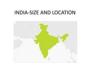
India's Location and Size: A Guide to its Geography and Borders
- 2. • India is one of the ancient civilisations in the world. civilisation- (the stage of human social and cultural development and organization that is considered most advanced.) • It has achieved multi-faceted socio-economic progress during the last five decades. Decades-(a period of ten years.) 10 years = one Decade, • moved forward displaying remarkable progress in the field of: • agriculture, • industry, • technology and overall economic development.
- 3. India - Union Territories • 1. Andaman and Nicobar • 2. Chandigarh • 3. Daman and Diu • 4. Dadar and Nagar Haveli • 5. Delhi • 6. Jammu and Kashmir • 7. Ladakh • 8. Lakshadweep • 9. Puducherry
- 4. ADDRESS • 20,SOUTH STREET, (4) PANUDAMANGALAM, (3) PARAMATHI-VELUR, (2) NAMAKKAL(DT), (1)
- 9. LATITUDE
- 10. LONGITUDE
- 13. • India is a vast country. • Northern hemisphere • the main land extends between • Latitudes 8°4'N and 37°6'N and • Longitudes 68°7'E and 97°25'E. • The Tropic of Cancer (23° 30'N) • divides the country into almost two equal parts.(NORTH AND SOUTH) • Andaman and Nicobar islands in Bay of Bengal (EAST) • Lakshadweep islands in Arabian Sea(WEST)
- 16. •The southernmost point of the Indian Union– ‘Indira Point’ got submerged under the sea water in 2004 during the Tsunami.
- 17. TROPIC OF CANCER PASSES THROUGH STATES: • GUJARAT • RAJASTHAN • MADHYAPRADESH • CHHATTISGARH • JHARKHAND • WESTBENGAL • TRIPURA AND MIZORAM
- 18. SIZE OF INDIA • the relative extent of something; • ANY OBJECT LIKE
- 19. • land mass of India has an area of 3.28 million square km. • 2.4 per cent of the total geographical area of the world. • India is the seventh largest country of the world. • land boundary of about 15,200 km • total length of the coastline of the mainland, including Andaman and Nicobar and Lakshadweep, is 7,516.6 km.
- 20. • India is bounded by the young fold mountains in the northwest, north and northeast. • South of about 22° north latitude, it begins to taper, and extends towards the Indian Ocean, dividing it into two seas, the Arabian Sea on the west and the Bay of Bengal on its east.
- 21. • The east-west extent appears to be smaller than the north-south extent. • From Gujarat to Arunachal Pradesh, there is a time lag of two hours. • Hence, time along the Standard Meridian of India (82°30'E) passing through Mirzapur (in Uttar Pradesh) is taken as the standard time for the whole country. • The latitudinal extent influences the duration of day and night, as one moves from south to north. • NORTH-SOUTH DISTANCE=3214 KM • WEST TO EAST DISTANCE=2933 KM
- 23. • GMT – GREENWICH MEAN TIME • IST – INDIAN STANDARD TIME
- 24. • Which state has the longest coastline in india? • Which country shares longest boarder in india? • Which state has the longest border in india? • First sunrise in india- • First sunrise in world-
- 25. INDIA AND THE WORLD
- 26. • The Indian landmass has a central location between the East and the West Asia. • India is a southward extension of the Asian continent. • The trans Indian Ocean routes, which connect the countries of Europe in the West and the countries of East Asia, provide a strategic central location to India. • the Deccan Peninsula protrudes into the Indian Ocean, thus helping • India to establish close contact with West Asia, Africa and Europe from the western coast and with Southeast and East Asia from the eastern coast. • protrudes -extend beyond or above a surface.
- 27. • Since the opening of the Suez Canal in 1869, India’s distance from Europe has been reduced by 7,000 km. • the land routes are much older than her maritime contacts.
- 30. • These routes have contributed in the exchange of ideas and commodities since ancient times.
- 31. • The ideas of the Upanishads and the Ramayana, the stories of Panchtantra, the Indian numerals and the decimal system thus could reach many parts of the world.
- 32. • The spices, muslin and other merchandise were taken from India to different countries.
- 33. • On the other hand, the influence of Greek sculpture, and the architectural styles of dome and minarets from West Asia can be seen in different parts of our country.
- 34. • commodities - a raw material or primary agricultural product that can be bought and sold, such as copper or coffee. • merchandise - goods to be bought and sold. • minarets - a slender tower, typically part of a mosque, with a balcony from which a muezzin calls Muslims to prayer.
- 35. INDIA’S NEIGHBOURS • India shares its land boundaries with • Pakistan and Afghanistan in the northwest, China (Tibet), • Nepal and Bhutan in the north • Myanmar and Bangladesh in the east.
- 36. • southern neighbours across the sea • consist of the two island countries, namely • Sri Lanka and Maldives. • Sri Lanka is separated from India by a narrow channel of sea formed by the Palk Strait and the Gulf of Mannar. • Maldives Islands are situated to the south of the Lakshadweep Islands.
- 37. • India has had strong geographical and • historical links with her neighbours.