SlideShare uma empresa Scribd logo
1 de 76
Baixar para ler offline
An exploration of Alameda County’s transportation
systems, how they are funded, what role they play
in supporting economic growth, and what changes
are needed to ensure a prosperous future.
InTheFast Lane:
An analysis prepared by the Bay Area Council Economic Institute
Improving Reliability, Stabilizing Local Funding, and Enabling
the Transportation Systems of the Future in Alameda County
Acknowledgments
This report was prepared by the Bay Area Council Economic Institute for the Alameda County Transportation
Commission. Sean Randolph (President & CEO) oversaw the development of the study. Tracey Grose (Vice
President) designed the study and directed the analysis and completion of the report. Matt Chwierut (Consulting
Senior Research Associate) was the primary contributor to Sections 1, 3 and 4 and also contributed to Section
2. Jeff Bellisario (Senior Research Associate) contributed to the overall narrative of the document. Alex Foard
(Research Associate) contributed to Sections 2 and 5.
The Bay Area Council Economic Institute
353 Sacramento Street, Suite 1000 | San Francisco, CA 94111
www.bayareaeconomy.org | bacei@bayareacouncil.org
Bay Area Council Economic Institute is a partnership of business with labor, government, higher education, and
philanthropy that works to support the economic vitality and competitiveness of the Bay Area and California.
The Association of Bay Area Governments (ABAG) is a founder and key institutional partner. The Economic Institute
also supports and manages the Bay Area Science and Innovation Consortium (BASIC), a partnership of Northern
California’s leading scientific research universities and federal and private research laboratories.
Through its economic and policy research and its many partnerships, the Economic
Institute addresses key issues impacting the competitiveness, economic
development, and quality of life of the region and the state, including
infrastructure, globalization, science and innovation, energy, and
governance. A public-private Board of Trustees oversees the
development of its products and initiatives.
Alameda County Transportation Commission’s mission is to plan, fund
and deliver a broad spectrum of transportation programs and projects
that expand access and improve mobility to foster a vibrant and
livable Alameda County.
Page 32014 | A Bay Area Council Economic Institute Report
Contents
6	 Executive Summary
9	 Introduction
10	 Advanced Transportation Systems and Economic Competitiveness	
	 10	 Looming Changes in Transportation: Technological, Economic, Political, Environmental, and Social Changes
		12	 An Array of Possibilities
	 17	 Responding to Change Is Critical – and Some Are Already There
	 19	 Cities and Regions Around the World Are Moving Into the Fast Lane
	 23	 Early Signs of the Transportation Future in the Bay Area
25	 Alameda County: A Critical Hub for the Movement of Goods and People in the Bay Area
	 25	 Alameda County, the Hub of Bay Area Commute Flows
		25	 Regional Commute Patterns by Geography
		30	 Diverse Commute Modes
		31	 Rising Commute Times
		33	 Trends in Passenger Vehicle Commutes: Reflecting the Pulse of the Economy
		34	 Trends in Public Transit Commutes
		35	 Bay Area Rapid Transit
		36	 Alameda-Contra Costa Transit District
		37	 Other Transit Operators
	 38	 Goods Movement
		40	 Bay Area Port Trade is Active and Growing
		41	 Air Freight Connects Bay Area Goods with the Country and the World
		42	 Trucks Play a Critical Role	
44	 The Sources of Transportation Funding in Alameda County
	 44	 Federal Transportation Funding
	 46	 The Growing Burden at the Local Level
	 49	 Looking Forward: Trends in Funding Sources	
	 52	 Transportation Funding in Alameda County	
	 55	 Reviewing the Performance of Measure B, 2000	
58	 The Alameda County 2014 Transportation Expenditure Plan	
	 59	 Expand and Improve Transit Services	
	 61	 Provide Traffic Relief	
	 62	 Freight and Economic Development	
	 63	 Bicycle and Pedestrian Paths	
	 63	 Critical Timing
64	 Transportation Spending: Estimating the Return on Investment	
	 64	 Economic Impact of Spending	
	 67	 Implications for Tax Revenue	
68	 Appendix A: Works Cited	
70	 Appendix B: Methodology	
74	 Appendix C: IMPLAN Input-Output Methodology
A Bay Area Council Economic Institute Report | 2014Page 4
20%
Strengthening Economic
Competitiveness
Efficient transportation systems are being
deployed around the world, positioning
regions for the future to:
• Support the clustering of firms
• Expand the regional labor pool
• Improve reliability
• Conserve natural resources
• Improve quality of life
• Lower the cost of moving people & goods
Alameda County has the second-largest population in
the region, and one of the fastest-growing
populations in the state.
Alameda County’s more than 600,000 jobs make it
the second largest employment base in the Bay Area,
behind Santa Clara County.
Alameda residents commuting outside the county
increased from 46% to 52% from 2003 to 2011.
12% of Alameda County commuters use public transit,
2% more than the regional average.
Alameda County, the Hub of
Bay Area Commute Flows
of all public transit
boardings in the
Bay Area are in
Alameda County
37%
of Bay Area
workers travel to,
from, or through
Alameda County
34%
of all BART
boardings
originate in
Alameda County
53%
of workers in
Alameda County
live outside
the county
Alameda County’s 2014 TEP*
addresses
current and future needs.
* Transportation Expenditure Plan that will be on Alameda County’s November 2014 ballot
In The Fast LaneImprove Reliability, Stabilize Local Funding, and Enable
the Transportation Systems of the Future in Alameda County
Well-functioning
transportation systems
are critical to economic
competitiveness
at the national and
the regional levels,
influencing commute
times, freight delays,
land use, quality of life,
and productivity.
2014 | A Bay Area Council Economic Institute Report Page 5
Alameda County represents a critical
focal point in the Bay Area’s regional
transportation system. While the Port
of Oakland accounts for a large share
of movement of goods in and out of
the region, the county also serves as
a vital conduit across all modes of
transportation for people within the
Bay Area.
Transportation systems must not only
be maintained but also upgraded
and expanded to keep pace with
population growth, connect housing
and jobs, and support the economic
competitiveness of the region.
The Bay Area’s trucking distribution system is
highly concentrated in Alameda County.
Expanding Goods Movement
Alameda County is the Bay Area’s hub
for international and domestic trade:
90%
of Bay Area trade in agriculture, wine,
and heavy machinery by weight goes
through the Port of Oakland, sending
California’s exports around the world
99%
of containerized cargo from
Northern California passes through
the Port of Oakland
Stimulating Economic
Impact
Direct spending from
Alameda County’s 30-year,
$8 billion 2014 Transportation
Expenditure Plan will yield:
150,000jobs*
$20B
in total economic
activity in the
Bay Area
• Construction
• Transit operations and
maintenance
• Professional, scientific,
and technical services
• Manufacturing
* Full-time equivalent jobs
The direct spending
of Alameda County’s
2014 Transportation
Expenditure Plan is
estimated to yield
$20 billion in total
economic activity in
the Bay Area economy
by extending and
augmenting the existing
1/2-cent transportation
sales tax.
Page 6 A Bay Area Council Economic Institute Report | 2014
Executive Summary
Alameda County represents a critical focal point in the Bay Area’s regional transportation system. While the
Port of Oakland accounts for a large share of movement of goods in and out of the region, the county also
serves as a vital conduit for people within the Bay Area across all modes of transportation.
As the population of the county and wider region grows, and as global trade increases, transportation
systems must not only be maintained but also upgraded and expanded. But, where does the funding come
from? And how does transportation funding translate into positive economic impact?
Alameda County has proposed a 2014 Transportation Expenditure Plan (TEP) that addresses the county’s
desire to expand transit services, keep fares affordable, provide traffic relief, improve air quality, and create
jobs. This document lays out the fundamentals of public transportation spending, illustrates signals of the
future of transportation systems, and highlights the role of transportation infrastructure in an advanced
economy in enhancing quality of life and securing global competitiveness. This report also provides an
overview of the proposed TEP and how it addresses the region’s current and future needs.
Advancing transportation infrastructure is critical for growing regional economic competitiveness
as it influences everything from the cost of production, the flow of innovation and ideas, and
property values.
•	 Efficient transportation systems increase reliability and can lower the cost of commuter flows and
goods movement.
•	 Quality transportation systems support the productive clustering of firms and expand the labor pool.
•	 Technological innovations are opening new possibilities in urban transportation, encouraging the
growth of systems that are more digital, multi-modal, efficient, adaptable, and accommodating of
petroleum alternatives.
•	 Cities around the world are experimenting with transportation solutions, ready to reap the economic
benefits of superior mobility.
•	 In this uncertain environment, regions must make transportation investments to prepare for a
changing future of moving goods and people.
Alameda County is at the heart of Bay Area commute flows, connecting diverse residential
communities (even outside the Bay Area) with the region’s job centers. As the economy and
population grow, Bay Area commutes are becoming longer, and the number of commuters
is rising.
•	 The Bay Area’s highly mobile regional labor pool consists of 1.3 million residents who cross at least one
county line to get to work. These workers account for 47 percent of employed residents in the Bay Area.
•	 Approximately 37 percent of Bay Area workers travel to, from, or through Alameda County. In 2011,
approximately 180,000 commuters traveled through the county each day to work destinations to both its
east and west, and over 300,000 commuters traveled into the county for work.
2014 | A Bay Area Council Economic Institute Report Page 7
•	 Alameda County is the largest source of inter-county commuters in the Bay Area with over 300,000
residents commuting outside of the county each day.
•	 The percentage of Alameda County residents commuting outside the county increased from
46 percent to 52 percent from 2003 to 2011.
•	 Over 12 percent of commutes originating in Alameda County use public transportation, compared to
10 percent of commutes in the broader Bay Area, and 5 percent in the United States.
•	 Approximately one-third of all BART system boardings occur in Alameda County.
•	 Home to 21 percent of the Bay Area’s population, Alameda County was one of the fastest growing
counties in California in 2013.
•	 More cars and longer distances translate into greater delays. Given its pivotal position in the
region, Alameda County experiences the largest number of vehicle hours spent delayed in traffic
in the Bay Area.
Alameda County is the Bay Area’s hub for international and domestic trade.
•	 By value, 41 percent of Bay Area trade passes through Alameda County.
•	 The Port of Oakland handles over 90 percent of total Bay Area trade by weight for many of
California’s key exports, including high-value agriculture, wine, and heavy machinery.
•	 The Port of Oakland handles 99 percent of containerized cargo that flows through
Northern California.
•	 The Oakland International Airport handles the majority
of all air cargo in the Bay Area, with a focus on domestic
trade.
•	 Highly concentrated in Alameda County, Bay Area trade
relies extensively on the trucking distribution system and,
in turn, on the region’s highways.
Transportation funding is complex, increasingly
unreliable, and more and more dependent on
local communities.
•	 The transportation funding system in the United States is
complex. Funds come from a variety of sources and flow
through multiple levels of governments until they can be
directed to local uses and projects.
•	 Federal sources of transportation funding are becoming
increasingly unreliable. Federal stimulus funding funneled
more than $50 billion in general funds to transportation
projects, but this recent surge in spending is unlikely to
continue.
The direct
spending
of Alameda
County’s 2014
Transportation
Expenditure Plan
is estimated to
yield $20 billion
in total economic
activity in the Bay
Area economy.
A Bay Area Council Economic Institute Report | 2014Page 8
•	 The federal gas tax - set at $0.184 per gallon for gasoline - has not been raised since 1993. Because it is
not indexed to inflation, its value has eroded immensely over the past 20 years.
•	 Bonds are increasingly relied on for transportation funding across the US and in California. A $20 billion
transportation bond, approved by voters statewide in 2006, is almost entirely spent.
•	 Local funding, including sales tax measures (like Measure B in Alameda County in 2000), supplies
approximately 50 percent of transportation revenues in California and, relative to other funding sources,
provides strong local transparency and control.
•	 Most of the projects envisioned in the voter-approved 2000 Measure B have been completed ahead of
schedule. A Citizens Watchdog Committee has found expenditures to be consistently satisfactory. This
has occurred even in the face of lower-than-forecast sales tax revenues.
•	 Measure B funds have helped secure over $3 billion in additional external funding to support
transportation projects in Alameda County.
Alameda County’s 2014 Transportation Expenditure Plan (TEP) invests in immediate transportation
needs with an eye toward the future success of the region’s economy.
•	 The 2014 TEP primarily focuses on maintaining existing transportation systems, particularly transit, and
on relieving congestion, improving air quality, and stimulating economic development.
•	 Major new projects envisioned in the 2014 TEP include BART modernization and expansion, improved
bicycle trails and facilities throughout the county, expanding high-occupancy vehicle/high-occupancy
toll (HOV/HOT) lanes, local community developments that connect transit to jobs, and projects that
improve the movement of freight on trucks and rail.
The direct spending of Alameda County’s 2014 Transportation Expenditure Plan is estimated to
yield $20 billion in total economic activity in the Bay Area economy.
•	 Planned spending across the economy for maintenance, operations, new construction, new
equipment, and other new systems will translate into approximately 149,900 full-time equivalent jobs.
•	 This added economic activity will generate an estimated total of approximately $2.4 billion in federal, state,
and local tax revenue.
Page 92014 | A Bay Area Council Economic Institute Report
Introduction
Alameda County is a critical focal point in the Bay Area’s regional transportation system. While the Port of
Oakland and Oakland International Airport account for a large share of the movement of goods in and out
of the region, the county also serves as a vital conduit for people moving throughout the Bay Area across
all modes of transportation.
As the population of the county and region grows, and as global trade increases, transportation systems
must not only be maintained but also upgraded and expanded. But, from where does the funding come?
And how does transportation funding translate into positive economic impact in the county?
This document illustrates signals of the future of transportation systems and highlights the role of
transportation infrastructure in enhancing quality of life and securing global competitiveness in an
advanced economy. The report focuses on Alameda County and the significant part it plays in the
movement of goods and people in the Bay Area economy. To support this vital role, Alameda County
has proposed a 2014 Transportation Expenditure Plan (TEP) that addresses the county’s desire to expand
transit services, keep fares affordable, provide traffic relief, improve air quality, and create jobs.
In order to better understand the importance of these investments and their potential positive
economic benefits, this report provides an overview of the evolution of transportation infrastructure
and the financing system that is used to pay for it. Alameda County’s TEP seeks to position the region
ahead of these changes, which will translate into economic advantages as the Bay Area becomes more
interconnected. Additionally, TEP investments will produce significant economic benefit for the area in
the form of job growth, while improving upon a transportation system that is a crucial piece of the region’s
competitive infrastructure.
Section 1 explores the role of advanced transportation systems in economic competitiveness today,
offers examples of early-stage transportation systems of the future, and discusses places in the world that
are early adopters of advanced technologies. Through a series of metrics, Section 2 illustrates Alameda
County’s critical role as the region’s hub for the movement of goods and people. Section 3 examines the
sources of transportation funding in Alameda County and how that funding has changed over the years.
Alameda County’s proposed 2014 (TEP) is laid out in Section 4. Reflecting on the planned expenditures of
the TEP, Section 5 estimates the broader regional economic impacts of this investment.
Page 10 A Bay Area Council Economic Institute Report | 2014
Advanced Transportation Systems and
Economic Competitiveness
Modern transportation systems play an important role in local and global commerce, growing economic
vitality and improving quality of life. Our context is changing locally and globally. External drivers as
well as changing preferences are forcing us to reconsider how we do things, and technology offers new
options for responding to change and shaping our future. Other places in the world are already in the
fast lane, implementing advanced transportation systems to support local economic growth and future
competitiveness. What are the systems of the future? How can new technology in transportation systems
improve our lives and commerce in the county and region?
New practices and new technological tools are emerging that offer new options either in response to
change or in advance of change. Positioning a region on the front end of change translates into a stronger
competitive position.
This section explores the role of advanced transportation systems in economic competitiveness today and
how improving system reliability and reducing traffic congestion can grow economic vitality and quality
of life. Pushing the envelope of creative problem-solving, examples of early-stage transportation systems
of the future are presented as well as examples of other metro areas in the world that are early adopters
of advanced technologies. This section closes by shifting the focus to Alameda County, where numerous
examples of innovative transportation systems are already in use. The 2014 Transportation Expenditure
Plan (TEP) provides funding to expand these types of advanced projects and services, which will help
shape and drive the county’s future development.
Looming Changes in Transportation: Technological,
Economic, Political, Environmental, and Social Changes
One hundred years ago, a Ford Model T – the famous first mass-produced automobile – could be produced
in 93 minutes, and Henry Ford’s plants produced more automobiles than all other automakers combined.
The Ford Model T helped draft the agenda for 20th century transportation, and since then, the story of
personal transportation in the US has largely been a series of footnotes to the Model T. Eighty years ago,
Robert Moses began the transformation of New York infrastructure to accommodate the automobile – and
many cities followed suit. The post World War II era saw massive investment in highway infrastructure across
the US, and the automobile dominated the aspirations of middle-class life. Were Henry Ford to step forward
100 years into the US, into California or into Alameda County to view the transportation system today, much
would be recognizable. The buses, bikes, rail, and cylinder-engine automobiles that today support the 1.5
million residents of Alameda County were all known in his day.
However, were he to step forward another 10 years, to 2024, much would likely surprise him. Numerous
technological and socioeconomic developments are laying the foundation for improved transportation
systems – using new strategies for addressing new mobility needs. Vehicles based on new fuels are
accelerating into the market. Digitization of the car, the road, and the driving experience are combining the
2014 | A Bay Area Council Economic Institute Report Page 11
IT industry and the transportation industry. Shifting demographic preferences and social practices are
destabilizing the dominant model of automobile ownership. Evolving practices in 21st century work are
changing how transportation is delivered and demanded. Preparing for – and harnessing – many of
these changes demands investments in a next-generation transportation system.
Henry Ford helped revolutionize how we move people, but our transportation system also must
move goods. Indeed, innovations in freight movement and broader economic changes over the past
half-century set the stage for Alameda County’s critical role in US freight transportation. In the mid-
20th century, Malcom McLean, a trucking entrepreneur, helped standardize the use of containers for
the transportation of goods; his particular genius was designing a system where containers could be
transported over sea and land without being unloaded in between. This began modern container
shipping, which today allows single containers to come through US ports and be loaded directly
onto trucks or rail. This innovation also caused shipping costs to plummet, trade to swell, and supply
chains to expand. One of containerization’s many effects was the decline of the Port of San Francisco,
which could not handle deep-hull ships, and the rise of the Port of Oakland, which could. In 2012,
the Port of Oakland handled over 2 million TEUs (twenty-foot equivalent unit) of cargo, including
machinery, apparel, wine, and produce.1
Air transportation also dramatically changed freight movement and trade, offering faster and more
flexible shipping routes. This, in turn, has helped globalize supply chains and available markets,
particularly for items with a high value-to-weight ratio, such as pharmaceuticals and advanced
electronics. In 2011, electronics accounted for 37 percent of the total value of California’s air exports
– more than any other category by value – but only 13 percent of total tonnage, second only to
agricultural products. In 2011, the Bay Area (San Jose, San Francisco, and Oakland) exported almost
$8 billion in electronics products by air – though only 20 kilotons.
Freight movement is undergoing a revolution. Automation is quietly infiltrating advanced port
operations. Advanced freight tracking and management help maximize the efficiency of the existing
system. Changes in oil prices and regulations requiring cleaner fuels will impact transportation costs
Photo Credit:
“Ford Focus (2 of 3)” by viZZZual.com
Photo Credit:
Wikimedia Commons
1910 Ford Model T 2013 Ford Focus
1	
Port of Oakland Container Statistics, http://www.portofoakland.com/maritime/containerstats.aspx. A TEU (twenty-foot equivalent units) is an
	 inexact unit measuring cargo capacity in container shipping. A 20-foot container is 1 TEU; a 40-foot container is 2 TEUs.
A Bay Area Council Economic Institute Report | 2014Page 12
and transportation modes. The expansion of the Panama Canal, expected to conclude in 2015, is likely to
change Pacific shipping routes. With major implications for West Coast ports, some shipping traffic from Asia
may bypass California and pass directly to the East Coast. But some Atlantic traffic may come directly to the
West Coast. The ultimate effect is uncertain. A 2008 study argues that Atlantic and Gulf ports could seize up
to 25 percent of West Coast cargo,2
but Dan Smith of the Tioga Group, a freight transportation consultancy,
argues that the importance of transit time, reliability, Southern California and Bay Area consumer markets, and
actual capacity on alternative routes will dampen cargo diversion.3
A major report analyzing the competitive position of West Coast Ports argues that further investment in
rail is needed to maintain cargo share.4
Regardless, many analysts agree that other economic forces, such
as consumer demand, will be greater drivers. Economic changes are favoring more agile, often more local,
supply chains – even as overall global trade is forecast to grow. Any changes in goods movement will have
major implications for our transportation systems.
An Array of Possibilities
Transportation planners are challenged to design and manage systems that must perform in an uncertain
future. Each decade brings a new set of disruptions, innovations, and regulations, but transportation
investments must be resilient. It is critical to examine areas of change that might affect transportation, and
the benefits of this scrutiny are twofold. It is possible to anticipate the consequences of major changes,
particularly issues that might influence demand for transportation. It is also possible to identify potential
technological tools that could enable new strategies for improving efficiency, could create economic
opportunities, or could pose policy challenges.
The next ten years will see a range of possibilities for personal and freight mobility. Transportation
infrastructure may change slowly in the US, but mobility practices are changing rapidly. Ten years ago, the
navigation aid in state-of-the-art cars was a dedicated GPS receiver; now, voice automated smartphones
can provide turn-by-turn instructions. In the US, car sharing used to mean borrowing a friend’s car; now,
car sharing is a widely recognized industry including organizations such as Zipcar and City CarShare.
2	
Drewry Supply Chain Advisors, “US Transpacific Intermodal Today and Tomorrow,” September 2008.
3	
Bonney, Joseph, “Redrawing Trade Winds,” Journal of Commerce, March 23, 2009.
4	
Cambridge Systematics, “Port Activity and Competitiveness Tracker Progress Report,” prepared for Southern California Association of
	 Governments, February 2011.
Photo Credit:
“Container Ship, Port of Oakland”
by Michael Layefsky
Photo Credit:
“Airplane at the Vienna International Airport”
by viZZZual.com
Cargo Plane Container Ship, Port of Oakland
2014 | A Bay Area Council Economic Institute Report Page 13
Autonomous vehicles were still science fiction; now financial analysts are predicting the economic
savings that autonomous cars will be contributing to the economy in the next decade, and California
is drafting regulations to allow autonomous cars on the road in 2015. Today, all of these developments
are major topics for media and, to varying degrees, for transportation planners.5
Analyzing the flow of
innovations and trends helps reveal how transportation systems might change over the next decade.
Global Drivers of Change
Category Developments in Transportation of People and Goods
People:
Changing needs
and preferences
•	 The wave of retirements in the coming decade is expected to present a
shortage of workers in the transport sector – both personal and freight.
•	 Retiring Baby Boomers and extended longevity will require more senior-
friendly transportation and land use.
•	 As Millennials (born in the 1980s and 1990s) enter adulthood, they are
preferring denser urban environments, public transit, and cycling.
Technology:
New tools for
today and the
future
•	 Digitization of transportation can enable autonomous and semi-autonomous
vehicles.
•	 Wireless sensors and advanced routers could enable cars connected to the
Internet, infrastructure, and each other.
•	 Alternative fuels will require new refueling infrastructure.
•	 Sensors and data analytics enable much more granular freight tracking and
complex supply chains.
Policy:
Geopolitical
and regulatory
changes reframing
the context
•	 Greenhouse gas (GHG) regulation will drive adoption of clean fuels, land use
changes, and demand-management strategies like road pricing.
•	 Densification of land use will encourage more urban and multimodal forms of
transportation, and have implications for non-work travel.
•	 Trade policy will impact the costs of freight, though this is difficult to forecast.
•	 Public-private partnership models – including private transportation systems –
are increasingly necessary to address transportation funding gaps.
Markets:
Shifting local and
global markets for
labor and goods
•	 Energy costs will be a major driver of change in transportation.
•	 A knowledge- and innovation-based economy in the US will concentrate in
metro areas, making well-functioning urban transportation systems essential.
•	 Mobile work and coworking are changing commute patterns.
•	 E-commerce and home delivery could put new demands on the urban freight
system, which will be required to transport goods to houses rather than just
to retail outlets.
•	 Mobility-as-a-service (such as car sharing) will challenge the automobile
ownership model.
•	 Reshoring of manufacturing may reduce imports but could also increase
exports.
•	 Digital fabrication technologies – and local manufacturing networks – could
increase intra-regional trade and domestic freight.
Environment:
Changing physical
landscape creates
disruptions
•	 Climate change will create an uncertain environment for climate policy.
•	 Extreme weather events will drive the need for simple or more agile supply
chains.
•	 Rising sea levels could threaten coastal infrastructure – at any point in the
supply chain.
•	 Planning for an uncertain environmental future will require resilience
measures and infrastructure adaption.
5	
An exhaustive analysis of new technologies or fully developed US transportation scenarios are beyond the scope of this paper. Examples
	 of such work include “Long Range Strategic Issues Facing the Transportation Industry,” by ICF International; the MIT “Future Freight Flows
	 Symposium,” and “The Future of Mobility: Scenarios for the United States in 2030,” by RAND.
A Bay Area Council Economic Institute Report | 2014Page 14
2014 | A Bay Area Council Economic Institute Report Page 15
These drivers of change are what will shape future transportation development in Alameda County
and across the globe. As a result, transportation in Alameda County will evolve over the next 30 years.
The 2014 TEP will shape the county’s development over this time and provide funding for the types of
projects and services that will be required as a result of these drivers of change. Potential implications
for next-generation transportation systems include:
	 Transportation systems are increasingly automated and digital. The core technologies for
transporting people and goods are undergoing a revolution. The internal combustion engine has
dominated transportation for over 100 years; now a host of innovations are rebuilding and rewiring
the automobile. The Google fleet of autonomous Priuses has logged over 140,000 miles. General
Motors predicts that autonomous vehicles will enter consumer markets by 2020. Even sooner,
carmakers are releasing vehicles with automation features, such as active cruise control with stop-and-
go function.6
New regulatory challenges arise when such vehicles share the road with other vehicles,
but policymakers have already been discussing these issues for several years, and California law will
allow these vehicles on the road in 2015. Moreover, autonomous vehicles might see more deployment
in port operations and other sites using heavy equipment. In October 2013, international research
consortium InTraDE successfully demonstrated technology for intelligent autonomous vehicles (IAVs)
for loading and unloading port cargo.7
Also close to deployment is connected vehicle technology,
which communicates wirelessly with other vehicles and with road infrastructure. The technology
underpinning autonomous vehicles also includes numerous other features, such as automatic breaking
to avoid collisions, traffic rerouting, and location-based services. Such efficiency is two-edged: allowing
more cars to move seamlessly on the roads can relieve congestion and increase safety, but it also
increases wear and tear on the roads, which already suffer from maintenance funding shortfalls.
	 Transportation strategies are multimodal. As the world urbanizes, a core challenge will be
developing transportation systems that are maximally efficient and multimodal. Cities around the
world are investing in pedestrian and bike facilities and in new transit systems. Global automobile
usage will rise, but many cities and regions around the world are simply too dense to rely solely
on single-occupancy vehicles. High density also dictates certain types of transportation, as new
car infrastructure often cannot be built out in dense areas. This has led to programs such as bike
sharing; in early 2013, there were over 500 bike sharing systems worldwide, with many more cities
in the process of planning or launching such systems.8
Hangzhou, home to China’s first commercial
car sharing scheme, also has one of the largest bicycle sharing systems in the world, with a fleet of
almost 70,000. Hangzhou has also integrated the bike network with transit and subway networks.9
Bike sharing systems, combined with bike infrastructure investment, can relieve congestion by
encouraging the mode shift from cars to bicycles. Demographic trends also point to multimodal
growth; Millenials in the US – roughly defined as those born in the 1980s and 90s – are driving less,
ride transit more, and prefer urban walkable neighborhoods more than previous generations.10
Another pillar of multimodal transportation systems is mobility-as-a-service (MaaS) systems, including
informal car sharing. Services like Zipcar allow people to rent cars by the hour. Car2go,
6	
BMW, “BMW Active Cruise Control with Stop&Go Function,”
	http://www.bmw.com/com/en/insights/technology/technology_guide/articles/active_cruise_control_stop_go.html.
7	
InTraDE, “Successful demo of the InTraDE IAV in Oostende!,” http://www.intrade-nwe.eu/project-live.
8	
Early Policy Institute, “Bike-sharing Programs Hit the Streets in Over 500 Cities Worldwide,”
	http://www.earth-policy.org/plan_b_updates/2013/update112.
9	
Ibid.
10	
See “A New Direction: Our Changing Relationship with Driving and Implications for America’s Future,” by US PIRG, 2013 and “Millennials
	 and Mobility: Understanding the Millennial Mindset,” by American Public Transportation Association, 2013.
A Bay Area Council Economic Institute Report | 2014Page 16
a European car sharing scheme managed by Daimler, allows members to rent small vehicles by the
minute and park them in areas throughout the urban service area. Peer-to-peer (P2P) programs allow
users to rent out their own cars to others. Uber, a service that allows members to share rides, creates
a P2P taxi service. Corporations are also entering the transportation market by providing commuter
shuttle services to and from their corporate campuses. All of these innovations decrease the need for
automobile ownership and help make urban mobility even easier.
	 Advanced transportation systems focus on efficient use. A growing body of research
is challenging the dominant paradigm of highway expansion as a cure for congestion, and
demand management systems are being seen as better alternatives. Research suggests that
expanding highways does not reduce congestion in
the long term, primarily because as highways expand,
more people choose to drive or move to areas where
driving is necessary.11
Congestion pricing and related
strategies that use price signals to encourage rational
user behavior are put forward as a preferred strategy for
managing congestion. McKinsey & Company has found
that expanding highway capacity has one of the lowest
benefit-cost ratios among congestion reduction strategies,
often much lower than demand management systems
like congestion pricing and signal optimization. Demand
management is also much cheaper. For example, the UK’s
M42 motorway intelligent transport system (ITS) cost $150
million and required two years to implement; widening the
road for the same outcome would have cost $800 million
and would have taken 10 years.12
	 Advanced transportation systems must be agile.
Expanding world trade will impact the freight transportation
system. If manufacturing increases in the US, exports may
rise. Broad market shifts that privilege speed to market
and niche offerings will likely also lead to complex supply
networks that must respond to shifts in production and market demand. E-commerce may increase the
need for transportation networks that connect to the home; the “last-mile problem” might become
warehouse to neighborhood, rather than warehouse to retailer. A 2012 report by Accenture notes
that more than 80 percent of companies are concerned about supply chain resilience; supply chain
managers globally are worried about supply chain disruptions due to extreme weather, political unrest,
and cyber security issues.13
An MIT report on the future of freight noted that digital fabrication and
small-scale manufacturing could change how consumers acquire goods.14
	 Advanced transportation systems need new petroleum-alternative infrastructure. Three major
reports on the future of transportation emphasize the importance of oil prices in driving transportation
11	
Gilles Duranton and Matthew A. Turner. “The Fundamental Law of Road Congestion: Evidence from US cities.” American Economic Review,
	 October 2011.
12	
McKinsey Global Institute, “Infrastructure Productivity: How to Save $1 Trillion a Year,” January 2013.
13	
Accenture, “Building Resilience in Supply Chains,” January 2013,
	http://www.accenture.com/SiteCollectionDocuments/PDF/Accenture-Building-Resilience-Supply-Chains.pdf.
14	
MIT Center for Transportation and Logistics, “Future Freight Flows Symposium,” 2011.
“When it comes to
the future, there
are three kinds
of people: those
who let it happen,
those who make it
happen, and those
who wonder what
happened.”
- John M. Richardson, Jr.,
pioneer in the field of systems dynamics
2014 | A Bay Area Council Economic Institute Report Page 17
futures.15
A review of cleantech investment by the Congressional Budget Office found that R&D funding
and federal tax incentives related to energy, including fossil fuels and energy efficiency, jumped after
the oil crisis in the 1970s, then fell as oil prices came down, and then rose again in the past decade as oil
prices rose again.16
Nonetheless, R&D investment has already led to new products and near-to-market
clean technologies, such as advanced biofuels, electric vehicles, fuel cells, and more. These will require
advanced fueling infrastructure, consumer confidence, and new technologies to make them viable in
the marketplace. Policy – in the form of incentives and renewables targets, such as California’s AB32 – is
advancing requirements that are funneling investments to alternative infrastructure and driving adoption.
These examples are major changes in transportation that will affect residents, planners, and companies.
Thinking through future alternatives is critical to designing robust transportation systems. As John M.
Richardson, Jr., a pioneer in the field of systems dynamics, noted, “When it comes to the future, there
are three kinds of people: those who let it happen, those who make it happen, and those who wonder
what happened.”17
In Alameda County, transportation planners are looking ahead to the infrastructure
needs of the county. The proposed 2014 TEP puts forth solutions that address present and future gaps in
furthering advanced transportation systems in Alameda County.
Responding to Change Is Critical – and Some Are
Already There
Transportation is the circulatory system of our economy. A complex network of infrastructure, vehicles,
and exchange points enables the flow of people and goods around the world. People can access jobs,
meet to exchange ideas, and engage in leisure activities. Goods can be manufactured in one area,
tested in another, and purchased in a third – taking advantage of the economic strengths of each place.
Ships, planes, trains, and trucks support an extraordinarily complex global supply chain. Well-functioning
transportation systems are critical to economic competitiveness at the national and the regional levels,
where they influence everything from commute times, freight delays, land use, quality of life, air quality,
productivity, and agglomeration.
•	 Cost of Production and Competitiveness: An efficient transportation system can lower the cost
of goods movement and increase reliability. Studies have found a correlation between infrastructure
investments and economic output; infrastructure supports private sector productivity gains, often
with higher returns than traditional business investments.18
•	 Agglomeration and Productivity: When firms cluster, they can more easily share ideas, supply chains,
and people, thus boosting productivity. A 2012 study by Patricia Melo and Daniel Graham found that
“doubling the number of jobs accessible within 20 minutes of driving time leads to an increase in real
average wages of 6.5 percent, while the impact for a similar increase within 20 to 30 minutes is as small
as 0.5 percent.”19
This effect is even more pronounced in knowledge-intensive industries.20
15	
See previous footnote on studies on studies by MIT, RAND, and ICF International.
16	
Congressional Budget Office, “Federal Financial Support for the Development and Production of Fuels and Energy Technologies,”
	 March 2012, http://www.cbo.gov/sites/default/files/cbofiles/attachments/03-06-FuelsandEnergy_Brief.pdf.
17	
John M Richardson, Jr. was a pioneer in the field of system dynamics and global modeling with the Club of Rome. He has applied systems
	 dynamics principles to multiple fields, including sustainability, civic conflict, and international development. Dr. Richardson is currently faculty
	 emeritus at American University.
18	
See “A New Economic Analysis of Infrastructure Investment,” Department of the Treasury with the Council of Economic Advisors, 2012
19	
Melo, Patricia and Daniel Graham, “Agglomeration, Accessibility, and Productivity: Evidence for Urbanized Areas,” Transportation Research
	 Board, Annual Meeting, 2013.
20	
American Public Transportation Association, “The Role of Transit in Support of High Growth Business Clusters in the U.S.,” December 2013.
A Bay Area Council Economic Institute Report | 2014Page 18
•	 Imports and Exports: A 2010 Brookings report on metropolitan exports found that exports are
critical to national and regional economic competitiveness. In addition, the report notes that many
US exports require intermediary inputs, implying that imports are also critical for the value-added
processes that US firms employ on eventual exports.21
•	 Expanded Labor Pool: Well-functioning transportation systems enable firms to access more workers.
This supports economic growth and facilitates efficient labor matching, allowing firms to access the
most talented workers in a given geographic area.
•	 Real Estate Values: Transportation infrastructure can boost local property values. For example, a study
of the Hiawatha Light Rail corridor running from Minneapolis to Bloomington, Minnesota found that
“the LRT [light rail transit] had a significant positive impact
on property values...” and that “residential property values
increased by $47 million along the segment of the corridor
studied.”22
Trails and greenways have been found to have a
similar positive effect on real estate.23
•	 Employment Benefits: Transportation provides well-paying
jobs and has ripple effects across the public and private
sector. For example, a study prepared for the American Public
Transportation Association found that for every billion dollars
of national investment in public transportation, 36,000 jobs
are supported for one year.24
Much like the human circulatory system, people most often
notice transportation systems when they malfunction.
Congestion, routing errors, and system failure all contribute
to economic losses.
•	 In 2013, over one-fifth of US scheduled flights were delayed
or canceled.25
•	 In 2011, US drivers lost 5.5 billion hours, 2.9 billion gallons of
fuel, and $121 billion due to traffic congestion and delay.26
•	 Nineteen percent of shipping vessels do not arrive on time in
ports; in the world’s busiest shipping lanes, container delivery
to the end customer was even less reliable.27
Maintaining transportation system performance is critical for economic competitiveness.
21	
Brookings Institution, “Export Nation 2012: How U.S. Metropolitan Areas are Driving National Growth,” 2012.
22	
Goetz, Edward G., et al., “The Hiawatha Line: Impacts on Land Use and Residential Housing Value,” Minneapolis: Center for Transportation
	 Studies, University of Minnesota, 2010.
23
	 Rails-to-Trails Conservancy, “From Trail Towns to TrOD: Trails and Economic Development,” August 2007.
24	
Glen Weisbrod and Arlee Reno, “Economic Impact of Public Transportation Investment,” APTA, October 2009.
25	
US Bureau of Transportation Statistics, “Research and Innovation Technology Statistics,”
	http://www.transtats.bts.gov/HomeDrillChart.asp.
26	
Texas Transportation Institute, “2011 Urban Mobility Report,”
	http://d2dtl5nnlpfr0r.cloudfront.net/tti.tamu.edu/documents/mobility-report-2011-wappx.pdf.
27	
DC Velocity, http://www.dcvelocity.com/articles/20120803-report-most-container-ships-arrive-on-time-but-delivery-to-customer-lags/.
Well-functioning
transportation
systems are critical
to economic
competitiveness
at the national
and the regional
levels, influencing
commute times,
freight delays, land
use, quality of life,
and productivity.
2014 | A Bay Area Council Economic Institute Report Page 19
Transportation systems are not easy to design, build, or manage. Some transportation technologies can
fundamentally change the architecture of transportation systems (as the advent of the automobile and
the airplane did). Other technologies, like cargo cranes or wireless sensors can introduce new ways to
manage transportation systems.
Transportation infrastructure must be engineered for safety, reliability, and efficiency. Transportation
investments are also about people, how they want to move around, and what impacts transportation
systems might have on their communities. Complex global supply chains rely on efficient transportation
systems that can handle multiple moving pieces. Transportation globally is increasingly becoming a
challenge for urban and suburban communities. Where physical space is a premium, construction is
more complex and costly, and the sheer density of people introduces critical tradeoffs between different
transportation modes. Even without a changing future, transportation systems are complex, and new
developments can intensify the challenges.
Cities and Regions Around the World Are Moving Into the
Fast Lane
Cities and regions around the world are not idling while the future overtakes them. Many are tackling the
challenges and defining the next era of transportation systems. Some transportation improvements are
humble design innovations whose time has come. Others are radical experiments in mobility. Historically,
US economic competitiveness has been supported by a world-class rail network and then by a road
network. New York City enjoys the human capital benefits of density, which are difficult to imagine without
its subway system. The Bay Area has similar pockets of density,28
which are connected by an extensive
rail network. US seaports and airports feed a complex trucking distribution system enabled by a highway
network. Today, other transportation systems are now positioning their regions for social and economic
success in the 21st century.
Examples of advanced transportation systems deployed or in early development around the world
include the following.
Agile Transit Infrastructure: Over the past
decade, bus rapid transit (BRT) has captured the
imagination of transportation planners around
the world. BRT offers many of the amenities of a
subway, including platform boarding, enclosed
stations, dedicated lanes, and the dramatically
reduced costs of using roads and wheels rather
than rail infrastructure and custom-designed trains.
BRT systems can be maintained and expanded at
a fraction of the costs for rail. TransMilenio, a BRT
system introduced in 2000 in Bogotá has been
viewed as a model BRT system and has convinced
28	
Smart Growth America, “Measuring Sprawl 2014,” http://www.smartgrowthamerica.org/documents/measuring-sprawl-2014.pdf.
Photo Credit:
Wikimedia Commons
Bogotá, Colombia TransMilenio
Bus Rapid Transit
A Bay Area Council Economic Institute Report | 2014Page 20
many skeptics that it can outperform alternative light rail systems. In 2012, the entire system covered 54 miles,
with ambitions to eventually cover 240 miles; in comparison, the entire BART (Bay Area Rapid Transit) system
in California covers 105 miles. There are now many BRT systems around the world, although there are few in
the US that actually have dedicated lanes, which are critical to improving performance.
Digitally Integrated Smart City: In Rio de Janeiro, city officials and administrators can monitor various
systems in the entire city from an IBM-created mission control room, which reports integrated city data in
real time. In response to an emergency such as a fire or
a building collapse, controllers can reroute traffic, close
transit stations, and issue warnings to travelers. This
lets first responders do their jobs, allows Rio residents
to continue their travels, and prevents already critical
situations from getting out of control. In integrating
transportation as part of a larger system of city behavior,
the intelligent operations center enables highly
coordinated responses to urban needs, including the flow
of goods and people.
Efficient Demand Management: In 2006, policymakers
in Stockholm, Sweden launched a pilot congestion
pricing scheme that charged vehicles entering the city
center a variable fee during the weekday rush hour. After
extensive outreach, planners held a six-month trial of the
system, then revoked it and later held a referendum to
see if Stockholm citizens wanted to keep it. They voted to
reinstall it permanently. The system avoids the cost and
traffic of tollbooths by using optical recognition of license
plates; monthly bills are sent to the drivers. Congestion
inside and outside the city center fell by 20 to 25 percent
during the trial period, public transit use increased, and air
quality improved. The city recouped its investment in less Stockholm Congestion
Pricing Signage
Photo Credit:
Wikimedia Commons
Photo Credit:
IBM.com
IBM Mission Control in
Rio de Janeiro
2014 | A Bay Area Council Economic Institute Report Page 21
than four years.29
Similar strategies have been employed in the Bay Area by SFpark and GoBerkeley in
order to better manage scarce parking spaces.
A New Transit Experience: In Seoul, South Korea, subway riders can shop for goods from Tesco
Homeplus (a major retailer) using a virtual store aisle in the downtown subway station. Riders can order
items via Quick Response Code from their phones and have them delivered to their homes or held for
pickup.30
This use of transportation infrastructure has enabled new financing streams and delivered a
unique service to riders.
Automated Port Operations: Located in Hong
Kong’s Kwai Tsing Container Terminals port facility,
Hong Kong International Terminals (HIT) uses a
technologically wired terminal management system
that is widely considered to be the most advanced
in the world. A massive data tracking system enables
automated rail-mounted cranes to operate 24 hours
a day. This technology will likely be explored by other
ports as a way to increase trade volume.
Automated Electric-Car Dispensing Vending
Machine: In China, the city of Hangzhou, home to
8.7 million people, is experimenting with a new system
of car sharing on a scale and density unmatched
anywhere in the world. Car sharing is not a novel
invention, but the complexity of cities in China
requires a model different from the Zipcar model
of surface-parked cars. A company called Kandi
Technologies intends to use a system that works like a
29	
McKinsey Global Institute, “Infrastructure Productivity: How to Save
	 $1 Trillion a Year,” page 59.
30	
Lawson, Alex “Tesco Expands Korean Virtual Stores,” Retail Week,
	 February 7, 2012.
Photo Credit:
B&R Automation
Photo Credit:
Tesco Homeplus
Tesco Virtual Subway Shopping Store
in Seoul
Port of Hong Kong Automated Crane
Chinese Kandi Car Dispenser Photo Credit:
Mundo Auto Motor
A Bay Area Council Economic Institute Report | 2014Page 22
vending machine to make 100,000 vehicles available to residents of Hangzhou through automated parking
garages that each hold up to 300 vehicles.31
By comparison, the entire Zipcar fleet in 2012 was less than
10,000 vehicles.32
The system allows one-way rentals, and the mechanically dispensed cars can be rented by
the hour and returned to any Kandi automated garage in the city.
Land Airbus: TBS China has proposed plans for a massive bus that travels over two lanes of traffic,
combining the minimal-infrastructure benefits of BRT with the high-tech interior and traffic independence of
a rail system. The bus would allow traffic to pass underneath even when stopped. The idea first appeared in
2010, with construction slated in Beijing’s Mentougou district,33
but an updated concept by TBS China was
released in 2012, showing increased capabilities and safety features. Actual deployment is unclear, but the
idea shows creative experimentation for highly dense urban areas where even rail and roads compete for
right of way.
Complete Street Design: New approaches to street design break down the traditional separation between
highways, transit, walking, and bicycling, and instead focus on the desired outcome of a transportation
system that supports safe use and beneficial public spaces. The complete streets movement is gaining
steam across the US, as cities like New York City, San Francisco, Oakland, Chicago, and Washington, D.C.
experiment with new cost-effective, context appropriate street designs. While complete streets policies are
different in every location, strategies that calm traffic, separate buses and bicycles from vehicle flows, and
enhance crosswalks and pedestrian refuges can make streets safer, optimize traffic speeds, and produce
economic vitality.
These innovations in cities and regions around the world offer more than points of inspiration; they also
represent economic competition. Mobility of goods and people is critical in the 21st century, and ideas,
investments, and businesses will flow where regional advantages, including transportation, are highest.
However, the future is not only occurring overseas; it is also happening today in Alameda County.
31	
Rogowsky, Mark,, “Kandi Crush: An Electric-Car Vending Machine From China Could Upend The Auto Industry,” Forbes, Dec. 28, 2013,
	http://www.forbes.com/sites/markrogowsky/2013/12/28/kandi-crush-an-electric-car-vending-machine-from-china-could-upend-the-auto-industry/.
32	
Zipcar, “Annual SEC Filing,” 2012,
	http://quote.morningstar.com/stock-filing/Annual-Report/2012/12/31/t.aspx?t=:ZIP&ft=10K&d=046ab7e63b7d64119cb4c2.
33	
Alter, Lloyd, “Straddle bus may be coming down the road soon.” September 11, 2013
	http://www.treehugger.com/public-transportation/straddle-bus-may-be-coming-down-road-soon.html.
Photo Credit:
Melanie Curry, Streetsblog San Francisco
Protected Bike Lanes
in Oakland
Photo Credit:
Shenzhen Huashi Future Parking Equipment Co.
Example of a Straddle Bus
2014 | A Bay Area Council Economic Institute Report Page 23
Early Signs of the Transportation Future in the Bay Area
Many of the technologies driving global infrastructure innovation are initially developed in the Bay
Area. In addition, many transportation agencies, including those in Alameda County, are investing
in advanced infrastructure systems. Examples exist where Alameda County is on the forefront of
innovation, moving beyond traditional transportation to adjust to changing demand preferences,
environmental considerations, and emerging technology.
•	 East Bay Bus Rapid Transit: Planned improvements include rail-like bus stations, dedicated bus
lanes, new traffic signals with priority for buses, street lighting, landscaped medians, and crosswalk
improvements between the cities of Oakland and San Leandro. The project corridor stretches
from 20th Street in downtown Oakland; extends along International Boulevard; and ends at the
San Leandro BART station. Projections show an increase in corridor ridership from 25,000 to 36,000
patrons per day with 28 percent faster travel speeds during the afternoon rush hour as compared
to current bus service.
•	 I-80 Integrated Corridor Mobility: This project will implement intelligent transportation
strategies, such as adaptive ramp metering and incident management systems, along a 19.5-mile
stretch of I-80 from the Bay Bridge Toll Plaza to the Carquinez Bridge in Contra Costa County.
Adaptive ramp metering – which uses an algorithm that takes into account ramp and freeway
volumes – will optimize the flow of traffic, while real-time traffic information displays will allow
drivers to make informed route decisions during their trip.
Across the Bay Area, many other elements of advanced transportation systems are also emerging.
Examples include dynamic pricing for highway use and parking, BRT, smart metering at highway on-
ramps, car and bike sharing, and digital freeway signs for real-time information. Companies in the
region such as Tesla and Google are also at the forefront of advancing transportation technologies.
Photo Credit:
ACTC
Express Lane on I-680
A Bay Area Council Economic Institute Report | 2014Page 24
Transportation systems represent a complex component of daily life. As physical infrastructure, they involve
large, long-term investments, and they are governed by multiple regulatory bodies at different levels
of government. They serve complex economies of goods and services, commuting workers, multiple
vehicles, and countless diverse communities. However, the diverse needs of residents and commerce and
the demands of public policy can shift quickly. A major challenge facing any infrastructure system – and
particularly the transportation system – is how to adapt to a rapidly changing future. Alameda County’s
2014 TEP proposes investments that will position the county to respond to evolving demands on its
transportation infrastructure while also moving toward a future in which mobility can continue to translate
into economic benefits.
Data Source: Bay Area Council Economic Institute
Image Source: Stamen Maps
Early Signs of the Transportation Future in the Bay Area
Alameda County
2014 | A Bay Area Council Economic Institute Report Page 25
Alameda County: A Critical Hub for the
Movement of Goods and People in the
Bay Area
Alameda County serves as the Bay Area’s hub for the movement of goods and people. Approximately
37 percent of Bay Area workers move to, from, or pass through Alameda County, an indication of the
county’s vital importance to the region’s economy.34
In addition, at least 41 percent of Bay Area trade (by
value) passes directly through Alameda County’s air and water ports, and much trade through other regional
ports relies on Alameda County’s extensive transportation system.35
The following sections detail current
transportation trends in Alameda County and around the Bay Area.
Alameda County, the Hub of Bay Area
Commute Flows
Given its central positioning in the nine-county Bay Area, Alameda
County serves as a conduit for commuters moving throughout
the region. With three bridges spanning San Francisco Bay, 20
BART stations, and multiple major highways, Alameda County has
connections to all corners of the region. In addition to being a hub
for transportation flows, the county also boasts a large and growing
population of over 1.5 million residents – making it the second
largest county in the Bay Area. With 21 percent of the region’s total
population, it trails only Santa Clara County. Its population increase
of 1.68 percent over the one-year period to July 2013 constituted
the fastest county population growth rate in all of California.36
Regional Commute Patterns by Geography
Unlike most metropolitan regions with a central city as the hub of the regional economy, the Bay Area has
multiple job centers and a diversity of residential communities. Given this situation, the region has a highly
mobile regional labor pool. With a total workforce of approximately 3 million people, large numbers of
commuters cross bridges and take trains in the region each day. Alameda County plays an outsized role in
supporting Bay Area commutes. With its central location, Alameda County frequently handles cross-regional
trips or is the home county for two-worker households living between two workplaces.
Forty-seven percent of all Bay Area workers cross at least one county line to reach their places of employment.
With Alameda County’s proximity to large employment centers in Silicon Valley and San Francisco, 52 percent
of the county’s employed residents work outside the county boundaries. In comparison to other commute
patterns in the broader Bay Area, a slightly larger percentage of Alameda County residents commute to
other counties for work.
34	
Calculation based on the US Census Bureau, Longitudinal Employment-Household Dynamics dataset. The calculation includes only those
	 that work in the nine-county Bay Area as its total population.
35	
Calculation based on US Trade Online dataset.
36	
State of California, Department of Finance, “July 1, 2013 County Estimates Ranked by Size, Numeric and Percent Change,” December 2013.
Approximately
37 percent of
Bay Area workers
move to, from,
or pass through
Alameda County
each day on their
way to work.
Page 26 A Bay Area Council Economic Institute Report | 2014
Bay Area Commute Patterns by County, 2011
County Residents Working
Outside the County
Residents Working
within the County
Workers Living
Outside the County
Alameda 52% 48% 53%
Contra Costa 61% 39% 49%
Marin 60% 40% 61%
Napa 47% 53% 49%
San Francisco 39% 61% 60%
San Mateo 61% 39% 61%
Santa Clara 30% 70% 38%
Solano 64% 36% 51%
Sonoma 39% 61% 32%
Bay Area 47% 53% 50%
Data Source: US Census Bureau, Longitudinal Employer-Household Dynamics
Analysis: Bay Area Council Economic Institute
Alameda County also attracts a significant number of workers from other areas, and it reports a net
commuter inflow of approximately 9,000 people. Fifty-three percent of workers employed in the county
reside outside of its bounds – a higher percentage than neighboring counties such as Contra Costa and
Santa Clara. Taken together, these data points exemplify the significant inbound and outbound commuter
flows that Alameda County experiences each day, all of which rely on the transportation system.
While the Bay Area job market is often thought to be led by San Francisco and Silicon Valley, Alameda
County actually has the second largest employment base in the region. Workers from around the Bay
Area rely on Alameda County’s diverse employment centers, such as UC Berkeley, Hacienda Business
Park in Pleasanton, the downtown Oakland business district, the three national laboratories, and many
hospitals. It is notable that more than 300,000 workers per day commute into the county – an amount
comparable to both San Francisco and Santa Clara Counties – fully offsetting the number of residents
that commute outside of Alameda County to reach their workplace.
Cross County Labor Flows, 2011
County Residents
Working within
the County
Residents
Working Outside
the County
Workers Living
Outside the
County
Total County
Employment
Net Inflows
Alameda 286,444 309,074 318,108 604,552 9,034
Contra Costa 156,706 243,083 152,721 309,427 (90,362)
Marin 36,289 55,404 56,925 93,214 1,521
Napa 29,586 26,466 28,106 57,692 1,640
San Francisco 216,910 139,260 321,849 538,759 182,589
San Mateo 118,985 183,949 184,544 303,529 595
Santa Clara 495,395 212,936 308,964 804,359 96,028
Solano 55,038 99,844 56,904 111,942 (42,940)
Sonoma 106,824 68,349 50,330 157,154 (18,019)
Bay Area 1,502,177 1,338,365 1,478,451 2,980,628 N/A
Note: Net Inflow is column 4 minus column 3.
Data Source: US Census Bureau, Longitudinal Employer-Household Dynamics
Analysis: Bay Area Council Economic Institute
2014 | A Bay Area Council Economic Institute Report Page 27
With over 300,000 residents leaving the county each day to reach
their workplaces, Alameda County is the largest source of inter-
county commuters in the Bay Area. The percentage of residents
commuting elsewhere for work has also been rising. The 52 percent
of Alameda County residents who crossed county lines to reach
their workplaces in 2011 rose from 46 percent in 2003, an increase of
27,500 commuters over just eight years.
The Bay Area has a number of job centers in San Francisco, Santa
Clara, Contra Costa, and San Mateo Counties, which account for
the vast majority of all commute destinations outside of Alameda
County. The San Francisco and Santa Clara employer destinations
produced significant growth, surging upward by 18 percent and 8
percent, respectively, in the number of Alameda County residents
that commute there since 2003.
The largest flow of workers into Alameda County comes from Contra
Costa County, a reflection of its geographic proximity and the fact
that Alameda County has nearly twice as many jobs. Contra Costa
County residents comprise 27 percent of all Alameda County workers commuting in from outside the county,
though in absolute terms, numbers fell by 3,500 between 2003 and 2011. Approximately 89 percent
of these workers from Contra Costa County drive to Alameda County.37
The largest influx of workers since
2003 has come from Santa Clara County, which added 5,400 commuters to Alameda County over this period.
Workplace County of Alameda County Residents
2003 and 2011
0 50,000 100,000 150,000 200,000 250,000 300,000 350,000
Fresno
Stanislaus
San Diego
Sonoma
Solano
Orange
San Joaquin
Marin
Los Angeles
Sacramento
San Mateo
Contra Costa
San Francisco
Santa Clara
Alameda
2003
2011
Data Source: US Census Bureau, Longitudinal Employer-Household Dynamics
Analysis: Bay Area Council Economic Institute
Alameda County’s
more than 600,000
jobs make it the
second largest
employment base
of any Bay Area
county, trailing
only Santa Clara
County.
37	
Calculated from American Community Survey data compiled by the US Census Bureau; the number of cross county car commuters is divided
	 by all commuters moving between the two counties.
A Bay Area Council Economic Institute Report | 2014Page 28
Residence County of Workers in Alameda County
2003 and 2011
0 50,000 100,000 150,000 200,000 250,000 300,000 350,000
Monterey
Fresno
Orange
Sonoma
Marin
Los Angeles
Stanislaus
Solano
Sacramento
San Joaquin
San Mateo
San Francisco
Santa Clara
Contra Costa
Alameda
2003
2011
Data Source: US Census Bureau, Longitudinal Employer-Household Dynamics
Analysis: Bay Area Council Economic Institute
In addition to commute traffic originating from and destined to Alameda County, the county is centrally
situated between several major residential and economic centers in the Bay Area. As a critical focal
point in the region’s transportation system, Alameda County has heavy volumes of through traffic on its
roadways and on public transportation systems. In 2011, as many as 181,640 Bay Area commuters moved
through Alameda County each day on their way to work.38
Approximately 75 percent of these trips were
associated with worker movements into San Francisco, San Mateo, and Santa Clara Counties – with nearly
two-thirds of those commutes originating in neighboring Contra Costa County. Since 2003, the number of
pass-through commuters has increased by 9 percent with influxes from all surrounding counties.
38	
Data include trips originating or ending in San Francisco, San Mateo, and Santa Clara Counties with connected origin or end in Contra Costa,
	 San Joaquin, Solano, and Stanislaus Counties.
2014 | A Bay Area Council Economic Institute Report Page 29
Commute Flow Through Alameda County
All Commuters 2003 and 2011
All commuters 2003 &2011
Commuters Working in San Francisco,
San Mateo, & Santa Clara Counties
Commuters Living in San Francisco,
San Mateo, & Santa Clara Counties
020,00040,00060,00080,000100,000
2011
2003
0 20,000 40,000 60,000 80,000 100,000
Stanislaus
Solano
San
Joaquin
Contra
Costa
2003
2011
2003
2011
Note: Data includes commuters moving to and from San Francisco, San Mateo, and Santa Clara Counties.
Data Source: Source: US Census Bureau, Longitudinal Employer-Household Dynamics
Analysis: Bay Area Council Economic Institute
One cause of the increased commuting movement throughout the Bay Area has been the
disparate effects of the recent recession on regional employment. The San Francisco and Silicon
Valley metropolitan areas have produced steady job growth in recent years to the point where
total employment now exceeds pre-recession levels. In contrast, the recession in the East Bay was
deeper and recovery has been slower, leaving the East Bay region with fewer reported jobs than in
2007. While workers have had to broaden their job searches to encompass the entire region, they
are less likely to change their housing when changing jobs;39
thus contributing to the increasing
trend in cross-county commutes.
Employment Trends in Bay Area Metropolitan Areas
Annual Average Employment
2007 2008 2009 2010 2011 2012 2013
Oakland-Fremont-Hayward 1,059,208 1,044,592 983,617 962,892 970,900 999,925 1,033,867
year-over-year change -1.4% -5.8% -2.1% 0.8% 3.0% 3.4%
San Francisco-San Mateo-Redwood City 1,002,100 1,013,633 963,933 954,942 978,708 1,024,825 1,070,058
year-over-year change 1.2% -4.9% -0.9% 2.5% 4.7% 4.4%
San Jose-Sunnyvale-Santa Clara 918,917 925,175 868,200 865,633 886,033 921,108 961,792
year-over-year change 0.7% -6.2% -0.3% 2.4% 4.0% 4.4%
Data Source: California Employment Development Department, CES
Analysis: Bay Area Council Economic Institute
39	
Farber, Henry S. (2010) Job Loss and the Decline in Job Security in the United States. Labor in the New Economy, National Bureau of
	 Economic Research, 223-262.
A Bay Area Council Economic Institute Report | 2014Page 30
Diverse Commute Modes
Over 1.3 million people in the Bay Area cross at least one county line to reach their workplaces. While
the majority of these workers drive, the regional average of 77 percent is well below the 86 percent of
Americans who rely on cars – either driving alone or in carpools—for their commutes.
Commute choices vary around the Bay Area. Alameda County’s
central location and heavy commute flows provide its commuters
with more choices than most. For example, 40 percent of Alameda
County residents who work in San Francisco travel by car, in
contrast to 94 percent traveling from Santa Clara County into
San Francisco.40
Over 12 percent of Alameda County residents
use public transportation to get to work, higher than the regional
average of 10.4 percent and much higher than the national rate of
5 percent.
While usage of public transportation has maintained a steady
share of overall Bay Area commute modes since 2005, public
transportation’s mode share in Alameda County expanded by 3
percentage points over the seven-year period from 2005 to 2012.
A slow steady trend toward more multimodal commuting is also notable, as driving modes’ combined share
dropped from 80 to 75 percent of commuters between 2000 and 2012. Prior to this period, driving had
grown or maintained its mode share in the Bay Area in each of the previous four decades.41
Additionally, the
growing trend of people working from home is observable throughout the Bay Area as technology allows
more distributed work.
Means of Commute
2000 2005 2006 2007 2008 2009 2010 2011 2012
60%
65%
70%
75%
80%
85%
90%
95%
100%
ShareofWorkingPopulation
2000 2005 2006 2007 2008 2009 2010 2011 2012
60%
65%
70%
75%
80%
85%
90%
95%
100%
ALAMEDA COUNTY BAY AREA UNITED STATES
2000 2005 2006 2007 2008 2009 2010 2011 2012
60%
65%
70%
75%
80%
85%
90%
95%
100%
Carpooled Public Transportation Worked at Home Other Means Walked
Walked Other Means Worked at Home Public Transportation Carpooled
Drove Alone
Note:The area between 0-60 percent is occupied by the category “Drove Alone”
Data Source: U.S. Census Department, 2000 Decennial Census and American Community Survey one-year estimates
Analysis: Bay Area Council Economic Institute
Bay Area commutes
are becoming
longer in distance
and duration, and
the total number of
commuters is rising.
40	
Calculated from American Community Survey data compiled by the US Census Bureau; the number of cross-county car commuters is divided
	 by all commuters moving between the two counties.
41	
SPUR, “The Urban Future of Work.” September 2011.
2014 | A Bay Area Council Economic Institute Report Page 31
Rising Commute Times
As populations grow and commuter preferences shift, average commute times of various transportation
modes also change. For workers across California, commute times have crept upward from 2005 to 2012.
The average commute in the Bay Area took 28.5 minutes in 2012, while the US average was 25.7 minutes.
Commute times in Alameda County averaged 29.3 minutes and have outpaced the broader Bay Area as
the number of Alameda County workers spending more than half an hour to get to work increased from
42.4 percent to 47.3 percent between 2005 and 2012. Additionally, the percentage of workers requiring
more than one hour to arrive to work rose from 7.5 percent to 10.7 percent over the same period.
Commute Times
Minutes to Work for Alameda County, Bay Area and California Workers
100%
90%
80%
70%
60%
50%
40%
30%
20%
10%
0%
Alameda County Bay Area California
Commute Times
Minutes to Work for Alameda County, Bay Area and California Workers
2005 2012 2005 2012 2005 2012
7.5%
0.6%
10.1%
24.3%
36.5%
21.1%
10.7%
0.6%
11.4%
24.6%
32.5%
20.2%
8.9%
0.7%
8.8%
21.8%
36.1%
23.8%
10.5%
0.9%
9.4%
22.1%
35.7%
21.3%
9.0%
1.2% 1.2%
7.8%
21.0%
35.2%
25.7%
9.3%
8.0%
21.5%
36.1%
23.9%
Two Hours
or More
One to Two
Hours
45-49
Minutes
30-44
Minutes
15-29
Minutes
<14
Minutes
PercentofCommuters
Data Source: U.S. Census Bureau, American Community Survey one-year estimates
Analysis: Bay Area Council Economic Institute
In short, Bay Area commutes are becoming longer in distance and duration, and the number of total
commuters has increased by 100,000 since its low in 2009. Region-wide, more than 20 percent of
commuters spend more than 45 minutes on their commutes, which is up from 2005. In Alameda County,
longer commutes have become more prevalent, which is partly attributable to the increasing trend of
Alameda County residents commuting greater distances to other counties for work, specifically to San
Francisco and Santa Clara counties where recent job growth has been stronger. The distribution of the
population farther from job centers is also reflected in the longer commute times on public transportation.
In Alameda County, 16.3 percent of commuters spent less than 30 minutes traveling to work on public
transit in 2012, which is down from 18.5 percent in 2005. Those driving are generally less likely to accept
long commutes as compared to users of public transit; 56 percent of vehicle commuters had commutes
of less than 30 minutes.
A Bay Area Council Economic Institute Report | 2014Page 32
Public Transit Commute Times
Minutes to Work for Alameda County, Bay Area and California Workers
100%
90%
80%
70%
60%
50%
40%
30%
20%
10%
0%
Alameda County Bay Area California
Public Transit Commute Times
Minutes to Work for Alameda County, Bay Area and California Workers
2005 2012 2005 2012 2005 2012
26.7%
0.8%
18.0%
35.9%
17.1%
1.6%
32.1%
20.6%
29.4%
14.3%
1.9%
25.6%
17.6%
32.6%
20.0%
2.3%
31.6%
18.5%
27.6%
17.7%
4.4% 4.3%
1.4% 1.8% 2.3% 2.4% 4.1% 3.9%
14.0%
28.7%
29.7%
19.1%
15.3%
32.6%
26.9%
17.1%
PercentofCommuters
Two Hours
or More
One to Two
Hours
45-49
Minutes
30-44
Minutes
15-29
Minutes
<14
Minutes
Data Source: U.S. Census Bureau, American Community Survey one-year estimates
Analysis: Bay Area Council Economic Institute
Passenger Vehicle Commute Time
Minutes to Work for Alameda County, Bay Area and California Workers
100%
90%
80%
70%
60%
50%
40%
30%
20%
10%
0%
Alameda County Bay Area California
Passenger Vehicle Commute Time
Minutes to Work for Alameda County, Bay Area and California Workers
2005 2012 2005 2012 2005 2012
5.1%0.5%
9.4%
23.3%
38.8%
22.8%
7.9%
0.4%
10.6%
24.7%
35.1%
21.2%
8.9%
0.7%
8.8%
21.8%
36.1%
23.8%
10.5%
0.9%
9.4%
22.1%
35.7%
21.3%
8.2%
1.0% 1.0%
7.7%
21.0%
36.5%
25.5%
8.2%
7.9%
21.7%
37.5%
23.7%
Two Hours
or More
One to Two
Hours
45-49
Minutes
30-44
Minutes
15-29
Minutes
<14
Minutes
PercentofCommuters
Data Source: U.S. Census Bureau, American Community Survey one-year estimates
Analysis: Bay Area Council Economic Institute
2014 | A Bay Area Council Economic Institute Report Page 33
Trends in Passenger Vehicle Commutes: Reflecting the Pulse of the Economy
With the total number of cars and trucks on the road in the Bay Area moving back above its pre-recession
high, the amount of time spent en route is also rising. Given the region’s growing economy and population,
and Alameda County’s central location, the county was home to four of the top 10 most congested freeway
routes in the Bay Area in 2012.42
Between 2009 and 2013, daily vehicle hours spent on the road in Alameda County increased by 67,700
hours to 353,000 hours. Of this additional time, more than 63 percent can be attributed to delayed traffic.
Most notably, Alameda County is home to the largest number of vehicle hours spent delayed in traffic in
the Bay Area with an average of 77,400 vehicle hours delayed per day when compared to a 60 mile per
hour (mph) norm. Santa Clara County follows with daily delays of 39,500 vehicle hours. Non-work travel is
also becoming more congested in Alameda County than in the rest of the Bay Area. Between 2005 and
2013, weekend and holiday vehicle hours of delay grew by 87 percent in Alameda County, but by only
72 percent in the broader region.
As congestion rises, average speeds fall. Average speeds at peak commuter travel times have seen a
noticeable decline across the Bay Area over the eight years since the Caltrans Mobility Performance
database began tracking commute flows on highways and freeways. Between 2005 and 2013, Bay Area
drivers experienced a decrease of 1 mph during the morning commute. Over the same period, morning
commute traffic slowed in Alameda County by approximately 3 mph. Evening commutes have slowed
more considerably. The broader Bay Area dropped 2.7 mph from 54.8 to 52.1 mph. Alameda County
drivers experienced 3.4 mph of reduced speed in the evening, from 51.7 to 48.3 mph.
It is important to note that increasing traffic congestion is a common side effect of a growing economy.
In analyzing Alameda County’s average annual vehicle speeds over time, it becomes clear that decreasing
speeds are a recent occurrence, tied directly to the economic upswing. Vehicle speeds actually increased
during the busiest commute hours between 2006 and 2009, a period that included the global economic
downturn. As the economy began picking up again, speeds began to decline. From 2009 to 2013, average
morning commute speeds dropped by 9.7 percent, losing 5.8 mph. Evening commute speeds dropped
even further by 6.8 mph, or 12.4 percent.
Average Daily Vehicle Hours on Freeways in Alameda County
Undelayed Vehicle Hours Traveled and Vehicle Hours of Delay in Thousands of Hours
3%
2009
56%
Daily Vehicle Hours Traveled
(in Thousands of Hours)
050
1
00
150 200 250
30
0
350400
2011
050
1
00
150 200 250
30
0
350400
2013
050
1
00
150 200 250
30
0
350400
Delayed Daily Commuting Vehicle Hours at a 60 mph Benchmark Undelayed Daily Commuting Vehicle Hours
12% 13% 22%
Undelayed Daily Commuting Vehicle Hours Delayed Daily Commuting Vehicle Hours at a 60 m
2009 251 34.4 285.4
2011 280 42.8 322.7
2013 275.9 77.1 353.0
Note: Data only includes weekday commutes that were not holidays
Data Source: Caltrans Mobility Performance Report using Performance Monitoring System (PeMS) database
Analysis: Bay Area Council Economic Institute
42	
Caltrans Mobility Performance Report using Performance Monitoring System (PeMS) database.
A Bay Area Council Economic Institute Report | 2014Page 34
Peak Commute Hour Travel Speeds in Miles Per Hour
Eight-Year Change in Alameda County and The Bay Area
40
44
56
60
48
52
40
44
56
60
48
52
2005
2005 2013
5-9 A.M. 3-7 P.M.
2005 2013
2006 2007 2008 2009 2010 2011 2012 2013
Annual Change in Alameda County
Eight-Year Change in Alameda County and The Bay Area
AverageAnnualVehicleSpeeds
(MilesPerHour)
AverageAnnualVehicleSpeeds
(MilesPerHour) Alameda County
Bay Area
5-9 A.M.
3-7 P.M.
Annual Change in Peak Hour Travel Speeds in Alameda County
40
44
56
60
48
52
40
44
56
60
48
52
2005
2005 2013
5-9 A.M. 3-7 P.M.
2005 2013
2006 2007 2008 2009 2010 2011 2012 2013
Annual Change in Alameda County
Eight-Year Change in Alameda County and The Bay Area
AverageAnnualVehicleSpeeds
(MilesPerHour)
AverageAnnualVehicleSpeeds
(MilesPerHour)
Alameda County
Bay Area
5-9 A.M.
3-7 P.M.
Note: “Peak Commute Hours” are defined as 5:00 - 9:00 A.M. and 3:00 - 7:00 P.M., Monday through Friday
Data Source: Caltrans Mobility Performance Report using the Performance Monitoring System (PeMS) Database
Analysis: Bay Area Council Economic Institute
Trends in Public Transit Commutes
In 2012, public transportation accounted for slightly more than 10 percent of the regional commuting mode
share. The Bay Area has 23 separate transit systems that bring people into, out of, and through its counties
via 4,271 total vehicles, which include buses, vans, rail vehicles, cable cars, and ferry boats.
Alameda County is integrated with six of these regional systems: Bay Area Rapid Transit (BART), Alameda-
Contra Costa Transit (AC Transit), Altamont Commuter Express (ACE), Livermore/Amador Valley Transit
Authority (LAVTA), the San Francisco Bay Area Water Emergency Transportation Authority (WETA),43
43	
WETA was formed in 2010 as a consolidation of regional ferry services. Prior to 2010, Alameda County residents were primarily served by ferry
	 services operated by the City of Alameda and the Port of Oakland.
2014 | A Bay Area Council Economic Institute Report Page 35
and Union City Transit. In 2010, these six systems together enabled approximately 93 million transit
boardings within Alameda County, or approximately 20 percent of all transit trips taken in the Bay
Area.44
The vast majority of transit trips originating from Alameda County occur on either BART or AC
Transit given their wider reach and relative ease of access compared to other systems. Other smaller
transit systems serve as important links to both BART and AC Transit and also connect passengers to
destinations outside of Alameda County as well as to interregional transit, such as the Amtrak Capitol
Corridor and the Altamont Commuter Express Rail. While annual ridership growth across each of the
six primary transit systems within the county has been mixed, the broader trend matches the general
increase in the use of public transportation across the Bay Area.
Bay Area Rapid Transit
BART ridership has increased steadily over the last 15 years. Its
upward trajectory has accelerated following the recession and
demand continues to grow. In April 2014, average weekday
boardings of nearly 404,000 represented a 1 percent year-over-
year increase. While service levels have increased 17 percent since
1998, measured in vehicle-revenue hours – time spent in revenue-
generating operation – passenger usage has grown at an even
greater rate. Over the period from 1998 to 2012, the number of
unlinked passenger trips (UPTs) has grown by 47 percent while
the number of passenger miles traveled has ballooned by nearly
56 percent, reflecting a growing dependence on longer BART
Alameda County
accounts for
20 percent of
all public transit
boardings in the
Bay Area.
Source:
Bay Area Council Economic Institute
Transit Systems Serving Alameda County and Annual Ridership
ALAMEDA
COUNTY
Ferry Services:
722,000
BART:
100 million
LAVTA:
1.7 million
AC Transit:
62 million
Union City Transit:
456,000
ACE:
787,000
44	
National Transit Database, 2013 ACTC Performance Report.
A Bay Area Council Economic Institute Report | 2014Page 36
trips across the Bay Area.45
With these additional rides, BART’s service
effectiveness46
has increased by 26 percent since 1998.
Alameda County BART entries across the county’s 20 stations accounted
for 34 percent of the more than 390,000 average daily BART trips taken in
the region in fiscal year 2013 – a proportion that has slowly grown since
2009 (for comparison, 44 percent of BART trips originated in San Francisco
County, 13 percent in Contra Costa County, and 9 percent in San Mateo
County). Passenger usage has jumped in recent years, with Alameda
County BART entries growing by 14 percent from their trough in 2010 in
the wake of reduced service following the recession. Alameda County
BART entries also outpaced the 8 percent passenger growth of the rest of the system over that same period,
reflecting both the county’s increasing population and its residents’ ability to shift travel modes.
Annual BART Ridership and Service Levels
	 Annual Bart Ridership					 BART Operations Index
120
80
60
40
20
0
100
1.5
1.3
1.2
1.1
1.0
0.9
1.4
Annual BART Ridership BART Operations Index
16%
1998
2000
2002
2004
2006
2008
2010
2012
1998
2000
2002
2004
2006
2008
2010
2012
Passengers
Vehicle-Revenue Hours
Service Effectiveness
MillionsofPassengers
1998levels=1
Data Source: MTC Transit Performance Reports
Analysis: Bay Area Council Economic Institute
Alameda-Contra Costa Transit District
Unlike BART, AC Transit has seen fairly inconsistent passenger growth patterns over the last 15 years. After
a decade of fluctuating annual trip numbers, there has been a significant decrease in trips related to cuts in
service in the last five years. Total passenger trips for AC Transit have seemingly moved in tandem with the
health of the broader economy, as ridership fell drastically in 2003 and 2009 in conjunction with economic
recessions. In contrast to the 2003 reduction in usage that was followed by a rebound, passenger trips
continued their lag through 2012.
Alameda County
accounts for
34 percent of all
BART boardings.
45	
Transit services are often measured in terms of Passenger-Miles Traveled (PMT) and unlinked passenger trips or boardings (UPT). Unlinked
	 Passenger Trips (UPTs) are an imprecise measure because they do not control for transfers: if a passenger’s trip involves two different bus
	 transfers, the trip is counted as three boardings. UPTs on bus systems likely overstate the number of passenger journeys, while UPTs on rail,
	 such as BART, should approximate passenger journeys closely because passengers rarely leave the system and tag back in.
46	
Service effectiveness is defined as the number of passengers served per vehicle-revenue hour.
2014 | A Bay Area Council Economic Institute Report Page 37
AC Transit has also experienced varying levels of service, with many routes cut in the past five years
in the wake of decreasing state and local funding. These cuts produced sharp drops in the number of
passengers, but the agency has witnessed a recent rebound in ridership. Average daily ridership grew
by 8.2 percent during the 2013 calendar year, with 78 of 107 bus lines experiencing higher passenger
levels.47
AC Transit service continues to face challenges from traffic congestion and road conditions
that other operators, such as BART, do not have to contend with. To combat these issues, AC Transit
has revamped its fleet with 210 new buses for greater
dependability and has instituted initiatives to improve
on-time performance. AC Transit is also the largest
recipient of projected 2014 TEP funds.
Annual AC Transit Ridership
80
40
30
20
10
0
50
60
70
1.3
1.1
1.0
0.9
0.8
0.7
1.2
Annual AC Transit Ridership AC Transit Operations Index
16%
1998
2000
2002
2004
2006
2008
2010
2012
1998
2000
2002
2004
2006
2008
2010
2012
Passengers
Vehicle-Revenue Hours
Service Effectiveness
MillionsofPassengers
1998levels=1
Data Source: MTC Transit Performance Reports
Analysis: Bay Area Council Economic Institute
Other Transit Operators
Other operators serve to connect diverse communities to the Bay Area’s job centers.
	 Altamont Corridor Express (ACE): In fiscal year 2012, ACE supported 787,000 trips between San
Joaquin, Alameda, and Santa Clara Counties with an average weekday ridership of 3,123. ACE
ridership has fluctuated over the past decade, though trips and passenger miles have rebounded
in the past few years after a post-recession dip. Alameda County stations – Vasco, Livermore,
Pleasanton, and Fremont – accounted for 33 percent of annual entries in fiscal year 2012, with
Santa Clara County and San Joaquin County each accounting for another 33 percent.
	 Alameda Ferry Services: Ferry services supported 722,000 trips in 2012, continuing the rebound in
passenger trips following the recent recession; ridership has grown by 33 percent since 2009. In 2010,
the Alameda Ferry was consolidated into the San Francisco Bay Area Water Emergency Transportation
47	
AC Transit. (2014). AC Transit Ridership Swells [Press release]. Accessed at:
	http://www.actransit.org/2014/01/30/high-spiraling-rideship-for-ac-transit/.
Transit systems not only
provide Alameda County
residents with a diverse
set of transportation
options, they play
the important role of
connecting people to
jobs, education, and
vital services – and they
do so in a way that
minimizes negative
environmental impacts.
A Bay Area Council Economic Institute Report | 2014Page 38
Authority (WETA), along with the Harbor Bay Ferry, the South San Francisco Ferry, and as of 2011, the
Vallejo Ferry. According to the most recent data, ridership has been rising across all ferry services.
	 Livermore Amador Valley Transit Authority (LAVTA) and Union City Transit: LAVTA and Union City
Transit are more local transit system services with smaller footprints, but have significant ridership. In
2012, LAVTA ridership totaled nearly 1.7 million, while Union City Transit accommodated 456,000 trips.
Both systems are critical connection points for the BART and ACE regional transit systems.
Goods Movement
The Bay Area has a robust and diverse trade profile, covering petroleum, electronics, chemicals, apparel,
scrap metal, automobiles, machinery, agricultural products, and wine, among other goods. In 2011, the Bay
Area exported an estimated $52 billion in goods and imported over $90 billion.48
Measured by weight, 99 percent of Bay Area imports and exports are water-borne and travel through the
region’s ports.49
The Port of Oakland is central to Bay Area maritime trade for several reasons. Its trade balance
is unique. Its exports, in twenty-foot equivalent units (TEUs), exceed its imports, making the Port a key export
node for the United States. The Port is generally the second port of call on the West Coast for Pacific shipping
lines, which drop cargo off in Southern California and then travel north with lighter loads to pick up containers
in the Bay Area.
•	 Over the past decade, local and regional markets have comprised a larger amount of the Port of Oakland’s
trade profile. Rail-borne goods bound for the eastern United States can be offloaded at any major West
Coast port. In other words, there is no unique geographic advantage for the Port of Oakland on such
goods, and domestic port selection is often dictated by the cost and frequency of rail service.
•	 The trade outlook with Asia is positive, particularly with China, whose growing middle class is demanding
more luxury goods. The Port of Oakland handles 99 percent of Bay Area wine exports, and China and
Hong Kong are becoming major recipients.50
As internal infrastructure in China improves, making the
inland transportation of goods easier and cheaper, this trade will likely continue.
•	 Investments in cold storage are also supporting trade in California’s high-value agricultural sector.
•	 Given the high cost of land in the Bay Area, much warehousing activity has gone inland to the San
Joaquin Valley, which positions the Port of Oakland as a gateway destination for goods handled by
major distributors, such as Amazon and Costco.
The Port of Oakland also handles 99 percent of containerized cargo that flows through Northern
California. The Port of Oakland has 20 deepwater berths, which enable it to handle containerized cargo
on massive cargo ships. In contrast, the Port of San Francisco has 6 deepwater berths but does not handle
containerized cargo anymore due to poor rail access, height restrictions, and other limitations.51
48	
Bay Area Council Economic Institute, “International Trade and the Bay Area Economy,” 2013; Freight Analysis Framework 2011 export estimates.
49	
Maritime freight is measured in a number of ways. Tonnage refers to the cargo volume and is correlated with the TEU (twenty-foot equivalent
	 unit) measure of cargo containers. However, not all cargo is shipped in containers, so bulk cargo is often converted to an estimated equivalent
	 tonnage. Some databases also measure tons of cargo in weight or mass, using tonnes (metric tons) or short tons (tons in pounds). Value is
	 measured in dollars. TEUs are generally the best measure of trade volume, since weight varies so much by product (automobiles versus
	 electronics) and value can fluctuate with exchange rates, which can change rapidly and are not necessarily correlated with trade product volumes.
50	
Interview with Port of Oakland Business Development representative. February 28, 2014.
51	
California DOT, “Port of San Francisco Fact Sheet.”
2014 | A Bay Area Council Economic Institute Report Page 39
$USBillions
Oakland Rest of Bay Area
The Port is Necessary for
Important Commodities
This Trade Relies on the
Surface Transportation Network
Port of Oakland Supports
International Trade
International
Port Trade,
by value (2011)
0
1
2
3
4
5
6
Optic, Photo,
Medical
or Surgical
Instr., Etc.
Machinery,
Boilers,
Parts, Etc.
Beverages,
Spirits and
Vinegar
Meat
And Edible
Meat Offal
Edible
Fruit & Nuts;
Citrus Fruit
or Melon Peel
Port of Oakland Exports:
Select Commodities, by value in 2013
Mode of domestic travel when goods reach ports (by value)
Truck
Water
Other and
unknown
Rail
No domestic
mode
Multiple
modes
Pipeline
31%
69%
Petroleum
Automobiles
Bulk Goods
Petroleum
Automobiles
Agriculture
Wine
Meats
Machinery
Electronics
Waste/scraps
Tourism
Bulk Goods
Scrap Metals
More than 99
percent of Bay Area
export trade in these
commodities flows
through the Port of
Oakland.
Data Source: Freight Analysis Framework and US Trade Online
Analysis: Bay Area Council Economic Institute
The Port of Oakland’s Role in Bay Area Trade and Transportation
A Bay Area Council Economic Institute Report | 2014Page 40
Each of the Bay Area ports has different specializations. The Port of San Francisco specializes in tourism
and non-containerized cargo. The Ports of Richmond and Benicia handle crude petroleum exports and
automobile imports. The Port of Richmond also handles dry bulk goods. The Port of Redwood City mostly
handles construction materials and scrap metal. In contrast, the Port of Oakland handles electronics,
machinery, agricultural products, and apparel, as well as scrap metal and paper. Its unique role in Bay Area
trade cannot be overstated, and it dominates Bay Area imports and exports.
In addition to its distinctive role in Bay Area trade, the Port of Oakland’s maritime operations sustain
approximately 29,000 regional jobs, or eight jobs for every 1,000 containers imported or exported.52
These jobs include those related to port operations – logistics, longshoremen, and waterfront workers –
and those related to off-site rail and truck transportation and warehousing. The Port’s economic impact
reaches far beyond just Alameda County as every container moved at the Port begins and ends with a
truck – contributing to job growth throughout the Bay Area and points beyond.
Bay Area Port Trade is Active and Growing
The Port of Oakland’s ability to handle containerized cargo has helped Bay Area imports and exports
grow over the past decade. The Port of Oakland also handles the majority of Bay Area water-borne
foreign imports and exports by value. However, its share of certain product types varies widely, and in
many commodity categories it is responsible for almost all Bay Area imports or exports. Most of the
valuable Bay Area water-borne trade that does not flow through the Port of Oakland is petroleum and
vehicle imports that go through the Ports of Richmond and Benicia and the waste/scrap exports that
go through the Port of Redwood City.
Bay Area Port Cargo
Inbound Cargo
Outbound Cargo
Inbound Cargo
12
16
18
1995 1996 1997 1998 1999 2000 2001 2002 2003 2004 2005 2006 2007 2008 2009 2010 2011 2012 2013
0
4
8
12
16
20
Port of Oakland Rest of Bay Area
TonnageinMillionsinMillions
52	
Port of Oakland, “Powering Jobs, Empowering Communities.” Prepared by Martin Associates, 2010.
BACEI_InTheFastLane_Report_20140627

Mais conteúdo relacionado

Mais procurados

Blue Ribbon Panel on Transportation Infrastructure Final Report to Governor P...
Blue Ribbon Panel on Transportation Infrastructure Final Report to Governor P...Blue Ribbon Panel on Transportation Infrastructure Final Report to Governor P...
Blue Ribbon Panel on Transportation Infrastructure Final Report to Governor P...Dan Schmidt
 
Traffic Congestion in Metro Manila
Traffic Congestion in Metro ManilaTraffic Congestion in Metro Manila
Traffic Congestion in Metro ManilaDeah Galas
 
Public Meeting Presentation 06/20/2011
Public Meeting Presentation 06/20/2011Public Meeting Presentation 06/20/2011
Public Meeting Presentation 06/20/2011Alx Block
 
Transportation problem with relevance to indian cities
Transportation problem with relevance to indian citiesTransportation problem with relevance to indian cities
Transportation problem with relevance to indian citiesSailish Cephas
 
National Urban Transport Policy
National Urban Transport PolicyNational Urban Transport Policy
National Urban Transport PolicyPhani Mohan K
 
Transantiago
TransantiagoTransantiago
TransantiagoBRTCoE
 
1. Africa's urban development context
1. Africa's urban development context1. Africa's urban development context
1. Africa's urban development contextACCUCT
 

Mais procurados (10)

The Strategic Importance of Railways in Africa. Overview of the Present Syste...
The Strategic Importance of Railways in Africa. Overview of the Present Syste...The Strategic Importance of Railways in Africa. Overview of the Present Syste...
The Strategic Importance of Railways in Africa. Overview of the Present Syste...
 
Regional Transportation Planning
Regional Transportation PlanningRegional Transportation Planning
Regional Transportation Planning
 
Blue Ribbon Panel on Transportation Infrastructure Final Report to Governor P...
Blue Ribbon Panel on Transportation Infrastructure Final Report to Governor P...Blue Ribbon Panel on Transportation Infrastructure Final Report to Governor P...
Blue Ribbon Panel on Transportation Infrastructure Final Report to Governor P...
 
Traffic Congestion in Metro Manila
Traffic Congestion in Metro ManilaTraffic Congestion in Metro Manila
Traffic Congestion in Metro Manila
 
Logistics costs in India
Logistics costs in India   Logistics costs in India
Logistics costs in India
 
Public Meeting Presentation 06/20/2011
Public Meeting Presentation 06/20/2011Public Meeting Presentation 06/20/2011
Public Meeting Presentation 06/20/2011
 
Transportation problem with relevance to indian cities
Transportation problem with relevance to indian citiesTransportation problem with relevance to indian cities
Transportation problem with relevance to indian cities
 
National Urban Transport Policy
National Urban Transport PolicyNational Urban Transport Policy
National Urban Transport Policy
 
Transantiago
TransantiagoTransantiago
Transantiago
 
1. Africa's urban development context
1. Africa's urban development context1. Africa's urban development context
1. Africa's urban development context
 

Destaque

Economic Development 411 | 2016 | Infrastructure Fuels Growth
Economic Development 411 | 2016 | Infrastructure Fuels GrowthEconomic Development 411 | 2016 | Infrastructure Fuels Growth
Economic Development 411 | 2016 | Infrastructure Fuels GrowthOne Columbus
 
Economic growth and development
Economic growth and developmentEconomic growth and development
Economic growth and developmentNishaad Sethi
 
Indicators Of Economic Development
Indicators Of Economic DevelopmentIndicators Of Economic Development
Indicators Of Economic DevelopmentDeighton Gooden
 
Indicators Of Economic Development
Indicators Of Economic DevelopmentIndicators Of Economic Development
Indicators Of Economic DevelopmentDeighton Gooden
 
Economic Growth and Development
Economic Growth and DevelopmentEconomic Growth and Development
Economic Growth and DevelopmentKrizza Lyn
 
Economic growth and economic development
Economic growth and economic developmentEconomic growth and economic development
Economic growth and economic developmentSweetp999
 

Destaque (7)

Economic Development - Transforming Lives by Larry Twele, CEcD, Howard County...
Economic Development - Transforming Lives by Larry Twele, CEcD, Howard County...Economic Development - Transforming Lives by Larry Twele, CEcD, Howard County...
Economic Development - Transforming Lives by Larry Twele, CEcD, Howard County...
 
Economic Development 411 | 2016 | Infrastructure Fuels Growth
Economic Development 411 | 2016 | Infrastructure Fuels GrowthEconomic Development 411 | 2016 | Infrastructure Fuels Growth
Economic Development 411 | 2016 | Infrastructure Fuels Growth
 
Economic growth and development
Economic growth and developmentEconomic growth and development
Economic growth and development
 
Indicators Of Economic Development
Indicators Of Economic DevelopmentIndicators Of Economic Development
Indicators Of Economic Development
 
Indicators Of Economic Development
Indicators Of Economic DevelopmentIndicators Of Economic Development
Indicators Of Economic Development
 
Economic Growth and Development
Economic Growth and DevelopmentEconomic Growth and Development
Economic Growth and Development
 
Economic growth and economic development
Economic growth and economic developmentEconomic growth and economic development
Economic growth and economic development
 

Semelhante a BACEI_InTheFastLane_Report_20140627

Focused Forward: Growing Economic Vitality
Focused Forward: Growing Economic VitalityFocused Forward: Growing Economic Vitality
Focused Forward: Growing Economic VitalityRPO America
 
Connecticut River Valley Commuter Rail Proposal
Connecticut River Valley Commuter Rail ProposalConnecticut River Valley Commuter Rail Proposal
Connecticut River Valley Commuter Rail ProposalEric Nielsen
 
EV Economy Recovery: National Stimulus Proposals by Matt Petersen
EV Economy Recovery: National Stimulus Proposals by Matt PetersenEV Economy Recovery: National Stimulus Proposals by Matt Petersen
EV Economy Recovery: National Stimulus Proposals by Matt PetersenForth
 
A New Vision for State Rail “Transportation Action Plans”
A New Vision for State Rail “Transportation Action Plans”A New Vision for State Rail “Transportation Action Plans”
A New Vision for State Rail “Transportation Action Plans”OnTrackNorthAmerica
 
Public Transportation And New Developments
Public Transportation And New DevelopmentsPublic Transportation And New Developments
Public Transportation And New DevelopmentsSandra Ahn
 
2040 RTP Outcomes Summary
2040 RTP Outcomes Summary2040 RTP Outcomes Summary
2040 RTP Outcomes SummaryCHCRPA
 
Advancing Equity in Transportation in Oakland_Final May 2016
Advancing Equity in Transportation in Oakland_Final May 2016Advancing Equity in Transportation in Oakland_Final May 2016
Advancing Equity in Transportation in Oakland_Final May 2016Fern Uennatornwaranggoon
 
Report to the Community 2014
Report to the Community 2014Report to the Community 2014
Report to the Community 2014COTA BUS
 
EV Fast Charging Infrastructure version 4.65 .pdf
EV Fast Charging Infrastructure version 4.65 .pdfEV Fast Charging Infrastructure version 4.65 .pdf
EV Fast Charging Infrastructure version 4.65 .pdfssuser0eaf3b
 
Steed.monday
Steed.mondaySteed.monday
Steed.mondaynado-web
 
greasing wheels of mobility
greasing wheels of mobilitygreasing wheels of mobility
greasing wheels of mobilityJon J. Johnson
 
VicRoads Corporate plan_Nov_WEB
VicRoads Corporate plan_Nov_WEBVicRoads Corporate plan_Nov_WEB
VicRoads Corporate plan_Nov_WEBMark Rowland
 
Micro Urbana Communities- Creating and Implementing Livable Transportatino So...
Micro Urbana Communities- Creating and Implementing Livable Transportatino So...Micro Urbana Communities- Creating and Implementing Livable Transportatino So...
Micro Urbana Communities- Creating and Implementing Livable Transportatino So...Cynthia Hoyle
 
IRJET- Re-Structuring of Regional Planning Strategies for the Development...
IRJET-  	  Re-Structuring of Regional Planning Strategies for the Development...IRJET-  	  Re-Structuring of Regional Planning Strategies for the Development...
IRJET- Re-Structuring of Regional Planning Strategies for the Development...IRJET Journal
 
Congestion, Carbon & Cost Management in Mass Transit Planning with Efficient ...
Congestion, Carbon & Cost Management in Mass Transit Planning with Efficient ...Congestion, Carbon & Cost Management in Mass Transit Planning with Efficient ...
Congestion, Carbon & Cost Management in Mass Transit Planning with Efficient ...AlexBoston3
 
Tilbury transit service meeting presentation
Tilbury  transit service meeting presentationTilbury  transit service meeting presentation
Tilbury transit service meeting presentationDeltaChamber
 

Semelhante a BACEI_InTheFastLane_Report_20140627 (20)

Focused Forward: Growing Economic Vitality
Focused Forward: Growing Economic VitalityFocused Forward: Growing Economic Vitality
Focused Forward: Growing Economic Vitality
 
Connecticut River Valley Commuter Rail Proposal
Connecticut River Valley Commuter Rail ProposalConnecticut River Valley Commuter Rail Proposal
Connecticut River Valley Commuter Rail Proposal
 
EV Economy Recovery: National Stimulus Proposals by Matt Petersen
EV Economy Recovery: National Stimulus Proposals by Matt PetersenEV Economy Recovery: National Stimulus Proposals by Matt Petersen
EV Economy Recovery: National Stimulus Proposals by Matt Petersen
 
A New Vision for State Rail “Transportation Action Plans”
A New Vision for State Rail “Transportation Action Plans”A New Vision for State Rail “Transportation Action Plans”
A New Vision for State Rail “Transportation Action Plans”
 
Public Transportation And New Developments
Public Transportation And New DevelopmentsPublic Transportation And New Developments
Public Transportation And New Developments
 
2040 RTP Outcomes Summary
2040 RTP Outcomes Summary2040 RTP Outcomes Summary
2040 RTP Outcomes Summary
 
Advancing Equity in Transportation in Oakland_Final May 2016
Advancing Equity in Transportation in Oakland_Final May 2016Advancing Equity in Transportation in Oakland_Final May 2016
Advancing Equity in Transportation in Oakland_Final May 2016
 
Logistics and Foreign Transport in Latin America and the Carribean
Logistics and Foreign Transport in Latin America and the CarribeanLogistics and Foreign Transport in Latin America and the Carribean
Logistics and Foreign Transport in Latin America and the Carribean
 
Report to the Community 2014
Report to the Community 2014Report to the Community 2014
Report to the Community 2014
 
2021 Scholars Program: Ms. Tamiko Brim-Burnell
2021 Scholars Program: Ms. Tamiko Brim-Burnell2021 Scholars Program: Ms. Tamiko Brim-Burnell
2021 Scholars Program: Ms. Tamiko Brim-Burnell
 
EV Fast Charging Infrastructure version 4.65 .pdf
EV Fast Charging Infrastructure version 4.65 .pdfEV Fast Charging Infrastructure version 4.65 .pdf
EV Fast Charging Infrastructure version 4.65 .pdf
 
Steed.monday
Steed.mondaySteed.monday
Steed.monday
 
greasing wheels of mobility
greasing wheels of mobilitygreasing wheels of mobility
greasing wheels of mobility
 
2015 MATC Scholars Program: Elaine Armster
2015 MATC Scholars Program: Elaine Armster2015 MATC Scholars Program: Elaine Armster
2015 MATC Scholars Program: Elaine Armster
 
VicRoads Corporate plan_Nov_WEB
VicRoads Corporate plan_Nov_WEBVicRoads Corporate plan_Nov_WEB
VicRoads Corporate plan_Nov_WEB
 
Colorado DOT
Colorado DOTColorado DOT
Colorado DOT
 
Micro Urbana Communities- Creating and Implementing Livable Transportatino So...
Micro Urbana Communities- Creating and Implementing Livable Transportatino So...Micro Urbana Communities- Creating and Implementing Livable Transportatino So...
Micro Urbana Communities- Creating and Implementing Livable Transportatino So...
 
IRJET- Re-Structuring of Regional Planning Strategies for the Development...
IRJET-  	  Re-Structuring of Regional Planning Strategies for the Development...IRJET-  	  Re-Structuring of Regional Planning Strategies for the Development...
IRJET- Re-Structuring of Regional Planning Strategies for the Development...
 
Congestion, Carbon & Cost Management in Mass Transit Planning with Efficient ...
Congestion, Carbon & Cost Management in Mass Transit Planning with Efficient ...Congestion, Carbon & Cost Management in Mass Transit Planning with Efficient ...
Congestion, Carbon & Cost Management in Mass Transit Planning with Efficient ...
 
Tilbury transit service meeting presentation
Tilbury  transit service meeting presentationTilbury  transit service meeting presentation
Tilbury transit service meeting presentation
 

BACEI_InTheFastLane_Report_20140627

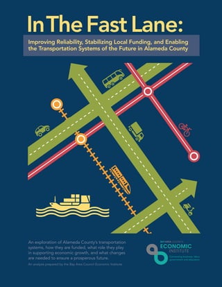
  • 1. An exploration of Alameda County’s transportation systems, how they are funded, what role they play in supporting economic growth, and what changes are needed to ensure a prosperous future. InTheFast Lane: An analysis prepared by the Bay Area Council Economic Institute Improving Reliability, Stabilizing Local Funding, and Enabling the Transportation Systems of the Future in Alameda County
  • 2. Acknowledgments This report was prepared by the Bay Area Council Economic Institute for the Alameda County Transportation Commission. Sean Randolph (President & CEO) oversaw the development of the study. Tracey Grose (Vice President) designed the study and directed the analysis and completion of the report. Matt Chwierut (Consulting Senior Research Associate) was the primary contributor to Sections 1, 3 and 4 and also contributed to Section 2. Jeff Bellisario (Senior Research Associate) contributed to the overall narrative of the document. Alex Foard (Research Associate) contributed to Sections 2 and 5. The Bay Area Council Economic Institute 353 Sacramento Street, Suite 1000 | San Francisco, CA 94111 www.bayareaeconomy.org | bacei@bayareacouncil.org Bay Area Council Economic Institute is a partnership of business with labor, government, higher education, and philanthropy that works to support the economic vitality and competitiveness of the Bay Area and California. The Association of Bay Area Governments (ABAG) is a founder and key institutional partner. The Economic Institute also supports and manages the Bay Area Science and Innovation Consortium (BASIC), a partnership of Northern California’s leading scientific research universities and federal and private research laboratories. Through its economic and policy research and its many partnerships, the Economic Institute addresses key issues impacting the competitiveness, economic development, and quality of life of the region and the state, including infrastructure, globalization, science and innovation, energy, and governance. A public-private Board of Trustees oversees the development of its products and initiatives. Alameda County Transportation Commission’s mission is to plan, fund and deliver a broad spectrum of transportation programs and projects that expand access and improve mobility to foster a vibrant and livable Alameda County.
  • 3. Page 32014 | A Bay Area Council Economic Institute Report Contents 6 Executive Summary 9 Introduction 10 Advanced Transportation Systems and Economic Competitiveness 10 Looming Changes in Transportation: Technological, Economic, Political, Environmental, and Social Changes 12 An Array of Possibilities 17 Responding to Change Is Critical – and Some Are Already There 19 Cities and Regions Around the World Are Moving Into the Fast Lane 23 Early Signs of the Transportation Future in the Bay Area 25 Alameda County: A Critical Hub for the Movement of Goods and People in the Bay Area 25 Alameda County, the Hub of Bay Area Commute Flows 25 Regional Commute Patterns by Geography 30 Diverse Commute Modes 31 Rising Commute Times 33 Trends in Passenger Vehicle Commutes: Reflecting the Pulse of the Economy 34 Trends in Public Transit Commutes 35 Bay Area Rapid Transit 36 Alameda-Contra Costa Transit District 37 Other Transit Operators 38 Goods Movement 40 Bay Area Port Trade is Active and Growing 41 Air Freight Connects Bay Area Goods with the Country and the World 42 Trucks Play a Critical Role 44 The Sources of Transportation Funding in Alameda County 44 Federal Transportation Funding 46 The Growing Burden at the Local Level 49 Looking Forward: Trends in Funding Sources 52 Transportation Funding in Alameda County 55 Reviewing the Performance of Measure B, 2000 58 The Alameda County 2014 Transportation Expenditure Plan 59 Expand and Improve Transit Services 61 Provide Traffic Relief 62 Freight and Economic Development 63 Bicycle and Pedestrian Paths 63 Critical Timing 64 Transportation Spending: Estimating the Return on Investment 64 Economic Impact of Spending 67 Implications for Tax Revenue 68 Appendix A: Works Cited 70 Appendix B: Methodology 74 Appendix C: IMPLAN Input-Output Methodology
  • 4. A Bay Area Council Economic Institute Report | 2014Page 4 20% Strengthening Economic Competitiveness Efficient transportation systems are being deployed around the world, positioning regions for the future to: • Support the clustering of firms • Expand the regional labor pool • Improve reliability • Conserve natural resources • Improve quality of life • Lower the cost of moving people & goods Alameda County has the second-largest population in the region, and one of the fastest-growing populations in the state. Alameda County’s more than 600,000 jobs make it the second largest employment base in the Bay Area, behind Santa Clara County. Alameda residents commuting outside the county increased from 46% to 52% from 2003 to 2011. 12% of Alameda County commuters use public transit, 2% more than the regional average. Alameda County, the Hub of Bay Area Commute Flows of all public transit boardings in the Bay Area are in Alameda County 37% of Bay Area workers travel to, from, or through Alameda County 34% of all BART boardings originate in Alameda County 53% of workers in Alameda County live outside the county Alameda County’s 2014 TEP* addresses current and future needs. * Transportation Expenditure Plan that will be on Alameda County’s November 2014 ballot In The Fast LaneImprove Reliability, Stabilize Local Funding, and Enable the Transportation Systems of the Future in Alameda County Well-functioning transportation systems are critical to economic competitiveness at the national and the regional levels, influencing commute times, freight delays, land use, quality of life, and productivity.
  • 5. 2014 | A Bay Area Council Economic Institute Report Page 5 Alameda County represents a critical focal point in the Bay Area’s regional transportation system. While the Port of Oakland accounts for a large share of movement of goods in and out of the region, the county also serves as a vital conduit across all modes of transportation for people within the Bay Area. Transportation systems must not only be maintained but also upgraded and expanded to keep pace with population growth, connect housing and jobs, and support the economic competitiveness of the region. The Bay Area’s trucking distribution system is highly concentrated in Alameda County. Expanding Goods Movement Alameda County is the Bay Area’s hub for international and domestic trade: 90% of Bay Area trade in agriculture, wine, and heavy machinery by weight goes through the Port of Oakland, sending California’s exports around the world 99% of containerized cargo from Northern California passes through the Port of Oakland Stimulating Economic Impact Direct spending from Alameda County’s 30-year, $8 billion 2014 Transportation Expenditure Plan will yield: 150,000jobs* $20B in total economic activity in the Bay Area • Construction • Transit operations and maintenance • Professional, scientific, and technical services • Manufacturing * Full-time equivalent jobs The direct spending of Alameda County’s 2014 Transportation Expenditure Plan is estimated to yield $20 billion in total economic activity in the Bay Area economy by extending and augmenting the existing 1/2-cent transportation sales tax.
  • 6. Page 6 A Bay Area Council Economic Institute Report | 2014 Executive Summary Alameda County represents a critical focal point in the Bay Area’s regional transportation system. While the Port of Oakland accounts for a large share of movement of goods in and out of the region, the county also serves as a vital conduit for people within the Bay Area across all modes of transportation. As the population of the county and wider region grows, and as global trade increases, transportation systems must not only be maintained but also upgraded and expanded. But, where does the funding come from? And how does transportation funding translate into positive economic impact? Alameda County has proposed a 2014 Transportation Expenditure Plan (TEP) that addresses the county’s desire to expand transit services, keep fares affordable, provide traffic relief, improve air quality, and create jobs. This document lays out the fundamentals of public transportation spending, illustrates signals of the future of transportation systems, and highlights the role of transportation infrastructure in an advanced economy in enhancing quality of life and securing global competitiveness. This report also provides an overview of the proposed TEP and how it addresses the region’s current and future needs. Advancing transportation infrastructure is critical for growing regional economic competitiveness as it influences everything from the cost of production, the flow of innovation and ideas, and property values. • Efficient transportation systems increase reliability and can lower the cost of commuter flows and goods movement. • Quality transportation systems support the productive clustering of firms and expand the labor pool. • Technological innovations are opening new possibilities in urban transportation, encouraging the growth of systems that are more digital, multi-modal, efficient, adaptable, and accommodating of petroleum alternatives. • Cities around the world are experimenting with transportation solutions, ready to reap the economic benefits of superior mobility. • In this uncertain environment, regions must make transportation investments to prepare for a changing future of moving goods and people. Alameda County is at the heart of Bay Area commute flows, connecting diverse residential communities (even outside the Bay Area) with the region’s job centers. As the economy and population grow, Bay Area commutes are becoming longer, and the number of commuters is rising. • The Bay Area’s highly mobile regional labor pool consists of 1.3 million residents who cross at least one county line to get to work. These workers account for 47 percent of employed residents in the Bay Area. • Approximately 37 percent of Bay Area workers travel to, from, or through Alameda County. In 2011, approximately 180,000 commuters traveled through the county each day to work destinations to both its east and west, and over 300,000 commuters traveled into the county for work.
  • 7. 2014 | A Bay Area Council Economic Institute Report Page 7 • Alameda County is the largest source of inter-county commuters in the Bay Area with over 300,000 residents commuting outside of the county each day. • The percentage of Alameda County residents commuting outside the county increased from 46 percent to 52 percent from 2003 to 2011. • Over 12 percent of commutes originating in Alameda County use public transportation, compared to 10 percent of commutes in the broader Bay Area, and 5 percent in the United States. • Approximately one-third of all BART system boardings occur in Alameda County. • Home to 21 percent of the Bay Area’s population, Alameda County was one of the fastest growing counties in California in 2013. • More cars and longer distances translate into greater delays. Given its pivotal position in the region, Alameda County experiences the largest number of vehicle hours spent delayed in traffic in the Bay Area. Alameda County is the Bay Area’s hub for international and domestic trade. • By value, 41 percent of Bay Area trade passes through Alameda County. • The Port of Oakland handles over 90 percent of total Bay Area trade by weight for many of California’s key exports, including high-value agriculture, wine, and heavy machinery. • The Port of Oakland handles 99 percent of containerized cargo that flows through Northern California. • The Oakland International Airport handles the majority of all air cargo in the Bay Area, with a focus on domestic trade. • Highly concentrated in Alameda County, Bay Area trade relies extensively on the trucking distribution system and, in turn, on the region’s highways. Transportation funding is complex, increasingly unreliable, and more and more dependent on local communities. • The transportation funding system in the United States is complex. Funds come from a variety of sources and flow through multiple levels of governments until they can be directed to local uses and projects. • Federal sources of transportation funding are becoming increasingly unreliable. Federal stimulus funding funneled more than $50 billion in general funds to transportation projects, but this recent surge in spending is unlikely to continue. The direct spending of Alameda County’s 2014 Transportation Expenditure Plan is estimated to yield $20 billion in total economic activity in the Bay Area economy.
  • 8. A Bay Area Council Economic Institute Report | 2014Page 8 • The federal gas tax - set at $0.184 per gallon for gasoline - has not been raised since 1993. Because it is not indexed to inflation, its value has eroded immensely over the past 20 years. • Bonds are increasingly relied on for transportation funding across the US and in California. A $20 billion transportation bond, approved by voters statewide in 2006, is almost entirely spent. • Local funding, including sales tax measures (like Measure B in Alameda County in 2000), supplies approximately 50 percent of transportation revenues in California and, relative to other funding sources, provides strong local transparency and control. • Most of the projects envisioned in the voter-approved 2000 Measure B have been completed ahead of schedule. A Citizens Watchdog Committee has found expenditures to be consistently satisfactory. This has occurred even in the face of lower-than-forecast sales tax revenues. • Measure B funds have helped secure over $3 billion in additional external funding to support transportation projects in Alameda County. Alameda County’s 2014 Transportation Expenditure Plan (TEP) invests in immediate transportation needs with an eye toward the future success of the region’s economy. • The 2014 TEP primarily focuses on maintaining existing transportation systems, particularly transit, and on relieving congestion, improving air quality, and stimulating economic development. • Major new projects envisioned in the 2014 TEP include BART modernization and expansion, improved bicycle trails and facilities throughout the county, expanding high-occupancy vehicle/high-occupancy toll (HOV/HOT) lanes, local community developments that connect transit to jobs, and projects that improve the movement of freight on trucks and rail. The direct spending of Alameda County’s 2014 Transportation Expenditure Plan is estimated to yield $20 billion in total economic activity in the Bay Area economy. • Planned spending across the economy for maintenance, operations, new construction, new equipment, and other new systems will translate into approximately 149,900 full-time equivalent jobs. • This added economic activity will generate an estimated total of approximately $2.4 billion in federal, state, and local tax revenue.
  • 9. Page 92014 | A Bay Area Council Economic Institute Report Introduction Alameda County is a critical focal point in the Bay Area’s regional transportation system. While the Port of Oakland and Oakland International Airport account for a large share of the movement of goods in and out of the region, the county also serves as a vital conduit for people moving throughout the Bay Area across all modes of transportation. As the population of the county and region grows, and as global trade increases, transportation systems must not only be maintained but also upgraded and expanded. But, from where does the funding come? And how does transportation funding translate into positive economic impact in the county? This document illustrates signals of the future of transportation systems and highlights the role of transportation infrastructure in enhancing quality of life and securing global competitiveness in an advanced economy. The report focuses on Alameda County and the significant part it plays in the movement of goods and people in the Bay Area economy. To support this vital role, Alameda County has proposed a 2014 Transportation Expenditure Plan (TEP) that addresses the county’s desire to expand transit services, keep fares affordable, provide traffic relief, improve air quality, and create jobs. In order to better understand the importance of these investments and their potential positive economic benefits, this report provides an overview of the evolution of transportation infrastructure and the financing system that is used to pay for it. Alameda County’s TEP seeks to position the region ahead of these changes, which will translate into economic advantages as the Bay Area becomes more interconnected. Additionally, TEP investments will produce significant economic benefit for the area in the form of job growth, while improving upon a transportation system that is a crucial piece of the region’s competitive infrastructure. Section 1 explores the role of advanced transportation systems in economic competitiveness today, offers examples of early-stage transportation systems of the future, and discusses places in the world that are early adopters of advanced technologies. Through a series of metrics, Section 2 illustrates Alameda County’s critical role as the region’s hub for the movement of goods and people. Section 3 examines the sources of transportation funding in Alameda County and how that funding has changed over the years. Alameda County’s proposed 2014 (TEP) is laid out in Section 4. Reflecting on the planned expenditures of the TEP, Section 5 estimates the broader regional economic impacts of this investment.
  • 10. Page 10 A Bay Area Council Economic Institute Report | 2014 Advanced Transportation Systems and Economic Competitiveness Modern transportation systems play an important role in local and global commerce, growing economic vitality and improving quality of life. Our context is changing locally and globally. External drivers as well as changing preferences are forcing us to reconsider how we do things, and technology offers new options for responding to change and shaping our future. Other places in the world are already in the fast lane, implementing advanced transportation systems to support local economic growth and future competitiveness. What are the systems of the future? How can new technology in transportation systems improve our lives and commerce in the county and region? New practices and new technological tools are emerging that offer new options either in response to change or in advance of change. Positioning a region on the front end of change translates into a stronger competitive position. This section explores the role of advanced transportation systems in economic competitiveness today and how improving system reliability and reducing traffic congestion can grow economic vitality and quality of life. Pushing the envelope of creative problem-solving, examples of early-stage transportation systems of the future are presented as well as examples of other metro areas in the world that are early adopters of advanced technologies. This section closes by shifting the focus to Alameda County, where numerous examples of innovative transportation systems are already in use. The 2014 Transportation Expenditure Plan (TEP) provides funding to expand these types of advanced projects and services, which will help shape and drive the county’s future development. Looming Changes in Transportation: Technological, Economic, Political, Environmental, and Social Changes One hundred years ago, a Ford Model T – the famous first mass-produced automobile – could be produced in 93 minutes, and Henry Ford’s plants produced more automobiles than all other automakers combined. The Ford Model T helped draft the agenda for 20th century transportation, and since then, the story of personal transportation in the US has largely been a series of footnotes to the Model T. Eighty years ago, Robert Moses began the transformation of New York infrastructure to accommodate the automobile – and many cities followed suit. The post World War II era saw massive investment in highway infrastructure across the US, and the automobile dominated the aspirations of middle-class life. Were Henry Ford to step forward 100 years into the US, into California or into Alameda County to view the transportation system today, much would be recognizable. The buses, bikes, rail, and cylinder-engine automobiles that today support the 1.5 million residents of Alameda County were all known in his day. However, were he to step forward another 10 years, to 2024, much would likely surprise him. Numerous technological and socioeconomic developments are laying the foundation for improved transportation systems – using new strategies for addressing new mobility needs. Vehicles based on new fuels are accelerating into the market. Digitization of the car, the road, and the driving experience are combining the
  • 11. 2014 | A Bay Area Council Economic Institute Report Page 11 IT industry and the transportation industry. Shifting demographic preferences and social practices are destabilizing the dominant model of automobile ownership. Evolving practices in 21st century work are changing how transportation is delivered and demanded. Preparing for – and harnessing – many of these changes demands investments in a next-generation transportation system. Henry Ford helped revolutionize how we move people, but our transportation system also must move goods. Indeed, innovations in freight movement and broader economic changes over the past half-century set the stage for Alameda County’s critical role in US freight transportation. In the mid- 20th century, Malcom McLean, a trucking entrepreneur, helped standardize the use of containers for the transportation of goods; his particular genius was designing a system where containers could be transported over sea and land without being unloaded in between. This began modern container shipping, which today allows single containers to come through US ports and be loaded directly onto trucks or rail. This innovation also caused shipping costs to plummet, trade to swell, and supply chains to expand. One of containerization’s many effects was the decline of the Port of San Francisco, which could not handle deep-hull ships, and the rise of the Port of Oakland, which could. In 2012, the Port of Oakland handled over 2 million TEUs (twenty-foot equivalent unit) of cargo, including machinery, apparel, wine, and produce.1 Air transportation also dramatically changed freight movement and trade, offering faster and more flexible shipping routes. This, in turn, has helped globalize supply chains and available markets, particularly for items with a high value-to-weight ratio, such as pharmaceuticals and advanced electronics. In 2011, electronics accounted for 37 percent of the total value of California’s air exports – more than any other category by value – but only 13 percent of total tonnage, second only to agricultural products. In 2011, the Bay Area (San Jose, San Francisco, and Oakland) exported almost $8 billion in electronics products by air – though only 20 kilotons. Freight movement is undergoing a revolution. Automation is quietly infiltrating advanced port operations. Advanced freight tracking and management help maximize the efficiency of the existing system. Changes in oil prices and regulations requiring cleaner fuels will impact transportation costs Photo Credit: “Ford Focus (2 of 3)” by viZZZual.com Photo Credit: Wikimedia Commons 1910 Ford Model T 2013 Ford Focus 1 Port of Oakland Container Statistics, http://www.portofoakland.com/maritime/containerstats.aspx. A TEU (twenty-foot equivalent units) is an inexact unit measuring cargo capacity in container shipping. A 20-foot container is 1 TEU; a 40-foot container is 2 TEUs.
  • 12. A Bay Area Council Economic Institute Report | 2014Page 12 and transportation modes. The expansion of the Panama Canal, expected to conclude in 2015, is likely to change Pacific shipping routes. With major implications for West Coast ports, some shipping traffic from Asia may bypass California and pass directly to the East Coast. But some Atlantic traffic may come directly to the West Coast. The ultimate effect is uncertain. A 2008 study argues that Atlantic and Gulf ports could seize up to 25 percent of West Coast cargo,2 but Dan Smith of the Tioga Group, a freight transportation consultancy, argues that the importance of transit time, reliability, Southern California and Bay Area consumer markets, and actual capacity on alternative routes will dampen cargo diversion.3 A major report analyzing the competitive position of West Coast Ports argues that further investment in rail is needed to maintain cargo share.4 Regardless, many analysts agree that other economic forces, such as consumer demand, will be greater drivers. Economic changes are favoring more agile, often more local, supply chains – even as overall global trade is forecast to grow. Any changes in goods movement will have major implications for our transportation systems. An Array of Possibilities Transportation planners are challenged to design and manage systems that must perform in an uncertain future. Each decade brings a new set of disruptions, innovations, and regulations, but transportation investments must be resilient. It is critical to examine areas of change that might affect transportation, and the benefits of this scrutiny are twofold. It is possible to anticipate the consequences of major changes, particularly issues that might influence demand for transportation. It is also possible to identify potential technological tools that could enable new strategies for improving efficiency, could create economic opportunities, or could pose policy challenges. The next ten years will see a range of possibilities for personal and freight mobility. Transportation infrastructure may change slowly in the US, but mobility practices are changing rapidly. Ten years ago, the navigation aid in state-of-the-art cars was a dedicated GPS receiver; now, voice automated smartphones can provide turn-by-turn instructions. In the US, car sharing used to mean borrowing a friend’s car; now, car sharing is a widely recognized industry including organizations such as Zipcar and City CarShare. 2 Drewry Supply Chain Advisors, “US Transpacific Intermodal Today and Tomorrow,” September 2008. 3 Bonney, Joseph, “Redrawing Trade Winds,” Journal of Commerce, March 23, 2009. 4 Cambridge Systematics, “Port Activity and Competitiveness Tracker Progress Report,” prepared for Southern California Association of Governments, February 2011. Photo Credit: “Container Ship, Port of Oakland” by Michael Layefsky Photo Credit: “Airplane at the Vienna International Airport” by viZZZual.com Cargo Plane Container Ship, Port of Oakland
  • 13. 2014 | A Bay Area Council Economic Institute Report Page 13 Autonomous vehicles were still science fiction; now financial analysts are predicting the economic savings that autonomous cars will be contributing to the economy in the next decade, and California is drafting regulations to allow autonomous cars on the road in 2015. Today, all of these developments are major topics for media and, to varying degrees, for transportation planners.5 Analyzing the flow of innovations and trends helps reveal how transportation systems might change over the next decade. Global Drivers of Change Category Developments in Transportation of People and Goods People: Changing needs and preferences • The wave of retirements in the coming decade is expected to present a shortage of workers in the transport sector – both personal and freight. • Retiring Baby Boomers and extended longevity will require more senior- friendly transportation and land use. • As Millennials (born in the 1980s and 1990s) enter adulthood, they are preferring denser urban environments, public transit, and cycling. Technology: New tools for today and the future • Digitization of transportation can enable autonomous and semi-autonomous vehicles. • Wireless sensors and advanced routers could enable cars connected to the Internet, infrastructure, and each other. • Alternative fuels will require new refueling infrastructure. • Sensors and data analytics enable much more granular freight tracking and complex supply chains. Policy: Geopolitical and regulatory changes reframing the context • Greenhouse gas (GHG) regulation will drive adoption of clean fuels, land use changes, and demand-management strategies like road pricing. • Densification of land use will encourage more urban and multimodal forms of transportation, and have implications for non-work travel. • Trade policy will impact the costs of freight, though this is difficult to forecast. • Public-private partnership models – including private transportation systems – are increasingly necessary to address transportation funding gaps. Markets: Shifting local and global markets for labor and goods • Energy costs will be a major driver of change in transportation. • A knowledge- and innovation-based economy in the US will concentrate in metro areas, making well-functioning urban transportation systems essential. • Mobile work and coworking are changing commute patterns. • E-commerce and home delivery could put new demands on the urban freight system, which will be required to transport goods to houses rather than just to retail outlets. • Mobility-as-a-service (such as car sharing) will challenge the automobile ownership model. • Reshoring of manufacturing may reduce imports but could also increase exports. • Digital fabrication technologies – and local manufacturing networks – could increase intra-regional trade and domestic freight. Environment: Changing physical landscape creates disruptions • Climate change will create an uncertain environment for climate policy. • Extreme weather events will drive the need for simple or more agile supply chains. • Rising sea levels could threaten coastal infrastructure – at any point in the supply chain. • Planning for an uncertain environmental future will require resilience measures and infrastructure adaption. 5 An exhaustive analysis of new technologies or fully developed US transportation scenarios are beyond the scope of this paper. Examples of such work include “Long Range Strategic Issues Facing the Transportation Industry,” by ICF International; the MIT “Future Freight Flows Symposium,” and “The Future of Mobility: Scenarios for the United States in 2030,” by RAND.
  • 14. A Bay Area Council Economic Institute Report | 2014Page 14
  • 15. 2014 | A Bay Area Council Economic Institute Report Page 15 These drivers of change are what will shape future transportation development in Alameda County and across the globe. As a result, transportation in Alameda County will evolve over the next 30 years. The 2014 TEP will shape the county’s development over this time and provide funding for the types of projects and services that will be required as a result of these drivers of change. Potential implications for next-generation transportation systems include: Transportation systems are increasingly automated and digital. The core technologies for transporting people and goods are undergoing a revolution. The internal combustion engine has dominated transportation for over 100 years; now a host of innovations are rebuilding and rewiring the automobile. The Google fleet of autonomous Priuses has logged over 140,000 miles. General Motors predicts that autonomous vehicles will enter consumer markets by 2020. Even sooner, carmakers are releasing vehicles with automation features, such as active cruise control with stop-and- go function.6 New regulatory challenges arise when such vehicles share the road with other vehicles, but policymakers have already been discussing these issues for several years, and California law will allow these vehicles on the road in 2015. Moreover, autonomous vehicles might see more deployment in port operations and other sites using heavy equipment. In October 2013, international research consortium InTraDE successfully demonstrated technology for intelligent autonomous vehicles (IAVs) for loading and unloading port cargo.7 Also close to deployment is connected vehicle technology, which communicates wirelessly with other vehicles and with road infrastructure. The technology underpinning autonomous vehicles also includes numerous other features, such as automatic breaking to avoid collisions, traffic rerouting, and location-based services. Such efficiency is two-edged: allowing more cars to move seamlessly on the roads can relieve congestion and increase safety, but it also increases wear and tear on the roads, which already suffer from maintenance funding shortfalls. Transportation strategies are multimodal. As the world urbanizes, a core challenge will be developing transportation systems that are maximally efficient and multimodal. Cities around the world are investing in pedestrian and bike facilities and in new transit systems. Global automobile usage will rise, but many cities and regions around the world are simply too dense to rely solely on single-occupancy vehicles. High density also dictates certain types of transportation, as new car infrastructure often cannot be built out in dense areas. This has led to programs such as bike sharing; in early 2013, there were over 500 bike sharing systems worldwide, with many more cities in the process of planning or launching such systems.8 Hangzhou, home to China’s first commercial car sharing scheme, also has one of the largest bicycle sharing systems in the world, with a fleet of almost 70,000. Hangzhou has also integrated the bike network with transit and subway networks.9 Bike sharing systems, combined with bike infrastructure investment, can relieve congestion by encouraging the mode shift from cars to bicycles. Demographic trends also point to multimodal growth; Millenials in the US – roughly defined as those born in the 1980s and 90s – are driving less, ride transit more, and prefer urban walkable neighborhoods more than previous generations.10 Another pillar of multimodal transportation systems is mobility-as-a-service (MaaS) systems, including informal car sharing. Services like Zipcar allow people to rent cars by the hour. Car2go, 6 BMW, “BMW Active Cruise Control with Stop&Go Function,” http://www.bmw.com/com/en/insights/technology/technology_guide/articles/active_cruise_control_stop_go.html. 7 InTraDE, “Successful demo of the InTraDE IAV in Oostende!,” http://www.intrade-nwe.eu/project-live. 8 Early Policy Institute, “Bike-sharing Programs Hit the Streets in Over 500 Cities Worldwide,” http://www.earth-policy.org/plan_b_updates/2013/update112. 9 Ibid. 10 See “A New Direction: Our Changing Relationship with Driving and Implications for America’s Future,” by US PIRG, 2013 and “Millennials and Mobility: Understanding the Millennial Mindset,” by American Public Transportation Association, 2013.
  • 16. A Bay Area Council Economic Institute Report | 2014Page 16 a European car sharing scheme managed by Daimler, allows members to rent small vehicles by the minute and park them in areas throughout the urban service area. Peer-to-peer (P2P) programs allow users to rent out their own cars to others. Uber, a service that allows members to share rides, creates a P2P taxi service. Corporations are also entering the transportation market by providing commuter shuttle services to and from their corporate campuses. All of these innovations decrease the need for automobile ownership and help make urban mobility even easier. Advanced transportation systems focus on efficient use. A growing body of research is challenging the dominant paradigm of highway expansion as a cure for congestion, and demand management systems are being seen as better alternatives. Research suggests that expanding highways does not reduce congestion in the long term, primarily because as highways expand, more people choose to drive or move to areas where driving is necessary.11 Congestion pricing and related strategies that use price signals to encourage rational user behavior are put forward as a preferred strategy for managing congestion. McKinsey & Company has found that expanding highway capacity has one of the lowest benefit-cost ratios among congestion reduction strategies, often much lower than demand management systems like congestion pricing and signal optimization. Demand management is also much cheaper. For example, the UK’s M42 motorway intelligent transport system (ITS) cost $150 million and required two years to implement; widening the road for the same outcome would have cost $800 million and would have taken 10 years.12 Advanced transportation systems must be agile. Expanding world trade will impact the freight transportation system. If manufacturing increases in the US, exports may rise. Broad market shifts that privilege speed to market and niche offerings will likely also lead to complex supply networks that must respond to shifts in production and market demand. E-commerce may increase the need for transportation networks that connect to the home; the “last-mile problem” might become warehouse to neighborhood, rather than warehouse to retailer. A 2012 report by Accenture notes that more than 80 percent of companies are concerned about supply chain resilience; supply chain managers globally are worried about supply chain disruptions due to extreme weather, political unrest, and cyber security issues.13 An MIT report on the future of freight noted that digital fabrication and small-scale manufacturing could change how consumers acquire goods.14 Advanced transportation systems need new petroleum-alternative infrastructure. Three major reports on the future of transportation emphasize the importance of oil prices in driving transportation 11 Gilles Duranton and Matthew A. Turner. “The Fundamental Law of Road Congestion: Evidence from US cities.” American Economic Review, October 2011. 12 McKinsey Global Institute, “Infrastructure Productivity: How to Save $1 Trillion a Year,” January 2013. 13 Accenture, “Building Resilience in Supply Chains,” January 2013, http://www.accenture.com/SiteCollectionDocuments/PDF/Accenture-Building-Resilience-Supply-Chains.pdf. 14 MIT Center for Transportation and Logistics, “Future Freight Flows Symposium,” 2011. “When it comes to the future, there are three kinds of people: those who let it happen, those who make it happen, and those who wonder what happened.” - John M. Richardson, Jr., pioneer in the field of systems dynamics
  • 17. 2014 | A Bay Area Council Economic Institute Report Page 17 futures.15 A review of cleantech investment by the Congressional Budget Office found that R&D funding and federal tax incentives related to energy, including fossil fuels and energy efficiency, jumped after the oil crisis in the 1970s, then fell as oil prices came down, and then rose again in the past decade as oil prices rose again.16 Nonetheless, R&D investment has already led to new products and near-to-market clean technologies, such as advanced biofuels, electric vehicles, fuel cells, and more. These will require advanced fueling infrastructure, consumer confidence, and new technologies to make them viable in the marketplace. Policy – in the form of incentives and renewables targets, such as California’s AB32 – is advancing requirements that are funneling investments to alternative infrastructure and driving adoption. These examples are major changes in transportation that will affect residents, planners, and companies. Thinking through future alternatives is critical to designing robust transportation systems. As John M. Richardson, Jr., a pioneer in the field of systems dynamics, noted, “When it comes to the future, there are three kinds of people: those who let it happen, those who make it happen, and those who wonder what happened.”17 In Alameda County, transportation planners are looking ahead to the infrastructure needs of the county. The proposed 2014 TEP puts forth solutions that address present and future gaps in furthering advanced transportation systems in Alameda County. Responding to Change Is Critical – and Some Are Already There Transportation is the circulatory system of our economy. A complex network of infrastructure, vehicles, and exchange points enables the flow of people and goods around the world. People can access jobs, meet to exchange ideas, and engage in leisure activities. Goods can be manufactured in one area, tested in another, and purchased in a third – taking advantage of the economic strengths of each place. Ships, planes, trains, and trucks support an extraordinarily complex global supply chain. Well-functioning transportation systems are critical to economic competitiveness at the national and the regional levels, where they influence everything from commute times, freight delays, land use, quality of life, air quality, productivity, and agglomeration. • Cost of Production and Competitiveness: An efficient transportation system can lower the cost of goods movement and increase reliability. Studies have found a correlation between infrastructure investments and economic output; infrastructure supports private sector productivity gains, often with higher returns than traditional business investments.18 • Agglomeration and Productivity: When firms cluster, they can more easily share ideas, supply chains, and people, thus boosting productivity. A 2012 study by Patricia Melo and Daniel Graham found that “doubling the number of jobs accessible within 20 minutes of driving time leads to an increase in real average wages of 6.5 percent, while the impact for a similar increase within 20 to 30 minutes is as small as 0.5 percent.”19 This effect is even more pronounced in knowledge-intensive industries.20 15 See previous footnote on studies on studies by MIT, RAND, and ICF International. 16 Congressional Budget Office, “Federal Financial Support for the Development and Production of Fuels and Energy Technologies,” March 2012, http://www.cbo.gov/sites/default/files/cbofiles/attachments/03-06-FuelsandEnergy_Brief.pdf. 17 John M Richardson, Jr. was a pioneer in the field of system dynamics and global modeling with the Club of Rome. He has applied systems dynamics principles to multiple fields, including sustainability, civic conflict, and international development. Dr. Richardson is currently faculty emeritus at American University. 18 See “A New Economic Analysis of Infrastructure Investment,” Department of the Treasury with the Council of Economic Advisors, 2012 19 Melo, Patricia and Daniel Graham, “Agglomeration, Accessibility, and Productivity: Evidence for Urbanized Areas,” Transportation Research Board, Annual Meeting, 2013. 20 American Public Transportation Association, “The Role of Transit in Support of High Growth Business Clusters in the U.S.,” December 2013.
  • 18. A Bay Area Council Economic Institute Report | 2014Page 18 • Imports and Exports: A 2010 Brookings report on metropolitan exports found that exports are critical to national and regional economic competitiveness. In addition, the report notes that many US exports require intermediary inputs, implying that imports are also critical for the value-added processes that US firms employ on eventual exports.21 • Expanded Labor Pool: Well-functioning transportation systems enable firms to access more workers. This supports economic growth and facilitates efficient labor matching, allowing firms to access the most talented workers in a given geographic area. • Real Estate Values: Transportation infrastructure can boost local property values. For example, a study of the Hiawatha Light Rail corridor running from Minneapolis to Bloomington, Minnesota found that “the LRT [light rail transit] had a significant positive impact on property values...” and that “residential property values increased by $47 million along the segment of the corridor studied.”22 Trails and greenways have been found to have a similar positive effect on real estate.23 • Employment Benefits: Transportation provides well-paying jobs and has ripple effects across the public and private sector. For example, a study prepared for the American Public Transportation Association found that for every billion dollars of national investment in public transportation, 36,000 jobs are supported for one year.24 Much like the human circulatory system, people most often notice transportation systems when they malfunction. Congestion, routing errors, and system failure all contribute to economic losses. • In 2013, over one-fifth of US scheduled flights were delayed or canceled.25 • In 2011, US drivers lost 5.5 billion hours, 2.9 billion gallons of fuel, and $121 billion due to traffic congestion and delay.26 • Nineteen percent of shipping vessels do not arrive on time in ports; in the world’s busiest shipping lanes, container delivery to the end customer was even less reliable.27 Maintaining transportation system performance is critical for economic competitiveness. 21 Brookings Institution, “Export Nation 2012: How U.S. Metropolitan Areas are Driving National Growth,” 2012. 22 Goetz, Edward G., et al., “The Hiawatha Line: Impacts on Land Use and Residential Housing Value,” Minneapolis: Center for Transportation Studies, University of Minnesota, 2010. 23 Rails-to-Trails Conservancy, “From Trail Towns to TrOD: Trails and Economic Development,” August 2007. 24 Glen Weisbrod and Arlee Reno, “Economic Impact of Public Transportation Investment,” APTA, October 2009. 25 US Bureau of Transportation Statistics, “Research and Innovation Technology Statistics,” http://www.transtats.bts.gov/HomeDrillChart.asp. 26 Texas Transportation Institute, “2011 Urban Mobility Report,” http://d2dtl5nnlpfr0r.cloudfront.net/tti.tamu.edu/documents/mobility-report-2011-wappx.pdf. 27 DC Velocity, http://www.dcvelocity.com/articles/20120803-report-most-container-ships-arrive-on-time-but-delivery-to-customer-lags/. Well-functioning transportation systems are critical to economic competitiveness at the national and the regional levels, influencing commute times, freight delays, land use, quality of life, and productivity.
  • 19. 2014 | A Bay Area Council Economic Institute Report Page 19 Transportation systems are not easy to design, build, or manage. Some transportation technologies can fundamentally change the architecture of transportation systems (as the advent of the automobile and the airplane did). Other technologies, like cargo cranes or wireless sensors can introduce new ways to manage transportation systems. Transportation infrastructure must be engineered for safety, reliability, and efficiency. Transportation investments are also about people, how they want to move around, and what impacts transportation systems might have on their communities. Complex global supply chains rely on efficient transportation systems that can handle multiple moving pieces. Transportation globally is increasingly becoming a challenge for urban and suburban communities. Where physical space is a premium, construction is more complex and costly, and the sheer density of people introduces critical tradeoffs between different transportation modes. Even without a changing future, transportation systems are complex, and new developments can intensify the challenges. Cities and Regions Around the World Are Moving Into the Fast Lane Cities and regions around the world are not idling while the future overtakes them. Many are tackling the challenges and defining the next era of transportation systems. Some transportation improvements are humble design innovations whose time has come. Others are radical experiments in mobility. Historically, US economic competitiveness has been supported by a world-class rail network and then by a road network. New York City enjoys the human capital benefits of density, which are difficult to imagine without its subway system. The Bay Area has similar pockets of density,28 which are connected by an extensive rail network. US seaports and airports feed a complex trucking distribution system enabled by a highway network. Today, other transportation systems are now positioning their regions for social and economic success in the 21st century. Examples of advanced transportation systems deployed or in early development around the world include the following. Agile Transit Infrastructure: Over the past decade, bus rapid transit (BRT) has captured the imagination of transportation planners around the world. BRT offers many of the amenities of a subway, including platform boarding, enclosed stations, dedicated lanes, and the dramatically reduced costs of using roads and wheels rather than rail infrastructure and custom-designed trains. BRT systems can be maintained and expanded at a fraction of the costs for rail. TransMilenio, a BRT system introduced in 2000 in Bogotá has been viewed as a model BRT system and has convinced 28 Smart Growth America, “Measuring Sprawl 2014,” http://www.smartgrowthamerica.org/documents/measuring-sprawl-2014.pdf. Photo Credit: Wikimedia Commons Bogotá, Colombia TransMilenio Bus Rapid Transit
  • 20. A Bay Area Council Economic Institute Report | 2014Page 20 many skeptics that it can outperform alternative light rail systems. In 2012, the entire system covered 54 miles, with ambitions to eventually cover 240 miles; in comparison, the entire BART (Bay Area Rapid Transit) system in California covers 105 miles. There are now many BRT systems around the world, although there are few in the US that actually have dedicated lanes, which are critical to improving performance. Digitally Integrated Smart City: In Rio de Janeiro, city officials and administrators can monitor various systems in the entire city from an IBM-created mission control room, which reports integrated city data in real time. In response to an emergency such as a fire or a building collapse, controllers can reroute traffic, close transit stations, and issue warnings to travelers. This lets first responders do their jobs, allows Rio residents to continue their travels, and prevents already critical situations from getting out of control. In integrating transportation as part of a larger system of city behavior, the intelligent operations center enables highly coordinated responses to urban needs, including the flow of goods and people. Efficient Demand Management: In 2006, policymakers in Stockholm, Sweden launched a pilot congestion pricing scheme that charged vehicles entering the city center a variable fee during the weekday rush hour. After extensive outreach, planners held a six-month trial of the system, then revoked it and later held a referendum to see if Stockholm citizens wanted to keep it. They voted to reinstall it permanently. The system avoids the cost and traffic of tollbooths by using optical recognition of license plates; monthly bills are sent to the drivers. Congestion inside and outside the city center fell by 20 to 25 percent during the trial period, public transit use increased, and air quality improved. The city recouped its investment in less Stockholm Congestion Pricing Signage Photo Credit: Wikimedia Commons Photo Credit: IBM.com IBM Mission Control in Rio de Janeiro
  • 21. 2014 | A Bay Area Council Economic Institute Report Page 21 than four years.29 Similar strategies have been employed in the Bay Area by SFpark and GoBerkeley in order to better manage scarce parking spaces. A New Transit Experience: In Seoul, South Korea, subway riders can shop for goods from Tesco Homeplus (a major retailer) using a virtual store aisle in the downtown subway station. Riders can order items via Quick Response Code from their phones and have them delivered to their homes or held for pickup.30 This use of transportation infrastructure has enabled new financing streams and delivered a unique service to riders. Automated Port Operations: Located in Hong Kong’s Kwai Tsing Container Terminals port facility, Hong Kong International Terminals (HIT) uses a technologically wired terminal management system that is widely considered to be the most advanced in the world. A massive data tracking system enables automated rail-mounted cranes to operate 24 hours a day. This technology will likely be explored by other ports as a way to increase trade volume. Automated Electric-Car Dispensing Vending Machine: In China, the city of Hangzhou, home to 8.7 million people, is experimenting with a new system of car sharing on a scale and density unmatched anywhere in the world. Car sharing is not a novel invention, but the complexity of cities in China requires a model different from the Zipcar model of surface-parked cars. A company called Kandi Technologies intends to use a system that works like a 29 McKinsey Global Institute, “Infrastructure Productivity: How to Save $1 Trillion a Year,” page 59. 30 Lawson, Alex “Tesco Expands Korean Virtual Stores,” Retail Week, February 7, 2012. Photo Credit: B&R Automation Photo Credit: Tesco Homeplus Tesco Virtual Subway Shopping Store in Seoul Port of Hong Kong Automated Crane Chinese Kandi Car Dispenser Photo Credit: Mundo Auto Motor
  • 22. A Bay Area Council Economic Institute Report | 2014Page 22 vending machine to make 100,000 vehicles available to residents of Hangzhou through automated parking garages that each hold up to 300 vehicles.31 By comparison, the entire Zipcar fleet in 2012 was less than 10,000 vehicles.32 The system allows one-way rentals, and the mechanically dispensed cars can be rented by the hour and returned to any Kandi automated garage in the city. Land Airbus: TBS China has proposed plans for a massive bus that travels over two lanes of traffic, combining the minimal-infrastructure benefits of BRT with the high-tech interior and traffic independence of a rail system. The bus would allow traffic to pass underneath even when stopped. The idea first appeared in 2010, with construction slated in Beijing’s Mentougou district,33 but an updated concept by TBS China was released in 2012, showing increased capabilities and safety features. Actual deployment is unclear, but the idea shows creative experimentation for highly dense urban areas where even rail and roads compete for right of way. Complete Street Design: New approaches to street design break down the traditional separation between highways, transit, walking, and bicycling, and instead focus on the desired outcome of a transportation system that supports safe use and beneficial public spaces. The complete streets movement is gaining steam across the US, as cities like New York City, San Francisco, Oakland, Chicago, and Washington, D.C. experiment with new cost-effective, context appropriate street designs. While complete streets policies are different in every location, strategies that calm traffic, separate buses and bicycles from vehicle flows, and enhance crosswalks and pedestrian refuges can make streets safer, optimize traffic speeds, and produce economic vitality. These innovations in cities and regions around the world offer more than points of inspiration; they also represent economic competition. Mobility of goods and people is critical in the 21st century, and ideas, investments, and businesses will flow where regional advantages, including transportation, are highest. However, the future is not only occurring overseas; it is also happening today in Alameda County. 31 Rogowsky, Mark,, “Kandi Crush: An Electric-Car Vending Machine From China Could Upend The Auto Industry,” Forbes, Dec. 28, 2013, http://www.forbes.com/sites/markrogowsky/2013/12/28/kandi-crush-an-electric-car-vending-machine-from-china-could-upend-the-auto-industry/. 32 Zipcar, “Annual SEC Filing,” 2012, http://quote.morningstar.com/stock-filing/Annual-Report/2012/12/31/t.aspx?t=:ZIP&ft=10K&d=046ab7e63b7d64119cb4c2. 33 Alter, Lloyd, “Straddle bus may be coming down the road soon.” September 11, 2013 http://www.treehugger.com/public-transportation/straddle-bus-may-be-coming-down-road-soon.html. Photo Credit: Melanie Curry, Streetsblog San Francisco Protected Bike Lanes in Oakland Photo Credit: Shenzhen Huashi Future Parking Equipment Co. Example of a Straddle Bus
  • 23. 2014 | A Bay Area Council Economic Institute Report Page 23 Early Signs of the Transportation Future in the Bay Area Many of the technologies driving global infrastructure innovation are initially developed in the Bay Area. In addition, many transportation agencies, including those in Alameda County, are investing in advanced infrastructure systems. Examples exist where Alameda County is on the forefront of innovation, moving beyond traditional transportation to adjust to changing demand preferences, environmental considerations, and emerging technology. • East Bay Bus Rapid Transit: Planned improvements include rail-like bus stations, dedicated bus lanes, new traffic signals with priority for buses, street lighting, landscaped medians, and crosswalk improvements between the cities of Oakland and San Leandro. The project corridor stretches from 20th Street in downtown Oakland; extends along International Boulevard; and ends at the San Leandro BART station. Projections show an increase in corridor ridership from 25,000 to 36,000 patrons per day with 28 percent faster travel speeds during the afternoon rush hour as compared to current bus service. • I-80 Integrated Corridor Mobility: This project will implement intelligent transportation strategies, such as adaptive ramp metering and incident management systems, along a 19.5-mile stretch of I-80 from the Bay Bridge Toll Plaza to the Carquinez Bridge in Contra Costa County. Adaptive ramp metering – which uses an algorithm that takes into account ramp and freeway volumes – will optimize the flow of traffic, while real-time traffic information displays will allow drivers to make informed route decisions during their trip. Across the Bay Area, many other elements of advanced transportation systems are also emerging. Examples include dynamic pricing for highway use and parking, BRT, smart metering at highway on- ramps, car and bike sharing, and digital freeway signs for real-time information. Companies in the region such as Tesla and Google are also at the forefront of advancing transportation technologies. Photo Credit: ACTC Express Lane on I-680
  • 24. A Bay Area Council Economic Institute Report | 2014Page 24 Transportation systems represent a complex component of daily life. As physical infrastructure, they involve large, long-term investments, and they are governed by multiple regulatory bodies at different levels of government. They serve complex economies of goods and services, commuting workers, multiple vehicles, and countless diverse communities. However, the diverse needs of residents and commerce and the demands of public policy can shift quickly. A major challenge facing any infrastructure system – and particularly the transportation system – is how to adapt to a rapidly changing future. Alameda County’s 2014 TEP proposes investments that will position the county to respond to evolving demands on its transportation infrastructure while also moving toward a future in which mobility can continue to translate into economic benefits. Data Source: Bay Area Council Economic Institute Image Source: Stamen Maps Early Signs of the Transportation Future in the Bay Area Alameda County
  • 25. 2014 | A Bay Area Council Economic Institute Report Page 25 Alameda County: A Critical Hub for the Movement of Goods and People in the Bay Area Alameda County serves as the Bay Area’s hub for the movement of goods and people. Approximately 37 percent of Bay Area workers move to, from, or pass through Alameda County, an indication of the county’s vital importance to the region’s economy.34 In addition, at least 41 percent of Bay Area trade (by value) passes directly through Alameda County’s air and water ports, and much trade through other regional ports relies on Alameda County’s extensive transportation system.35 The following sections detail current transportation trends in Alameda County and around the Bay Area. Alameda County, the Hub of Bay Area Commute Flows Given its central positioning in the nine-county Bay Area, Alameda County serves as a conduit for commuters moving throughout the region. With three bridges spanning San Francisco Bay, 20 BART stations, and multiple major highways, Alameda County has connections to all corners of the region. In addition to being a hub for transportation flows, the county also boasts a large and growing population of over 1.5 million residents – making it the second largest county in the Bay Area. With 21 percent of the region’s total population, it trails only Santa Clara County. Its population increase of 1.68 percent over the one-year period to July 2013 constituted the fastest county population growth rate in all of California.36 Regional Commute Patterns by Geography Unlike most metropolitan regions with a central city as the hub of the regional economy, the Bay Area has multiple job centers and a diversity of residential communities. Given this situation, the region has a highly mobile regional labor pool. With a total workforce of approximately 3 million people, large numbers of commuters cross bridges and take trains in the region each day. Alameda County plays an outsized role in supporting Bay Area commutes. With its central location, Alameda County frequently handles cross-regional trips or is the home county for two-worker households living between two workplaces. Forty-seven percent of all Bay Area workers cross at least one county line to reach their places of employment. With Alameda County’s proximity to large employment centers in Silicon Valley and San Francisco, 52 percent of the county’s employed residents work outside the county boundaries. In comparison to other commute patterns in the broader Bay Area, a slightly larger percentage of Alameda County residents commute to other counties for work. 34 Calculation based on the US Census Bureau, Longitudinal Employment-Household Dynamics dataset. The calculation includes only those that work in the nine-county Bay Area as its total population. 35 Calculation based on US Trade Online dataset. 36 State of California, Department of Finance, “July 1, 2013 County Estimates Ranked by Size, Numeric and Percent Change,” December 2013. Approximately 37 percent of Bay Area workers move to, from, or pass through Alameda County each day on their way to work.
  • 26. Page 26 A Bay Area Council Economic Institute Report | 2014 Bay Area Commute Patterns by County, 2011 County Residents Working Outside the County Residents Working within the County Workers Living Outside the County Alameda 52% 48% 53% Contra Costa 61% 39% 49% Marin 60% 40% 61% Napa 47% 53% 49% San Francisco 39% 61% 60% San Mateo 61% 39% 61% Santa Clara 30% 70% 38% Solano 64% 36% 51% Sonoma 39% 61% 32% Bay Area 47% 53% 50% Data Source: US Census Bureau, Longitudinal Employer-Household Dynamics Analysis: Bay Area Council Economic Institute Alameda County also attracts a significant number of workers from other areas, and it reports a net commuter inflow of approximately 9,000 people. Fifty-three percent of workers employed in the county reside outside of its bounds – a higher percentage than neighboring counties such as Contra Costa and Santa Clara. Taken together, these data points exemplify the significant inbound and outbound commuter flows that Alameda County experiences each day, all of which rely on the transportation system. While the Bay Area job market is often thought to be led by San Francisco and Silicon Valley, Alameda County actually has the second largest employment base in the region. Workers from around the Bay Area rely on Alameda County’s diverse employment centers, such as UC Berkeley, Hacienda Business Park in Pleasanton, the downtown Oakland business district, the three national laboratories, and many hospitals. It is notable that more than 300,000 workers per day commute into the county – an amount comparable to both San Francisco and Santa Clara Counties – fully offsetting the number of residents that commute outside of Alameda County to reach their workplace. Cross County Labor Flows, 2011 County Residents Working within the County Residents Working Outside the County Workers Living Outside the County Total County Employment Net Inflows Alameda 286,444 309,074 318,108 604,552 9,034 Contra Costa 156,706 243,083 152,721 309,427 (90,362) Marin 36,289 55,404 56,925 93,214 1,521 Napa 29,586 26,466 28,106 57,692 1,640 San Francisco 216,910 139,260 321,849 538,759 182,589 San Mateo 118,985 183,949 184,544 303,529 595 Santa Clara 495,395 212,936 308,964 804,359 96,028 Solano 55,038 99,844 56,904 111,942 (42,940) Sonoma 106,824 68,349 50,330 157,154 (18,019) Bay Area 1,502,177 1,338,365 1,478,451 2,980,628 N/A Note: Net Inflow is column 4 minus column 3. Data Source: US Census Bureau, Longitudinal Employer-Household Dynamics Analysis: Bay Area Council Economic Institute
  • 27. 2014 | A Bay Area Council Economic Institute Report Page 27 With over 300,000 residents leaving the county each day to reach their workplaces, Alameda County is the largest source of inter- county commuters in the Bay Area. The percentage of residents commuting elsewhere for work has also been rising. The 52 percent of Alameda County residents who crossed county lines to reach their workplaces in 2011 rose from 46 percent in 2003, an increase of 27,500 commuters over just eight years. The Bay Area has a number of job centers in San Francisco, Santa Clara, Contra Costa, and San Mateo Counties, which account for the vast majority of all commute destinations outside of Alameda County. The San Francisco and Santa Clara employer destinations produced significant growth, surging upward by 18 percent and 8 percent, respectively, in the number of Alameda County residents that commute there since 2003. The largest flow of workers into Alameda County comes from Contra Costa County, a reflection of its geographic proximity and the fact that Alameda County has nearly twice as many jobs. Contra Costa County residents comprise 27 percent of all Alameda County workers commuting in from outside the county, though in absolute terms, numbers fell by 3,500 between 2003 and 2011. Approximately 89 percent of these workers from Contra Costa County drive to Alameda County.37 The largest influx of workers since 2003 has come from Santa Clara County, which added 5,400 commuters to Alameda County over this period. Workplace County of Alameda County Residents 2003 and 2011 0 50,000 100,000 150,000 200,000 250,000 300,000 350,000 Fresno Stanislaus San Diego Sonoma Solano Orange San Joaquin Marin Los Angeles Sacramento San Mateo Contra Costa San Francisco Santa Clara Alameda 2003 2011 Data Source: US Census Bureau, Longitudinal Employer-Household Dynamics Analysis: Bay Area Council Economic Institute Alameda County’s more than 600,000 jobs make it the second largest employment base of any Bay Area county, trailing only Santa Clara County. 37 Calculated from American Community Survey data compiled by the US Census Bureau; the number of cross county car commuters is divided by all commuters moving between the two counties.
  • 28. A Bay Area Council Economic Institute Report | 2014Page 28 Residence County of Workers in Alameda County 2003 and 2011 0 50,000 100,000 150,000 200,000 250,000 300,000 350,000 Monterey Fresno Orange Sonoma Marin Los Angeles Stanislaus Solano Sacramento San Joaquin San Mateo San Francisco Santa Clara Contra Costa Alameda 2003 2011 Data Source: US Census Bureau, Longitudinal Employer-Household Dynamics Analysis: Bay Area Council Economic Institute In addition to commute traffic originating from and destined to Alameda County, the county is centrally situated between several major residential and economic centers in the Bay Area. As a critical focal point in the region’s transportation system, Alameda County has heavy volumes of through traffic on its roadways and on public transportation systems. In 2011, as many as 181,640 Bay Area commuters moved through Alameda County each day on their way to work.38 Approximately 75 percent of these trips were associated with worker movements into San Francisco, San Mateo, and Santa Clara Counties – with nearly two-thirds of those commutes originating in neighboring Contra Costa County. Since 2003, the number of pass-through commuters has increased by 9 percent with influxes from all surrounding counties. 38 Data include trips originating or ending in San Francisco, San Mateo, and Santa Clara Counties with connected origin or end in Contra Costa, San Joaquin, Solano, and Stanislaus Counties.
  • 29. 2014 | A Bay Area Council Economic Institute Report Page 29 Commute Flow Through Alameda County All Commuters 2003 and 2011 All commuters 2003 &2011 Commuters Working in San Francisco, San Mateo, & Santa Clara Counties Commuters Living in San Francisco, San Mateo, & Santa Clara Counties 020,00040,00060,00080,000100,000 2011 2003 0 20,000 40,000 60,000 80,000 100,000 Stanislaus Solano San Joaquin Contra Costa 2003 2011 2003 2011 Note: Data includes commuters moving to and from San Francisco, San Mateo, and Santa Clara Counties. Data Source: Source: US Census Bureau, Longitudinal Employer-Household Dynamics Analysis: Bay Area Council Economic Institute One cause of the increased commuting movement throughout the Bay Area has been the disparate effects of the recent recession on regional employment. The San Francisco and Silicon Valley metropolitan areas have produced steady job growth in recent years to the point where total employment now exceeds pre-recession levels. In contrast, the recession in the East Bay was deeper and recovery has been slower, leaving the East Bay region with fewer reported jobs than in 2007. While workers have had to broaden their job searches to encompass the entire region, they are less likely to change their housing when changing jobs;39 thus contributing to the increasing trend in cross-county commutes. Employment Trends in Bay Area Metropolitan Areas Annual Average Employment 2007 2008 2009 2010 2011 2012 2013 Oakland-Fremont-Hayward 1,059,208 1,044,592 983,617 962,892 970,900 999,925 1,033,867 year-over-year change -1.4% -5.8% -2.1% 0.8% 3.0% 3.4% San Francisco-San Mateo-Redwood City 1,002,100 1,013,633 963,933 954,942 978,708 1,024,825 1,070,058 year-over-year change 1.2% -4.9% -0.9% 2.5% 4.7% 4.4% San Jose-Sunnyvale-Santa Clara 918,917 925,175 868,200 865,633 886,033 921,108 961,792 year-over-year change 0.7% -6.2% -0.3% 2.4% 4.0% 4.4% Data Source: California Employment Development Department, CES Analysis: Bay Area Council Economic Institute 39 Farber, Henry S. (2010) Job Loss and the Decline in Job Security in the United States. Labor in the New Economy, National Bureau of Economic Research, 223-262.
  • 30. A Bay Area Council Economic Institute Report | 2014Page 30 Diverse Commute Modes Over 1.3 million people in the Bay Area cross at least one county line to reach their workplaces. While the majority of these workers drive, the regional average of 77 percent is well below the 86 percent of Americans who rely on cars – either driving alone or in carpools—for their commutes. Commute choices vary around the Bay Area. Alameda County’s central location and heavy commute flows provide its commuters with more choices than most. For example, 40 percent of Alameda County residents who work in San Francisco travel by car, in contrast to 94 percent traveling from Santa Clara County into San Francisco.40 Over 12 percent of Alameda County residents use public transportation to get to work, higher than the regional average of 10.4 percent and much higher than the national rate of 5 percent. While usage of public transportation has maintained a steady share of overall Bay Area commute modes since 2005, public transportation’s mode share in Alameda County expanded by 3 percentage points over the seven-year period from 2005 to 2012. A slow steady trend toward more multimodal commuting is also notable, as driving modes’ combined share dropped from 80 to 75 percent of commuters between 2000 and 2012. Prior to this period, driving had grown or maintained its mode share in the Bay Area in each of the previous four decades.41 Additionally, the growing trend of people working from home is observable throughout the Bay Area as technology allows more distributed work. Means of Commute 2000 2005 2006 2007 2008 2009 2010 2011 2012 60% 65% 70% 75% 80% 85% 90% 95% 100% ShareofWorkingPopulation 2000 2005 2006 2007 2008 2009 2010 2011 2012 60% 65% 70% 75% 80% 85% 90% 95% 100% ALAMEDA COUNTY BAY AREA UNITED STATES 2000 2005 2006 2007 2008 2009 2010 2011 2012 60% 65% 70% 75% 80% 85% 90% 95% 100% Carpooled Public Transportation Worked at Home Other Means Walked Walked Other Means Worked at Home Public Transportation Carpooled Drove Alone Note:The area between 0-60 percent is occupied by the category “Drove Alone” Data Source: U.S. Census Department, 2000 Decennial Census and American Community Survey one-year estimates Analysis: Bay Area Council Economic Institute Bay Area commutes are becoming longer in distance and duration, and the total number of commuters is rising. 40 Calculated from American Community Survey data compiled by the US Census Bureau; the number of cross-county car commuters is divided by all commuters moving between the two counties. 41 SPUR, “The Urban Future of Work.” September 2011.
  • 31. 2014 | A Bay Area Council Economic Institute Report Page 31 Rising Commute Times As populations grow and commuter preferences shift, average commute times of various transportation modes also change. For workers across California, commute times have crept upward from 2005 to 2012. The average commute in the Bay Area took 28.5 minutes in 2012, while the US average was 25.7 minutes. Commute times in Alameda County averaged 29.3 minutes and have outpaced the broader Bay Area as the number of Alameda County workers spending more than half an hour to get to work increased from 42.4 percent to 47.3 percent between 2005 and 2012. Additionally, the percentage of workers requiring more than one hour to arrive to work rose from 7.5 percent to 10.7 percent over the same period. Commute Times Minutes to Work for Alameda County, Bay Area and California Workers 100% 90% 80% 70% 60% 50% 40% 30% 20% 10% 0% Alameda County Bay Area California Commute Times Minutes to Work for Alameda County, Bay Area and California Workers 2005 2012 2005 2012 2005 2012 7.5% 0.6% 10.1% 24.3% 36.5% 21.1% 10.7% 0.6% 11.4% 24.6% 32.5% 20.2% 8.9% 0.7% 8.8% 21.8% 36.1% 23.8% 10.5% 0.9% 9.4% 22.1% 35.7% 21.3% 9.0% 1.2% 1.2% 7.8% 21.0% 35.2% 25.7% 9.3% 8.0% 21.5% 36.1% 23.9% Two Hours or More One to Two Hours 45-49 Minutes 30-44 Minutes 15-29 Minutes <14 Minutes PercentofCommuters Data Source: U.S. Census Bureau, American Community Survey one-year estimates Analysis: Bay Area Council Economic Institute In short, Bay Area commutes are becoming longer in distance and duration, and the number of total commuters has increased by 100,000 since its low in 2009. Region-wide, more than 20 percent of commuters spend more than 45 minutes on their commutes, which is up from 2005. In Alameda County, longer commutes have become more prevalent, which is partly attributable to the increasing trend of Alameda County residents commuting greater distances to other counties for work, specifically to San Francisco and Santa Clara counties where recent job growth has been stronger. The distribution of the population farther from job centers is also reflected in the longer commute times on public transportation. In Alameda County, 16.3 percent of commuters spent less than 30 minutes traveling to work on public transit in 2012, which is down from 18.5 percent in 2005. Those driving are generally less likely to accept long commutes as compared to users of public transit; 56 percent of vehicle commuters had commutes of less than 30 minutes.
  • 32. A Bay Area Council Economic Institute Report | 2014Page 32 Public Transit Commute Times Minutes to Work for Alameda County, Bay Area and California Workers 100% 90% 80% 70% 60% 50% 40% 30% 20% 10% 0% Alameda County Bay Area California Public Transit Commute Times Minutes to Work for Alameda County, Bay Area and California Workers 2005 2012 2005 2012 2005 2012 26.7% 0.8% 18.0% 35.9% 17.1% 1.6% 32.1% 20.6% 29.4% 14.3% 1.9% 25.6% 17.6% 32.6% 20.0% 2.3% 31.6% 18.5% 27.6% 17.7% 4.4% 4.3% 1.4% 1.8% 2.3% 2.4% 4.1% 3.9% 14.0% 28.7% 29.7% 19.1% 15.3% 32.6% 26.9% 17.1% PercentofCommuters Two Hours or More One to Two Hours 45-49 Minutes 30-44 Minutes 15-29 Minutes <14 Minutes Data Source: U.S. Census Bureau, American Community Survey one-year estimates Analysis: Bay Area Council Economic Institute Passenger Vehicle Commute Time Minutes to Work for Alameda County, Bay Area and California Workers 100% 90% 80% 70% 60% 50% 40% 30% 20% 10% 0% Alameda County Bay Area California Passenger Vehicle Commute Time Minutes to Work for Alameda County, Bay Area and California Workers 2005 2012 2005 2012 2005 2012 5.1%0.5% 9.4% 23.3% 38.8% 22.8% 7.9% 0.4% 10.6% 24.7% 35.1% 21.2% 8.9% 0.7% 8.8% 21.8% 36.1% 23.8% 10.5% 0.9% 9.4% 22.1% 35.7% 21.3% 8.2% 1.0% 1.0% 7.7% 21.0% 36.5% 25.5% 8.2% 7.9% 21.7% 37.5% 23.7% Two Hours or More One to Two Hours 45-49 Minutes 30-44 Minutes 15-29 Minutes <14 Minutes PercentofCommuters Data Source: U.S. Census Bureau, American Community Survey one-year estimates Analysis: Bay Area Council Economic Institute
  • 33. 2014 | A Bay Area Council Economic Institute Report Page 33 Trends in Passenger Vehicle Commutes: Reflecting the Pulse of the Economy With the total number of cars and trucks on the road in the Bay Area moving back above its pre-recession high, the amount of time spent en route is also rising. Given the region’s growing economy and population, and Alameda County’s central location, the county was home to four of the top 10 most congested freeway routes in the Bay Area in 2012.42 Between 2009 and 2013, daily vehicle hours spent on the road in Alameda County increased by 67,700 hours to 353,000 hours. Of this additional time, more than 63 percent can be attributed to delayed traffic. Most notably, Alameda County is home to the largest number of vehicle hours spent delayed in traffic in the Bay Area with an average of 77,400 vehicle hours delayed per day when compared to a 60 mile per hour (mph) norm. Santa Clara County follows with daily delays of 39,500 vehicle hours. Non-work travel is also becoming more congested in Alameda County than in the rest of the Bay Area. Between 2005 and 2013, weekend and holiday vehicle hours of delay grew by 87 percent in Alameda County, but by only 72 percent in the broader region. As congestion rises, average speeds fall. Average speeds at peak commuter travel times have seen a noticeable decline across the Bay Area over the eight years since the Caltrans Mobility Performance database began tracking commute flows on highways and freeways. Between 2005 and 2013, Bay Area drivers experienced a decrease of 1 mph during the morning commute. Over the same period, morning commute traffic slowed in Alameda County by approximately 3 mph. Evening commutes have slowed more considerably. The broader Bay Area dropped 2.7 mph from 54.8 to 52.1 mph. Alameda County drivers experienced 3.4 mph of reduced speed in the evening, from 51.7 to 48.3 mph. It is important to note that increasing traffic congestion is a common side effect of a growing economy. In analyzing Alameda County’s average annual vehicle speeds over time, it becomes clear that decreasing speeds are a recent occurrence, tied directly to the economic upswing. Vehicle speeds actually increased during the busiest commute hours between 2006 and 2009, a period that included the global economic downturn. As the economy began picking up again, speeds began to decline. From 2009 to 2013, average morning commute speeds dropped by 9.7 percent, losing 5.8 mph. Evening commute speeds dropped even further by 6.8 mph, or 12.4 percent. Average Daily Vehicle Hours on Freeways in Alameda County Undelayed Vehicle Hours Traveled and Vehicle Hours of Delay in Thousands of Hours 3% 2009 56% Daily Vehicle Hours Traveled (in Thousands of Hours) 050 1 00 150 200 250 30 0 350400 2011 050 1 00 150 200 250 30 0 350400 2013 050 1 00 150 200 250 30 0 350400 Delayed Daily Commuting Vehicle Hours at a 60 mph Benchmark Undelayed Daily Commuting Vehicle Hours 12% 13% 22% Undelayed Daily Commuting Vehicle Hours Delayed Daily Commuting Vehicle Hours at a 60 m 2009 251 34.4 285.4 2011 280 42.8 322.7 2013 275.9 77.1 353.0 Note: Data only includes weekday commutes that were not holidays Data Source: Caltrans Mobility Performance Report using Performance Monitoring System (PeMS) database Analysis: Bay Area Council Economic Institute 42 Caltrans Mobility Performance Report using Performance Monitoring System (PeMS) database.
  • 34. A Bay Area Council Economic Institute Report | 2014Page 34 Peak Commute Hour Travel Speeds in Miles Per Hour Eight-Year Change in Alameda County and The Bay Area 40 44 56 60 48 52 40 44 56 60 48 52 2005 2005 2013 5-9 A.M. 3-7 P.M. 2005 2013 2006 2007 2008 2009 2010 2011 2012 2013 Annual Change in Alameda County Eight-Year Change in Alameda County and The Bay Area AverageAnnualVehicleSpeeds (MilesPerHour) AverageAnnualVehicleSpeeds (MilesPerHour) Alameda County Bay Area 5-9 A.M. 3-7 P.M. Annual Change in Peak Hour Travel Speeds in Alameda County 40 44 56 60 48 52 40 44 56 60 48 52 2005 2005 2013 5-9 A.M. 3-7 P.M. 2005 2013 2006 2007 2008 2009 2010 2011 2012 2013 Annual Change in Alameda County Eight-Year Change in Alameda County and The Bay Area AverageAnnualVehicleSpeeds (MilesPerHour) AverageAnnualVehicleSpeeds (MilesPerHour) Alameda County Bay Area 5-9 A.M. 3-7 P.M. Note: “Peak Commute Hours” are defined as 5:00 - 9:00 A.M. and 3:00 - 7:00 P.M., Monday through Friday Data Source: Caltrans Mobility Performance Report using the Performance Monitoring System (PeMS) Database Analysis: Bay Area Council Economic Institute Trends in Public Transit Commutes In 2012, public transportation accounted for slightly more than 10 percent of the regional commuting mode share. The Bay Area has 23 separate transit systems that bring people into, out of, and through its counties via 4,271 total vehicles, which include buses, vans, rail vehicles, cable cars, and ferry boats. Alameda County is integrated with six of these regional systems: Bay Area Rapid Transit (BART), Alameda- Contra Costa Transit (AC Transit), Altamont Commuter Express (ACE), Livermore/Amador Valley Transit Authority (LAVTA), the San Francisco Bay Area Water Emergency Transportation Authority (WETA),43 43 WETA was formed in 2010 as a consolidation of regional ferry services. Prior to 2010, Alameda County residents were primarily served by ferry services operated by the City of Alameda and the Port of Oakland.
  • 35. 2014 | A Bay Area Council Economic Institute Report Page 35 and Union City Transit. In 2010, these six systems together enabled approximately 93 million transit boardings within Alameda County, or approximately 20 percent of all transit trips taken in the Bay Area.44 The vast majority of transit trips originating from Alameda County occur on either BART or AC Transit given their wider reach and relative ease of access compared to other systems. Other smaller transit systems serve as important links to both BART and AC Transit and also connect passengers to destinations outside of Alameda County as well as to interregional transit, such as the Amtrak Capitol Corridor and the Altamont Commuter Express Rail. While annual ridership growth across each of the six primary transit systems within the county has been mixed, the broader trend matches the general increase in the use of public transportation across the Bay Area. Bay Area Rapid Transit BART ridership has increased steadily over the last 15 years. Its upward trajectory has accelerated following the recession and demand continues to grow. In April 2014, average weekday boardings of nearly 404,000 represented a 1 percent year-over- year increase. While service levels have increased 17 percent since 1998, measured in vehicle-revenue hours – time spent in revenue- generating operation – passenger usage has grown at an even greater rate. Over the period from 1998 to 2012, the number of unlinked passenger trips (UPTs) has grown by 47 percent while the number of passenger miles traveled has ballooned by nearly 56 percent, reflecting a growing dependence on longer BART Alameda County accounts for 20 percent of all public transit boardings in the Bay Area. Source: Bay Area Council Economic Institute Transit Systems Serving Alameda County and Annual Ridership ALAMEDA COUNTY Ferry Services: 722,000 BART: 100 million LAVTA: 1.7 million AC Transit: 62 million Union City Transit: 456,000 ACE: 787,000 44 National Transit Database, 2013 ACTC Performance Report.
  • 36. A Bay Area Council Economic Institute Report | 2014Page 36 trips across the Bay Area.45 With these additional rides, BART’s service effectiveness46 has increased by 26 percent since 1998. Alameda County BART entries across the county’s 20 stations accounted for 34 percent of the more than 390,000 average daily BART trips taken in the region in fiscal year 2013 – a proportion that has slowly grown since 2009 (for comparison, 44 percent of BART trips originated in San Francisco County, 13 percent in Contra Costa County, and 9 percent in San Mateo County). Passenger usage has jumped in recent years, with Alameda County BART entries growing by 14 percent from their trough in 2010 in the wake of reduced service following the recession. Alameda County BART entries also outpaced the 8 percent passenger growth of the rest of the system over that same period, reflecting both the county’s increasing population and its residents’ ability to shift travel modes. Annual BART Ridership and Service Levels Annual Bart Ridership BART Operations Index 120 80 60 40 20 0 100 1.5 1.3 1.2 1.1 1.0 0.9 1.4 Annual BART Ridership BART Operations Index 16% 1998 2000 2002 2004 2006 2008 2010 2012 1998 2000 2002 2004 2006 2008 2010 2012 Passengers Vehicle-Revenue Hours Service Effectiveness MillionsofPassengers 1998levels=1 Data Source: MTC Transit Performance Reports Analysis: Bay Area Council Economic Institute Alameda-Contra Costa Transit District Unlike BART, AC Transit has seen fairly inconsistent passenger growth patterns over the last 15 years. After a decade of fluctuating annual trip numbers, there has been a significant decrease in trips related to cuts in service in the last five years. Total passenger trips for AC Transit have seemingly moved in tandem with the health of the broader economy, as ridership fell drastically in 2003 and 2009 in conjunction with economic recessions. In contrast to the 2003 reduction in usage that was followed by a rebound, passenger trips continued their lag through 2012. Alameda County accounts for 34 percent of all BART boardings. 45 Transit services are often measured in terms of Passenger-Miles Traveled (PMT) and unlinked passenger trips or boardings (UPT). Unlinked Passenger Trips (UPTs) are an imprecise measure because they do not control for transfers: if a passenger’s trip involves two different bus transfers, the trip is counted as three boardings. UPTs on bus systems likely overstate the number of passenger journeys, while UPTs on rail, such as BART, should approximate passenger journeys closely because passengers rarely leave the system and tag back in. 46 Service effectiveness is defined as the number of passengers served per vehicle-revenue hour.
  • 37. 2014 | A Bay Area Council Economic Institute Report Page 37 AC Transit has also experienced varying levels of service, with many routes cut in the past five years in the wake of decreasing state and local funding. These cuts produced sharp drops in the number of passengers, but the agency has witnessed a recent rebound in ridership. Average daily ridership grew by 8.2 percent during the 2013 calendar year, with 78 of 107 bus lines experiencing higher passenger levels.47 AC Transit service continues to face challenges from traffic congestion and road conditions that other operators, such as BART, do not have to contend with. To combat these issues, AC Transit has revamped its fleet with 210 new buses for greater dependability and has instituted initiatives to improve on-time performance. AC Transit is also the largest recipient of projected 2014 TEP funds. Annual AC Transit Ridership 80 40 30 20 10 0 50 60 70 1.3 1.1 1.0 0.9 0.8 0.7 1.2 Annual AC Transit Ridership AC Transit Operations Index 16% 1998 2000 2002 2004 2006 2008 2010 2012 1998 2000 2002 2004 2006 2008 2010 2012 Passengers Vehicle-Revenue Hours Service Effectiveness MillionsofPassengers 1998levels=1 Data Source: MTC Transit Performance Reports Analysis: Bay Area Council Economic Institute Other Transit Operators Other operators serve to connect diverse communities to the Bay Area’s job centers. Altamont Corridor Express (ACE): In fiscal year 2012, ACE supported 787,000 trips between San Joaquin, Alameda, and Santa Clara Counties with an average weekday ridership of 3,123. ACE ridership has fluctuated over the past decade, though trips and passenger miles have rebounded in the past few years after a post-recession dip. Alameda County stations – Vasco, Livermore, Pleasanton, and Fremont – accounted for 33 percent of annual entries in fiscal year 2012, with Santa Clara County and San Joaquin County each accounting for another 33 percent. Alameda Ferry Services: Ferry services supported 722,000 trips in 2012, continuing the rebound in passenger trips following the recent recession; ridership has grown by 33 percent since 2009. In 2010, the Alameda Ferry was consolidated into the San Francisco Bay Area Water Emergency Transportation 47 AC Transit. (2014). AC Transit Ridership Swells [Press release]. Accessed at: http://www.actransit.org/2014/01/30/high-spiraling-rideship-for-ac-transit/. Transit systems not only provide Alameda County residents with a diverse set of transportation options, they play the important role of connecting people to jobs, education, and vital services – and they do so in a way that minimizes negative environmental impacts.
  • 38. A Bay Area Council Economic Institute Report | 2014Page 38 Authority (WETA), along with the Harbor Bay Ferry, the South San Francisco Ferry, and as of 2011, the Vallejo Ferry. According to the most recent data, ridership has been rising across all ferry services. Livermore Amador Valley Transit Authority (LAVTA) and Union City Transit: LAVTA and Union City Transit are more local transit system services with smaller footprints, but have significant ridership. In 2012, LAVTA ridership totaled nearly 1.7 million, while Union City Transit accommodated 456,000 trips. Both systems are critical connection points for the BART and ACE regional transit systems. Goods Movement The Bay Area has a robust and diverse trade profile, covering petroleum, electronics, chemicals, apparel, scrap metal, automobiles, machinery, agricultural products, and wine, among other goods. In 2011, the Bay Area exported an estimated $52 billion in goods and imported over $90 billion.48 Measured by weight, 99 percent of Bay Area imports and exports are water-borne and travel through the region’s ports.49 The Port of Oakland is central to Bay Area maritime trade for several reasons. Its trade balance is unique. Its exports, in twenty-foot equivalent units (TEUs), exceed its imports, making the Port a key export node for the United States. The Port is generally the second port of call on the West Coast for Pacific shipping lines, which drop cargo off in Southern California and then travel north with lighter loads to pick up containers in the Bay Area. • Over the past decade, local and regional markets have comprised a larger amount of the Port of Oakland’s trade profile. Rail-borne goods bound for the eastern United States can be offloaded at any major West Coast port. In other words, there is no unique geographic advantage for the Port of Oakland on such goods, and domestic port selection is often dictated by the cost and frequency of rail service. • The trade outlook with Asia is positive, particularly with China, whose growing middle class is demanding more luxury goods. The Port of Oakland handles 99 percent of Bay Area wine exports, and China and Hong Kong are becoming major recipients.50 As internal infrastructure in China improves, making the inland transportation of goods easier and cheaper, this trade will likely continue. • Investments in cold storage are also supporting trade in California’s high-value agricultural sector. • Given the high cost of land in the Bay Area, much warehousing activity has gone inland to the San Joaquin Valley, which positions the Port of Oakland as a gateway destination for goods handled by major distributors, such as Amazon and Costco. The Port of Oakland also handles 99 percent of containerized cargo that flows through Northern California. The Port of Oakland has 20 deepwater berths, which enable it to handle containerized cargo on massive cargo ships. In contrast, the Port of San Francisco has 6 deepwater berths but does not handle containerized cargo anymore due to poor rail access, height restrictions, and other limitations.51 48 Bay Area Council Economic Institute, “International Trade and the Bay Area Economy,” 2013; Freight Analysis Framework 2011 export estimates. 49 Maritime freight is measured in a number of ways. Tonnage refers to the cargo volume and is correlated with the TEU (twenty-foot equivalent unit) measure of cargo containers. However, not all cargo is shipped in containers, so bulk cargo is often converted to an estimated equivalent tonnage. Some databases also measure tons of cargo in weight or mass, using tonnes (metric tons) or short tons (tons in pounds). Value is measured in dollars. TEUs are generally the best measure of trade volume, since weight varies so much by product (automobiles versus electronics) and value can fluctuate with exchange rates, which can change rapidly and are not necessarily correlated with trade product volumes. 50 Interview with Port of Oakland Business Development representative. February 28, 2014. 51 California DOT, “Port of San Francisco Fact Sheet.”
  • 39. 2014 | A Bay Area Council Economic Institute Report Page 39 $USBillions Oakland Rest of Bay Area The Port is Necessary for Important Commodities This Trade Relies on the Surface Transportation Network Port of Oakland Supports International Trade International Port Trade, by value (2011) 0 1 2 3 4 5 6 Optic, Photo, Medical or Surgical Instr., Etc. Machinery, Boilers, Parts, Etc. Beverages, Spirits and Vinegar Meat And Edible Meat Offal Edible Fruit & Nuts; Citrus Fruit or Melon Peel Port of Oakland Exports: Select Commodities, by value in 2013 Mode of domestic travel when goods reach ports (by value) Truck Water Other and unknown Rail No domestic mode Multiple modes Pipeline 31% 69% Petroleum Automobiles Bulk Goods Petroleum Automobiles Agriculture Wine Meats Machinery Electronics Waste/scraps Tourism Bulk Goods Scrap Metals More than 99 percent of Bay Area export trade in these commodities flows through the Port of Oakland. Data Source: Freight Analysis Framework and US Trade Online Analysis: Bay Area Council Economic Institute The Port of Oakland’s Role in Bay Area Trade and Transportation
  • 40. A Bay Area Council Economic Institute Report | 2014Page 40 Each of the Bay Area ports has different specializations. The Port of San Francisco specializes in tourism and non-containerized cargo. The Ports of Richmond and Benicia handle crude petroleum exports and automobile imports. The Port of Richmond also handles dry bulk goods. The Port of Redwood City mostly handles construction materials and scrap metal. In contrast, the Port of Oakland handles electronics, machinery, agricultural products, and apparel, as well as scrap metal and paper. Its unique role in Bay Area trade cannot be overstated, and it dominates Bay Area imports and exports. In addition to its distinctive role in Bay Area trade, the Port of Oakland’s maritime operations sustain approximately 29,000 regional jobs, or eight jobs for every 1,000 containers imported or exported.52 These jobs include those related to port operations – logistics, longshoremen, and waterfront workers – and those related to off-site rail and truck transportation and warehousing. The Port’s economic impact reaches far beyond just Alameda County as every container moved at the Port begins and ends with a truck – contributing to job growth throughout the Bay Area and points beyond. Bay Area Port Trade is Active and Growing The Port of Oakland’s ability to handle containerized cargo has helped Bay Area imports and exports grow over the past decade. The Port of Oakland also handles the majority of Bay Area water-borne foreign imports and exports by value. However, its share of certain product types varies widely, and in many commodity categories it is responsible for almost all Bay Area imports or exports. Most of the valuable Bay Area water-borne trade that does not flow through the Port of Oakland is petroleum and vehicle imports that go through the Ports of Richmond and Benicia and the waste/scrap exports that go through the Port of Redwood City. Bay Area Port Cargo Inbound Cargo Outbound Cargo Inbound Cargo 12 16 18 1995 1996 1997 1998 1999 2000 2001 2002 2003 2004 2005 2006 2007 2008 2009 2010 2011 2012 2013 0 4 8 12 16 20 Port of Oakland Rest of Bay Area Port of Oakland Rest of Bay Area TonnageinMillionsinMillions 52 Port of Oakland, “Powering Jobs, Empowering Communities.” Prepared by Martin Associates, 2010.