Navarro Watershed Map
- 1. Sources: Esri, HERE, DeLorme, Intermap, increment P Corp., GEBCO, USGS, FAO, NPS, NRCAN, GeoBase,
IGN, Kadaster NL, Ordnance Survey, Esri Japan, METI, Esri China (Hong Kong), swisstopo, MapmyIndia, ©
OpenStreetMap contributors, and the GIS User Community
Ü
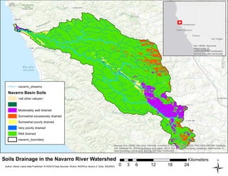
Soils Drainage in the Navarro River Watershed
0 6 12 18 243
Kilometers
Author: Adrian Labra Date Published: 9/19/2016 Data Sources: Rivers: NHDPlus Version 2. Soils: SSURGO
navarro_streams
Navarro Basin Soils
<all other values>
Moderately well drained
Somewhat excessively drained
Somewhat poorly drained
Very poorly drained
Well drained
navarro_boundary
Esri, HERE, DeLorme,
MapmyIndia, ©
OpenStreetMap contributors,
and the GIS user community