
Recomendados
Recomendados
Mais conteúdo relacionado
Mais procurados
Mais procurados (20)
Semelhante a The Paterson Greenway Project
Semelhante a The Paterson Greenway Project (20)
Mais de APA-NJ
Mais de APA-NJ (20)
Último
Último (20)
The Paterson Greenway Project
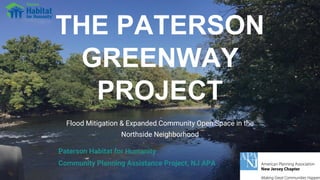
- 1. THE PATERSON GREENWAY PROJECT Flood Mitigation & Expanded Community Open Space in the Northside Neighborhood Paterson Habitat for Humanity Community Planning Assistance Project, NJ APA
- 4. Overview The Paterson Greenway Project is a phased effort to create a Riverwalk and parkland along the Passaic River in the Northside Neighborhood of the First Ward that will: • Promote local economic development within the area. • Create welcoming gateways at the bridges that cross the river. • Address the need for improved and expanded community open space. • Mitigate flooding through green infrastructure. • Improve community safety and sustainability. • Extend the greenway from the Great Falls Park to the Straight Street Bridge. • Provide access to the riverfront for recreation and enjoyment.
- 5. Project Team • Margaret (Peg) Seip, AICP/PP, Project Lead • Zainab Al Mansour, “Zee”, Project Intern, GIS Cartography and Design • Michael DiGeronimo, AIA/AICP/PP, Urban Design Lead • Thomas Fusillo, Environmental, Brownfields & Property Analysis • William Long, Planning & Visioning • Steven Martini, AICP/PP, Planning & Community Assessment • Julio Mora, Mapping & Design • Shweta Puri, Mapping & Design • Eric Sturm, Urban Planning & Riverwalk Design • Brian White, Property Research • Tom Schulze, Coordinator, NJAPA Community Planning Assistance Program
- 6. NJAPA, Community Planning & Assistance Program The project team evaluated: • Client and community needs. • Demographic and other economic data. • Planning, zoning and key development proposals. • Land use, building conditions, property ownership. • Geological and environmental conditions. To provide mapping, design proposals, and relevant examples to inform: • Community and government stakeholder engagement. • Investigation of potential funding and strategies for development.
- 7. Paterson Habitat for Humanity • Focus on 1st & 4th wards • Housing construction and renovation - 277 homes for over 300 families • CPTED safety improvements to homes & streets • Micro-enterprise program • Streetscape improvements - commercial corridors • NRTC grant for Northside Neighborhood Plan • New community open space - Clinton Street Garden, Paterson Greenway
- 8. Community Context • HISTORY • COMMUNITY • HOUSING & LAND USE • PLANNING & ZONING
- 10. ● Historic (1903) ● Hurricane Diane (1955) ● 13 occasions of major flooding (1979) ● Hurricane Irene (2011) ● Hurricane Sandy (2012) ● Neighborhood devastation ● Combined Sewer Outflow (CSO) & other environmental impacts Flooding - Increasing Impacts 19032007
- 11. Northside - Demographics • Slight population decline 2000-2010 • Primarily Black/African American & Latino/Hispanic • Youthful population with median age 25.7 years; 36% 19 years and younger; and 16% of population 5-14 years old • High levels of educational achievement (67% total population) with 42% HS graduate/GED; 19% assoc. degree/some college; and 7% college degree. Source: US Census ACS 2013-2017 5 Year Study & 2010 US Census for Census Tract 1807
- 12. Northside - Income & Employment • Median household income $30,887 (City of Paterson $36,106) • Nearly 20% employment in manufacturing; • 16% employed in education/health care/social services (St. Joseph’s Regional Medical Center; Paterson School District) • 14% working in transportation/warehousing • 10% unemployment rate in 2017 (6.4% city of Paterson) • 32% family poverty (37% individual) • 44% food stamp/SNAP assistance • 17% cash public assistance Source: US Census ACS 2013-2017
- 13. Northside - Housing & Transportation • 63% two-family homes • Median household value $179,700 • Low rate of homeownership (26% for Paterson; 12% in some neighborhoods) • 22% housing vacancy (956 units total) • Older housing stock (46% built before 1940) • 37% with no vehicle; 40% with one vehicle • Diversified commuting: nearly 20% walk/public transport; 20% carpool/jitney (Source: ACS 2013-17 5 Year Study)
- 14. Community Resources • Schools: PS12 and Dr. Frank Napier Tech (K-8); PS28 (PreK-8); Urban Leadership Academy • Northside Library (Temple St.) • Northside Firehouse (Matlock St) • Religious - numerous houses of worship • Parks - Cobb Memorial Park; Tyrone Collins Memorial Basketball Courts; Clinton Street playground (in development) • Habitat for Humanity and other CBO’s • Local & regional employment Community Strategies • Support homeownership • Provide services for young families and children • Enhance outdoor recreation and open space resources • Promote community safety • Support local economic development and employment • Mitigate impact of flooding • Promote equitable development • Honor local culture and leadership • Engage & support community-driven decision-making
- 15. Planning and Zoning Context • KEY PLANS & STUDIES • LAND USE • BUILDING CONDITIONS • OWNERSHIP
- 16. Plans and Studies • Northside Neighborhood Plan (2011) Paterson Habitat for Humanity • The Paterson Northside Community Action Plan (2014) Together North Jersey • Crime Prevention Through Environmental Design (CPTED) City of Paterson, Audit of Six Corridors(2015) Together North Jersey • First Ward Redevelopment Plan (2017) City of Paterson • Vista Park Master Plan (2017) • Great Falls National Park General Management Plan (2016)
- 18. -Northside Source: NJGin Open Data
- 20. Paterson Greenway Project Environmental & Property Analysis NORTHERN SECTION: “Blue Acres” Park & Straight Street Gateway CENTER SECTION: “Mechanic’s Row” & Arch Street Gateway SOUTHERN SECTION: West Broadway & Ryle Avenue Gateways
- 21. Southern Section- Overview 1. Connection to Great Falls National Park 2. “Maker” Redevelopment Property 3. Existing Riverfront Park, Playground, and Courts 4. West Broadway Bridge 5. Main Street Bridge 6. P.S. 28 Elementary School 1 2 3 3 4 5 6
- 22. Bridge connecting from Downtown View along Ryle Ave. Connection from Great Falls & Vista Park View of the River from West Broadway Bridge
- 23. View along Ryle Ave. Today View along Ryle Ave. from 1930s
- 24. Source: NJGin Open Data
- 25. Southern Section: Vacant & Public-Owned Properties Source: NJ DEP GIS
- 26. Southern Section: Industrial Properties Southern Section: Commercial Properties Southern Section: NJDEP Site Remediation Program Southern Section: Brownfield Sites Source: NJ DEP GIS
- 27. Central Section Overview 1. Vacant Library Property 2. Arch Street Bridge 3. Existing Riverfront Park, Playground, and Courts 4. Galaxie Chemical Property 5. North Main Street Corridor 6. P.S. 28 Elementary School 1 2 3 4 5 6 4
- 28. Vacant Library building Arch Street Bridge View of River from Main Street Bridge Sidewalk on Main Street
- 29. 29 • Adjacent to the existing riverfront park space, schools and community center • Arch Street Bridge - Trestle Style - opportunity for design • Arch Street Bridge has small sidewalks • Main Street Bridge has wider sidewalks and nice views of River • Potential adaptive reuse of Library • Auto and Salvage Uses – Long-term park and redevelopment opportunities Central section – Arch and Main Street Gateways
- 30. Source: NJGin Open Data
- 31. Central Section: Industrial Properties Central Section: Commercial Properties Central Section: Properties in NJDEP Site Remediation Program Source: NJ DEP GIS
- 32. Central Section: Vacant PropertiesCentral Section - Government Owned Properties Source: NJ DEP GIS
- 33. Northern Section Overview 1. Haledon Avenue Corridor - County “Green Streets” 2. Straight Street Bridge 3. “Blue Acres” Blocks 4. Galaxie Chemical Property 5. Redevelopment Opportunity Site 6. P.S. 12 Elementary School 7. North Main Street Corridor 8. Bunker Hill Industrial Park 1 2 5 6 4 3 3 3 1 3 3 3 3 5 7 8 8
- 34. Historic portion of Galaxie Straight Street Bridge Typical “Blue Acres” Block
- 35. Vacant and abandoned lots Galaxie Chemical along Piercy Street
- 36. Source: NJGin Open Data
- 37. Source: NJGin Open Data
- 38. Northern Section: Government-Owned Properties Northern Section: Vacant Properties Northern Section: Vacant and Government-Owned Source: NJ DEP GIS
- 39. Northern Section Groundwater Classification Areas Source: NJ DEP GIS
- 40. Northern Section: Industrial Properties Northern Section: Commercial Properties Northern Section: Properties in NJDEP Site Remediation ProgramSource: NJ DEP GIS
- 41. Design Concept • SITE ANALYSIS & DESIGN CONCEPT • PHASES AND APPROACH • GATEWAY AND CONNECTIONS • PRECEDENTS
- 44. PHASE I 1. Promenade along river edge behind the existing playground and basketball courts 2. Lighting, signage, public art to existing park spaces 3. Clearing of buildings and greening of City-owned land and connecting promenade to Great Falls Park 4. Sidewalk, lighting, gateway enhancements for Arch and Straight Street bridges 5. Clearing & greening of existing buyouts/publicly owned in Northern Section
- 45. PHASE II 1. New active/passive park elements in City-acquired area 2. Incorporation of the “Maker” redevelopment Continue promenade from Arch to Straight street behind “Mechanics Row” 3. Indicate Clinton Street Park and Library site adaptive reuse 4. Connection to riverfront walk to North 5. Clearing of buildings at the foot of bridge for future park space 6. Additional streetscape enhancement to Haledon/Straight 7. Connection to riverfront walk to South 8. Clearing of buildings commercial uses with active/passive park elements
- 46. PHASE III 1. Relocation of “Mechanic’s Row” businesses and replacing with active/passive park elements 2. Adaptive Reuse of Galaxie site 3. Redevelopment of “triangle” space on Haledon per other plans and studies 4. Clearing of remaining properties East of East Main with ball fields and other active/passive park elements
- 47. Southern Section Concept Plan Credit to: Michael DiGeronimo
- 48. Southern Section - Connection to Great Falls National Park
- 49. Central Section Design Concept 1. Scattered Site Infill of Single Family, Duplex, and Small Townhouses 2. Gateway improvements to the Arch Street Bridge including lighting, pedestrian upgrades, and public art 3. Streetscape improvements to North Main Street 4. Adaptive reuse of the Library Building 5. Connecting the riverfront trail in a series of paths and boardwalks to the Southern and Northern Sections 6. Long-term relocation and redevelopment of auto- oriented and salvage uses for new park spaces and “riverfront and parkfront” redevelopment
- 50. Riverwalk with access points at gateways
- 52. 52 • Phased approach for Blue Acres area - neighborhood “gardens” to large park • Continuing Habitat’s strategic infill and development • Trestle Style Bridge – opportunity for design • Adaptive Reuse of Galaxie Chemical Corp (former National Silk Dyeing Co.) – original brick building and taller warehouse portion • Redevelopment of Triangle area on Haledon – identified in Redevelopment Plan and other studies Northern section – Blue Acres parkland and Straight Street gateway
- 55. Credit to: Michael DiGeronimo PHASE I
- 56. Credit to: Michael DiGeronimo PHASE II
- 57. Credit to: Michael DiGeronimo PHASE III
- 58. 58 Park Design Precedents & Case Studies
- 59. 59 Precedent: Riverfront Park Newark, NJ • Local example along urban riverfront • Theme and branding with color and design elements • Planned & implemented in phases with environmental and acquisition issues
- 61. 61 Precedent: Gowanus Canal Brooklyn, NY • Urban waterway in an industrial area • Implemented in phases • Design guidelines for development
- 62. 62
- 63. 63 Precedent: Monan Trail Indianapolis, IN • Rails-to-trails project • Used the color red and very distinctive graphics all along it to brand it in a very creative way. • Use of industrial artifacts as public art and branding • Use of iconic bridge architecture
- 64. 64
- 65. 65 Pittsburgh, PA • Creative design with lighting and public art. • Number of bridges that have be repurposed to connect areas in the City a few for pedestrians/bikes only. • Use of iconic bridge architecture Precedent: Pittsburgh Bridges
- 66. 66
- 67. Normal 100 Year Flood 500 Year Flood Seasonal flooding fertilize soil Terraced landforms serve as storm water management infrastructure, which provides opportunity for both cultural programs and urban agricultural productions. Case Study Let it Flood/ Let it Grow Source:https://bustler.net/news/3124/asla-2013-student-excellence-award-winner-natural-water-as-cultural-water- by-daniel-zhicheng-xu
- 68. Street Section Components: ● ~ 6-7 ft Sidewalk ● 5 ft Green Strip ● 3 ft protected bike lane ● 6 ft parking space ● 7 ft driving lane Case Study: Street Improvements
- 69. • Place making - place keeping • Honor local culture & leadership • Community Land Trusts, Homebuyer Workshops, Displacement Free Zones • Support from Our Place America • Urban Institute measuring impact of equity work Case Study: Community Engagement for Equitable Development Anacostia River 11th Street Bridge Park - Building Bridges Across the River Source: bbardc.org - Anacostia Park Copyright OMA & Luxigon
- 70. Source: bbardc.org Building Bridges Across the Park - Anacostia River 11th Street Bridge Park
- 71. Paterson Greenway Project • STAKEHOLDER OUTREACH • COMMUNITY ENGAGEMENT AND PARTICIPATORY DESIGN • SURVEYING/ ENGINEERING • COST ANALYSIS • FUNDING RESEARCH & PROPOSALS