SlideShare uma empresa Scribd logo
1 de 23
A new Social Atlas of Europe
Benjamin Hennig
Senior Research Fellow, University of Oxford
benjamin.hennig@ouce.ox.ac.uk | @geoviews | http://www.viewsoftheworld.net
A country called Europe?
“… we must re-create the
European family in a regional
structure, called, it may be, the
United States of Europe…”
(Winston Churchill, Zurich 19 September 1946)
Eurobarometer, Spring 2014
http://ec.europa.eu/public_opinion/archives/eb/eb81/eb81_first_en.pdf
A country called Europe?
• One way in which the debate on Europe might
progress is to see Europe in a new light by
redrawing the map of Europe.
• A new cartography can further develop ideas of
Europe as a single mass of people and help
our thinking to move further towards a “Europe
of people” instead of “nation-states”.
• Through such action we may see a bolstering of
European identity to help us think of Europe and
its economy, culture, history and both human
and physical geography in terms of a single
large land and population entity.
A country called Europe?
Conventional maps
• cannot show how many people live in small areas – instead they
show how little land supports so many people;
• cannot show who the people are, what they do, where they go;
• They will not show the distributions of people changing –
international migration, moving house, or just going to work;
• They cannot portray the distribution of the wealthy or the poor; on
the map, at almost any scale, they live in much the same square
inch of paper. Nor will they show where and when people had
certain jobs, certain power, voted, were out of work, lived and died.
Mercator (17. Century) Gall/Peters (19. & 20. Century)
Cartograms
"Erwin Raisz called cartograms 'diagrammatic maps.' Today they might be
called cartograms, value-by-area maps, anamorphated images or simply
spatial transformations. Whatever their name, cartograms are unique
representations of geographical space. Examined more closely, the value-
by-area mapping technique encodes the mapped data in a simple and
efficient manner with no data generalization or loss of detail. Two forms,
contiguous and non-contiguous, have become popular. Mapping
requirements include the preservation of shape, orientation contiguity,
and data that have suitable variation. Successful communication
depends on how well the map reader recognizes the shapes of the
internal enumeration units, the accuracy of estimating these areas,
and effective legend design. Complex forms include the two-variable map.
Cartogram construction may be by manual or computer means. In either
method, a careful examination of the logic behind the use of the cartogram
must first be undertaken.“
Dent, 1996, my emphasis
Cited from http://www.ncgia.ucsb.edu/projects/Cartogram_Central/types.html
“… a general method for constructing density-equalizing projections or
cartograms, which provide an invaluable tool for the presentation and
analysis of geographic data. Our method is simpler than many earlier
methods, allowing for rapid calculations, while generating accurate and
readable maps.”
Gastner, M.T. and Newman, M.E.J. (2004) ‘Diffusion-based method for producing density equalizing
maps’, Proc. Natl. Acad. Sci. USA, vol 101, pp 7499–504 (my emphasis)
Europe
Europe
The Social Atlas of Europe
• Thinking about Europe as a continent of regions
and cities rather than nation-states and to
realise the huge number of ways in which
people living in different parts of Europe have so
much in common.
• By transforming the human and physical space
of Europe simultaneously, we argue that it is
more likely for Europeans to make more sense
of both their home area’s physical and human
geography and to think of Europe as one place.
Key data sources
• Gridded Population of the World (SEDAC/NASA)
• European Values Survey
• Eurostat
• European Union Statistics on Income and Living
Conditions
• International Labour Organisation
• The World Bank
• World Health Organisation
• Barro-Lee education attainment database
Types of maps
• Country cartograms, using a rainbow colour
scheme, with each country resized on the basis
of a variable of interest.
• Country population cartograms with thematic
mapping showing the geographical distribution
of a variable of interest
• Gridded population cartograms with thematic
mapping
Types of maps
• Country cartograms, using a rainbow colour
scheme, with each country resized on the
basis of a variable of interest.
• Country population cartograms with thematic
mapping showing the geographical distribution
of a variable of interest
• Gridded population cartograms with thematic
mapping
Country cartograms
Types of maps
• Country cartograms, using a rainbow colour
scheme, with each country resized on the basis
of a variable of interest.
• Country population cartograms with thematic
mapping showing the geographical
distribution of a variable of interest
• Gridded population cartograms with thematic
mapping
Country population cartograms
Types of maps
• Country cartograms, using a rainbow colour
scheme, with each country resized on the basis
of a variable of interest.
• Country population cartograms with thematic
mapping showing the geographical distribution
of a variable of interest
• Gridded population cartograms with thematic
mapping
Gridded population cartograms
A Human Atlas of Europe - What’s new?
Infographics
(draft preview)
Updated and improved maps
(draft preview)
Updated and improved maps
(draft preview)
benjamin.hennig@ouce.ox.ac.uk | @geoviews | www.viewsoftheworld.net
Thanks for your attention!

Mais conteúdo relacionado

Mais procurados

Re-Mapping the World's Population
Re-Mapping the World's PopulationRe-Mapping the World's Population
Re-Mapping the World's PopulationBenjamin Hennig
 
Application of remote sensing,population identification
Application of remote sensing,population identificationApplication of remote sensing,population identification
Application of remote sensing,population identificationSATISH KUMAR
 
Mapping Cyberspace
Mapping CyberspaceMapping Cyberspace
Mapping Cyberspaces.meyer
 
Introduction to Open Source GIS Day 1 - Institute of Archaeologists of Irelan...
Introduction to Open Source GIS Day 1 - Institute of Archaeologists of Irelan...Introduction to Open Source GIS Day 1 - Institute of Archaeologists of Irelan...
Introduction to Open Source GIS Day 1 - Institute of Archaeologists of Irelan...Gianmarco Cattari
 
Distribution maps
Distribution mapsDistribution maps
Distribution mapsivisdude82
 
Storyboard Miraikan Sorting Out Cities
Storyboard Miraikan Sorting Out CitiesStoryboard Miraikan Sorting Out Cities
Storyboard Miraikan Sorting Out CitiesDietmar Offenhuber
 
Geographical Information System(GIS) in Urban Design
Geographical Information System(GIS) in Urban DesignGeographical Information System(GIS) in Urban Design
Geographical Information System(GIS) in Urban DesignPurushottam Uttarwar
 
GEOGRAPHIC SKILLS: CHOROPLETH MAPS
GEOGRAPHIC SKILLS: CHOROPLETH MAPSGEOGRAPHIC SKILLS: CHOROPLETH MAPS
GEOGRAPHIC SKILLS: CHOROPLETH MAPSGeorge Dumitrache
 
Wherecamp Berlin 2012 Population Grids
Wherecamp Berlin 2012 Population GridsWherecamp Berlin 2012 Population Grids
Wherecamp Berlin 2012 Population GridsMax Friedrich Hartmann
 
Urban Sprawl for modelling using GIS
Urban Sprawl for modelling using GISUrban Sprawl for modelling using GIS
Urban Sprawl for modelling using GISpankaj kumar
 
Data visualization representation of Analytics data
Data visualization representation of Analytics  dataData visualization representation of Analytics  data
Data visualization representation of Analytics dataPrasad Narasimhan
 
GEOGRAPHICAL INFORMATION SYSTEMS
GEOGRAPHICALINFORMATIONSYSTEMSGEOGRAPHICALINFORMATIONSYSTEMS
GEOGRAPHICAL INFORMATION SYSTEMSStudent
 
Chapter 1: True Maps, False Impressions
Chapter 1: True Maps, False ImpressionsChapter 1: True Maps, False Impressions
Chapter 1: True Maps, False Impressionsjstubblefield
 
Analysing and creating maps
Analysing and creating mapsAnalysing and creating maps
Analysing and creating mapsŠkola Futura
 
Map Design and Symbology in GIS Environment
Map Design and Symbology in GIS EnvironmentMap Design and Symbology in GIS Environment
Map Design and Symbology in GIS EnvironmentKaium Chowdhury
 
ifp-Annual-Report2015-Chance
ifp-Annual-Report2015-Chanceifp-Annual-Report2015-Chance
ifp-Annual-Report2015-ChanceChance Coughenour
 

Mais procurados (20)

Re-Mapping the World's Population
Re-Mapping the World's PopulationRe-Mapping the World's Population
Re-Mapping the World's Population
 
Application of remote sensing,population identification
Application of remote sensing,population identificationApplication of remote sensing,population identification
Application of remote sensing,population identification
 
History of cartography
History of cartographyHistory of cartography
History of cartography
 
Mapping Cyberspace
Mapping CyberspaceMapping Cyberspace
Mapping Cyberspace
 
Introduction to Open Source GIS Day 1 - Institute of Archaeologists of Irelan...
Introduction to Open Source GIS Day 1 - Institute of Archaeologists of Irelan...Introduction to Open Source GIS Day 1 - Institute of Archaeologists of Irelan...
Introduction to Open Source GIS Day 1 - Institute of Archaeologists of Irelan...
 
Distribution maps
Distribution mapsDistribution maps
Distribution maps
 
Storyboard Miraikan Sorting Out Cities
Storyboard Miraikan Sorting Out CitiesStoryboard Miraikan Sorting Out Cities
Storyboard Miraikan Sorting Out Cities
 
Geographical Information System(GIS) in Urban Design
Geographical Information System(GIS) in Urban DesignGeographical Information System(GIS) in Urban Design
Geographical Information System(GIS) in Urban Design
 
GEOGRAPHIC SKILLS: CHOROPLETH MAPS
GEOGRAPHIC SKILLS: CHOROPLETH MAPSGEOGRAPHIC SKILLS: CHOROPLETH MAPS
GEOGRAPHIC SKILLS: CHOROPLETH MAPS
 
Wherecamp Berlin 2012 Population Grids
Wherecamp Berlin 2012 Population GridsWherecamp Berlin 2012 Population Grids
Wherecamp Berlin 2012 Population Grids
 
Urban Sprawl for modelling using GIS
Urban Sprawl for modelling using GISUrban Sprawl for modelling using GIS
Urban Sprawl for modelling using GIS
 
GEOGRAPHIC SKILLS: DOT MAPS
GEOGRAPHIC SKILLS: DOT MAPSGEOGRAPHIC SKILLS: DOT MAPS
GEOGRAPHIC SKILLS: DOT MAPS
 
Data visualization representation of Analytics data
Data visualization representation of Analytics  dataData visualization representation of Analytics  data
Data visualization representation of Analytics data
 
GISdayposter 3
GISdayposter 3GISdayposter 3
GISdayposter 3
 
GEOGRAPHICAL INFORMATION SYSTEMS
GEOGRAPHICALINFORMATIONSYSTEMSGEOGRAPHICALINFORMATIONSYSTEMS
GEOGRAPHICAL INFORMATION SYSTEMS
 
5 youcanhelp
5 youcanhelp5 youcanhelp
5 youcanhelp
 
Chapter 1: True Maps, False Impressions
Chapter 1: True Maps, False ImpressionsChapter 1: True Maps, False Impressions
Chapter 1: True Maps, False Impressions
 
Analysing and creating maps
Analysing and creating mapsAnalysing and creating maps
Analysing and creating maps
 
Map Design and Symbology in GIS Environment
Map Design and Symbology in GIS EnvironmentMap Design and Symbology in GIS Environment
Map Design and Symbology in GIS Environment
 
ifp-Annual-Report2015-Chance
ifp-Annual-Report2015-Chanceifp-Annual-Report2015-Chance
ifp-Annual-Report2015-Chance
 

Destaque

Winter_brochure_en
Winter_brochure_enWinter_brochure_en
Winter_brochure_enS Birr
 
Clinico-haematological Profile of Falciparum Malaria in a Rural Hospital of T...
Clinico-haematological Profile of Falciparum Malaria in a Rural Hospital of T...Clinico-haematological Profile of Falciparum Malaria in a Rural Hospital of T...
Clinico-haematological Profile of Falciparum Malaria in a Rural Hospital of T...iosrphr_editor
 
ดูแลตัวเองเพื่อตัวเอง
ดูแลตัวเองเพื่อตัวเองดูแลตัวเองเพื่อตัวเอง
ดูแลตัวเองเพื่อตัวเองManatsanan O-aree
 
Serat Class - Madni Daur - Class 8 - Part2
Serat Class - Madni Daur - Class 8 - Part2 Serat Class - Madni Daur - Class 8 - Part2
Serat Class - Madni Daur - Class 8 - Part2 muftimunirahmad
 
Bibliography Strength training In children and adolescents. Paoli, Moro.
Bibliography Strength training In children and adolescents. Paoli, Moro. Bibliography Strength training In children and adolescents. Paoli, Moro.
Bibliography Strength training In children and adolescents. Paoli, Moro. Calzetti & Mariucci Editori
 
xCALLY Motion Multichannel Asterisk Contact Centre
xCALLY Motion Multichannel Asterisk Contact CentrexCALLY Motion Multichannel Asterisk Contact Centre
xCALLY Motion Multichannel Asterisk Contact CentreClarotech_Events
 
Landmark Forum enables you to become a Better Leader
Landmark Forum enables you to become a Better LeaderLandmark Forum enables you to become a Better Leader
Landmark Forum enables you to become a Better LeaderLandmark Forum
 
Nota competencia perfecta
Nota competencia perfectaNota competencia perfecta
Nota competencia perfectanyec
 
Renal replacement therapy in the ICU
Renal replacement therapy in the ICURenal replacement therapy in the ICU
Renal replacement therapy in the ICUmeducationdotnet
 
Biologia – 12º Ano (FecundaçãO, Desenvolvimento EmbrionáRio E GestaçãO)
Biologia – 12º Ano (FecundaçãO, Desenvolvimento EmbrionáRio E GestaçãO)Biologia – 12º Ano (FecundaçãO, Desenvolvimento EmbrionáRio E GestaçãO)
Biologia – 12º Ano (FecundaçãO, Desenvolvimento EmbrionáRio E GestaçãO)Nuno Correia
 
TETRALOGY OF FALLOT, PARENT TEACHING
TETRALOGY OF FALLOT, PARENT TEACHINGTETRALOGY OF FALLOT, PARENT TEACHING
TETRALOGY OF FALLOT, PARENT TEACHINGJEENA AEJY
 

Destaque (18)

bietkal.adam
bietkal.adambietkal.adam
bietkal.adam
 
Robert-Foley
Robert-FoleyRobert-Foley
Robert-Foley
 
Skylar's Resume
Skylar's ResumeSkylar's Resume
Skylar's Resume
 
Winter_brochure_en
Winter_brochure_enWinter_brochure_en
Winter_brochure_en
 
Clinico-haematological Profile of Falciparum Malaria in a Rural Hospital of T...
Clinico-haematological Profile of Falciparum Malaria in a Rural Hospital of T...Clinico-haematological Profile of Falciparum Malaria in a Rural Hospital of T...
Clinico-haematological Profile of Falciparum Malaria in a Rural Hospital of T...
 
ดูแลตัวเองเพื่อตัวเอง
ดูแลตัวเองเพื่อตัวเองดูแลตัวเองเพื่อตัวเอง
ดูแลตัวเองเพื่อตัวเอง
 
Serat Class - Madni Daur - Class 8 - Part2
Serat Class - Madni Daur - Class 8 - Part2 Serat Class - Madni Daur - Class 8 - Part2
Serat Class - Madni Daur - Class 8 - Part2
 
Bibliography Strength training In children and adolescents. Paoli, Moro.
Bibliography Strength training In children and adolescents. Paoli, Moro. Bibliography Strength training In children and adolescents. Paoli, Moro.
Bibliography Strength training In children and adolescents. Paoli, Moro.
 
xCALLY Motion Multichannel Asterisk Contact Centre
xCALLY Motion Multichannel Asterisk Contact CentrexCALLY Motion Multichannel Asterisk Contact Centre
xCALLY Motion Multichannel Asterisk Contact Centre
 
Social media savage
Social media savageSocial media savage
Social media savage
 
Chettiar Foundation q
Chettiar Foundation qChettiar Foundation q
Chettiar Foundation q
 
Landmark Forum enables you to become a Better Leader
Landmark Forum enables you to become a Better LeaderLandmark Forum enables you to become a Better Leader
Landmark Forum enables you to become a Better Leader
 
Nota competencia perfecta
Nota competencia perfectaNota competencia perfecta
Nota competencia perfecta
 
Renal replacement therapy in the ICU
Renal replacement therapy in the ICURenal replacement therapy in the ICU
Renal replacement therapy in the ICU
 
Biologia – 12º Ano (FecundaçãO, Desenvolvimento EmbrionáRio E GestaçãO)
Biologia – 12º Ano (FecundaçãO, Desenvolvimento EmbrionáRio E GestaçãO)Biologia – 12º Ano (FecundaçãO, Desenvolvimento EmbrionáRio E GestaçãO)
Biologia – 12º Ano (FecundaçãO, Desenvolvimento EmbrionáRio E GestaçãO)
 
Tharun Resume
Tharun ResumeTharun Resume
Tharun Resume
 
Pagine da rivista Scienza e Movimento 9
Pagine da rivista Scienza e Movimento 9Pagine da rivista Scienza e Movimento 9
Pagine da rivista Scienza e Movimento 9
 
TETRALOGY OF FALLOT, PARENT TEACHING
TETRALOGY OF FALLOT, PARENT TEACHINGTETRALOGY OF FALLOT, PARENT TEACHING
TETRALOGY OF FALLOT, PARENT TEACHING
 

Semelhante a New Social Atlas of Europe Reveals Continent as Single Mass of People

DSH Week 3 – Storytelling with Place.pdf
DSH Week 3 – Storytelling with Place.pdfDSH Week 3 – Storytelling with Place.pdf
DSH Week 3 – Storytelling with Place.pdfStefanAngelDx
 
Statistical techniques in geographical analysis
Statistical techniques in geographical analysisStatistical techniques in geographical analysis
Statistical techniques in geographical analysisakida mbugi
 
Crowdsourcing and Participation in Cartography (G572 Guest Lecture)
Crowdsourcing and Participation in Cartography (G572 Guest Lecture)Crowdsourcing and Participation in Cartography (G572 Guest Lecture)
Crowdsourcing and Participation in Cartography (G572 Guest Lecture)Carl Sack
 
The Look of (Participatory) Maps
The Look of (Participatory) MapsThe Look of (Participatory) Maps
The Look of (Participatory) MapsAmber Bosse
 
History of Data Visualization
History of Data VisualizationHistory of Data Visualization
History of Data VisualizationManimaran A
 
The Discipline of Cartography – philosophical basis and modern transformations
The Discipline of Cartography – philosophical basis and modern transformationsThe Discipline of Cartography – philosophical basis and modern transformations
The Discipline of Cartography – philosophical basis and modern transformationsProf Ashis Sarkar
 
Information Visualization Workshop, ASIS&T 2015
Information Visualization Workshop, ASIS&T 2015Information Visualization Workshop, ASIS&T 2015
Information Visualization Workshop, ASIS&T 2015Joseph Ryan
 
An introduction to geographic information systems (gis) m goulbourne 2007
An introduction to geographic information systems (gis)   m goulbourne 2007An introduction to geographic information systems (gis)   m goulbourne 2007
An introduction to geographic information systems (gis) m goulbourne 2007Michelle Goulbourne @ DiaMind Health
 
TYBSC IT PGIS Unit V Data Visualization
TYBSC IT PGIS Unit V  Data VisualizationTYBSC IT PGIS Unit V  Data Visualization
TYBSC IT PGIS Unit V Data VisualizationArti Parab Academics
 
Mapping Cybergeographies
Mapping CybergeographiesMapping Cybergeographies
Mapping CybergeographiesStephen Graham
 
Geographical Sources Governmental Publications/ Documents Continuing Resour...
Geographical Sources  Governmental Publications/ Documents  Continuing Resour...Geographical Sources  Governmental Publications/ Documents  Continuing Resour...
Geographical Sources Governmental Publications/ Documents Continuing Resour...Janecatalla
 
Exploring our geographic world by tessie calimag bb.
Exploring our geographic world by tessie calimag bb.Exploring our geographic world by tessie calimag bb.
Exploring our geographic world by tessie calimag bb.Tessie Calimag
 
History and impact of sci vis
History and impact of sci visHistory and impact of sci vis
History and impact of sci visCharles Flynt
 
Exploring our geographic world by tessie calimag bb.
Exploring our geographic world by tessie calimag bb.Exploring our geographic world by tessie calimag bb.
Exploring our geographic world by tessie calimag bb.Tessie Calimag
 
On Spatial, Data and Mapping myopia
On Spatial, Data and Mapping myopiaOn Spatial, Data and Mapping myopia
On Spatial, Data and Mapping myopiaJan Willem van Eck
 

Semelhante a New Social Atlas of Europe Reveals Continent as Single Mass of People (20)

DSH Week 3 – Storytelling with Place.pdf
DSH Week 3 – Storytelling with Place.pdfDSH Week 3 – Storytelling with Place.pdf
DSH Week 3 – Storytelling with Place.pdf
 
Statistical techniques in geographical analysis
Statistical techniques in geographical analysisStatistical techniques in geographical analysis
Statistical techniques in geographical analysis
 
Crowdsourcing and Participation in Cartography (G572 Guest Lecture)
Crowdsourcing and Participation in Cartography (G572 Guest Lecture)Crowdsourcing and Participation in Cartography (G572 Guest Lecture)
Crowdsourcing and Participation in Cartography (G572 Guest Lecture)
 
MapMaker.pdf
MapMaker.pdfMapMaker.pdf
MapMaker.pdf
 
Map reading
Map readingMap reading
Map reading
 
The Look of (Participatory) Maps
The Look of (Participatory) MapsThe Look of (Participatory) Maps
The Look of (Participatory) Maps
 
History of Data Visualization
History of Data VisualizationHistory of Data Visualization
History of Data Visualization
 
The Discipline of Cartography – philosophical basis and modern transformations
The Discipline of Cartography – philosophical basis and modern transformationsThe Discipline of Cartography – philosophical basis and modern transformations
The Discipline of Cartography – philosophical basis and modern transformations
 
Information Visualization Workshop, ASIS&T 2015
Information Visualization Workshop, ASIS&T 2015Information Visualization Workshop, ASIS&T 2015
Information Visualization Workshop, ASIS&T 2015
 
An introduction to geographic information systems (gis) m goulbourne 2007
An introduction to geographic information systems (gis)   m goulbourne 2007An introduction to geographic information systems (gis)   m goulbourne 2007
An introduction to geographic information systems (gis) m goulbourne 2007
 
TYBSC IT PGIS Unit V Data Visualization
TYBSC IT PGIS Unit V  Data VisualizationTYBSC IT PGIS Unit V  Data Visualization
TYBSC IT PGIS Unit V Data Visualization
 
Cartography
CartographyCartography
Cartography
 
Mapping Cybergeographies
Mapping CybergeographiesMapping Cybergeographies
Mapping Cybergeographies
 
Thinking about Classifications & Making up Spaces
Thinking about Classifications & Making up SpacesThinking about Classifications & Making up Spaces
Thinking about Classifications & Making up Spaces
 
Geography and Cartography
Geography and CartographyGeography and Cartography
Geography and Cartography
 
Geographical Sources Governmental Publications/ Documents Continuing Resour...
Geographical Sources  Governmental Publications/ Documents  Continuing Resour...Geographical Sources  Governmental Publications/ Documents  Continuing Resour...
Geographical Sources Governmental Publications/ Documents Continuing Resour...
 
Exploring our geographic world by tessie calimag bb.
Exploring our geographic world by tessie calimag bb.Exploring our geographic world by tessie calimag bb.
Exploring our geographic world by tessie calimag bb.
 
History and impact of sci vis
History and impact of sci visHistory and impact of sci vis
History and impact of sci vis
 
Exploring our geographic world by tessie calimag bb.
Exploring our geographic world by tessie calimag bb.Exploring our geographic world by tessie calimag bb.
Exploring our geographic world by tessie calimag bb.
 
On Spatial, Data and Mapping myopia
On Spatial, Data and Mapping myopiaOn Spatial, Data and Mapping myopia
On Spatial, Data and Mapping myopia
 

Mais de Benjamin Hennig

Worldmapper: The Relaunch
Worldmapper: The RelaunchWorldmapper: The Relaunch
Worldmapper: The RelaunchBenjamin Hennig
 
Inequalities in Higher Education / Ungleichheiten in der Hochschulbildung
Inequalities in Higher Education / Ungleichheiten in der HochschulbildungInequalities in Higher Education / Ungleichheiten in der Hochschulbildung
Inequalities in Higher Education / Ungleichheiten in der HochschulbildungBenjamin Hennig
 
Geographic perspectives: The role of spatial thinking and geovisualisation in...
Geographic perspectives: The role of spatial thinking and geovisualisation in...Geographic perspectives: The role of spatial thinking and geovisualisation in...
Geographic perspectives: The role of spatial thinking and geovisualisation in...Benjamin Hennig
 
Beyond fire and ice: Mapping Iceland in the 21st Century
Beyond fire and ice: Mapping Iceland in the 21st CenturyBeyond fire and ice: Mapping Iceland in the 21st Century
Beyond fire and ice: Mapping Iceland in the 21st CenturyBenjamin Hennig
 
The Power of Maps: A Cartographic Journey along the World's Borders
The Power of Maps: A Cartographic Journey along the World's BordersThe Power of Maps: A Cartographic Journey along the World's Borders
The Power of Maps: A Cartographic Journey along the World's BordersBenjamin Hennig
 
“Calling Abidjan” - estimating population distribution through analysis of mo...
“Calling Abidjan” - estimating population distribution through analysis of mo...“Calling Abidjan” - estimating population distribution through analysis of mo...
“Calling Abidjan” - estimating population distribution through analysis of mo...Benjamin Hennig
 
Unequal Worlds - 100% Equality?
Unequal Worlds - 100% Equality?Unequal Worlds - 100% Equality?
Unequal Worlds - 100% Equality?Benjamin Hennig
 
Hyperspectral remote sensing and analysis of intertidal zones: A contribution...
Hyperspectral remote sensing and analysis of intertidal zones: A contribution...Hyperspectral remote sensing and analysis of intertidal zones: A contribution...
Hyperspectral remote sensing and analysis of intertidal zones: A contribution...Benjamin Hennig
 
New Geographies of China
New Geographies of ChinaNew Geographies of China
New Geographies of ChinaBenjamin Hennig
 
Inequality and Sustainability
Inequality and SustainabilityInequality and Sustainability
Inequality and SustainabilityBenjamin Hennig
 
The Social Atlas of Europe
The Social Atlas of EuropeThe Social Atlas of Europe
The Social Atlas of EuropeBenjamin Hennig
 
Visualization of Satellite Data Availability : TerraSAR-X and TanDEM-X Runni...
Visualization of Satellite Data Availability: TerraSAR-X and TanDEM-X Runni...Visualization of Satellite Data Availability: TerraSAR-X and TanDEM-X Runni...
Visualization of Satellite Data Availability : TerraSAR-X and TanDEM-X Runni...Benjamin Hennig
 
Mapping Perspectives of Changing China
Mapping Perspectives of Changing ChinaMapping Perspectives of Changing China
Mapping Perspectives of Changing ChinaBenjamin Hennig
 
Data driven storytelling: The impact of visualisation on teaching and research
Data driven storytelling: The impact of visualisation on teaching and researchData driven storytelling: The impact of visualisation on teaching and research
Data driven storytelling: The impact of visualisation on teaching and researchBenjamin Hennig
 
Where the wild spaces are: Visualising wilderness
Where the wild spaces are: Visualising wildernessWhere the wild spaces are: Visualising wilderness
Where the wild spaces are: Visualising wildernessBenjamin Hennig
 
Into the big wide open: Think (twice) before you map!
Into the big wide open: Think (twice) before you map!Into the big wide open: Think (twice) before you map!
Into the big wide open: Think (twice) before you map!Benjamin Hennig
 
One Planet, Many Worlds: Visualising the social and physical environment of h...
One Planet, Many Worlds: Visualising the social and physical environment of h...One Planet, Many Worlds: Visualising the social and physical environment of h...
One Planet, Many Worlds: Visualising the social and physical environment of h...Benjamin Hennig
 
Changing views of a changing planet
Changing views of a changing planetChanging views of a changing planet
Changing views of a changing planetBenjamin Hennig
 
Megacity London - ever growing, ever more unequal?
Megacity London - ever growing, ever more unequal?Megacity London - ever growing, ever more unequal?
Megacity London - ever growing, ever more unequal?Benjamin Hennig
 

Mais de Benjamin Hennig (20)

Worldmapper: The Relaunch
Worldmapper: The RelaunchWorldmapper: The Relaunch
Worldmapper: The Relaunch
 
Inequalities in Higher Education / Ungleichheiten in der Hochschulbildung
Inequalities in Higher Education / Ungleichheiten in der HochschulbildungInequalities in Higher Education / Ungleichheiten in der Hochschulbildung
Inequalities in Higher Education / Ungleichheiten in der Hochschulbildung
 
Geographic perspectives: The role of spatial thinking and geovisualisation in...
Geographic perspectives: The role of spatial thinking and geovisualisation in...Geographic perspectives: The role of spatial thinking and geovisualisation in...
Geographic perspectives: The role of spatial thinking and geovisualisation in...
 
Beyond fire and ice: Mapping Iceland in the 21st Century
Beyond fire and ice: Mapping Iceland in the 21st CenturyBeyond fire and ice: Mapping Iceland in the 21st Century
Beyond fire and ice: Mapping Iceland in the 21st Century
 
The Power of Maps: A Cartographic Journey along the World's Borders
The Power of Maps: A Cartographic Journey along the World's BordersThe Power of Maps: A Cartographic Journey along the World's Borders
The Power of Maps: A Cartographic Journey along the World's Borders
 
“Calling Abidjan” - estimating population distribution through analysis of mo...
“Calling Abidjan” - estimating population distribution through analysis of mo...“Calling Abidjan” - estimating population distribution through analysis of mo...
“Calling Abidjan” - estimating population distribution through analysis of mo...
 
Unequal Worlds - 100% Equality?
Unequal Worlds - 100% Equality?Unequal Worlds - 100% Equality?
Unequal Worlds - 100% Equality?
 
Hyperspectral remote sensing and analysis of intertidal zones: A contribution...
Hyperspectral remote sensing and analysis of intertidal zones: A contribution...Hyperspectral remote sensing and analysis of intertidal zones: A contribution...
Hyperspectral remote sensing and analysis of intertidal zones: A contribution...
 
New Geographies of China
New Geographies of ChinaNew Geographies of China
New Geographies of China
 
Inequality and Sustainability
Inequality and SustainabilityInequality and Sustainability
Inequality and Sustainability
 
The Social Atlas of Europe
The Social Atlas of EuropeThe Social Atlas of Europe
The Social Atlas of Europe
 
Visualization of Satellite Data Availability : TerraSAR-X and TanDEM-X Runni...
Visualization of Satellite Data Availability: TerraSAR-X and TanDEM-X Runni...Visualization of Satellite Data Availability: TerraSAR-X and TanDEM-X Runni...
Visualization of Satellite Data Availability : TerraSAR-X and TanDEM-X Runni...
 
Mapping Perspectives of Changing China
Mapping Perspectives of Changing ChinaMapping Perspectives of Changing China
Mapping Perspectives of Changing China
 
Londonmapper
LondonmapperLondonmapper
Londonmapper
 
Data driven storytelling: The impact of visualisation on teaching and research
Data driven storytelling: The impact of visualisation on teaching and researchData driven storytelling: The impact of visualisation on teaching and research
Data driven storytelling: The impact of visualisation on teaching and research
 
Where the wild spaces are: Visualising wilderness
Where the wild spaces are: Visualising wildernessWhere the wild spaces are: Visualising wilderness
Where the wild spaces are: Visualising wilderness
 
Into the big wide open: Think (twice) before you map!
Into the big wide open: Think (twice) before you map!Into the big wide open: Think (twice) before you map!
Into the big wide open: Think (twice) before you map!
 
One Planet, Many Worlds: Visualising the social and physical environment of h...
One Planet, Many Worlds: Visualising the social and physical environment of h...One Planet, Many Worlds: Visualising the social and physical environment of h...
One Planet, Many Worlds: Visualising the social and physical environment of h...
 
Changing views of a changing planet
Changing views of a changing planetChanging views of a changing planet
Changing views of a changing planet
 
Megacity London - ever growing, ever more unequal?
Megacity London - ever growing, ever more unequal?Megacity London - ever growing, ever more unequal?
Megacity London - ever growing, ever more unequal?
 

Último

ACC 2024 Chronicles. Cardiology. Exam.pdf
ACC 2024 Chronicles. Cardiology. Exam.pdfACC 2024 Chronicles. Cardiology. Exam.pdf
ACC 2024 Chronicles. Cardiology. Exam.pdfSpandanaRallapalli
 
ECONOMIC CONTEXT - LONG FORM TV DRAMA - PPT
ECONOMIC CONTEXT - LONG FORM TV DRAMA - PPTECONOMIC CONTEXT - LONG FORM TV DRAMA - PPT
ECONOMIC CONTEXT - LONG FORM TV DRAMA - PPTiammrhaywood
 
How to Add Barcode on PDF Report in Odoo 17
How to Add Barcode on PDF Report in Odoo 17How to Add Barcode on PDF Report in Odoo 17
How to Add Barcode on PDF Report in Odoo 17Celine George
 
MULTIDISCIPLINRY NATURE OF THE ENVIRONMENTAL STUDIES.pptx
MULTIDISCIPLINRY NATURE OF THE ENVIRONMENTAL STUDIES.pptxMULTIDISCIPLINRY NATURE OF THE ENVIRONMENTAL STUDIES.pptx
MULTIDISCIPLINRY NATURE OF THE ENVIRONMENTAL STUDIES.pptxAnupkumar Sharma
 
Q4 English4 Week3 PPT Melcnmg-based.pptx
Q4 English4 Week3 PPT Melcnmg-based.pptxQ4 English4 Week3 PPT Melcnmg-based.pptx
Q4 English4 Week3 PPT Melcnmg-based.pptxnelietumpap1
 
Computed Fields and api Depends in the Odoo 17
Computed Fields and api Depends in the Odoo 17Computed Fields and api Depends in the Odoo 17
Computed Fields and api Depends in the Odoo 17Celine George
 
INTRODUCTION TO CATHOLIC CHRISTOLOGY.pptx
INTRODUCTION TO CATHOLIC CHRISTOLOGY.pptxINTRODUCTION TO CATHOLIC CHRISTOLOGY.pptx
INTRODUCTION TO CATHOLIC CHRISTOLOGY.pptxHumphrey A Beña
 
Influencing policy (training slides from Fast Track Impact)
Influencing policy (training slides from Fast Track Impact)Influencing policy (training slides from Fast Track Impact)
Influencing policy (training slides from Fast Track Impact)Mark Reed
 
Visit to a blind student's school🧑‍🦯🧑‍🦯(community medicine)
Visit to a blind student's school🧑‍🦯🧑‍🦯(community medicine)Visit to a blind student's school🧑‍🦯🧑‍🦯(community medicine)
Visit to a blind student's school🧑‍🦯🧑‍🦯(community medicine)lakshayb543
 
Full Stack Web Development Course for Beginners
Full Stack Web Development Course  for BeginnersFull Stack Web Development Course  for Beginners
Full Stack Web Development Course for BeginnersSabitha Banu
 
What is Model Inheritance in Odoo 17 ERP
What is Model Inheritance in Odoo 17 ERPWhat is Model Inheritance in Odoo 17 ERP
What is Model Inheritance in Odoo 17 ERPCeline George
 
Proudly South Africa powerpoint Thorisha.pptx
Proudly South Africa powerpoint Thorisha.pptxProudly South Africa powerpoint Thorisha.pptx
Proudly South Africa powerpoint Thorisha.pptxthorishapillay1
 
Judging the Relevance and worth of ideas part 2.pptx
Judging the Relevance  and worth of ideas part 2.pptxJudging the Relevance  and worth of ideas part 2.pptx
Judging the Relevance and worth of ideas part 2.pptxSherlyMaeNeri
 
Barangay Council for the Protection of Children (BCPC) Orientation.pptx
Barangay Council for the Protection of Children (BCPC) Orientation.pptxBarangay Council for the Protection of Children (BCPC) Orientation.pptx
Barangay Council for the Protection of Children (BCPC) Orientation.pptxCarlos105
 
4.18.24 Movement Legacies, Reflection, and Review.pptx
4.18.24 Movement Legacies, Reflection, and Review.pptx4.18.24 Movement Legacies, Reflection, and Review.pptx
4.18.24 Movement Legacies, Reflection, and Review.pptxmary850239
 
Inclusivity Essentials_ Creating Accessible Websites for Nonprofits .pdf
Inclusivity Essentials_ Creating Accessible Websites for Nonprofits .pdfInclusivity Essentials_ Creating Accessible Websites for Nonprofits .pdf
Inclusivity Essentials_ Creating Accessible Websites for Nonprofits .pdfTechSoup
 
Field Attribute Index Feature in Odoo 17
Field Attribute Index Feature in Odoo 17Field Attribute Index Feature in Odoo 17
Field Attribute Index Feature in Odoo 17Celine George
 

Último (20)

ACC 2024 Chronicles. Cardiology. Exam.pdf
ACC 2024 Chronicles. Cardiology. Exam.pdfACC 2024 Chronicles. Cardiology. Exam.pdf
ACC 2024 Chronicles. Cardiology. Exam.pdf
 
ECONOMIC CONTEXT - LONG FORM TV DRAMA - PPT
ECONOMIC CONTEXT - LONG FORM TV DRAMA - PPTECONOMIC CONTEXT - LONG FORM TV DRAMA - PPT
ECONOMIC CONTEXT - LONG FORM TV DRAMA - PPT
 
How to Add Barcode on PDF Report in Odoo 17
How to Add Barcode on PDF Report in Odoo 17How to Add Barcode on PDF Report in Odoo 17
How to Add Barcode on PDF Report in Odoo 17
 
MULTIDISCIPLINRY NATURE OF THE ENVIRONMENTAL STUDIES.pptx
MULTIDISCIPLINRY NATURE OF THE ENVIRONMENTAL STUDIES.pptxMULTIDISCIPLINRY NATURE OF THE ENVIRONMENTAL STUDIES.pptx
MULTIDISCIPLINRY NATURE OF THE ENVIRONMENTAL STUDIES.pptx
 
FINALS_OF_LEFT_ON_C'N_EL_DORADO_2024.pptx
FINALS_OF_LEFT_ON_C'N_EL_DORADO_2024.pptxFINALS_OF_LEFT_ON_C'N_EL_DORADO_2024.pptx
FINALS_OF_LEFT_ON_C'N_EL_DORADO_2024.pptx
 
Q4 English4 Week3 PPT Melcnmg-based.pptx
Q4 English4 Week3 PPT Melcnmg-based.pptxQ4 English4 Week3 PPT Melcnmg-based.pptx
Q4 English4 Week3 PPT Melcnmg-based.pptx
 
Model Call Girl in Tilak Nagar Delhi reach out to us at 🔝9953056974🔝
Model Call Girl in Tilak Nagar Delhi reach out to us at 🔝9953056974🔝Model Call Girl in Tilak Nagar Delhi reach out to us at 🔝9953056974🔝
Model Call Girl in Tilak Nagar Delhi reach out to us at 🔝9953056974🔝
 
Computed Fields and api Depends in the Odoo 17
Computed Fields and api Depends in the Odoo 17Computed Fields and api Depends in the Odoo 17
Computed Fields and api Depends in the Odoo 17
 
INTRODUCTION TO CATHOLIC CHRISTOLOGY.pptx
INTRODUCTION TO CATHOLIC CHRISTOLOGY.pptxINTRODUCTION TO CATHOLIC CHRISTOLOGY.pptx
INTRODUCTION TO CATHOLIC CHRISTOLOGY.pptx
 
Influencing policy (training slides from Fast Track Impact)
Influencing policy (training slides from Fast Track Impact)Influencing policy (training slides from Fast Track Impact)
Influencing policy (training slides from Fast Track Impact)
 
Visit to a blind student's school🧑‍🦯🧑‍🦯(community medicine)
Visit to a blind student's school🧑‍🦯🧑‍🦯(community medicine)Visit to a blind student's school🧑‍🦯🧑‍🦯(community medicine)
Visit to a blind student's school🧑‍🦯🧑‍🦯(community medicine)
 
Full Stack Web Development Course for Beginners
Full Stack Web Development Course  for BeginnersFull Stack Web Development Course  for Beginners
Full Stack Web Development Course for Beginners
 
What is Model Inheritance in Odoo 17 ERP
What is Model Inheritance in Odoo 17 ERPWhat is Model Inheritance in Odoo 17 ERP
What is Model Inheritance in Odoo 17 ERP
 
Proudly South Africa powerpoint Thorisha.pptx
Proudly South Africa powerpoint Thorisha.pptxProudly South Africa powerpoint Thorisha.pptx
Proudly South Africa powerpoint Thorisha.pptx
 
Judging the Relevance and worth of ideas part 2.pptx
Judging the Relevance  and worth of ideas part 2.pptxJudging the Relevance  and worth of ideas part 2.pptx
Judging the Relevance and worth of ideas part 2.pptx
 
Barangay Council for the Protection of Children (BCPC) Orientation.pptx
Barangay Council for the Protection of Children (BCPC) Orientation.pptxBarangay Council for the Protection of Children (BCPC) Orientation.pptx
Barangay Council for the Protection of Children (BCPC) Orientation.pptx
 
4.18.24 Movement Legacies, Reflection, and Review.pptx
4.18.24 Movement Legacies, Reflection, and Review.pptx4.18.24 Movement Legacies, Reflection, and Review.pptx
4.18.24 Movement Legacies, Reflection, and Review.pptx
 
Inclusivity Essentials_ Creating Accessible Websites for Nonprofits .pdf
Inclusivity Essentials_ Creating Accessible Websites for Nonprofits .pdfInclusivity Essentials_ Creating Accessible Websites for Nonprofits .pdf
Inclusivity Essentials_ Creating Accessible Websites for Nonprofits .pdf
 
YOUVE_GOT_EMAIL_PRELIMS_EL_DORADO_2024.pptx
YOUVE_GOT_EMAIL_PRELIMS_EL_DORADO_2024.pptxYOUVE_GOT_EMAIL_PRELIMS_EL_DORADO_2024.pptx
YOUVE_GOT_EMAIL_PRELIMS_EL_DORADO_2024.pptx
 
Field Attribute Index Feature in Odoo 17
Field Attribute Index Feature in Odoo 17Field Attribute Index Feature in Odoo 17
Field Attribute Index Feature in Odoo 17
 

New Social Atlas of Europe Reveals Continent as Single Mass of People

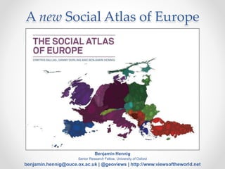
  • 1. A new Social Atlas of Europe Benjamin Hennig Senior Research Fellow, University of Oxford benjamin.hennig@ouce.ox.ac.uk | @geoviews | http://www.viewsoftheworld.net
  • 2. A country called Europe? “… we must re-create the European family in a regional structure, called, it may be, the United States of Europe…” (Winston Churchill, Zurich 19 September 1946)
  • 4. • One way in which the debate on Europe might progress is to see Europe in a new light by redrawing the map of Europe. • A new cartography can further develop ideas of Europe as a single mass of people and help our thinking to move further towards a “Europe of people” instead of “nation-states”. • Through such action we may see a bolstering of European identity to help us think of Europe and its economy, culture, history and both human and physical geography in terms of a single large land and population entity. A country called Europe?
  • 5. Conventional maps • cannot show how many people live in small areas – instead they show how little land supports so many people; • cannot show who the people are, what they do, where they go; • They will not show the distributions of people changing – international migration, moving house, or just going to work; • They cannot portray the distribution of the wealthy or the poor; on the map, at almost any scale, they live in much the same square inch of paper. Nor will they show where and when people had certain jobs, certain power, voted, were out of work, lived and died. Mercator (17. Century) Gall/Peters (19. & 20. Century)
  • 6. Cartograms "Erwin Raisz called cartograms 'diagrammatic maps.' Today they might be called cartograms, value-by-area maps, anamorphated images or simply spatial transformations. Whatever their name, cartograms are unique representations of geographical space. Examined more closely, the value- by-area mapping technique encodes the mapped data in a simple and efficient manner with no data generalization or loss of detail. Two forms, contiguous and non-contiguous, have become popular. Mapping requirements include the preservation of shape, orientation contiguity, and data that have suitable variation. Successful communication depends on how well the map reader recognizes the shapes of the internal enumeration units, the accuracy of estimating these areas, and effective legend design. Complex forms include the two-variable map. Cartogram construction may be by manual or computer means. In either method, a careful examination of the logic behind the use of the cartogram must first be undertaken.“ Dent, 1996, my emphasis Cited from http://www.ncgia.ucsb.edu/projects/Cartogram_Central/types.html
  • 7. “… a general method for constructing density-equalizing projections or cartograms, which provide an invaluable tool for the presentation and analysis of geographic data. Our method is simpler than many earlier methods, allowing for rapid calculations, while generating accurate and readable maps.” Gastner, M.T. and Newman, M.E.J. (2004) ‘Diffusion-based method for producing density equalizing maps’, Proc. Natl. Acad. Sci. USA, vol 101, pp 7499–504 (my emphasis)
  • 10. The Social Atlas of Europe • Thinking about Europe as a continent of regions and cities rather than nation-states and to realise the huge number of ways in which people living in different parts of Europe have so much in common. • By transforming the human and physical space of Europe simultaneously, we argue that it is more likely for Europeans to make more sense of both their home area’s physical and human geography and to think of Europe as one place.
  • 11. Key data sources • Gridded Population of the World (SEDAC/NASA) • European Values Survey • Eurostat • European Union Statistics on Income and Living Conditions • International Labour Organisation • The World Bank • World Health Organisation • Barro-Lee education attainment database
  • 12. Types of maps • Country cartograms, using a rainbow colour scheme, with each country resized on the basis of a variable of interest. • Country population cartograms with thematic mapping showing the geographical distribution of a variable of interest • Gridded population cartograms with thematic mapping
  • 13. Types of maps • Country cartograms, using a rainbow colour scheme, with each country resized on the basis of a variable of interest. • Country population cartograms with thematic mapping showing the geographical distribution of a variable of interest • Gridded population cartograms with thematic mapping
  • 15. Types of maps • Country cartograms, using a rainbow colour scheme, with each country resized on the basis of a variable of interest. • Country population cartograms with thematic mapping showing the geographical distribution of a variable of interest • Gridded population cartograms with thematic mapping
  • 17. Types of maps • Country cartograms, using a rainbow colour scheme, with each country resized on the basis of a variable of interest. • Country population cartograms with thematic mapping showing the geographical distribution of a variable of interest • Gridded population cartograms with thematic mapping
  • 19. A Human Atlas of Europe - What’s new?
  • 21. Updated and improved maps (draft preview)
  • 22. Updated and improved maps (draft preview)
  • 23. benjamin.hennig@ouce.ox.ac.uk | @geoviews | www.viewsoftheworld.net Thanks for your attention!