A Wikimap of Landscape Values in the Bad River Watershed - Carl Sack

This presentation will demonstrate the development and use of the Bad River Watershed Wikimap, an online participatory mapping application for an area of northern Wisconsin where new mining has been proposed. The issue of mining has drawn a great deal of recent interest and debate statewide. Different sides of the debate emphasize differing sets of landscape values, the symbolic meanings and instrumental uses that people associate with certain places. Online participatory mapping can inform difficult or contentious land use decision-making by using volunteered geographic information, a form of public input, to reveal where different landscape values exist. The Bad River Watershed Wikimap provides a case study designed as part of a master’s thesis project.

Recomendados
Recomendados
Mais conteúdo relacionado
Destaque
Destaque (11)
Mais de Wisconsin Land Information Association
Mais de Wisconsin Land Information Association (20)
Último
Último (20)
A Wikimap of Landscape Values in the Bad River Watershed - Carl Sack
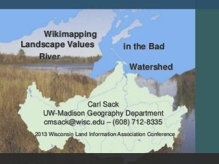
- 1. Wikimapping Landscape Values in the Bad River Watershed Carl Sack UW-Madison Geography Department cmsack@wisc.edu – (608) 712-8335 2013 Wisconsin Land Information Association Conference
- 2. Problem How can online maps empower the views of local people in decisions regarding land use policy and natural resource development?
- 3. Online Participatory Mapping From Beverly et. al. 2008 (Canadian Journal of Forestry Research)
- 5. Case Study The Bad River Watershed: 1,061 Square Miles Mix of forest, wetlands, agriculture Bad River Indian Reservation (Ojibwe) 2010-2012 Mining Proposal Variety of landscape values
- 6. Design & Development User-Centered Design After Robinson et al. (2005)
- 7. Design & Development Stakeholder themes: Uses for science, information, na rrative Stakeholder support and engagement Local outreach vital Concerns: moderation, private information control
- 8. Design and Development Web application construction
- 9. Deployment Wikimap Demo Behind the Scenes Public Workshops
- 10. Evaluation Cartographic: How did users make use of the system? Anthropological: Did the wikimap have a public impact on landscape values perception? True Value by Ann Singsaas From Robinson, 2008 (Penn State GeoVISTA Center)
- 11. Acknowledgements Funding and support: Cartography Specialty Group Special thanks to Dr. Robert E. Roth