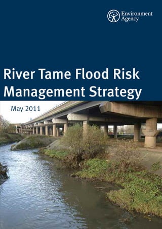
4. Introduction
This is the River Tame Flood Risk Management Overview
Strategy (the Strategy) and sets out our strategic
The Environment Agency has a vision of a rich,
approach to flood risk management on the River healthy and diverse environment for present and
Tame by considering opportunities to manage future generations. Part of this vision is to
flood risk across a wide area, while providing manage flood risk and improve the environment.
environmental benefits. Flooding is a natural process that can have a
major effect on people, communities, the
We consulted between May and August 2009 on economy and the environment. We cannot
the options for managing flood risk in the River prevent all floods but we can prepare for them as
Tame. Although we have not fundamentally part of flood risk management.
changed our preferred options, we have carefully
considered the responses and feedback and The risk of flooding is influenced by river
modified the Strategy accordingly. The final processes, urban drainage and land use. By
Strategy was approved for adoption by the managing land and river systems, we can reduce
Environment Agency’s Director of Operations in the chance of flooding from rivers. To reduce the
October 2010. impact of flooding we:
This documents sets out the adopted Strategy • provide flood warning systems for river
and how we propose to implement it. It should flooding;
be read in conjunction with the River Tame Flood • influence the planning process to
Risk Management Strategy: Environmental restrict development in areas at risk of
Report, and the River Tame Flood Risk flooding;
Management Strategy: Statement of • encourage the use of flood resilience
Environmental Particulars, to understand the measures;
impacts and proposed mitigation for • provide flood storage areas;
implementing the Strategy. Any developments • maintain and construct flood defences;
since the adoption of the Strategy are • work closely with local authorities and
summarised towards the end of this document. water utility companies on urban
drainage.
Kingsbury Water Park
4 Environment Agency River Tame Flood Risk Management Strategy
5. To plan our activities we take a wide view of flood built or natural) and the climate;
risk across a large geographical area. We call this • ensuring all proposals are technically
a Flood Risk Management Strategy. For feasible, economically viable, socially
Birmingham, the Black Country and Tamworth we acceptable and environmentally
have produced the River Tame Flood Risk appropriate (by meeting the strategic
Management Strategy. This Strategy examines environmental objectives);
the options available for managing flood risk • seeking opportunities for environmental
from the River Tame. The objectives of the improvements wherever possible through
Strategy are: the recommendation of integrated flood
risk management measures;
• understanding and raising awareness of • working in partnership with and
the risk of flooding on the River Tame, encouraging co-operation between
both now and in the future; stakeholders.
• developing a plan for the management of
flood risk on the River Tame that is This document is a summary of our proposals for
sustainable, taking into account future managing flood risk in the area for the next 100
changes in the environment (human, years (from 2009 to 2109).
Tamworth Castle
Environment Agency River Tame Flood Risk Management Strategy 5
6. Our study area
The River Tame is the largest tributary of the River modified by human activity. Sections of the river
Trent. The total catchment is approximately 1500 have been engineered with brick walls and
square kilometres and the river is 100 kilometres concrete. This is not unusual for an urbanised
long. Over 1.7 million people live within the catchment. This has resulted in a river that is
catchment area. The River Tame starts as two very different to its original size, shape and
distinct watercourses: the Oldbury Arm and the course. The alterations are mainly in the upper
Willenhall Arm, in the Black Country. These catchment of Birmingham and the Black Country.
combine at Bescot and continue eastwards
through Birmingham before changing direction History of flooding along the River Tame
at Water Orton. The river then flows north Like all major river systems, the River Tame has a
through Tamworth to the confluence with the history of flooding. In Summer 2007, England
River Trent. It has a number of major tributaries.
experienced the wettest three months since
The most significant are the Ford Brook, River records began. Flood events in June and July
Rea, River Cole, River Blythe and the River Anker.
2007 caused widespread flooding on the River
The tributaries are not included within the Tame. Areas that were significantly affected
Strategy. include Bescot, Witton, Water Orton, Fazeley,
Tamworth and Elford. Other notable flood events
Our study area starts at Ashes Road on the on the River Tame occurred in June 1955, August
Oldbury Arm and County Bridge on the Willenhall 1987, December 1992, September 1994, January
Arm and finishes where the River Tame enters the 1999 and November 2000.
River Trent. The study area is divided into nine
sections or reaches as shown on the plan on We have used the information from these flood
page 7. events to inform the River Tame Strategy,
ensuring that past knowledge guides future
Over time, the River Tame has been heavily decisions.
One Stop Shopping Centre, Perry Barr
6 Environment Agency River Tame Flood Risk Management Strategy
7. The existing flood risk situation
Terminology • Sheepwash Balancing Ponds: this area
When we explain flood risk we refer to ‘flood holds 166,000m3 of water
events’. Flood events are characterised by their • Ocker Hill Balancing Pond: this area holds
size and how often they occur. The larger a flood 19,000m3 of water
event, the less often it will occur. • Bescot Controlled Washland: this area
holds 37,000m3 of water
A flood event with a 1% probability of occurring • Forge Mill Lake at Sandwell Valley: this
is also expressed as a flood that has a 1 in 100 area holds 575,000m3 of water
chance of occurring in any given year. If a flood • Perry Hall Playing Fields: this area holds
event of this magnitude occurs in one year the 156,000m3 of water
chance of it occurring the following year is still
the same, 1 in 100. This system was designed in the 1970s to reduce
risk of flooding to an event which at that time
A flood event with 0.5% probability of occurring
had a 2% annual probability of occurring. Forge
is expressed as a flood that has a 1 in 200
Mill Lake is the most significant storage area and
chance of occurring in any given year. A flood of
this size occurs less frequently and so it is larger holds more than double the amount of water of
than a flood event with a 1% probability. any other location. Other localised flood
Consequently, more properties will flood. defences exist downstream at Water Orton,
Minworth, Whitacre Heath, Fazeley and
In this document we refer to numbers of Tamworth. We have identified that some of the
properties (residential and commercial) at risk of existing flood defences need replacement in the
flooding. Unless otherwise stated these figures near future. If we do not take appropriate action
refer to the number of properties (residential and there is a risk that in the future these defences
commercial) that would be flooded in a flood could fail and cause widespread flooding.
event with a 1% probability (1 in 100 chance of
occurring in any given year) of occurring. Climate change
Government guidance sets out how we should
All reference to left/right banks in this document predict the effect that climate change may have
are based on looking at the river in a on flood levels in the future. Using computer
downstream direction. flood modelling we can identify how many
properties may be affected by these changes.
Existing Flood Risk Management
Currently, there are 3,100 residential and The Strategy allows us to plan how we respond to
commercial properties at risk from flooding. From these changes. We have predicted that a further
2025 this number is forecast to increase to 5,400 2,300 properties could be at risk in the future
properties as a result of the impact of climate (from 2025) as a result of climate change.
change on flood levels.
There is an existing flood risk management
scheme in place in the upper catchment of the
River Tame, which provides a varied level of flood
risk management. This is a combination of
channel maintenance, earth embankments,
flood walls and flood water storage areas. The
storage areas hold flood water until a flood event
has passed, after which it is slowly released back
into the River Tame. The existing storage areas
are:-
Environment Agency River Tame Flood Risk Management Strategy 7
8. River Tame Flood Risk
Management Strategy Overview
8 Environment Agency River Tame Flood Risk Management Strategy
9. How we have developed
our Strategy
The key aim of the Strategy is to enable us, with land;
partners, to manage flood risk sustainably over
the long term. We have developed a Strategy
which seeks to embrace a holistic approach and
have developed the strategy to follow four key
aims of sustainability; maximising
environmental benefit; developing safe
schemes; and securing value for money.
We apply a clearly defined approach to assessing
flood risk management options which is set by
the Department for Environment, Food and Rural
Affairs (Defra).
To develop our Strategy we have identified all the
possible options to manage flood risk at a broad
strategic level. We identified the following
options:
• Do nothing – This would be a ‘walk away’
option. It would mean that all of the work
we currently do now, such as flood River Tame at Perry Hall playing fields
warning, channel and defence
maintenance would stop. This is a
standard option against which the ‘ storing water during a flood and slowly
benefits and costs of the other options releasing it back into the river afterwards;
are compared. ‘ improving the flow of water down a river
(this is called conveyance);
• Do minimum – This would mean that we ‘ providing defences to reduce the risk of
would continue to maintain the existing flooding.
walls and embankments. However, at the
end of their design-life the defences We have engaged external stakeholders to share
would not be replaced. ideas and expertise and we have assessed these
options against the following criteria:
• Do something – Under this approach we
would change what we do now to manage 1 The cost of each option compared with
flood risk. The Strategy has considered the benefits gained, including the
large-scale options for the whole area number of properties affected.
and more local options. These options 2 Whether the option would effectively
included combinations of: manage flood risk.
3 The environmental impact of each option.
‘ managing the causes of flooding
by changing the way people The tables on pages 10 and 11 give a summary
design and use urban and rural of the option assessment:-
Environment Agency River Tame Flood Risk Management Strategy 9
10. Summary of options
The Strategy has adopted the following broad options:
For full list of options please refer to the Environmental Report and the Statement of Environmental
Particulars
Option Justification for taking forward
Option 2: Do minimum We will continue current flood risk management
activities to reduce the affects of climate change and
improve resilience to flooding.
Option 3: Maintain existing defences We will continue to maintain the existing level of
flood risk management (as Option 2) and replace
defences at the end of their useful life.
Option 4: Do something – Optimise existing flood We will improve how the existing storage areas
storage function to reduce the damage caused by flooding.
Option 6: Do something - Improve conveyance and We will improve flow through critical areas of the
provide permanent flood defences River Tame by removing/ redesigning bridges and
opening up culverts where possible.
We will also replace and raise existing flood
defences and where appropriate, build new
defences to manage the risk of flooding.
River Tame at Forge Mill
10 Environment Agency River Tame Flood Risk Management Strategy
11. Summary of options
The Strategy has dismissed the following broad options:
Option Justification for dismissal
Do nothing (take no action) This option does not reduce flood risk in a managed
way and flood risk would increase over time as
existing flood defences fail.
Do something - Underground storage tanks This would involve creating large storage tanks
underground and diverting flood water into these to
reduce flood risk downstream. This option would be
too expensive and could have significant
environmental impacts.
Do something - Groundwater recharge This option would involve pumping floodwater into
underground aquifers. This is technically
impractical due to the geology of the area and would
have environmental contamination risks.
Do something - Tributary storage This option would involve creating flood storage
areas on the tributaries of the River Tame. There are
not enough available sites to store significant
volumes of water. However, the River Tame
Management Strategy will promote the creation of
storage areas as policy recommendations for future
development of these areas.
Do something - Dredging Dredging the river bed has little effect in reducing
flooding and has a significant detrimental
environmental impact. This would not provide a
sustainable solution.
Do something - Overland flow diversion This would involve creating a diversion for the River
Tame, to bypass urban areas such as Birmingham.
This would be too expensive and could have
significant environmental impacts and disruption.
Do something - Underground flow diversion This option would involve the construction of large
culverts for the flood water to flow along bypassing
areas that have a high risk of flooding. This option
does not work due to the rivers shallow gradient in
the area identified for implementation (Witton).
Do something - Add or remove weirs to the river This option has little impact to reduce flooding as the
channel weirs become submerged and do not influence
levels at high flows. However we may remove or
modify weirs for fisheries and biodiversity
improvements.
Do something - Use temporary defences Temporary defences could be erected when a flood
event is expected and removed after the risk has
reduced. This solution is unsuitable as the River
Tame catchment responds very quickly to rainfall
events and there would not be enough time
available to put the defences in place.
This process has provided a short list of potential options for each of the reaches within the overall
study area. Further details of the proposals in each of the nine reaches are provided in the following
section. The short listed options are explained below.
Environment Agency River Tame Flood Risk Management Strategy 11
12. Our Strategy
Following the public consultation exercise, we information the Strategy has taken into account
have modified our Strategy to take account of the when being drafted and finalised. We also
issues raised. Although fundamentally we have explain the potential impacts of implementing
not changed our preferred options, there are the Strategy, the mitigation proposed to reduce
various issues we are now aware of that have or remove these impacts, and potential
assisted us in our understanding of flood risk environmental and social improvements that we
issues and how the Strategy could be propose to undertake in tandem with
implemented. We have also added clarification implementing the Strategy.
to parts of our Strategy as a result of responses
received. The Tame Strategy study area contains a highly
urbanised upstream catchment and a rural
This document contains our final Strategy. We downstream catchment. The existing flood risk
have also produced a Statement of management involves a combination of flood
Environmental Particulars as required by the storage areas, flood walls and embankments.
Environmental Assessment of Plans and Consequently, there is no simple solution for
Programmes Regulations 2004. It sets out how managing flood risk along the river. The Strategy
the findings of the Environmental Report and has identified that it is not viable to provide the
views expressed during the consultation period same level of flood risk management across all
have been taken into account as the Tame the communities in the flood plain. As a result we
Strategy has been finalised and formally are suggesting different proposals within each of
approved (adopted). This Strategy should be the nine reaches. These proposals are based on
read in conjunction with the Environmental a high level study undertaken as part of the
Report and the Statement of Environmental Strategy development. Whilst we don’t
Particulars in order to understand what anticipate that the preferred options will change,
the method of implementation e.g. exact heights
of walls may change as a result of more detailed
work. The Strategy proposals involve a number of
key components which are summarised below.
Management activities
We currently undertake a range of flood risk
management activities and we are proposing to
continue with these:
• improving the flood warning service and
promoting its wider use;
• channel maintenance, where necessary;
• maintaining existing flood defences and
replacing them when they reach the end
of their useful life, unless there are
special circumstances in which we would
either cease maintenance or remove the
defence;
• continuing to influence planning and
development proposals;
• continuing to provide advice on
protecting individual properties to
River Tame at Witton increase their resistance to flooding.
12 Environment Agency River Tame Flood Risk Management Strategy
13. Optimise upstream storage flood defences, where this work can be justified.
We propose to optimise the existing flood Some of the existing defences will be raised
storage areas in the upper sections of the River either now or in the future. This will allow us to
Tame. We have identified that changes can be manage the impacts of increased water levels
made to the existing flood storage areas, in through climate change. Where possible, we take
particular at Forge Mill and Perry Hall playing opportunities to set back defences, to make
fields to reduce the risk of flooding downstream. more space for water along the river corridor
during flood conditions.
Remove obstructions to flow
Where possible, we will remove or redesign The following section explains the strategic
structures that impede the flow of the River Tame preferred option and how the desired reduction
in critical locations such as Brookvale Road in flood risk could be achieved in each of the
(Atlas Industrial Estate Bridge) and Nechells/Star nine reaches along the river. These options will
City (utility crossings). The alternative is that the be further investigated and refined in local areas
height of the flood walls and embankment along during the implementation of the Strategy.
parts of the River would need to be increased.
This could result in increased construction costs Climate change
and significant social and environmental Without further action an additional 2,400
impacts. properties will be at risk of flooding in the future
as a result of climate change. However with the
At Meteor Park, near Spaghetti Junction we are proposals recommended in the Strategy this
planning to open up the outer arches of the canal number will reduce to 402. We will review our
bridges to improve conveyance. We also proposals to manage climate change on a case
propose to modify existing culverts to improve by case basis but our options will include the
water flows for example at Titford, just upstream following:
of the Wolverhampton Road, on the Oldbury Arm.
• building some defences higher, now, to
Provide flood defences prevent the risk of flooding in the future;
In some locations there are existing defences • designing defences so that they can be
which require replacement in the near future. In raised in the future;
other locations there are currently no measures • accepting that in some locations the risk
in place, in these locations we will construct new of flooding will increase in the future.
Spaghetti Junction
Environment Agency River Tame Flood Risk Management Strategy 13
14. Oldbury Arm (reach one)
The Oldbury Arm stretches from Ashes Road, Our proposals – Combination of Option 3
Oldbury downstream to Bescot, Wednesbury. (Maintain) and Option 6 (Improve conveyance
This reach is heavily urbanised, containing a mix and new flood defences)
of residential and industrial areas. Near Horseley To improve the flow of water we are proposing to
Heath, the river flows through Sheepwash Urban alter a section of the existing culvert in the
Park, which has been designed to store water Titford area (between Titford Road and Titford
during a flood event. Pool). We propose to remove the culvert to create
an open channel reducing the risk of flooding
Flood risk and creating environmental benefit by increasing
• Without defences there would be 1,297 public open space and a more natural channel. If
properties at risk in the Oldbury Arm; this is not possible we propose to increase the
• There are currently 286 properties at risk; size of the existing culvert or to install an
• The current flood defences therefore additional culvert.
manage the risk of flooding to 1,011
properties; We propose to construct new flood walls on the
• There will be 95 properties at risk with the left bank at Tipton Junction (just upstream of
Strategy in place; Holloway Bank) and improve the existing
• The Strategy will therefore manage the defences at the rear of Collins Road, Wednesbury
risk of flooding to an additional 191 to reduce the risk of flooding to a 0.5%
properties. probability in any given year.
• By 2025 an additional 61 properties will
be at risk of flooding as a result of climate In addition we are proposing to replace existing
change. defences when they reach the end of their useful
life. We plan to undertake the majority of this
work in the short term (next five years) and the
remainder within the medium term (20 years).
14 Environment Agency River Tame Flood Risk Management Strategy
15. Oldbury Arm (reach one)
Environment Agency River Tame Flood Risk Management Strategy 15
16. Willenhall Arm (reach two)
The Willenhall Arm runs from the Head of Main Our proposals – Option 3 (Maintain)
River at County Bridge, Willenhall downstream to Our strategy has shown that the existing
Bescot, Wednesbury. Like the Oldbury Arm, the defences provide the required level of flood risk
Willenhall Arm is heavily urbanised and contains management and therefore no new defences or
a mix of residential and industrial areas that defence raising is required. However, we are
border the River Tame. proposing to replace existing defences as they
reach the end of their useful life. We plan to
Flood risk undertake the majority of this work in the next
• Without defences there would be 290 five years and the remainder within the next 20
properties at risk in the Willenhall Arm; years. In addition, we will continue to provide
• There are currently 2 properties at risk; flood warnings and maintain the channel and
• The current flood defences therefore existing defences.
manage the risk of flooding to 288
properties;
• There will be 2 properties at risk with the
Strategy in place;
• The Strategy will not therefore manage
the risk of flooding to any additional
properties;
• By 2025 an additional 19 properties will
be at risk of flooding as a result of climate
change.
16 Environment Agency River Tame Flood Risk Management Strategy
17. Willenhall Arm (reach two)
Environment Agency River Tame Flood Risk Management Strategy 17
18. Bescot Junction (reach three)
The Bescot Junction location contains a mix of Our proposals – Option 3 (Maintain)
residential and industrial properties including The Strategy proposes to increase the height of
the local landmark of Walsall Football Club the existing embankment to approximately 2
stadium and a nationally important rail freight metres on the left bank to reduce flood risk to the
yard. former Spear & Jackson works. This will reduce
the risk of flooding to 0.5% probability in any
given year.
Flood risk
• Without defences there would be 34 We are also proposing to replace existing
properties at risk; defences when they reach the end of their useful
• There are currently 34 properties at risk; life. We plan to undertake the majority of this
• The current flood defences therefore do work in the next five years and the remainder
not manage the risk of flooding to any within the next 20 years.
properties;
• There will be 20 properties at risk with the
Strategy in place;
• The Strategy will therefore manage the
risk of flooding to 14 additional
properties;
• By 2025 an additional 5 properties will be
at risk of flooding as a result of climate
change.
18 Environment Agency River Tame Flood Risk Management Strategy
19. Bescot Junction (reach three)
Environment Agency River Tame Flood Risk Management Strategy 19
20. Newton and Hamstead (reach four)
Downstream of Bescot Junction the River Tame Flood risk
flows past Yew Tree and on towards the Sandwell • Without defences there would be 160
Valley Country Park, which provides 1700 acres properties at risk;
of public open space in the heart of the West • There are currently no properties at risk;
Midlands. This area is an important haven for • The current flood defences therefore
flora and fauna and plays an important role in manage the risk of flooding to 160
the flood risk management of the River Tame. properties;
Forge Mill Lake in the Country Park provides • There will be no properties at risk with the
essential flood water storage, in addition to Strategy in place;
being a Royal Society for the Protection of Birds • The Strategy will not therefore manage
(RSPB) nature reserve. the risk of flooding to any additional
properties;
Downstream of the park, the river flows through • By 2025 an additional 24 properties will
the residential and industrial area of Perry Barr, be at risk of flooding as a result of climate
before entering Perry Hall Playing Fields. The change.
Playing Fields also provide flood water storage.
Our proposals – Option 3 (Maintain) and Option
4 (Optimised Storage)
We propose to improve the way in which the
flood storage areas of Forge Mill and Perry Hall
function. This will be done by allowing water to
enter them earlier in a flood event. This will
reduce flood risk to communities downstream at
Witton in reach five.
One section of defence within this reach is
nearing the end of its useful life and is proposed
to be replaced within the next five years. Further
replacement of existing defences is proposed
over the next 20 years.
20 Environment Agency River Tame Flood Risk Management Strategy
21. Newton and Hamstead (reach four)
Environment Agency River Tame Flood Risk Management Strategy 21
22. Perry Barr and Witton (reach five)
This area of the River Tame contains mostly 2.5 metres high on the left (north) bank and 1 metre
commercial, industrial and residential properties. It and 2 metres high on the right bank. This will reduce
covers Perry Barr in the upstream sections, Witton in the risk of flooding to a 0.5% annual probability in this
the middle section, before the River Tame flows location. As some of these defences will be up to 2.5
underneath the iconic Spaghetti Junction road metres high, we will work with the local community to
network. ensure that we reduce the visual impact through
sympathetic design.
Flood risk
• Without defences there would be 1,025 New defences are proposed on the left bank between
properties at risk; the river and Tame Road. These defences will need to
• There are currently 874 properties at risk; tie in to any defences constructed as part of the
• The current flood defences therefore manage Siemens housing development and will need to
the risk of flooding to 151 properties; extend down to the Electric Avenue area.
• There will be 10 properties at risk with the
Strategy in place; To improve the flow of floodwater in this section we
• The Strategy will therefore manage the risk of also propose to remove flow restrictions at Brookvale
flooding to an additional 864 properties. Road (Atlas Road Industrial Estate Bridge) and in
• By 2025 an additional 124 properties will be Meteor Park, Nechells (open up the outer arches of
at risk of flooding as a result of climate two canal bridges). If we are unable to undertake this
change. work, the flood defences upstream through the
Witton area will need to be built to a higher level.
Our proposals – Combination of Option 3 (Maintain)
and Option 6 (Improve conveyance and new flood We also propose to replace existing defences as their
defences) condition reduces. These works are proposed within
We propose to improve the flood embankments on the next 20 years.
the left (north) bank in the Regina Drive area of Perry
Barr, adjacent to the “One Stop” shopping centre. The
defences will reduce the risk of flooding to a 1%
annual probability. As a result of the works on the left
bank at this location, a new low defence will be
required on the right bank to reduce flood risk to the
shopping centre.
We also propose to improve/replace the existing
defence walls to the rear of the industrial units on the
left bank just downstream of the A34 bridge. These
defences will be made continuous and raised slightly
higher than the current defences which are in poor
condition.
Along the Tameside Drive area of Witton we will
improve the flood defences along the edge of the
road. This will reduce the risk of flooding to a 0.5%
annual probability and will ensure that improvements
to defences downstream do not increase flood risk
here.
Along the Brookvale Road area of Witton, we propose
to raise the existing flood wall to between 1 metre and
22 Environment Agency River Tame Flood Risk Management Strategy
23. Perry Barr and Witton (reach five)
Environment Agency River Tame Flood Risk Management Strategy 23
24. Gravelly Hill and Bromford
(reach six)
Downstream of Spaghetti Junction the River Tame Our proposals – Combination of Option 3
flows underneath the M6, through Gravelly Hill, (Maintain) and Option 6 (Improve conveyance
Bromford and Castle Vale. The Gravelly Hill area and new flood defences)
contains a high number of commercial and We propose to raise the height of the existing
industrial properties. Further on, the river flows defence on the right bank to manage flood risk in
past the large residential areas of Bromford on Bromford. This will reduce the risk of flooding to
the right bank, and Castle Vale on the left bank. a 1% probability for any given year and will be
achieved by constructing new flood defences 1.8
Flood risk metres high. Flood defences are also proposed
• Without defences there would be 3,410 to protect the area of Castle Vale on the left bank
properties at risk; of the River Tame. These will be built to a 1%
• There are currently 1,250 properties at annual probability of flooding and will consist of
risk; walls between 1 metre and 2.5 metres in height
• The current flood defences therefore and an embankment approximately 1.5 metres
manage the risk of flooding to 2,160 high. These will replace a section of old defences
properties; approximately 1 metre high and are required to
• There will be 11 properties at risk with the ensure that the improvements proposed for
Strategy in place; Bromford do not increase flood risk to Castle
• The Strategy will therefore manage the Vale.
risk of flooding to an additional 1,239
properties. We are also proposing to replace existing
• By 2025 an additional 17 properties will defences when they reach the end of their useful
be at risk of flooding as a result of climate life. Some of this work is proposed in the next
change. five years, but the majority will be undertaken
within the next 20 years.
24 Environment Agency River Tame Flood Risk Management Strategy
25. Gravelly Hill and Bromford
(reach six)
Environment Agency River Tame Flood Risk Management Strategy 25
26. Water Orton, Lea Marston and
Kingsbury (reach seven)
Downstream of Birmingham the River Tame Our proposals – Combination of Option 3
passes through Water Orton. From here it flows (Maintain) and Option 6 (Improve conveyance
through a series of purification lakes at Lea and new flood defences)
Marston (designed to remove the pollution that We propose to raise the height of the existing
originates in the upper reaches of the embankments on the right bank at Whitacre
catchment). Further on it passes through the Heath from 1.5 metres to approximately 2
600 acre Kingsbury Water Park Country Park. metres. This will reduce the risk of flooding to
This reach is characterised by small settlements, 0.5% probability in any given year.
former gravel workings, and agricultural land
with large floodplains. As a result of the works proposed at Whitacre
Heath, our investigations have shown that there
Flood risk may be a marginal increase in flood risk
• Without defences there would be 460 downstream (in the remainder of reach seven
properties at risk; and reach eight). However this is based on a high
• There are currently 334 properties at risk; level assessment based on the information we
• The current flood defences therefore have now (e.g. approximate property threshold
manage the risk of flooding to 126 levels/ground levels) and will be reviewed in
properties; more detail as part of any future scheme.
• There will be 49 properties at risk with the
Strategy in place; We also propose to replace two sections of
• The Strategy will therefore manage the existing defences within the next five years and
risk of flooding to an additional 285 one section of defence within the next 20 years.
properties;
• By 2025 an additional 16 properties will
be at risk of flooding as a result of climate
change.
26 Environment Agency River Tame Flood Risk Management Strategy
27. Water Orton, Lea Marston and
Kingsbury (reach seven)
Environment Agency River Tame Flood Risk Management Strategy 27
28. Fazeley and Tamworth
(reach eight)
Downstream of Kingsbury the River Tame of approximately 1.5 metres that will reduce the
continues to flow through agricultural land and risk of flooding to this part of Fazeley to a 0.5%
former gravel workings. Recent river habitat probability of flooding in any given year.
improvements have been undertaken at
Middleton creating a braided channel. The river We also propose to reduce the risk of flooding in
then flows through Fazeley and Tamworth which the Brook End vicinity of Fazeley on the left bank,
are protected by flood walls and earth by increasing the height of the existing
embankments. embankment defences to approximately 2
metres. These measures will reduce the risk of
Flood risk flooding to properties in this location to a 0.5%
• Without defences there would be 3,030 annual probability of flooding.
properties at risk;
• There are currently 304 properties at risk; As a result of the preferred options in reach
• The current flood defences therefore seven, the risk of flooding will be marginally
manage the risk of flooding to 2,726 increased in reach eight. Based on the Strategy
properties; level investigations, we anticipate that works
• There will be 5 properties at risk with the will be required in the Coton Lane area (in the
Strategy in place; north of Tamworth) to ensure that the residual
• The Strategy will therefore manage the flood risk is managed. We propose to construct
risk of flooding to an additional 299 new embankments to a height of approximately
properties; 1 metre. South of here additional embankments
• By 2025 an additional 3 properties will be are proposed to a similar height to provide a
at risk of flooding as a result of climate 0.5% probability of flooding in Lichfield Road in
change. the vicinity of Chatsworth Road and The Fox
Public House.
Our proposals – Combination of Option 3
(Maintain) and Option 6 (Improve conveyance None of the existing defences in this reach
and new flood defences) require replacement within the next five years,
New defences are proposed on the left bank however sections of defence will reach the end of
around the Mayfair Drive area of Fazeley. This will their useful life within the next 20 years and will
consist of a flood embankment built to a height require replacement.
28 Environment Agency River Tame Flood Risk Management Strategy
30. Comberford to Alrewas
(reach nine)
Downstream of Tamworth the river flows through Our proposals – Option 3 (Maintain)
a largely rural landscape with wide floodplains, We propose to continue maintaining current
passing the small settlements of Comberford defences and structures to the existing standard
and Elford which are situated on the right bank, of protection, plus removing blockages where
before the confluence with the River Trent. they cause a flood risk.
Flood risk Based on the information we know now, we
• Without defences there would be 285 expect that the measures proposed upstream on
properties at risk; the river will marginally increase flood risk to a
• There are currently 26 properties at risk; small number of properties in this reach. These
• The current flood defences therefore properties are already at risk of flooding, but we
manage the risk of flooding to 259 expect them to be put at marginally increased
properties; flood risk as a result of the Strategy proposals
• There will be 31 properties at risk with the upstream. We will engage with the community
Strategy in place; and property owners concerned to address this
• We predict that the Strategy will issue and will undertake appropriate flood risk
marginally increase flood risk to 5 management measures (if required) to minimise
properties; this impact. This may for example, include
• By 2025 an additional 133 properties will individual property protection. In addition, we
be at risk of flooding as a result of climate will also promote increased use of our flood
change. warning service.
30 Environment Agency River Tame Flood Risk Management Strategy
32. Environmental summary
Strategic Environmental Assessment • habitat improvements to improve
We have undertaken a Strategic Environmental biodiversity;
Assessment (SEA) to understand the impacts of • improvements to public access and
the draft Strategy and propose mitigation for enjoyment of the River Tame corridor, and
them. We have documented this in the interpretation of this environment for the
Environmental Report (ER). We have explained public benefit;
how we have dealt with responses to the • improvements to fish passage and
consultation on the draft Strategy, along with habitat by installing fish passes on weirs
how consultation responses have changed the or removing weirs, and creation of fish
SEA and the final Strategy, within the Statement refuges;
of Environmental Particulars (SoEP). Both of • river restoration and naturalisation.
these documents should be read in conjunction
with this Strategy. The opportunities we develop further will depend
on the flood risk management works we
The high level environmental and social impacts undertake, our funding, willingness and
of the Strategy are explained in the ER. We have involvement of partners, whether the proposals
identified mitigation to reduce or eliminate these will help us achieve our targets to improve the
impacts in the ER, and updated this with environment, and whether we can achieve
consultation responses in the SoEP. targets for other organisations along with ours.
We want to work in partnership with other
Environmental opportunities organisations and communities to take more of
There are significant opportunities for these opportunities forward than we could do by
environmental and social improvements which ourselves.
can either be integrated in our flood risk
management work or be undertaken alongside The Strategy will include and develop the
our works. mitigation and environmental improvements
identified within the ER and SoEP alongside
The opportunities that are identified within the developing the flood risk management works.
ER and updated by the SoEP focus on these
themes:
River Tame at Lady Walk
32 Environment Agency River Tame Flood Risk Management Strategy
33. Review of the Strategy
As we implement the Strategy, we will review it to strategic environmental assessment to
ensure that it remains appropriate. At an determine whether they are still valid or need
appropriate point in the future, for example reassessing. Our reviews would include
before our next set of flood risk management determining whether the on-going management
assets need to be replaced, we will review the activities provide value for money and whether
preferred Strategy options along with the they should be continued.
Summary of the Strategy
The Strategy proposals will reduce the risk of of these are located in the following reaches:
flooding from the River Tame for 2,850
residential and commercial properties. In • Oldbury Arm
addition it will manage flood risk to an additional • Bescot
6,900 properties by maintaining/replacing • Water Orton and Lea Marston
existing flood defences, • Comberford to Alrewas
However, there are 223 properties where we We will work with these communities to provide
cannot justify the economic cost of increasing general advice and where appropriate identify
the level of flood risk management. The majority ways of improving flood resilience.
Environment Agency River Tame Flood Risk Management Strategy 33
34. Responses to the draft Strategy
consultation
How we consulted Query: The proposals to improve flood risk
Public consultation was carried out between May management in the upper reaches will increase
and August 2009. We aimed to contact and flooding to downstream locations. How will this
provide information to all those affected and be managed?
interested by the proposals. Consultation
documents were made available at our offices, at Response: We will ensure that any impacts as a
public libraries as well as on our public website. result of measures undertaken elsewhere are
mitigated and that no property receives a
We carried out a wide range of consultation reduced standard of protection as a result of the
activities, including public meetings and drop in proposals.
sessions. We contacted statutory consultees
Query: There is a risk that flooding may be made
such as Natural England, English Heritage and
worse temporarily if the improvements start at
local planning authorities. We also consulted
the upstream end and progress down the river.
parish councils and local flood groups that use
How will the work be sequenced to avoid this
the river or have an interest on how it is
situation?
managed. We did leaflet drops at several
locations and issued press releases in local Response: As part of the Strategy
newspapers to raise awareness of consultation implementation stage, we will review the
on the draft Strategy and to identify interested sequencing of the work to ensure that flooding is
and affected parties. not made worse for anyone.
We are aware that we may not have reached Query: The Strategy should make it clear that the
everyone that has an interest in the Strategy. Environment Agency has responsibility over
There will be future opportunities for groundwater flooding.
organisations and individuals to have their say
on our proposals when they are developed into Response: Currently, there is no single
more detail, as many detailed decisions still organisation responsible for all forms of
need to be made. flooding, including groundwater flooding. Recent
recommendations have been made to give the
Environment Agency sole responsibility for all
Specific responses to the consultation forms of flooding. However, at present we are
Many of the respondents requested further unable to take responsibility for groundwater
information that we endeavoured to provide. flooding.
There were many comments relevant to the
Strategic Environmental Assessment Query: The Strategy doesn’t refer to Regional
(Environmental Report), which are dealt with in Spatial Strategy, which proposes a significant
the Statement of Environmental Particulars. increase in house building across the West
Many comments have resulted in clarifications of Midlands region, in particular Birmingham and
or additional information being included in the the Black Country.
Strategy above. The following are the key
remaining suggestions or issues raised on the Response: The Strategy doesn’t refer to specific
Strategy along with our responses to them. housing development within the Tame
catchment area, as any new developments built
on floodplain would need to provide their own
flood risk management measures.
34 Environment Agency River Tame Flood Risk Management Strategy
35. Query: The Strategy should give provide greater Response: Whilst the Strategy does not
detail on how the flood warning system operates specifically make reference to the bunds around
and how local businesses and residents can sign the Water Ski Centre the Strategy has identified
up to receive warnings. that they cause minimal impact to flood levels
due to the wide nature of the floodplain. We are
Response: The Environment Agency can issue currently working with the landowner to reinstate
direct flood warnings to customers when river the floodplain by altering the bunds. This will
levels begin to rise and there is a risk of your avoid the need to remove the bunds, which
property flooding. You can receive warnings by would cause significant local disruption.
telephone, mobile, email, sms text message or
fax. You can find out if your property or business Query: Will the proposal to increase the height of
is at risk of flooding by calling Floodline on the existing embankments on the right bank at
0845 988 1188 or by visiting www.environment- Whitacre Heath by 500mm send more water
agency.gov.uk/floodmidlands. You can sign up along the valley into the Kingsbury Water Park
to the Environment Agency’s free 24 hour flood and potentially increase flooding in the park?
warning service online or via the Floodline
number above. Response: We have investigated this issue as
part of the Strategy. Based on the information we
Query: Vegetation growth and littering cause know now, we expect that there will be a
blockages in the water course and increase marginal increase to flood risk at Kingsbury
flooding - who is responsible for clearing Water Park. As we obtain more information and
vegetation and removing litter? details, we will be able to quantify the impact, if
any and discuss any mitigation works with the
Response: The Environment Agency may relevant parties.
undertake routine maintenance of its assets on
main rivers, however ultimate responsibility to
remove vegetation and litter lies with the riparian
owners. However, if there are blockages in the
watercourse, which cause increased flood risk,
we may take action to remove them. Everyone
can reduce the likelihood of blockages causing
flooding by not littering or dumping rubbish near
rivers.
Query: The Strategy fails to recognise the serious
problems caused by building the large bunds
around the Water Ski Centre, just north of
Kingsbury village. These bunds have been
erected in recent years on natural flood plain
with the result that during severe flood events,
more water is pushed towards the Birmingham
and Fazeley Canal exacerbating flooding
problems in Kingsbury.
Environment Agency River Tame Flood Risk Management Strategy 35
36. Other issues
The following is a summary of issues that were • To consult with the relevant emergency
raised through the consultation exercise, which planning organisations such as the
have not been considered in detail in the Staffordshire Resilience Forum.
Strategy. These issues will be considered as the
Strategy is implemented and as more details • To identify opportunities to improve
become available. recreational areas and promote wildlife
especially in the urban areas in
• Review flood risk in the Titford Road area consultation with local communities.
(Oldbury Arm), taking in to account the
recent drainage improvements undertaken • Any new/improvement works to the
by Severn Trent Water Authority. defences in Witton will need to take in to
account the proposal for a new residential
• The affect that raised defences may have development on the old Siemens site, off
on the canal network. Brookvale Road.
• Any proposed works to improve flood • Investigate the flood route along the
defences should take in to account public Birmingham & Fazeley Canal which causes
rights of ways and ensure there are no flooding to a number of cottages in
negative impacts. Kingsbury Water Park as well as flooding of
a housing estate close to the marina
• Need to identify opportunities in the urban at Fazeley.
sections of the Tame to re-engage the
public with the River course, through • Investigate the culvert along the A51 by
promotion and development of the Tame the Fox Public House (reach eight) which is
walkway, linkages from adjacent parks and thought to contribute to flooding in this
open space and education/recreation. location.
• Any proposed works near/adjacent to the
Strategic Road Network will need to be
discussed and reviewed with the
Highways Agency.
River Tame at Tamworth
36 Environment Agency River Tame Flood Risk Management Strategy
37. Next steps
We will now look at specific solutions to reducingsecure contributions from beneficiaries. Any
flood risk in line with the adopted Strategy. Thiscontributions we receive (financial or cost
will involve further investigation and design of avoidance) towards the costs of implementing
the individual works that can be justified and the improvement works will increase the
promoted. likelihood of those works going ahead.
This is in line with the Environment Agency’s
Key stages Flood and Coastal Risk Management External
The Strategy has now been approved by the Contributions Policy (http://www.environment-
Environment Agency, allowing us to move agency.gov.uk/research/planning/33700.aspx)
forward to implementation. To enable this, we
will produce more detailed proposals for each of We have recently completed one of the
the recommendations made in the Strategy to recommendations made in the Strategy through
ensure that the solutions are developed within a scheme which has optimised the Perry Hall
the strategic vision and in an integrated manner. Flood Storage Area at Perry Hall Playing Fields,
In doing so, the Tame Flood Risk Management Birmingham. This has improved the standard of
Strategy will provide the best opportunity to: protection to downstream communities in the
Witton area of Birmingham.
a) reduce flood risk;
b) minimise and mitigate potential impacts; For each of the projects arising from the Strategy
c) maximise opportunities for environmental we will obtain more information and data to
improvements. establish whether the Strategy option can be
implemented and to develop detailed proposals
We have developed a programme to take forward in each area. We will consult further with local
the recommendations made within the Strategy. communities to explain these proposals and our
We plan (subject to funding) to deliver the short overall timetable.
term (five year) recommendations through a
number of separate projects, which may be The longer term measures recommended in the
phased over several years depending on funding Strategy will be reviewed and updated as the
availability and the most efficient way of changes and developments occur within the
delivering the works on the ground. catchment. Programmes of work to deliver this
work will be identified and delivered in line with
To support the delivery of the Strategy the Strategy in order to manage flood risk over
recommendations, in some areas we will need to the next 100 years.
Forge Mill Flood Storage Area
Environment Agency River Tame Flood Risk Management Strategy 37
38. What has changed since the
adoption of the Strategy?
Since the adoption of the Strategy, there has • We have reviewed the proposals to improve
been a number of policy changes within the flood storage in the upper Tame in more detail
Environment Agency, which has resulted in a while investigating ways to implement the
refocus on our priorities. These are summarised preferred option in reach four. As part of the
below: consultation exercise, concerns were raised by
the RSPB and Sandwell Metropolitan Borough
• Following recent changes to Environment Council regarding the impact on birds and the
Agency policy we have amended our approach to nature reserve of using the storage area at Forge
environmental improvements on the River Tame. Mill more frequently. Further detailed
The draft Strategy recommended the creation of investigation in to the operation of the existing
Biodiversity Action Plan (BAP) habitat as the flood storage areas has identified that stand
main environmental opportunity. However, large alone improvements at Perry Hall Playing Fields
scale freshwater BAP habitat creation at will provide an acceptable reduction in flood risk
Middleton Lakes is no longer a priority target for downstream at Witton. This means that the
the Environment Agency. New environmental Strategy can currently be implemented with none
targets set by government include our statutory of the foreseen impacts at Forge Mill Lake. The
requirement under the Water Framework improvements to the storage area at Perry Hall
Directive to improve the ecological quality of playing fields have recently been completed on
water bodies, for example improvements to site.
water quality or creation of more natural
channels, especially in the urban areas. • In some cases the Strategy identifies
Therefore, we will review environmental new/improved defences which would benefit
opportunities proposed in the Strategy and SEA development land only. In these cases, we would
and our priority will change to focus on these expect the landowner to provide their own
new targets. We have discussed this change with defences as part of any future redevelopment
the key stakeholders affected. proposals.
Perry Park, Birmimgham
38 Environment Agency River Tame Flood Risk Management Strategy
39. Glossary
Assets These are flood defences and structures such as sluices that we maintain and may
also own.
Braided channel A river with a variation in water depths and water flow. It incorporates series of
inter-connecting channels. This encourages river biodiversity.
Catchment The area contributing flow to a point on a drainage system.
Climate change The predicted variations in the earths climate whether by human or natural causes.
Confluence Where one river joins another.
Conveyance The flow of a river through a section of channel. Conveyance can be reduced by
obstacles or constrictions to flow.
Culvert A man-made channel usually used to divert flows around or under structures.
A culvert can be covered to form a tunnel.
Design life The time when a defence is considered acceptable in terms of serviceability and
structural strength.
Dredging Lowering the river bed or widening the banks to create a larger or deeper channel
profile.
Flood resilience These are measures that can be introduced to properties that limit damage during a
measures flood and subsequently speed up recovery after a flood.
Floodplain Any area of land over which water flows or is stored during a flood event or would
flow but for the presence of flood defences.
Flood Risk The level of flood risk is the product of the frequency or likelihood of the flood
events and their consequences (such as loss, damage, harm, distress and disruption).
Flood Risk A long-term (usually 100 years) documented plan for river or coastal management,
Management Strategy including all necessary work to meet defined flood and coastal defence objectives for
the target area.
Impacts A change in the baseline condition due to the implementation of the option (e.g. the
works associated with the construction of defences on the River Tame).
Statement of A document that outlines the changes that have occurred to a Plan or Strategy as
Environmental a result of consultation on the draft Plan or Strategy. It explains how environmental
Particulars information has influenced the Strategy as adopted.
Reach Sections or lengths of river.
Standard The level of flood protection provided by a defence.
of protection
Environment Agency River Tame Flood Risk Management Strategy 39
40. Strategic The application of environmental assessment at a strategic level in the decision-
Environmental making process. The application has become statutory under both UK and
Assessment (SEA) European legislation.
Sustainability Development which meets the needs of the present without affecting the ability of
future generations to meet their own needs. It should also take account, for example,
of the long-term demands for non-renewable materials.
40 Environment Agency River Tame Flood Risk Management Strategy
41. Notes
Environment Agency River Tame Flood Risk Management Strategy 41
42. Notes
42 Environment Agency River Tame Flood Risk Management Strategy
43. Related publications
River Tame Flood Risk Management Strategy: Environmental Report (May
2009) - this documents the likely impacts of the draft Strategy, how they
could be mitigated, and opportunities for environmental improvements.
The impacts and mitigation have not fundamentally changed since
consultation during finalisation of the Strategy.
This document is available on our website under the following chapters:
Chapter 1 - Introduction and Background, Chapter 2 - Approach to SEA,
Chapter 3 - Relevant Plans and Strategies, Chapter 4 - Consultation
Product code: GEMI0511BTWV-E-E
Chapter 5 - Key Issues, Constraints and Opportunities, Chapter 6 -
Assessment of Environmental Effects and Evaluation of Impact Significance
(part 1/2)
Product code: GEMI0511BTWW-E-E
Chapter 6 - Assessment of Environmental Effects and Evaluation of Impact
Significance (part 2/2)
Product code: GEMI0511BTWX-E-E
Chapter 7 - Implementation and Monitoring Plan and Figures
Product code: GEMI0511BTWY-E-E
Glossary of terms and abbreviations, Appendix A: Relevant Plans and
Policies, Appendix B: Consultation
Product code: GEMI0511BTWZ-E-E
Appendix C: Results of Option Screening, Appendix D: Summary of Options
Appraisal - Individual Flood Cells
Product code: GEMI0511BTXA-E-E
Appendix E: Indicative Landscape Plans
Product code: GEMI0511BTXB-E-E
River Tame Flood Risk Management Strategy: Statement of Environmental
Particulars (May 2011) - this document explains how consultation
responses on the draft Strategy have been taken into account, how the
environment has been taken into account when finalising the Strategy,
clarifies aspects of the Environmental Report, adds more detail to some
mitigation, and identifies additional opportunities for environmental
improvements.
This document is availabe on our website.
Statement of Environmental Particulars:
Product code GEMI0511BTWU-E-E
44. Would you like to find out more about us,
or about your environment?
Then call us on
03708 506506 (Mon-Fri 8-6)
email
enquiries@environment-agency.gov.uk
or visit our website
www.environment-agency.gov.uk
incident hotline 0800 80 70 60 (24hrs)
floodline 0845 988 1188
Environment first: This publication is printed on paper made
from 100 per cent previously used waste. By-products from
making the pulp and paper are used for composting and fertiliser, for
making cement and for generating energy.
GEMI0511BTWT-E-E