Smoothing coarse raster data
•
0 gostou•497 visualizações

This document discusses smoothing coarse resolution raster data for integration with vector data. It describes applying a low pass filter to a 3x3 raster window to average cell values and reduce noise. This smoothing technique is demonstrated on several geospatial datasets from GeoSure related to landslides, shrink-swell soils, and other terrain factors. The current coarse resolution rasters are shown alongside the smoothed outputs, which have noise reduced while preserving overall patterns.

Recomendados
Recomendados
Mais conteúdo relacionado
Mais de British Cartographic Society
Mais de British Cartographic Society (20)
Último
Último (20)
Smoothing coarse raster data
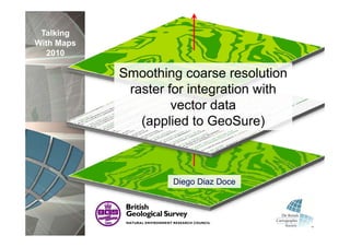
- 1. Talking With Maps 2010 Smoothing coarse resolution raster for integration with g vector data (applied to GeoSure) Diego Di D Di Diaz Doce
- 2. Talking With Maps 2010
- 3. Talking GeoSure With Maps 2010 Collapsible deposits Compressible ground Landslides Running Sand Shrink swell Soluble rocks
- 4. Talking GeoSure With Maps 2010 Collapsible deposits Compressible ground Landslides Running Sand Shrink swell Soluble rocks
- 5. Talking With Maps 2010
- 6. Talking GeoSure With Maps 2010
- 7. Initial Data Talking . . D With Maps 2010 sing Process Processing P Result . R
- 8. Initial Data Talking . . D With Maps 2010 ( (coarse resolution) ) sing Process Processing P Result . R
- 9. Talking With Maps 2010
- 10. Initial Data Talking . . D With Maps 2010 Smoothing sing . Process Processing P (coarse resolution) Result . R
- 11. Smoothing Talking With Maps 2010 3x3 raster t
- 12. Talking With Maps 2010 Low Pass Filter 1 1 1 7 5 2 7 5 2 1 1 1 4 8 3 = 4 4.2 3 1 1 1 3 1 5 3 1 5 Value Vl =( (7 * 1) + (5 * 1) + (2 * 1) + (4 *1 ) + (8 * 1) + (3 * 1) + (3 * 1) + (1 * 1) + (5 * 1) ) / 9 = (7 + 5 + 2 + 1 + 4 + 8 + 3 + 3 + 1 + 5) / 9 = 38/ 9 = 4.2
- 13. Talking With Maps 2010 Low Pass Filter
- 14. Talking With Maps 25 m 2010 25m x 25m raster cross-section
- 15. Talking With Maps 3m 2010 3m x 3m raster cross-section
- 16. Talking With Maps 3m 2010 3m x 3m raster cross-section after Low Pass Filter
- 17. Smoothing Talking With Maps 2010
- 18. Initial Data Talking . . D With Maps 2010 Smoothing sing . Process Processing P (coarse resolution) Result . R
- 19. Talking With Maps 2010
- 20. Talking Example 1: Shrink swell dataset (GeoSure) With Maps 2010 Current version Smoothed version
- 21. Talking Example 2: Shrink swell dataset (GeoSure) With Maps 2010 Current version Smoothed version
- 22. Talking Example 3: Landslides dataset (GeoSure) With Maps 2010 Current version Smoothed version
- 23. Talking Example 4: Landslides dataset (GeoSure) With Maps 2010 Current version Smoothed version
- 24. Talking With Maps 2010